
Crete
Beschreibung
Wanderwege Region
Links
Fakten
Berichte
Führer und Karten
Übernachtung
Organisationen
Reisebüros
GPS
Sonstiges
Bücher

The Book Depository
United Kingdom
United Kingdom
- Crete East walking guide
- This Rother Walking Guide to Crete East presents the hiker with a wide variety of 50 tour recommendations encompassing all regions of the eastern part of the island. The selections range from the bathing suit walk to hikes reaching hidden bays, excursions to picturesque villages and secluded monasteries, to tours of the alpine mountain terrain.... Read more

The Book Depository
United Kingdom
2023
United Kingdom
2023
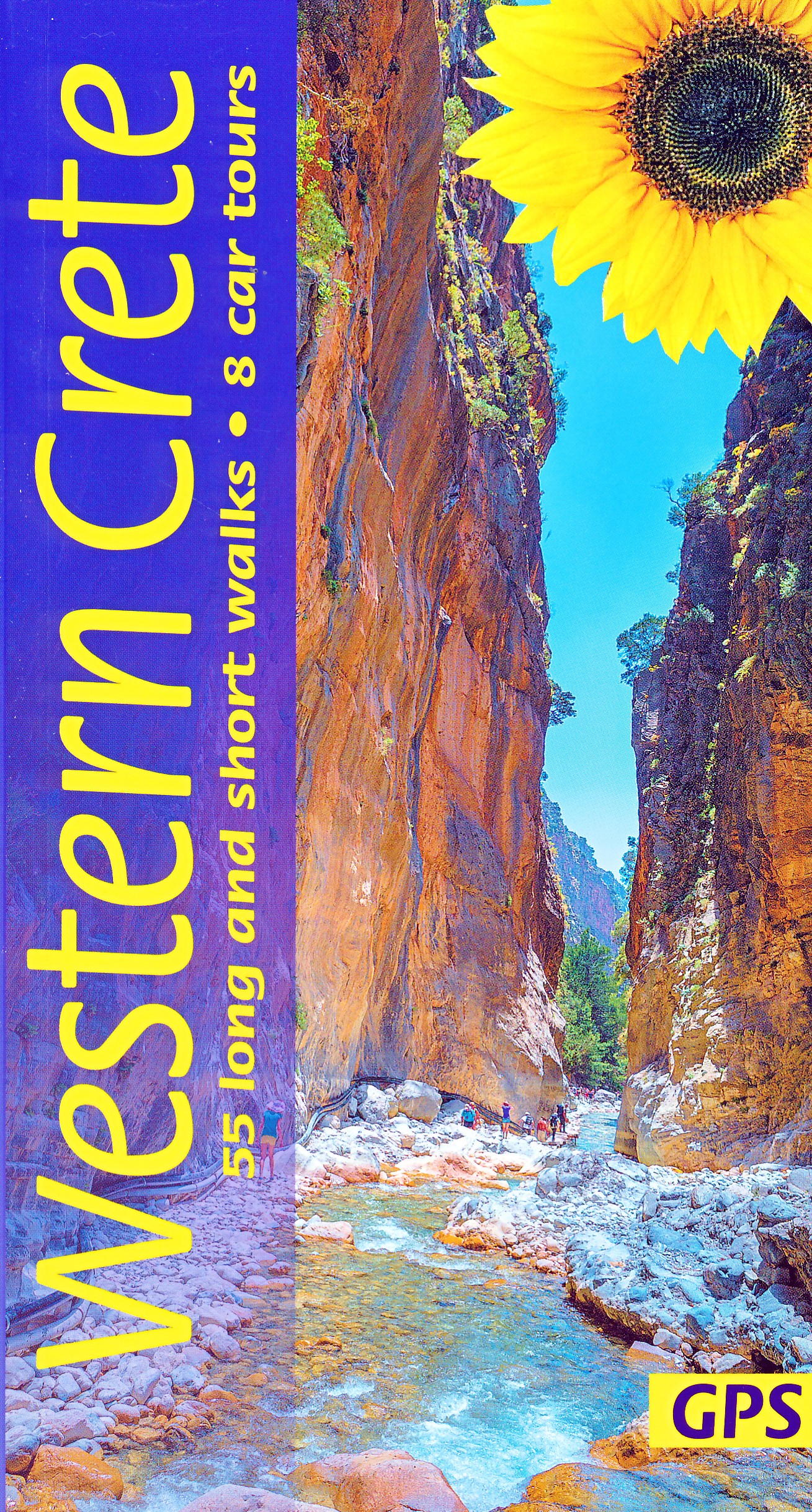
- Western Crete Sunflower Walking Guide
- 55 long and short walks, 8 car tours Read more
- Also available from:
- De Zwerver, Netherlands
De Zwerver
Netherlands
2023
Netherlands
2023
- Wandelgids Western Crete - Kreta west | Sunflower books
- 55 long and short walks, 8 car tours Read more

The Book Depository
United Kingdom
2023
United Kingdom
2023
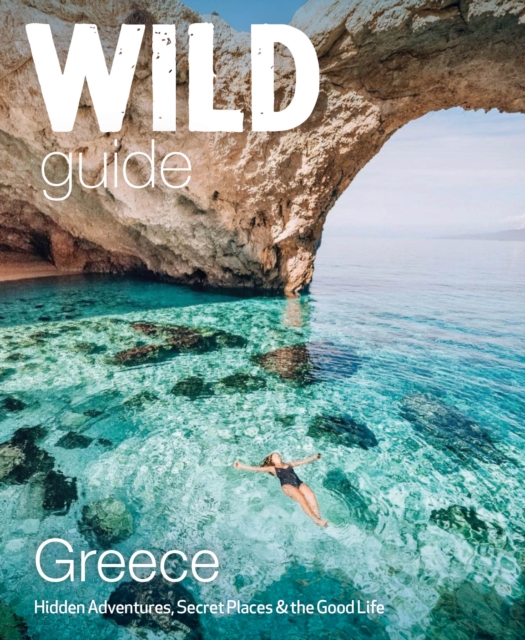
- Wild Guide Greece
- Hidden Places, Great Adventures and the Good Life (including the mainland, Crete, Corfu, Rhodes and over 20 other islands) Read more
- Also available from:
- De Zwerver, Netherlands
De Zwerver
Netherlands
2023
Netherlands
2023
- Reisgids Wild Guide Greece | Wild Things Publishing
- Hidden Places, Great Adventures and the Good Life (including the mainland, Crete, Corfu, Rhodes and over 20 other islands) Read more

De Zwerver
Netherlands
2014
Netherlands
2014
- Reisgids Merian live Kreta | Deltas
- Handige en overzichtelijke, kleine reisgids voor een eerste kennismaking met het land. Voor- en achterin uitklapbare kaart. Aandacht voor o.a. taal, festivals en eten en drinken. Prettig formaat en toch met veel foto’s. Nederlands Read more

De Zwerver
Netherlands
2021
Netherlands
2021
- Reisgids Eyewitness Travel The Greek Islands - Griekse Eilanden | Dorling Kindersley
- Explore hundreds of irresistible islands.Whether you want to follow in the footsteps of legendary heroes at the Minoan palace, swim in the turquoise waters of idyllic Zakynthos bay, or watch the sun set over Corfu from Kaiser`s throne, your DK Eyewitness travel guide makes sure you experience all that the Greek Islands have to offer.The perfect... Read more
- Also available from:
- Stanfords, United Kingdom

Stanfords
United Kingdom
2021
United Kingdom
2021
- DK Eyewitness Greek Islands
- Explore hundreds of irresistible islands.Whether you want to follow in the footsteps of legendary heroes at the Minoan palace, swim in the turquoise waters of idyllic Zakynthos bay, or watch the sun set over Corfu from Kaiser`s throne, your DK Eyewitness travel guide makes sure you experience all that the Greek Islands have to offer.The perfect... Read more
De Zwerver
Netherlands
2017
Netherlands
2017
- Wandelgids 34 Wandelingen op Oost Kreta | Peter Dijkstra
- Al meer dan 17 jaar verblijven Peter Dijkstra en zijn vrouw Loes in de zomer op Kreta, het grootste eiland van Griekenland. In het zuidoosten van Kreta, volgens velen het mooiste gebied, runnen zij Tania Apartments, een vakantieverblijf met 10 bungalows. Peter Dijkstra is een gedreven wandelaar die in de loop der jaren reeds honderden... Read more
Weitere Bücher…

Karten

The Book Depository
United Kingdom
United Kingdom
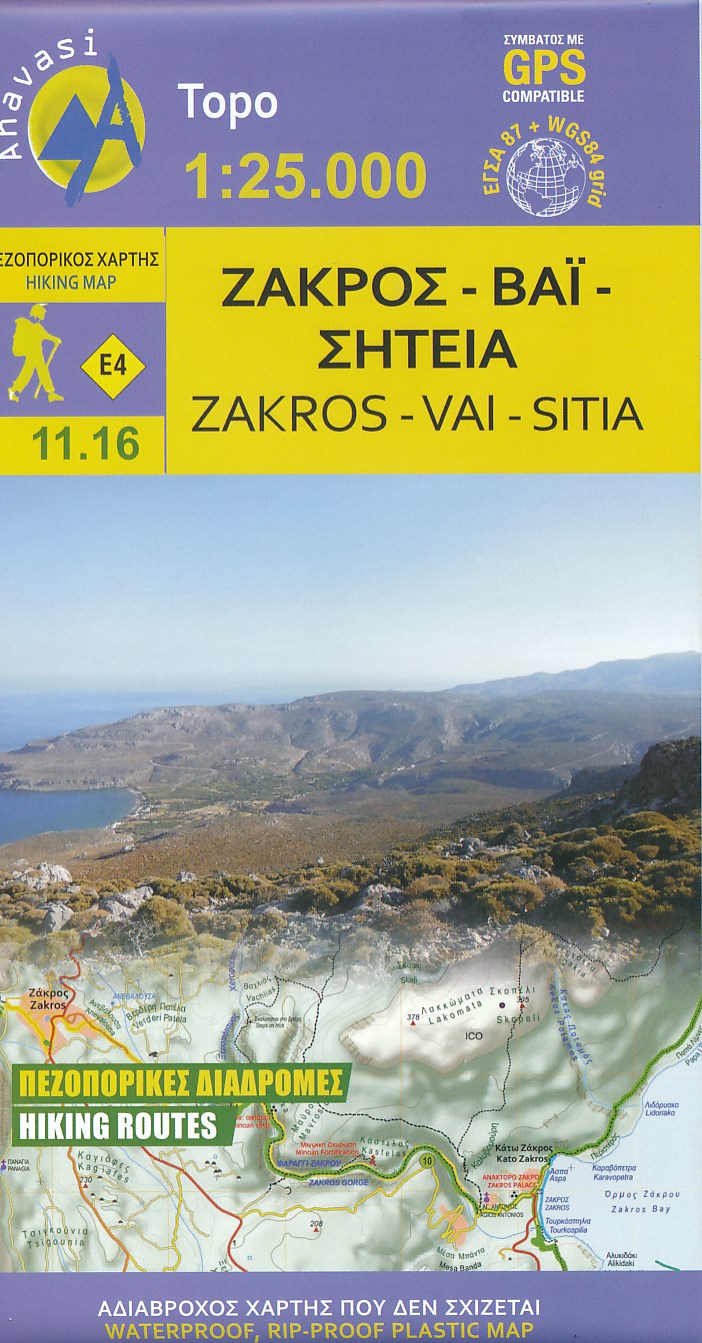
- Zakros - Vai - Sitia 2019
- Zakros - Vai - Sitia area on the easternmost tip of Crete on a light, waterproof and tear-resistant, GPS compatible and contoured, double-sided hiking map at 1:25,000 from Anavasi. Coverage along the northern coast starts at Sitia, extending south to cover the Zakros Mountains and the eastern coast south of Kato Zakros.Topography is shown by... Read more
- Also available from:
- De Zwerver, Netherlands
- Stanfords, United Kingdom
De Zwerver
Netherlands
Netherlands
- Wandelkaart 11.16 Zakros - Vai - Kreta | Anavasi
- Zakros - Vai - Sitia area on the easternmost tip of Crete on a light, waterproof and tear-resistant, GPS compatible and contoured, double-sided hiking map at 1:25,000 from Anavasi. Coverage along the northern coast starts at Sitia, extending south to cover the Zakros Mountains and the eastern coast south of Kato Zakros.Topography is shown by... Read more

Stanfords
United Kingdom
United Kingdom
- Zakros - Vai - Sitia Anavasi 11.16
- Zakros - Vai - Sitia area on the easternmost tip of Crete on a light, waterproof and tear-resistant, GPS compatible and contoured, double-sided hiking map at 1:25,000 from Anavasi. Coverage along the northern coast starts at Sitia, extending south to cover the Zakros Mountains and the eastern coast south of Kato Zakros.Topography is shown by... Read more

- Also available from:
- De Zwerver, Netherlands
De Zwerver
Netherlands
Netherlands

The Book Depository
United Kingdom
United Kingdom
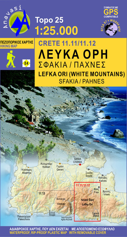
- Lefka Ori: Sfakia - Pahnes
- Sfakia - Pahnes area of the White Mountains on Crete on a waterproof and tear-resistant, GPS compatible and contoured hiking map at 1:25,000 from Anavasi. Coverage is centered on Pahnes, Crete Read more
- Also available from:
- De Zwerver, Netherlands
- Stanfords, United Kingdom
De Zwerver
Netherlands
Netherlands
- Wandelkaart 11.11-11.12 Lefka Ora, Sfakia - Pahnes - Kreta | Anavasi
- Sfakia - Pahnes area of the White Mountains on Crete on a waterproof and tear-resistant, GPS compatible and contoured hiking map at 1:25,000 from Anavasi. Coverage is centered on Pahnes, Crete Read more

Stanfords
United Kingdom
United Kingdom
- White Mountains / Lefka Ori - Sfakia - Pahnes Anavasi 11.11/11.12
- Sfakia - Pahnes area of the White Mountains on Crete on a waterproof and tear-resistant, GPS compatible and contoured hiking map at 1:25,000 from Anavasi. Coverage is centered on Pahnes, Crete’s second highest mountain, and the surrounding peaks, extending west to the Eligia Gorge and east to Chora Sfakion on the coast.Topography is shown by... Read more

The Book Depository
United Kingdom
United Kingdom
- Fragokastelo - Plakias 2016
- Uitstekende topografische kaarten van een deel van Griekenland: zonder meer hele goede kaarten voor wandeltochten in een onbekend stuk Griekenland! Ze zijn gedrukt op scheurvast en watervast papier op een schaal van 1:25.000 met een UTM grid voor GPS gebruikers. Op de meeste kaarten is geven de hoogtelijnen een interval van 20m. aan. Met... Read more
- Also available from:
- De Zwerver, Netherlands
- Stanfords, United Kingdom

De Zwerver
Netherlands
Netherlands
- Wandelkaart 11.17 Frangokastelo - Plakias - Kreta | Anavasi
- Uitstekende topografische kaarten van een deel van Griekenland: zonder meer hele goede kaarten voor wandeltochten in een onbekend stuk Griekenland! Ze zijn gedrukt op scheurvast en watervast papier op een schaal van 1:25.000 met een UTM grid voor GPS gebruikers. Op de meeste kaarten is geven de hoogtelijnen een interval van 20m. aan. Met... Read more

Stanfords
United Kingdom
United Kingdom
- Frangokastelo - Plakias Anavasi 11.17
- The Frangokastelo – Plakias area on the southern coast of Crete at 1:25,000 in a series of contoured, GPS compatible hiking maps of Crete from Anavasi, printed waterproof and tear-resistant paper. Annotations provide useful hints for walkers. Coverage extends from Imbros Gorge in the west to Plakias in the east.Topography is shown by contour... Read more

The Book Depository
United Kingdom
United Kingdom
- Samaria - Sougia
- Uitstekende topografische kaarten van een deel van Griekenland: zonder meer hele goede kaarten voor wandeltochten in een onbekend stuk Griekenland! Ze zijn gedrukt op scheurvast en watervast papier op een schaal van 1:25.000 met een UTM grid voor GPS gebruikers. Op de meeste kaarten is geven de hoogtelijnen een interval van 20m. aan. Met... Read more
- Also available from:
- De Zwerver, Netherlands
- Stanfords, United Kingdom

De Zwerver
Netherlands
Netherlands
- Wandelkaart 11.13 Samaria - Soughia - Kreta | Anavasi
- Uitstekende topografische kaarten van een deel van Griekenland: zonder meer hele goede kaarten voor wandeltochten in een onbekend stuk Griekenland! Ze zijn gedrukt op scheurvast en watervast papier op een schaal van 1:25.000 met een UTM grid voor GPS gebruikers. Op de meeste kaarten is geven de hoogtelijnen een interval van 20m. aan. Met... Read more

Stanfords
United Kingdom
United Kingdom
- Samaria - Sougia - Paliochora Anavasi 11.13
- Samaria – Sougia area of the White Mountains on Crete on a waterproof and tear-resistant, GPS compatible and contoured hiking map at 1:25,000 from Anavasi, extending from the famous Gorge of Samaria westwards to Azogyres and Plemeniana, and north past Omalos and the peaks of Troili and Kaimeni Kafala.Topography is shown by contour lines at 20m... Read more

The Book Depository
United Kingdom
United Kingdom
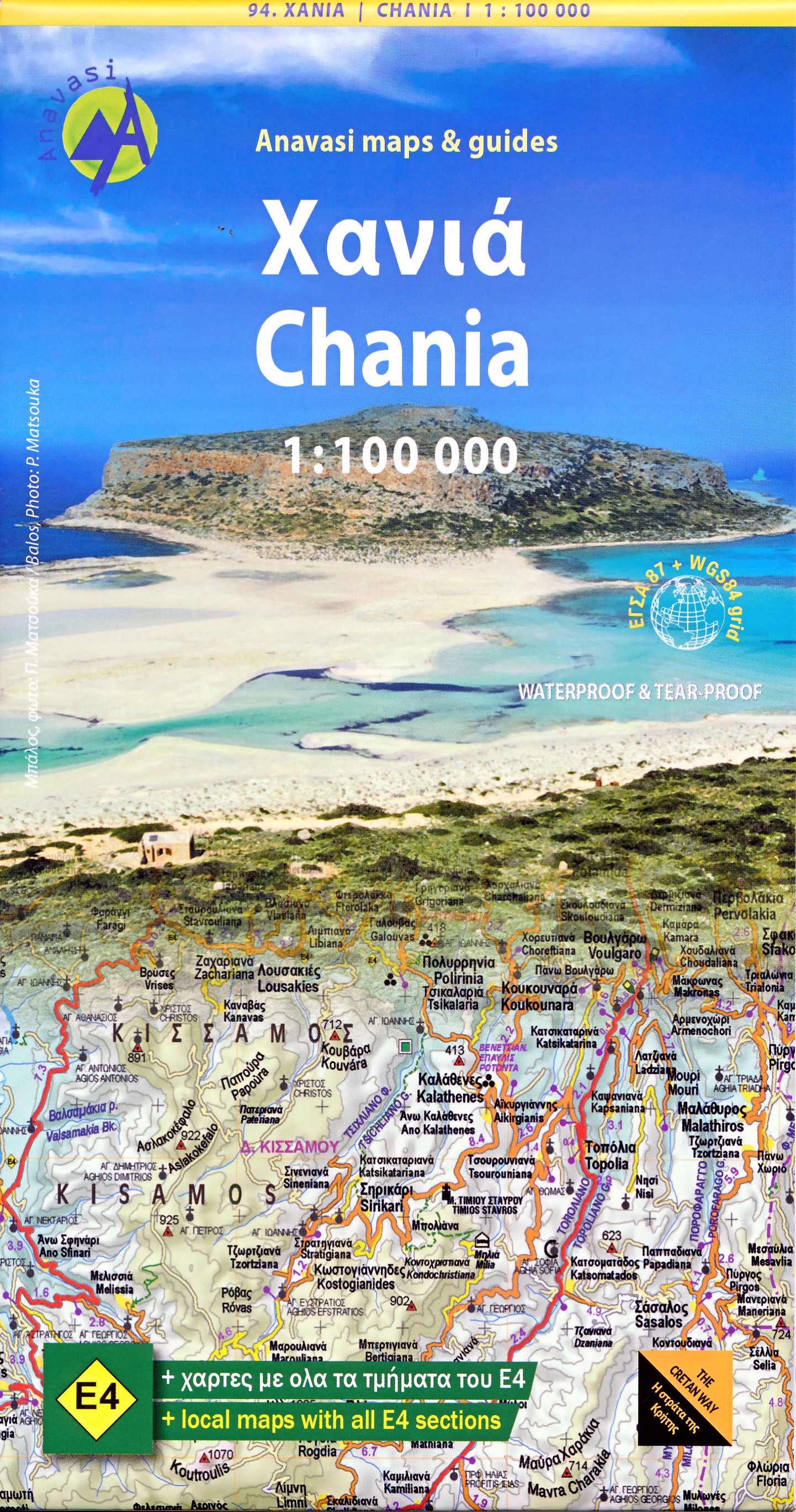
- Crete West
- Western Crete on a double-sided, contoured and GPS compatible map at 1:100,000 from Harms Verlag, with highlighting for numerous places of interest and 20 recommended hiking trails, plus street plans of central Heraklion, Rethymnon and Chania and a plan of the archaeological site at Knossos. All place names are in both Greek and Latin alphabet.... Read more
- Also available from:
- De Zwerver, Netherlands

De Zwerver
Netherlands
Netherlands
- Wandelkaart Kreta west | Harms IC Verlag
- Western Crete on a double-sided, contoured and GPS compatible map at 1:100,000 from Harms Verlag, with highlighting for numerous places of interest and 20 recommended hiking trails, plus street plans of central Heraklion, Rethymnon and Chania and a plan of the archaeological site at Knossos. All place names are in both Greek and Latin alphabet.... Read more

The Book Depository
United Kingdom
United Kingdom
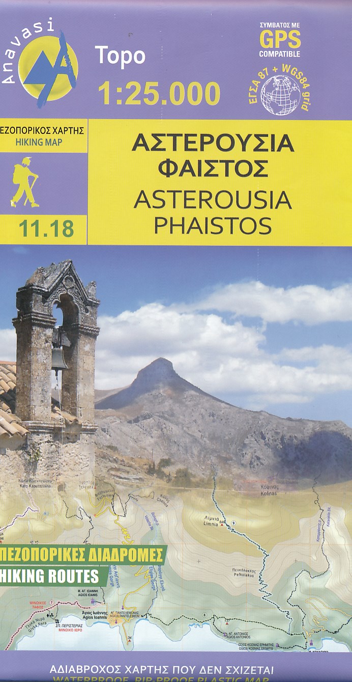
- Asterousia - Phaistos 2018
- Uitstekende topografische kaarten van een deel van Griekenland: zonder meer hele goede kaarten voor wandeltochten in een onbekend stuk Griekenland! Ze zijn gedrukt op scheurvast en watervast papier op een schaal van 1:25.000 met een UTM grid voor GPS gebruikers. Op de meeste kaarten is geven de hoogtelijnen een interval van 20m. aan. Met... Read more
- Also available from:
- De Zwerver, Netherlands
De Zwerver
Netherlands
Netherlands
- Wandelkaart 11.18 Asterousia - Phaistos, zuidkust Kreta | Anavasi
- Uitstekende topografische kaarten van een deel van Griekenland: zonder meer hele goede kaarten voor wandeltochten in een onbekend stuk Griekenland! Ze zijn gedrukt op scheurvast en watervast papier op een schaal van 1:25.000 met een UTM grid voor GPS gebruikers. Op de meeste kaarten is geven de hoogtelijnen een interval van 20m. aan. Met... Read more

The Book Depository
United Kingdom
United Kingdom
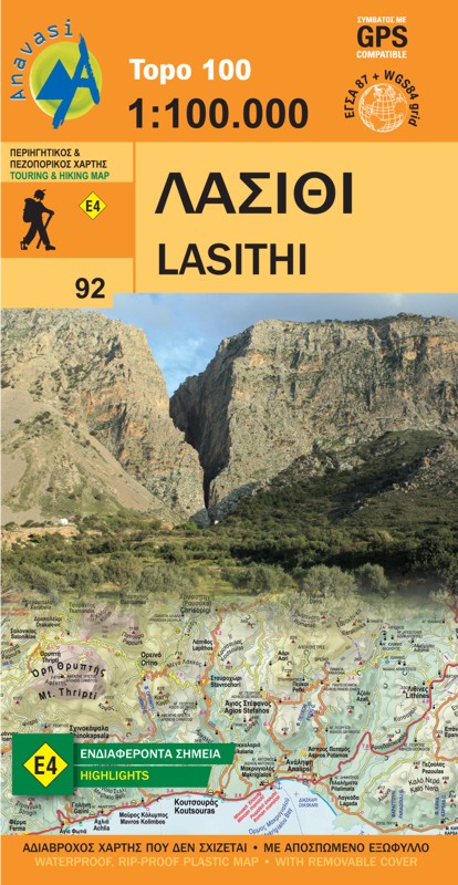
- Lasithi - Crete
- Topografische Landkarte Griechenland 92 Lasithi (Kreta) 1 : 100 000 ab 10.99 EURO new edition Read more
- Also available from:
- De Zwerver, Netherlands
De Zwerver
Netherlands
Netherlands
- Wegenkaart - landkaart 92 Kreta oost - Lasithi | Anavasi
- Topografische Landkarte Griechenland 92 Lasithi (Kreta) 1 : 100 000 ab 10.99 EURO new edition Read more

De Zwerver
Netherlands
2016
Netherlands
2016
- Wandelgids The Cretan Way E4 | Anavasi
- The Cretan Way is a 500km walking route which takes you from east to west across the varied and spectacular landscapes of Crete. It is the ideal way to discover the rural, mountainous and costal regions of this incredible island. This guide is based on a 28-day walk.This guide includes practical information, maps at a scale of 1:25.000 of... Read more
- Also available from:
- Stanfords, United Kingdom

Stanfords
United Kingdom
2016
United Kingdom
2016
- The Cretan Way - A 28 Day Walk
- The Cretan Way is a 500km walking route which takes you from east to west across the varied and spectacular landscapes of Crete. It is the ideal way to discover the rural, mountainous and costal regions of this incredible island. This guide is based on a 28-day walk.This guide includes practical information, maps at a scale of 1:25.000 of... Read more
De Zwerver
Netherlands
Netherlands
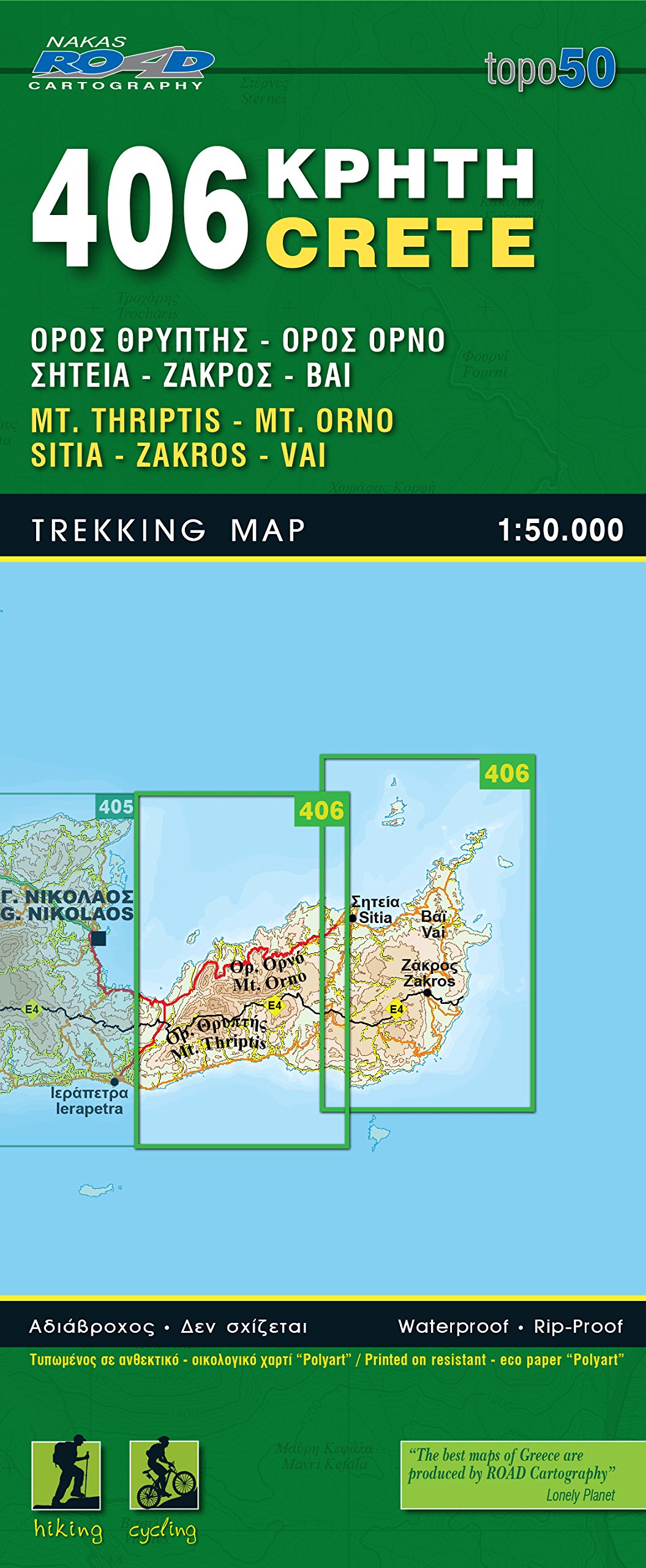
- Wandelkaart 406 Crete - Kreta | Road Editions
- Uitstekende wandelkaart van een deel van Kreta. De kaart is gedrukt op watervast en onverscheurbaar papier. hierdoor gaat deze veel langer mee! De wandelkaart heeft alle noodzakelijke details voor wandelen of fietsen: naast de topografische informatie als hoogtelijnen, alle plaatsnamen (zowel Grieks als Europees schrift), het wegennet, rivieren... Read more
De Zwerver
Netherlands
Netherlands
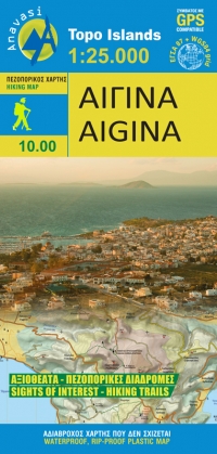
- Wandelkaart 10.00 Aigina | Anavasi
- Aegina at 1:25,000 on light, waterproof and tear-resistant, GPS compatible and contoured map from Anavasi, with on the reverse a simplified map of the island for sightseeing and recommended hiking trails.On one side is a contoured map of the island (interval 20m), with additional altitude colouring and shading. All place names are in both Greek... Read more
- Also available from:
- Stanfords, United Kingdom

Stanfords
United Kingdom
United Kingdom
- Aigina / Aegina Anavasi 10.00
- Aegina at 1:25,000 on light, waterproof and tear-resistant, GPS compatible and contoured map from Anavasi, with on the reverse a simplified map of the island for sightseeing and recommended hiking trails.On one side is a contoured map of the island (interval 20m), with additional altitude colouring and shading. All place names are in both Greek... Read more
De Zwerver
Netherlands
Netherlands
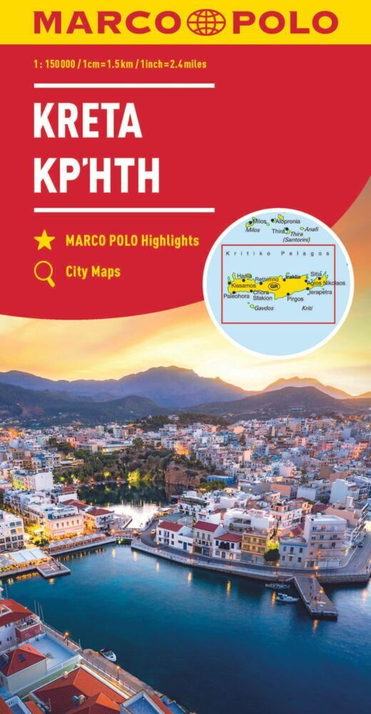
.jpg)
De Zwerver
Netherlands
Netherlands
- Wandelkaart 404 Crete - Kreta | Road Editions
- Uitstekende wandelkaart van een deel van Kreta. De kaart is gedrukt op watervast en onverscheurbaar papier. hierdoor gaat deze veel langer mee! De wandelkaart heeft alle noodzakelijke details voor wandelen of fietsen: naast de topografische informatie als hoogtelijnen, alle plaatsnamen (zowel Grieks als Europees schrift), het wegennet, rivieren... Read more