Friesland
Beschreibung
Karte

Wanderwege Landesteil
Links
Fakten
Berichte
Führer und Karten
Übernachtung
Organisationen
Reisebüros
GPS
Sonstiges
Bücher

- Also available from:
- De Zwerver, Netherlands
- Stanfords, United Kingdom

De Zwerver
Netherlands
Netherlands

Stanfords
United Kingdom
United Kingdom
- Brighton, Lewes, Worthing, Horsham & Haywards Heath OS Landranger Map 198 (paper)
- Brighton and Lewes area, including the South Downs National Park and a section of the South Downs Way / E9 European Long-distance Path, on a paper version of map No. 198 from the Ordnance Survey’s Landranger series at 1:50,000, with contoured and GPS compatible topographic mapping plus tourist information.MOBILE DOWNLOADS: As well as the... Read more

- Also available from:
- Stanfords, United Kingdom

Stanfords
United Kingdom
United Kingdom
- Chichester, South Downs, Bognor Regis & Arundel OS Landranger Active Map 197 (waterproof)
- Chichester and Bognor Regis area, including the South Downs National Park and a section of the South Downs Way / E9 European Long-distance Path, on a waterproof and tear-resistant OS Active version of map No. 197 from the Ordnance Survey’s Landranger series at 1:50,000, with contoured and GPS compatible topographic mapping plus tourist... Read more

- Also available from:
- Stanfords, United Kingdom

Stanfords
United Kingdom
United Kingdom
- Dorchester, Weymouth, Cerne Abbas & Bere Regis OS Landranger Active Map 194 (waterproof)
- Dorchester and Weymouth area, including a section of the South West Coast Path / E9 European Long-distance Path, on a waterproof and tear-resistant OS Active version of map No. 194 from the Ordnance Survey’s Landranger series at 1:50,000, with contoured and GPS compatible topographic mapping plus tourist information.MOBILE DOWNLOADS: As well as... Read more

- Also available from:
- De Zwerver, Netherlands
- Stanfords, United Kingdom

De Zwerver
Netherlands
Netherlands

Stanfords
United Kingdom
United Kingdom
- Canterbury, East Kent, Dover & Margate OS Landranger Map 179 (paper)
- Eastern Kent with Canterbury, Dover and Margate, including sections of the North Downs Way and the E2 and E9 European Long-Distance Paths, on a paper version of map No. 179 from the Ordnance Survey’s Landranger series at 1:50,000, with contoured and GPS compatible topographic mapping plus tourist information.MOBILE DOWNLOADS: As well as the... Read more

- Also available from:
- Stanfords, United Kingdom

Stanfords
United Kingdom
United Kingdom
- Brighton, Lewes, Worthing, Horsham & Haywards Heath OS Landranger Active Map 198 (waterproof)
- Brighton and Lewes area, including the South Downs National Park and a section of the South Downs Way / E9 European Long-distance Path, on a waterproof and tear-resistant OS Active version of map No. 198 from the Ordnance Survey’s Landranger series at 1:50,000, with contoured and GPS compatible topographic mapping plus tourist... Read more

- Also available from:
- De Zwerver, Netherlands
- Stanfords, United Kingdom

De Zwerver
Netherlands
Netherlands

Stanfords
United Kingdom
United Kingdom
- Eastbourne, Hastings, Crowborough, Battle & Heathfield OS Landranger Map 199 (paper)
- Eastbourne and Hastings area, including the Seven Sisters and sections of the South Downs Way and the E9 European Long-distance Path, on a paper version of map No. 199 from the Ordnance Survey’s Landranger series at 1:50,000, with contoured and GPS compatible topographic mapping plus tourist information.MOBILE DOWNLOADS: As well as the physical... Read more

- Also available from:
- Stanfords, United Kingdom

Stanfords
United Kingdom
United Kingdom
- Taunton, Lyme Regis, Chard & Bridport OS Landranger Active Map 193 (waterproof)
- Taunton and Lyme Regis area, including a section of the South West Coast Path / E9 European Long-distance Path, on a waterproof and tear-resistant OS Active version of map No. 193 from the Ordnance Survey’s Landranger series at 1:50,000, with contoured and GPS compatible topographic mapping plus tourist information.MOBILE DOWNLOADS: As well as... Read more

- Also available from:
- Stanfords, United Kingdom

Stanfords
United Kingdom
United Kingdom
- Canterbury, East Kent, Dover & Margate OS Landranger Active Map 179 (waterproof)
- Eastern Kent with Canterbury, Dover and Margate, including sections of the North Downs Way and the E2 and E9 European Long-Distance Paths, on a waterproof and tear-resistant OS Active version of map No. 179 from the Ordnance Survey’s Landranger series at 1:50,000, with contoured and GPS compatible topographic mapping plus tourist... Read more

The Book Depository
United Kingdom
United Kingdom
- Also available from:
- Stanfords, United Kingdom

Stanfords
United Kingdom
United Kingdom
- Purbeck & South Dorset - Poole, Dorchester - Weymouth & Swanage OS Explorer Active Map OL15 (waterproof)
- Purbeck and the southern part of Dorset on a detailed topographic and GPS compatible map OL15, waterproof version, from the Ordnance Survey’s 1:25,000 Explorer series. Coverage extends from Poole and Swanage in the east to Bridport in the west, and includes Dorchester, Tolpuddle, Bere Regis, Wareham, Weymouth, Chesil Beach, Portland Bill, the... Read more

- Also available from:
- De Zwerver, Netherlands
- Stanfords, United Kingdom

De Zwerver
Netherlands
Netherlands

Stanfords
United Kingdom
United Kingdom
- Ashford, Romney Marsh, Rye & Folkestone OS Landranger Map 189 (paper)
- Ashford and Romney Marsh area, including sections of the North Downs Way and the E9 European Long-distance Path, on a paper version of map No. 189 from the Ordnance Survey’s Landranger series at 1:50,000, with contoured and GPS compatible topographic mapping plus tourist information.MOBILE DOWNLOADS: As well as the physical edition of the map,... Read more

- Also available from:
- De Zwerver, Netherlands
- Stanfords, United Kingdom

De Zwerver
Netherlands
Netherlands

Stanfords
United Kingdom
United Kingdom
- Dorchester, Weymouth, Cerne Abbas & Bere Regis OS Landranger Map 194 (paper)
- Dorchester and Weymouth area, including a section of the South West Coast Path / E9 European Long-distance Path, on a paper version of map No. 194 from the Ordnance Survey’s Landranger series at 1:50,000, with contoured and GPS compatible topographic mapping plus tourist information.MOBILE DOWNLOADS: As well as the physical edition of the map,... Read more

- Also available from:
- De Zwerver, Netherlands
- Stanfords, United Kingdom

De Zwerver
Netherlands
Netherlands

Stanfords
United Kingdom
United Kingdom
- Exeter, Sidmouth, Exmouth & Teignmouth OS Landranger Map 192 (paper)
- Exeter and Sidmouth area, including a section of the South West Coast Path / E9 European Long-distance Path, on a paper version of map No. 192 from the Ordnance Survey’s Landranger series at 1:50,000, with contoured and GPS compatible topographic mapping plus tourist information.MOBILE DOWNLOADS: As well as the physical edition of the map, each... Read more

- Also available from:
- De Zwerver, Netherlands
- Stanfords, United Kingdom

De Zwerver
Netherlands
Netherlands

Stanfords
United Kingdom
United Kingdom
- The Solent, Isle of Wight, Southampton & Portsmouth OS Landranger Map 196 (paper)
- Isle of Wight with the Southampton - Portsmouth area, including part of the New Forest National Park and a section of the E9 European Long-distance Path, on a paper version of map No. 196 from the Ordnance Survey’s Landranger series at 1:50,000, with contoured and GPS compatible topographic mapping plus tourist information.MOBILE DOWNLOADS: As... Read more

- Also available from:
- De Zwerver, Netherlands
- Stanfords, United Kingdom

De Zwerver
Netherlands
Netherlands

Stanfords
United Kingdom
United Kingdom
- Taunton, Lyme Regis, Chard & Bridport OS Landranger Map 193 (paper)
- Taunton and Lyme Regis area, including a section of the South West Coast Path / E9 European Long-distance Path, on a paper version of map No. 193 from the Ordnance Survey’s Landranger series at 1:50,000, with contoured and GPS compatible topographic mapping plus tourist information.MOBILE DOWNLOADS: As well as the physical edition of the map,... Read more

- Also available from:
- Stanfords, United Kingdom

Stanfords
United Kingdom
United Kingdom
- Ashford, Romney Marsh, Rye & Folkestone OS Landranger Active Map 189 (waterproof)
- Ashford and Romney Marsh area, including sections of the North Downs Way and the E9 European Long-distance Path, on a waterproof and tear-resistant OS Active version of map No. 189 from the Ordnance Survey’s Landranger series at 1:50,000, with contoured and GPS compatible topographic mapping plus tourist information.MOBILE DOWNLOADS: As well as... Read more
Karten

De Zwerver
Netherlands
Netherlands
- Topografische kaart - Wandelkaart 10G Oudega | Kadaster
- De meest gedetailleerde kaart die via de verkoopkanalen verkrijgbaar is. Gemaakt door de Nederlandse Topografische dienst bevat deze kaart alle topografische elementen van het landschap en geeft daarmee een nauwkeurig beeld van het terrein. De meeste kaarten hebben een kaartbeeld dat overeenkomt met 12,5 x 10 kilometer in werkelijkheid. Naast... Read more
De Zwerver
Netherlands
Netherlands
- Topografische kaart - Wandelkaart 5H Dronrijp | Kadaster
- De meest gedetailleerde kaart die via de verkoopkanalen verkrijgbaar is. Gemaakt door de Nederlandse Topografische dienst bevat deze kaart alle topografische elementen van het landschap en geeft daarmee een nauwkeurig beeld van het terrein. De meeste kaarten hebben een kaartbeeld dat overeenkomt met 12,5 x 10 kilometer in werkelijkheid. Naast... Read more

De Zwerver
Netherlands
Netherlands
- Topografische kaart - Wandelkaart 6H Grootegast | Kadaster
- De meest gedetailleerde kaart die via de verkoopkanalen verkrijgbaar is. Gemaakt door de Nederlandse Topografische dienst bevat deze kaart alle topografische elementen van het landschap en geeft daarmee een nauwkeurig beeld van het terrein. De meeste kaarten hebben een kaartbeeld dat overeenkomt met 12,5 x 10 kilometer in werkelijkheid. Naast... Read more

De Zwerver
Netherlands
Netherlands
- Topografische kaart - Wandelkaart 11B Nij Beets - Nije Beets | Kadaster
- Boornbergum De Tike De Veenhoop De Wilgen Eernewoude Nij Beets Nijega Oudega Smalle Ee De meest gedetailleerde kaart die via de verkoopkanalen verkrijgbaar is. Gemaakt door de Nederlandse Topografische dienst bevat deze kaart alle topografische elementen van het landschap en geeft daarmee een nauwkeurig beeld van het terrein. De meeste kaarten... Read more
De Zwerver
Netherlands
2020
Netherlands
2020

De Zwerver
Netherlands
Netherlands
- Topografische kaart - Wandelkaart 15B Stavoren | Kadaster
- Bakhuizen Hemelum Koudum Molkwerum Stavoren Warns De meest gedetailleerde kaart die via de verkoopkanalen verkrijgbaar is. Gemaakt door de Nederlandse Topografische dienst bevat deze kaart alle topografische elementen van het landschap en geeft daarmee een nauwkeurig beeld van het terrein. De meeste kaarten hebben een kaartbeeld dat overeenkomt... Read more

De Zwerver
Netherlands
Netherlands
- Topografische kaart - Wandelkaart 16E Noordwolde | Kadaster
- De Hoeve De Pol Eesveen Frederiksoord Nijeholtpade Nijensleek Noordwolde Steggerda Vinkega Wilhelminaoord Willemsoord De meest gedetailleerde kaart die via de verkoopkanalen verkrijgbaar is. Gemaakt door de Nederlandse Topografische dienst bevat deze kaart alle topografische elementen van het landschap en geeft daarmee een nauwkeurig beeld van... Read more
De Zwerver
Netherlands
Netherlands
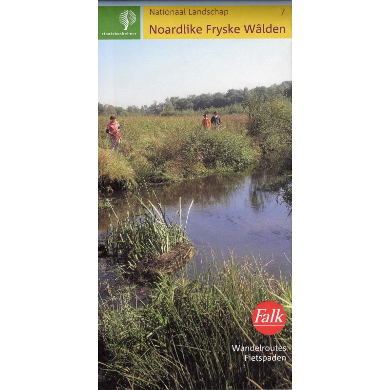
- Wandelkaart 07 Staatsbosbeheer Noardlike Fryske Wâlden | Falk
- North Frisian Woodlands, east of Leeuwarden in the Netherlands in a series of walking and cycling maps at 1:25,000 Read more
- Also available from:
- Stanfords, United Kingdom

Stanfords
United Kingdom
United Kingdom
- North Frysian Woodlands
- North Frisian Woodlands, east of Leeuwarden in the Netherlands in a series of walking and cycling maps at 1:25,000 – 1:35,000, published by Falk BV in cooperation with Staatsbosbeheer – Dutch government’s organization for forestry and the management of nature reserves.Colouring indicates different types of vegetation or terrain: woodland,... Read more

De Zwerver
Netherlands
Netherlands
- Topografische kaart - Wandelkaart 6A Ferwerd, Ferwert | Kadaster
- De meest gedetailleerde kaart die via de verkoopkanalen verkrijgbaar is. Gemaakt door de Nederlandse Topografische dienst bevat deze kaart alle topografische elementen van het landschap en geeft daarmee een nauwkeurig beeld van het terrein. De meeste kaarten hebben een kaartbeeld dat overeenkomt met 12,5 x 10 kilometer in werkelijkheid. Naast... Read more
De Zwerver
Netherlands
Netherlands
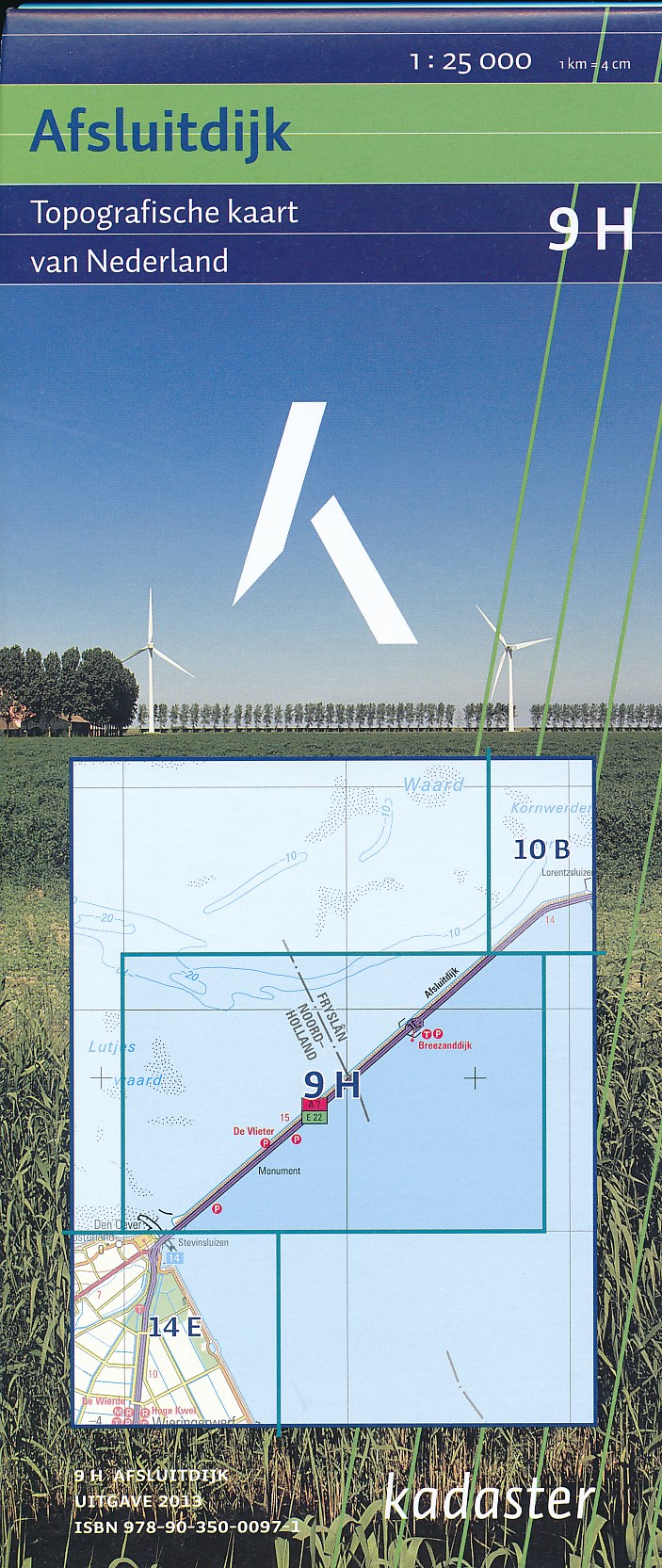
- Wandelkaart - Topografische kaart 9H Afsluitdijk | Kadaster
- Unieke Nederlandse topografische kaart met nauwelijks land: alleen de Afsluitdijk! De meest gedetailleerde kaart die via de verkoopkanalen verkrijgbaar is. Gemaakt door de Nederlandse Topografische dienst bevat deze kaart alle topografische elementen van het landschap en geeft daarmee een nauwkeurig beeld van het terrein. De meeste kaarten... Read more
Weitere …