
Andalucía
Beschreibung
Autonomous region in the south of Spain.
Wanderwege Landesteil
Links
Fakten
Berichte
Führer und Karten
Übernachtung
Organisationen
Reisebüros
GPS
Sonstiges
Bücher

The Book Depository
United Kingdom
2018
United Kingdom
2018
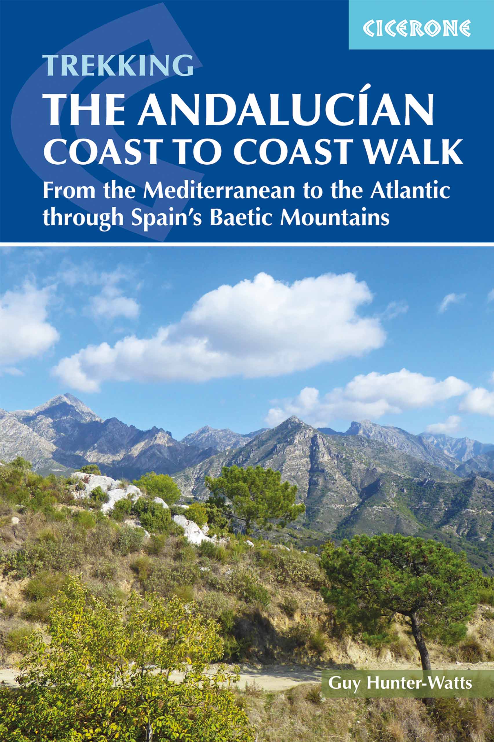
- The Andalucian Coast to Coast Walk
- From the Mediterranean to the Atlantic through the Baetic Mountains Read more
- Also available from:
- De Zwerver, Netherlands
De Zwerver
Netherlands
2018
Netherlands
2018
- Wandelgids The Andalucian Coast to Coast Walk - Andalusie | Cicerone
- Guidebook to the Andalucian Coast to Coast Walk, a 440km, 21-day route from Maro on the Mediterranean coast to Bolonia, on the Atlantic. The route, which passes through 7 Natural Parks, links some of Andalucía's most beautiful villages and passes historical sites of both Roman and Moorish origins, including Ronda and Tarifa. Read more

De Zwerver
Netherlands
2017
Netherlands
2017
De Zwerver
Netherlands
2023
Netherlands
2023

Stanfords
United Kingdom
United Kingdom
- Walking The Camino: A Modern Pilgrimage To Santiago
- In May 2006, armed only with a small rucksack and a staff, Tony Kevin, an overweight, sedentary, 63- year-old former diplomat, set off on an eight-week trek across Spain. But this was not just a very long walk - it was a pilgrimage. From Granada, in the southeast, to Santiago de Compostela, in the far northwest, Tony followed the Via Mozarabe... Read more

Stanfords
United Kingdom
United Kingdom
- Walking in Andalucía
- Walking in Andalucía is an illustrated guide to the best walks in the diverse terrain of southern Spain’s natural parks. 36 full- and half-day walks, most of which are circular, are featured in six of Andalusia’s natural parks: Grazalema, La Alpujarra, Cazorla, Los Alcornocales, Aracena and La Axarquia. The guide contains clear and detailed... Read more

Stanfords
United Kingdom
United Kingdom
- Sierra Nevada Mountain Guidebook
- Sierra Nevada Mountain Guidebook in English from Editorial Penibetica, publishers of a wide range of detailed, contoured walking maps of popular hiking areas of Andalucía. Colour extracts from their maps, overprinted with 40 routes, accompany the text.The guide is divided into colour-coded sections covering walks from different locations such... Read more

Stanfords
United Kingdom
United Kingdom
- DK Eyewitness Seville and Andalucia
- Your journey starts here. Featuring DK`s much-loved maps and illustrations, walks and information, plus all new, full-colour photography, this 100% updated guide to Seville and Andalucía brings you the best of this stunning Spanish region and its capital in a brand-new, lightweight format.What`s inside?- full-colour photography, hand-drawn... Read more
De Zwerver
Netherlands
2020
Netherlands
2020
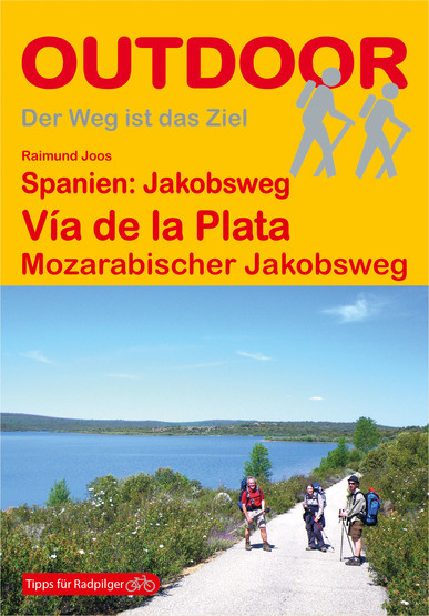
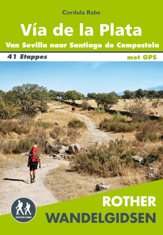
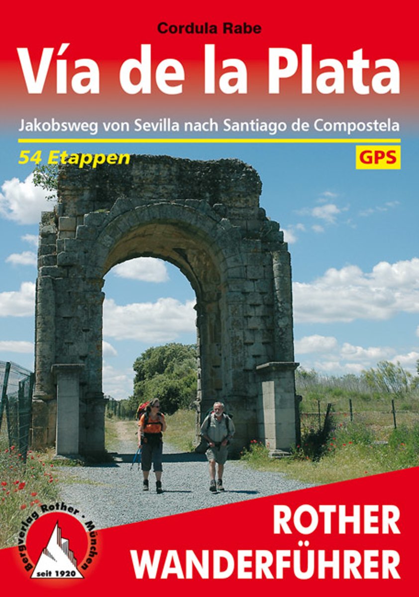
- Wandelgids 291 Via de la Plata | Rother Bergverlag
- Uitstekende beschrijvingen van deze steeds populairder wordende pelgrimstocht! Met alle noodzakelijke info. Zie voor beschrijving de duitse tekst hieronder ..... Die von Sevilla nach Santiago de Compostela führende Vía de la Plata erfreut sich einer stetig wachsenden Beliebtheit als Fernwanderroute. Freunde des berühmten Camino francés, des von... Read more
- Also available from:
- Bol.com, Netherlands
- Bol.com, Belgium
Bol.com
Netherlands
2011
Netherlands
2011
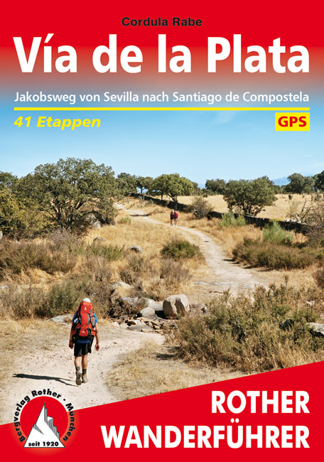
- Vía de la Plata
- Die von Sevilla nach Santiago de Compostela f hrende V a de la Plata erfreut sich einer stetig wachsenden Beliebtheit als Fernwanderroute. Freunde des ber hmten Camino franc s, des von den Pyren en nach Westen verlaufenden Jakobsweges, sch tzen die fast 1000 Kilometer lange S d-Nord-Strecke als noch wenig frequentierte, ruhigere Alternative.... Read more
Bol.com
Belgium
2011
Belgium
2011
- Vía de la Plata
- Die von Sevilla nach Santiago de Compostela f hrende V a de la Plata erfreut sich einer stetig wachsenden Beliebtheit als Fernwanderroute. Freunde des ber hmten Camino franc s, des von den Pyren en nach Westen verlaufenden Jakobsweges, sch tzen die fast 1000 Kilometer lange S d-Nord-Strecke als noch wenig frequentierte, ruhigere Alternative.... Read more
Bol.com
Netherlands
2018
Netherlands
2018
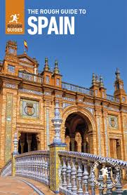
- The Rough Guide to Spain
- Discover Spain with the most incisive and entertaining guidebook on the market. Whether you plan on exploring Andalucia's White Towns, sampling the legendary nightlife of Madrid or hiking in the Picos de Euuropa, this new edition of The Rough Guide to Spain will show you the ideal places to sleep, eat, drink, shop and visit along the way.... Read more
- Also available from:
- Bol.com, Belgium
Bol.com
Belgium
2018
Belgium
2018
- The Rough Guide to Spain
- Discover Spain with the most incisive and entertaining guidebook on the market. Whether you plan on exploring Andalucia's White Towns, sampling the legendary nightlife of Madrid or hiking in the Picos de Euuropa, this new edition of The Rough Guide to Spain will show you the ideal places to sleep, eat, drink, shop and visit along the way.... Read more

Stanfords
United Kingdom
United Kingdom
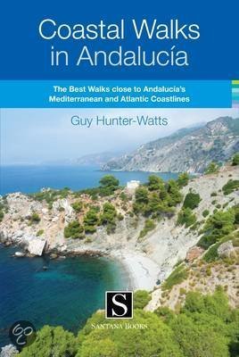
- Coastal Walks in Andalucía
- Coastal Walks in Andalucía from Guy Hunter-Watts is an illustrated guide to the best trails close to the Mediterranean and Atlantic Coastline of Andalucía, inland from the famous beaches of Vejer, Tarifa, Bolonia, Gibraltar, Estepona, Marbella, Mijas, Nerja and Maro.The guide features 43 full and half day walks, mostly circular routes in seven... Read more
- Also available from:
- Bol.com, Netherlands
- Bol.com, Belgium
Bol.com
Netherlands
Netherlands
- Coastal Walks in Andalucia
- A guidebook to 40 half and full day coastal walks in Andalucía. The graded routes, which are suitable for any reasonably fit walker, range from 6km to 19.5km and can be walked all year round. The walks are located in seven of the region's most beautiful National Parks and protected areas (including La Breña y las Marismas, Los Alcornocales y... Read more
Bol.com
Belgium
Belgium
- Coastal Walks in Andalucia
- A guidebook to 40 half and full day coastal walks in Andalucía. The graded routes, which are suitable for any reasonably fit walker, range from 6km to 19.5km and can be walked all year round. The walks are located in seven of the region's most beautiful National Parks and protected areas (including La Breña y las Marismas, Los Alcornocales y... Read more
Karten

The Book Depository
United Kingdom
United Kingdom
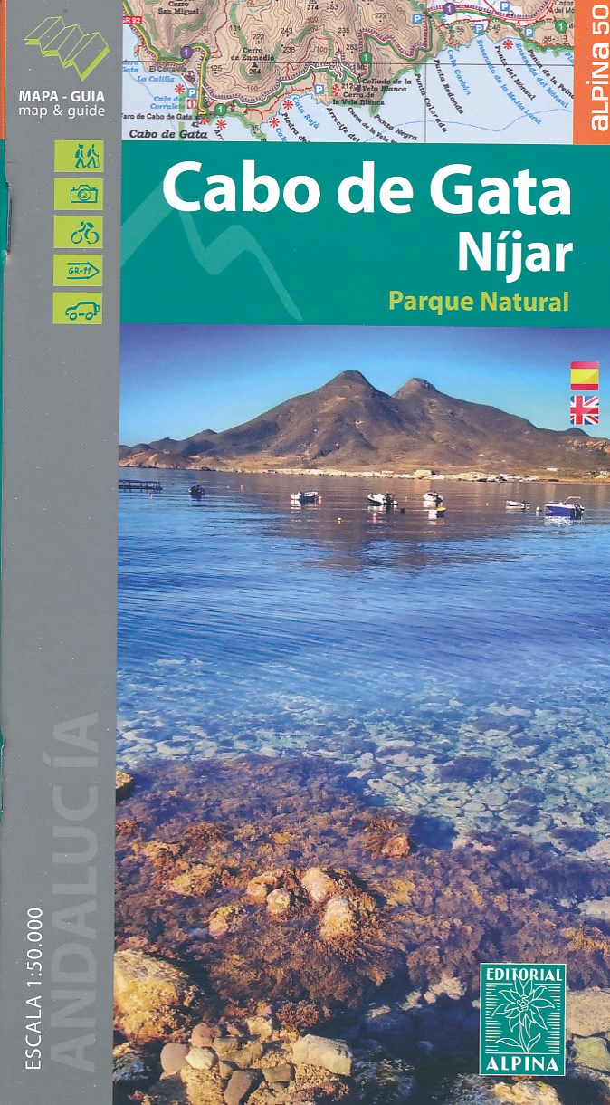
- Cabo de Gata / Nijar
- Gedetailleerde wandelkaart van een interessant wandelgebied. Uitstekend leesbaar, inhoudelijk een goede kaart met allerhande informatie op topografische basis waarbij wandelroutes, campings en hutten. Bij een aantal Alpina kaarten is een boekje bijgevoegd met routes. Door de toevoeging van gradengrid is deze kaart bruikbaar voor GPS. Cabo da... Read more
- Also available from:
- De Zwerver, Netherlands
- Stanfords, United Kingdom
De Zwerver
Netherlands
Netherlands
- Wandelkaart Cabo de Gata - Nijar | Editorial Alpina
- Gedetailleerde wandelkaart van een interessant wandelgebied. Uitstekend leesbaar, inhoudelijk een goede kaart met allerhande informatie op topografische basis waarbij wandelroutes, campings en hutten. Bij een aantal Alpina kaarten is een boekje bijgevoegd met routes. Door de toevoeging van gradengrid is deze kaart bruikbaar voor GPS. Cabo da... Read more

Stanfords
United Kingdom
United Kingdom
- Cabo de Gata-Níjar Natural Park Editorial Alpina
- Cabo da Gata area on the south-eastern tip of Andalucía on a contoured and GPS compatible map at 1:50,000 from Editorial Alpina highlighting hiking and cycling trails, plus a booklet with English language descriptions of recommended routes, accommodation lists, etc.Topography is shown by contours at 20m intervals, with relief shading and... Read more

- Also available from:
- De Zwerver, Netherlands
- Stanfords, United Kingdom

Stanfords
United Kingdom
United Kingdom
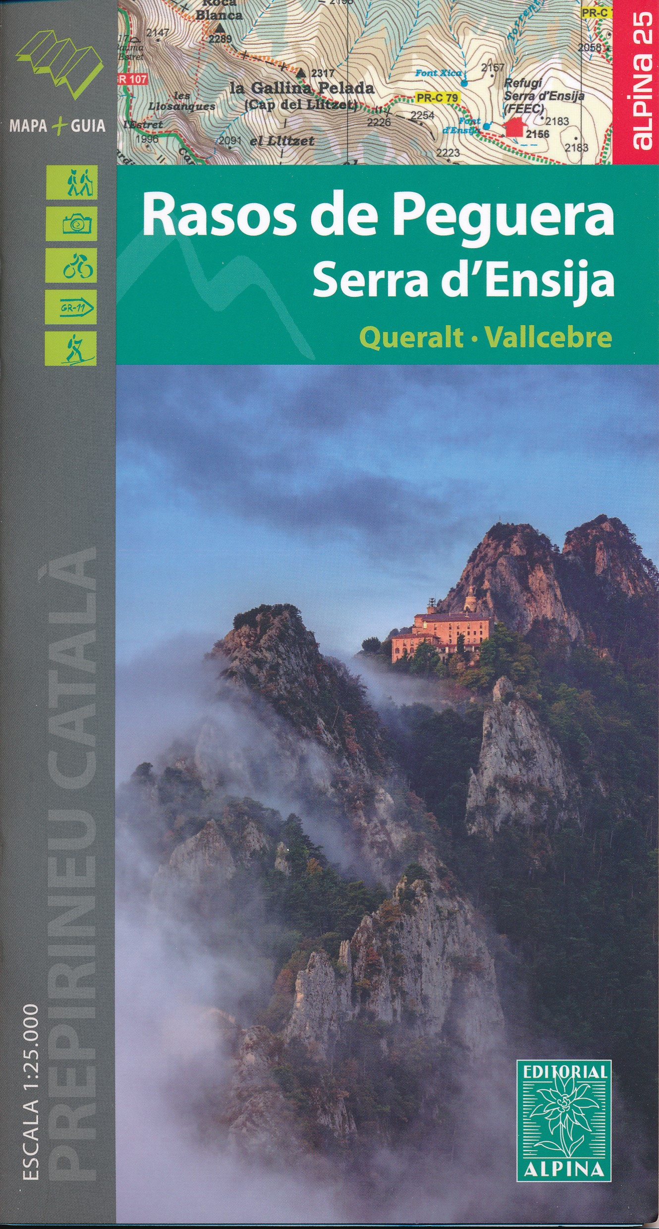
- Rasos de Peguera - Serra d`Ensija Editorial Alpina
- Rasos de Peguera - Serra d`Ensija in an extensive and very popular series of walking maps from Editorial Alpina covering the Pyrenees, Catalonia and other selected hiking areas in Spain, including Picos de Europa, Sierra Nevada and parts of Andalucía, Majorca, etc. Scales vary from 1:50,000 to 1:10,000, with the majority of the titles at... Read more

The Book Depository
United Kingdom
United Kingdom
- Delta de l'Ebre PN - Serra de Montsia
- The Delta of the Ebro – Serra de Montsià in an extensive and very popular series of walking maps from Editorial Alpina covering the Pyrenees, Catalonia and other selected hiking areas in Spain, including Picos de Europa, Sierra Nevada and parts of Andalucía, Majorca, etc. Scales vary from 1:50,000 to 1:10,000, with the majority of the titles... Read more
- Also available from:
- Stanfords, United Kingdom

Stanfords
United Kingdom
United Kingdom
- Delta of the Ebro – Serra de Montsià Editorial Alpina
- The Delta of the Ebro – Serra de Montsià in an extensive and very popular series of walking maps from Editorial Alpina covering the Pyrenees, Catalonia and other selected hiking areas in Spain, including Picos de Europa, Sierra Nevada and parts of Andalucía, Majorca, etc. Scales vary from 1:50,000 to 1:10,000, with the majority of the titles... Read more

The Book Depository
United Kingdom
United Kingdom
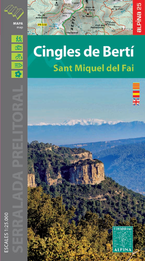
- Cingles del Berti - Sant Miquel des Fai
- Cingles de Berti area at 1:25,000 in an extensive and very popular series of walking maps from Editorial Alpina. Contours are at 10m intervals, enhanced by relief shading and vegetation colouring. The map has UTM grid and 1’ margin ticks. In addition to footpaths, the overprint shows various types of accommodation (hotels, campsites, etc.),... Read more
- Also available from:
- De Zwerver, Netherlands
- Stanfords, United Kingdom
De Zwerver
Netherlands
Netherlands
- Wandelkaart 54 Cingles de Berti | Editorial Alpina
- Cingles de Berti area at 1:25,000 in an extensive and very popular series of walking maps from Editorial Alpina. Contours are at 10m intervals, enhanced by relief shading and vegetation colouring. The map has UTM grid and 1’ margin ticks. In addition to footpaths, the overprint shows various types of accommodation (hotels, campsites, etc.),... Read more

Stanfords
United Kingdom
United Kingdom
- Cingles de Berti - Sant Miquel des Fai Editorial Alpina
- Cingles de Berti area at 1:25,000 in an extensive and very popular series of walking maps from Editorial Alpina. Contours are at 10m intervals, enhanced by relief shading and vegetation colouring. The map has UTM grid and 1’ margin ticks. In addition to footpaths, the overprint shows various types of accommodation (hotels, campsites, etc.),... Read more

The Book Depository
United Kingdom
United Kingdom
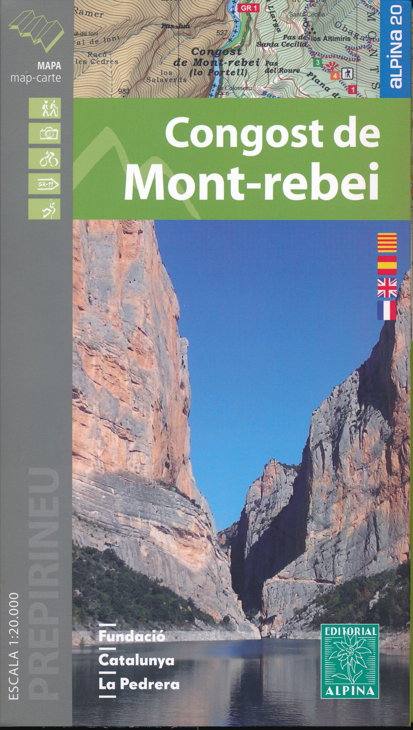
- Mont-rebei congost de
- Congost de Mont-rebei in an extensive and very popular series of walking maps from Editorial Alpina covering the Pyrenees, Catalonia and other selected hiking areas in Spain, including Picos de Europa, Sierra Nevada and parts of Andalucía, Majorca, etc. Scales vary from 1:50,000 to 1:10,000, with the majority of the titles at 1:25,000. The... Read more
- Also available from:
- De Zwerver, Netherlands
- Stanfords, United Kingdom
De Zwerver
Netherlands
Netherlands
- Wandelkaart 33 Congost de Mont-rebei | Editorial Alpina
- Congost de Mont-rebei in an extensive and very popular series of walking maps from Editorial Alpina covering the Pyrenees, Catalonia and other selected hiking areas in Spain, including Picos de Europa, Sierra Nevada and parts of Andalucía, Majorca, etc. Scales vary from 1:50,000 to 1:10,000, with the majority of the titles at 1:25,000. The... Read more

Stanfords
United Kingdom
United Kingdom
- Congost de Mont-rebei Editorial Alpina
- Congost de Mont-rebei in an extensive and very popular series of walking maps from Editorial Alpina covering the Pyrenees, Catalonia and other selected hiking areas in Spain, including Picos de Europa, Sierra Nevada and parts of Andalucía, Majorca, etc. Scales vary from 1:50,000 to 1:10,000, with the majority of the titles at 1:25,000. The... Read more

The Book Depository
United Kingdom
United Kingdom
- Also available from:
- De Zwerver, Netherlands
- Stanfords, United Kingdom

Stanfords
United Kingdom
United Kingdom
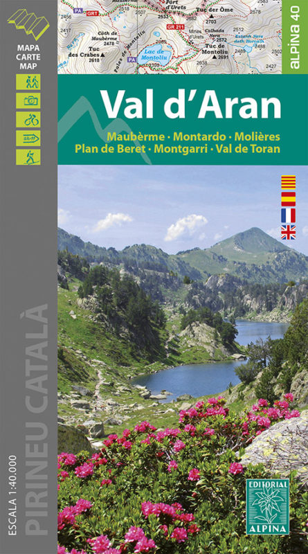
- Val d`Aran - Mauberme - Montardo - Molieres Editorial Alpina
- Val d`Aran in an extensive and very popular series of walking maps from Editorial Alpina covering the Pyrenees, Catalonia and other selected hiking areas in Spain, including Picos de Europa, Sierra Nevada and parts of Andalucía, Majorca, etc. Scales vary from 1:50,000 to 1:10,000, with the majority of the titles at 1:25,000. The maps have... Read more

The Book Depository
United Kingdom
United Kingdom
- Also available from:
- De Zwerver, Netherlands
- Stanfords, United Kingdom

Stanfords
United Kingdom
United Kingdom
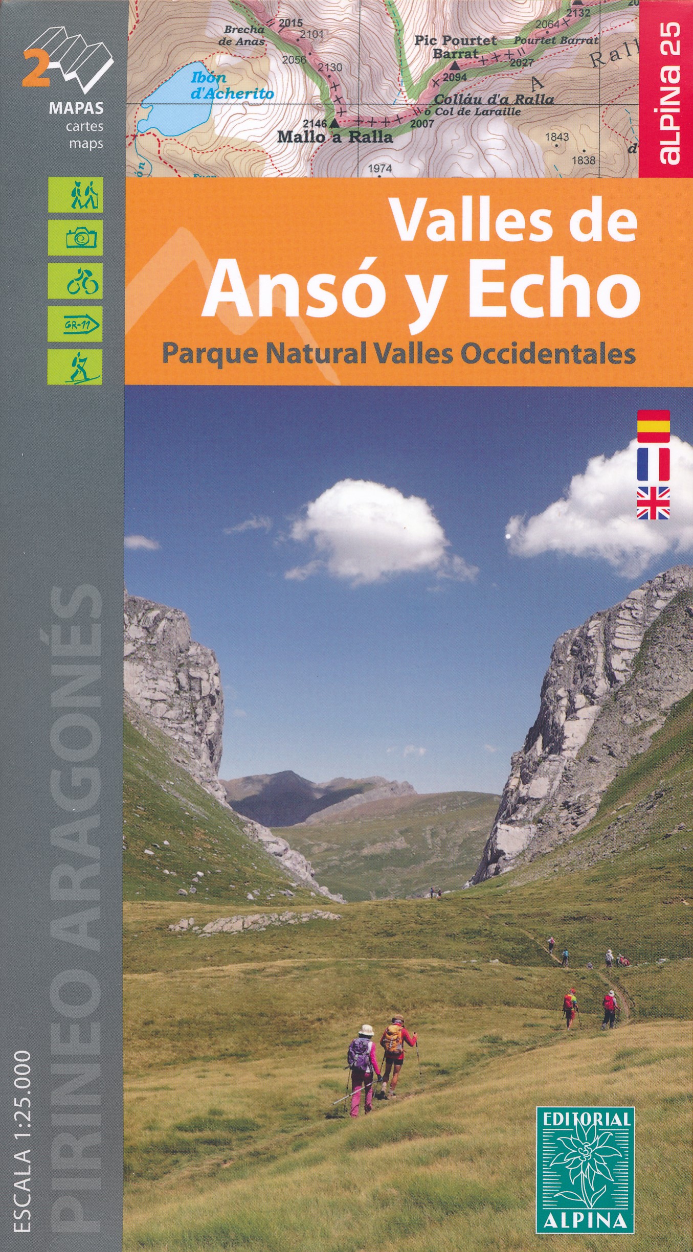
- Valles de Ansó & Echo Editorial Alpina
- Valles de Ansó & Echo in an extensive and very popular series of walking maps from Editorial Alpina covering the Pyrenees, Catalonia and other selected hiking areas in Spain, including Picos de Europa, Sierra Nevada and parts of Andalucía, Majorca, etc. Scales vary from 1:50,000 to 1:10,000, with the majority of the titles at 1:25,000. The maps... Read more

- Also available from:
- De Zwerver, Netherlands
- Stanfords, United Kingdom
Stanfords
United Kingdom
United Kingdom
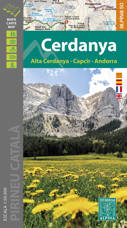
- Cerdanya - Alta Cerdanya - Capcir - Andorra Editorial Alpina
- Cerdanya: Alta Cerdanya - Capcir - Andorra at 1;50,000 in an extensive and very popular series of walking maps from Editorial Alpina covering the Pyrenees, Catalonia and other selected hiking areas in Spain, including Picos de Europa, Sierra Nevada and parts of Andalucía, Majorca, etc. Scales vary from 1:50,000 to 1:10,000, with the majority of... Read more

The Book Depository
United Kingdom
United Kingdom
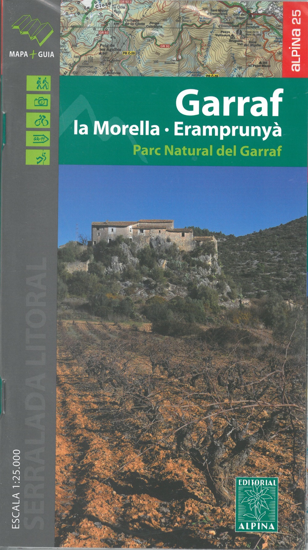
- Garraf - La Morella - Eramprunya - Parc Natural del Garraf
- Zeer gedetailleerde wandelkaart van dit mooie natuurgebied in Noord Oost Spanje. Met ingetekende wandelroutes en andere informatie. Spaans en deel in het engels, maar uitstekende kaart. Met symbolen voor campings, hutten. Read more
- Also available from:
- De Zwerver, Netherlands
- Stanfords, United Kingdom
De Zwerver
Netherlands
Netherlands
- Wandelkaart 62 Parc Naturel del Garraf | Editorial Alpina
- Zeer gedetailleerde wandelkaart van dit mooie natuurgebied in Noord Oost Spanje. Met ingetekende wandelroutes en andere informatie. Spaans en deel in het engels, maar uitstekende kaart. Met symbolen voor campings, hutten. Read more
Stanfords
United Kingdom
United Kingdom
- Garraf - la Morella - Eramprunya Editorial Alpina
- Massíf de Garraf in an extensive and very popular series of walking maps from Editorial Alpina covering the Pyrenees, Catalonia and other selected hiking areas in Spain, including Picos de Europa, Sierra Nevada and parts of Andalucía, Majorca, etc. Scales vary from 1:50,000 to 1:10,000, with the majority of the titles at 1:25,000. The maps have... Read more

- Also available from:
- De Zwerver, Netherlands
- Stanfords, United Kingdom

Stanfords
United Kingdom
United Kingdom
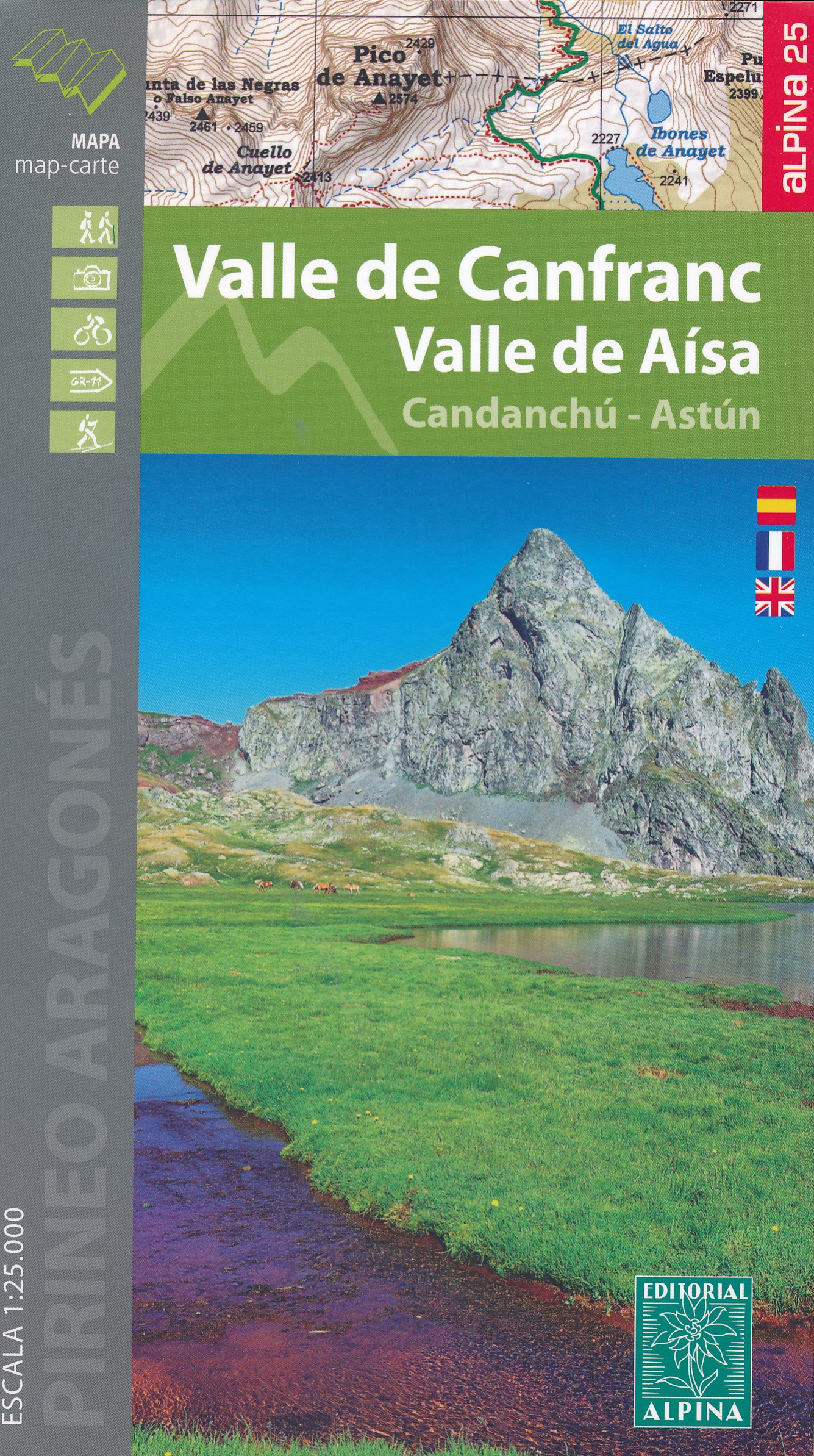
- Valle de Canfranc - Valle de Aisa - Candanchu - Astun Editorial Alpina
- Valle de Canfranc - Valle de Aisa in an extensive and very popular series of walking maps from Editorial Alpina covering the Pyrenees, Catalonia and other selected hiking areas in Spain, including Picos de Europa, Sierra Nevada and parts of Andalucía, Majorca, etc. Scales vary from 1:50,000 to 1:10,000, with the majority of the titles at... Read more

De Zwerver
Netherlands
Netherlands
- Pelgrimsroute (kaart) - Wandelkaart Camino de Santiago in Spanje | CNIG - Instituto Geográfico Nacional
- All roads leading to Santiago de Compostela in the Iberian Peninsula are represented on this Caminos de Santiago / The Way of St. James Map. Routes highlighted on a physical map of the Iberian Peninsula at 1:1,250,000 from IGN/CNIG, Spain civilian topographic survey organization. The base map with altitude colouring and relief shading provides... Read more
- Also available from:
- Stanfords, United Kingdom

Stanfords
United Kingdom
United Kingdom
- Caminos de Santiago / Ways of St. James on the Iberian Peninsula CNIG Overview Map
- All roads leading to Santiago de Compostela in the Iberian Peninsula are represented on this Caminos de Santiago / The Way of St. James Map. Routes highlighted on a physical map of the Iberian Peninsula at 1:1,250,000 from IGN/CNIG, Spain civilian topographic survey organization. The base map with altitude colouring and relief shading provides... Read more

De Zwerver
Netherlands
Netherlands
- Wandelkaart 55 Montseny Parc Natural | Editorial Alpina
- Montseny in an extensive and very popular series of walking maps from Editorial Alpina covering the Pyrenees, Catalonia and other selected hiking areas in Spain, including Picos de Europa, Sierra Nevada and parts of Andalucía, Majorca, etc. Scales vary from 1:50,000 to 1:10,000, with the majority of the titles at 1:25,000. The maps have... Read more
- Also available from:
- Stanfords, United Kingdom

Stanfords
United Kingdom
United Kingdom
- Montseny NP - Turo de l`Home - Les Agudas - Matagalls - la Calma Editorial Alpina 2-Map Set
- Montseny in an extensive and very popular series of walking maps from Editorial Alpina covering the Pyrenees, Catalonia and other selected hiking areas in Spain, including Picos de Europa, Sierra Nevada and parts of Andalucía, Majorca, etc. Scales vary from 1:50,000 to 1:10,000, with the majority of the titles at 1:25,000. The maps have... Read more
De Zwerver
Netherlands
Netherlands
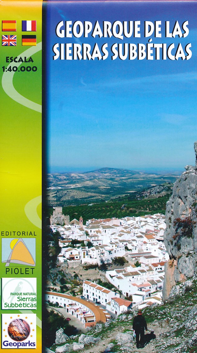
- Wandelkaart Geoparque de las Sierras Subbeticas | Editorial Piolet
- Uitstekende wandelkaart van een klein gebied. Met ingetekende wandelroutes en hoogtelijnen. Excellent 1:20.000 scale map of the area of Geoparque de las Sierras Subbeticas. Includes local signaling pathways, GR, PR, Nordik Walking tour and most characteristic areas of diving. Equidistance between contours 10 m. Read more
- Also available from:
- Stanfords, United Kingdom

Stanfords
United Kingdom
United Kingdom
- Geoparque de las Sierras Subbeticas Editorial Piolet Hiking Map
- Geoparque de las Sierras Subbeticas in Andalucía, roughly half Cordoba, on a very clear, contoured and GPS compatible map at 1:40,000 from Editorial Piolet highlighting local walking trails including 10 recommended routes, long-distance hiking routes, Via Verde cycling trails, and various places of interest. Hiking maps in the Editorial Piolet... Read more
De Zwerver
Netherlands
Netherlands
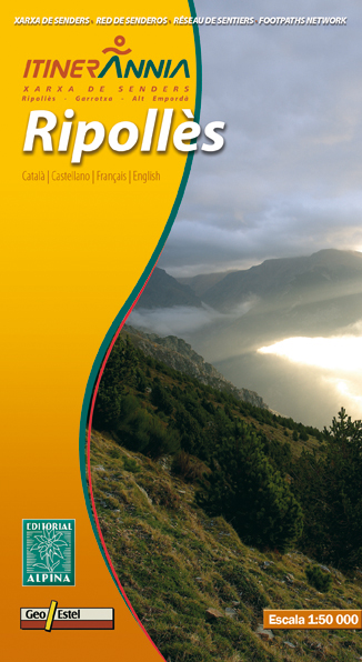
- Wandelkaart Ripolles | Editorial Alpina
- Zeer gedetailleerde wandelkaart van een klein deel van de Spaanse Pyreneeen. Met ingetekende wandelroutes en andere informatie. Uitstekende kaart. Met symbolen voor campings, hutten. Op de topografische wandelkaart worden o.a. berghutten, campings aangeduid en hoogtelijnen, ingetekende wandelroutes en de GR paden (doorgaande... Read more
- Also available from:
- Stanfords, United Kingdom

Stanfords
United Kingdom
United Kingdom
- Ripollès Editorial Alpina
- Ripollès in an extensive and very popular series of walking maps from Editorial Alpina covering the Pyrenees, Catalonia and other selected hiking areas in Spain, including Picos de Europa, Sierra Nevada and parts of Andalucía, Majorca, etc. Scales vary from 1:50,000 to 1:10,000, with the majority of the titles at 1:25,000. The maps have... Read more
De Zwerver
Netherlands
Netherlands
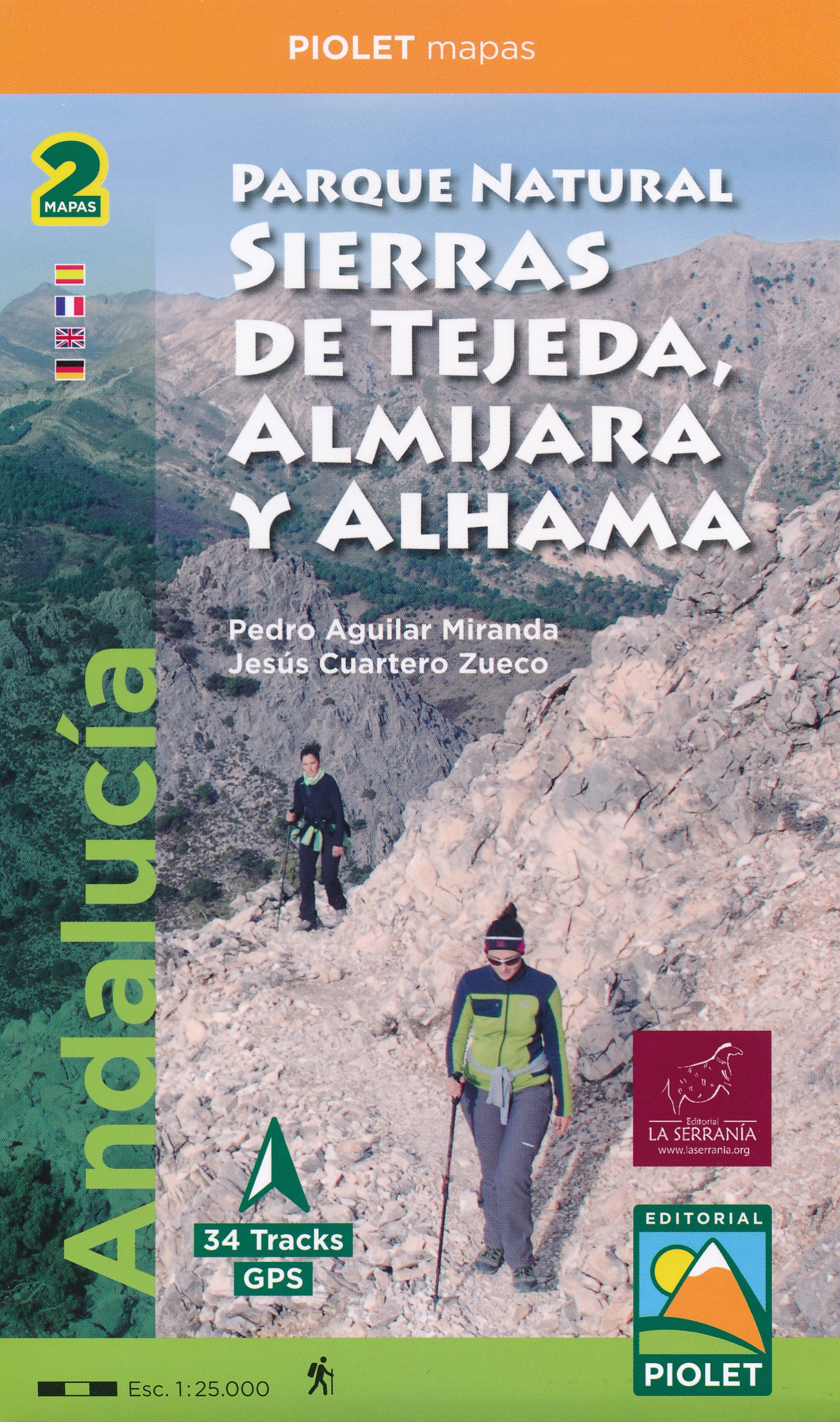
- Wandelkaart Parque Natural Sierras de Tejeda, Almijara y Alhama | Editorial Piolet
- Sierras de Tejeda, Almijara y Alhama, popular hiking area east of Vélez-Málaga, at 1:40,000 on a detailed, GPS compatible topographic map from the Instituto de Cartografia de Andalucía, the region’s official survey organization, printed on light, waterproof and tear-resistant synthetic paper. Coverage along the coast extends from Velez-Malaga... Read more
- Also available from:
- Stanfords, United Kingdom

Stanfords
United Kingdom
United Kingdom
- Sierras de Tejeda, Almijara y Alhama Editorial Piolet 2-Map Set
- Sierras de Tejeda, Almijara y Alhama, popular hiking area east of Vélez-Málaga, at 1:40,000 on a detailed, GPS compatible topographic map from the Instituto de Cartografia de Andalucía, the region’s official survey organization, printed on light, waterproof and tear-resistant synthetic paper. Coverage along the coast extends from Velez-Malaga... Read more