
Extremadura
Beschreibung
Autonomous region in the west of Spain, bordering Portugal.
Wanderwege Landesteil
Links
Fakten
Berichte
Führer und Karten
Übernachtung
Organisationen
Reisebüros
GPS
Sonstiges
Bücher

De Zwerver
Netherlands
2023
Netherlands
2023
De Zwerver
Netherlands
2017
Netherlands
2017
De Zwerver
Netherlands
2019
Netherlands
2019

Stanfords
United Kingdom
United Kingdom
- Walking The Camino: A Modern Pilgrimage To Santiago
- In May 2006, armed only with a small rucksack and a staff, Tony Kevin, an overweight, sedentary, 63- year-old former diplomat, set off on an eight-week trek across Spain. But this was not just a very long walk - it was a pilgrimage. From Granada, in the southeast, to Santiago de Compostela, in the far northwest, Tony followed the Via Mozarabe... Read more

Stanfords
United Kingdom
United Kingdom
- Walking in Extremadura
- Walking in Extremadura – Discover Spain’s Secret Paradise by Gisela Radant Wood, is a fully illustrated guide describing routes in this little known, yet beautiful region. The 30 walks will lead you to breathtaking views around Cáceres and Badajoz provinces, and along places such as the Sierra de Gata and the Sierra de Montánchez. The walks... Read more

Stanfords
United Kingdom
United Kingdom
- Extremadura
- This guide to Extremadura provides an introduction to this fascinating region and suggests a number of itineraries which enable the visitor to discover the area at their own pace.This is the revised second edition, containing a full description of the landscapes and scenery of the whole region, from the rugged landscapes of Monfrague to the... Read more

The Book Depository
United Kingdom
2017
United Kingdom
2017
- The Sierras of Extremadura
- 32 half and full-day walks in western Spain's hills Read more
- Also available from:
- De Zwerver, Netherlands
- Stanfords, United Kingdom
- Bol.com, Netherlands
- Bol.com, Belgium
De Zwerver
Netherlands
2017
Netherlands
2017
- Wandelgids The Sierras of Extremadura | Cicerone
- Guidebook to Extremadura, one of Spain's most unspoilt regions, comprising the provinces of Caceres and Badajoz. 32 mainly circular walks (6 to 19km) explore Sierras, rolling hills and oak forests criss-crossed by thousands of kilometres of ancient paths. Includes the Jerte Valley, the hill town of Montánchez, Guadalupe and Monesterio. Read more

Stanfords
United Kingdom
2017
United Kingdom
2017
- The Sierras of Extremadura: 32 half and full day walks in western Spain`s hills
- This guidebook showcases 32 walks exploring the sierras of Caceres and Badajoz, one of Spain`s least known regions and a gem for walkers and nature lovers. Walks range in length from 6 to 20km are suitable for any reasonably fit walker. They can be done from a number of bases in the area including San Martin de Trevejo, Gata, Hervas, Jerte,... Read more

Bol.com
Netherlands
2017
Netherlands
2017
- The Sierras of Extremadura
- This guidebook showcases 32 walks exploring the sierras of Caceres and Badajoz, one of Spain's least known regions and a gem for walkers and nature lovers. Walks range in length from 6 to 20km are suitable for any reasonably fit walker. They can be done from a number of bases in the area including San Martin de Trevejo, Gata, Hervas, Jerte,... Read more
Bol.com
Belgium
2017
Belgium
2017
- The Sierras of Extremadura
- This guidebook showcases 32 walks exploring the sierras of Caceres and Badajoz, one of Spain's least known regions and a gem for walkers and nature lovers. Walks range in length from 6 to 20km are suitable for any reasonably fit walker. They can be done from a number of bases in the area including San Martin de Trevejo, Gata, Hervas, Jerte,... Read more
Bol.com
Netherlands
Netherlands
- Lonely Planet Spain
- Lonely Planet: The world's leading travel guide publisherLonely Planet Spainis your passport to the most relevant, up-to-date advice on what to see and skip, and what hidden discoveries await you. Marvel at the exquisite perfection of the Alhambra, hike the Pyrenean high country and laze on the Mediterranean's best beaches; all with your... Read more
- Also available from:
- Bol.com, Belgium
Bol.com
Belgium
Belgium
- Lonely Planet Spain
- Lonely Planet: The world's leading travel guide publisherLonely Planet Spainis your passport to the most relevant, up-to-date advice on what to see and skip, and what hidden discoveries await you. Marvel at the exquisite perfection of the Alhambra, hike the Pyrenean high country and laze on the Mediterranean's best beaches; all with your... Read more
Karten

De Zwerver
Netherlands
Netherlands
- Pelgrimsroute (kaart) - Wandelkaart Camino de Santiago in Spanje | CNIG - Instituto Geográfico Nacional
- All roads leading to Santiago de Compostela in the Iberian Peninsula are represented on this Caminos de Santiago / The Way of St. James Map. Routes highlighted on a physical map of the Iberian Peninsula at 1:1,250,000 from IGN/CNIG, Spain civilian topographic survey organization. The base map with altitude colouring and relief shading provides... Read more
- Also available from:
- Stanfords, United Kingdom

Stanfords
United Kingdom
United Kingdom
- Caminos de Santiago / Ways of St. James on the Iberian Peninsula CNIG Overview Map
- All roads leading to Santiago de Compostela in the Iberian Peninsula are represented on this Caminos de Santiago / The Way of St. James Map. Routes highlighted on a physical map of the Iberian Peninsula at 1:1,250,000 from IGN/CNIG, Spain civilian topographic survey organization. The base map with altitude colouring and relief shading provides... Read more
De Zwerver
Netherlands
2021
Netherlands
2021
De Zwerver
Netherlands
Netherlands
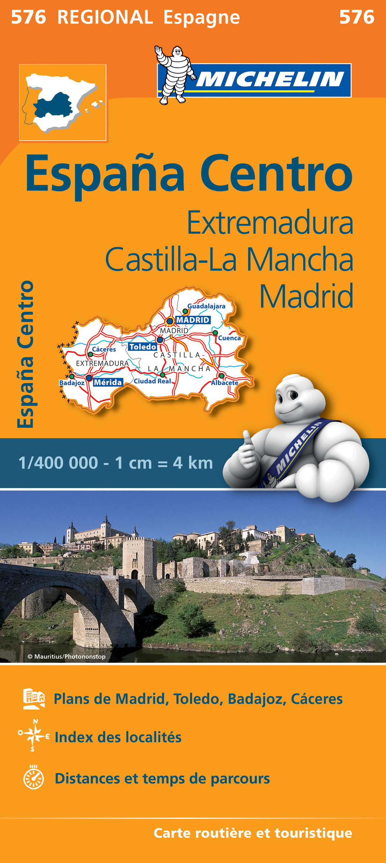
- Wegenkaart - landkaart 576 Extremadura - Castilla La Mancha - Madrid - Toledo - Mérida | Michelin
- Une carte fiable pour parcourir les régions d'Europe Read more

Stanfords
United Kingdom
United Kingdom
- Extremadura: Badajoz - Toledo - Córdoba 500K CNIG Regional Map No. 8
- The south-western part of central Spain between the Portuguese border and Toledo, Ciudad Real and Córdoba, at 1:500,000 in a series of regional road maps from the country’s civilian survey organization IGN-CNIG (Instituto Geográfico Nacional - Centro Nacional de Información Geográfica), vividly presenting the topography by altitude colouring,... Read more

Stanfords
United Kingdom
United Kingdom
- Extremadura Auotomous Community CNIG Physical Road Map
- Extremadura Autonomous Region of Spain at 1:300,000 in a series of physical road maps from IGN/CNIG - the country’s civilian survey organization, with an excellent presentation of the topography through relief shading and altitude colouring, plenty of names of mountain ranges, peaks, etcRelief shading is enhanced by bright altitude colouring,... Read more

Stanfords
United Kingdom
United Kingdom
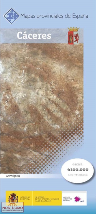
- Cáceres Province 200K CNIG Map Np. 11
- Contoured, GPS-compatible, indexed road map at 1:200,000 from CNIG - Spain’s civilian survey organization, with exceptionally informative presentation of the landscape and highlighting for facilities and places of interest including campsites and paradors.Maps in CNIG’s 200K Provincial Series provide an excellent picture the topography through... Read more

Stanfords
United Kingdom
United Kingdom
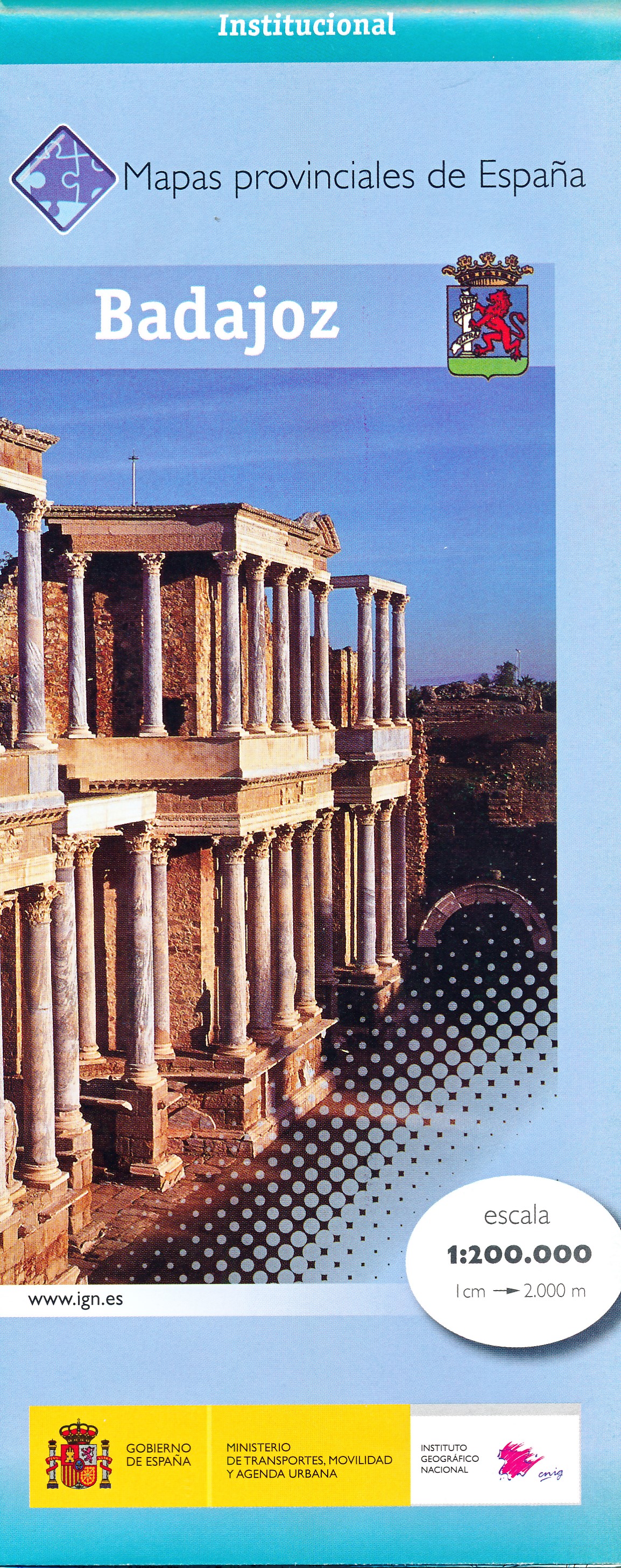
- Badajoz Province 200K CNIG Map No. 7
- Contoured, GPS-compatible, indexed road map at 1:200,000 from CNIG - Spain’s civilian survey organization, with exceptionally informative presentation of the landscape and highlighting for facilities and places of interest including campsites and paradors.Maps in CNIG’s 200K Provincial Series provide an excellent picture the topography through... Read more

Stanfords
United Kingdom
United Kingdom
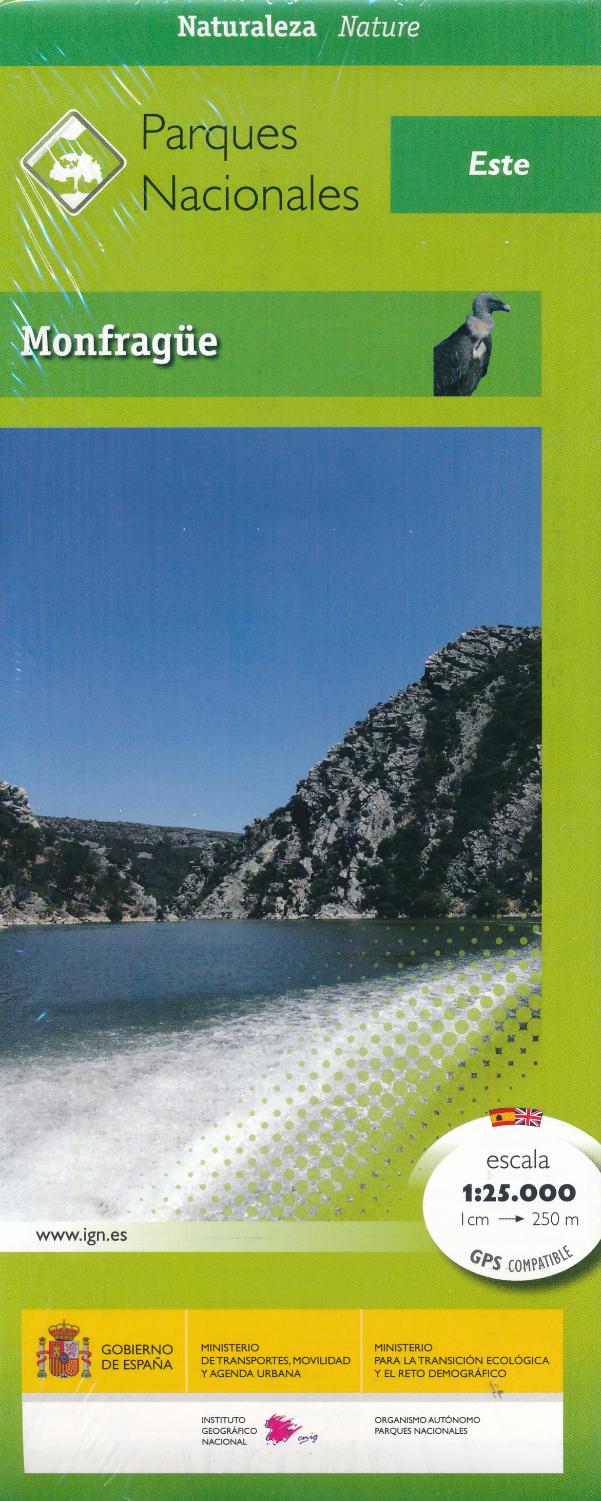
- Sierra Norte Natural Park CNIG Map
- Sierra Norte, directly north of Seville on the border with the Extremadura region, on a contoured and GPS compatible map at 1:100,000 from IGN/CNIG with cartography from their topographic survey of Spain. The map has contours at 50m intervals enhanced by bold relief shading with colouring and graphics to show different types of vegetation, and... Read more