
Isle of Man
Beschreibung
The Isle of Man lies halfway between England and Northern Ireland. The island measures about 20 by 50 km. The island offers several hiking trails, the best known of which is Raad ny Foillan or Way of the Gull or Isle of Man Coastal Path, a 150km path around the coast.
Wanderwege Region
Links
Fakten
Berichte
Führer und Karten
Übernachtung
Organisationen
Reisebüros
GPS
Sonstiges
Bücher

The Book Depository
United Kingdom
2019
United Kingdom
2019
- The Big Rounds
- Running and walking the Bob Graham, Paddy Buckley and Charlie Ramsay Rounds Read more


- Also available from:
- De Zwerver, Netherlands
- Stanfords, United Kingdom

De Zwerver
Netherlands
Netherlands

Stanfords
United Kingdom
United Kingdom
- The Solent, Isle of Wight, Southampton & Portsmouth OS Landranger Map 196 (paper)
- Isle of Wight with the Southampton - Portsmouth area, including part of the New Forest National Park and a section of the E9 European Long-distance Path, on a paper version of map No. 196 from the Ordnance Survey’s Landranger series at 1:50,000, with contoured and GPS compatible topographic mapping plus tourist information.MOBILE DOWNLOADS: As... Read more

The Book Depository
United Kingdom
United Kingdom

- Also available from:
- De Zwerver, Netherlands
- Stanfords, United Kingdom
De Zwerver
Netherlands
Netherlands

Stanfords
United Kingdom
United Kingdom
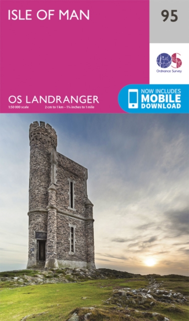
- Isle of Man OS Landranger Map 95 (paper)
- Paper version of map No. 95 from the Ordnance Survey’s Landranger series at 1:50,000, with contoured and GPS compatible topographic mapping plus tourist information.MOBILE DOWNLOADS: As well as the physical edition of the map, each Landranger title now includes a code for downloading after purchase its digital version onto your smartphone or... Read more

- Also available from:
- Stanfords, United Kingdom

Stanfords
United Kingdom
United Kingdom
- Isle of Man OS Landranger Active Map 95 (waterproof)
- Waterproof and tear-resistant OS Active version of map No. 95 from the Ordnance Survey’s Landranger series at 1:50,000, with contoured and GPS compatible topographic mapping plus tourist information.MOBILE DOWNLOADS: As well as the physical edition of the map, each Landranger title now includes a code for downloading after purchase its digital... Read more

Stanfords
United Kingdom
2015
United Kingdom
2015
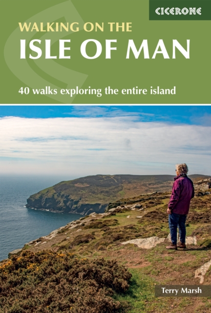
- Isle of Man Walking
- 40 half to full day walks on the coast and fells of the Isle of Man are explored in this guide book. Most of the walks are short and accessible for walkers of all abilities. For walkers looking for a greater challenge, there are longer adventures and plenty of opportunities to combine routes. Walking on the Isle of Man is a clear demonstration... Read more

- Also available from:
- Bol.com, Netherlands
- Bol.com, Belgium
Bol.com
Netherlands
Netherlands
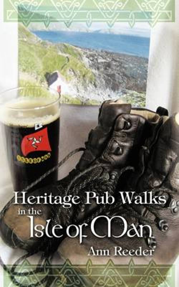
- Heritage Pub Walks in the Isle of Man
- If you want the perfect concise introduction to the best that the Isle of Man has to offer, this book is all you need. It provides the ideal mix of a scenic walk, outstanding scenery, fascinating history, atmospheric legends, key heritage sites and delightful pubs and real ale in one place. If you have one week or less and want to seek out the... Read more
Bol.com
Belgium
Belgium
- Heritage Pub Walks in the Isle of Man
- If you want the perfect concise introduction to the best that the Isle of Man has to offer, this book is all you need. It provides the ideal mix of a scenic walk, outstanding scenery, fascinating history, atmospheric legends, key heritage sites and delightful pubs and real ale in one place. If you have one week or less and want to seek out the... Read more
Bol.com
Netherlands
Netherlands
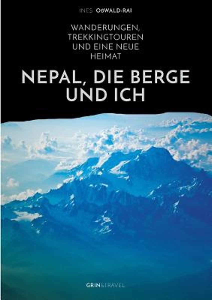
- Nepal
- Nepal, Heimat der hochsten Gebirgsketten der Welt, ist ein Anziehungspunkt fur Bergsteiger und Abenteurer. Auch die Bloggerin Ines Osswald-Rai zog das Land der Yaks und Yetis in seinen Bann. Immer wieder kehrte sie dorthin zuruck und wagte sich bis hinauf in eisige Hohen - aus Liebe zu Nepal, seinen majestatischen Bergen und Gletschern und... Read more
- Also available from:
- Bol.com, Belgium
Bol.com
Belgium
Belgium
- Nepal
- Nepal, Heimat der hochsten Gebirgsketten der Welt, ist ein Anziehungspunkt fur Bergsteiger und Abenteurer. Auch die Bloggerin Ines Osswald-Rai zog das Land der Yaks und Yetis in seinen Bann. Immer wieder kehrte sie dorthin zuruck und wagte sich bis hinauf in eisige Hohen - aus Liebe zu Nepal, seinen majestatischen Bergen und Gletschern und... Read more
Bol.com
Netherlands
2014
Netherlands
2014
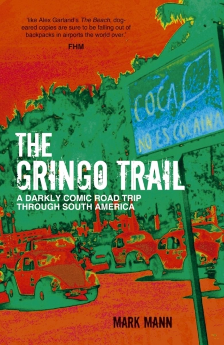
- The Gringo Trail
- "… there I was in the middle of Bogotá, coked up to my eyeballs, in a hallway holding two machetes, while some drunk Colombians argued about whether or not to blow up a bar with a live hand grenade…'Asia has the hippie trail. South America has the gringo trail. Mark Mann and his girlfriend Melissa set off to explore the ancient monuments,... Read more
- Also available from:
- Bol.com, Belgium
Bol.com
Belgium
2014
Belgium
2014
- The Gringo Trail
- "… there I was in the middle of Bogotá, coked up to my eyeballs, in a hallway holding two machetes, while some drunk Colombians argued about whether or not to blow up a bar with a live hand grenade…'Asia has the hippie trail. South America has the gringo trail. Mark Mann and his girlfriend Melissa set off to explore the ancient monuments,... Read more
Bol.com
Netherlands
Netherlands
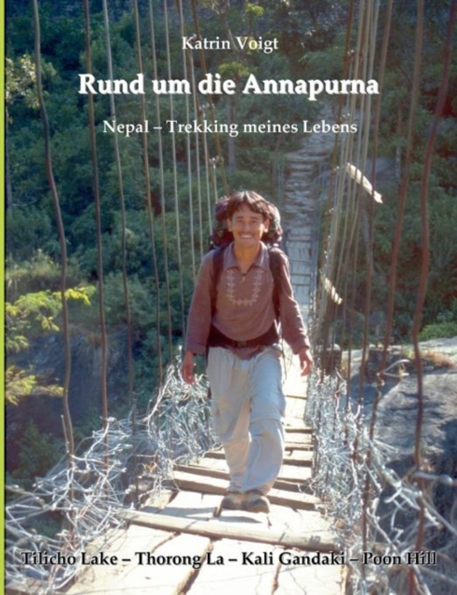
- Rund Um Die Annapurna - Nepal Trekking Meines Lebens
- Vier Wochen Trekking in Nepal. Als besonderes Geschenk für ihren Mann gedacht, wird die Annapurna-Umrundung für Katrin Voigt das Trekking-Erlebnis ihres Lebens. Gemeinsam mit Prem, ihrem nepalesischen Guide, wandern die beiden von Lodge zu Lodge, zum Tilicho Lake, zum Ice Lake, über den Pass Thorong La, durch das Kali Gandaki Tal und auf den... Read more
- Also available from:
- Bol.com, Belgium
Bol.com
Belgium
Belgium
- Rund Um Die Annapurna - Nepal Trekking Meines Lebens
- Vier Wochen Trekking in Nepal. Als besonderes Geschenk für ihren Mann gedacht, wird die Annapurna-Umrundung für Katrin Voigt das Trekking-Erlebnis ihres Lebens. Gemeinsam mit Prem, ihrem nepalesischen Guide, wandern die beiden von Lodge zu Lodge, zum Tilicho Lake, zum Ice Lake, über den Pass Thorong La, durch das Kali Gandaki Tal und auf den... Read more

The Book Depository
United Kingdom
2018
United Kingdom
2018
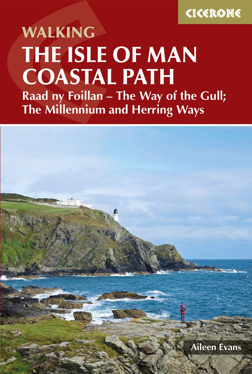
- Isle of Man Coastal Path
- Raad Ny Foillan - The Way of the Gull; The Millennium and Herring Ways Read more
- Also available from:
- De Zwerver, Netherlands
- Stanfords, United Kingdom
- Bol.com, Netherlands
- Bol.com, Belgium
De Zwerver
Netherlands
2018
Netherlands
2018
- Wandelgids Walking guide Isle of Man Coastal Path | Cicerone
- Guidebook to walking the Isle of Man coastal path, the Way of the Gull (Raad ny Foillan). The spectacular 98 mile route is described in 9 stages and takes in beaches, glens, moorland and rugged sea cliffs. It can be walked in around a week. Two other paths, the Millennium Way (Bayr ny Ree) and the Herring Way (Bayr ny Skeddan), are also described. Read more

Stanfords
United Kingdom
2018
United Kingdom
2018
- Isle of Man Coastal Path - with the Millennium & Herring Ways
- Raad ny Foillan (The Way of the Gull) is a 98 mile footpath around the Isle of Man. The route description is set out as a circuit and split into stages, with the longest walk being 15.5 miles and the shortest being 7 miles. Any fast walkers may wish to complete two stages per day, while those progressing at a more leisurely pace may decide to... Read more
Bol.com
Netherlands
2018
Netherlands
2018
- Isle of Man Coastal Path
- This handy guidebook describes the 98 mile Isle of Man coastal path, Raad ny Foillan. The route never strays far from the sea and boasts spectacular scenery, from rugged sea cliffs and mountain moorland to beaches and glens. The Raad ny Foillan path can be completed in about a week. The Milennium Way and the Herring Way are also described. Read more
Bol.com
Belgium
2018
Belgium
2018
- Isle of Man Coastal Path
- This handy guidebook describes the 98 mile Isle of Man coastal path, Raad ny Foillan. The route never strays far from the sea and boasts spectacular scenery, from rugged sea cliffs and mountain moorland to beaches and glens. The Raad ny Foillan path can be completed in about a week. The Milennium Way and the Herring Way are also described. Read more
Karten
De Zwerver
Netherlands
Netherlands
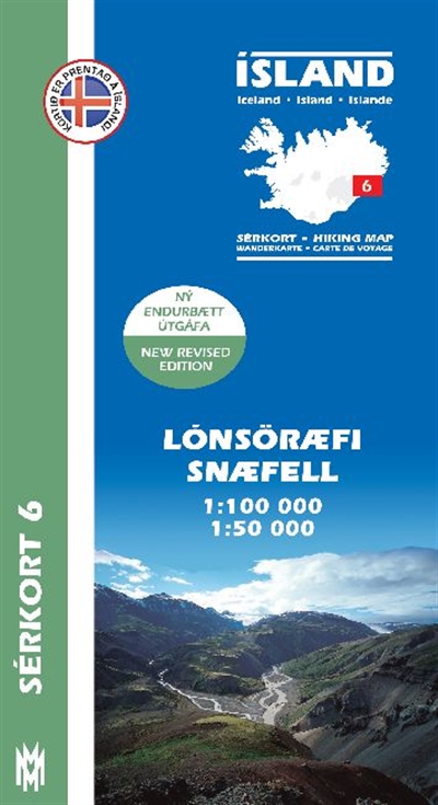
- Wandelkaart 06 Serkort Lónsöræfi - Snæfell - IJsland | Mal og Menning
- De wandelkaartenserie van Mal og Menning is bijzonder duidelijk en geschikt voor alle recreatieve doeleinden, ze zijn gebaseerd op de topografische kaarten van IJsland. De kaart laat een gedetailleerd beeld zien van de landschapskenmerken, hoogtelijnen op basis van 20 m. met hoogtepunten apart vermeld. Verschil in kleur en symbolen geven een... Read more
- Also available from:
- Stanfords, United Kingdom

Stanfords
United Kingdom
United Kingdom
- Lónsöræfi - Snæfell
- Lónsöræfi - Snæfell area of Iceland at 1:100,000 in a series of detailed hiking and recreational topographic maps from Mál og menning - the country`s leading cartographic publishers, with beautiful drawings of local birds and tourist information. An enlargement shows the Snæfell area in greater detail at 1:50,000.The maps in this series... Read more

Stanfords
United Kingdom
United Kingdom
- Admiralty Chart 2696 - Plans in the Isle of Man
- NEW EDITION OUT ON 01/08/2019Plans included in this chart:A Douglas Bay 1:7,500B Ramsey Bay 1:10,000C Castletown Bay 1:20,000D Calf Sound 1:10,000E Peel 1:10,000F Port Erin 1:10,000G Bay Ny Carrickey 1:20,000Admiralty standard nautical charts comply with Safety of Life at Sea (SOLAS) regulations and are ideal for professional, commercial and... Read more

Stanfords
United Kingdom
United Kingdom
- ADMIRALTY Leisure Folio SC 5613 - Irish Sea, Eastern Part including Isle of Man
- NEW EDITION OUT ON 10/09/2020Irish Sea - Eastern Part including Isle of Man Chart Pack is a leisure folio of forty two admiralty charts, recognized by the MCA as meeting UK national chart carriage requirements for fishing vessels under 24m and for MCA coded vessels under 24m.Folio includes:1 - Great Ormes Head to Haveraig Point 1:200,000 56132... Read more

Stanfords
United Kingdom
United Kingdom
- Isle of Man 1874
- Map No. 95, Isle of Man 1874, in the Cassini Historical Series of old Ordnance Survey mapping of England and Wales at 1:50,000 in a format designed to offer a convenient comparison with the present day coverage from the OS, and most locations in three different editions. Old historical maps have been combined so that the sheet lines correspond... Read more
Stanfords
United Kingdom
United Kingdom
- Isle of Man 1921
- Map No. 95, Isle of Man 1925, in the Cassini Historical Series of old Ordnance Survey mapping of England and Wales at 1:50,000 in a format designed to offer a convenient comparison with the present day coverage from the OS, and most locations in three different editions. Old historical maps have been combined so that the sheet lines correspond... Read more

Stanfords
United Kingdom
United Kingdom
- ADMIRALTY Leisure Folio SC 5613 - Irish Sea, Eastern Part including Isle of Man SUPERCEDED
- NEW EDITION OUT ON 10/09/2020Irish Sea - Eastern Part including Isle of Man Chart Pack is a leisure folio of forty two admiralty charts, recognized by the MCA as meeting UK national chart carriage requirements for fishing vessels under 24m and for MCA coded vessels under 24m.Folio includes:1 - Great Ormes Head to Haveraig Point 1:200,000 56132... Read more

Stanfords
United Kingdom
United Kingdom
- 2000 Plus England: 254 Summits over 2000ft.
- The 2000 Plus map of England showing summits over 2000ft (609.6m), together with markings for subsidiary tops and minor summits, combining them into 16 groups listed with full details and presented with mountain profiles.The main map at 1:250,000 shows the Pennines, with three insets at 1:350,000 covering the Peak District, Dartmoor and the... Read more

Stanfords
United Kingdom
United Kingdom
- Ordnance Survey Landranger Maps: Complete Set
- OS Landranger maps at 1:50 000 scale show all the main landscape features - roads, settlements, terrain and points of interest. This bundle covers the whole of Great Britain in a 204 map set, which includes the British Mainland, Scottish Islands and Isle of Man. Read more