
Lake District
Beschreibung
The Lake District in northwestern England is one of the most popular hiking and holiday destinations of England. The contrast between the wild, sometimes rugged mountains, and the friendly valleys is striking. The lakes offer excellent holiday entertainment. Speaking about the Lake District, one should not forget to mention the romantic poet William Wordsworth. You may find copies of his writings in the villages.
Several long distance hikes traverse the region. The Coast to Coast Path chooses some of the best scenery. But there is much more to enjoy. The extended network of well marked trails is awaiting you.
Wanderwege Region
Links
Fakten
Berichte
Führer und Karten
Übernachtung
Organisationen
Reisebüros
GPS
Sonstiges
Bücher

The Book Depository
United Kingdom
2020
United Kingdom
2020
- Walking in the Salzkammergut: the Austrian Lake District
- 30 walks in Salzburg's lakes and mountains, including the Dachstein Read more
- Also available from:
- De Zwerver, Netherlands
- Stanfords, United Kingdom

De Zwerver
Netherlands
2020
Netherlands
2020

Stanfords
United Kingdom
2020
United Kingdom
2020
- Walking in the Salzkammergut: the Austrian Lake District: 30 walks in Salzburg`s lakes and mountains, including the Dachstein
- Guidebook of 30 stunning day walks in the beautiful Salzkammergut lake district of Austria. Easy to get to from Linz and Salzburg, the area is studded with lakes and bristling with mountain peaks, and has a great range of waymarked trails, from lakeside strolls to challenging mountain walks. The routes in this book are within the capabilities... Read more

The Book Depository
United Kingdom
United Kingdom
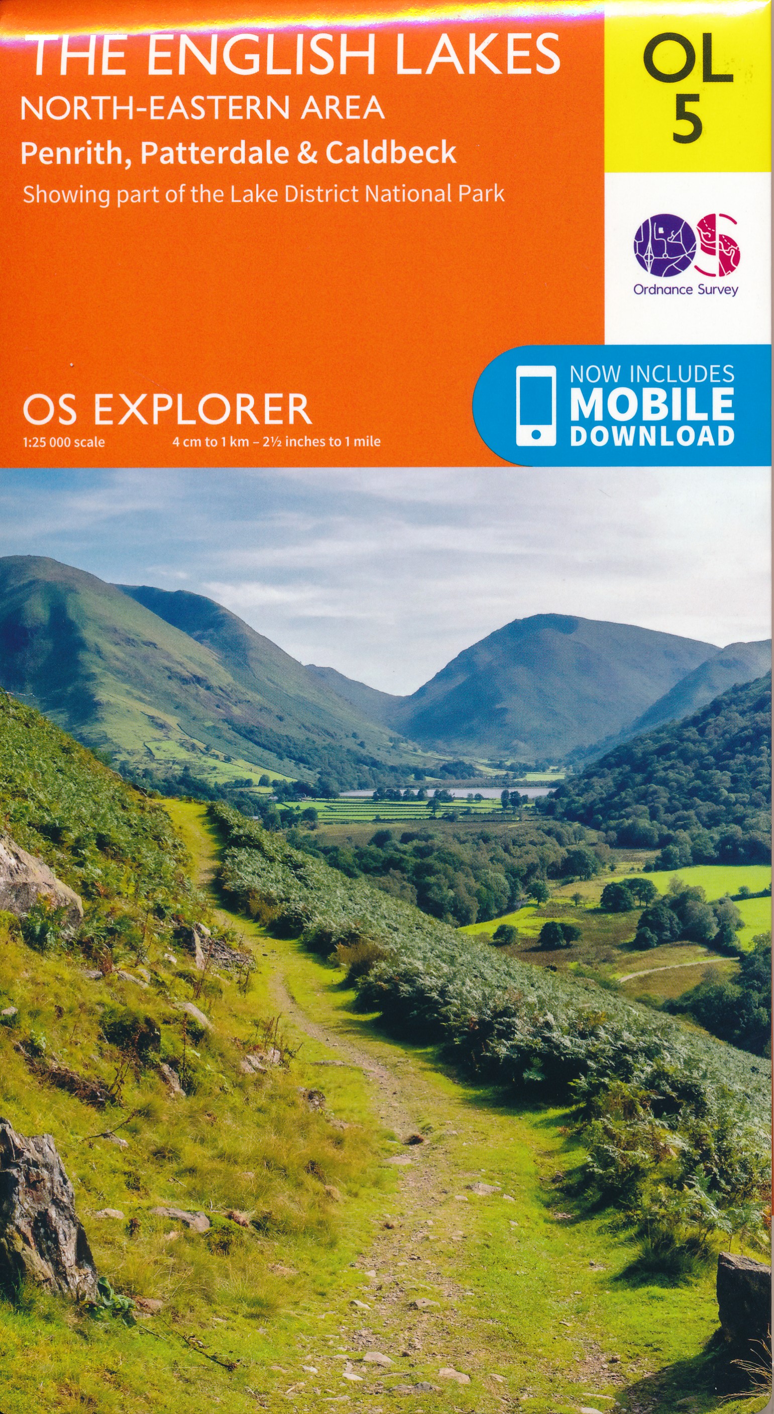
- The English Lakes North-Eastern Area
- Penrith, Patterdale & Caldbeck Read more
- Also available from:
- De Zwerver, Netherlands
De Zwerver
Netherlands
Netherlands
- Wandelkaart - Topografische kaart OL05 OS Explorer Map The English Lakes - North Eastern area | Ordnance Survey
- Penrith, Patterdale & Caldbeck Read more
The Book Depository
United Kingdom
2018
United Kingdom
2018
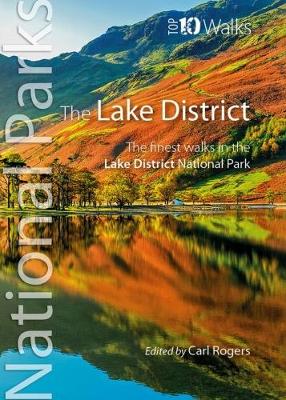
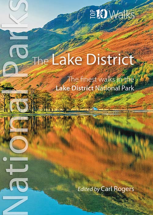
- The Lake District
- The finest walks in the Lake District National Park Read more
- Also available from:
- De Zwerver, Netherlands

- Also available from:
- De Zwerver, Netherlands

- Also available from:
- De Zwerver, Netherlands
- Stanfords, United Kingdom
De Zwerver
Netherlands
2018
Netherlands
2018

Stanfords
United Kingdom
2018
United Kingdom
2018
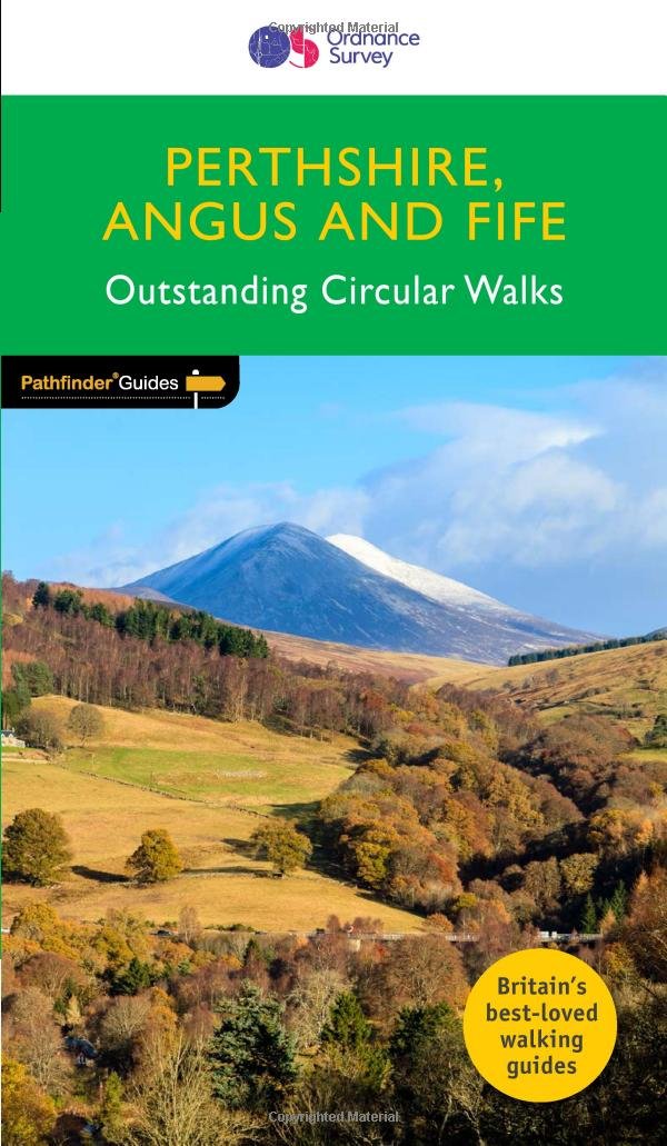
- Perthshire, Angus & Fife
- Approaching the eastern part of central Scotland, where the Grampians dominate the horizon, it appears at first glance to be mountain country. In fact much of the area is low-lying, with flat woodland and agricultural land bordered by gentle, rounded hills and an attractive North Sea coastline. Perthshire has enough lochs to vie with Cumbria`s... Read more

The Book Depository
United Kingdom
2013
United Kingdom
2013
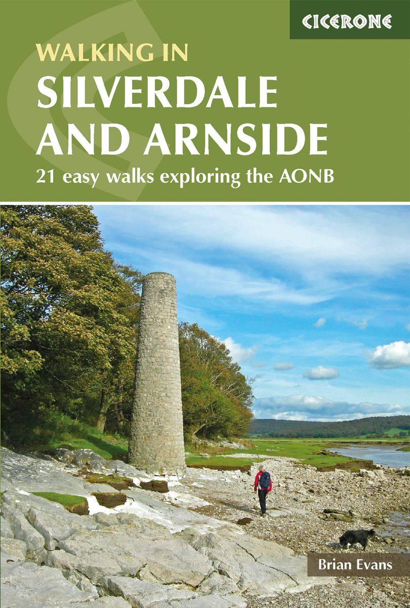
- Walks in Silverdale and Arnside
- 21 easy walks exploring the AONB Read more
- Also available from:
- De Zwerver, Netherlands
- Stanfords, United Kingdom
De Zwerver
Netherlands
2018
Netherlands
2018
- Wandelgids Walks in Silverdale and Arnside - rand van Lake District | Cicerone
- The 21 easy day walks in this book will help you explore the Silverdale and Arnside Area of Outstanding Natural Beauty, with its rugged coastal paths and enchanting woodland trails. There are routes through Leighton Moss (RSPB centre), Dallam Park, Arnside Knott, Hutton Roof and Morecambe Bay that are suitable for all abilities and every season. Read more

Stanfords
United Kingdom
2013
United Kingdom
2013
- Silverdale and Arnside Walks
- Walking Guide for Silverdale and Arnside in a series from Cicerone. Guides are a smaller format and illustrated with OS mapping and colour photography. Very thorough route descriptions are given, with walk profile boxes summarizing essential data such as distance, height gain, grade, walking time, Ordnance Survey mapping references, and... Read more

The Book Depository
United Kingdom
United Kingdom
- Peak Bagging: Wainwrights Fold-out Poster
- Folding poster map (438mm x 672mm) of 45 routes designed to complete all 214 Wainwrights in the most efficient way Read more
- Also available from:
- Stanfords, United Kingdom

Stanfords
United Kingdom
United Kingdom
- Peak Bagging Wainwrights fold-out Poster Map
- The Peak Bagging Wainwrights Fold-out Poster is designed to give you an at-a-glance guide to 45 routes designed to help you complete all 214 of Alfred Wainwright`s Lake District fells in the most efficient way.Derived from the bestselling guidebook Peak Bagging Wainwrights, by Karen and Dan Parker, it allows you to easily plan and record your... Read more

The Book Depository
United Kingdom
2015
United Kingdom
2015
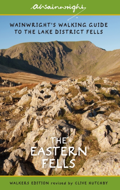
- The Eastern Fells (Walkers Edition): Volume 1
- Wainwright's Walking Guide to the Lake District Fells Book 1 Read more
- Also available from:
- De Zwerver, Netherlands
- Stanfords, United Kingdom
De Zwerver
Netherlands
2015
Netherlands
2015
- Wandelgids The Eastern Fells | Lake District | Frances Lincoln
- One name above all others has become associated with walking in the Lake District: Alfred Wainwright, whose seven-volume Pictorial Guide to the Lakeland Fells, first published in 1955-66, has become the definitive guidebook. Wainwright's meticulously hand-drawn maps, diagrams and drawings take walkers up the 214 principal hills and mountains of... Read more

Stanfords
United Kingdom
2015
United Kingdom
2015
- Eastern Fells - Book 1 (Revised Edition)
- One name above all others has become associated with walking in the Lake District: Alfred Wainwright, whose seven-volume Pictorial Guide to the Lakeland Fells, first published in 1955-66, has become the definitive guidebook. Wainwright`s meticulously hand-drawn maps, diagrams and drawings take walkers up the 214 principal hills and mountains of... Read more


The Book Depository
United Kingdom
United Kingdom
- Walks for All Ages Lake District
- 20 Short Walks for All the Family Read more

- Also available from:
- De Zwerver, Netherlands


The Book Depository
United Kingdom
2017
United Kingdom
2017
- The Lune Valley and Howgills
- 40 scenic fell, river and woodland walks Read more
- Also available from:
- Stanfords, United Kingdom

Stanfords
United Kingdom
2017
United Kingdom
2017
- The Lune Valley and Howgills: 40 Scenic Fell, River and Woodland Walks
- This guidebook offers a wide range of walks from the source of the river Lune in the Howgill Fells to Glasson Dock, just below Lancaster. The 40 day walks range between 3 and 11 miles in length and are all illustrated with extracts of 1:50,000 OS mapping. They explore the infinitely varied landscape as the river Lune flows between the Lake... Read more

The Book Depository
United Kingdom
United Kingdom
- Lake District Ridge Walks & Scrambles
- Challenging high-level routes in the Lake District Read more
- Also available from:
- Stanfords, United Kingdom

Stanfords
United Kingdom
United Kingdom
- Lake District Ridge Walks & Scrambles: Challenging high-level routes in the Lake District
- The Lakeland Fells have some of the finest ridge walks in the country. Exploring these ridges offers fell walking at its most satisfying - staying high, taking in several summits and enjoying the spectacular settings.Many of the Lake District`s ridge walks have become classics, like the grassy edges of the Fairfield and Kentmere Horseshoes, or... Read more

The Book Depository
United Kingdom
United Kingdom
- The Central Fells: Volume 3
- A Pictorial Guide to the Lakeland Fells Read more
- Also available from:
- Stanfords, United Kingdom

Stanfords
United Kingdom
United Kingdom
- Central Fells - Book 3 (Readers Edition)
- About this series:Re-issues of A. Wainwright`s classic series of hand-illustrated fell walking guides. These compact hardbacks have not been amended, so they should be used with caution and alongside up-to-date maps when walking. However, Mr. Wainwright`s sheer enthusiasm for fell walking is communicated to the reader and each title will add a... Read more
Karten

The Book Depository
United Kingdom
United Kingdom
- The Cumbria Way
- A Footprint Map-Guide to the 73-Mile Route Between Ulverston & Carlisle Read more
- Also available from:
- Stanfords, United Kingdom

Stanfords
United Kingdom
United Kingdom
- The Cumbria Way
- The waterproof Footprint map-guide to the Cumbria Way - the 73 mile (117km) route between Ulverstone and Carlisle. It generally follows well maintained paths and tracks through some of the Lake District`s finest scenery. This Footprint map is divided into 5 sections each portrayed on a separate panel. It is marked in miles, starting in... Read more

The Book Depository
United Kingdom
United Kingdom
- Topographical Map of the Lake District Wainwright Fells
- The fells of the Lake District shown on a contoured map at 1:100,000 approx. from Rivers Publishing, with on the reverse side tables showing the 214 fells grouped by location and each presented with its height and a column so the user can record the date climbed or other personal notes. Coverage extends from the Northern Fells group southwards... Read more
- Also available from:
- Stanfords, United Kingdom

Stanfords
United Kingdom
United Kingdom
- Topographical Map of the Lake District - Wainwright Fells
- The fells of the Lake District shown on a contoured map at 1:100,000 approx. from Rivers Publishing, with on the reverse side tables showing the 214 fells grouped by location and each presented with its height and a column so the user can record the date climbed or other personal notes. Coverage extends from the Northern Fells group southwards... Read more
The Book Depository
United Kingdom
United Kingdom
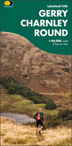
- Gerry Charnley Round
- Bob Graham Round, a 63km / 38 mile approx. circuit in the fells of the Lake District presented at 1:40,000 on a light, waterproof and tear-resistant map from Harvey Map Services. The circuit, first devised in 1984, includes Scafell and Scafell Pike but provides a shorter alternative to the better known and more challenging Bob Graham Round. The... Read more
- Also available from:
- Stanfords, United Kingdom

Stanfords
United Kingdom
United Kingdom
- Gerry Charnley Round in the Lakeland Fells
- Bob Graham Round, a 63km / 38 mile approx. circuit in the fells of the Lake District presented at 1:40,000 on a light, waterproof and tear-resistant map from Harvey Map Services. The circuit, first devised in 1984, includes Scafell and Scafell Pike but provides a shorter alternative to the better known and more challenging Bob Graham Round. The... Read more

The Book Depository
United Kingdom
United Kingdom
- Lake District Adventure Atlas
- The A-Z Adventure Series of maps combines the best of OS and A-Z, creating the perfect companion for walkers, off-road cyclists, horse riders and anyone wishing to explore the great outdoors.The Lake District is a National Park and a Unesco World Heritage Site in northwest England. It is a region rich in natural beauty with breathtaking views... Read more
- Also available from:
- Stanfords, United Kingdom

Stanfords
United Kingdom
United Kingdom
- Lake District A-Z Adventure Atlas
- The A-Z Adventure Series of maps combines the best of OS and A-Z, creating the perfect companion for walkers, off-road cyclists, horse riders and anyone wishing to explore the great outdoors.The Lake District is a National Park and a Unesco World Heritage Site in northwest England. It is a region rich in natural beauty with breathtaking views... Read more

The Book Depository
United Kingdom
2015
United Kingdom
2015
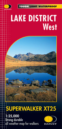
- Lake District West
- The western part of the Lake District at 1:25,000 on a light, waterproof and tear-resistant, GPS compatible, double-sided map from Harvey Map Services in their Superwalker series. Coverage includes Grasmere, Coniston, Torver, Wast Water, Coniston Water, the peaks of Scaffel and Scaffel Pike, etc. The whole of Lake District is covered on four... Read more
- Also available from:
- De Zwerver, Netherlands
- Stanfords, United Kingdom
De Zwerver
Netherlands
2015
Netherlands
2015
- Wandelkaart Lake District West | Harvey Maps
- The western part of the Lake District at 1:25,000 on a light, waterproof and tear-resistant, GPS compatible, double-sided map from Harvey Map Services in their Superwalker series. Coverage includes Grasmere, Coniston, Torver, Wast Water, Coniston Water, the peaks of Scaffel and Scaffel Pike, etc. The whole of Lake District is covered on four... Read more

Stanfords
United Kingdom
2015
United Kingdom
2015
- Lake District West Harvey Superwalker XT25
- The western part of the Lake District at 1:25,000 on a light, waterproof and tear-resistant map from Harvey Map Services in their Superwalker series. Coverage includes Grasmere, Coniston, Torver, Wast Water, Coniston Water, the peaks of Scaffel and Scaffel Pike, etc.PLEASE NOTE: this title is also available as a pocket-size Ultramap with its... Read more

The Book Depository
United Kingdom
United Kingdom
- Lakes SE
- The south-eastern area of the Lake District on a detailed topographic and GPS compatible map OL7, waterproof version, from the Ordnance Survey’s 1:25,000 Explorer series. Coverage extends eastwards from Coniston and the northern part of the Coniston Water to the Killington Reservoir and includes Grasmere, Ambleside, Windermere, Kendal, Penny... Read more

The Book Depository
United Kingdom
United Kingdom
- Cumbria Way
- Cumbria Way, a 112km / 70 mile route liking Ulverston and Carlisle across the heart of the Lake District, presented at 1:40,000 on a light, waterproof and tear-resistant map from Harvey Map Services. The route is shown on five overlapping panels, with additional street plans of Carlisle, Keswick, and Ulverston.Maps in the Harvey Read more
- Also available from:
- De Zwerver, Netherlands
- Stanfords, United Kingdom

De Zwerver
Netherlands
Netherlands
- Wandelkaart Cumbria Way | Harvey Maps
- Cumbria Way, a 112km / 70 mile route liking Ulverston and Carlisle across the heart of the Lake District, presented at 1:40,000 on a light, waterproof and tear-resistant map from Harvey Map Services. The route is shown on five overlapping panels, with additional street plans of Carlisle, Keswick, and Ulverston.Maps in the Harvey Read more

Stanfords
United Kingdom
United Kingdom
- Cumbria Way Harvey National Trail XT40
- Cumbria Way, a 112km / 70 mile route liking Ulverston and Carlisle across the heart of the Lake District, presented at 1:40,000 on a light, waterproof and tear-resistant map from Harvey Map Services. The route is shown on five overlapping panels, with additional street plans of Carlisle, Keswick, and Ulverston.Maps in the Harvey’s series... Read more

The Book Depository
United Kingdom
2015
United Kingdom
2015
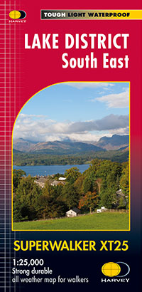
- Lake District South East
- The south-eastern part of the Lake District at 1:25,000 on a light, waterproof and tear-resistant, GPS compatible, double-sided map from Harvey Map Services in their Superwalker series. Coverage includes Kendal, Windermere, Bowness-on-Windermere, Coniston, Newby Bridge, Coniston Water, Lake Windermere, etc, and extends from Ambleside in the... Read more
- Also available from:
- De Zwerver, Netherlands
- Stanfords, United Kingdom
De Zwerver
Netherlands
2015
Netherlands
2015
- Wandelkaart Lake District Zuid Oost | Harvey Maps
- The south-eastern part of the Lake District at 1:25,000 on a light, waterproof and tear-resistant, GPS compatible, double-sided map from Harvey Map Services in their Superwalker series. Coverage includes Kendal, Windermere, Bowness-on-Windermere, Coniston, Newby Bridge, Coniston Water, Lake Windermere, etc, and extends from Ambleside in the... Read more

Stanfords
United Kingdom
2015
United Kingdom
2015
- Lake District South East Harvey Superwalker XT25
- The south-eastern part of the Lake District at 1:25,000 on a light, waterproof and tear-resistant map from Harvey Map Services in their Superwalker series. Coverage includes Kendal, Windermere, Bowness-on-Windermere, Coniston, Newby Bridge, Coniston Water, Lake Windermere, etc, and extends from Ambleside in the north to Newby Bridge in the... Read more

The Book Depository
United Kingdom
United Kingdom
- Dales Way
- The Dales Way, a 135km / 85 mile route in the Yorkshire Dales and the Lake District National Parks, presented at 1:40,000 on a map from Harvey Map Services. The route itself, between Ilkley and Bowness-on-Windermere, is shown on six panels, with additional three panels covering the access to the start of the Dales Way in Ilkley from Leeds,... Read more
- Also available from:
- De Zwerver, Netherlands
- Stanfords, United Kingdom

De Zwerver
Netherlands
Netherlands
- Wandelkaart Dales Way | Harvey Maps
- The Dales Way, a 135km / 85 mile route in the Yorkshire Dales and the Lake District National Parks, presented at 1:40,000 on a map from Harvey Map Services. The route itself, between Ilkley and Bowness-on-Windermere, is shown on six panels, with additional three panels covering the access to the start of the Dales Way in Ilkley from Leeds,... Read more

Stanfords
United Kingdom
United Kingdom
- Dales Way Harvey National Trail XT40
- The Dales Way, a 135km / 85 mile route in the Yorkshire Dales and the Lake District National Parks, presented at 1:40,000 on a map from Harvey Map Services. The route itself, between Ilkley and Bowness-on-Windermere, is shown on six panels, with additional three panels covering the access to the start of the Dales Way in Ilkley from Leeds,... Read more
De Zwerver
Netherlands
2021
Netherlands
2021
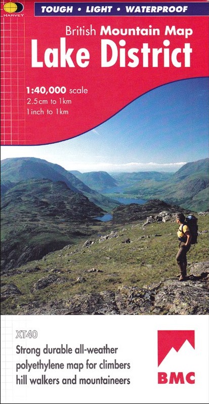
- Wandelkaart Lake District | Harvey Maps
- Waterproof mountain map of the Lake District from Harvey at 1:40,000, with a geological map of the region on the reverse, enlargements of Scafell andPillar, and advice on navigating the region safely.MAIN MAP: Topography is shown through clear altitude shading, spot heights, contours at 15m intervals, and index contours at 75m intervals. A... Read more
- Also available from:
- Stanfords, United Kingdom

Stanfords
United Kingdom
2021
United Kingdom
2021
- Lake District Harvey British Mountain Map XT40
- Waterproof mountain map of the Lake District from Harvey at 1:40,000, with a geological map of the region on the reverse, enlargements of Scafell andPillar, and advice on navigating the region safely.*MAIN MAP:* Topography is shown through clear altitude shading, spot heights, contours at 15m intervals, and index contours at 75m intervals. A... Read more
De Zwerver
Netherlands
2018
Netherlands
2018
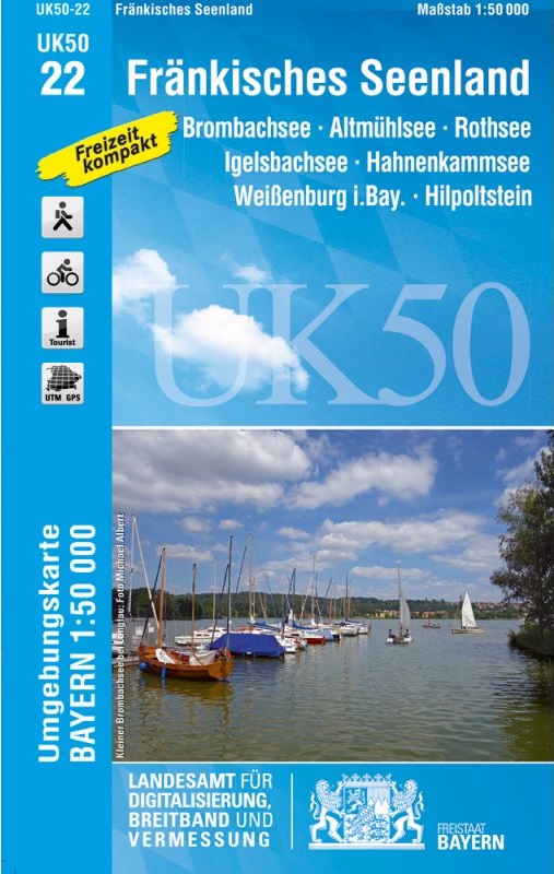
- Wandelkaart 22 UK50 Fränkisches Seenland | LVA Bayern
- Franconia Lake District, map no. 50-22 covering an area around Altmühlsee, Rothsee, Bronbachsee, Ingelsbachsee, Hahnenkamm and Dennenloher See, in a series of special contoured and GP-compatible recreational maps from the Bavarian state survey organization, with cartography of the German topographic survey at 1:50,000 and extensive additional... Read more
- Also available from:
- Stanfords, United Kingdom

Stanfords
United Kingdom
2018
United Kingdom
2018
- Franconia Lake District UK50-22
- Franconia Lake District, map no. 50-22 covering an area around Altmühlsee, Rothsee, Bronbachsee, Ingelsbachsee, Hahnenkamm and Dennenloher See, in a series of special contoured and GP-compatible recreational maps from the Bavarian state survey organization, with cartography of the German topographic survey at 1:50,000 and extensive additional... Read more
De Zwerver
Netherlands
2022
Netherlands
2022
Weitere …
