
Southern Uplands
Beschreibung
The sparsely populated southern part of Scotland is located south of the line Edinburgh - Prestwick and north of the English border. In this empty space, quite a few long distance trails are laid out. The most important of them is the Southern Upland Way, traversing the entire distance from coast to coast. The mountains may be not as high as in the Highlands, they are wild and remote nevertheless.
Wanderwege Region
Links
Fakten
Berichte
Führer und Karten
Übernachtung
Organisationen
Reisebüros
GPS
Sonstiges
Bücher

- Also available from:
- Stanfords, United Kingdom

Stanfords
United Kingdom
United Kingdom
- Cheviot Hills - Jedburgh & Wooler OS Explorer Active Map OL16 (waterproof)
- The Cheviot Hills on a detailed topographic and GPS compatible map OL16, waterproof version, from the Ordnance Survey’s 1:25,000 Explorer series. Coverage includes Jedburgh, Woolmer, part of the Northumberland National Park, the peaks of The Cheviot, Corby Pike, Cold Law, Scrathy Holes and Windy Gyle, Catcleugh Reservoir, sections of the... Read more

- Also available from:
- De Zwerver, Netherlands
- Stanfords, United Kingdom

De Zwerver
Netherlands
Netherlands

Stanfords
United Kingdom
United Kingdom
- Colchester, Halstead & Maldon OS Landranger Map 168 (paper)
- Colchester, Halstead and Maldon area, including part of the E2 European Long-distance Path, on a paper version of map No. 168 from the Ordnance Survey’s Landranger series at 1:50,000, with contoured and GPS compatible topographic mapping plus tourist information.MOBILE DOWNLOADS: As well as the physical edition of the map, each Landranger title... Read more

- Also available from:
- De Zwerver, Netherlands
- Stanfords, United Kingdom

De Zwerver
Netherlands
Netherlands

Stanfords
United Kingdom
United Kingdom
- Peterborough, Market Deeping & Chatteris OS Landranger Map 142 (paper)
- The area around Peterborough, Market Deeping and Chatteris, including the Fens of the North and Middle Levels with part of the E2 European Long-distance Path, on a paper version of map No. 142 from the Ordnance Survey’s Landranger series at 1:50,000, with contoured and GPS compatible topographic mapping plus tourist information.MOBILE... Read more

- Also available from:
- Stanfords, United Kingdom

Stanfords
United Kingdom
United Kingdom
- Worcester, The Malverns, Evesham & Tewkesbury OS Landranger Active Map 150 (waterproof)
- The area around Worcester, Great Malvern, Evesham and Tewkesbury, including the Malvern Hills and part of the Cotswold Way / E2 European Long-distance Path, on a waterproof and tear-resistant OS Active version of map No. 150 from the Ordnance Survey’s Landranger series at 1:50,000, with contoured and GPS compatible topographic mapping plus... Read more

The Book Depository
United Kingdom
2012
United Kingdom
2012
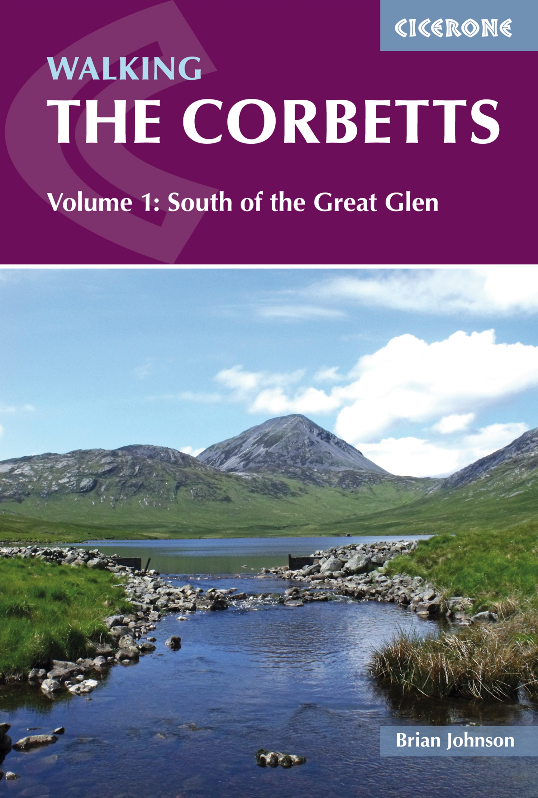
- Walking the Corbetts Vol 1 South of the Great Glen
- Walking the Corbetts describes routes up all 112 Scottish Corbetts (Scotland's 2500-2999ft mountains) south of the Great Glen, covering the Southern Uplands, Southern Highlands, Cairngorms, Jura and Arran. These Scottish hills are every bit as interesting as the Munros, and often clear when the Munros are in cloud. Read more
- Also available from:
- De Zwerver, Netherlands
- Stanfords, United Kingdom
De Zwerver
Netherlands
2019
Netherlands
2019
- Wandelgids Walking the Corbetts: Volume 1 | Cicerone
- Walking the Corbetts describes routes up all 112 Scottish Corbetts (Scotland's 2500-2999ft mountains) south of the Great Glen, covering the Southern Uplands, Southern Highlands, Cairngorms, Jura and Arran. These Scottish hills are every bit as interesting as the Munros, and often clear when the Munros are in cloud. Read more

Stanfords
United Kingdom
2012
United Kingdom
2012
- Corbetts Walking Vol 1: South of the Great Glen
- Walking the Corbetts Volume 1: South of the Great Glen guide from Cicerone Press describes in 95 routes the most interesting ascents of the 112 peaks south of the Fort William - Loch Ness - Inverness line, including the Southern Highlands, Southern Uplands and the islands of Jura and Arran.The Corbetts are Scottish mountains between 2500 and... Read more

- Also available from:
- De Zwerver, Netherlands

- Also available from:
- De Zwerver, Netherlands
- Stanfords, United Kingdom

De Zwerver
Netherlands
Netherlands

Stanfords
United Kingdom
United Kingdom
- Thames Estuary, Rochester & Southend-on-Sea OS Landranger Map 178 (paper)
- Thames Estuary with Rochester and Southend-on-Sea, including a section of the North Downs Way / E2 European Long-Distance Path, on a paper version of map No. 178 from the Ordnance Survey’s Landranger series at 1:50,000, with contoured and GPS compatible topographic mapping plus tourist information.MOBILE DOWNLOADS: As well as the physical... Read more

- Also available from:
- Stanfords, United Kingdom

Stanfords
United Kingdom
United Kingdom
- Colchester, Halstead & Maldon OS Landranger Active Map 168 (waterproof)
- Colchester, Halstead and Maldon area, including part of the E2 European Long-distance Path, on a waterproof and tear-resistant OS Active version of map No. 168 from the Ordnance Survey’s Landranger series at 1:50,000, with contoured and GPS compatible topographic mapping plus tourist information.MOBILE DOWNLOADS: As well as the physical edition... Read more

- Also available from:
- De Zwerver, Netherlands
- Stanfords, United Kingdom

De Zwerver
Netherlands
Netherlands

Stanfords
United Kingdom
United Kingdom
- Ely, Wisbech & Downham Market OS Landranger Map 143 (paper)
- Cambridgeshire around Ely, Wisbech and Downham Market, including part of the E2 European Long-distance Path, on a paper version of map No. 143 from the Ordnance Survey’s Landranger series at 1:50,000, with contoured and GPS compatible topographic mapping plus tourist information.MOBILE DOWNLOADS: As well as the physical edition of the map, each... Read more

- Also available from:
- De Zwerver, Netherlands
- Stanfords, United Kingdom

De Zwerver
Netherlands
Netherlands

Stanfords
United Kingdom
United Kingdom
- Dorking, Reigate, Crawley & Horsham OS Landranger Map 187 (paper)
- Dorking and Reigate area, including a section of the North Downs Way / E2 European Long-distance Path, on a paper version of map No. 187 from the Ordnance Survey’s Landranger series at 1:50,000, with contoured and GPS compatible topographic mapping plus tourist information.MOBILE DOWNLOADS: As well as the physical edition of the map, each... Read more

The Book Depository
United Kingdom
2019
United Kingdom
2019
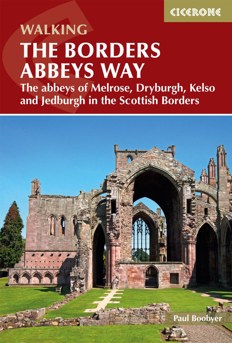
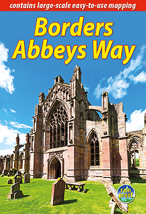
- The Borders Abbeys Way
- The abbeys of Melrose, Dryburgh, Kelso and Jedburgh in the Scottish Borders Read more
- Also available from:
- De Zwerver, Netherlands
De Zwerver
Netherlands
2019
Netherlands
2019
- Wandelgids The Borders Abbeys Ways | Cicerone
- Guidebook to The Borders Abbeys Way, a 68 mile circuit in the Scottish Borders, taking in four of Britain's grandest ruined medieval abbeys. Beginning and ending in Tweedbank, the route, which is described over 6 stages, is as rich in history as it is pastoral charm. Relatively flat, it is suitable for people with a moderate level of fitness. Read more

- Also available from:
- Stanfords, United Kingdom

Stanfords
United Kingdom
United Kingdom
- Aldershot, Guildford, Camberley & Haslemere OS Landranger Active Map 186 (waterproof)
- Aldershot and Guildford area, including the northern part of the South Downs National Park and a section of the North Downs Way / E2 European Long-distance Path, on a waterproof and tear-resistant OS Active version of map No. 186 from the Ordnance Survey’s Landranger series at 1:50,000, with contoured and GPS compatible topographic mapping plus... Read more

- Also available from:
- De Zwerver, Netherlands
- Stanfords, United Kingdom

De Zwerver
Netherlands
Netherlands

Stanfords
United Kingdom
United Kingdom
- Worcester, The Malverns, Evesham & Tewkesbury OS Landranger Map 150 (paper)
- The area around Worcester, Great Malvern, Evesham and Tewkesbury, including the Malvern Hills and part of the Cotswold Way / E2 European Long-distance Path, on a paper version of map No. 150 from the Ordnance Survey’s Landranger series at 1:50,000, with contoured and GPS compatible topographic mapping plus tourist information.MOBILE DOWNLOADS:... Read more

The Book Depository
United Kingdom
2015
United Kingdom
2015
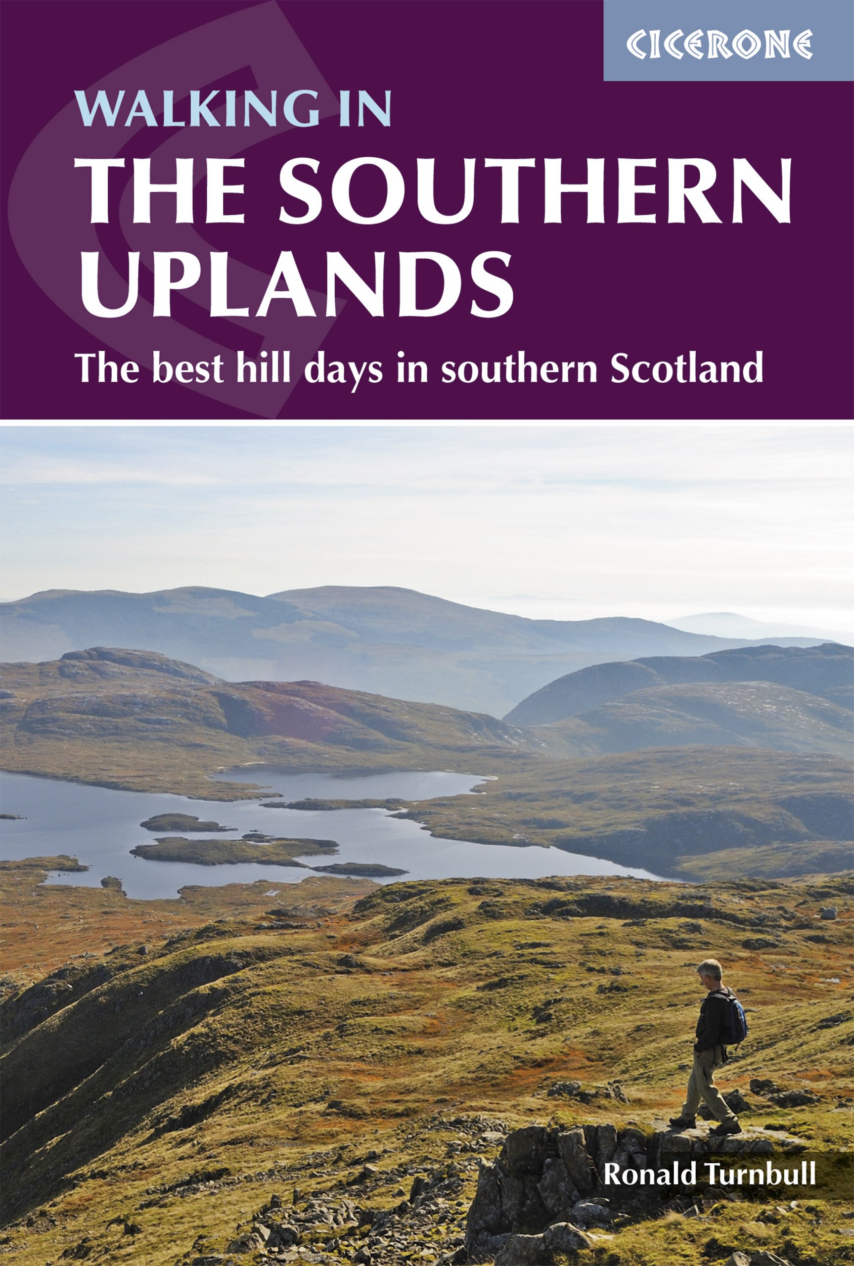
- Walking in the Southern Uplands
- 44 best hill days in southern Scotland Read more
- Also available from:
- De Zwerver, Netherlands
- Stanfords, United Kingdom
De Zwerver
Netherlands
2021
Netherlands
2021
- Wandelgids Walking in the Southern Uplands | Cicerone
- Guidebook to 44 varied day walks and over 100 summits in the Southern Uplands of Scotland, stretching south-west from Edinburgh to the English border, including the Galloway and Pentland Hills. Between 2 and 29km, there is something for all seasons and all abilities in remote and rugged hill country. Read more

Stanfords
United Kingdom
2015
United Kingdom
2015
- Southern Uplands Walking: 44 Best Hill Days in Southern Scotland
- This guidebook describes 44 routes and over 100 summits stretching across the Southern Uplands of Scotland, stretching south-west from Edinburgh to the English border, including the Galloway and Pentland Hills. The walks range between 2 and 29km, suitable for walkers of all abilities. The Scottish Southern Uplands is a range that is about as... Read more

- Also available from:
- De Zwerver, Netherlands
Karten
De Zwerver
Netherlands
Netherlands
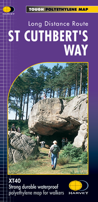
- Wandelkaart St Cuthbert's Way | Harvey Maps
- St. Cuthbert's Way, a 100km / 62.5 mile route from Melrose in the Scottish Borders through the Northumberland National Park to the Holly Island of Lindisfarne, presented at 1:40,000 on a GPS compatible, light, waterproof and tear-resistant map from Harvey Map Services. The route is shown on six panels, with additional small street plans of... Read more
- Also available from:
- Stanfords, United Kingdom

Stanfords
United Kingdom
United Kingdom
- St Cuthbert`s Way Harvey National Trail XT40
- St. Cuthbert`s Way, a 100km / 62.5 mile route from Melrose in the Scottish Borders through the Northumberland National Park to the Holly Island of Lindisfarne, presented at 1:40,000 on a GPS compatible, light, waterproof and tear-resistant map from Harvey Map Services. The route is shown on six panels, with additional small street plans of... Read more

Stanfords
United Kingdom
United Kingdom
- Luxembourg North
- One of two topographic survey maps of Luxembourg at 1:50,000, with contours at 10-metres intervals and additional relief shading. An overprint highlights long-distance footpaths, including the GR5 (E-2), cycle routes, and various places of interest, including campsites. The map covers an area of approximately 53 x 43 km / 33 x 27 miles. Map... Read more

Stanfords
United Kingdom
United Kingdom
- Luxembourg South
- One of two topographic survey maps of Luxembourg at 1:50,000, with contours at 10-metres intervals and additional relief shading. An overprint highlights long-distance footpaths, including the GR5 (E-2), cycle routes, and various places of interest, including campsites. The map covers an area of approximately 53 x 43 km / 33 x 27 miles. Map... Read more

The Book Depository
United Kingdom
United Kingdom
- La Palma Hiking + Leisure Map 1:30 000
- Uitstekende wandelkaart van La Palma, tweezijdig, met ingetekende routes, hoogtelijnen en andere belangrijke informatie. Ook met fietsroutes, bovendien GPS geschikt! Read more
- Also available from:
- De Zwerver, Netherlands
- Bol.com, Netherlands
- Bol.com, Belgium

De Zwerver
Netherlands
Netherlands
- Wandelkaart WKE2 La Palma | Freytag & Berndt
- Uitstekende wandelkaart van La Palma, tweezijdig, met ingetekende routes, hoogtelijnen en andere belangrijke informatie. Ook met fietsroutes, bovendien GPS geschikt! Read more

Bol.com
Netherlands
Netherlands
- FB WKE2 La Palma
- Dubbelzijdige wandel- en vrijetijdskaart • toeristische tips • stadsplattegronden • fietspaden en mountainbikeroutes • GPS-punten • ski- en langlaufroutes Read more
Bol.com
Belgium
Belgium
- FB WKE2 La Palma
- Dubbelzijdige wandel- en vrijetijdskaart • toeristische tips • stadsplattegronden • fietspaden en mountainbikeroutes • GPS-punten • ski- en langlaufroutes Read more

Stanfords
United Kingdom
2010
United Kingdom
2010
- St Cuthbert`s Way Rucksack Reader
- St Cuthbert`s Way, a 100km /62 miles trail from Melrose Abbey in the Scottish Borders to the Holy Island of Lindisfarne, presented by Rucksack Readers in handy A5 size, spiral-bound, waterproof guide with mapping at 1:100,000. Coverage includes a high-level option over the Cheviot Hills.The guide provides general advice on when to go,... Read more
- Also available from:
- Bol.com, Netherlands
- Bol.com, Belgium

Bol.com
Netherlands
2010
Netherlands
2010
- St Cuthbert's Way
- Follow the footsteps of St Cuthbert in this easy-going walk of 62 miles (100 km) from Melrose Abbey in the Scottish borders to the Holy Island of Lindisfarne in the North Sea. The route passes many fine abbeys, hill forts and castles, includes a section of Roman road and finishes with the barefoot Pilgrims' Path across tidal sands. The walk can... Read more
Bol.com
Belgium
2010
Belgium
2010
- St Cuthbert's Way
- Follow the footsteps of St Cuthbert in this easy-going walk of 62 miles (100 km) from Melrose Abbey in the Scottish borders to the Holy Island of Lindisfarne in the North Sea. The route passes many fine abbeys, hill forts and castles, includes a section of Roman road and finishes with the barefoot Pilgrims' Path across tidal sands. The walk can... Read more