The Book Depository
United Kingdom
2012
» Click to open
De Zwerver
Netherlands
2012
» Click to close
The Book Depository
United Kingdom
» Click to open
Stanfords
United Kingdom
  • Tobermory & North Mull OS Landranger Map 47 (paper)
  • Paper version of map No. 47 from the Ordnance Survey’s Landranger series at 1:50,000, with contoured and GPS compatible topographic mapping plus tourist information.MOBILE DOWNLOADS: As well as the physical edition of the map, each Landranger title now includes a code for downloading after purchase its digital version onto your smartphone or... Read more
» Click to close
The Book Depository
United Kingdom
» Click to open
De Zwerver
Netherlands
» Click to close
The Book Depository
United Kingdom
The Book Depository
United Kingdom
» Click to open
Stanfords
United Kingdom
  • Oban & East Mull OS Landranger Map 49 (paper)
  • Paper version of map No. 49 from the Ordnance Survey’s Landranger series at 1:50,000, with contoured and GPS compatible topographic mapping plus tourist information.MOBILE DOWNLOADS: As well as the physical edition of the map, each Landranger title now includes a code for downloading after purchase its digital version onto your smartphone or... Read more
» Click to close
The Book Depository
United Kingdom
2019
» Click to open
» Click to close
The Book Depository
United Kingdom
2015
» Click to open
Stanfords
United Kingdom
2015
  • Iona, Staffa & Ross of Mull OS Explorer Map 373 (paper)
  • The islands of Iona and Staffa, plus the Ross of Mull on a detailed topographic and GPS compatible map No. 373, paper version, from the Ordnance Survey’s 1:25,000 Explorer series.MOBILE DOWNLOADS: this title and all the other OS Explorer maps include a code for downloading after purchase the digital version onto your smartphone or tablet for... Read more
» Click to close
The Book Depository
United Kingdom
» Click to open
Stanfords
United Kingdom
  • Iona, West Mull & Ulva OS Landranger Map 48 (paper)
  • Paper version of map No. 48 from the Ordnance Survey’s Landranger series at 1:50,000, with contoured and GPS compatible topographic mapping plus tourist information.MOBILE DOWNLOADS: As well as the physical edition of the map, each Landranger title now includes a code for downloading after purchase its digital version onto your smartphone or... Read more
» Click to close
The Book Depository
United Kingdom
2019
» Click to open
De Zwerver
Netherlands
2019
  • Wandelgids Galloway | Pocket Mountains
  • Made up of the old counties of Wigtownshire and The Stewartry, Galloway covers a vast swathe of Scotland`s quiet southwest corner. This under-discovered area offers 260km of coast, full of sandy beaches and towering cliffs, lonely heather-clad moors and quiet hills. Add to this plenty of wildlife, a rich artistic heritage, strong spiritual... Read more
Stanfords
United Kingdom
2019
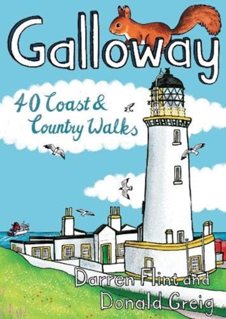
  • Galloway: 40 Coast & Country Walks
  • Made up of the old counties of Wigtownshire and The Stewartry, Galloway covers a vast swathe of Scotland`s quiet southwest corner. This under-discovered area offers 260km of coast, full of sandy beaches and towering cliffs, lonely heather-clad moors and quiet hills. Add to this plenty of wildlife, a rich artistic heritage, strong spiritual... Read more
» Click to close
The Book Depository
United Kingdom
2015
» Click to open
Stanfords
United Kingdom
2015
» Click to close
The Book Depository
United Kingdom
» Click to open
Stanfords
United Kingdom
  • Tobermory & North Mull OS Landranger Active Map 47 (waterproof)
  • Waterproof and tear-resistant OS Active version of map No. 47 from the Ordnance Survey’s Landranger series at 1:50,000, with contoured and GPS compatible topographic mapping plus tourist information.MOBILE DOWNLOADS: As well as the physical edition of the map, each Landranger title now includes a code for downloading after purchase its digital... Read more
» Click to close
The Book Depository
United Kingdom
2015
» Click to open
Stanfords
United Kingdom
2015
  • Isle of Mull East - Craignure OS Explorer Map 375 (paper)
  • The eastern part of Mull with Craignure on a detailed topographic and GPS compatible map No. 375, paper version, from the Ordnance Survey’s 1:25,000 Explorer series. MOBILE DOWNLOADS: this title and all the other OS Explorer maps include a code for downloading after purchase the digital version onto your smartphone or tablet for viewing on the... Read more
» Click to close
The Book Depository
United Kingdom
2021
» Click to open
De Zwerver
Netherlands
2021
Stanfords
United Kingdom
2021
  • Walking the Munros Vol 1 - Southern, Central and Western Highlands
  • Half of a two-volume set describing challenging and inspiring routes to climb Scotland`s 282 3000ft+ mountains, this guide covers the southern, central and western Highlands (south of the Great Glen), taking in stunning areas such as Glen Coe, Glen Shee, Lochaber and Mull. 69 demanding and inspiring routes are described, covering 139 Munro... Read more
» Click to close
The Book Depository
United Kingdom
» Click to open
Stanfords
United Kingdom
  • Iona, Staffa & Ross of Mull OS Explorer Active Map 373 (waterproof)
  • The islands of Iona and Staffa, plus the Ross of Mull on a detailed topographic and GPS compatible map No. 373, waterproof version, from the Ordnance Survey’s 1:25,000 Explorer series. MOBILE DOWNLOADS: this title and all the other OS Explorer maps include a code for downloading after purchase the digital version onto your smartphone or tablet... Read more
» Click to close
The Book Depository
United Kingdom
» Click to open
Stanfords
United Kingdom
  • Iona & West Mull - Ulva OS Landranger Active Map 48 (waterproof)
  • Waterproof and tear-resistant OS Active version of map No. 48 from the Ordnance Survey’s Landranger series at 1:50,000, with contoured and GPS compatible topographic mapping plus tourist information.MOBILE DOWNLOADS: As well as the physical edition of the map, each Landranger title now includes a code for downloading after purchase its digital... Read more
» Click to close