The Book Depository
United Kingdom
» Click to open
Stanfords
United Kingdom
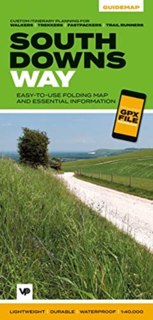
  • Trekking the South Downs Way: Two-way trekking guide
  • The South Downs Way leads you on an unforgettable journey of discovery through the magnificent chalk hills of Sussex and Hampshire. It travels the length of the South Downs National Park across wonderful hills and meadows bedecked with wildflowers, through endless fields of shimmering golden corn and along the edge of the epic white cliffs of... Read more
» Click to close
The Book Depository
United Kingdom
The Book Depository
United Kingdom
2022
» Click to open
» Click to close
The Book Depository
United Kingdom
2021
» Click to open
Stanfords
United Kingdom
2021
  • Haslemere & Petersfield - Midhurst & Selborne OS Explorer Map OL33 (paper)
  • Haslemere and Petersfield area of Hampshire, Sussex and Surrey on a detailed topographic and GPS compatible map OL33, paper version, from the Ordnance Survey’s 1:25,000 Explorer series. Coverage extends from Alton and Witley southwards to Midhurst, and includes parts of the South Downs National Park and the Surrey Downs Area of Outstanding... Read more
» Click to close
The Book Depository
United Kingdom
» Click to open
Stanfords
United Kingdom
» Click to close
The Book Depository
United Kingdom
» Click to open
Stanfords
United Kingdom
  • Atkinsons Walks V1 - Southern England
  • ”ATCHISON`s Complete Hills of Britain Series” is a comprehensive guidebook series in 10 volumes. Each book divides a region of Britain into 50 separate walking areas, each with a major impressive hill to walk around - or ascend. It illustrates 3 superb walks for each area; a 2hr easy walk, a 3-4 hrs keep fit walk, and a challenging 5-7 hour... Read more
» Click to close
The Book Depository
United Kingdom
2020
» Click to open
De Zwerver
Netherlands
2020
  • Wandelgids Hampshire | Pocket Mountains
  • With a network of over 4,800 km of rights of way and two national parks, Hampshire offers a myriad of adventures for walkers. The jewel in the county`s crown is the New Forest, one of Britain`s most stunning national parks and a remarkable example of a medieval hunting forest. The South Downs, England`s newest national park, also presents... Read more
Stanfords
United Kingdom
2020
  • Hampshire: 40 Coast & Country Walks
  • With a network of over 4,800 km of rights of way and two national parks, Hampshire offers a myriad of adventures for walkers. The jewel in the county`s crown is the New Forest, one of Britain`s most stunning national parks and a remarkable example of a medieval hunting forest. The South Downs, England`s newest national park, also presents... Read more
» Click to close
The Book Depository
United Kingdom
2018
The Book Depository
United Kingdom
2020
» Click to open
De Zwerver
Netherlands
2020
Stanfords
United Kingdom
2020
  • South Downs Way - Easy-to-use Folding Map and Essential Information
  • The 162-kilometre South Downs Way begins in Winchester and traces a ridgeline along the rolling, green South Downs to the coast at Eastbourne. It is rightly regarded as one of the finest long-distance trails in England. Predominantly bridleway, the trail is generally wide and hard-surfaced and can be walked at any time of year. The South Downs... Read more
» Click to close
The Book Depository
United Kingdom
2023
» Click to open
» Click to close
The Book Depository
United Kingdom
» Click to open
Stanfords
United Kingdom
  • Chichester, South Harting and Selsey OS Explorer Active Map OL8 (waterproof)
  • Chichester, South Harting and Selsey area of Sussex and Hampshire on a detailed topographic and GPS compatible map OL8, waterproof version, from the Ordnance Survey’s 1:25,000 Explorer series. Coverage along the coast extends from Pagham westwards across Selsey Bill and Hayling Island to Langstone Harbour, and includes part of the South Downs... Read more
» Click to close
The Book Depository
United Kingdom
» Click to open
Stanfords
United Kingdom
  • The South Downs A Dog Walker`s Guide
  • With its ancient woodland, river valleys and rolling hillsides, the South Downs, spanning the southern coastal counties of Hampshire and Sussex, is a dog-walker`s delight.This collection of 20 tried-and-tested circular walks has been written specifically for dogs and their owners, allowing for maximum off-lead time. These routes, covering the... Read more
» Click to close
The Book Depository
United Kingdom
» Click to open
Stanfords
United Kingdom
  • Chichester, South Downs, Bognor Regis & Arundel OS Landranger Map 197 (paper)
  • Chichester and Bognor Regis area, including the South Downs National Park and a section of the South Downs Way / E9 European Long-distance Path, on a paper version of map No. 197 from the Ordnance Survey’s Landranger series at 1:50,000, with contoured and GPS compatible topographic mapping plus tourist information.MOBILE DOWNLOADS: As well as... Read more
» Click to close
The Book Depository
United Kingdom
» Click to open
Stanfords
United Kingdom
» Click to close
The Book Depository
United Kingdom
» Click to open
Stanfords
United Kingdom
  • Meon Valley, Portsmouth, Gosport & Fareham OS Explorer Map OL3 (paper)
  • Meon Valley, Portsmouth, Gosport and Fareham area of south Hampshire on a detailed topographic and GPS compatible map OL3, paper version, from the Ordnance Survey’s 1:25,000 Explorer series. Coverage extends from the coast to Owslebury and East Meon, and includes part of the South Downs National Park, a section of the South Downs Way National... Read more
» Click to close