The Book Depository
United Kingdom
» Click to open
Stanfords
United Kingdom
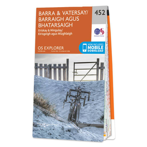
  • Barra & Vatersay - Eriskay & Mingulay OS Explorer Active Map 452 (waterproof)
  • Barra, Vatersay, Eriskay, Mingulay and the surrounding smaller islands on a detailed topographic and GPS compatible map No. 452, waterproof version, from the Ordnance Survey’s 1:25,000 Explorer series. MOBILE DOWNLOADS: this title and all the other OS Explorer maps include a code for downloading after purchase the digital version onto your... Read more
» Click to close
The Book Depository
United Kingdom
» Click to open
Stanfords
United Kingdom
  • North Lewis - St Kilda & Flannan Isles OS Explorer Active Map 460 (waterproof)
  • North Lewis with St Kilda and the Flannan Isles on a detailed topographic and GPS compatible map No. 460, waterproof version, from the Ordnance Survey’s 1:25,000 Explorer series.MOBILE DOWNLOADS: this title and all the other OS Explorer maps include a code for downloading after purchase the digital version onto your smartphone or tablet for... Read more
» Click to close
The Book Depository
United Kingdom
» Click to open
Stanfords
United Kingdom
» Click to close
The Book Depository
United Kingdom
2015
» Click to open
Stanfords
United Kingdom
2015
  • Harris & Lewis Walking - 2nd ed.
  • Walking on Harris and Lewis by Richard Barrett features 30 routes of between 4km and 22km on these Outer Hebrides islands, which are viewed by many as one of the last remaining refuges for walkers looking for spectacular yet non-tourist trail locations. There are few mapped footpaths on the islands, but Cicerone’s Walking on Harris and Lewis... Read more
» Click to close
The Book Depository
United Kingdom
2015
» Click to open
Stanfords
United Kingdom
2015
  • North Uist & Berneray OS Explorer Map 454 (paper)
  • North Uist, Berneray and the surrounding smaller islands on a detailed topographic and GPS compatible map No. 454, paper version, from the Ordnance Survey’s 1:25,000 Explorer series. MOBILE DOWNLOADS: this title and all the other OS Explorer maps include a code for downloading after purchase the digital version onto your smartphone or tablet... Read more
» Click to close
The Book Depository
United Kingdom
2015
» Click to open
Stanfords
United Kingdom
2015
  • North Lewis - St Kilda & Flannan Isles OS Explorer Map 460 (paper)
  • North Lewis with St Kilda and the Flannan Isles on a detailed topographic and GPS compatible map No. 460, paper version, from the Ordnance Survey’s 1:25,000 Explorer series.MOBILE DOWNLOADS: this title and all the other OS Explorer maps include a code for downloading after purchase the digital version onto your smartphone or tablet for viewing... Read more
» Click to close
The Book Depository
United Kingdom
» Click to open
Stanfords
United Kingdom
  • Barra, South Uist, Vatersay & Eriskay OS Landranger Map 31 (paper)
  • Paper version of map No. 31 from the Ordnance Survey’s Landranger series at 1:50,000, with contoured and GPS compatible topographic mapping plus tourist information.MOBILE DOWNLOADS: As well as the physical edition of the map, each Landranger title now includes a code for downloading after purchase its digital version onto your smartphone or... Read more
» Click to close
The Book Depository
United Kingdom
» Click to open
Stanfords
United Kingdom
  • Barra, South Uist, Vatersay & Eriskay OS Landranger Active Map 31 (waterproof)
  • Waterproof and tear-resistant OS Active version of map No. 31 from the Ordnance Survey’s Landranger series at 1:50,000, with contoured and GPS compatible topographic mapping plus tourist information.MOBILE DOWNLOADS: As well as the physical edition of the map, each Landranger title now includes a code for downloading after purchase its digital... Read more
» Click to close
The Book Depository
United Kingdom
2015
» Click to open
Stanfords
United Kingdom
2015
  • Benbecula & South Uist - Eriskay OS Explorer Map 453 (paper)
  • Benbecula, South Uist, Eriskay and the surrounding smaller islands on a detailed topographic and GPS compatible map No. 453, paper version, from the Ordnance Survey’s 1:25,000 Explorer series. MOBILE DOWNLOADS: this title and all the other OS Explorer maps include a code for downloading after purchase the digital version onto your smartphone or... Read more
» Click to close
The Book Depository
United Kingdom
2015
» Click to open
Stanfords
United Kingdom
2015
  • West Lewis - Callanish & Great Bernera OS Explorer Map 458 (paper)
  • West Lewis with Callanish and Great Bernera on a detailed topographic and GPS compatible map No. 458, paper version, from the Ordnance Survey’s 1:25,000 Explorer series. MOBILE DOWNLOADS: this title and all the other OS Explorer maps include a code for downloading after purchase the digital version onto your smartphone or tablet for viewing on... Read more
» Click to close
The Book Depository
United Kingdom
» Click to open
Stanfords
United Kingdom
  • Stornoway & North Lewis OS Landranger Map 8 (paper)
  • Paper version of map No. 8 from the Ordnance Survey’s Landranger series at 1:50,000, with contoured and GPS compatible topographic mapping plus tourist information.MOBILE DOWNLOADS: As well as the physical edition of the map, each Landranger title now includes a code for downloading after purchase its digital version onto your smartphone or... Read more
» Click to close
The Book Depository
United Kingdom
» Click to open
Stanfords
United Kingdom
  • Benbecula & South Uist OS Landranger Acrive Map 22 (waterproof)
  • Waterproof and tear-resistant OS Active version of map No. 22 from the Ordnance Survey’s Landranger series at 1:50,000, with contoured and GPS compatible topographic mapping plus tourist information.MOBILE DOWNLOADS: As well as the physical edition of the map, each Landranger title now includes a code for downloading after purchase its digital... Read more
» Click to close
The Book Depository
United Kingdom
2015
» Click to open
Stanfords
United Kingdom
2015
  • Barra & Vatersay - Eriskay & Mingulay OS Explorer Map 452 (paper)
  • Barra, Vatersay, Eriskay, Mingulay and the surrounding smaller islands on a detailed topographic and GPS compatible map No. 452, paper version, from the Ordnance Survey’s 1:25,000 Explorer series. MOBILE DOWNLOADS: this title and all the other OS Explorer maps include a code for downloading after purchase the digital version onto your... Read more
» Click to close
The Book Depository
United Kingdom
2015
» Click to open
Stanfords
United Kingdom
2015
  • South East Lewis - Loch Eireasort & Shiant Islands OS Explorer Map 457 (paper)
  • South East Lewis with Loch Eireasort and the Shiant Islands on a detailed topographic and GPS compatible map No. 457, paper version, from the Ordnance Survey’s 1:25,000 Explorer series. MOBILE DOWNLOADS: this title and all the other OS Explorer maps include a code for downloading after purchase the digital version onto your smartphone or tablet... Read more
» Click to close
The Book Depository
United Kingdom
» Click to open
Stanfords
United Kingdom
  • West Lewis & North Harris OS Landranger Map 13 (paper)
  • Paper version of map No. 13 from the Ordnance Survey’s Landranger series at 1:50,000, with contoured and GPS compatible topographic mapping plus tourist information.MOBILE DOWNLOADS: As well as the physical edition of the map, each Landranger title now includes a code for downloading after purchase its digital version onto your smartphone or... Read more
» Click to close