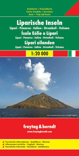
Aeolian (Lipari) Islands at 1:20,000 from Freytag & Berndt on a double-sided map which presents on the reverse coverage of Italy south of Rome at 1:600,000 and shows ferry access to the islands from the mainland or Sicily.On one side the islands are shown in a series of panels, with the three largest: Salina, Lipari and Vulcano together, and...Read more
Aeolian (Lipari) Islands at 1:20,000 from Freytag & Berndt on a double-sided map which presents on the reverse coverage of Italy south of Rome at 1:600,000 and shows ferry access to the islands from the mainland or Sicily.On one side the islands are shown in a series of panels, with the three largest: Salina, Lipari and Vulcano together, and...Read more
A brand new chart of the Sicilian Channel, designed to show passage from West Sicily to Isola di Pantelleria and the Tunisian Coast. Plans included: Bizerte (1:30 000) Cap Gammarth to Carthage (1:65 000) Port de Kelibia (1:15 000) Port Yasmine Hammamet (1:25 000) Pantelleria (1:10 000)Read more
Parco Naturale dei Monti Nebrodi on the northern coast of Sicily on a contoured and GPS compatible map at 1:50,000 from Litografia Artistica Cartografica in their Global Map imprint, highlighting hiking trails plus various facilities and/or places of interest in and around the park.Topography is shown by contours at 25m intervals with light...Read more