The Book Depository
United Kingdom
2020
» Click to open
Stanfords
United Kingdom
2020
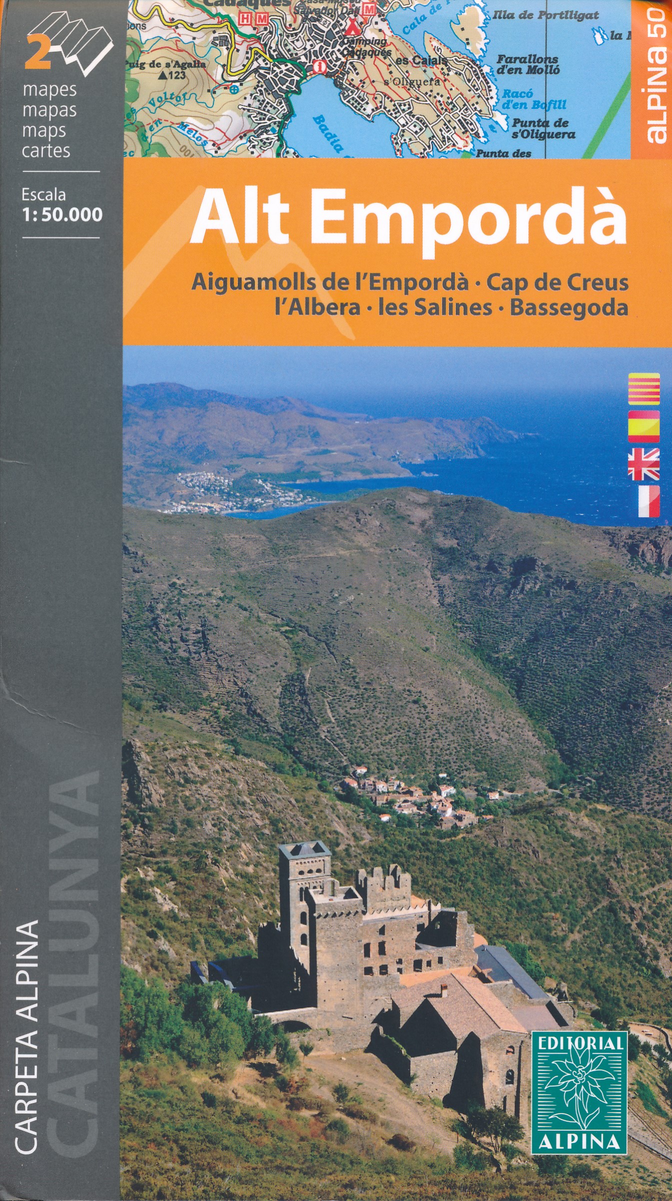
  • Alt Empordá 2-Map Set Editorial Alpina
  • Alta Empordá administrative district on the Costa Brava at 1:50,000 in a set of two contoured and GPS compatible maps from Editorial Alpina highlighting local and long-distance waymarked hiking trails, different types of accommodation, etc. Coverage of the whole area is conveniently divided east-west; one map shows the coastal region from... Read more
» Click to close
The Book Depository
United Kingdom
» Click to open
Stanfords
United Kingdom
  • High Jura - Northern Alps IGN Top200 202
  • Pyrénées Ouest map from the IGN at 1:200,000, with excellent presentation of the terrain through contours and vivid relief shading, plenty of names of topographic features, long-distance GR hiking routes, places of interest, etc. The map is designed to provide convenient coverage of the western and central part of the Pyrenees, extending across... Read more
» Click to close
The Book Depository
United Kingdom
» Click to open
Stanfords
United Kingdom
  • Southern Alps IGN Top200 203
  • Pyrénées Ouest map from the IGN at 1:200,000, with excellent presentation of the terrain through contours and vivid relief shading, plenty of names of topographic features, long-distance GR hiking routes, places of interest, etc. The map is designed to provide convenient coverage of the western and central part of the Pyrenees, extending across... Read more
» Click to close
The Book Depository
United Kingdom
» Click to open
Stanfords
United Kingdom
  • Valle de Tena - Panticosa - Partacua - Sallent Editorial Alpina
  • Valle de Tena in the central part of the Spanish Pyrenees on a contoured and GPS compatible map at 1:25,000 from Editorial Alpina, with coverage including Panticosa, Sallent de Gállego, Sierra de Partacua, Sierra de Tendeñera, etc. Accompanying booklet includes contact details for campsites, refuges, etc.Topography is presented by contours at... Read more
» Click to close
The Book Depository
United Kingdom
» Click to open
» Click to close
The Book Depository
United Kingdom
» Click to open
De Zwerver
Netherlands
  • Wandelkaart Cabo de Gata - Nijar | Editorial Alpina
  • Gedetailleerde wandelkaart van een interessant wandelgebied. Uitstekend leesbaar, inhoudelijk een goede kaart met allerhande informatie op topografische basis waarbij wandelroutes, campings en hutten. Bij een aantal Alpina kaarten is een boekje bijgevoegd met routes. Door de toevoeging van gradengrid is deze kaart bruikbaar voor GPS. Cabo da... Read more
Stanfords
United Kingdom
  • Cabo de Gata-Níjar Natural Park Editorial Alpina
  • Cabo da Gata area on the south-eastern tip of Andalucía on a contoured and GPS compatible map at 1:50,000 from Editorial Alpina highlighting hiking and cycling trails, plus a booklet with English language descriptions of recommended routes, accommodation lists, etc.Topography is shown by contours at 20m intervals, with relief shading and... Read more
» Click to close
The Book Depository
United Kingdom
» Click to open
Stanfords
United Kingdom
  • Pyrenees West IGN Top200 205
  • Pyrénées Ouest map from the IGN at 1:200,000, with excellent presentation of the terrain through contours and vivid relief shading, plenty of names of topographic features, long-distance GR hiking routes, places of interest, etc. The map is designed to provide convenient coverage of the western and central part of the Pyrenees, extending across... Read more
» Click to close
The Book Depository
United Kingdom
» Click to open
Stanfords
United Kingdom
» Click to close
The Book Depository
United Kingdom
» Click to open
Stanfords
United Kingdom
  • Pyrenees East IGN Top200 206
  • Pyrénées Ouest map from the IGN at 1:200,000, with excellent presentation of the terrain through contours and vivid relief shading, plenty of names of topographic features, long-distance GR hiking routes, places of interest, etc. The map is designed to provide convenient coverage of the western and central part of the Pyrenees, extending across... Read more
» Click to close
The Book Depository
United Kingdom
2021
» Click to open
» Click to close
The Book Depository
United Kingdom
» Click to open
Stanfords
United Kingdom
  • Ordesa and Monte Perdido National Park Editorial Alpina
  • Ordesa and Monte Perdido National Park at 1:40,000 on a GPS compatible recreational map in an extensive and very popular series from Editorial Alpina, including a booklet with English language descriptions of several walks, climbs, etc.Contours are at 20m intervals, with relief shading and altitude colouring. An overprint highlights waymarked... Read more
» Click to close
The Book Depository
United Kingdom
2017
» Click to open
De Zwerver
Netherlands
2017
  • Wandelkaart Senda Pirenaica GR11 | Editorial Alpina
  • Set van 21 kaarten, schaal 1:50.000, met intekening van de GR11, de lange-afstandswandeling door de Spaanse Pyreneeën. Van kust tot kust, van Cabo Higuer (bij Irun) naar Cap de Creus (Costa Brava). Onderverdeeld in 43 trajecten. Met hoogteprofielen, gemiddelde looptijden, afstanden, locaties van berghutten, campings en hotels. Read more
» Click to close
The Book Depository
United Kingdom
» Click to open
De Zwerver
Netherlands
  • Wandelkaart 67 Tramuntana Central - Mallorca | Editorial Alpina
  • Zeer gedetailleerde wandelkaart van een deel van de Tramuntana op Mallorca. Met ingetekende wandelroutes en andere informatie. uitstekende kaart. Met symbolen voor campings, hutten. Let op: deze uitgever is traag met het vernieuwen van kaarten; het kan zo maar zijn dat een bepaalde kaart gedurende langere tijd niet beschikbaar is. Majorca:... Read more
Stanfords
United Kingdom
  • Mallorca - Tramuntana Central Editorial Alpina
  • The central part of Mallorca’s Serra de Tramuntana mountains on a contoured and GPS-compatible map at 1:25,000 from Editorial Alpina, highlighting numerous local hiking trails and the course of the GR221 long-distance trail, climbing and canyoning sites, refuges and campsites, etc. Accompanying booklet includes English-language descriptions of... Read more
» Click to close
The Book Depository
United Kingdom
» Click to open
Stanfords
United Kingdom
  • Delta of the Ebro – Serra de Montsià Editorial Alpina
  • The Delta of the Ebro – Serra de Montsià in an extensive and very popular series of walking maps from Editorial Alpina covering the Pyrenees, Catalonia and other selected hiking areas in Spain, including Picos de Europa, Sierra Nevada and parts of Andalucía, Majorca, etc. Scales vary from 1:50,000 to 1:10,000, with the majority of the titles... Read more
» Click to close
The Book Depository
United Kingdom
» Click to open
Stanfords
United Kingdom
  • Carros de Foc Hiking Circuit Editorial Alpina
  • Carros de Foc (Chariots of Fire) Hiking Circuit, a five to seven day long hiking route in the Aigüestortes i Estany de Sant Maurici National Park, shown on a 1:25,000 map from Editorial Alpina. The map, from the publishers of an extensive hiking series for the Spanish Pyrenees, has contours at 20m intervals, relief shading, and vegetation... Read more
» Click to close