De Zwerver
Netherlands
2021
» Click to open
Stanfords
United Kingdom
2021
  • Ortles / Ortler - Cevedale Kompass 72
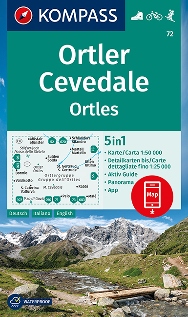
  • Ortles/Ortler – Cevedale area of the Dolomites on a GPS compatible hiking and recreational map at 1:50,000 from Kompass with a panorama map on the reverse and printed on durable, waterproof and tear-resistant synthetic paper.KOMPASS HIKING MAPS OF ITALY:This title is part of an extensive series of walking maps from Kompass covering selected... Read more
» Click to close
De Zwerver
Netherlands
» Click to open
Stanfords
United Kingdom
  • Alpi Orobie Bergamasche - Valle Brembana - Valle Seriana Kompass 104
  • Alpi Orobie (Bergamasker Alps) between Bergamo and Sondrio including Lago d’Iseo, on a GPS compatible hiking and recreational map at 1:50,000 from Kompass, printed on durable, waterproof and tear-resistant synthetic paper.KOMPASS HIKING MAPS OF ITALY – TO SEE THE OTHER TITLES IN THIS SERIES PLEASE CLICK ON THE SERIES LINK. The series covers the... Read more
» Click to close
De Zwerver
Netherlands
De Zwerver
Netherlands
» Click to open
Stanfords
United Kingdom
  • Bormio - Livigno - Alta Valtellina Kompass 96
  • Map No. 96, Bormio - Livigno - Corna di Campo, from Kompass printed on sturdy, waterproof and tear-resistant synthetic paper in a series of walking maps of selected areas of Italy at 1:50,000, with hiking routes on a topographic base, various types of accommodation, recreational facilities, places of interest, etc. Kompass are Europe’s largest... Read more
» Click to close
De Zwerver
Netherlands
2023
De Zwerver
Netherlands
» Click to open
Stanfords
United Kingdom
  • Bolzano Vignetei e Dolomiti / Southern South Tyrol Kompass 74
  • Map No. 74, Termeno/Tramin - Cavalese - with a panorama map on the reverse, from Kompass in a series of walking maps of selected areas of Italy at 1:50,000, with hiking routes on a topographic base, various types of accommodation, recreational facilities, places of interest, etc. Kompass are Europe’s largest publishers of walking maps, with... Read more
» Click to close
De Zwerver
Netherlands
» Click to open
Stanfords
United Kingdom
  • Maremma - Grosseto - Monte Argentario - Isola di Giglio Kompass 2470
  • Maremma - Grosseto - Monte Argentario - Isola di Giglio area on a double-sided map at 1:50,000 from Kompass, printed on durable, waterproof and tear-resistant synthetic paper. Coverage includes Parco Regionale della Maremma, Parco Naturale dell’Iccellina, Monte Bellino, etc. Contours are at 40m intervals, with a 2-km UTM grid. Extensive... Read more
» Click to close
De Zwerver
Netherlands
De Zwerver
Netherlands
» Click to open
Stanfords
United Kingdom
  • Rovereto - Monte Pasubio Kompass 101
  • Map No. 101, Rovereto - Monte Pasubio, from Kompass in a series of walking maps of selected areas of Italy at 1:50,000, with hiking routes on a topographic base, various types of accommodation, recreational facilities, places of interest, etc. Kompass are Europe’s largest publishers of walking maps, with extensive coverage of hiking areas in... Read more
» Click to close
De Zwerver
Netherlands
De Zwerver
Netherlands
De Zwerver
Netherlands
» Click to open
Stanfords
United Kingdom
  • Florence - Siena - Chianti Kompass 2458
  • Florence - Siena - Chianti area on a double-sided map at 1:50,000 from Kompass, printed on durable, waterproof and tear-resistant synthetic paper. Coverage includes Val di Pesa, Val d’Elsa, Monteriggioni, etc. Contours are at 40m intervals, with a 2-km UTM grid. Extensive overprint includes GEA - Grande Escursione Appenninica, Sentiero Italia,... Read more
» Click to close
De Zwerver
Netherlands
2021
» Click to open
Stanfords
United Kingdom
2021
  • Adamello - La Presanella Kompass 71
  • Adamello - La Presanella area just north of Lake Garda on a GPS compatible hiking and recreational map at 1:50,000 from Kompass, printed on durable, waterproof and tear-resistant synthetic paper. KOMPASS HIKING MAPS OF ITALY: this title is part of an extensive series of walking maps from Kompass covering selected areas of Italy at mainly... Read more
» Click to close
De Zwerver
Netherlands
De Zwerver
Netherlands
» Click to open
Stanfords
United Kingdom
  • Lake Garda - Monte Baldo Kompass 102
  • Lake Garda and the surrounding mountain on a waterproof and tear-resistant, contoured and GPS compatible map at 1:50,000 from Kompass with hiking and cycling trails, plus on the reverse a panorama map of the area, street plans of central Verona, Riva del Garda and Peschiera, and extensive English language to the area. Contours are at 40m... Read more
» Click to close