Topographical survey of Belgium at 1:20,000 from Nationaal Geografisch Instituut / Institut Géographique National, the country’s national survey organization. Each 20K map covers one quarter of the corresponding 1:50,000 map (with adjustments in the border and coastal areas). The maps provide all the information expected of topographic mapping...Read more
Topographical survey of Belgium at 1:20,000 from Nationaal Geografisch Instituut / Institut Géographique National, the country’s national survey organization. Each 20K map covers one quarter of the corresponding 1:50,000 map (with adjustments in the border and coastal areas). The maps provide all the information expected of topographic mapping...Read more
Stara Planina Central: Zlatitsa to Kalofer map at 1:50,000 from Bulgarian publishers Domino, contoured and GPS compatible, with hiking trails, accommodation options including a list of local mountain refuges, etc. The map is double-sided and covers the mountains from just west of Ribaritsa and Zlatitsa eastwards beyond Kalofer to the peak of...Read more
Stara Planina Central: Zlatitsa to Kalofer map at 1:50,000 from Bulgarian publishers Domino, contoured and GPS compatible, with hiking trails, accommodation options including a list of local mountain refuges, etc. The map is double-sided and covers the mountains from just west of Ribaritsa and Zlatitsa eastwards beyond Kalofer to the peak of...Read more
Topographical survey of Belgium at 1:50,000 from the country’s national survey organization, Nationaal Geografisch Instituut / Institut Géographique National. Contour interval varies according to the terrain, from 2.5 metres in the coastal areas to 10 metres in the Ardennes. The maps provide all the information expected of topographic mapping...Read more
Strandzha Mountains in the south-eastern corner of Bulgaria between Burgas to the Turkish border on a contoured and GPS compatible map from Domino showing local hiking trails and highlighting various interesting sites, with three more detailed enlargements at 1:25,000. Most place names are in both Latin and Cyrillic alphabet; map legend...Read more
Strandzha Mountains in the south-eastern corner of Bulgaria between Burgas to the Turkish border on a contoured and GPS compatible map from Domino showing local hiking trails and highlighting various interesting sites, with three more detailed enlargements at 1:25,000. Most place names are in both Latin and Cyrillic alphabet; map legend...Read more
Topographical survey of Belgium at 1:20,000 from Nationaal Geografisch Instituut / Institut Géographique National, the country’s national survey organization. Each 20K map covers one quarter of the corresponding 1:50,000 map (with adjustments in the border and coastal areas). The maps provide all the information expected of topographic mapping...Read more
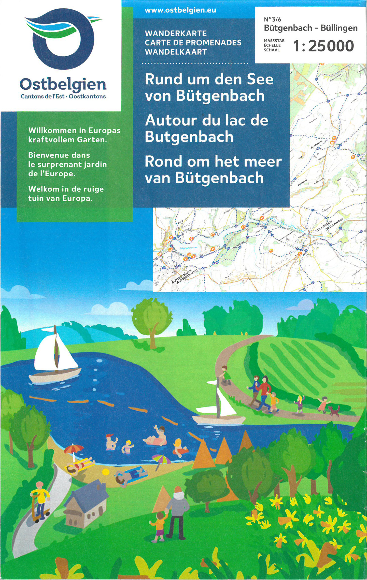
Zeer gedetailleerde topografische kaart van een deel van Belgie. Deze kaart is bijzonder geschikt voor wandeltochten in met name het heuvelachtige gebied van de Ardennen. Voorzien van alle topografische details als hoogtelijnen, waterlopen, bosgebieden, paden en brandgangen. Hoogtelijnen maken het mogelijk de moeilijkheidsgraad van een...Read more
Stara Planina Central: Uzana to Vratnik map at 1:50,000 from Bulgarian publishers Domino, contoured and GPS compatible, with hiking trails, accommodation options including a list of local mountain refuges, etc. The map is double-sided and covers the mountains from just west of the Uzana massif, the geographical centre of Bulgaria, eastwards to...Read more
Stara Planina Central: Uzana to Vratnik map at 1:50,000 from Bulgarian publishers Domino, contoured and GPS compatible, with hiking trails, accommodation options including a list of local mountain refuges, etc. The map is double-sided and covers the mountains from just west of the Uzana massif, the geographical centre of Bulgaria, eastwards to...Read more
Pirin Mountains at 1:50,000 on a large, double-sided, contoured map with GPS waypoints for shelters and chalets, peaks, etc. and highlighting hiking routes. Topography is shown by contours at 40m intervals with additional relief shading and graphics and colouring for sandstone stacks, single rocks over 5m high, marshlands and different types of...Read more