De Zwerver
Netherlands
Netherlands
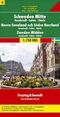
- Wegenkaart - landkaart 04 Schweden Mitte - Sundsvall - Falun - Gävle ( Zweden midden) | Freytag & Berndt
- FuB Schweden 04 Mitte, Sundsvall, Falun, Gävle 1 : 250 000. Autokarte ab 10.9 EURO Sehenswürdigkeiten. Entfernungen in km. Campingplätze Schweden Freytag & Berndt Auto + Freizeitkarte. Neuauflage Read more