
Brava
Beschreibung
 One of the smaller islands, Brava - Wild - can only be reached by boat from Santiago and Fogo. The mountainous island is still relatively untouched by tourism, mainly because of the absence of beaches. The weathered and eroded appearance of this round island hides the fact that it is a stratovolcano, like neighbour Fogo, but older. This is the cycle of the earth, volcanoes rising and then quickly weathering away.
The interior of Brava is green and offers a good environment for agriculture, counting many exotic harvests. Small hamlets and scattered farms populate the surroundings of Monte Fontainhas, 976 m high. The coastal region is rugged and arid.
Brava lags behind in comparison with Fogo or Santo Antão on the subject of tourism. The advantage of all this is that you will find a unique and quiet island with good hiking options.
Links
Fakten
Berichte
Führer und Karten
Übernachtung
Organisationen
Reisebüros
GPS
Sonstiges
Bücher

United Kingdom


United Kingdom
2017
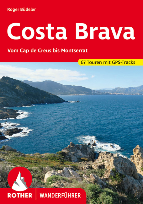
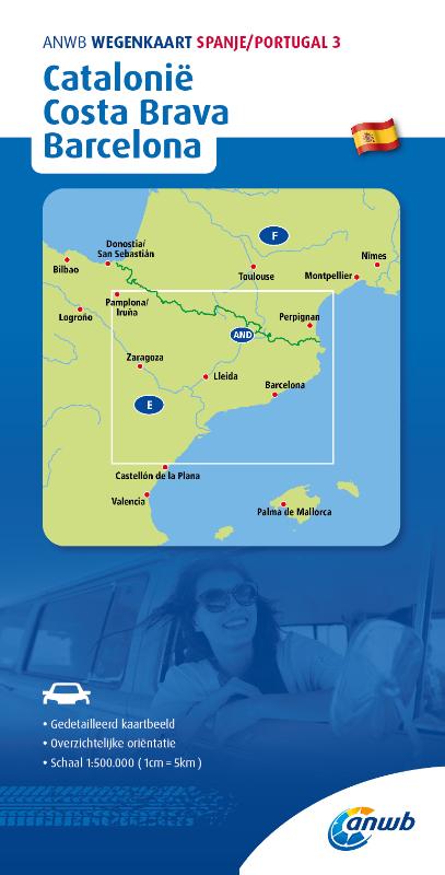
- Costa Brava and Barcelona
- 6 car tours, 55 long and short walks with GPS Read more
- Also available from:
- De Zwerver, Netherlands


United Kingdom
2018
- Walking on Madeira
- 60 mountain and levada routes on Madeira and Porto Santo Read more
- Also available from:
- De Zwerver, Netherlands
- Stanfords, United Kingdom
Netherlands
2018
- Wandelgids Walking on Madeira | Cicerone
- A walking guide to the islands of Madeira and Porto Santo. Selection of varied day walks exploring Madeira's network of levadas (water channels) as well as routes across steep and rugged mountains, with slopes of bare rock or laurisilva 'cloud' forest. The neighbouring island of Porto Santo offers easy walking and a sandy beach. Read more

United Kingdom
2018
- Walking on Madeira: 60 mountain and levada routes on Madeira and Porto Santo
- This guide describes a varied selection of 57 walks on the Portuguese island of Madeira, exploring the dramatic cliff coastline, scenic levadas (irrigation channels), dense laurisilva `cloud` forests and high mountain peaks, plus three walks on neighbouring Porto Santo. There are routes to suit all abilities, from easy, level levada walks to... Read more

- Also available from:
- De Zwerver, Netherlands

- Also available from:
- De Zwerver, Netherlands

Netherlands
2021
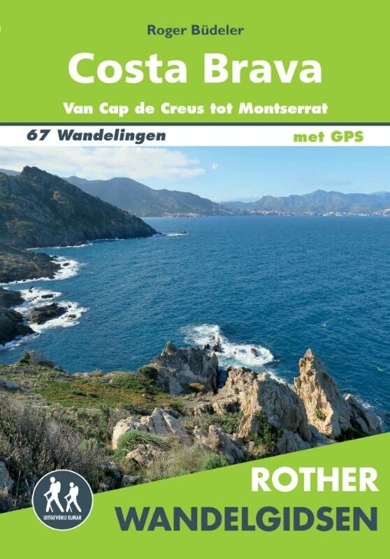
- Wandelgids 270 Costa Brava | Rother Bergverlag
- Uitstekende wandelgids met een groot aantal dagtochten in dal en hooggebergte. Met praktische informatie en beperkt kaartmateriaal! Wandelingen in verschillende zwaarte weergegeven in rood/blauw/zwart. Die »wilde Küste« Spaniens ist eines der beliebtesten Ferienziele der Iberischen Halbinsel. Von den andernorts bekannten Auswüchsen... Read more
Netherlands
2017
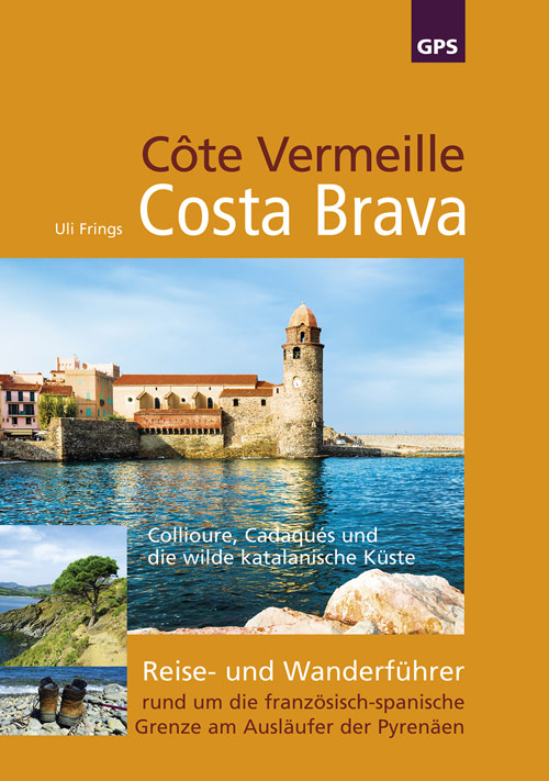
- Wandelgids Côte Vermeille, Costa Brava, Katalonien | Uli Frings Verlag
- Reise- und Wanderführer rund um die französisch-spanische Grenze am Ausläufer der Pyrenäen Read more

Netherlands
2021
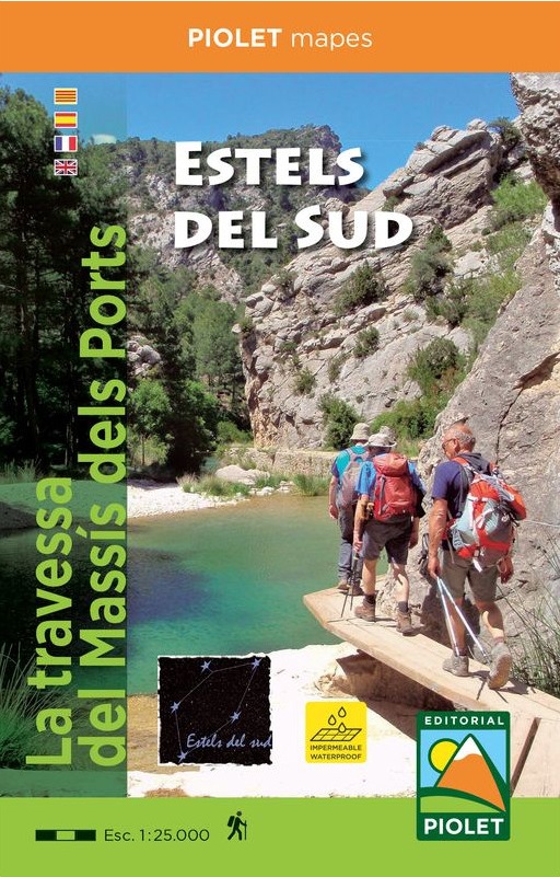
- Wandelkaart Estels del Sud | Editorial Piolet
- La travessa del MassÃs dels Ports Read more
Netherlands
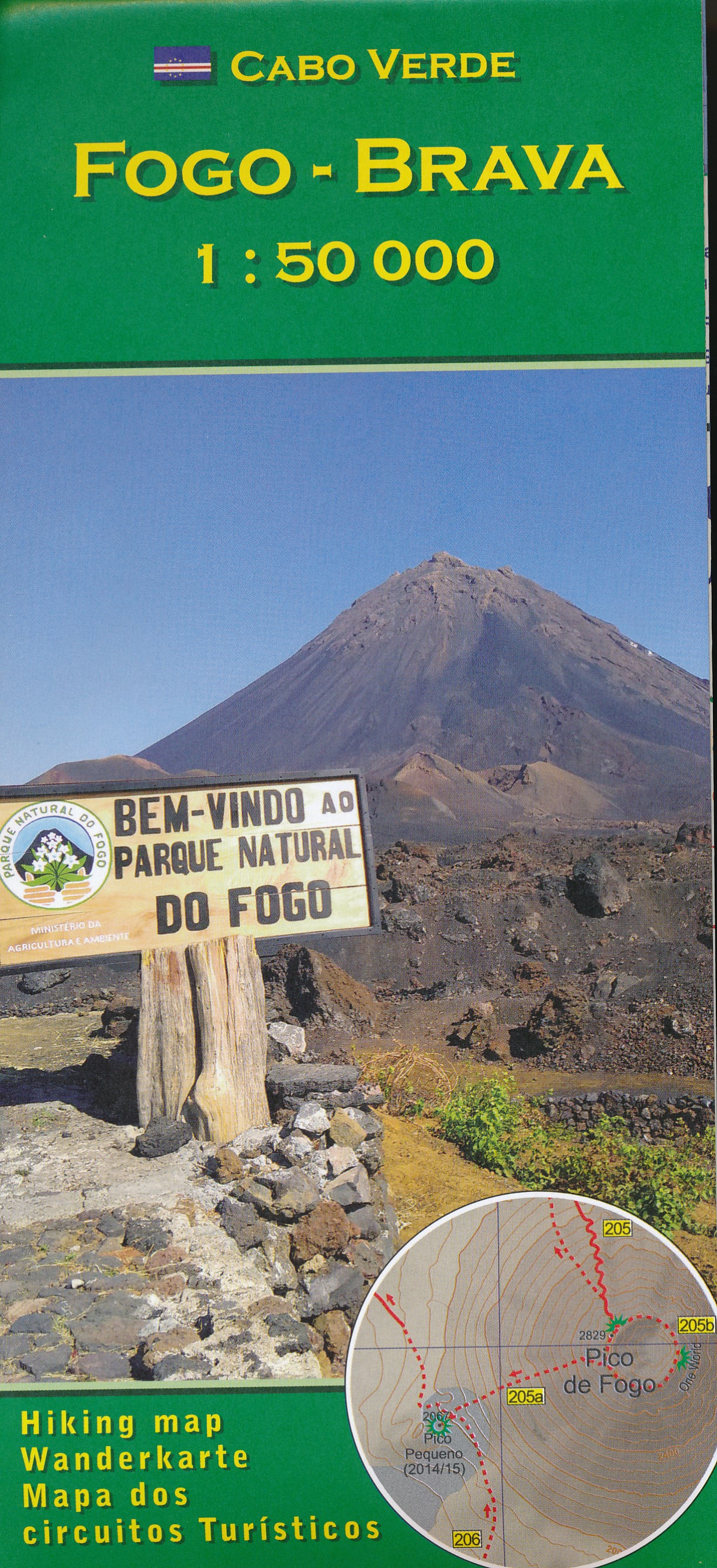
- Wandelkaart Fogo Brava - Kaapverdische Eilanden | AB Kartenverlag
- Fogo and Brava in the Cape Verde archipelago on a detailed, GPS compatible, contoured map at 1:50,000 from AB Kartenverlag highlighting over 50 hiking routes, with a street plan of central São Filipe.The map has contours at 100m intervals, spot heights and elevation colouring enhanced by relief shading to present the topography. Roads and... Read more
- Also available from:
- Stanfords, United Kingdom

United Kingdom
- Fogo - Brava AB Kartenverlag Hiking Map
- Fogo and Brava in the Cape Verde archipelago on a detailed, GPS compatible, contoured map at 1:50,000 from AB Kartenverlag highlighting over 50 hiking routes, with a street plan of central São Filipe.The map has contours at 100m intervals, spot heights and elevation colouring enhanced by relief shading to present the topography. Roads and... Read more
Karten

- Also available from:
- De Zwerver, Netherlands
- Also available from:
- De Zwerver, Netherlands


United Kingdom
- Delta de l'Ebre PN - Serra de Montsia
- The Delta of the Ebro – Serra de Montsià in an extensive and very popular series of walking maps from Editorial Alpina covering the Pyrenees, Catalonia and other selected hiking areas in Spain, including Picos de Europa, Sierra Nevada and parts of Andalucía, Majorca, etc. Scales vary from 1:50,000 to 1:10,000, with the majority of the titles... Read more
- Also available from:
- Stanfords, United Kingdom

United Kingdom
- Delta of the Ebro – Serra de Montsià Editorial Alpina
- The Delta of the Ebro – Serra de Montsià in an extensive and very popular series of walking maps from Editorial Alpina covering the Pyrenees, Catalonia and other selected hiking areas in Spain, including Picos de Europa, Sierra Nevada and parts of Andalucía, Majorca, etc. Scales vary from 1:50,000 to 1:10,000, with the majority of the titles... Read more

United Kingdom
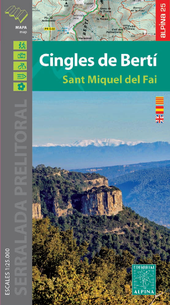
- Cingles del Berti - Sant Miquel des Fai
- Cingles de Berti area at 1:25,000 in an extensive and very popular series of walking maps from Editorial Alpina. Contours are at 10m intervals, enhanced by relief shading and vegetation colouring. The map has UTM grid and 1’ margin ticks. In addition to footpaths, the overprint shows various types of accommodation (hotels, campsites, etc.),... Read more
- Also available from:
- De Zwerver, Netherlands
- Stanfords, United Kingdom
Netherlands
- Wandelkaart 54 Cingles de Berti | Editorial Alpina
- Cingles de Berti area at 1:25,000 in an extensive and very popular series of walking maps from Editorial Alpina. Contours are at 10m intervals, enhanced by relief shading and vegetation colouring. The map has UTM grid and 1’ margin ticks. In addition to footpaths, the overprint shows various types of accommodation (hotels, campsites, etc.),... Read more

United Kingdom
- Cingles de Berti - Sant Miquel des Fai Editorial Alpina
- Cingles de Berti area at 1:25,000 in an extensive and very popular series of walking maps from Editorial Alpina. Contours are at 10m intervals, enhanced by relief shading and vegetation colouring. The map has UTM grid and 1’ margin ticks. In addition to footpaths, the overprint shows various types of accommodation (hotels, campsites, etc.),... Read more

United Kingdom
2020
- Also available from:
- De Zwerver, Netherlands
- Stanfords, United Kingdom

United Kingdom
2020
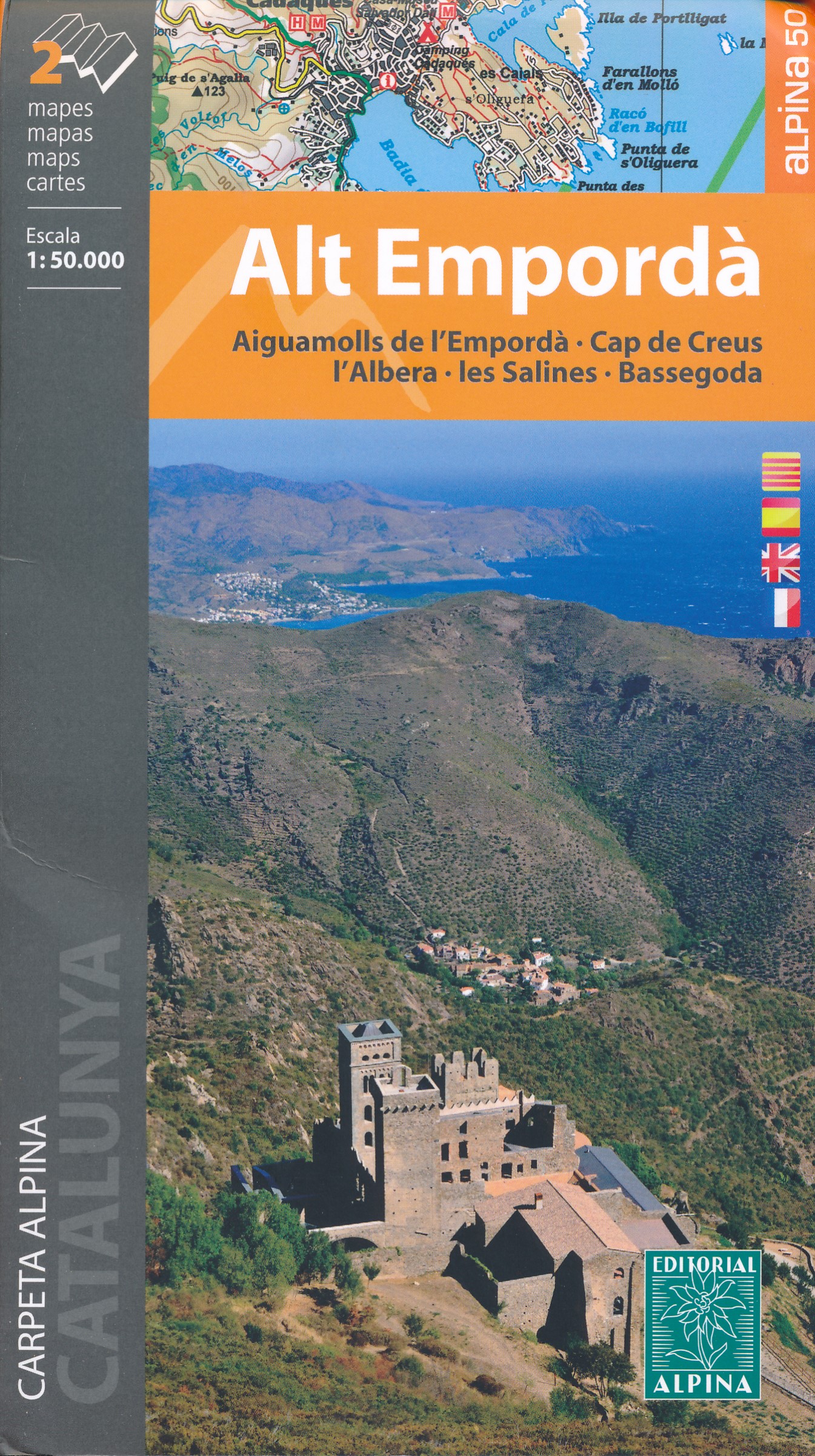
- Alt Empordá 2-Map Set Editorial Alpina
- Alta Empordá administrative district on the Costa Brava at 1:50,000 in a set of two contoured and GPS compatible maps from Editorial Alpina highlighting local and long-distance waymarked hiking trails, different types of accommodation, etc. Coverage of the whole area is conveniently divided east-west; one map shows the coastal region from... Read more
Netherlands
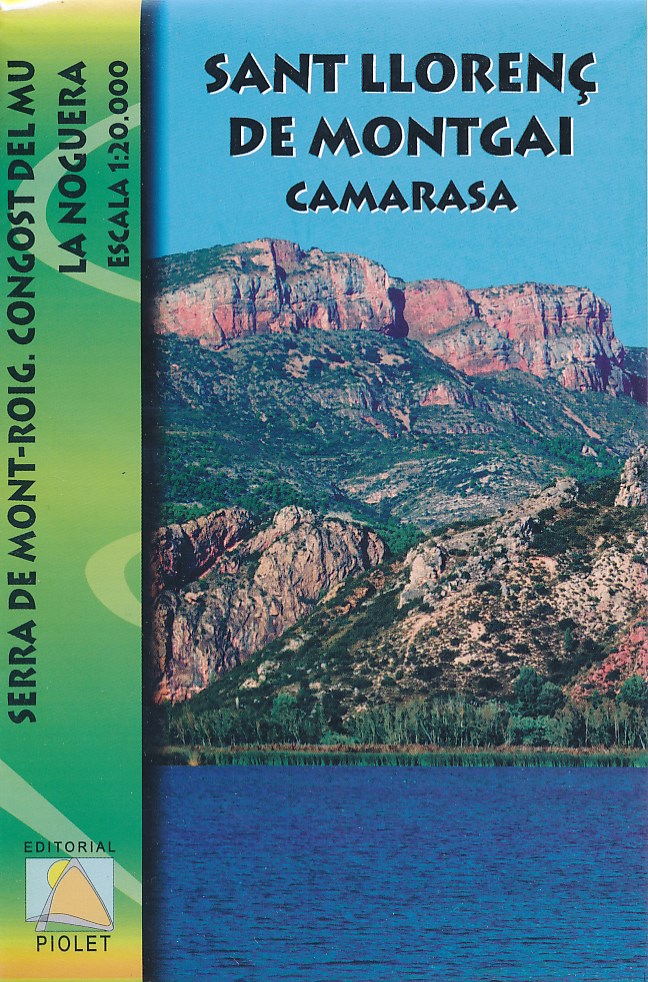
- Wandelkaart Sant Llorenç de Montgai, Camarasa | Editorial Piolet
- Wandelkaart van een deel van Catalonie: Sant Llorenç de Montgai, Camarasa, met ingetekende wandelroutes en hoogtelijnen. Read more

Netherlands
- Wandelkaart 55 Montseny Parc Natural | Editorial Alpina
- Montseny in an extensive and very popular series of walking maps from Editorial Alpina covering the Pyrenees, Catalonia and other selected hiking areas in Spain, including Picos de Europa, Sierra Nevada and parts of Andalucía, Majorca, etc. Scales vary from 1:50,000 to 1:10,000, with the majority of the titles at 1:25,000. The maps have... Read more
- Also available from:
- Stanfords, United Kingdom

United Kingdom
- Montseny NP - Turo de l`Home - Les Agudas - Matagalls - la Calma Editorial Alpina 2-Map Set
- Montseny in an extensive and very popular series of walking maps from Editorial Alpina covering the Pyrenees, Catalonia and other selected hiking areas in Spain, including Picos de Europa, Sierra Nevada and parts of Andalucía, Majorca, etc. Scales vary from 1:50,000 to 1:10,000, with the majority of the titles at 1:25,000. The maps have... Read more
Netherlands
Netherlands
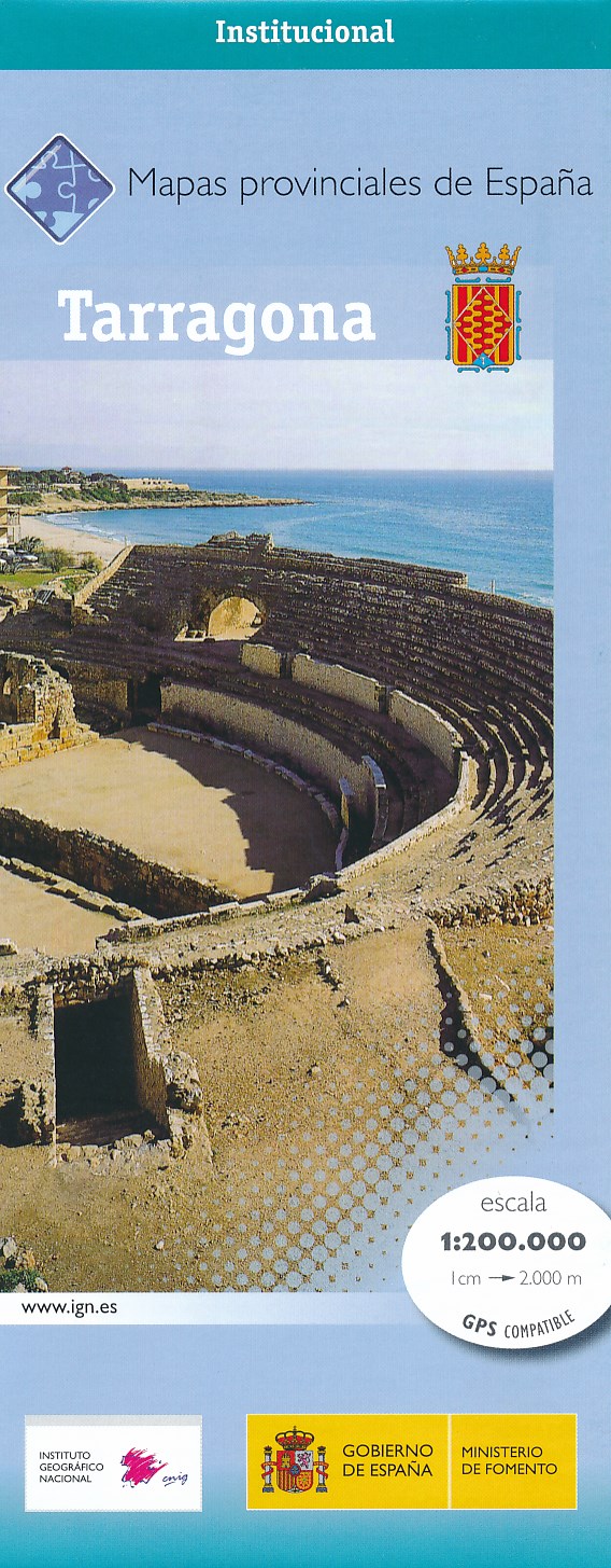
- Wegenkaart - landkaart Mapa Provincial Tarragona | CNIG - Instituto Geográfico Nacional
- Tarragona Province in a series of contoured, GPS-compatible, indexed road maps at 1:200,000 from the IGN - CNIG, Spain Read more
- Also available from:
- Stanfords, United Kingdom

United Kingdom
- Tarragona Province 200K CNIG Map No. 42
- Contoured, GPS-compatible, indexed road map at 1:200,000 from CNIG - Spain’s civilian survey organization, with exceptionally informative presentation of the landscape and highlighting for facilities and places of interest including campsites and paradors.Maps in CNIG’s 200K Provincial Series provide an excellent picture the topography through... Read more
Netherlands
- Wegenkaart - landkaart 577 Comunidad Valenciana - Murcia - Alicante - Benidorm | Michelin
- une carte fiable pour parcourir les régions d'Europe Read more
Netherlands
2014
- Wegenkaart - landkaart Mapa Provincial Girona | CNIG - Instituto Geográfico Nacional
- Girona Province in a series of contoured, GPS-compatible, indexed road maps at 1:200,000 from the IGN - CNIG, Spain Read more
- Also available from:
- Stanfords, United Kingdom

United Kingdom
2014
- Girona Province 200K CNIG Map No. 18
- Contoured, GPS-compatible, indexed road map at 1:200,000 from CNIG - Spain’s civilian survey organization, with exceptionally informative presentation of the landscape and highlighting for facilities and places of interest including campsites and paradors.Maps in CNIG’s 200K Provincial Series provide an excellent picture the topography through... Read more
Netherlands
- Wandelkaart Muntanyes de Prades (Catalonië) | Editorial Piolet
- Muntanyes de Prades at 1:25,000 in a series of GPS compatible maps from Editorial Piolet with cartography based on Spain Read more
- Also available from:
- Stanfords, United Kingdom

United Kingdom
- Muntanyes de Prades
- Muntanyes de Prades at 1:25,000 in a series of GPS compatible maps from Editorial Piolet with cartography based on Spain’s civilian topographic survey overprinted with hiking routes and other tourist information. Hiking maps in the Editorial Piolet series, unless indicated to the contrary in the individual description, have contours at 10m... Read more