
Matterhorn
Beschreibung
Karte

Wanderwege Region
Links
Fakten
Berichte
Führer und Karten
Übernachtung
Organisationen
Reisebüros
GPS
Sonstiges
Bücher

The Book Depository
United Kingdom
2020
United Kingdom
2020
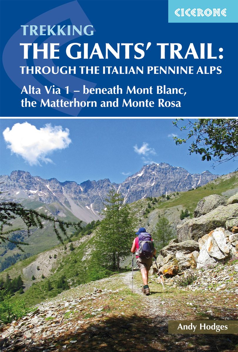
- Trekking the Giants' Trail: Alta Via 1 through the Italian Pennine Alps
- Beneath Mont Blanc, the Matterhorn and Monte Rosa Read more
- Also available from:
- De Zwerver, Netherlands
De Zwerver
Netherlands
2020
Netherlands
2020
- Wandelgids The Giants' Trail: Alta Via 1 Through the Italian Pennine Alps | Cicerone
- Beneath Mont Blanc, the Matterhorn and Monte Rosa Read more

The Book Depository
United Kingdom
2022
United Kingdom
2022
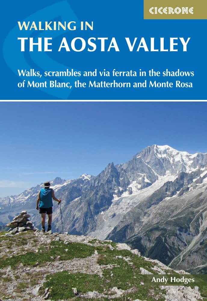
- Walking in the Aosta Valley
- Walks and scrambles in the shadows of Mont Blanc, the Matterhorn and Monte Rosa Read more
- Also available from:
- De Zwerver, Netherlands
- Stanfords, United Kingdom
De Zwerver
Netherlands
2022
Netherlands
2022
- Wandelgids Walking in the Aosta Valley | Cicerone
- A stunning, autonomous region in the Italian Alps, the Aosta valley is a walker`s paradise. This guidebook describes 32 varied and scenic routes both within the main valley and those to the north (including the Lys valley, Valpelline, Valtournenche and Grand St Bernard). The routes vary in difficulty and distance, offering something for walkers... Read more

Stanfords
United Kingdom
2022
United Kingdom
2022
- Walking in the Aosta Valley: Walks and scrambles in the shadows of Mont Blanc, the Matterhorn and Monte Rosa
- A stunning, autonomous region in the Italian Alps, the Aosta valley is a walker`s paradise. This guidebook describes 32 varied and scenic routes both within the main valley and those to the north (including the Lys valley, Valpelline, Valtournenche and Grand St Bernard). The routes vary in difficulty and distance, offering something for walkers... Read more

The Book Depository
United Kingdom
2019
United Kingdom
2019
- Walkers's Haute Route: Chamonix to Zermatt
- The epic journey between Mont Blanc and the Matterhorn Read more
- Also available from:
- De Zwerver, Netherlands
- Stanfords, United Kingdom

De Zwerver
Netherlands
2019
Netherlands
2019
- Wandelgids Walker's Haute Route: Chamonix to Zermatt | Knife Edge Outdoor
- The epic journey between Mont Blanc and the Matterhorn Read more

Stanfords
United Kingdom
2019
United Kingdom
2019
- Walkers`s Haute Route: Chamonix to Zermatt: The epic journey between Mont Blanc and the Matterhorn
- An incredible trek between the two most famous mountain towns in the Alps. Travelling from Chamonix in France to Zermatt in Switzerland, you will start at Mont Blanc and finish at the Matterhorn. On the way, pass the largest collection of snowy 4000m summits in the Alps: Mont Blanc, Grand Combin, the Weisshorn, the Zinalrothorn, the Dom, the... Read more

The Book Depository
United Kingdom
2021
United Kingdom
2021
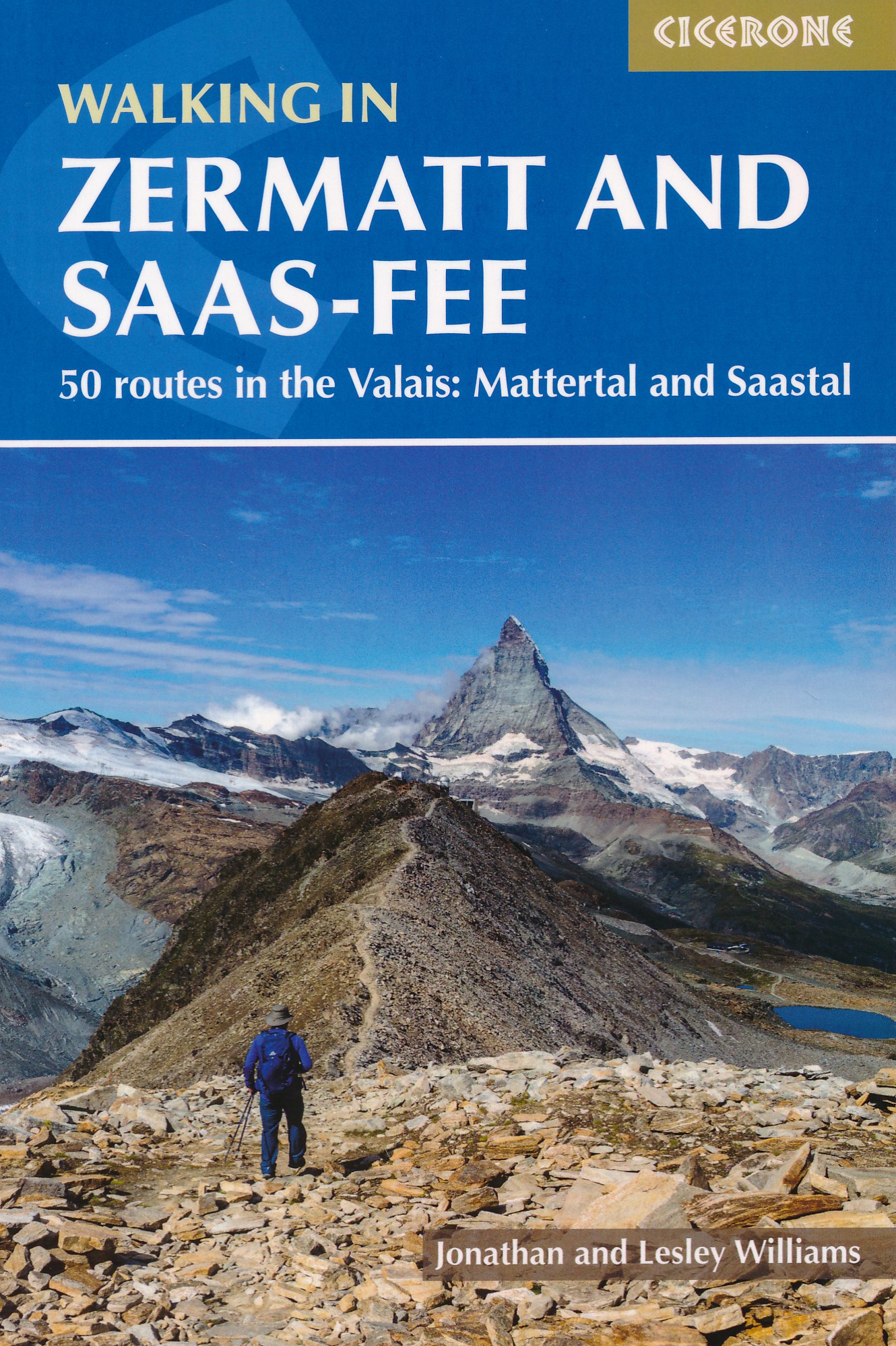
- Walking in Zermatt and Saas-Fee
- 50 routes in the Valais: Mattertal and Saastal Read more
- Also available from:
- De Zwerver, Netherlands
- Stanfords, United Kingdom
De Zwerver
Netherlands
2021
Netherlands
2021
- Wandelgids Walking in Zermatt and Saas-Fee | Cicerone
- Guidebook describing 50 varied walks in the Valais region in the heart of the Swiss Alps. The graded day walks based around the popular resort towns of Zermatt and Saas-Fee explore the Mattertal and Saastal valleys and the surrounding mountains. Ranging from 4 to 18km, the easily accessible routes make use of the area`s extensive network of... Read more

Stanfords
United Kingdom
2021
United Kingdom
2021
- Walking in Zermatt and Saas-Fee
- Guidebook describing 50 varied walks in the Valais region in the heart of the Swiss Alps. The graded day walks based around the popular resort towns of Zermatt and Saas-Fee explore the Mattertal and Saastal valleys and the surrounding mountains. Ranging from 4 to 18km, the easily accessible routes make use of the area`s extensive network of... Read more
De Zwerver
Netherlands
2010
Netherlands
2010
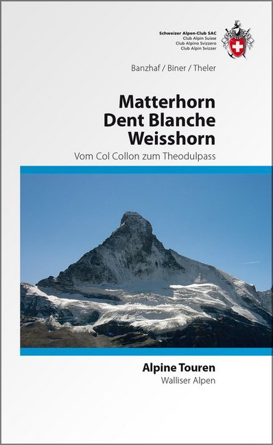
- Wandelgids Alpine Touren Matterhorn - Weisshorn - Dent Blanche | SAC Schweizer Alpenclub
- Wandel- klimgids voor de Walliser Alpen met beschrijvingen van de routes naar toppen van bekende topppen: Bouquetins - Dents de Perroc, Dent Blanche, Grand Cornier, Gable horner - Zinalrothorn , Weisshorn, Diablons - Bella Tola & Matterhorn. Im Gebiet dieses Führers liegen die schönsten und berühmtesten Viertausender der Schweizer Alpen. In der... Read more

De Zwerver
Netherlands
2022
Netherlands
2022
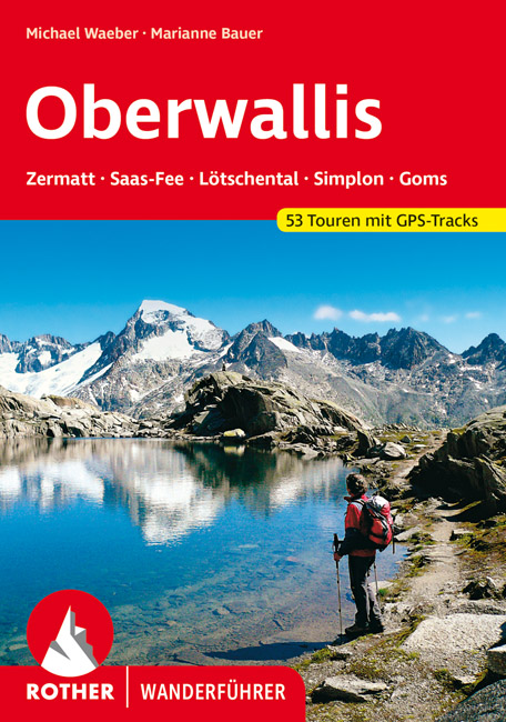
- Wandelgids Oberwallis | Rother Bergverlag
- Goede duitstalige wandelgids. Veel dagtochten, met gradaties en kleuren in zwaarte gerangschikt. Veel praktische informatie. Handzaam formaat. Das Wallis mit seinen mehr als viertausend Meter hohen Bergriesen wie Matterhorn und Monte Rosa, mit Gletscherbrüchen, Eisflanken und Felswänden ist nicht nur ein Paradies für Alpinisten, sondern... Read more
De Zwerver
Netherlands
2012
Netherlands
2012
- Wandelgids Walliser Alpen Gebietsführer | Rother Bergverlag
- Wallis: »Land der weißen Riesen«, »Mekka des Bergsteigens«, der markigen Worthülsen und klingenden Attribute gibt es viele, namentlich im Sprachschatz einheimischer Tourismusmanager und alpenferner Werbeleute. Doch in der Tat, es steckt viel Wahres in den verbalen Superlativen für Landschaft und Natur des Viertausender-Kantons: Nirgendwo sonst... Read more

Stanfords
United Kingdom
United Kingdom
- DK Eyewitness Travel Guide Switzerland
- Marvel at the iconic Matterhorn, explore the fascinating art galleries and museums of Basel or stroll around the historic town of Lausanne on Lake Geneva. The DK Eyewitness Guide to Switzerland covers the must-see sights and the hidden backstreets, so you won`t miss a thing.- See Switzerland from a different angle - 14 pages of fresh ideas for... Read more
Bol.com
Netherlands
Netherlands
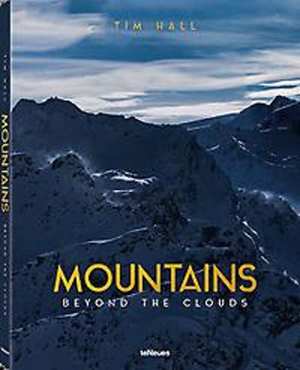
- Mountains
- Mountains, one of nature's greatest masterpieces, in their rugged beauty, breathtaking views from the top, clear air, green pastures, mountain lakes and glaciers, have captivated mankind all along. Climbing mountains or just gazing at their majestic splendor causes us to slow down and contemplate, maybe even giving us a little serenity.... Read more
- Also available from:
- Bol.com, Belgium
Bol.com
Belgium
Belgium
- Mountains
- Mountains, one of nature's greatest masterpieces, in their rugged beauty, breathtaking views from the top, clear air, green pastures, mountain lakes and glaciers, have captivated mankind all along. Climbing mountains or just gazing at their majestic splendor causes us to slow down and contemplate, maybe even giving us a little serenity.... Read more
Bol.com
Netherlands
Netherlands
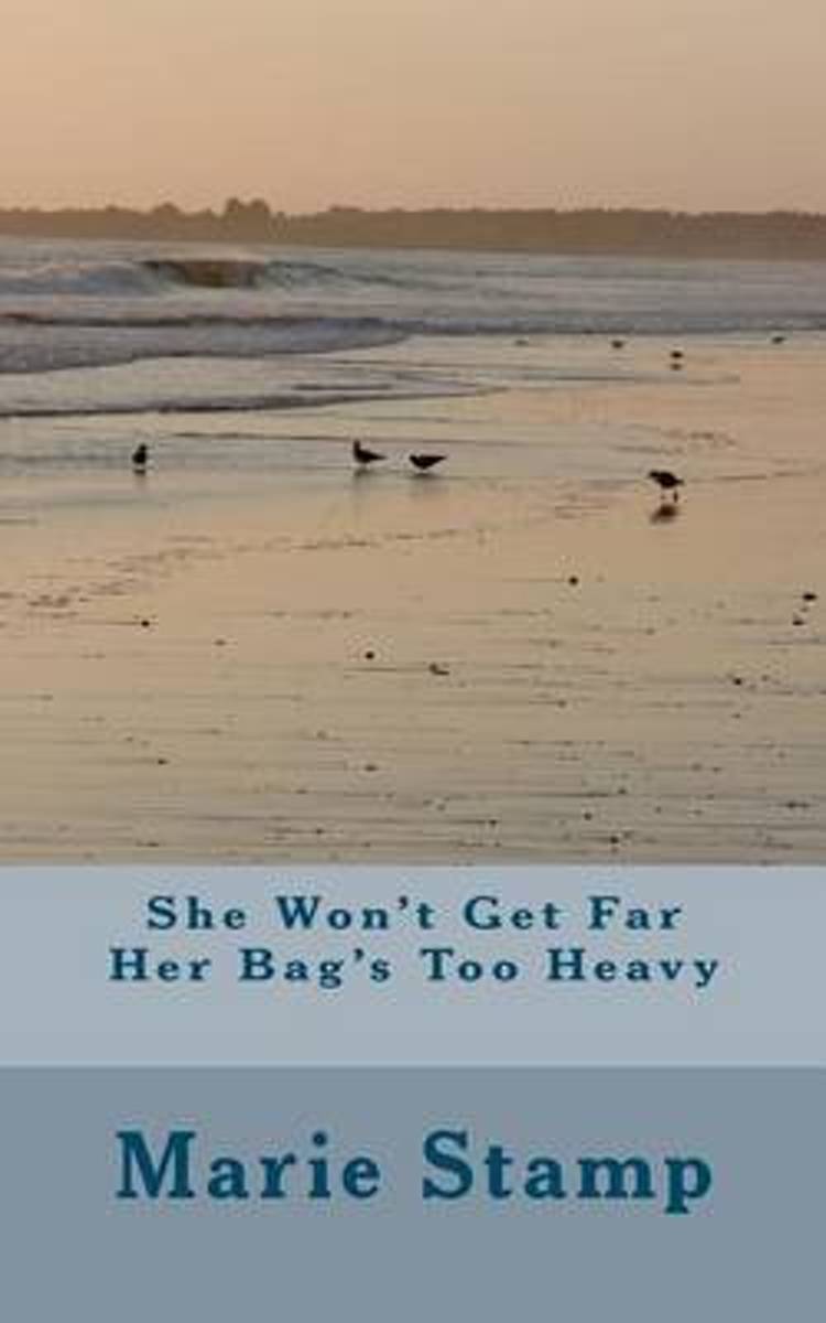
- She Won't Get Far Her Bag's Too Heavy
- SHE WON'T GET FAR HER BAG'S TOO HEAVYAuthor Marie StampA story about a woman and her dog starting out on a walk on the South West Coast Pathin 2010 with the intention of walking from Minehead to Land's End. Her dog carrying his ownbaggage and she carrying a huge rucksack full of things that give her self sufficiency. Sportingshin splints, she... Read more
- Also available from:
- Bol.com, Belgium
Bol.com
Belgium
Belgium
- She Won't Get Far Her Bag's Too Heavy
- SHE WON'T GET FAR HER BAG'S TOO HEAVYAuthor Marie StampA story about a woman and her dog starting out on a walk on the South West Coast Pathin 2010 with the intention of walking from Minehead to Land's End. Her dog carrying his ownbaggage and she carrying a huge rucksack full of things that give her self sufficiency. Sportingshin splints, she... Read more
Bol.com
Netherlands
Netherlands
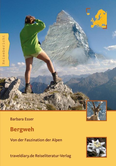
- Bergweh
- Gerade einmal zehn Minuten Gipfelglück sind der Lohn für die Mühen, die ich auf mich genommen habe, um ganz oben zu stehen. An einem hitzerekordverdächtigen Augusttag gehört das Matterhorn für einen einzigartigen Moment uns ganz alleine. Aus dem Inhalt: Das Bergweh begann ein paar Jahre zuvor. Vielleicht ergriff es Barbara Esser, als sie das... Read more
- Also available from:
- Bol.com, Belgium
Bol.com
Belgium
Belgium
- Bergweh
- Gerade einmal zehn Minuten Gipfelglück sind der Lohn für die Mühen, die ich auf mich genommen habe, um ganz oben zu stehen. An einem hitzerekordverdächtigen Augusttag gehört das Matterhorn für einen einzigartigen Moment uns ganz alleine. Aus dem Inhalt: Das Bergweh begann ein paar Jahre zuvor. Vielleicht ergriff es Barbara Esser, als sie das... Read more
Bol.com
Netherlands
Netherlands
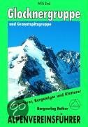
- Glockner- Und Granatspitzgruppe
- Der Großglockner, Primus inter pares im Land der Berge, übt seit jeher auf Alpinisten aller Herren Länder eine ungebrochen magische Anziehungskraft aus. Und in der Tat bieten seine Grate, Flanken und Wände immer noch Traumziele und Höhepunkte eines Bergsteigerlebens und brauchen einen Vergleich mit westalpinen Größen wie Jungfrau, Matterhorn... Read more
- Also available from:
- Bol.com, Belgium
Bol.com
Belgium
Belgium
- Glockner- Und Granatspitzgruppe
- Der Großglockner, Primus inter pares im Land der Berge, übt seit jeher auf Alpinisten aller Herren Länder eine ungebrochen magische Anziehungskraft aus. Und in der Tat bieten seine Grate, Flanken und Wände immer noch Traumziele und Höhepunkte eines Bergsteigerlebens und brauchen einen Vergleich mit westalpinen Größen wie Jungfrau, Matterhorn... Read more
De Zwerver
Netherlands
2013
Netherlands
2013
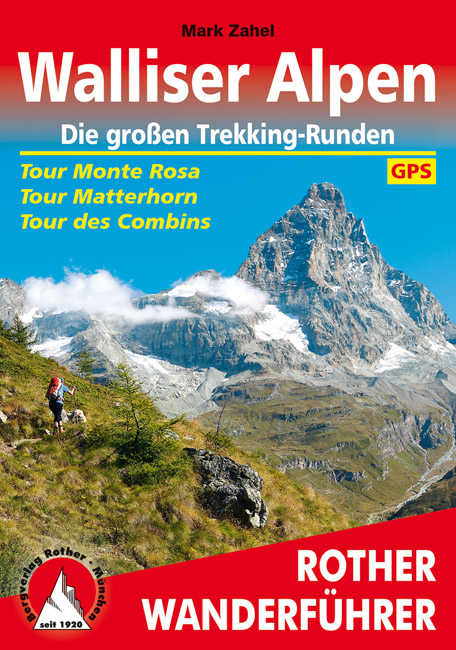
- Wandelgids Walliser Alpen | Rother Bergverlag
- Uitstekende wandelgids met een groot aantal dagtochten in dal en hooggebergte. Met praktische informatie en beperkt kaartmateriaal! Wandelingen in verschillende zwaarte weergegeven in rood/blauw/zwart. Nirgends ballen sich solch großartige hochalpine Impressionen, so viele Viertausender auf engem Raum wie in den Walliser Alpen. Drei große... Read more
- Also available from:
- Bol.com, Netherlands
- Bol.com, Belgium
Bol.com
Netherlands
2013
Netherlands
2013
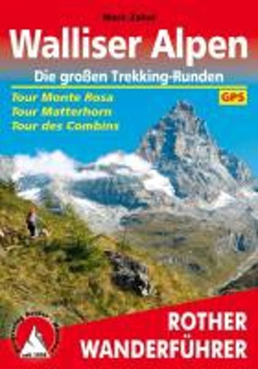
- Walliser Alpen. Die gro en Trekking-Runden
- Uitstekende wandelgids met een groot aantal dagtochten in dal en hooggebergte. Met praktische informatie en beperkt kaartmateriaal! Wandelingen in verschillende zwaarte weergegeven in rood/blauw/zwart. Nirgends ballen sich solch großartige hochalpine Impressionen, so viele Viertausender auf engem Raum wie in den Walliser Alpen. Drei große... Read more
Bol.com
Belgium
2013
Belgium
2013
- Walliser Alpen. Die gro en Trekking-Runden
- Uitstekende wandelgids met een groot aantal dagtochten in dal en hooggebergte. Met praktische informatie en beperkt kaartmateriaal! Wandelingen in verschillende zwaarte weergegeven in rood/blauw/zwart. Nirgends ballen sich solch großartige hochalpine Impressionen, so viele Viertausender auf engem Raum wie in den Walliser Alpen. Drei große... Read more
Karten
De Zwerver
Netherlands
Netherlands
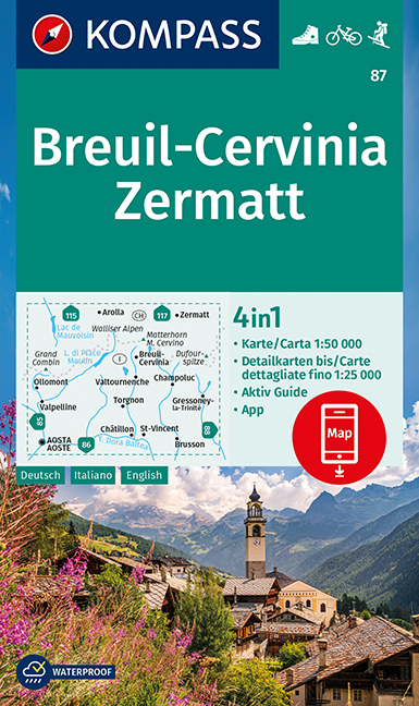
- Wandelkaart 87 Breuil-Cervinia - Zermatt | Kompass
- Breuil-Cervinia - Matterhorn - Zermatt area straddling the border of Italy and Switzerland on a GPS compatible hiking and recreational map at 1:50,000 from Kompass, printed on durable, waterproof and tear-resistant synthetic paper. Coverage extends north to Arolla and east to Monte Rosa, with Aosta in the south-western corner of the map, and... Read more
- Also available from:
- Stanfords, United Kingdom

Stanfords
United Kingdom
United Kingdom
- Breuil-Cervinia - Zermatt Kompass 87
- Breuil-Cervinia - Matterhorn - Zermatt area straddling the border of Italy and Switzerland on a GPS compatible hiking and recreational map at 1:50,000 from Kompass, printed on durable, waterproof and tear-resistant synthetic paper. Coverage extends north to Arolla and east to Monte Rosa, with Aosta in the south-western corner of the map, and... Read more
De Zwerver
Netherlands
Netherlands
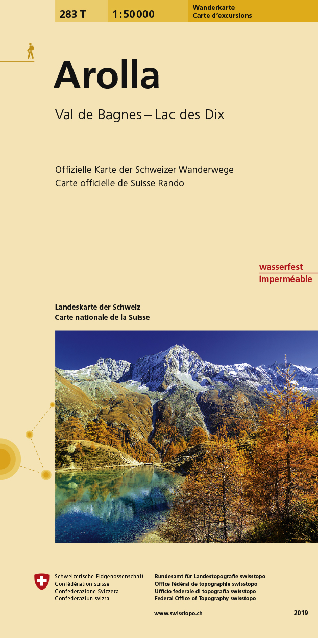
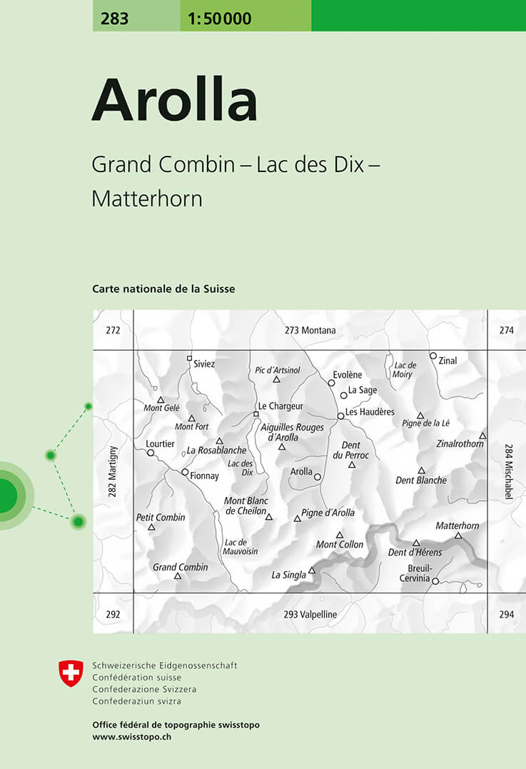
- Wandelkaart 283T Arolla | Swisstopo
- Arolla area, map No. 283T, at 1:50,000 in a special hiking edition of the country Read more
- Also available from:
- Stanfords, United Kingdom

Stanfords
United Kingdom
United Kingdom
- Arolla Swisstopo Hiking 283T
- Arolla area, map No. 283T, at 1:50,000 in a special hiking edition of the country’s topographic survey, published by Swisstopo in cooperation with the Swiss Hiking Federation. The map covers the peaks from the Matterhorn to Grand Combin, and the southern part of Val d’Herens with Evolène and La Forclaz.Cartography, identical to the standard... Read more
De Zwerver
Netherlands
Netherlands
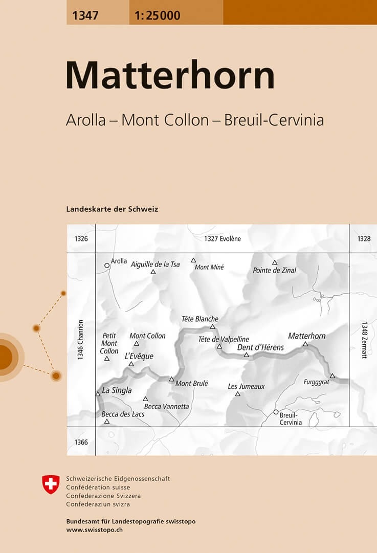
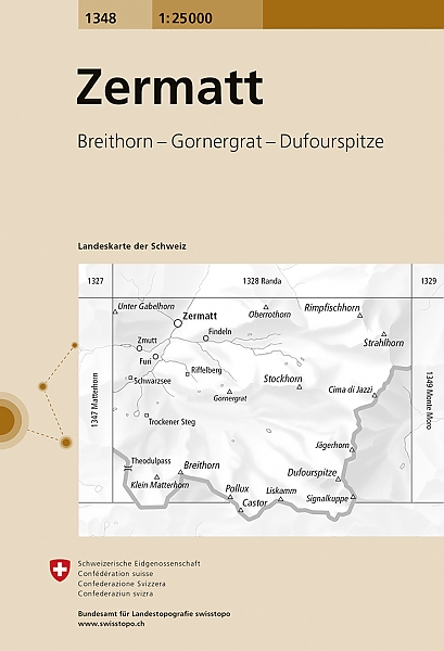
- Wandelkaart - Topografische kaart 1347 Matterhorn | Swisstopo
- Map No. 1347, Matterhorn, in the topographic survey of Switzerland at 1:25,000 from Bundesamt f Read more
- Also available from:
- Stanfords, United Kingdom

Stanfords
United Kingdom
United Kingdom
- Matterhorn Swisstopo 1347
- Map No. 1347, Matterhorn, in the topographic survey of Switzerland at 1:25,000 from Bundesamt für Landestopographie (swisstopo), covering the whole country on 247 small format sheets, with special larger maps published for popular regions including some titles now available in hiking versions.Highly regarded for their superb use of graphic... Read more
De Zwerver
Netherlands
Netherlands
- Wandelkaart - Topografische kaart 3306T Zermatt - Saas - Fee | Swisstopo
- Een nieuwe serie van de Zwitserse topografische dienst: eindelijk goede wandelkaarten met ingetekende wandelroutes op scheur- en watervast papier. Vooralsnog zijn ze uitgebracht van de populaire wandelgebieden en niet landelijk dekkend (zie overzicht) Op een gedetailleerde schaal van 1:33.333 met als ondergrond de onovertroffen topografische... Read more
- Also available from:
- Stanfords, United Kingdom

Stanfords
United Kingdom
United Kingdom
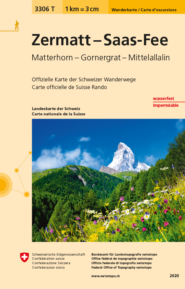
- Zermatt - Saas-Fee - Matterhorn - Gornergrat - Mittelallalin Swisstopo Hiking 3306T
- Zermatt - Saas Fee - Matterhorn - Gornergrat - Mischabel area at 1:33,333 on light, waterproof and tear-resistant map No. 3306T published by Swisstopo in cooperation with the Swiss Hiking Federation. Cartography is the same as in Swisstopo’s 50K hiking maps, simply enlarged to 1:33,333 for extra clarity but without additional information.... Read more
De Zwerver
Netherlands
Netherlands
- Wandelkaart - Topografische kaart 2526 Saas - Fee | Swisstopo
- Map No. 2526, Saas-Fee, in the topographic survey of Switzerland at 1:25,000 from Swisstopo, covering the central part of the Mischabel range and both sides of the two adjoining valleys: the Mattertal between Zermatt and St Niklaus and the Saastal from north of Saas-Balen to the Mattmark Reservoir. Please note: Zermatt is at the southern edge... Read more
- Also available from:
- Stanfords, United Kingdom

Stanfords
United Kingdom
United Kingdom
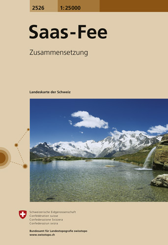
- Saas-Fee Swisstopo 2526
- Map No. 2526, Saas-Fee, in the topographic survey of Switzerland at 1:25,000 from Swisstopo, covering the central part of the Mischabel range and both sides of the two adjoining valleys: the Mattertal between Zermatt and St Niklaus and the Saastal from north of Saas-Balen to the Mattmark Reservoir. Please note: Zermatt is at the southern edge... Read more
De Zwerver
Netherlands
Netherlands
- Wandelkaart - Topografische kaart 5006 Matterhorn Mischabel | Swisstopo
- Matterhorn - Mischabel area, map No. 5006, in the standard topographic survey of Switzerland at 1:50,000 from Swisstopo, i.e. without the special overprint highlighting walking trails, local bus stops, etc, presented in Swisstopo Read more
- Also available from:
- Stanfords, United Kingdom

Stanfords
United Kingdom
United Kingdom
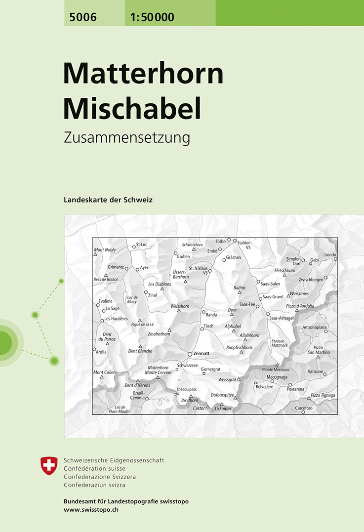
- Matterhorn - Mischabel Swisstopo 5006
- Matterhorn - Mischabel area, map No. 5006, in the standard topographic survey of Switzerland at 1:50,000 from Swisstopo, i.e. without the special overprint highlighting walking trails, local bus stops, etc, presented in Swisstopo’s hiking editions of the 50K survey. The map covers the whole of the Mattertal and Saastal valleys with Zermatt,... Read more

De Zwerver
Netherlands
Netherlands
- Wandelkaart 05 Cervino Matterhorn e Monte Rosa | IGC - Istituto Geografico Centrale
- Matterhorn/M.Cervino and Monte Rosa, map no. 5, in a series contoured hiking maps at 1:50,000 with local trails, long-distance footpaths, mountain accommodation, etc. from the Turin based Istituto Geografico Centrale covering the Italian Alps and Piedmont, the lakes and northern Lombardy, and the Italian Riviera.The maps have contours at 50m... Read more
- Also available from:
- Stanfords, United Kingdom

Stanfords
United Kingdom
United Kingdom
- Matterhorn / M. Cervino - Monte Rosa IGC 5
- The Italian side of the Matterhorn and Monte Rosa, with coverage extending from Zermatt to Aosta, in a series contoured hiking maps at 1:50,000 with local trails, long-distance footpaths, mountain accommodation, etc. from the Turin based Istituto Geografico Centrale. Maps in this series have contours at 50m intervals, enhanced by shading and... Read more
De Zwerver
Netherlands
2022
Netherlands
2022
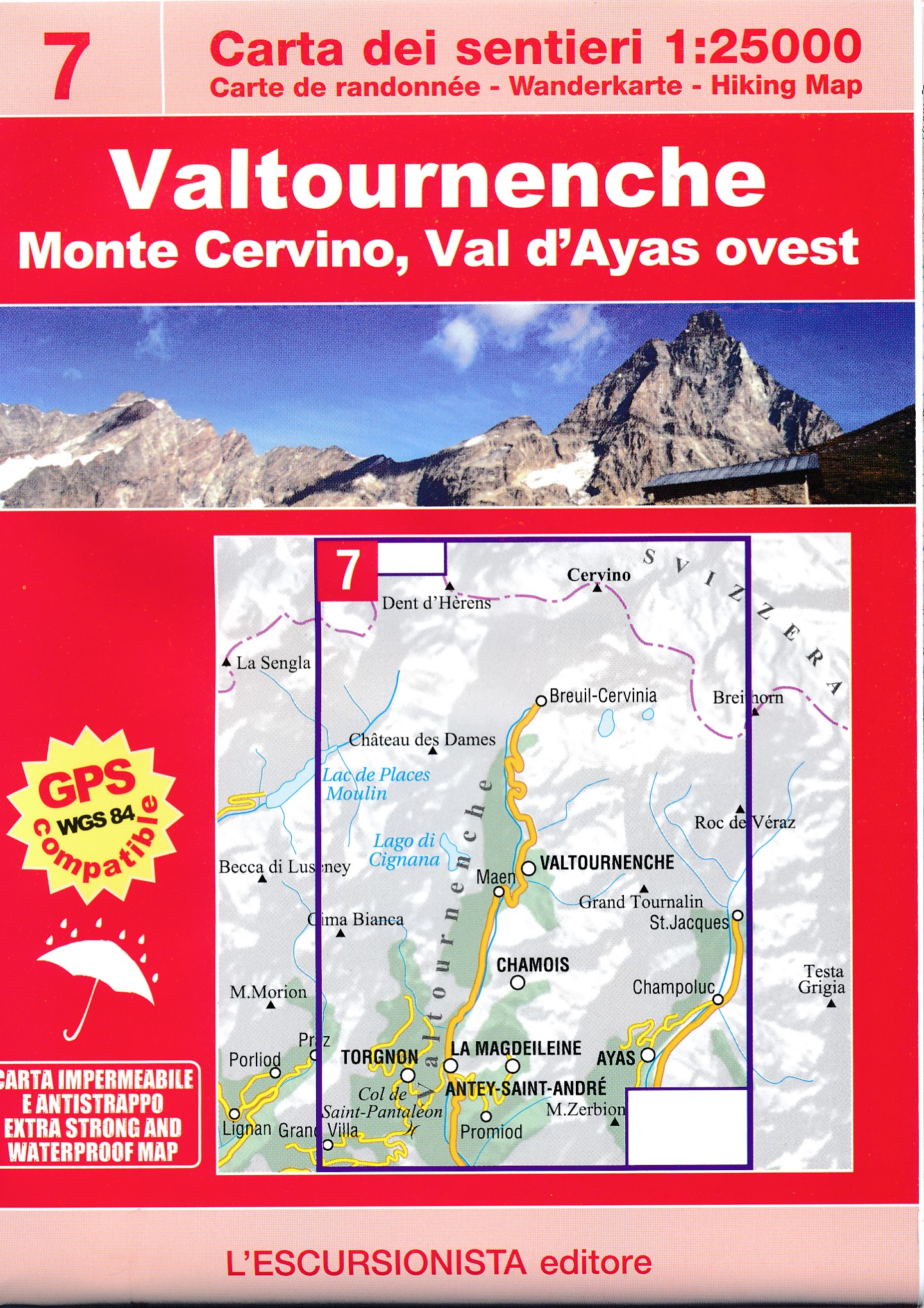
- Wandelkaart 07 Valtournenche, Monte Cervino | L'Escursionista editore
- Voor weinig gebieden in Italië zijn echt goede wandelkaarten beschikbaar. Dit is gelukkig zo'n serie: voor de noordwestelijke Alpen van Italië; Gran Paradiso, Mont Blanc en Aosta en omgeving. Met GPS grid uitgeruste detailkaart, schaal 1:25.000 met alle noodzakelijke wandelinformatie als ingetekende routes, Via Ferrata routes, campings,... Read more
De Zwerver
Netherlands
Netherlands
- Wandelkaart - Topografische kaart 283 Arolla | Swisstopo
- Arolla, map No. 283, in the standard topographic survey of Switzerland at 1:50,000 from Swisstopo, i.e. without the special overprint highlighting walking trails, local bus stops, etc, presented in Swisstopo Read more
- Also available from:
- Stanfords, United Kingdom

Stanfords
United Kingdom
United Kingdom
- Arolla Swisstopo 283
- Arolla, map No. 283, in the standard topographic survey of Switzerland at 1:50,000 from Swisstopo, i.e. without the special overprint highlighting walking trails, local bus stops, etc, presented in Swisstopo’s hiking editions of the 50K survey. The map covers the peaks from the Matterhorn to Grand Combin, and the southern part of Val d’Herens... Read more
De Zwerver
Netherlands
Netherlands
- Wandelkaart - Topografische kaart 1348 Zermatt | Swisstopo
- Map No. 1348, Zermatt, in the topographic survey of Switzerland at 1:25,000 from Bundesamt f Read more
- Also available from:
- Stanfords, United Kingdom

Stanfords
United Kingdom
United Kingdom
- Zermatt Swisstopo 1348
- Map No. 1348, Zermatt, in the topographic survey of Switzerland at 1:25,000 from Bundesamt für Landestopographie (swisstopo), covering the whole country on 247 small format sheets, with special larger maps published for popular regions including some titles now available in hiking versions.Highly regarded for their superb use of graphic relief... Read more
De Zwerver
Netherlands
Netherlands
- Also available from:
- Stanfords, United Kingdom

Stanfords
United Kingdom
United Kingdom
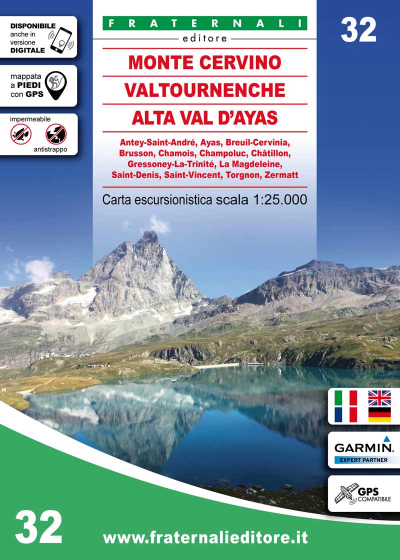
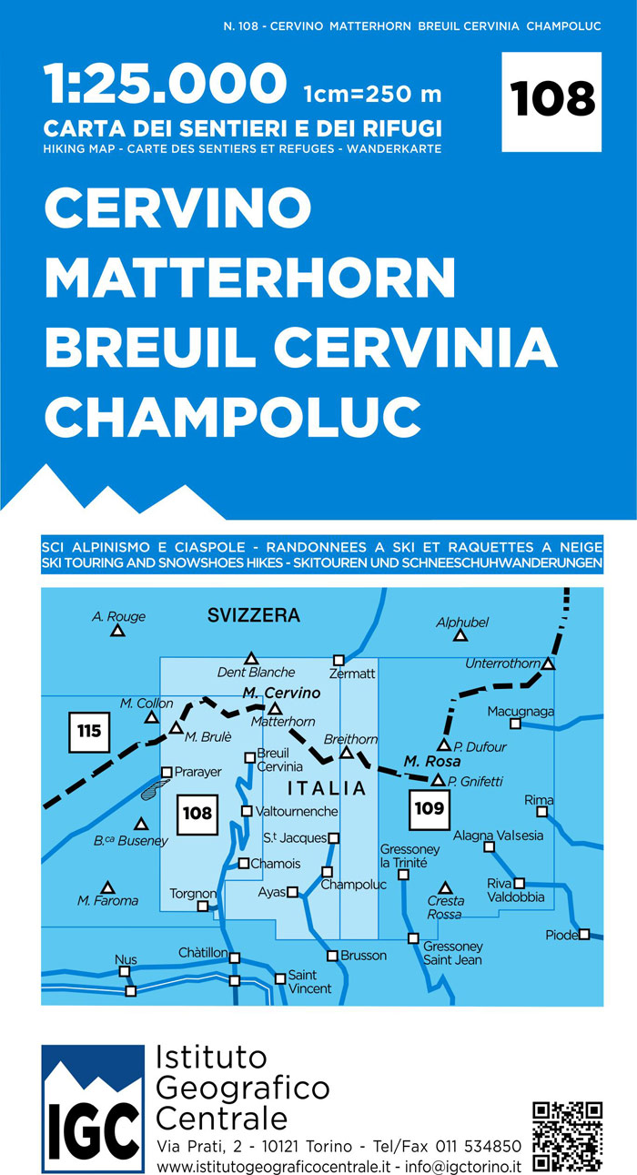
- Matterhorn / Cervino - Breuil Cervinia - Champoluc IGC 108
- Matterhorn/M. Cervino - Breuil-Cervinia - Champoluc area at 1:25,000 in a series of contoured, GPS compatible walking maps from the Turin based Istituto Geografico Centrale, highlighting hiking trails including long-distance routes, ski routes and alpine accommodation. Maps in this series have contours at 25m intervals, enhanced by shading and... Read more
De Zwerver
Netherlands
Netherlands
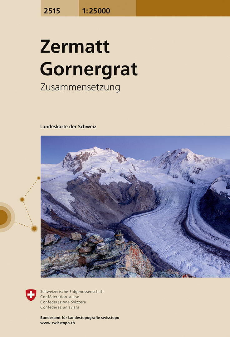
- Wandelkaart - Topografische kaart 2515 Zermatt - Gornergrat | Swisstopo
- Map No. 2515, Zermatt - Gornergrat, in the topographic survey of Switzerland at 1:25,000 from Swisstopo, covering the upper part of the Mattertal with T Read more
- Also available from:
- Stanfords, United Kingdom

Stanfords
United Kingdom
United Kingdom
- Zermatt - Gornergrat Swisstopo 2515
- Map No. 2515, Zermatt - Gornergrat, in the topographic survey of Switzerland at 1:25,000 from Swisstopo, covering the upper part of the Mattertal with Täsch and Zermatt and extending south across the peaks (Monte Rosa/Dufourspitze, Breithorn, Theodulpass, Matterhorn and Dents d’Hérens) to Breuil-Cervinia in Italy. Peaks on both sides of the... Read more
Stanfords
United Kingdom
United Kingdom
- Zermatt - Matterhorn K+F Hiking 13
- The Mattertal and the lower part of the Saastal valleys, the Mischabel group with Dom, and the upper part of the Val d`Anniviers presented at 1:50,000 on a waterproof and tear-resistant, contoured and GPS compatible map from the Hallwag/Kümmerly + Frey group, with route profiles, grading for the severity of the terrain and the degree of fitness... Read more

Stanfords
United Kingdom
United Kingdom
- Montreux
- Montreux - Col du Pillon area at 1:50,000 in a series from Hallwag covering Switzerland’s popular hiking regions on light, waterproof and tear-resistant maps highlighting long-distance paths: the nine national routes plus special regional routes, as well as other local hiking trails.Cartography is similar to that used both in Hallwag’s hiking... Read more