
Monte Rosa
Beschreibung
Karte

Wanderwege Region
Links
Fakten
Berichte
Führer und Karten
Übernachtung
Organisationen
Reisebüros
GPS
Sonstiges
Bücher

The Book Depository
United Kingdom
2021
United Kingdom
2021
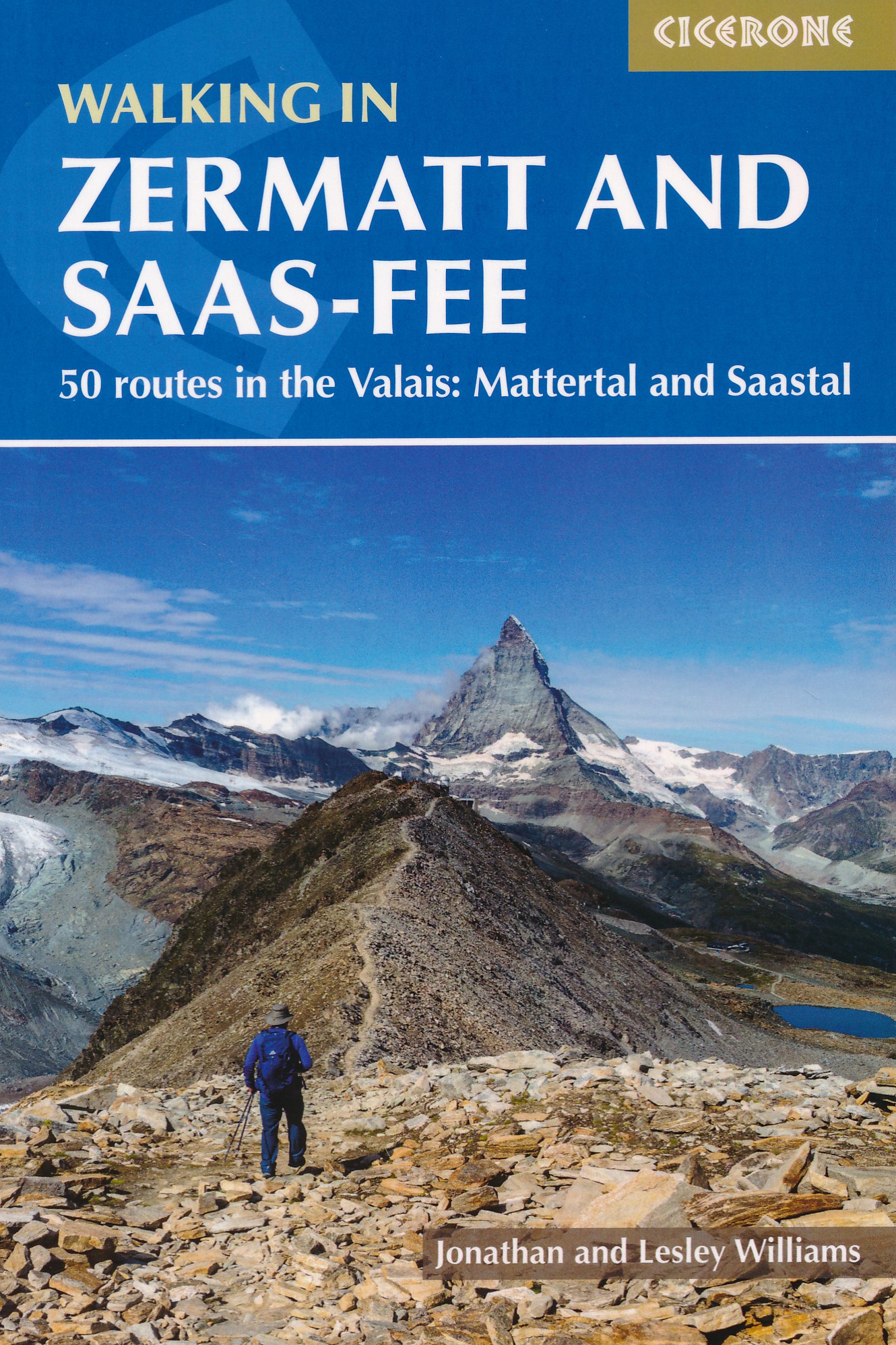
- Walking in Zermatt and Saas-Fee
- 50 routes in the Valais: Mattertal and Saastal Read more
- Also available from:
- De Zwerver, Netherlands
- Stanfords, United Kingdom
De Zwerver
Netherlands
2021
Netherlands
2021
- Wandelgids Walking in Zermatt and Saas-Fee | Cicerone
- Guidebook describing 50 varied walks in the Valais region in the heart of the Swiss Alps. The graded day walks based around the popular resort towns of Zermatt and Saas-Fee explore the Mattertal and Saastal valleys and the surrounding mountains. Ranging from 4 to 18km, the easily accessible routes make use of the area`s extensive network of... Read more

Stanfords
United Kingdom
2021
United Kingdom
2021
- Walking in Zermatt and Saas-Fee
- Guidebook describing 50 varied walks in the Valais region in the heart of the Swiss Alps. The graded day walks based around the popular resort towns of Zermatt and Saas-Fee explore the Mattertal and Saastal valleys and the surrounding mountains. Ranging from 4 to 18km, the easily accessible routes make use of the area`s extensive network of... Read more

The Book Depository
United Kingdom
2020
United Kingdom
2020
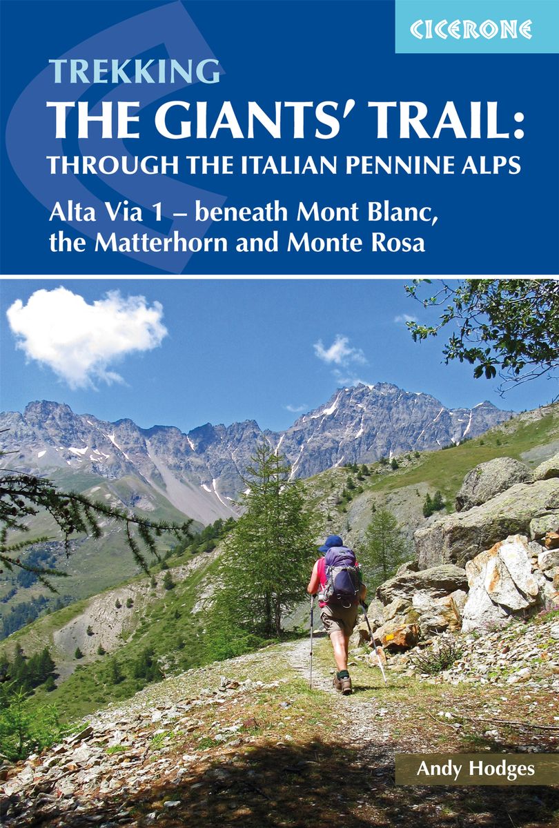
- Trekking the Giants' Trail: Alta Via 1 through the Italian Pennine Alps
- Beneath Mont Blanc, the Matterhorn and Monte Rosa Read more
- Also available from:
- De Zwerver, Netherlands
De Zwerver
Netherlands
2020
Netherlands
2020
- Wandelgids The Giants' Trail: Alta Via 1 Through the Italian Pennine Alps | Cicerone
- Beneath Mont Blanc, the Matterhorn and Monte Rosa Read more

The Book Depository
United Kingdom
2022
United Kingdom
2022
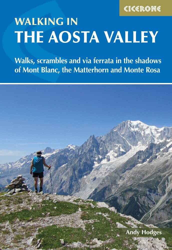
- Walking in the Aosta Valley
- Walks and scrambles in the shadows of Mont Blanc, the Matterhorn and Monte Rosa Read more
- Also available from:
- De Zwerver, Netherlands
- Stanfords, United Kingdom
De Zwerver
Netherlands
2022
Netherlands
2022
- Wandelgids Walking in the Aosta Valley | Cicerone
- A stunning, autonomous region in the Italian Alps, the Aosta valley is a walker`s paradise. This guidebook describes 32 varied and scenic routes both within the main valley and those to the north (including the Lys valley, Valpelline, Valtournenche and Grand St Bernard). The routes vary in difficulty and distance, offering something for walkers... Read more

Stanfords
United Kingdom
2022
United Kingdom
2022
- Walking in the Aosta Valley: Walks and scrambles in the shadows of Mont Blanc, the Matterhorn and Monte Rosa
- A stunning, autonomous region in the Italian Alps, the Aosta valley is a walker`s paradise. This guidebook describes 32 varied and scenic routes both within the main valley and those to the north (including the Lys valley, Valpelline, Valtournenche and Grand St Bernard). The routes vary in difficulty and distance, offering something for walkers... Read more
De Zwerver
Netherlands
2021
Netherlands
2021
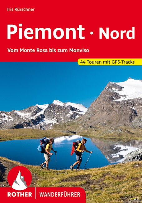
- Wandelgids 77 Piemonte Piemont - Nord | Rother Bergverlag
- Uitstekende wandelgids met een groot aantal dagtochten in dal en hooggebergte. Met praktische informatie en beperkt kaartmateriaal! Wandelingen in verschillende zwaarte weergegeven in rood/blauw/zwart 192 Seiten mit 93 Farbabbildungen 44 Höhenprofile, 44 Wanderkärtchen im Maßstab 1:25.000/1:50.000/1:75.000, eine Übersichtskarte Eine Reise ins... Read more
De Zwerver
Netherlands
2022
Netherlands
2022
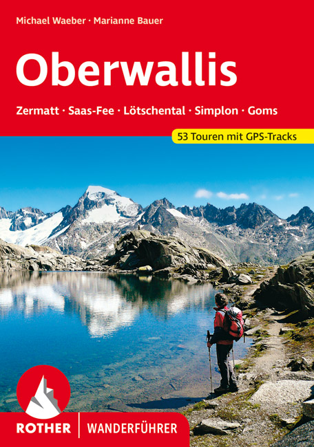
- Wandelgids Oberwallis | Rother Bergverlag
- Goede duitstalige wandelgids. Veel dagtochten, met gradaties en kleuren in zwaarte gerangschikt. Veel praktische informatie. Handzaam formaat. Das Wallis mit seinen mehr als viertausend Meter hohen Bergriesen wie Matterhorn und Monte Rosa, mit Gletscherbrüchen, Eisflanken und Felswänden ist nicht nur ein Paradies für Alpinisten, sondern... Read more
De Zwerver
Netherlands
2021
Netherlands
2021
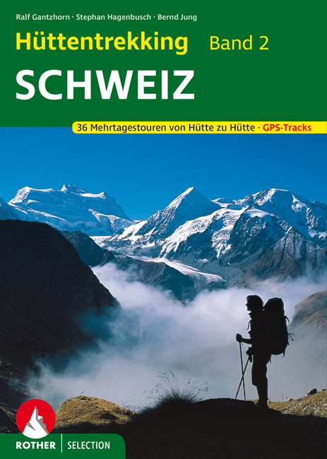
- Wandelgids Hüttentrekking Schweiz - Zwitserland Band 2 | Rother Bergverlag
- Absolute aanrader als het gaat om meerdaagse tochten van hut naar hut in Zwitserland. Gedegen Duitstalig boek! Die Schweiz gilt als Inbegriff einer schönen Landschaft. Nicht zufällig werden weltweit die unterschiedlichsten Regionen mit dem Beinamen der kleinen Alpenrepublik versehen und stets ist ein besonders reizvolles Fleckchen unserer Erde... Read more
De Zwerver
Netherlands
2012
Netherlands
2012
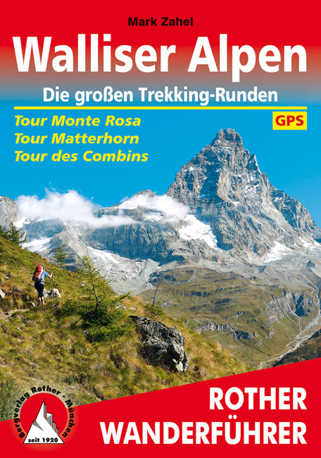
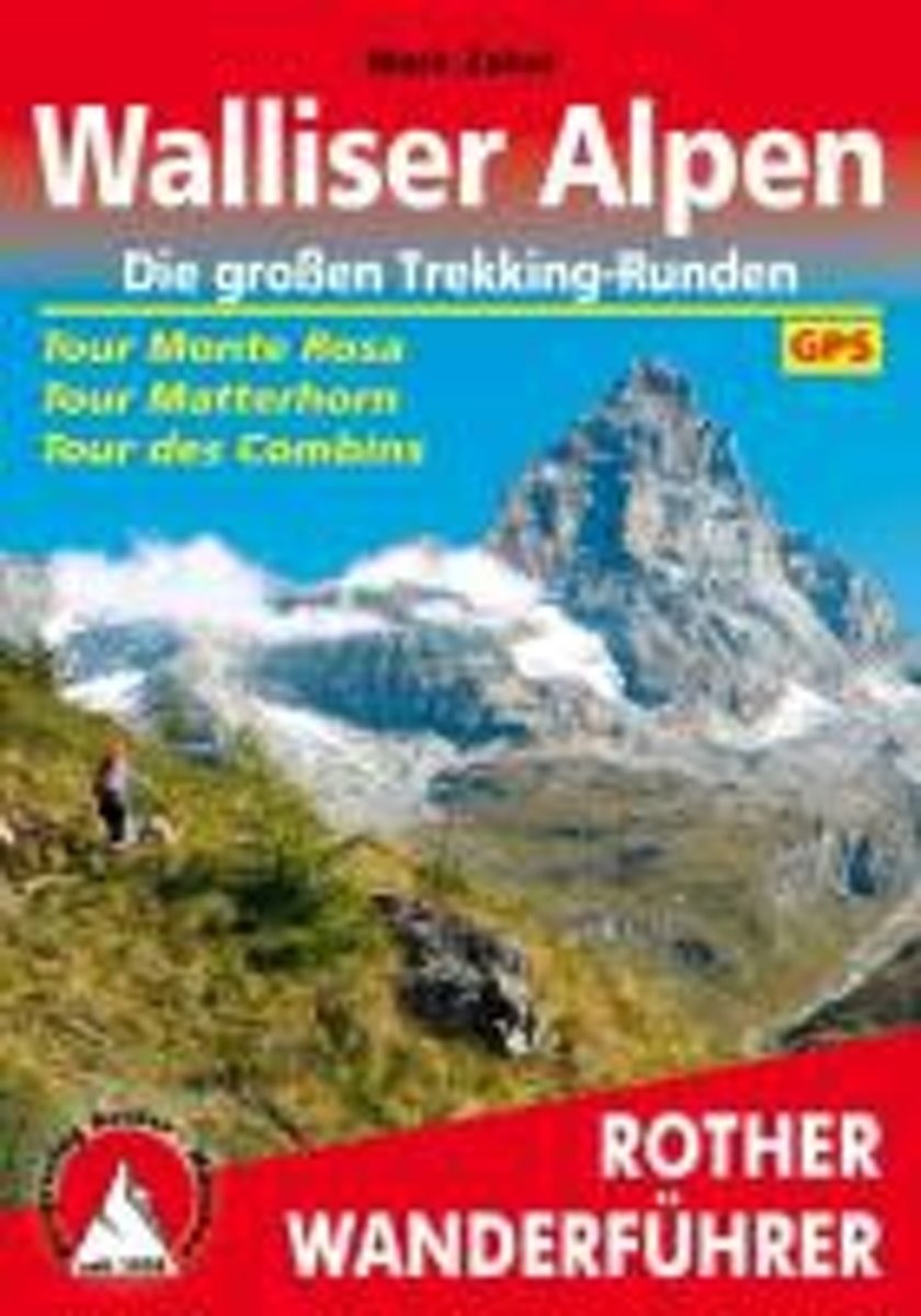
- Wandelgids Walliser Alpen Gebietsführer | Rother Bergverlag
- Wallis: »Land der weißen Riesen«, »Mekka des Bergsteigens«, der markigen Worthülsen und klingenden Attribute gibt es viele, namentlich im Sprachschatz einheimischer Tourismusmanager und alpenferner Werbeleute. Doch in der Tat, es steckt viel Wahres in den verbalen Superlativen für Landschaft und Natur des Viertausender-Kantons: Nirgendwo sonst... Read more
De Zwerver
Netherlands
2013
Netherlands
2013
- Wandelgids Walliser Alpen | Rother Bergverlag
- Uitstekende wandelgids met een groot aantal dagtochten in dal en hooggebergte. Met praktische informatie en beperkt kaartmateriaal! Wandelingen in verschillende zwaarte weergegeven in rood/blauw/zwart. Nirgends ballen sich solch großartige hochalpine Impressionen, so viele Viertausender auf engem Raum wie in den Walliser Alpen. Drei große... Read more
- Also available from:
- Bol.com, Netherlands
- Bol.com, Belgium
Bol.com
Netherlands
2013
Netherlands
2013
- Walliser Alpen. Die gro en Trekking-Runden
- Uitstekende wandelgids met een groot aantal dagtochten in dal en hooggebergte. Met praktische informatie en beperkt kaartmateriaal! Wandelingen in verschillende zwaarte weergegeven in rood/blauw/zwart. Nirgends ballen sich solch großartige hochalpine Impressionen, so viele Viertausender auf engem Raum wie in den Walliser Alpen. Drei große... Read more
Bol.com
Belgium
2013
Belgium
2013
- Walliser Alpen. Die gro en Trekking-Runden
- Uitstekende wandelgids met een groot aantal dagtochten in dal en hooggebergte. Met praktische informatie en beperkt kaartmateriaal! Wandelingen in verschillende zwaarte weergegeven in rood/blauw/zwart. Nirgends ballen sich solch großartige hochalpine Impressionen, so viele Viertausender auf engem Raum wie in den Walliser Alpen. Drei große... Read more
Bol.com
Netherlands
Netherlands
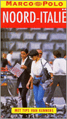
- Marco Polo Reisgids Noord-Italie
- Ontdek Noord-ItaliëOlijven- en citrusbomen aan de voet van de besneeuwde Alpentoppen, een modern leven in 2000 jaar oude stadjes. Als het echt helder is, wat in de vochtige nevels van de Povlakte niet vaak gebeurt, kan men vanaf het dak van de Dom van Milaan de machtige bergketens van de Centrale Alpen in het noorden en de eerste hoge heuvels... Read more
- Also available from:
- Bol.com, Belgium
Bol.com
Belgium
Belgium
- Marco Polo Reisgids Noord-Italie
- Ontdek Noord-ItaliëOlijven- en citrusbomen aan de voet van de besneeuwde Alpentoppen, een modern leven in 2000 jaar oude stadjes. Als het echt helder is, wat in de vochtige nevels van de Povlakte niet vaak gebeurt, kan men vanaf het dak van de Dom van Milaan de machtige bergketens van de Centrale Alpen in het noorden en de eerste hoge heuvels... Read more
Bol.com
Netherlands
Netherlands
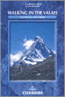
- Walking In The Valais
- The Pennine Alps in the Valais region of Switzerland contain more 4000m peaks than anywhere else in Western Europe and some of the greats: the Matterhorn, Monte Rosa, Dent Blanche and Grand Combin, all surrounded by idyllic valleys and hillsides dotted with chalets, hay barns and hardy little alpine flowers as well as pristine snowfields and... Read more
- Also available from:
- Bol.com, Belgium
Bol.com
Belgium
Belgium
- Walking In The Valais
- The Pennine Alps in the Valais region of Switzerland contain more 4000m peaks than anywhere else in Western Europe and some of the greats: the Matterhorn, Monte Rosa, Dent Blanche and Grand Combin, all surrounded by idyllic valleys and hillsides dotted with chalets, hay barns and hardy little alpine flowers as well as pristine snowfields and... Read more
Bol.com
Netherlands
Netherlands
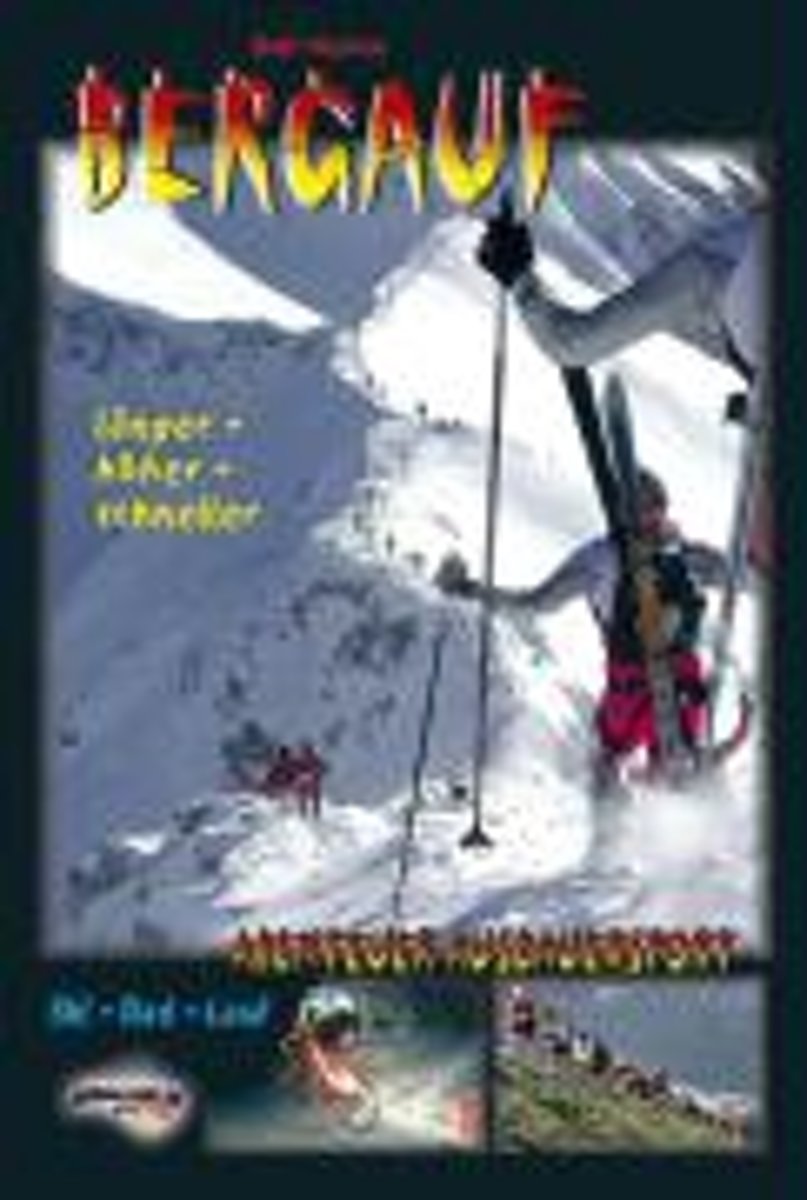
- Bergauf - Abenteuer Ausdauersport
- "BERGAUF" gibt einen faszinierenden und einmaligen Einblick in das Leben eines Menschen, der Spa am (Extrem-) Sport und Liebe zur Natur in gro artiger Weise zu verbinden versteht. Der Autor bringt einen spannenden Mix seiner Erlebnisse und Erfahrungen beim hochalpinen Skibergsteigen, Rad-Bergrennen, Berg- und Treppenlaufen und erg nzt seine... Read more
- Also available from:
- Bol.com, Belgium
Bol.com
Belgium
Belgium
- Bergauf - Abenteuer Ausdauersport
- "BERGAUF" gibt einen faszinierenden und einmaligen Einblick in das Leben eines Menschen, der Spa am (Extrem-) Sport und Liebe zur Natur in gro artiger Weise zu verbinden versteht. Der Autor bringt einen spannenden Mix seiner Erlebnisse und Erfahrungen beim hochalpinen Skibergsteigen, Rad-Bergrennen, Berg- und Treppenlaufen und erg nzt seine... Read more
De Zwerver
Netherlands
2022
Netherlands
2022
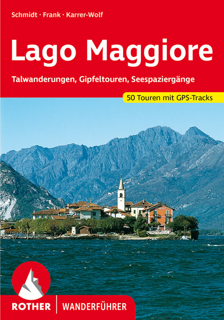
- Wandelgids 61 Lago Maggiore | Rother Bergverlag
- Uitstekende wandelgids met een groot aantal dagtochten in dal en hooggebergte. Met praktische informatie en beperkt kaartmateriaal! Wandelingen in verschillende zwaarte weergegeven in rood/blauw/zwart. Touristen, die den Lago Maggiore in jedem Jahr zu Hunderttausenden besuchen, erleben die Berge, in die der See eingebettet ist, oft nur als... Read more
- Also available from:
- Bol.com, Netherlands
- Bol.com, Belgium
Bol.com
Netherlands
2015
Netherlands
2015
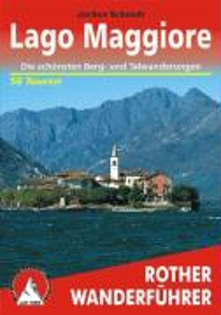
- Lago Maggiore
- 50 ausgew hlte Wanderungen im Varesotto, Alto Luinese, Alto und Basso Verbano sowie im Nationalpark Val Grande. Read more
Bol.com
Belgium
2015
Belgium
2015
- Lago Maggiore
- 50 ausgew hlte Wanderungen im Varesotto, Alto Luinese, Alto und Basso Verbano sowie im Nationalpark Val Grande. Read more
Bol.com
Netherlands
2015
Netherlands
2015
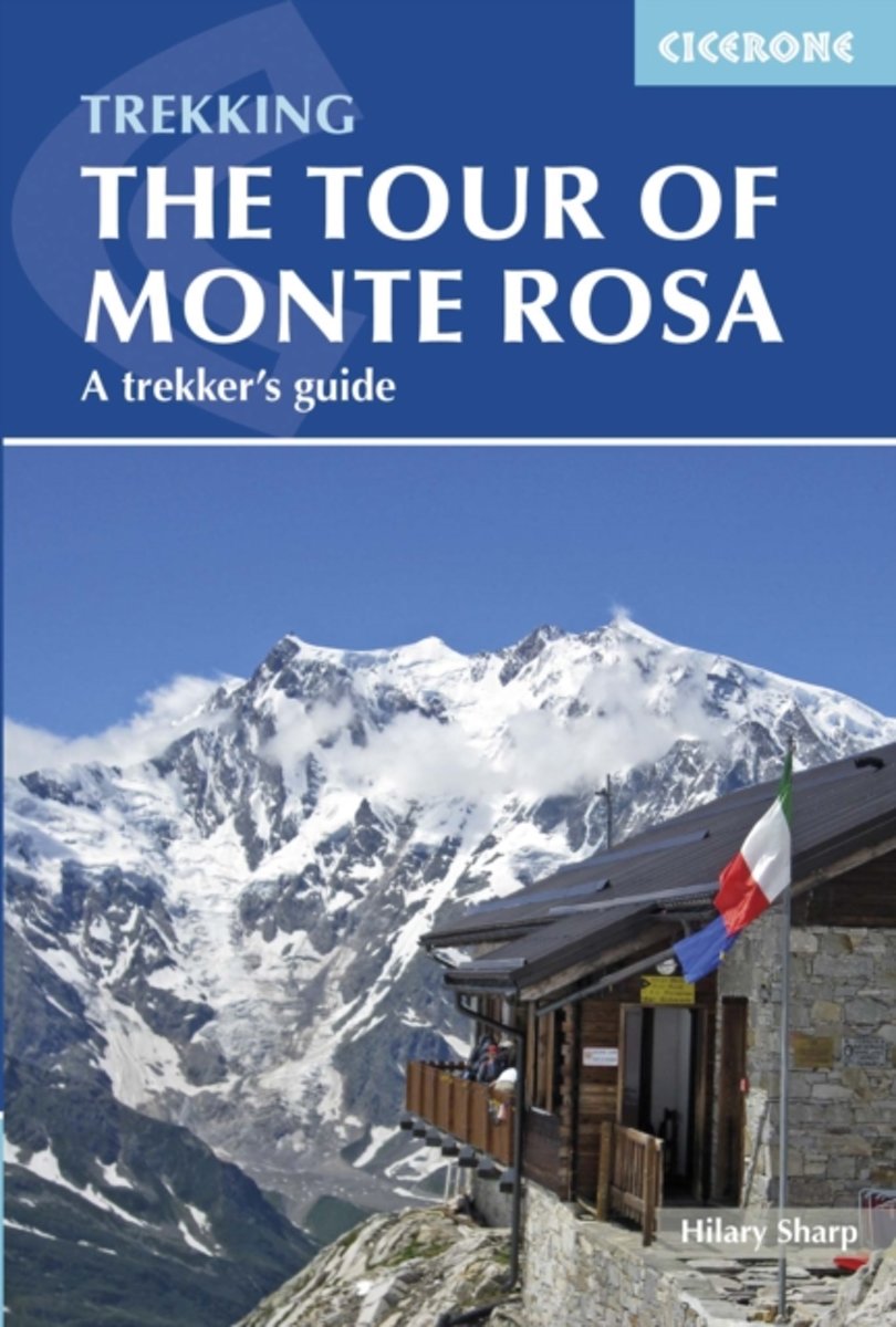
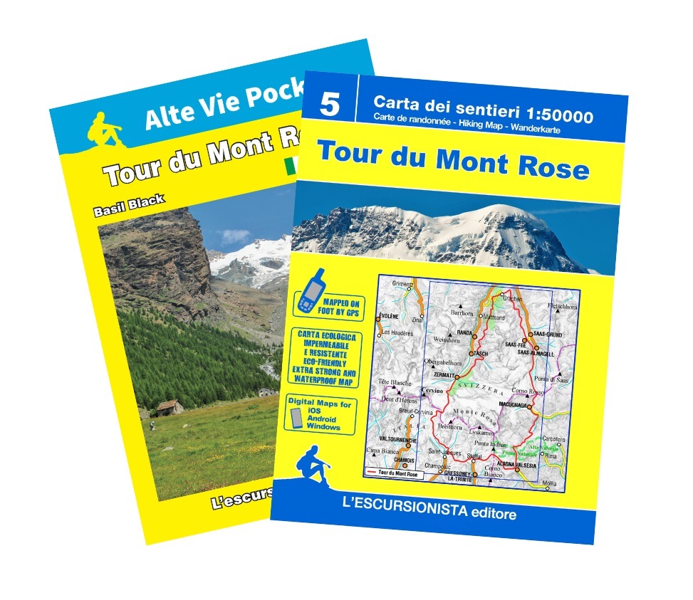
- Tour of Monte Rosa
- The 134km Tour of Monte Rosa is a challenging and very varied trek that takes a high route around the massif, in a circuit that begins and ends in Zermatt. The trek is described in eight stages, but these are not necessarily one-day stages, and some will be more comfortably achieved over two days or more. Realistically you should allow 9-10... Read more
- Also available from:
- Bol.com, Belgium
Bol.com
Belgium
2015
Belgium
2015
- Tour of Monte Rosa
- The 134km Tour of Monte Rosa is a challenging and very varied trek that takes a high route around the massif, in a circuit that begins and ends in Zermatt. The trek is described in eight stages, but these are not necessarily one-day stages, and some will be more comfortably achieved over two days or more. Realistically you should allow 9-10... Read more

The Book Depository
United Kingdom
2011
United Kingdom
2011
- Trekking in the Alps
- An inspirational guidebook to 20 classic treks in the Alps. As well as introducing new hiking areas in the Alps, classics such as the Tour of Mont Blanc, and Chamonix to Zermatt are included. Trekking in the Alps is immensely satisfying, and this book celebrates the rich and scenic diversity for which this great mountain range is renowned. Read more
- Also available from:
- De Zwerver, Netherlands
- Stanfords, United Kingdom
- Bol.com, Netherlands
- Bol.com, Belgium

De Zwerver
Netherlands
2019
Netherlands
2019
- Wandelgids Trekking in the Alps | Cicerone
- An inspirational guidebook to 20 classic treks in the Alps. As well as introducing new hiking areas in the Alps, classics such as the Tour of Mont Blanc, and Chamonix to Zermatt are included. Trekking in the Alps is immensely satisfying, and this book celebrates the rich and scenic diversity for which this great mountain range is renowned. Read more

Stanfords
United Kingdom
2011
United Kingdom
2011
- Alps Trekking
- An inspirational walking guide to 20 summer treks in the European Alps in Italy, Austria, Switzerland, France and Slovenia, by 8 Alpine trekking experts, including the classics such as the Tour of Mont Blanc and lesser-known routes like the Traverse of the Slovenian Alps. All the rich scenic diversity for which the Alps are renowned is... Read more

Bol.com
Netherlands
2011
Netherlands
2011
- Trekking in the Alps
- An inspirational guide to the delights of Alpine multi-day hikes. With 20 hikes described, including classics such as the Tour of Mont Blanc and the Tour of the Vanoise as well as new multi-day routes like the Traverse of the Slovenian Alps, this guide celebrates the rich scenic diversity for which the Alps are renowned.The eight talented... Read more
Bol.com
Belgium
2011
Belgium
2011
- Trekking in the Alps
- An inspirational guide to the delights of Alpine multi-day hikes. With 20 hikes described, including classics such as the Tour of Mont Blanc and the Tour of the Vanoise as well as new multi-day routes like the Traverse of the Slovenian Alps, this guide celebrates the rich scenic diversity for which the Alps are renowned.The eight talented... Read more

The Book Depository
United Kingdom
2018
United Kingdom
2018
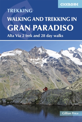
- Walking and Trekking in the Gran Paradiso
- Alta Via 2 trek and 28 day walks Read more
- Also available from:
- Stanfords, United Kingdom
- Bol.com, Netherlands
- Bol.com, Belgium

Stanfords
United Kingdom
2018
United Kingdom
2018
- Walking and Trekking in the Gran Paradiso: Alta Via 2 Trek and 28 Day Walks
- A guidebook to walking in the Gran Paradiso National Park in the Italian Alps, describing the 12-stage Alta Via 2 trek between Courmayeur and Chardonnay, and 28 walks ranging from 2 to 33km, as well as suggestions for combining routes into long-distance hikes. The Gran Paradiso sits in the Valle d`Aosta, in northwestern Italy, a region verging... Read more
Bol.com
Netherlands
2018
Netherlands
2018
- Walking and Trekking in the Gran Paradiso
- A guidebook to walking in the Gran Paradiso National Park in the Italian Alps, describing the 12-stage Alta Via 2 trek between Courmayeur and Chardonnay, and 28 walks ranging from 2 to 33km, as well as suggestions for combining routes into long-distance hikes. The Gran Paradiso sits in the Valle d'Aosta, in northwestern Italy, a region verging... Read more
Bol.com
Belgium
2018
Belgium
2018
- Walking and Trekking in the Gran Paradiso
- A guidebook to walking in the Gran Paradiso National Park in the Italian Alps, describing the 12-stage Alta Via 2 trek between Courmayeur and Chardonnay, and 28 walks ranging from 2 to 33km, as well as suggestions for combining routes into long-distance hikes. The Gran Paradiso sits in the Valle d'Aosta, in northwestern Italy, a region verging... Read more
Karten
De Zwerver
Netherlands
Netherlands
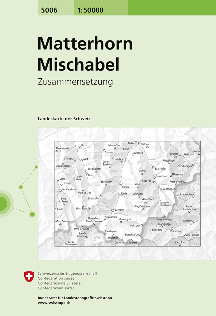
- Wandelkaart - Topografische kaart 5006 Matterhorn Mischabel | Swisstopo
- Matterhorn - Mischabel area, map No. 5006, in the standard topographic survey of Switzerland at 1:50,000 from Swisstopo, i.e. without the special overprint highlighting walking trails, local bus stops, etc, presented in Swisstopo Read more
- Also available from:
- Stanfords, United Kingdom

Stanfords
United Kingdom
United Kingdom
- Matterhorn - Mischabel Swisstopo 5006
- Matterhorn - Mischabel area, map No. 5006, in the standard topographic survey of Switzerland at 1:50,000 from Swisstopo, i.e. without the special overprint highlighting walking trails, local bus stops, etc, presented in Swisstopo’s hiking editions of the 50K survey. The map covers the whole of the Mattertal and Saastal valleys with Zermatt,... Read more
De Zwerver
Netherlands
Netherlands
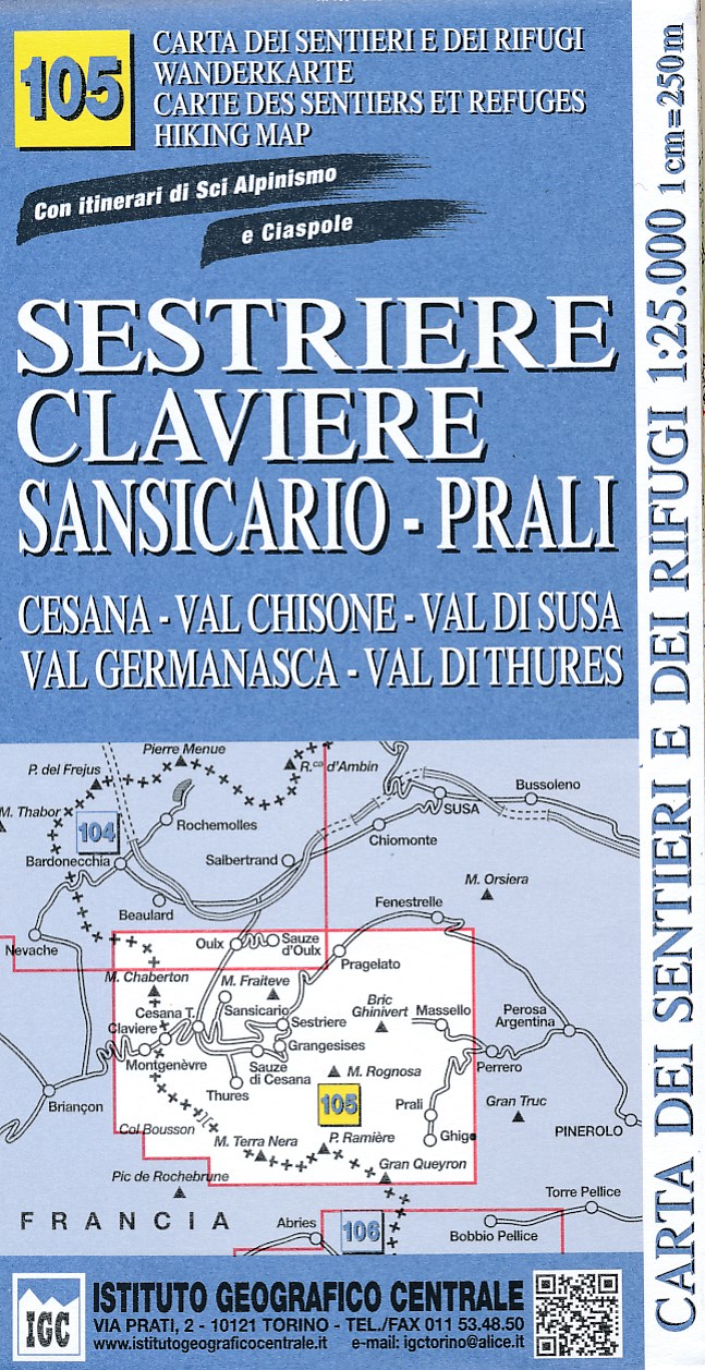
- Wandelkaart 105 Sestriere, Claviere, Sansicario, Prali | IGC - Istituto Geografico Centrale
- Sestriere - Claviere - Prali area at 1:25,000 in a series of contoured, GPS compatible walking maps from the Turin based Istituto Geografico Centrale, highlighting hiking trails including long-distance routes, ski routes and alpine accommodation. The maps have contours at 25m intervals, enhanced by shading and graphic relief for very clear... Read more
- Also available from:
- Stanfords, United Kingdom

Stanfords
United Kingdom
United Kingdom
- Sestriere - Claviere Sansiciaro - Prali 25K IGC Map No. 105
- Sestriere - Claviere - Prali area at 1:25,000 in a series of contoured, GPS compatible walking maps from the Turin based Istituto Geografico Centrale, highlighting hiking trails including long-distance routes, ski routes and alpine accommodation. Maps in this series have contours at 25m intervals, enhanced by shading and graphic relief for very... Read more
De Zwerver
Netherlands
Netherlands
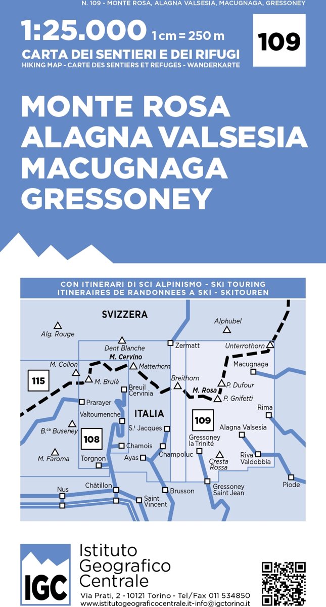
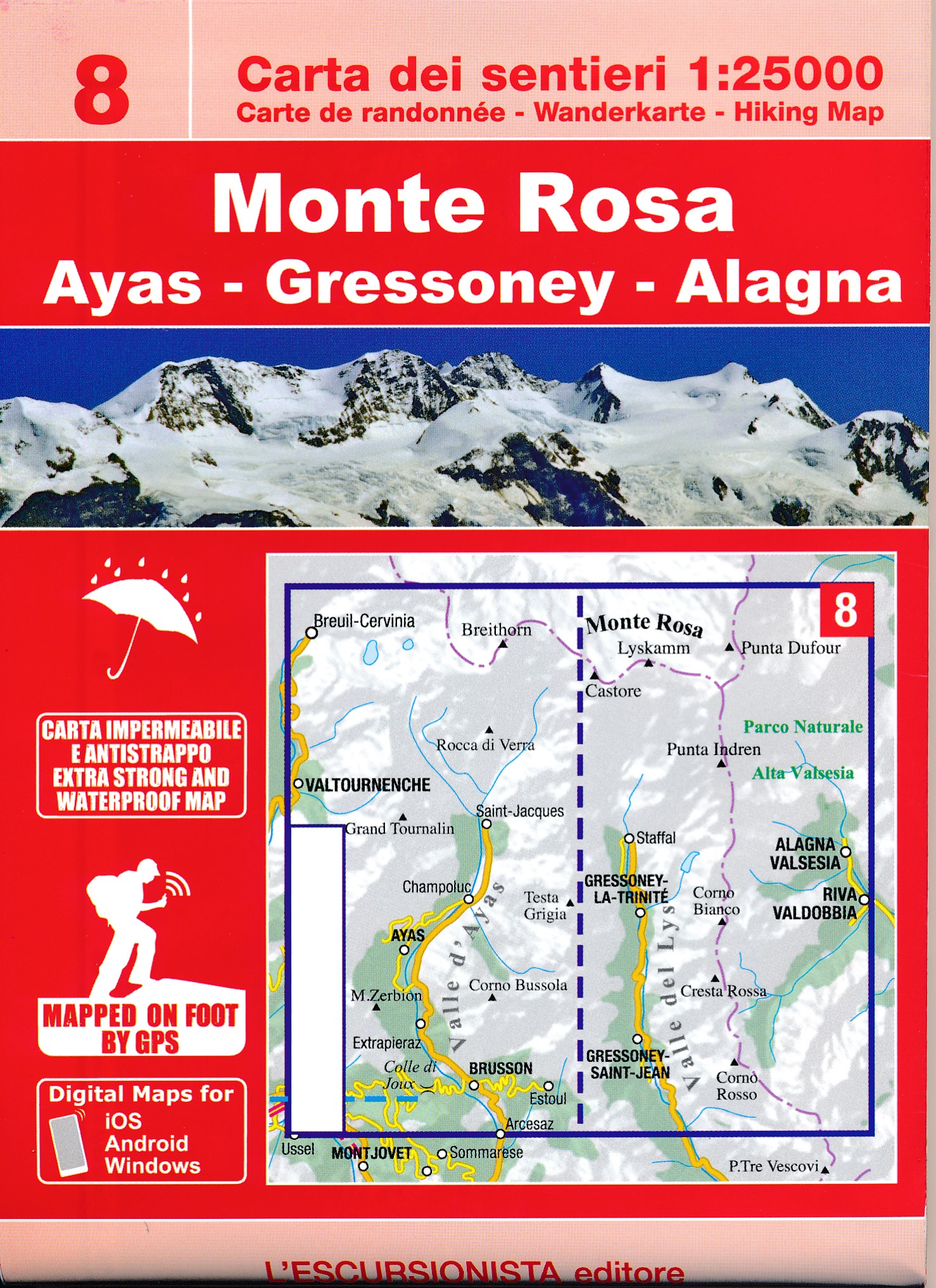
- Wandelkaart 109 Monte Rosa - Alagna Valsesia - Macugnaga - Gressoney | IGC - Istituto Geografico Centrale
- Monte Rosa - Alagna - Macugnaga - Gressoney area at 1:25,000 in a series of contoured, GPS compatible walking maps from the Turin based Istituto Geografico Centrale, highlighting hiking trails including long-distance routes, ski routes and alpine accommodation. Maps in this series have contours at 25m intervals, enhanced by shading and graphic... Read more
- Also available from:
- Stanfords, United Kingdom

Stanfords
United Kingdom
United Kingdom
- Monte Rosa - Alagna - Valsesia - Macugnaga - Gressoney IGC 109
- Monte Rosa - Alagna - Macugnaga - Gressoney area at 1:25,000 in a series of contoured, GPS compatible walking maps from the Turin based Istituto Geografico Centrale, highlighting hiking trails including long-distance routes, ski routes and alpine accommodation. Maps in this series have contours at 25m intervals, enhanced by shading and graphic... Read more

De Zwerver
Netherlands
Netherlands
- Wandelkaart 03 Il parco nazionale del Gran Paradiso | IGC - Istituto Geografico Centrale
- Gran Paradiso National Park in a series contoured hiking maps at 1:50,000 with local trails, long-distance footpaths, mountain accommodation, etc, from the Turin based Istituto Geografico Centrale. This new edition published in late 2013 highlights, among other routes, the GTA (Grande Traversata delle Alpi), Via Alpina and Alta Via 2. Coverage... Read more
- Also available from:
- Stanfords, United Kingdom

Stanfords
United Kingdom
United Kingdom
- Gran Paradiso National Park IGC 3
- Gran Paradiso National Park in a series contoured hiking maps at 1:50,000 with local trails, long-distance footpaths, mountain accommodation, etc, from the Turin based Istituto Geografico Centrale. The map highlights, among other routes, the GTA (Grande Traversata delle Alpi), Via Alpina and Alta Via 2. Coverage extends from Aosta at the top of... Read more
De Zwerver
Netherlands
2022
Netherlands
2022

De Zwerver
Netherlands
Netherlands
- Wandelkaart 20 Il Monferrato da Asti a Casale Monferrato | IGC - Istituto Geografico Centrale
- Il Monferrato, map no. 20, in a series contoured hiking maps at 1:50,000 with local trails, long-distance footpaths, mountain accommodation, etc. from the Turin based Istituto Geografico Centrale covering the Italian Alps and Piedmont, the lakes and northern Lombardy, and the Italian Riviera.The maps have contours at 50m intervals, enhanced by... Read more
- Also available from:
- Stanfords, United Kingdom

Stanfords
United Kingdom
United Kingdom
- Il Monferrato: Asti - Casale Monferrato 50K IGC Map No. 20
- The Monferrato region of Piedmont east of Turin, between Asti and Casale Monferrato, in a series contoured hiking maps at 1:50,000 with local trails, long-distance footpaths, mountain accommodation, etc. from the Turin based Istituto Geografico Centrale. This title also shows local cycle routes.Maps in this series have contours at 50m... Read more
De Zwerver
Netherlands
Netherlands
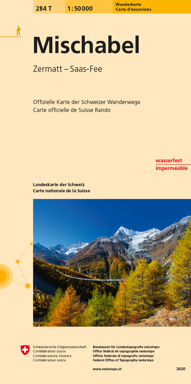
- Wandelkaart 284T Mischabel | Swisstopo
- The Michabel range, map No. 284T, at 1:50,000 in a special hiking edition of the country Read more
- Also available from:
- Stanfords, United Kingdom

Stanfords
United Kingdom
United Kingdom
- Mischabel Swisstopo Hiking 284T
- The Michabel range, map No. 284T, at 1:50,000 in a special hiking edition of the country’s topographic survey, published by Swisstopo in cooperation with the Swiss Hiking Federation. The map covers most of the Mischabel range with the southern part of the Mattertal including Zermatt and Randa, the Saastal with Saas Fe, Theodul Pass, Monte Rosa... Read more
De Zwerver
Netherlands
Netherlands
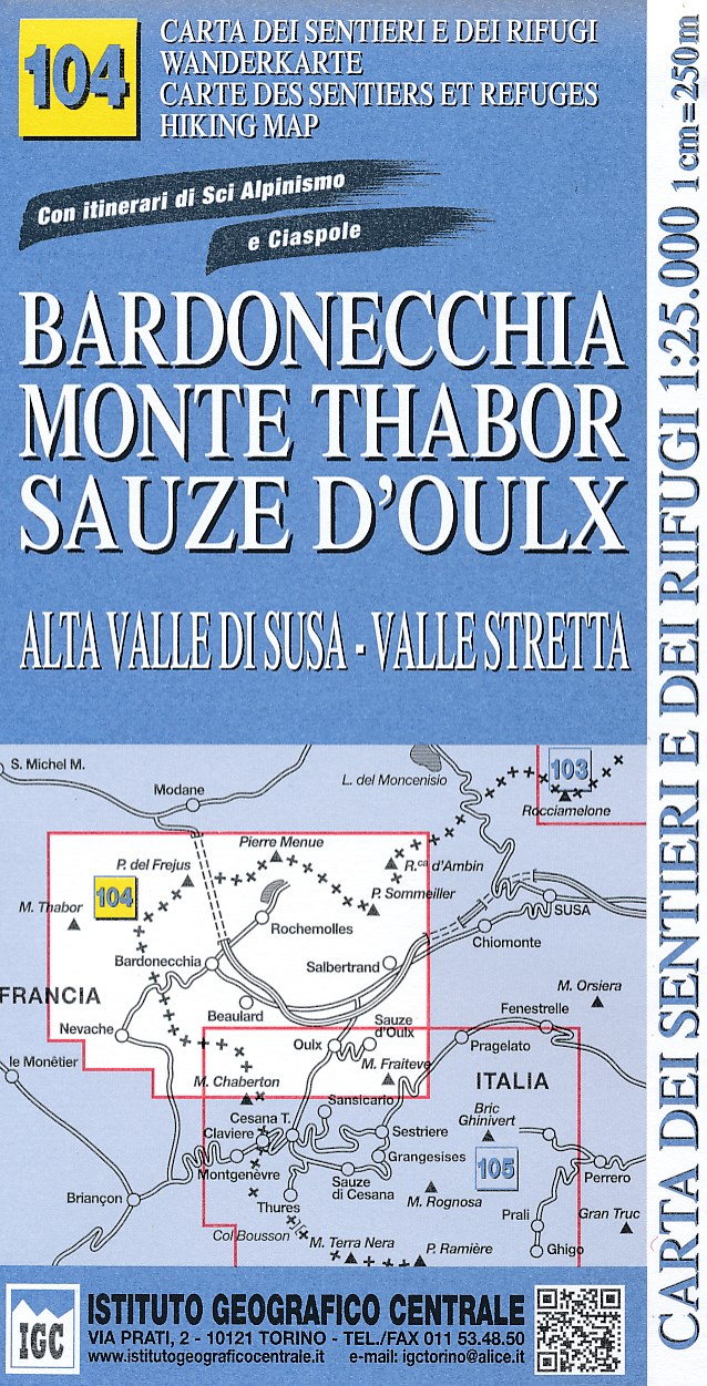
- Wandelkaart 104 Bardonecchia, Monte Thabor, Sauze D'oulx | IGC - Istituto Geografico Centrale
- Bardonecchia - Monte Thabor - Sauze d`Oulx area at 1:25,000 in a series of contoured, GPS compatible walking maps from the Turin based Istituto Geografico Centrale, highlighting hiking trails including long-distance routes, ski routes and alpine accommodation. The maps have contours at 25m intervals, enhanced by shading and graphic relief for... Read more
- Also available from:
- Stanfords, United Kingdom

Stanfords
United Kingdom
United Kingdom
- Bardonecchia - Monte Thabor - Sauze d`Oulx 25K IGC Map No. 104
- Bardonecchia - Monte Thabor - Sauze d`Oulx area at 1:25,000 in a series of contoured, GPS compatible walking maps from the Turin based Istituto Geografico Centrale, highlighting hiking trails including long-distance routes, ski routes and alpine accommodation. Maps in this series have contours at 25m intervals, enhanced by shading and graphic... Read more

- Also available from:
- Stanfords, United Kingdom

Stanfords
United Kingdom
United Kingdom
- Langhe Meridionali IGC 18
- The southern part of the Langhe region of Piedmont, famous for its wines, cheeses, and truffles, in a series contoured hiking maps at 1:50,000 with local trails, long-distance footpaths, mountain accommodation, etc. from the Turin based Istituto Geografico Centrale.Maps in this series have contours at 50m intervals, enhanced by shading and... Read more

De Zwerver
Netherlands
Netherlands
- Wandelkaart 05 Cervino Matterhorn e Monte Rosa | IGC - Istituto Geografico Centrale
- Matterhorn/M.Cervino and Monte Rosa, map no. 5, in a series contoured hiking maps at 1:50,000 with local trails, long-distance footpaths, mountain accommodation, etc. from the Turin based Istituto Geografico Centrale covering the Italian Alps and Piedmont, the lakes and northern Lombardy, and the Italian Riviera.The maps have contours at 50m... Read more
- Also available from:
- Stanfords, United Kingdom

Stanfords
United Kingdom
United Kingdom
- Matterhorn / M. Cervino - Monte Rosa IGC 5
- The Italian side of the Matterhorn and Monte Rosa, with coverage extending from Zermatt to Aosta, in a series contoured hiking maps at 1:50,000 with local trails, long-distance footpaths, mountain accommodation, etc. from the Turin based Istituto Geografico Centrale. Maps in this series have contours at 50m intervals, enhanced by shading and... Read more

De Zwerver
Netherlands
Netherlands
- Wandelkaart 21 Il Canavese da Ivrea a Chivasso | IGC - Istituto Geografico Centrale
- Il Canavese: Ivrea to Chiavasso, map no. 21, in a series contoured hiking maps at 1:50,000 with local trails, long-distance footpaths, mountain accommodation, etc. from the Turin based Istituto Geografico Centrale covering the Italian Alps and Piedmont, the lakes and northern Lombardy, and the Italian Riviera.The maps have contours at 50m... Read more
- Also available from:
- Stanfords, United Kingdom

Stanfords
United Kingdom
United Kingdom
- Il Canavese: Ivrea to Chiavasso 50K IGC Map No. 21
- Il Canavesea area including Ivrea and Chiavasso in a series contoured hiking maps at 1:50,000 with local trails, long-distance footpaths, mountain accommodation, etc. from the Turin based Istituto Geografico Centrale. This title also shows cycle routes.Maps in this series have contours at 50m intervals, enhanced by shading and graphic relief.... Read more

De Zwerver
Netherlands
Netherlands
- Wandelkaart 04 Massiccio del Monte Bianco | IGC - Istituto Geografico Centrale
- The Mont Blanc Massif in a series contoured hiking maps at 1:50,000 with local trails, long-distance footpaths, mountain accommodation, etc, from the Turin based Istituto Geografico Centrale. This new edition published in late 2013 highlights, among other routes, the Alta Via 1 and the northern section of the Alta Via 2, both of which join up... Read more
- Also available from:
- Stanfords, United Kingdom

Stanfords
United Kingdom
United Kingdom
- Mont Blanc Massif IGC 4
- The Mont Blanc Massif in a series contoured hiking maps at 1:50,000 with local trails, long-distance footpaths, mountain accommodation, etc, from the Turin based Istituto Geografico Centrale. The map highlights, among other routes, the Alta Via 1 and the northern section of the Alta Via 2, both of which join up with TMB, as well as the local... Read more
.jpg)
De Zwerver
Netherlands
Netherlands
- Wandelkaart 102 Valsavarenche, Val di Rhemes, Valgrisenche | IGC - Istituto Geografico Centrale
- Valsavarenche -Val di Rhêmes – Valgrisenche area at 1:25,000 in a series of contoured, GPS compatible walking maps from the Turin based Istituto Geografico Centrale, highlighting hiking trails including long-distance routes, ski routes and alpine accommodation. The maps have contours at 25m intervals, enhanced by shading and graphic relief for... Read more
- Also available from:
- Stanfords, United Kingdom

Stanfords
United Kingdom
United Kingdom
- Valsavarenche - Val di Rhêmes - Valgrisenche IGC 102
- Valsavarenche -Val di Rhêmes – Valgrisenche area of the Italian Alps at 1:25,000 in a series of contoured, GPS compatible walking maps from the Turin based Istituto Geografico Centrale, highlighting hiking trails including long-distance routes, ski routes and alpine accommodation. Maps in this series have contours at 25m intervals, enhanced by... Read more

De Zwerver
Netherlands
Netherlands
- Wandelkaart 15 Finale Ligure Alassio Savona | IGC - Istituto Geografico Centrale
- The coast of the Italian Riviera around Albenga, Alassio and Savona in a series contoured hiking maps at 1:50,000 with local trails, long-distance footpaths, mountain accommodation, etc. from the Turin based Istituto Geografico Centrale.Maps in this series have contours at 50m intervals, enhanced by shading and graphic relief. An overprint... Read more
- Also available from:
- Stanfords, United Kingdom

Stanfords
United Kingdom
United Kingdom
- Finale Ligure - Alassio - Savona IGC 15
- The coast of the Italian Riviera around Albenga, Alassio and Savona in a series contoured hiking maps at 1:50,000 with local trails, long-distance footpaths, mountain accommodation, etc. from the Turin based Istituto Geografico Centrale.Maps in this series have contours at 50m intervals, enhanced by shading and graphic relief. An overprint... Read more