
Triglav National Park
Beschreibung

The eastern parts of the Alps are composed of limestone, as in the case of the Julian Alps, starting in the eastern parts of Austria and covering the north of Slovenia. The best known formation in the Julian Alps is the Triglav massif. Triglav is the name of Slovenia's highest mountain, 2864 m. The massif is characterised by steep wild mountains and shining white rocks. The paths are strenuous. The principal trails for reaching the huts are okay, but crossing the massif frequently requires the use of hands. There is a choice of easy and difficult trails. An abundance of flowers early in summer welcomes the walker. Special too are the small lakes amidst the bare rocks and the extensive forests. The huts are simple and welcoming.


Links
Fakten
Berichte
Führer und Karten
Übernachtung
Organisationen
Reisebüros
GPS
Sonstiges
Bücher

- Also available from:
- De Zwerver, Netherlands
De Zwerver
Netherlands
2019
Netherlands
2019
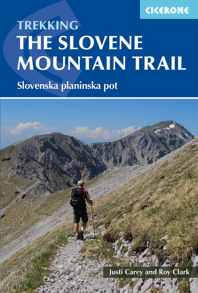
- Wandelgids The Slovene Mountain Trail | Cicerone
- Guidebook to trekking the Slovene Mountain Trail or Transverzala, 550km across Slovenia. Beginning at Maribor near the Austrian border to Ankaran on the Adriatic coast, the route is described as a series of 3 to 6-day treks through the region of Pohorje and the limestone mountains of the Karavanke and Kamnik-Savinja and Julian Alps. Read more
De Zwerver
Netherlands
2014
Netherlands
2014
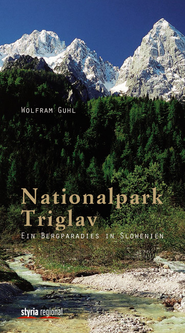
- Wandelgids Nationalpark Triglav - Ein Bergparadies in Slowenien | Styria Verlag
- Duitstalige wandelgids met beschrijvingen van wandelroutes en eenvoudige routekaartjes door het nationale park Triglav in de Julische Alpen van Slovenie. Der Tourenreigen von Wolfram Guhl führt uns quer durch das Gebiet des Nationalparks Triglav in den Julischen Alpen und an die slowenische Adria. Vom tiefsten Punkt, der Tolminka-Klamm mit nur... Read more
De Zwerver
Netherlands
2014
Netherlands
2014
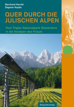
- Wandelgids Quer Durch die Julischen Alpen - Triglav | Rotpunktverlag
- Vom Triglav-Nationalpark Sloweniens in die Voralpen des Friauls. 1. Auflage. Read more

De Zwerver
Netherlands
Netherlands
- Wegenkaart - landkaart 3327 Adventure Map Western Balkans - Westelijke Balkan | National Geographic
- Travel & Languages Reference Atlases International Books Read more
- Also available from:
- Bol.com, Netherlands
- Bol.com, Belgium
Bol.com
Netherlands
Netherlands
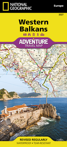
- Western Balkans
- • Waterproof • Tear-Resistant • Travel MapThe Western Balkans region, an adventure playground and rising star of Europe, is loaded with Old World traditions, slow food culture, ancient towns, and rarely visited villages. The area stretches from the Adriatic Sea in the west, up and over mountain ranges, raging rivers, tectonic lakes, steep... Read more
Bol.com
Belgium
Belgium
- Western Balkans
- • Waterproof • Tear-Resistant • Travel MapThe Western Balkans region, an adventure playground and rising star of Europe, is loaded with Old World traditions, slow food culture, ancient towns, and rarely visited villages. The area stretches from the Adriatic Sea in the west, up and over mountain ranges, raging rivers, tectonic lakes, steep... Read more
Bol.com
Netherlands
Netherlands
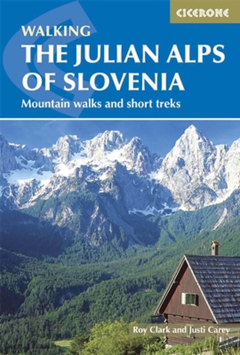
- Julian Alps of Slovenia
- 'The Julian Alps of Slovenia' contains over 60 walks which bring the best of the Julian Alps to the English-speaking walker. The walks and treks in this guidebook are organised around five bases in the Julian Alps - Kranjska Gora, Bovec, Kobarid, Bled and Bohinj - all of which have a range of accommodation and public transport facilities. There... Read more
- Also available from:
- Bol.com, Belgium
Bol.com
Belgium
Belgium
- Julian Alps of Slovenia
- 'The Julian Alps of Slovenia' contains over 60 walks which bring the best of the Julian Alps to the English-speaking walker. The walks and treks in this guidebook are organised around five bases in the Julian Alps - Kranjska Gora, Bovec, Kobarid, Bled and Bohinj - all of which have a range of accommodation and public transport facilities. There... Read more

Bol.com
Netherlands
2019
Netherlands
2019
- WF5966 Julische Alpen mit Karte Kompass
- De Kompass wandelgids + kaart geeft een overzicht van alle wandelroutes in het gebied met nauwkeurige routeaanwijzingen en hoogteaanduidingen, De extra grote kaart, schaal 1:35 000, is ideaal om van te voren uw route uit te stippelen en om onderweg te gebruiken; naast de bekende bestemmingen, worden ook de minder bekende vermeld; openbaar... Read more
- Also available from:
- Bol.com, Belgium
Bol.com
Belgium
2019
Belgium
2019
- WF5966 Julische Alpen mit Karte Kompass
- De Kompass wandelgids + kaart geeft een overzicht van alle wandelroutes in het gebied met nauwkeurige routeaanwijzingen en hoogteaanduidingen, De extra grote kaart, schaal 1:35 000, is ideaal om van te voren uw route uit te stippelen en om onderweg te gebruiken; naast de bekende bestemmingen, worden ook de minder bekende vermeld; openbaar... Read more

The Book Depository
United Kingdom
2015
United Kingdom
2015
- The Julian Alps of Slovenia
- Mountain Walks and Short Treks Read more
- Also available from:
- De Zwerver, Netherlands
- Stanfords, United Kingdom
- Bol.com, Netherlands
- Bol.com, Belgium

De Zwerver
Netherlands
2015
Netherlands
2015
- Wandelgids Julian Alps of Slovenia - Julische Alpen | Cicerone
- Guidebook describing 58 walks in the Julian Alps of Slovenia. The walks are organized around five bases - Kranjska Gora, Bovec, Kobarid, Bled and Bohinj. The routes in the Julian Alps range from easy valley walks and rougher forest trails to high-mountain protected routes, including Triglav at 2864m, and multi-day treks. Read more

Stanfords
United Kingdom
2015
United Kingdom
2015
- Julian Alps of Slovenia: Mountain Walks and Short Treks
- The Julian Alps of Slovenia in a walking guide from Cicerone Press with 58 hiking routes including a couple of multi-day itineraries, grouped geographically to provide a variety of choices for casual walkers to experienced hill walkers, and accessible from popular holiday destinations, with descriptions accompanied by colour sketch maps.Day... Read more

Bol.com
Netherlands
2015
Netherlands
2015
- The Julian Alps of Slovenia
- This guidebook contains 58 walking routes which explore the best of the Julian Alps of Slovenia. The walks and treks in this guidebook are organised around five bases in the Julian Alps - Kranjska Gora, Bovec, Kobarid, Bled and Bohinj - all of which have a range of accommodation and public transport facilities. There is something here for... Read more
Bol.com
Belgium
2015
Belgium
2015
- The Julian Alps of Slovenia
- This guidebook contains 58 walking routes which explore the best of the Julian Alps of Slovenia. The walks and treks in this guidebook are organised around five bases in the Julian Alps - Kranjska Gora, Bovec, Kobarid, Bled and Bohinj - all of which have a range of accommodation and public transport facilities. There is something here for... Read more
Karten
De Zwerver
Netherlands
Netherlands
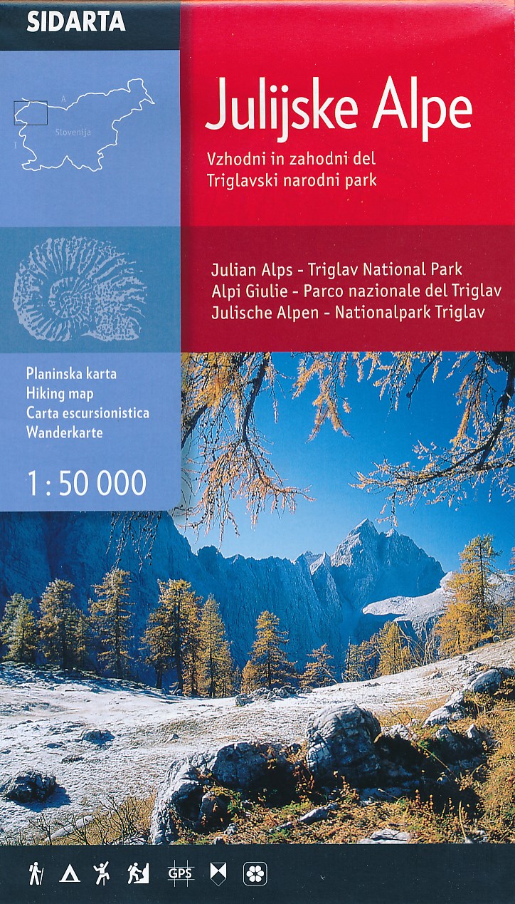
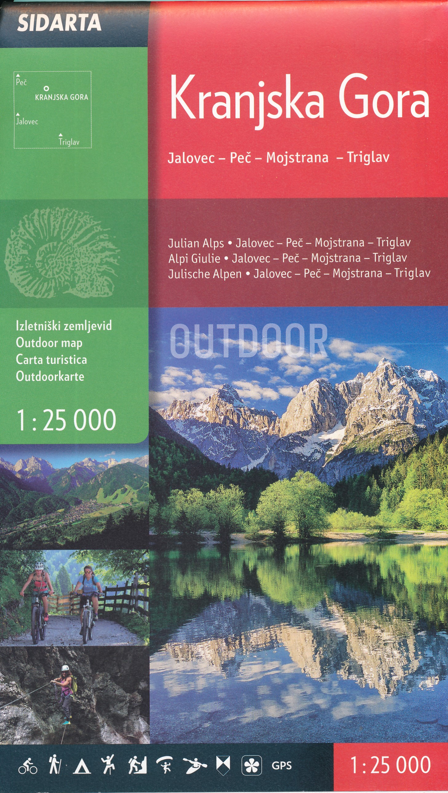
- Wandelkaart Julische Alpen - Triglav National Park | Sidarta
- Dit is de overzichtskaart 50.000 van de Julische Alpen, er zijn daarnaast van uitgever Sidarta nog 3 hele goede deelkaarten 25.000 van dit gebied. Deze dubbelzijdige detailkaart (1:50.000) heeft ingetekende wandelroutes waarbij met verschillende kleuren de moeilijkheidsgraad wordt aangegeven, een aanduiding van de berghutten (met op de... Read more
De Zwerver
Netherlands
Netherlands
De Zwerver
Netherlands
Netherlands
De Zwerver
Netherlands
Netherlands
De Zwerver
Netherlands
Netherlands
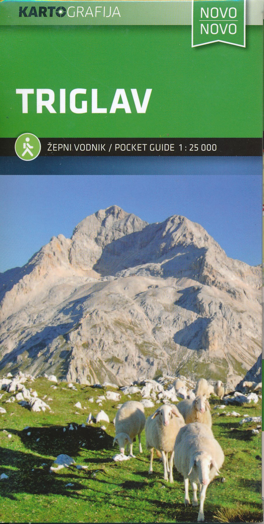
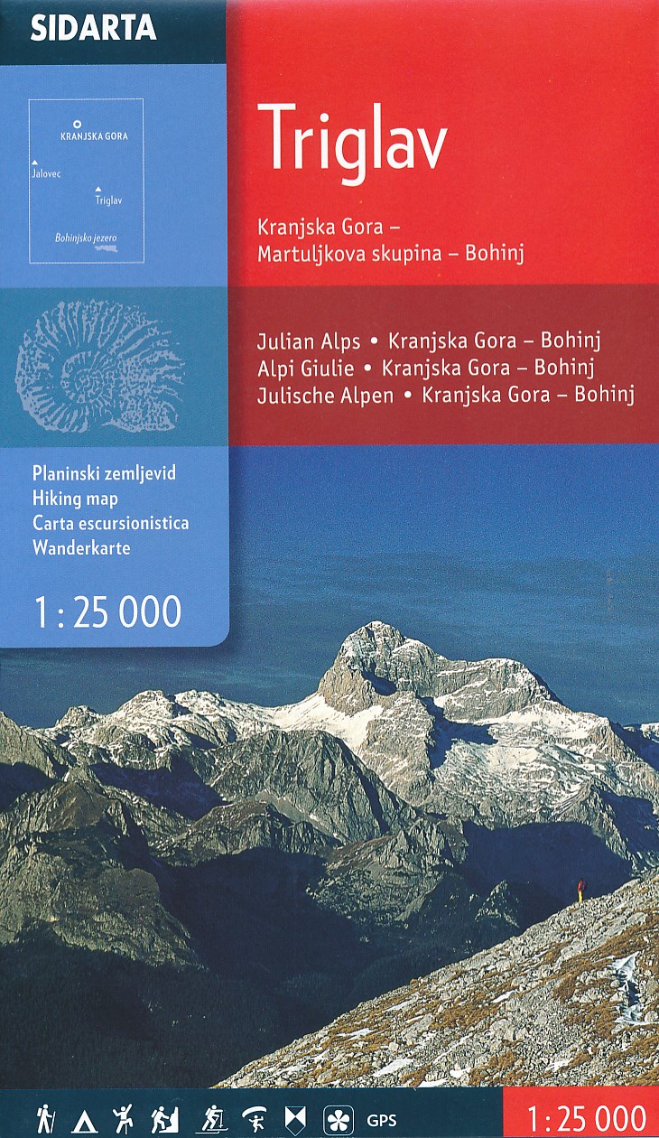
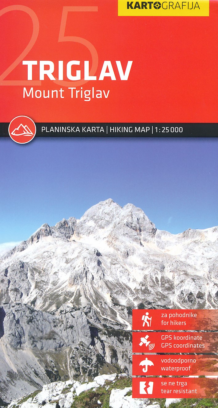
- Wandelkaart Triglav | Kartografija
- Uitstekende wandel- en klimkaart van de Triglav en directe omgeving. Met ingetekende routes, alle berghutten met foto en gegevens. Mooi gedetailleerd met een schaal van 1:25.000. De ideale wandelkaart voor de heilige berg voor de Slovenen: iedereen moet er in zijn of haar leven op hebben gestaan! Gedrukt op watervast papier. Read more
De Zwerver
Netherlands
Netherlands
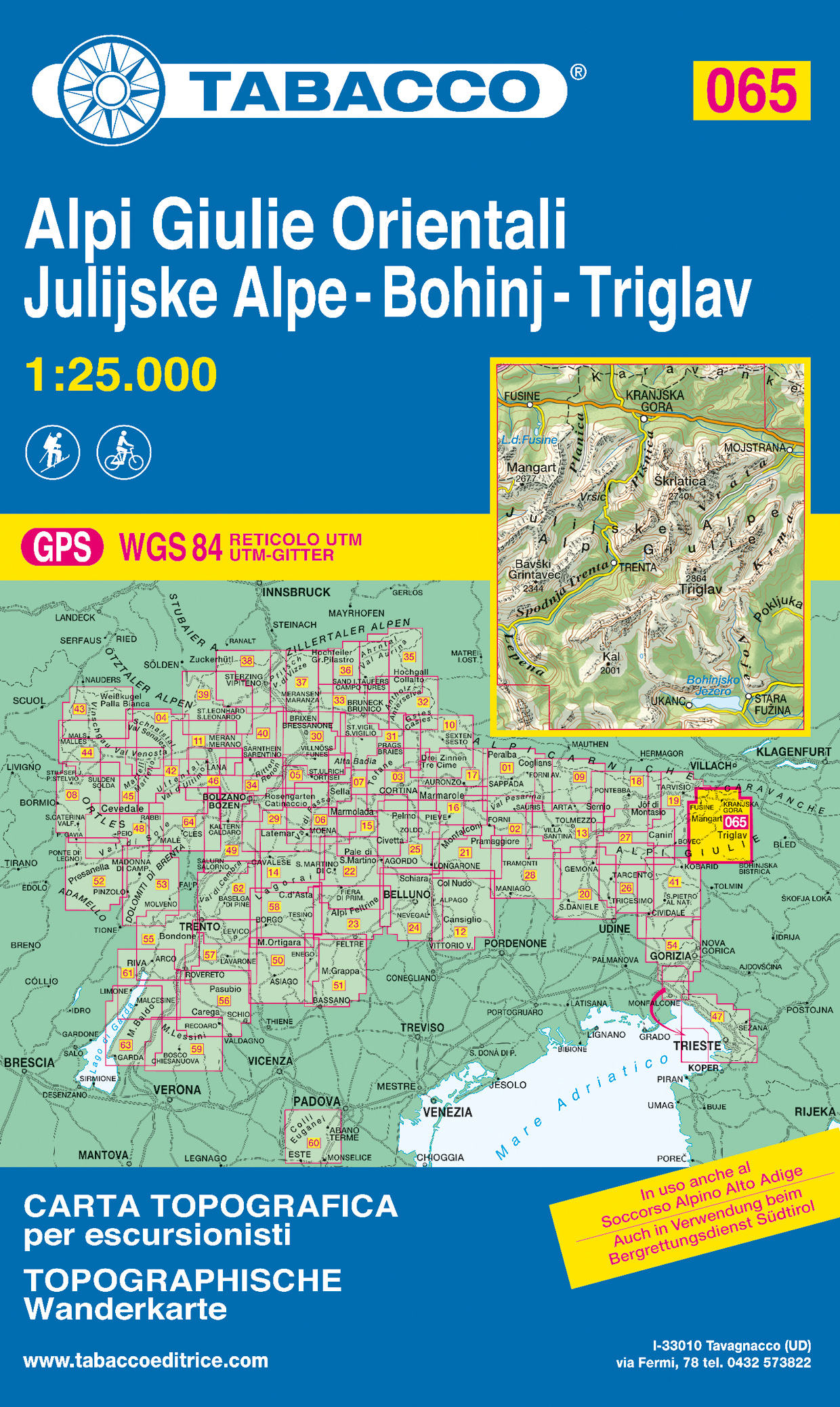
- Wandelkaart 065 Alpi Giulie Orientali - Julijske Alpe - Bohinj - Triglav | Tabacco Editrice
- De beste wandelkaarten voor de Dolomieten. Zeer veel topografische details met secure hoogtelijnen (25 meter interval), helder kleurgebruik en bijna alle Tabacco kaarten hebben een UTM grid (voor GPS toepasbaar). Daarnaast zijn op deze wandelkaarten wandelroutes ingetekend met nummering gelijk aan markering onderweg aangebracht door de lokale... Read more

Stanfords
United Kingdom
United Kingdom
- Triglav National Park
- Triglav National Park at 1:50,000 on a contoured and GPS compatible recreational maps from Planinska zveza Slovenie - Slovenian Alpine Club, with on the reverse details of 42 alpine huts and QR codes for further information, plus lists of the areas 76 exceptional natural heritage sites and 29 cultural monuments.Maps at 1:50,000 in the Planinska... Read more

Stanfords
United Kingdom
United Kingdom
- Šmarna Gora - Rašica Pocket Map
- Šmarna Gora - Rašica recreational area just north of Ljubljana on a handy size pocket map from Kartografija. On one side is a GPS compatible topographic map at 1:25,000 of the area between Menges and Medvode overprinted with hiking trails, cycling routes and other tourist information including hotels, campsites and mountain huts, inns,... Read more

Stanfords
United Kingdom
United Kingdom
- Julian Alps West Kartografija Tourist Map
- The western part of Slovenia’s Julian Alps on a contoured and GPS compatible map at 1:75,000 from the Ljubljana-based Kartografija. Coverage includes the Triglav National Park, Kranjska Gora, Bovec, Bled, Jesenice, Tolmin, Škofja Loka, etc. On the reverse are bilingual English/Slovenian descriptions of the region’s best sights.Maps in this... Read more

Stanfords
United Kingdom
United Kingdom
- Triglav Slovenian Alpine Club 25K Map
- The central part of the Triglav National Park with the peak of Triglav and Kranjska Gora on a contoured and GPS compatible map at 1:25,000 from Planinska zveza Slovenie - Slovenian Alpine Club, with on the reverse details of 22 local mountain refuges with OR codes for further information and recommended hiking trails.The map very vividly... Read more

Stanfords
United Kingdom
United Kingdom
- Triglav National Park Kartografija WATERPROOF Hiking Map
- Triglav National Park at 1:50,000 on a contoured and GPS compatible walking and cycling map from Kartografija in Ljubljana, waterproof and tear-resistant version, with on the reverse descriptions of the area’s best sights. Coverage extends from Bovec in the west to Bled in the east, and from Kranjska Gora in the north to just short of Tolmin in... Read more

Stanfords
United Kingdom
United Kingdom
- Julian Alps
- Julian Alps at 1:50,000 on a GPS compatible, contoured hiking map from Sidarta with on the reverse details of 41 mountain huts, each annotated with main trails leading to it; also climbing areas, natural heritage sites, etc. The map covers the whole of the Triglav National Park, extending outside its boundary north to Kranjska Gora and the... Read more
- Also available from:
- Stanfords, United Kingdom

Stanfords
United Kingdom
United Kingdom
- Julian Alps
- Julian Alps in a series of double-sided maps at 1:40,000 from Kartografija in Ljubljana, accompanied by a 71-page bilingual Slovenian/English colour booklet with 42 pages of descriptions of the region’s numerous places of interest, plus brief descriptions of 44 recommended hiking trails and of 9 cycling routes, from 8.5km to 48km long and... Read more

Stanfords
United Kingdom
United Kingdom
- Triglav Kartografija WATERPROOF Hiking Map
- The central part of the Triglav National Park on a light, waterproof and tear-resistant, contoured and GPS compatible map at 1:25,000 from Kartografija, with on the reverse details of local mountain shelters with photos and QR codes. The map is centered on the peak of Triglav and coverage extends north to Kranjska Gora, south to the Bohinj... Read more

Stanfords
United Kingdom
United Kingdom
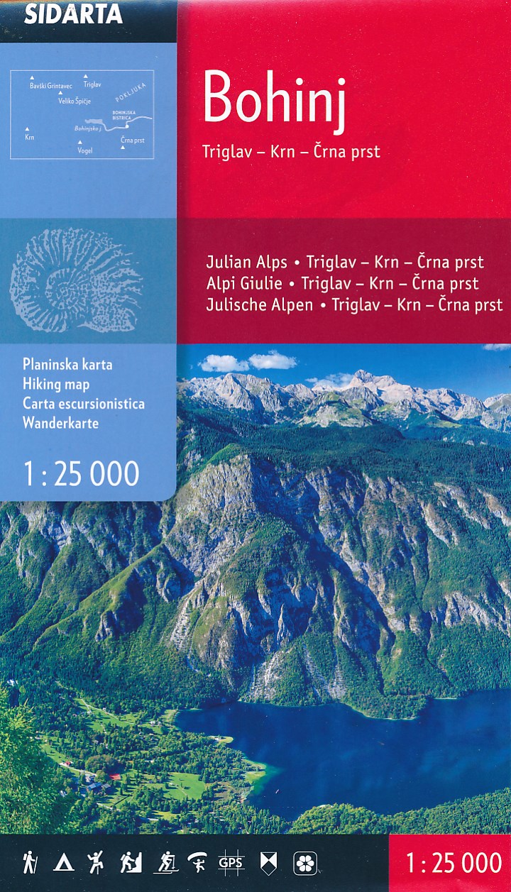
- Triglav - Kranjska Gora - Bohinj
- Triglav - Kranjska Gora - Bohinj area of the Triglav National Park in the Julian Alps at 1:25,000 on a double-sided, contoured and GPS compatible hiking map from Sidarta with details of 27 mountain huts, each annotated with main trails leading to it; also climbing areas, natural heritage sites, etc. The map is double-sided and covers the... Read more