
Aragón
Beschreibung
Karte

Wanderwege Region
- GR1 Sendero Histórico, Senda TransversalGPX
- GR10 Senderos de la MielGPX
- GR11 Sendero PirenaicoGPX
- GR15 Sendero PrepirenaicoGPX
- GR16 Sendero del SerrabloGPX
- GR17 Sendero MarianoGPX
- GR18 Senderos de la RibagorzaGPX
- GR19 Senderos de SobrabeGPX
- GR23 Senderos por la LiteraGPX
- GR24 Senderos de Calatayud, Darroca y GallocantaGPX
- GR260 Vuelta al Moncayo-Calcenada
- GR45 Sendero del SomontanoGPX
- GR65 Camino de SantiagoGPX
- GR8 Puertos de Beceite - JavalambreGPX
- GR90 Tierras del MontcayoGPX
- GR95 Calzada Romana de Zaragoza a FranciaGPX
- GR99 Sendero del EbroGPX
Links
Fakten
Berichte
Führer und Karten
Übernachtung
Organisationen
Reisebüros
GPS
Sonstiges
Bücher

The Book Depository
United Kingdom
2019
United Kingdom
2019
- Shorter Treks in the Pyrenees
- 7 great one and two week circular treks Read more
- Also available from:
- De Zwerver, Netherlands

De Zwerver
Netherlands
2019
Netherlands
2019
- Wandelgids Shorter Treks in the Pyrenees | Cicerone
- Guidebook detailing seven circular treks of 4-12 days in the beautiful Pyrenees. The varied routes cover both sides of the French-Spanish border and include both the High Pyrenees and the lower, more gentle mountains of the Basque Country and Catalonia. Variants are suggested for those wishing to shorten or extend the treks. Read more

The Book Depository
United Kingdom
United Kingdom
- Guadeloupe & ses iles a pied
- La Guadeloupe et ses îles à pied, FFRP topo-guide Ref. No. D971, with 49 day walks of varying length and difficulty, plus coverage of the 65km-long GR1 across the mountains of the Basse Terre. The day walks include two on Marie-Galante, one on La Désirade, and two on Les Saintes islands. Each walk is presented on a separate colour extract from... Read more
- Also available from:
- Stanfords, United Kingdom
Stanfords
United Kingdom
United Kingdom
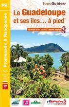
- La Guadeloupe et ses îles à pied
- La Guadeloupe et ses îles à pied, FFRP topo-guide Ref. No. D971, with 49 day walks of varying length and difficulty, plus coverage of the 65km-long GR1 across the mountains of the Basse Terre. The day walks include two on Marie-Galante, one on La Désirade, and two on Les Saintes islands. Each walk is presented on a separate colour extract from... Read more

The Book Depository
United Kingdom
United Kingdom

The Book Depository
United Kingdom
United Kingdom
- Pocket Pilgrim
- A wobbly journey along the Camino de Santiago Read more


The Book Depository
United Kingdom
2021
United Kingdom
2021
- Also available from:
- De Zwerver, Netherlands
- Stanfords, United Kingdom


Stanfords
United Kingdom
2021
United Kingdom
2021
- Tour du Cotentin - Littorral de la Normandie GR223
- Tour du Cotentin, FFRP topoguide Ref. no. 200, covering the GR223 along the coast of the Cotentin Peninsula from Isigny-sur-Mer to Mont-St-Michel, including the Utah Beach of the D-Day Normandy Landings. Together with several variants off the main route, the guide provides coverage of nearly 600kms of hiking trails. Current edition of this... Read more

The Book Depository
United Kingdom
United Kingdom
- Guided by Shadows
- A Westward Walk on Spain's Camino de Santiago Read more

The Book Depository
United Kingdom
United Kingdom
- The Road to Find Out
- A Modern Pilgrim and the Camino de Santiago Read more

The Book Depository
United Kingdom
United Kingdom
- Senior Camino
- A Guide for Seniors Walking the Camino de Santiago Read more

- Also available from:
- De Zwerver, Netherlands


The Book Depository
United Kingdom
United Kingdom


The Book Depository
United Kingdom
United Kingdom
- There's something going on!
- Walking the Camino de Santiago Read more

- Also available from:
- De Zwerver, Netherlands
- Stanfords, United Kingdom
De Zwerver
Netherlands
2021
Netherlands
2021
Stanfords
United Kingdom
2021
United Kingdom
2021
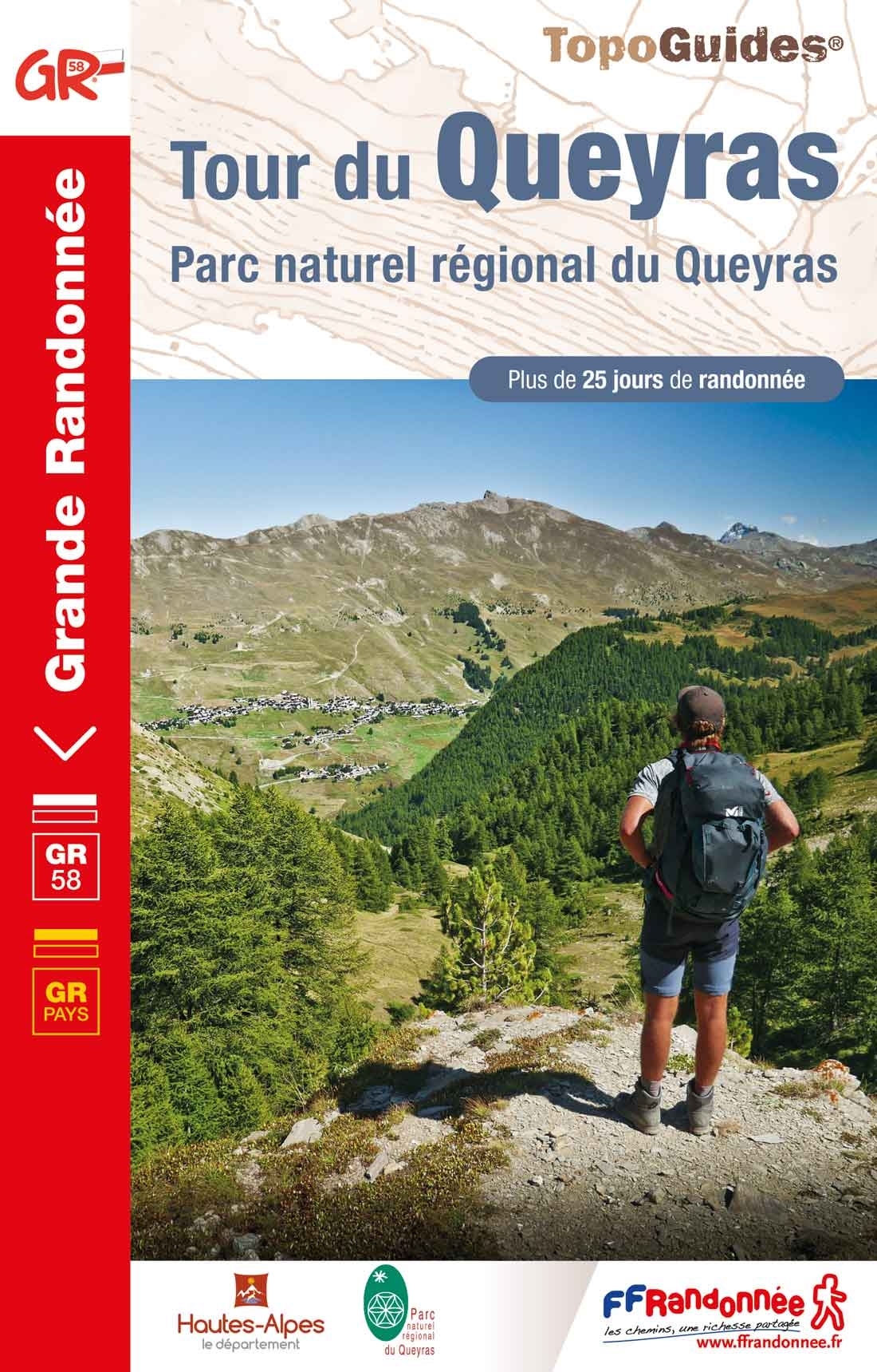
- Tour du Queyras GR58
- Tour du Queyras, FFRP topoguide Ref. No. 505, covering in addition to the tour of this picturesque mountain range several other circular routes within the Parc Régional du Queyras. Current edition of this title was published in July 2015.ABOUT THE FFRP (Fédération française de la randonnée pédestre) TOPOGUIDES: published in a handy A5 paperback... Read more
Weitere Bücher…
Karten

The Book Depository
United Kingdom
United Kingdom
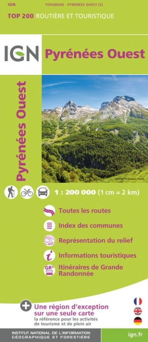
- Pyrenees Western
- Pyrénées Ouest map from the IGN at 1:200,000, with excellent presentation of the terrain through contours and vivid relief shading, plenty of names of topographic features, long-distance GR hiking routes, places of interest, etc. The map is designed to provide convenient coverage of the western and central part of the Pyrenees, extending across... Read more
- Also available from:
- Stanfords, United Kingdom
Stanfords
United Kingdom
United Kingdom
- Pyrenees West IGN Top200 205
- Pyrénées Ouest map from the IGN at 1:200,000, with excellent presentation of the terrain through contours and vivid relief shading, plenty of names of topographic features, long-distance GR hiking routes, places of interest, etc. The map is designed to provide convenient coverage of the western and central part of the Pyrenees, extending across... Read more

- Also available from:
- De Zwerver, Netherlands
- Stanfords, United Kingdom


Stanfords
United Kingdom
United Kingdom
- Canigou-Garrotxa Rando Editions 10
- Canigou Massif and the surrounding region of the French Pyrenees on a contoured and GPS compatible map at 1:50,000 from Rando Editions with topographic base provided by the IGN, highlighting local and long-distance hiking trails, mountain biking routes, etc. Topography is vividly presented by contours at 20m intervals enhanced by shading and... Read more

- Also available from:
- Stanfords, United Kingdom

Stanfords
United Kingdom
United Kingdom
- Carros de Foc Hiking Circuit Editorial Alpina
- Carros de Foc (Chariots of Fire) Hiking Circuit, a five to seven day long hiking route in the Aigüestortes i Estany de Sant Maurici National Park, shown on a 1:25,000 map from Editorial Alpina. The map, from the publishers of an extensive hiking series for the Spanish Pyrenees, has contours at 20m intervals, relief shading, and vegetation... Read more

The Book Depository
United Kingdom
United Kingdom
- Pyrenees Eastern
- Pyrénées Ouest map from the IGN at 1:200,000, with excellent presentation of the terrain through contours and vivid relief shading, plenty of names of topographic features, long-distance GR hiking routes, places of interest, etc. The map is designed to provide convenient coverage of the western and central part of the Pyrenees, extending across... Read more
- Also available from:
- Stanfords, United Kingdom

Stanfords
United Kingdom
United Kingdom
- Pyrenees East IGN Top200 206
- Pyrénées Ouest map from the IGN at 1:200,000, with excellent presentation of the terrain through contours and vivid relief shading, plenty of names of topographic features, long-distance GR hiking routes, places of interest, etc. The map is designed to provide convenient coverage of the western and central part of the Pyrenees, extending across... Read more

The Book Depository
United Kingdom
United Kingdom
- Bearn - Aspe - Ossau - Pyrenees NP
- Uitstekende wandelkaart met veel toeristische informatie en bijzonder gedetailleerd. Wandelroute en hutten / campings zijn ingetekend, met hoogtelijnen. Andere dorpen op deze kaart: Etsaut - Col du Somport - Fabrèges - Col du Pourtalet - la Pierre Saint Martin - Arette - Arudy - Laruns - Arrens Marsous - Argelès Gazost (Frankrijk - Pyreneeen)... Read more
- Also available from:
- De Zwerver, Netherlands
- Stanfords, United Kingdom

De Zwerver
Netherlands
Netherlands
- Wandelkaart 03 Béarn - Bearn | Rando Editions
- Uitstekende wandelkaart met veel toeristische informatie en bijzonder gedetailleerd. Wandelroute en hutten / campings zijn ingetekend, met hoogtelijnen. Andere dorpen op deze kaart: Etsaut - Col du Somport - Fabrèges - Col du Pourtalet - la Pierre Saint Martin - Arette - Arudy - Laruns - Arrens Marsous - Argelès Gazost (Frankrijk - Pyreneeen)... Read more

Stanfords
United Kingdom
United Kingdom
- Béarn - Aspe - Ossau - Pyrenees National Park Rando Editions 3
- French Pyrenees of the Béarn region, from Tardets-Sorholus to the western part of the Pyrenees National Park including the Ossau and Balaïtous massifs, on a contoured and GPS compatible map at 1:50,000 from Rando Editions with topographic base provided by the IGN, highlighting local and long-distance hiking trails, cycle and mountain bike... Read more

The Book Depository
United Kingdom
United Kingdom
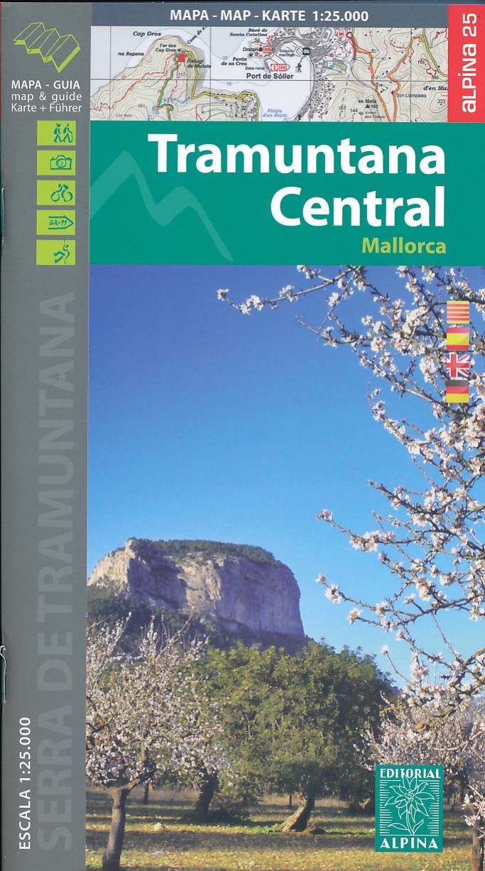
- Mallorca -Tramuntana Central GR11 Map and Hiking Guide
- Zeer gedetailleerde wandelkaart van een deel van de Tramuntana op Mallorca. Met ingetekende wandelroutes en andere informatie. uitstekende kaart. Met symbolen voor campings, hutten. Let op: deze uitgever is traag met het vernieuwen van kaarten; het kan zo maar zijn dat een bepaalde kaart gedurende langere tijd niet beschikbaar is. Majorca:... Read more
- Also available from:
- De Zwerver, Netherlands
- Stanfords, United Kingdom
De Zwerver
Netherlands
Netherlands
- Wandelkaart 67 Tramuntana Central - Mallorca | Editorial Alpina
- Zeer gedetailleerde wandelkaart van een deel van de Tramuntana op Mallorca. Met ingetekende wandelroutes en andere informatie. uitstekende kaart. Met symbolen voor campings, hutten. Let op: deze uitgever is traag met het vernieuwen van kaarten; het kan zo maar zijn dat een bepaalde kaart gedurende langere tijd niet beschikbaar is. Majorca:... Read more

Stanfords
United Kingdom
United Kingdom
- Mallorca - Tramuntana Central Editorial Alpina
- The central part of Mallorca’s Serra de Tramuntana mountains on a contoured and GPS-compatible map at 1:25,000 from Editorial Alpina, highlighting numerous local hiking trails and the course of the GR221 long-distance trail, climbing and canyoning sites, refuges and campsites, etc. Accompanying booklet includes English-language descriptions of... Read more

- Also available from:
- De Zwerver, Netherlands
- Stanfords, United Kingdom

Stanfords
United Kingdom
United Kingdom
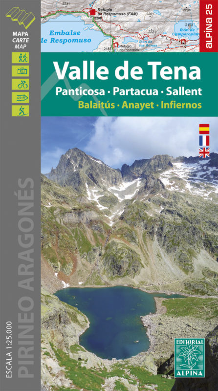
- Valle de Tena - Panticosa - Partacua - Sallent Editorial Alpina
- Valle de Tena in the central part of the Spanish Pyrenees on a contoured and GPS compatible map at 1:25,000 from Editorial Alpina, with coverage including Panticosa, Sallent de Gállego, Sierra de Partacua, Sierra de Tendeñera, etc. Accompanying booklet includes contact details for campsites, refuges, etc.Topography is presented by contours at... Read more

The Book Depository
United Kingdom
United Kingdom
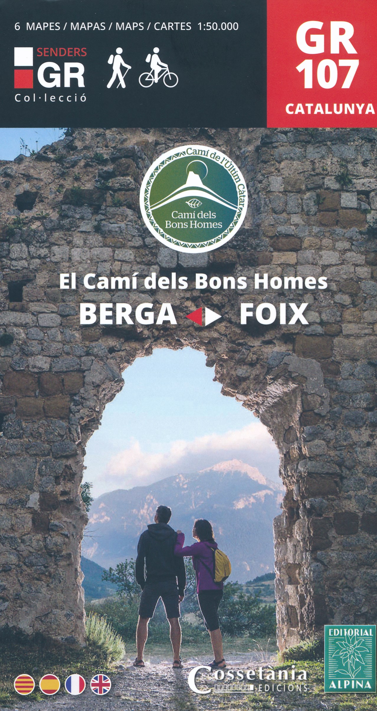
- El Cami dels Bons Homes / Trail of the Cathars GR107
- Uitstekende wandelkaart (in een set met 6 deelkaarten) van de GR107 die loopt van Foix in de Franse Pyreneeen tot Berga in de Catalaanse Pyreneeen. De kaarten zijn voldoende gedetailleerd om deze lange route te lopen. Met hoogteprofielen aan de zijkant, symbolen voor de noodzakelijke praktische informatie. Ruta a pie y en BTT, que recorre el... Read more
- Also available from:
- De Zwerver, Netherlands
- Stanfords, United Kingdom
De Zwerver
Netherlands
Netherlands
- Wandelkaart GR107 Berga - Foix , El Cami dels Bons Homes | Editorial Alpina
- Uitstekende wandelkaart (in een set met 6 deelkaarten) van de GR107 die loopt van Foix in de Franse Pyreneeen tot Berga in de Catalaanse Pyreneeen. De kaarten zijn voldoende gedetailleerd om deze lange route te lopen. Met hoogteprofielen aan de zijkant, symbolen voor de noodzakelijke praktische informatie. Ruta a pie y en BTT, que recorre el... Read more

Stanfords
United Kingdom
United Kingdom
- The Trail of the Cathars GR107 Editorial Alpina 6-Map Set
- 6 maps at 1:50,000 of the Camí dels Bons Homes (GR 107), between Berga and Foix, suitable for both hiking and mountain bikingThe reverse of the maps contains details of each stage and useful suggestions to carry on this trans-Pyrenean crossing to this end in four languages (Catalan, Castellà, English and French). Read more

The Book Depository
United Kingdom
United Kingdom
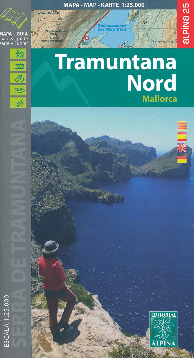
- Mallorca -Tramuntana Norte GR11 map and hiking guide
- Zeer gedetailleerde wandelkaart van een deel van de Tramuntana op Mallorca. Met ingetekende wandelroutes en andere informatie. uitstekende kaart. Met symbolen voor campings, hutten. Let op: deze uitgever is traag met het vernieuwen van kaarten; het kan zo maar zijn dat een bepaalde kaart gedurende langere tijd niet beschikbaar is. Majorca:... Read more
- Also available from:
- De Zwerver, Netherlands
- Stanfords, United Kingdom
De Zwerver
Netherlands
Netherlands
- Wandelkaart 68 Tramuntana Noord GR221 Mallorca | Editorial Alpina
- Zeer gedetailleerde wandelkaart van een deel van de Tramuntana op Mallorca. Met ingetekende wandelroutes en andere informatie. uitstekende kaart. Met symbolen voor campings, hutten. Let op: deze uitgever is traag met het vernieuwen van kaarten; het kan zo maar zijn dat een bepaalde kaart gedurende langere tijd niet beschikbaar is. Majorca:... Read more

Stanfords
United Kingdom
United Kingdom
- Mallorca - Tramuntana North Editorial Alpina
- The northern part of Mallorca’s Serra de Tramuntana mountains on a contoured and GPS-compatible map at 1:25,000 from Editorial Alpina, highlighting numerous local hiking trails and the course of the GR221 long-distance trail, climbing and canyoning sites, refuges and campsites, etc. Accompanying booklet includes English-language descriptions of... Read more

- Also available from:
- Stanfords, United Kingdom

Stanfords
United Kingdom
United Kingdom
- Ordesa and Monte Perdido National Park Editorial Alpina
- Ordesa and Monte Perdido National Park at 1:40,000 on a GPS compatible recreational map in an extensive and very popular series from Editorial Alpina, including a booklet with English language descriptions of several walks, climbs, etc.Contours are at 20m intervals, with relief shading and altitude colouring. An overprint highlights waymarked... Read more

The Book Depository
United Kingdom
United Kingdom
- Haut-Jura / Alpes du Nord
- Pyrénées Ouest map from the IGN at 1:200,000, with excellent presentation of the terrain through contours and vivid relief shading, plenty of names of topographic features, long-distance GR hiking routes, places of interest, etc. The map is designed to provide convenient coverage of the western and central part of the Pyrenees, extending across... Read more
- Also available from:
- Stanfords, United Kingdom

Stanfords
United Kingdom
United Kingdom
- High Jura - Northern Alps IGN Top200 202
- Pyrénées Ouest map from the IGN at 1:200,000, with excellent presentation of the terrain through contours and vivid relief shading, plenty of names of topographic features, long-distance GR hiking routes, places of interest, etc. The map is designed to provide convenient coverage of the western and central part of the Pyrenees, extending across... Read more

The Book Depository
United Kingdom
United Kingdom
- Alpes du Sud
- Pyrénées Ouest map from the IGN at 1:200,000, with excellent presentation of the terrain through contours and vivid relief shading, plenty of names of topographic features, long-distance GR hiking routes, places of interest, etc. The map is designed to provide convenient coverage of the western and central part of the Pyrenees, extending across... Read more
- Also available from:
- Stanfords, United Kingdom

Stanfords
United Kingdom
United Kingdom
- Southern Alps IGN Top200 203
- Pyrénées Ouest map from the IGN at 1:200,000, with excellent presentation of the terrain through contours and vivid relief shading, plenty of names of topographic features, long-distance GR hiking routes, places of interest, etc. The map is designed to provide convenient coverage of the western and central part of the Pyrenees, extending across... Read more

The Book Depository
United Kingdom
2020
United Kingdom
2020
- Tour et travers�es du Massif des Bauges GR96/GRP
- Tours et Traversées du Massif des Bauges, FFRP topoguide Ref. no. 902, covering 500kms of routes in the French Alps between Annecy, Aix-les-Bains, Chambéry and Albertville. Current edition of this title was published in May 2015.ABOUT THE FFRP (Fédération française de la randonnée pédestre) TOPOGUIDES: published in a handy A5 paperback format,... Read more
- Also available from:
- Stanfords, United Kingdom
Stanfords
United Kingdom
2020
United Kingdom
2020
- Tours et Traversées du Massif des Bauges GR96
- Tours et Traversées du Massif des Bauges, FFRP topoguide Ref. no. 902, covering 500kms of routes in the French Alps between Annecy, Aix-les-Bains, Chambéry and Albertville. Current edition of this title was published in May 2015.ABOUT THE FFRP (Fédération française de la randonnée pédestre) TOPOGUIDES: published in a handy A5 paperback format,... Read more

The Book Depository
United Kingdom
2021
United Kingdom
2021
- Le long des ch�teaux de la Loire GR3/GR3B
- Le long des Châteaux de la Loire, FFRP topoguide Ref. No. 333, covering 552km route along the Loire from Bonny-sur-Loire across Orléans, Blois and Tours to Angers. Current edition of this title was published in May 2018.The Loire is world famous for its castles and gardens, now classified as World Heritage by UNESCO. The site of the Loire... Read more
- Also available from:
- Stanfords, United Kingdom
Stanfords
United Kingdom
2021
United Kingdom
2021
- Le long des Chateaux de la Loire GR3/GR3B
- Le long des Châteaux de la Loire, FFRP topoguide Ref. No. 333, covering 552km route along the Loire from Bonny-sur-Loire across Orléans, Blois and Tours to Angers. Current edition of this title was published in May 2018.The Loire is world famous for its castles and gardens, now classified as World Heritage by UNESCO. The site of the Loire... Read more

- Also available from:
- De Zwerver, Netherlands
- Stanfords, United Kingdom

Stanfords
United Kingdom
United Kingdom
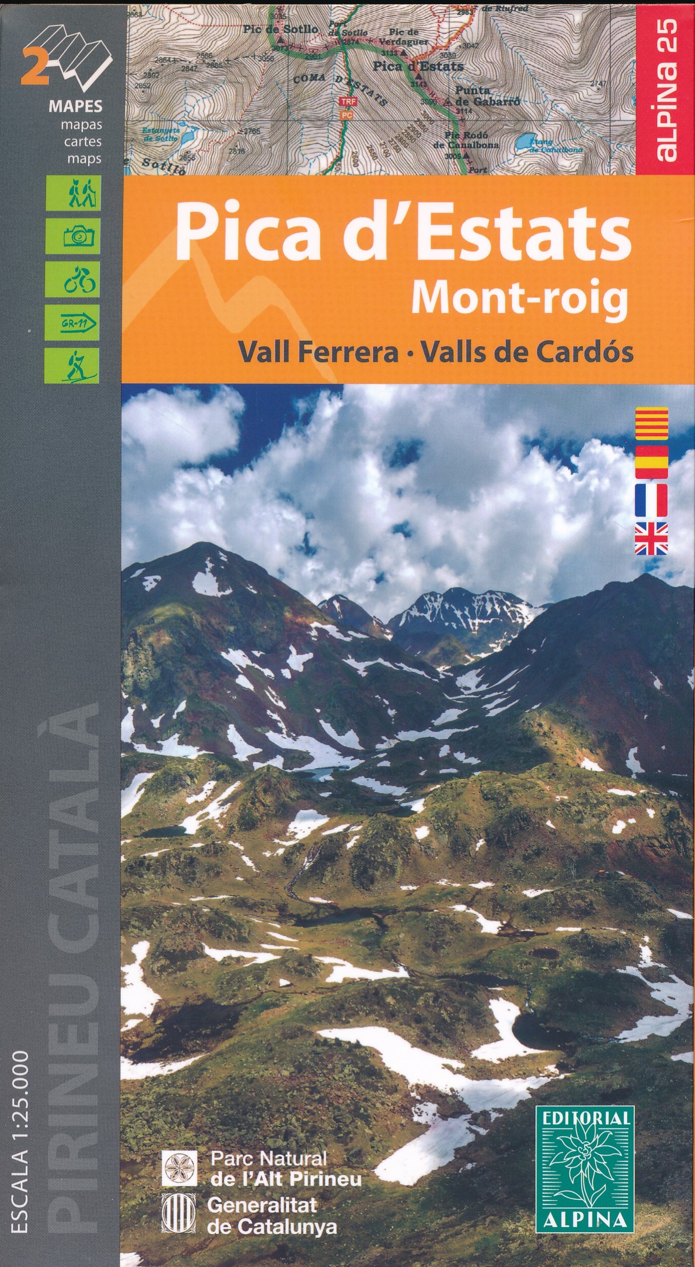
- Pica d`Estats - Mont-roig - Vall Ferrera - Valls de Cardos Editorial Alpina 2-Map Set
- Pica d`Estats - Mont-roig area of the Catalan Pyrenees just west of Andorra on a contoured and GPS-compatible map at 1:25,000 from Editorial Alpina, highlighting local and long-distance hiking trails, tourist accommodation, etc. Coverage extends from the Andorran border westwards beyond the peak of Mont-roig and from the French border south to... Read more