
Menorca, Baleares
Beschreibung

Menorca - or Minorca - is one of the Balearic Islands. It’s popular with sun lovers, who populate the coastal areas near the beaches. But elsewhere the island is quiet. It’s interior is rather arid, mostly flat, with some low hills. The farmland is partly abandoned and generally loosely structured, giving the island its own charm.
Main interest for hikers is the GR223 that circumvents the entire island. This is another very interesting project by the Spanish and Catalans. The aim in this case is to restore an old coastal route and give it to hikers.
Check the list of Balearic Islands.
Karte

Wanderwege Region
Links
Fakten
Berichte
Führer und Karten
Übernachtung
Organisationen
Reisebüros
GPS
Sonstiges
Bücher

The Book Depository
United Kingdom
2021
United Kingdom
2021
- Also available from:
- De Zwerver, Netherlands
- Stanfords, United Kingdom


Stanfords
United Kingdom
2021
United Kingdom
2021
- Tour du Cotentin - Littorral de la Normandie GR223
- Tour du Cotentin, FFRP topoguide Ref. no. 200, covering the GR223 along the coast of the Cotentin Peninsula from Isigny-sur-Mer to Mont-St-Michel, including the Utah Beach of the D-Day Normandy Landings. Together with several variants off the main route, the guide provides coverage of nearly 600kms of hiking trails. Current edition of this... Read more

- Also available from:
- De Zwerver, Netherlands
- Stanfords, United Kingdom

Stanfords
United Kingdom
2021
United Kingdom
2021
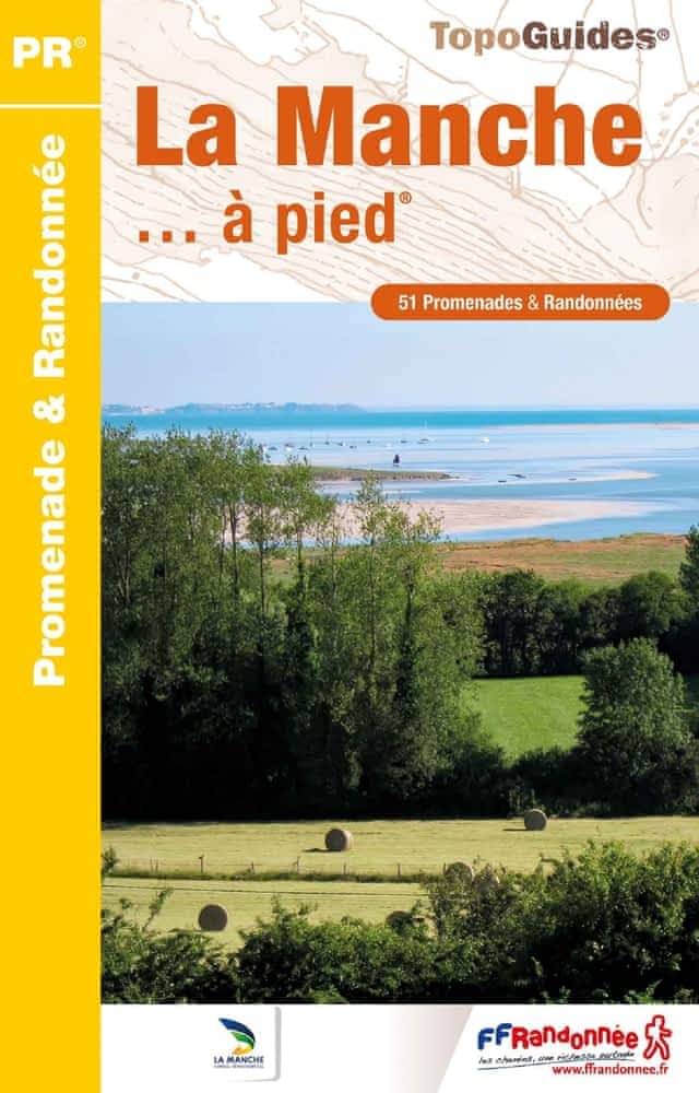
- La Manche à pied
- La Manche à pied, FFRP topo-guide Ref. No. D050, with 51 day walks of varying length and difficulty in the department of La Manche. Coverage extends from Avranches to the tip of the Cotentin Peninsula and includes a walk along the Utah D-Day Beach. Each walk is presented on a separate colour extract from IGN’s topographic survey of France at... Read more

The Book Depository
United Kingdom
2022
United Kingdom
2022
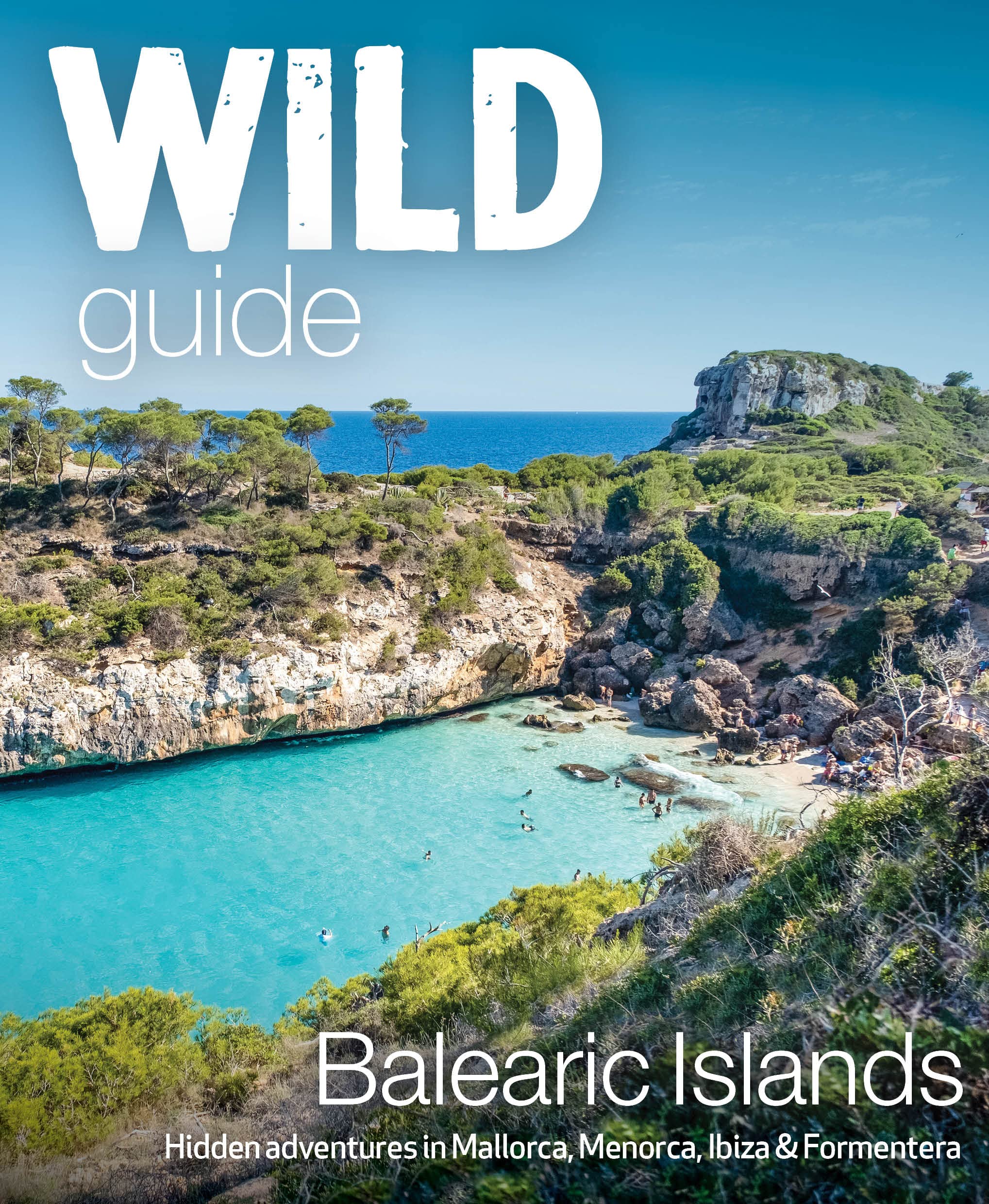
- Wild Guide Balearic Islands
- Secret coves, mountains, caves and adventure in Mallorca, Menorca, Ibiza & Formentera Read more
- Also available from:
- De Zwerver, Netherlands
De Zwerver
Netherlands
2022
Netherlands
2022
- Reisgids Wild Guide Balearic Islands | Wild Things Publishing
- Secret coves, mountains, caves and adventure in Mallorca, Menorca, Ibiza & Formentera Read more

The Book Depository
United Kingdom
2022
United Kingdom
2022
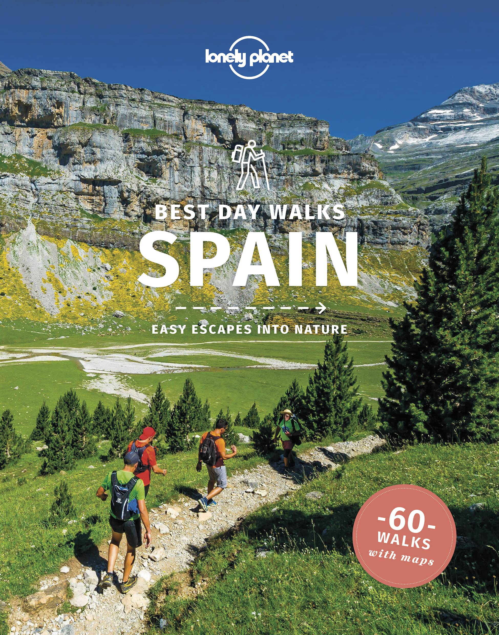
- Lonely Planet Best Day Walks Spain
- Lonely Planet`s Best Day Walks Spain is your passport to 60 easy escapes into nature. Stretch your legs away from the city by picking a walk that works for you, from just a couple of hours to a full day, from easy to hard. Marvel at the Pyrenees, hike along the Mediterranean coast, and experience island walks in Mallorca. Inside Lonely... Read more
- Also available from:
- De Zwerver, Netherlands
- Stanfords, United Kingdom

De Zwerver
Netherlands
2022
Netherlands
2022
- Wandelgids Best Day Walks Spain - Spanje | Lonely Planet
- Lonely Planet`s Best Day Walks Spain is your passport to 60 easy escapes into nature. Stretch your legs away from the city by picking a walk that works for you, from just a couple of hours to a full day, from easy to hard. Marvel at the Pyrenees, hike along the Mediterranean coast, and experience island walks in Mallorca. Inside Lonely... Read more
Stanfords
United Kingdom
2022
United Kingdom
2022
- Lonely Planet Best Day Walks Spain
- Lonely Planet`s Best Day Walks Spain is your passport to 60 easy escapes into nature. Stretch your legs away from the city by picking a walk that works for you, from just a couple of hours to a full day, from easy to hard. Marvel at the Pyrenees, hike along the Mediterranean coast, and experience island walks in Mallorca. Inside Lonely... Read more

De Zwerver
Netherlands
2018
Netherlands
2018
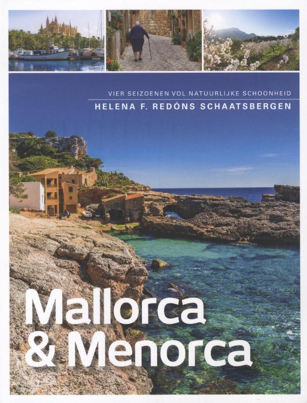
- Reisgids Mallorca en Menorca | Edicola
- 'Todo bajo el Sol'. Dat was de reden waarom we allemaal met de zomervakantie naar Mallorca en Menorca gingen. Tegenwoordig is er in het aangename klimaat ook van alles te doen in de winter. Mallorca en Menorca vertegenwoordigen het continent Spanje in het klein. Het huidige katholieke Spanje is gevormd door koning Jacobus I, die aan land ging... Read more
De Zwerver
Netherlands
Netherlands
- Wandelgids Wandelen op Menorca | One Day Walks
- Menorca is één van de minst toeristische eilanden van de Balearen (Spanje). In deze eerste en enige Nederlandstalige wandelgids vind je 20 uitgebreid beschreven dagtochten en rondwandelingen van een paar uur. Met duidelijk omschreven routes, 70 prachtige full colour foto's van alle bezienswaardigheden, handige kaarten en GPS-coördinaten.... Read more
De Zwerver
Netherlands
2023
Netherlands
2023
De Zwerver
Netherlands
2016
Netherlands
2016
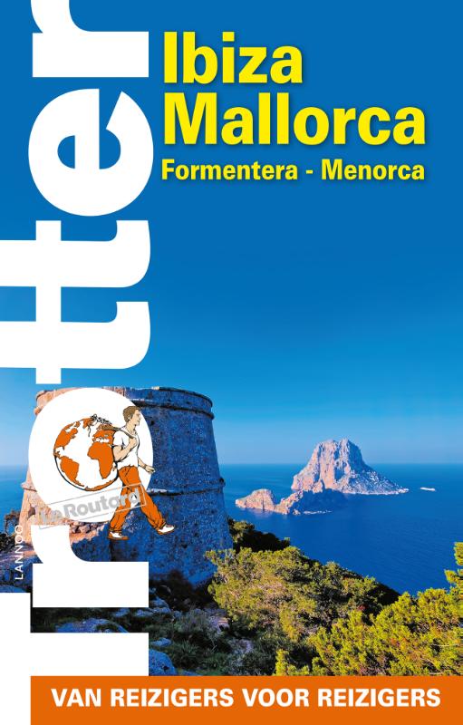
- Reisgids Trotter Ibiza - Mallorca - Formentera - Menorca | Lannoo
- De onmisbare gids voor echte trotters - Het echte verhaal achter de klassieke trekpleisters - Tips om de verborgen parels buiten de platgetreden paden te verkennen - Verrassende anekdotes en topervaringen van Trotter - Honderden budgetvriendelijke en uitgeteste horeca-adressen - Kaarten en plattegronden waarop je al onze adressen terug vindt Read more
Karten

- Also available from:
- De Zwerver, Netherlands
De Zwerver
Netherlands
Netherlands
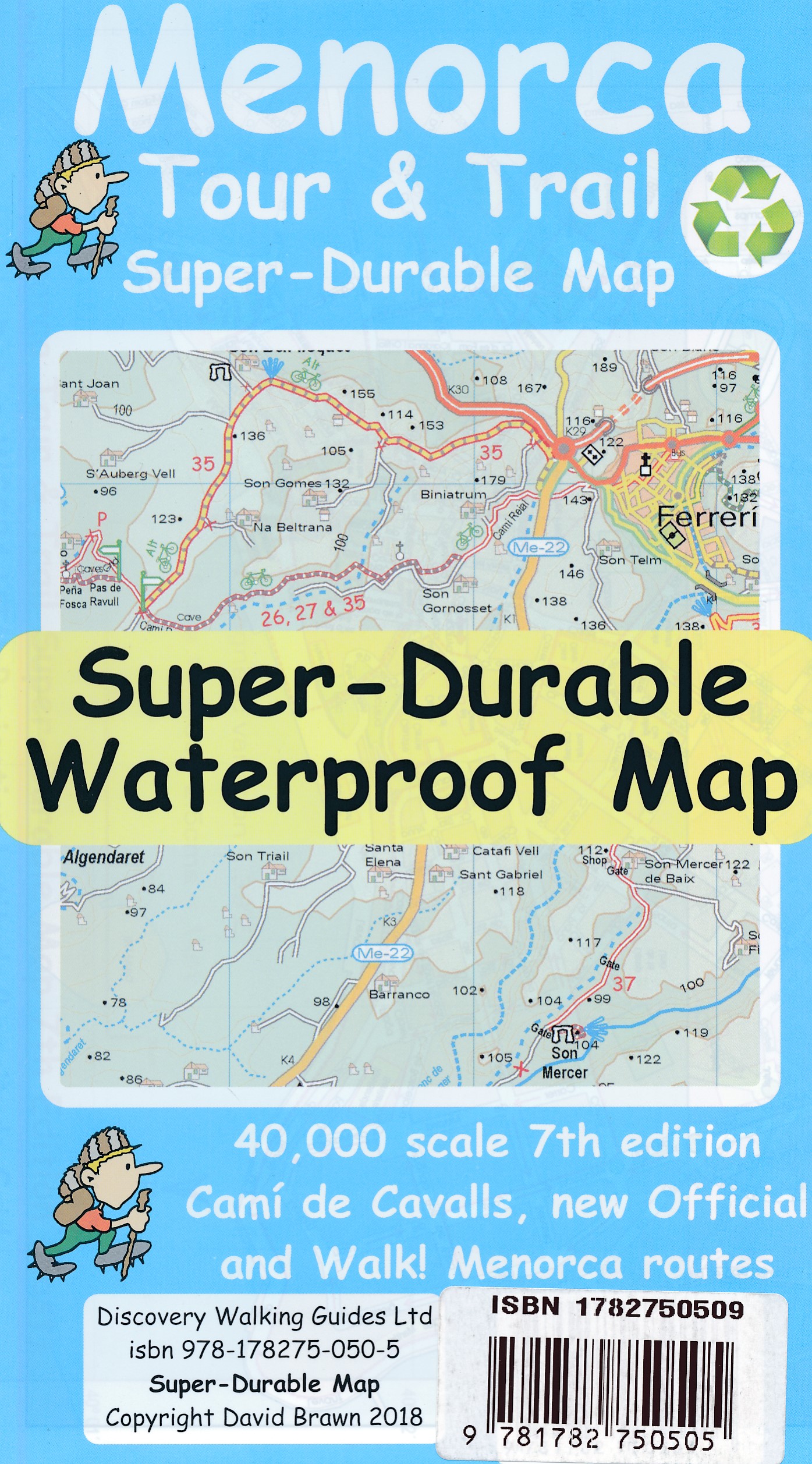
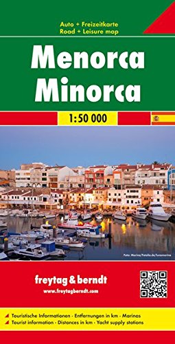
- Wandelkaart - Wegenkaart - landkaart Menorca | Freytag & Berndt
- Menorca 1 : 50 000 Autokarte ab 10.9 EURO 1:50. 000. Touristische Informationen, Entfernungen in km, Marinas Freytag & Berndt Auto + Freizeitkarte Read more

Stanfords
United Kingdom
United Kingdom
- Menorca - Camí de Cavalls - GR223 Editorial Alpina CATALAN
- Menorca at 1:50,000 on a contoured, GPS compatible map from Editorial Alpina with a special overprint for the GR223 – Camí de Cavalls, a long-distance hiking path along the island’s coast, plus local trails, mountain bike routes, accommodation, sights, etc, plus a booklet in Catalan only.The map has contours at 20m intervals, with additional... Read more

Stanfords
United Kingdom
United Kingdom
- Es Grau 25K Menorca CNIG Topographic Survey Map No. 647-I
- Topographic coverage of the Balearic Islands at 1:25,000 published by the Instituto Geográfico Nacional – Centro Nacional de Información Geografica, the country’s civilian survey organization. The maps have contours at 10m intervals and colouring and/or graphics to show different types of vegetation or land use. Boundaries of national parks and... Read more
Stanfords
United Kingdom
United Kingdom
- Ciutadella - Menorca CNIG Topo 618-3
- Topographic coverage of the Balearic Islands at 1:25,000 published by the Instituto Geográfico Nacional – Centro Nacional de Información Geografica, the country’s civilian survey organization. The maps have contours at 10m intervals and colouring and/or graphics to show different types of vegetation or land use. Boundaries of national parks and... Read more
Stanfords
United Kingdom
United Kingdom
- Mao-Mahon - Menorca CNIG Topo 647-3/673-1
- Topographic coverage of the Balearic Islands at 1:25,000 published by the Instituto Geográfico Nacional – Centro Nacional de Información Geografica, the country’s civilian survey organization. The maps have contours at 10m intervals and colouring and/or graphics to show different types of vegetation or land use. Boundaries of national parks and... Read more

Stanfords
United Kingdom
United Kingdom
- Mahon / Mao CNIG Topo 647
- Topographic coverage of the Balearic Islands at 1:50,000 in the MTN50 (Mapa Topográfico Nacional) series from the Instituto Geográfico Nacional – Centro Nacional de Información Geografica, the country’s civilian survey organization. The maps have contours at 20m intervals, enhanced by relief shading, plus colouring and/or graphics to show... Read more
Stanfords
United Kingdom
United Kingdom
- Son Parc CNIG Topo 619
- Topographic coverage of the Balearic Islands at 1:50,000 in the MTN50 (Mapa Topográfico Nacional) series from the Instituto Geográfico Nacional – Centro Nacional de Información Geografica, the country’s civilian survey organization. The maps have contours at 20m intervals, enhanced by relief shading, plus colouring and/or graphics to show... Read more

Stanfords
United Kingdom
United Kingdom
- Eschenbach in der Oberpfalz E12
- Eschenbach i.d.OPf. in a series of GPS compatible recreational editions of the Bavarian topographic survey at 1:25,000, with waymarked hiking trails and cycling routes, campsites and youth hostels, etc. Coverage includes Creußen, Kirchenthumbach, Speichersdorf, Kemnath, Neustadt am Kulm, Grafenwöhr.Contours used in this map vary between 5 to... Read more
Stanfords
United Kingdom
United Kingdom
- Son Parc - Menorca CNIG Topo 619-3
- Topographic coverage of the Balearic Islands at 1:25,000 published by the Instituto Geográfico Nacional – Centro Nacional de Información Geografica, the country’s civilian survey organization. The maps have contours at 10m intervals and colouring and/or graphics to show different types of vegetation or land use. Boundaries of national parks and... Read more
Stanfords
United Kingdom
United Kingdom
- Alaior CNIG Topo 646
- Topographic coverage of the Balearic Islands at 1:50,000 in the MTN50 (Mapa Topográfico Nacional) series from the Instituto Geográfico Nacional – Centro Nacional de Información Geografica, the country’s civilian survey organization. The maps have contours at 20m intervals, enhanced by relief shading, plus colouring and/or graphics to show... Read more
Stanfords
United Kingdom
United Kingdom
- Fornells - Menorca CNIG Topo 618-4
- Topographic coverage of the Balearic Islands at 1:25,000 published by the Instituto Geográfico Nacional – Centro Nacional de Información Geografica, the country’s civilian survey organization. The maps have contours at 10m intervals and colouring and/or graphics to show different types of vegetation or land use. Boundaries of national parks and... Read more
Stanfords
United Kingdom
United Kingdom
- Illa de L`Aire CNIG Topo 673
- Topographic coverage of the Balearic Islands at 1:50,000 in the MTN50 (Mapa Topográfico Nacional) series from the Instituto Geográfico Nacional – Centro Nacional de Información Geografica, the country’s civilian survey organization. The maps have contours at 20m intervals, enhanced by relief shading, plus colouring and/or graphics to show... Read more

Stanfords
United Kingdom
United Kingdom
- Menorca
- Menorca at 1:75,000 on an indexed road map from Telstar, highlighting numerous places of interest and the long-distance trail around the island, plus indexed street plans of Ciutadella, Maó and Alaior.The road map shows the island with altitude colouring to indicate its topography. Road network includes small local roads and cart tracks.... Read more