Skåne
Beschreibung
Wanderwege Landesteil
Links
Fakten
Berichte
Führer und Karten
Übernachtung
Organisationen
Reisebüros
GPS
Sonstiges
Bücher
De Zwerver
Netherlands
2022
Netherlands
2022

Stanfords
United Kingdom
United Kingdom
- Istria Kompass 238
- Istria at 1:75,000 on a double-sided, waterproof and tear-resistant, detailed contoured map from Kompass, with hiking and cycling routes, street plans of 10 main towns, plus tourist information. Coverage extends north beyond the Croatian border to include Trieste and the coast of Slovenia. Contours at 50m intervals and spot heights present the... Read more
Karten

The Book Depository
United Kingdom
United Kingdom
- Prespa - Vitsi - Voras
- Uitstekende topografische kaarten van een deel van Griekenland: zonder meer hele goede kaarten voor wandeltochten in een onbekend stuk Griekenland! Ze zijn gedrukt op scheurvast en watervast papier op een schaal van 1:50.000 met een UTM grid voor GPS gebruikers. Op de meeste kaarten is geven de hoogtelijnen een interval van 20m. aan. Met... Read more
- Also available from:
- De Zwerver, Netherlands
- Stanfords, United Kingdom

De Zwerver
Netherlands
Netherlands
- Wandelkaart 6.2 Prespa - Vitsi - Voras | Anavasi
- Uitstekende topografische kaarten van een deel van Griekenland: zonder meer hele goede kaarten voor wandeltochten in een onbekend stuk Griekenland! Ze zijn gedrukt op scheurvast en watervast papier op een schaal van 1:50.000 met een UTM grid voor GPS gebruikers. Op de meeste kaarten is geven de hoogtelijnen een interval van 20m. aan. Met... Read more

Stanfords
United Kingdom
United Kingdom
- Prespa - Vitsi - Voras Anavasi 6.2
- Prespa - Vitsi – Voras area of northern Greece at 1:50,000 on a light, waterproof and tear-resistant, GPS compatible, contoured map from Anavasi, with recommendations for three hiking trails and notes on the E4 and E6 cross-European trails. The map is double-sided; coverage in the west starts from the Prespa Lake on the border with Albania and... Read more
De Zwerver
Netherlands
2020
Netherlands
2020
De Zwerver
Netherlands
Netherlands
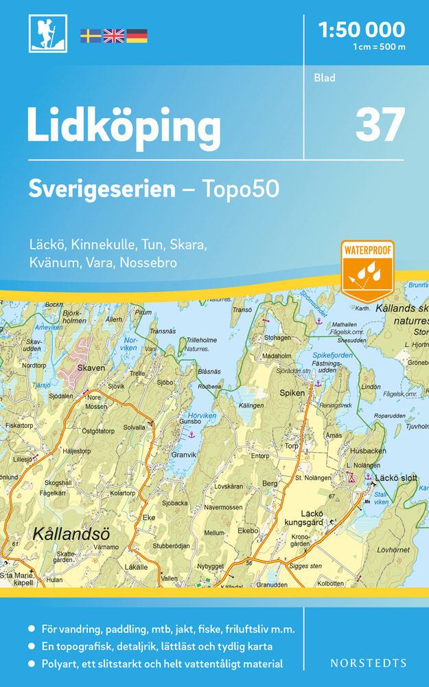
- Wandelkaart - Topografische kaart 37 Sverigeserien Lidköping | Norstedts
- Sverigeserien is an outdoor map series consisting of 116 sheets with coverage of southern and central Sweden and the northern coastline. The map is suitable for outdoor activities such as hiking, excursions, trail running, hunting, fishing, riding, cycling, mountain biking, paddling, skating and much more. Every sheet covers an area of... Read more
De Zwerver
Netherlands
Netherlands
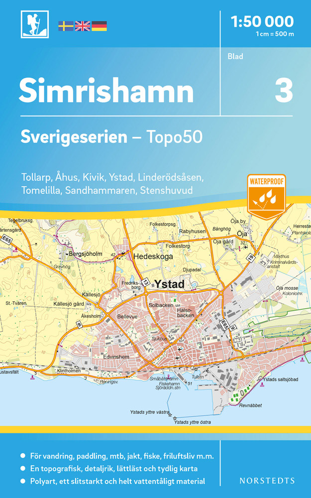
- Wandelkaart - Topografische kaart 03 Sverigeserien Simrishamn | Norstedts
- Sverigeserien is an outdoor map series consisting of 116 sheets with coverage of southern and central Sweden and the northern coastline. The map is suitable for outdoor activities such as hiking, excursions, trail running, hunting, fishing, riding, cycling, mountain biking, paddling, skating and much more. Every sheet covers an area of... Read more

De Zwerver
Netherlands
Netherlands
- Wandelkaart 2.4 Nafpaktos - Panaitoliko - Karpenisi | Anavasi
- Prespa - Vitsi – Voras area of northern Greece at 1:50,000 on a light, waterproof and tear-resistant, GPS compatible, contoured map from Anavasi, with recommendations for three hiking trails and notes on the E4 and E6 cross-European trails. The map is double-sided; coverage in the west starts from the Prespa Lake on the border with Albania and... Read more
De Zwerver
Netherlands
Netherlands
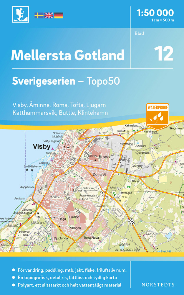
- Wandelkaart - Topografische kaart 12 Sverigeserien Mellersta Gotland midden | Norstedts
- Sverigeserien is an outdoor map series consisting of 116 sheets with coverage of southern and central Sweden and the northern coastline. The map is suitable for outdoor activities such as hiking, excursions, trail running, hunting, fishing, riding, cycling, mountain biking, paddling, skating and much more. Every sheet covers an area of... Read more
De Zwerver
Netherlands
Netherlands
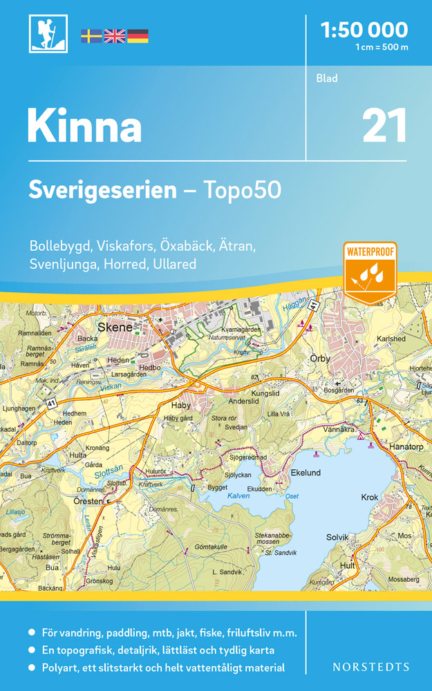
- Wandelkaart - Topografische kaart 21 Sverigeserien Kinna | Norstedts
- Sverigeserien is an outdoor map series consisting of 116 sheets with coverage of southern and central Sweden and the northern coastline. The map is suitable for outdoor activities such as hiking, excursions, trail running, hunting, fishing, riding, cycling, mountain biking, paddling, skating and much more. Every sheet covers an area of... Read more
De Zwerver
Netherlands
Netherlands
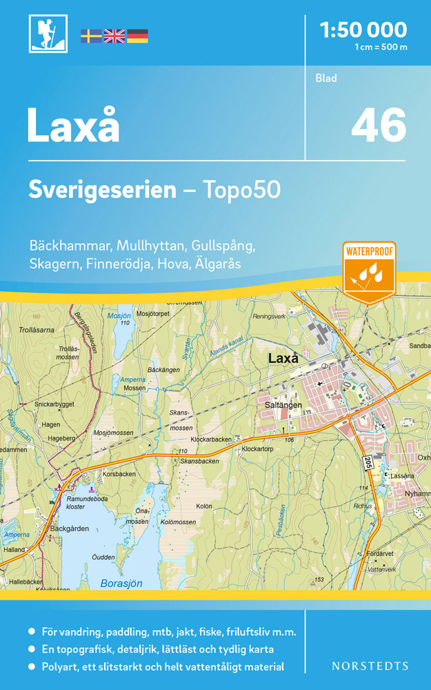
- Wandelkaart - Topografische kaart 46 Sverigeserien Laxå - Laxa | Norstedts
- Sverigeserien is an outdoor map series consisting of 116 sheets with coverage of southern and central Sweden and the northern coastline. The map is suitable for outdoor activities such as hiking, excursions, trail running, hunting, fishing, riding, cycling, mountain biking, paddling, skating and much more. Every sheet covers an area of... Read more
De Zwerver
Netherlands
Netherlands
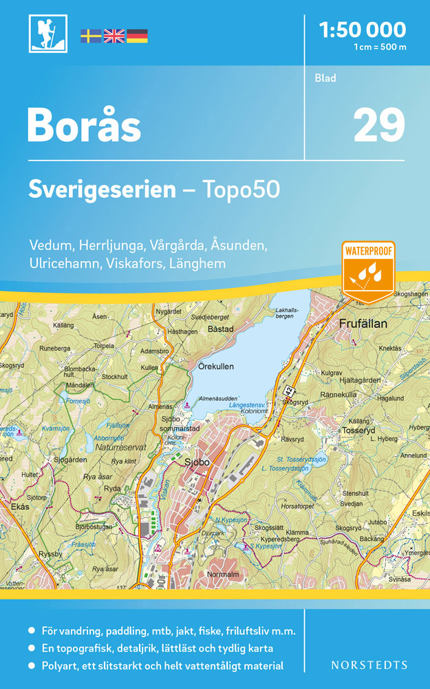
- Wandelkaart - Topografische kaart 29 Sverigeserien Borås - Boras | Norstedts
- Sverigeserien is an outdoor map series consisting of 116 sheets with coverage of southern and central Sweden and the northern coastline. The map is suitable for outdoor activities such as hiking, excursions, trail running, hunting, fishing, riding, cycling, mountain biking, paddling, skating and much more. Every sheet covers an area of... Read more
De Zwerver
Netherlands
2015
Netherlands
2015
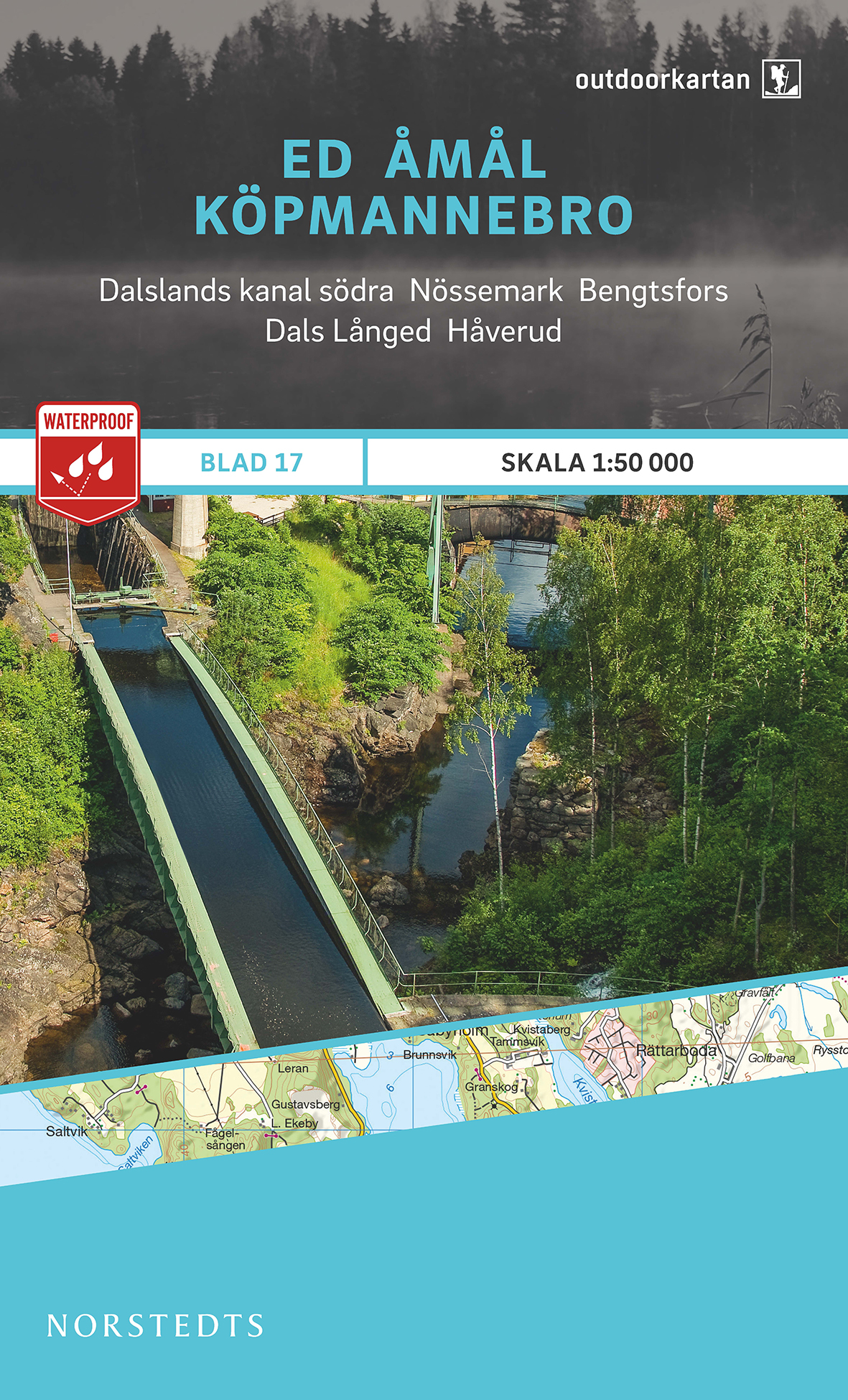
- Wandelkaart 17 Outdoorkartan Ed - Åmål - Köpmannebro | Norstedts
- This map of Ed Amal Kopmannebro in 1:50,000 is part of a series of topographic maps from Norstedts Kartforlaget which includes 28 outdoor maps covering the mountain areas and popular recreation areas in southern Sweden. The maps in this series have a new look and are printed on a durable and water resistant paper. Cartography, material and... Read more
- Also available from:
- Stanfords, United Kingdom

Stanfords
United Kingdom
2015
United Kingdom
2015
- Ed Amal Kopmannebro
- This map of Ed Amal Kopmannebro in 1:50,000 is part of a series of topographic maps from Norstedts Kartforlaget which includes 28 outdoor maps covering the mountain areas and popular recreation areas in southern Sweden. The maps in this series have a new look and are printed on a durable and water resistant paper. Cartography, material and... Read more
Weitere …