
Lincolnshire Wolds
Beschreibung
Area of Outstanding Natural Beauty in eastern England. The Lincolnshire Wolds are a gently sloping and mostly open landscape, with few people living in it. They are a continuation of the well known Yorkshire Wolds, further north. The hills consist of clay and chalk grounds. The Viking Way runs through the area.
Wanderwege Region
Links
Fakten
Berichte
Führer und Karten
Übernachtung
Organisationen
Reisebüros
GPS
Sonstiges
Bücher

- Also available from:
- Stanfords, United Kingdom

Stanfords
United Kingdom
United Kingdom
- Canterbury, East Kent, Dover & Margate OS Landranger Active Map 179 (waterproof)
- Eastern Kent with Canterbury, Dover and Margate, including sections of the North Downs Way and the E2 and E9 European Long-Distance Paths, on a waterproof and tear-resistant OS Active version of map No. 179 from the Ordnance Survey’s Landranger series at 1:50,000, with contoured and GPS compatible topographic mapping plus tourist... Read more

- Also available from:
- Stanfords, United Kingdom

Stanfords
United Kingdom
United Kingdom
- Kettering, Corby, Market Harborough & Stamford OS Landranger Active Map 141 (waterproof)
- The area around Kettering, Corby, Market Harborough and Stamford, including Rockingham Forest and part of the E2 European Long-distance Path, on a waterproof and tear-resistant OS Active version of map No. 141 from the Ordnance Survey’s Landranger series at 1:50,000, with contoured and GPS compatible topographic mapping plus tourist... Read more

- Also available from:
- Stanfords, United Kingdom

Stanfords
United Kingdom
United Kingdom
- Birmingham, Wolverhampton & The Black Country OS Landranger Active Map 139 (waterproof)
- Birmingham with the surrounding area including the Black Country, Wolverhampton, Walsall, Solihull, Stourbridge, Bromsgrove and a section of the E2 European Long-distance Path on a waterproof and tear-resistant OS Active version of map No. 139 from the Ordnance Survey’s Landranger series at 1:50,000, with contoured and GPS compatible... Read more

- Also available from:
- De Zwerver, Netherlands
- Stanfords, United Kingdom
De Zwerver
Netherlands
2015
Netherlands
2015

Stanfords
United Kingdom
2015
United Kingdom
2015
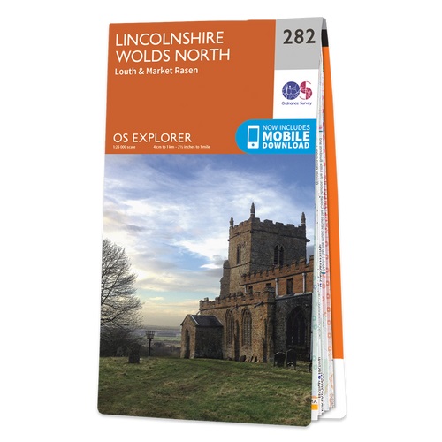
- Lincolnshire Wolds North - Louth & Market Rasen OS Explorer Map 282 (paper)
- Lincolnshire Wolds North, Louth and Market Rasen area on a detailed topographic and GPS compatible map No. 282, paper version, from the Ordnance Survey’s 1:25,000 Explorer series. MOBILE DOWNLOADS: this title and all the other OS Explorer maps include a code for downloading after purchase the digital version onto your smartphone or tablet for... Read more

- Also available from:
- Stanfords, United Kingdom

Stanfords
United Kingdom
United Kingdom
- Peterborough, Market Deeping & Chatteris OS Landranger Active Map 142 (waterproof)
- The area around Peterborough, Market Deeping and Chatteris, including the Fens of the North and Middle Levels with part of the E2 European Long-distance Path, on a waterproof and tear-resistant OS Active version of map No. 142 from the Ordnance Survey’s Landranger series at 1:50,000, with contoured and GPS compatible topographic mapping plus... Read more

- Also available from:
- De Zwerver, Netherlands
- Stanfords, United Kingdom

De Zwerver
Netherlands
Netherlands

Stanfords
United Kingdom
United Kingdom
- Cheviot Hills - Jedburgh & Wooler OS Explorer Map OL16 (paper)
- The Cheviot Hills on a detailed topographic and GPS compatible map OL16, paper version, from the Ordnance Survey’s 1:25,000 Explorer series. Coverage includes Jedburgh, Woolmer, part of the Northumberland National Park, the peaks of The Cheviot, Corby Pike, Cold Law, Scrathy Holes and Windy Gyle, Catcleugh Reservoir, sections of the Pennine Way... Read more

- Also available from:
- De Zwerver, Netherlands
- Stanfords, United Kingdom

De Zwerver
Netherlands
Netherlands

Stanfords
United Kingdom
United Kingdom
- Canterbury, East Kent, Dover & Margate OS Landranger Map 179 (paper)
- Eastern Kent with Canterbury, Dover and Margate, including sections of the North Downs Way and the E2 and E9 European Long-Distance Paths, on a paper version of map No. 179 from the Ordnance Survey’s Landranger series at 1:50,000, with contoured and GPS compatible topographic mapping plus tourist information.MOBILE DOWNLOADS: As well as the... Read more

- Also available from:
- De Zwerver, Netherlands
- Stanfords, United Kingdom

De Zwerver
Netherlands
Netherlands

Stanfords
United Kingdom
United Kingdom
- Peterborough, Market Deeping & Chatteris OS Landranger Map 142 (paper)
- The area around Peterborough, Market Deeping and Chatteris, including the Fens of the North and Middle Levels with part of the E2 European Long-distance Path, on a paper version of map No. 142 from the Ordnance Survey’s Landranger series at 1:50,000, with contoured and GPS compatible topographic mapping plus tourist information.MOBILE... Read more

- Also available from:
- De Zwerver, Netherlands
- Stanfords, United Kingdom

De Zwerver
Netherlands
Netherlands

Stanfords
United Kingdom
United Kingdom
- North York Moors Western OS Explorer Map OL26 (paper)
- The western part of the North York Moors National Park on a detailed topographic and GPS compatible map OL26, paper version, from the Ordnance Survey’s 1:25,000 Explorer series. Coverage extends from Ampleforth in the south northwards to Saltburn-by-the-Sea, and from Ingleby Arncliffe to Danby, Castleton and Hutton-le-Hole, and includes... Read more

- Also available from:
- De Zwerver, Netherlands
- Stanfords, United Kingdom

De Zwerver
Netherlands
Netherlands

Stanfords
United Kingdom
United Kingdom
- Aldershot, Guildford, Camberley & Haslemere OS Landranger Map 186 (paper)
- Aldershot and Guildford area, including the northern part of the South Downs National Park and a section of the North Downs Way / E2 European Long-distance Path, on a paper version of map No. 186 from the Ordnance Survey’s Landranger series at 1:50,000, with contoured and GPS compatible topographic mapping plus tourist information.MOBILE... Read more

- Also available from:
- Stanfords, United Kingdom

Stanfords
United Kingdom
United Kingdom
- Colchester, Halstead & Maldon OS Landranger Active Map 168 (waterproof)
- Colchester, Halstead and Maldon area, including part of the E2 European Long-distance Path, on a waterproof and tear-resistant OS Active version of map No. 168 from the Ordnance Survey’s Landranger series at 1:50,000, with contoured and GPS compatible topographic mapping plus tourist information.MOBILE DOWNLOADS: As well as the physical edition... Read more

- Also available from:
- De Zwerver, Netherlands
- Stanfords, United Kingdom

De Zwerver
Netherlands
Netherlands

Stanfords
United Kingdom
United Kingdom
- Ely, Wisbech & Downham Market OS Landranger Map 143 (paper)
- Cambridgeshire around Ely, Wisbech and Downham Market, including part of the E2 European Long-distance Path, on a paper version of map No. 143 from the Ordnance Survey’s Landranger series at 1:50,000, with contoured and GPS compatible topographic mapping plus tourist information.MOBILE DOWNLOADS: As well as the physical edition of the map, each... Read more

- Also available from:
- Stanfords, United Kingdom

Stanfords
United Kingdom
United Kingdom
- Worcester, The Malverns, Evesham & Tewkesbury OS Landranger Active Map 150 (waterproof)
- The area around Worcester, Great Malvern, Evesham and Tewkesbury, including the Malvern Hills and part of the Cotswold Way / E2 European Long-distance Path, on a waterproof and tear-resistant OS Active version of map No. 150 from the Ordnance Survey’s Landranger series at 1:50,000, with contoured and GPS compatible topographic mapping plus... Read more

- Also available from:
- Stanfords, United Kingdom

Stanfords
United Kingdom
United Kingdom
- Cheviot Hills - Jedburgh & Wooler OS Explorer Active Map OL16 (waterproof)
- The Cheviot Hills on a detailed topographic and GPS compatible map OL16, waterproof version, from the Ordnance Survey’s 1:25,000 Explorer series. Coverage includes Jedburgh, Woolmer, part of the Northumberland National Park, the peaks of The Cheviot, Corby Pike, Cold Law, Scrathy Holes and Windy Gyle, Catcleugh Reservoir, sections of the... Read more

- Also available from:
- De Zwerver, Netherlands
- Stanfords, United Kingdom

De Zwerver
Netherlands
Netherlands

Stanfords
United Kingdom
United Kingdom
- Colchester, Halstead & Maldon OS Landranger Map 168 (paper)
- Colchester, Halstead and Maldon area, including part of the E2 European Long-distance Path, on a paper version of map No. 168 from the Ordnance Survey’s Landranger series at 1:50,000, with contoured and GPS compatible topographic mapping plus tourist information.MOBILE DOWNLOADS: As well as the physical edition of the map, each Landranger title... Read more
Karten

Stanfords
United Kingdom
United Kingdom
- Luxembourg North
- One of two topographic survey maps of Luxembourg at 1:50,000, with contours at 10-metres intervals and additional relief shading. An overprint highlights long-distance footpaths, including the GR5 (E-2), cycle routes, and various places of interest, including campsites. The map covers an area of approximately 53 x 43 km / 33 x 27 miles. Map... Read more

Stanfords
United Kingdom
United Kingdom
- Luxembourg South
- One of two topographic survey maps of Luxembourg at 1:50,000, with contours at 10-metres intervals and additional relief shading. An overprint highlights long-distance footpaths, including the GR5 (E-2), cycle routes, and various places of interest, including campsites. The map covers an area of approximately 53 x 43 km / 33 x 27 miles. Map... Read more

The Book Depository
United Kingdom
United Kingdom
- La Palma Hiking + Leisure Map 1:30 000
- Uitstekende wandelkaart van La Palma, tweezijdig, met ingetekende routes, hoogtelijnen en andere belangrijke informatie. Ook met fietsroutes, bovendien GPS geschikt! Read more
- Also available from:
- De Zwerver, Netherlands
- Bol.com, Netherlands
- Bol.com, Belgium

De Zwerver
Netherlands
Netherlands
- Wandelkaart WKE2 La Palma | Freytag & Berndt
- Uitstekende wandelkaart van La Palma, tweezijdig, met ingetekende routes, hoogtelijnen en andere belangrijke informatie. Ook met fietsroutes, bovendien GPS geschikt! Read more

Bol.com
Netherlands
Netherlands
- FB WKE2 La Palma
- Dubbelzijdige wandel- en vrijetijdskaart • toeristische tips • stadsplattegronden • fietspaden en mountainbikeroutes • GPS-punten • ski- en langlaufroutes Read more
Bol.com
Belgium
Belgium
- FB WKE2 La Palma
- Dubbelzijdige wandel- en vrijetijdskaart • toeristische tips • stadsplattegronden • fietspaden en mountainbikeroutes • GPS-punten • ski- en langlaufroutes Read more