
Yosemite National Park
Beschreibung
Wanderwege Region
Links
Fakten
Berichte
Führer und Karten
Übernachtung
Organisationen
Reisebüros
GPS
Sonstiges
Bücher

The Book Depository
United Kingdom
United Kingdom
- Moon Yosemite, Sequoia & Kings Canyon (Ninth Edition)
- Hiking, Camping, Waterfalls & Big Trees Read more
The Book Depository
United Kingdom
United Kingdom
- Pacific Crest Trail, Washington North
- Topographic Map Guide Read more

The Book Depository
United Kingdom
United Kingdom
- Hiking Yosemite National Park
- A Guide to 62 of the Park's Greatest Hiking Adventures Read more

The Book Depository
United Kingdom
United Kingdom
- Pacific Crest Trail: Northern California
- From Tuolumne Meadows to the Oregon Border Read more


The Book Depository
United Kingdom
United Kingdom
- Trail Angels
- Tales of Generosity and Kindness On the Pacific Crest Trail Read more

The Book Depository
United Kingdom
United Kingdom
- Oregon Uncaged
- A Tale of Two-Sips on the Pacific Crest Trail Read more
The Book Depository
United Kingdom
United Kingdom

The Book Depository
United Kingdom
United Kingdom
- John Muir Trail
- The Essential Guide to Hiking America's Most Famous Trail Read more
Karten

The Book Depository
United Kingdom
United Kingdom
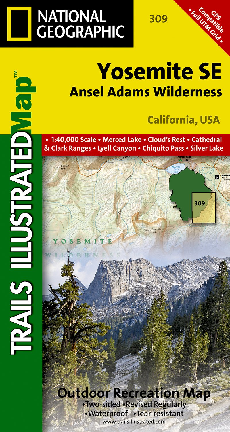
- Yosemite Se, Ansel Adams Wilderness
- Trails Illustrated National Parks Read more
- Also available from:
- De Zwerver, Netherlands
- Stanfords, United Kingdom
De Zwerver
Netherlands
Netherlands
- Wandelkaart 309 Yosemite SE - Ansel Adams Wilderness | National Geographic
- Prachtige geplastificeerde kaart van het nationaal park. Met alle recreatieve voorzieningen als campsites, maar ook met topografische details en wandelroutes ed. Door uitgekiend kleurgebruik zeer prettig in gebruik. Scheur en watervast! Coverage of the Tuolomne Meadows and Hoover Wilderness area of Yosemite National Park includes Ansel Adams... Read more

Stanfords
United Kingdom
United Kingdom
- Yosemite SE - Ansel Adams Wilderness CA
- Map No. 309, Yosemite SE: Ansel Adams Wilderness, CA, in an extensive series of GPS compatible, contoured hiking maps of USA’s national and state parks or forests and other popular recreational areas. Cartography based on the national topographic survey, with additional tourist information.The maps, with most titles now printed on light,... Read more

The Book Depository
United Kingdom
United Kingdom
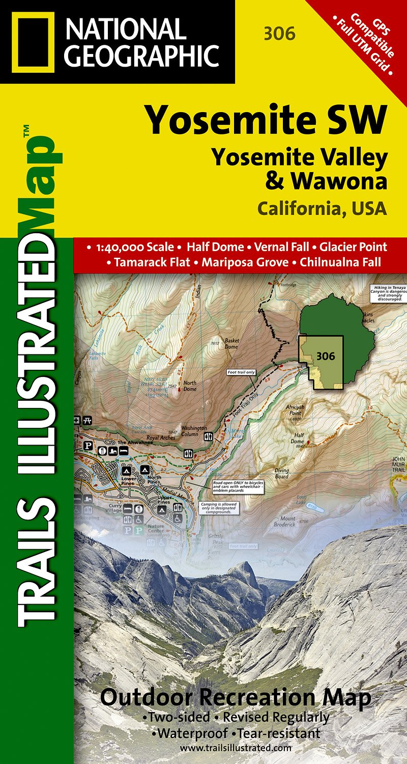
- Yosemite Sw, Yosemite Valley & Wawona
- Trails Illustrated National Parks Read more
- Also available from:
- De Zwerver, Netherlands
- Stanfords, United Kingdom
De Zwerver
Netherlands
Netherlands
- Wandelkaart - Topografische kaart 306 Yosemite SW - Yosemite Valley & Wawona | National Geographic
- Prachtige geplastificeerde kaart van het nationaal park. Met alle recreatieve voorzieningen als campsites, maar ook met topografische details en wandelroutes ed. Door uitgekiend kleurgebruik zeer prettig in gebruik. Scheur en watervast! Coverage of the Yosemite Valley and Wawona area of Yosemite National Park includes Sierra National Forest,... Read more

Stanfords
United Kingdom
United Kingdom
- Yosemite SW - Yosemite Valley and Wawona CA NGS Trails Illustrated Mpa 306
- Map No. 306, Yosemite SW: Yosemite Valley and Wawona, CA, in an extensive series of GPS compatible, contoured hiking maps of USA’s national and state parks or forests and other popular recreational areas. Cartography based on the national topographic survey, with additional tourist information.The maps, with most titles now printed on light,... Read more

The Book Depository
United Kingdom
United Kingdom
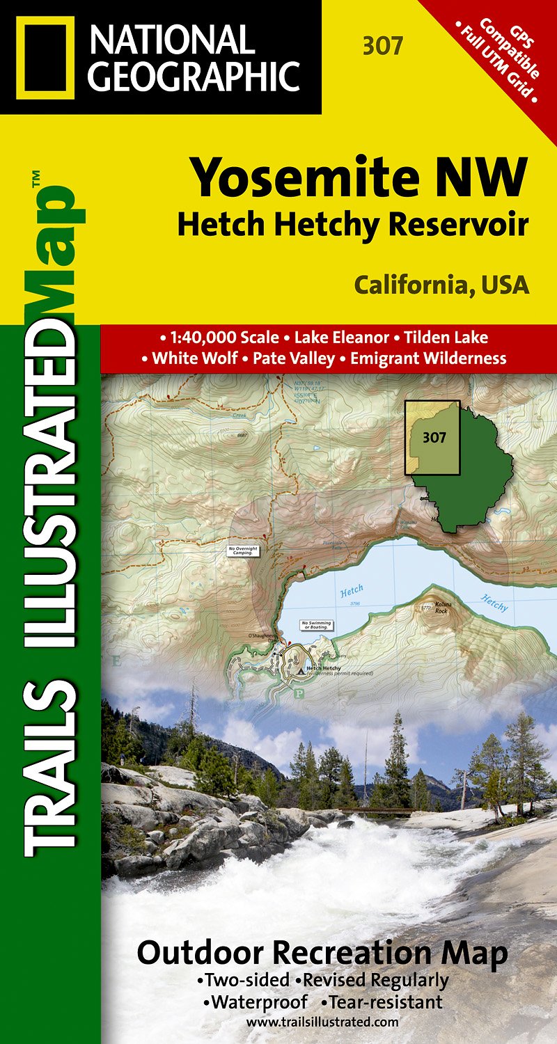
- Yosemite Nw, Hetch Hetchy Reservoir
- Trails Illustrated National Parks Read more
- Also available from:
- De Zwerver, Netherlands
- Stanfords, United Kingdom
De Zwerver
Netherlands
Netherlands
- Wandelkaart - Topografische kaart 307 Yosemite NW - Hetch Hetchy Reservoir | National Geographic
- Prachtige geplastificeerde kaart van het nationaal park. Met alle recreatieve voorzieningen als campsites, maar ook met topografische details en wandelroutes ed. Door uitgekiend kleurgebruik zeer prettig in gebruik. Scheur en watervast! Coverage of the Yosemite Valley and Wawona area of Yosemite National Park includes Sierra National Forest,... Read more

Stanfords
United Kingdom
United Kingdom
- Yosemite NW - Hetch Hetchy Reservoir CA
- Map No. 307, Yosemite NW: Hetch Hetchy Reservoir, CA, in an extensive series of GPS compatible, contoured hiking maps of USA’s national and state parks or forests and other popular recreational areas. Cartography based on the national topographic survey, with additional tourist information.The maps, with most titles now printed on light,... Read more
De Zwerver
Netherlands
2019
Netherlands
2019
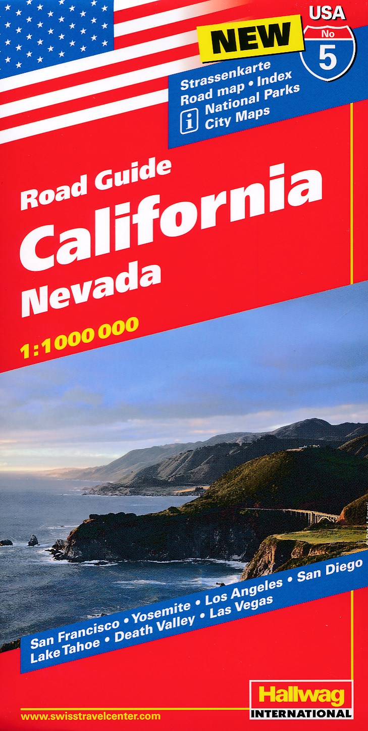
- Wegenkaart - landkaart 05 Californië, California - Nevada | Hallwag
- Hallwag USA Road Guide 05. California 1 : 1 000 000 ab 11.95 EURO Nevada. Straßenkarte. Road map. Index. National Parks. City Maps: San Francisco, Yosemite, Los Angeles, San Diego, Lake Tahoe, Death Valley, Las Vegas Hallwag USA Road Guide. Neuauflage, Laufzeit bis 2022 Read more
De Zwerver
Netherlands
Netherlands
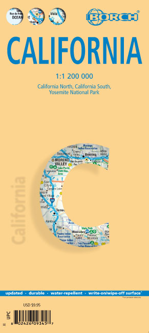
- Wegenkaart - landkaart Californië - California | Borch
- California ( Kalifornien) 1 : 1 200 000 ab 9.9 EURO California North, California South, Yosemite National Park Borch Map. 12. Auflage Read more
De Zwerver
Netherlands
2019
Netherlands
2019
De Zwerver
Netherlands
Netherlands
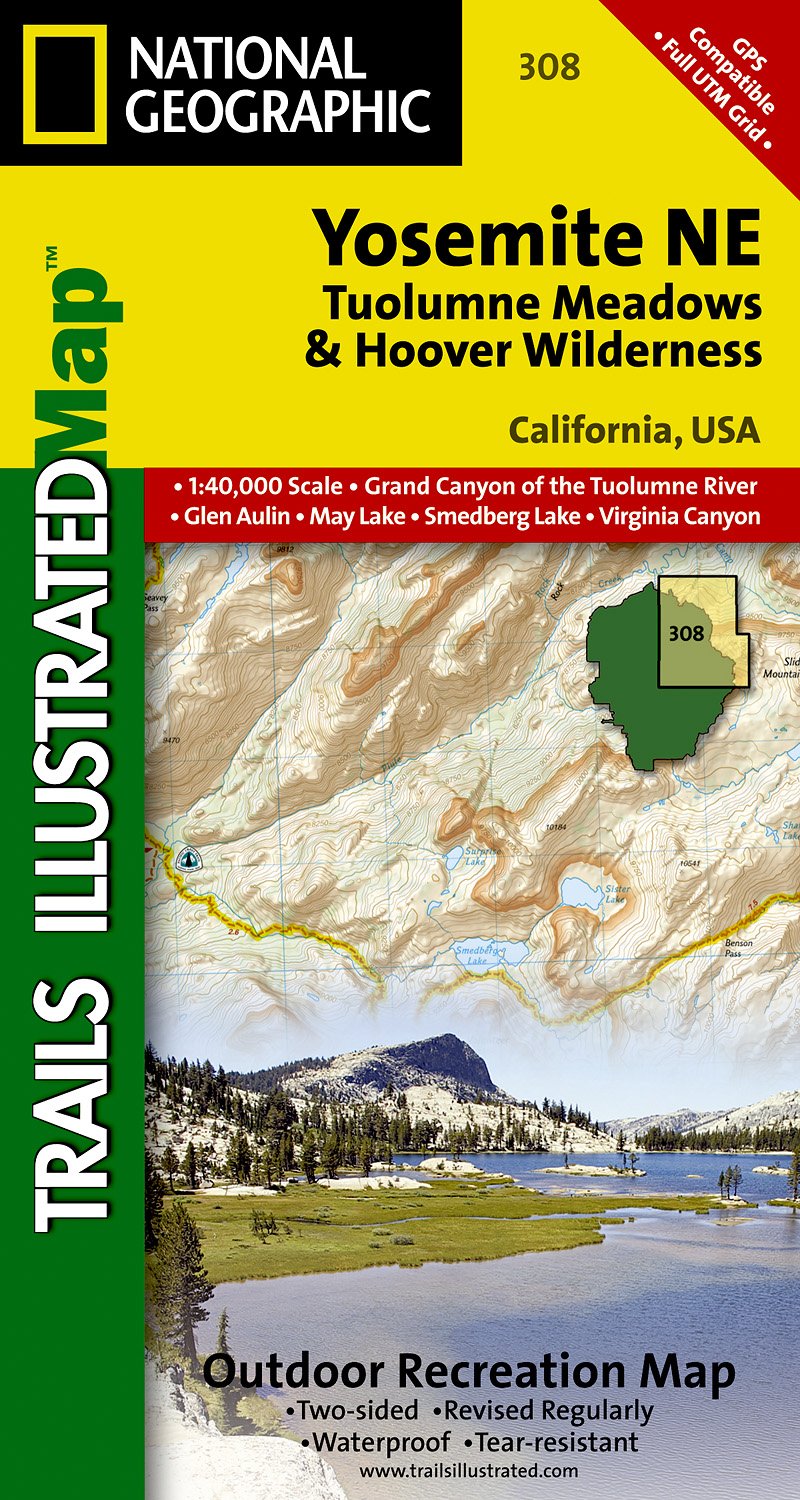
- Wandelkaart - Topografische kaart 308 Yosemite NE - Tuolumne Meadows and Hoover Wilderness | National Geographic
- Prachtige geplastificeerde kaart van het nationaal park. Met alle recreatieve voorzieningen als campsites, maar ook met topografische details en wandelroutes ed. Door uitgekiend kleurgebruik zeer prettig in gebruik. Scheur en watervast! Coverage of the Tuolomne Meadows and Hoover Wilderness area of Yosemite National Park includes Ansel Adams... Read more
- Also available from:
- Stanfords, United Kingdom

Stanfords
United Kingdom
United Kingdom
- Yosemite NE - Tuolumne Meadows & Hoover Wilderness CA
- Map No. 308, Yosemite NE: Tuolumne Meadows and Hoover Wilderness, CA, in an extensive series of GPS compatible, contoured hiking maps of USA’s national and state parks or forests and other popular recreational areas. Cartography based on the national topographic survey, with additional tourist information.The maps, with most titles now printed... Read more

- Also available from:
- De Zwerver, Netherlands
- Stanfords, United Kingdom
- Bol.com, Netherlands
- Bol.com, Belgium
De Zwerver
Netherlands
Netherlands
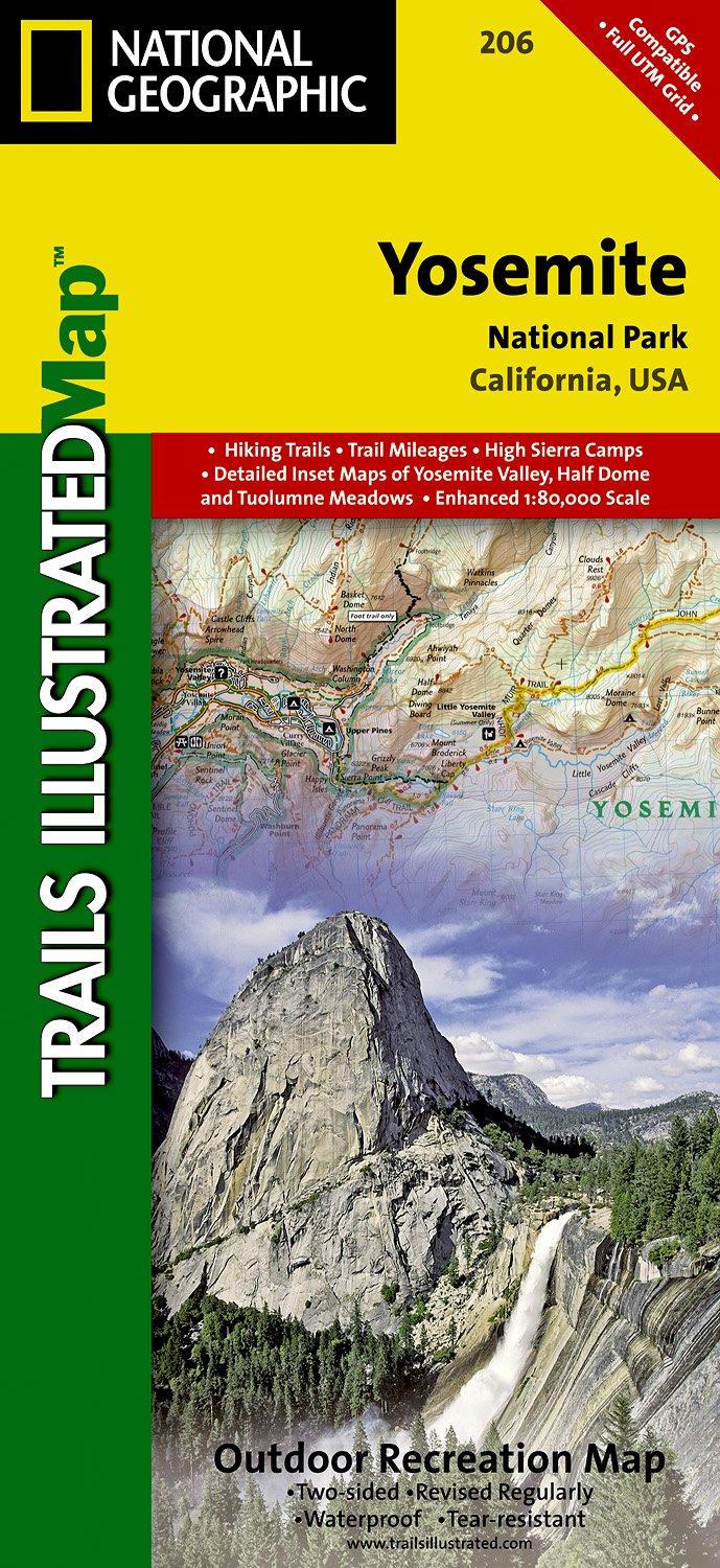
- Wandelkaart - Topografische kaart 206 Yosemite National Park | National Geographic
- Prachtige geplastificeerde kaart van het bekende nationaal park. Met alle recreatieve voorzieningen als campsites, maar ook met topografische details en wandelroutes ed. Door uitgekiend kleurgebruik zeer prettig in gebruik. Scheur en watervast! Coverage includes Stanislaus National Forest, Emigrant Wilderness, Carson Iceberg Wilderness, Toiyabe... Read more

Stanfords
United Kingdom
United Kingdom
- Yosemite National Park CA NGS Trails Illustrated Map 206
- Map No. 206, Yosemite National Park, CA, in an extensive series of GPS compatible, contoured hiking maps of USA’s national and state parks or forests and other popular recreational areas. Cartography based on the national topographic survey, with additional tourist information.The maps, with most titles now printed on light, waterproof and... Read more
Bol.com
Netherlands
Netherlands
- Yosemite National Park
- Waterproof Tear-Resistant Topographic MapExplore the majesty of Yosemite National Park with National Geographic's Trails Illustrated map. Loaded with helpful information on camping, hiking, lodging, transportation, regulations, and safety, this map is an invaluable tool for casual park visitors and avid adventurers alike. Expertly... Read more
Bol.com
Belgium
Belgium
- Yosemite National Park
- Waterproof Tear-Resistant Topographic MapExplore the majesty of Yosemite National Park with National Geographic's Trails Illustrated map. Loaded with helpful information on camping, hiking, lodging, transportation, regulations, and safety, this map is an invaluable tool for casual park visitors and avid adventurers alike. Expertly... Read more

Stanfords
United Kingdom
United Kingdom
- Goat Rocks - Norse Peak William O. Douglas Wilderness Area WA
- Map No. 823, Goat Rocks and Norse Peak Wilderness Area - Gifford-Pinchot and Okanogan-Wenatchee National Forests, WA, in an extensive series of GPS compatible, contoured hiking maps of USA’s national and state parks or forests and other popular recreational areas. Cartography based on the national topographic survey, with additional tourist... Read more
- Also available from:
- Bol.com, Netherlands
- Bol.com, Belgium

Bol.com
Netherlands
Netherlands
- Goat Rocks & Norse Peak Wilderness Area, Gifford-pinchot & Okanogan-wenatchee National Forests
- Waterproof Tear-Resistant Topographic MapGifford-Pinchot and Okanogan-Wenatchee National Forests Washington, USAOne of five new Trails Illustrated maps for the Washington Cascades region offers the most detailed and up-to-date map for the forest, carefully researched and developed in co-operation with local land managers and agencies.... Read more
Bol.com
Belgium
Belgium
- Goat Rocks & Norse Peak Wilderness Area, Gifford-pinchot & Okanogan-wenatchee National Forests
- Waterproof Tear-Resistant Topographic MapGifford-Pinchot and Okanogan-Wenatchee National Forests Washington, USAOne of five new Trails Illustrated maps for the Washington Cascades region offers the most detailed and up-to-date map for the forest, carefully researched and developed in co-operation with local land managers and agencies.... Read more

Stanfords
United Kingdom
United Kingdom
- Alpine Lakes Wilderness - Mt Baker-Snoqualmie and Okanogan-Wenatchee National Forests WA
- Map No. 825, Alpine Lakes Wilderness Area - Mount Baker-Snoqualmie Wilderness Areas and Okanogan-Wenatchee National Forests, WA, in an extensive series of GPS compatible, contoured hiking maps of USA’s national and state parks or forests and other popular recreational areas. Cartography based on the national topographic survey, with additional... Read more
- Also available from:
- Bol.com, Netherlands
- Bol.com, Belgium

Bol.com
Netherlands
Netherlands
- Alpine Lakes Wilderness Area, Mount Baker-snoqualmie & Okanogan-wenatchee National Forests
- Waterproof Tear-Resistant Topographic MapMount Baker-Snoqualmie and Okanogan-Wenatchee National Forests Washington, USAOne of five new Trails Illustrated maps for the Washington Cascades region offering the most detailed and up-to-date map for the forest, carefully researched and developed in co-operation with local land managers and... Read more
Bol.com
Belgium
Belgium
- Alpine Lakes Wilderness Area, Mount Baker-snoqualmie & Okanogan-wenatchee National Forests
- Waterproof Tear-Resistant Topographic MapMount Baker-Snoqualmie and Okanogan-Wenatchee National Forests Washington, USAOne of five new Trails Illustrated maps for the Washington Cascades region offering the most detailed and up-to-date map for the forest, carefully researched and developed in co-operation with local land managers and... Read more

Stanfords
United Kingdom
United Kingdom
- Mount Whitney CA NGS Trails Illustrated Map 322
- Map No. 322, Mount Whitney in California at 1:40,000, in an extensive series of GPS compatible, contoured hiking maps of USA’s national and state parks or forests and other popular recreational areas. Cartography is based on the national topographic survey, with additional tourist information.The maps, with most titles now printed on light,... Read more
- Also available from:
- Bol.com, Netherlands
- Bol.com, Belgium

Bol.com
Netherlands
Netherlands
- Mount Whitney
- Waterproof Tear-Resistant Topographic MapMount Whitney is universally famous as the highest mountain in the United State outside of Alaska, as well as the highest point in California. National Geographic's Trails Illustrated map of Mount Whitney is a two-sided, waterproof map designed to meet the needs of Whitney visitors with unmatched... Read more
Bol.com
Belgium
Belgium
- Mount Whitney
- Waterproof Tear-Resistant Topographic MapMount Whitney is universally famous as the highest mountain in the United State outside of Alaska, as well as the highest point in California. National Geographic's Trails Illustrated map of Mount Whitney is a two-sided, waterproof map designed to meet the needs of Whitney visitors with unmatched... Read more

The Book Depository
United Kingdom
United Kingdom
- Sequoia/kings Canyon National Park
- Trails Illustrated National Parks Read more
- Also available from:
- De Zwerver, Netherlands
- Stanfords, United Kingdom
- Bol.com, Netherlands
- Bol.com, Belgium

De Zwerver
Netherlands
Netherlands
- Wandelkaart - Topografische kaart 205 Sequoia - Kings Canyon National Parks | National Geographic
- Prachtige geplastificeerde kaart van het nationaal park. Met alle recreatieve voorzieningen als campsites, maar ook met topografische details en wandelroutes ed. Door uitgekiend kleurgebruik zeer prettig in gebruik. Scheur en watervast! Trails Illustrated maps are the most trusted and popular recreation maps available. Continually setting the... Read more

Stanfords
United Kingdom
United Kingdom
- Sequoia - Kings Canyon National Parks CA NGS Trails Illustrated Map 205
- Map No. 205, Sequoia/Kings Canyon National Park, CA, in an extensive series of GPS compatible, contoured hiking maps of USA’s national and state parks or forests and other popular recreational areas. Cartography based on the national topographic survey, with additional tourist information.The maps, with most titles now printed on light,... Read more

Bol.com
Netherlands
Netherlands
- Sequoia/kings Canyon National Park
- Waterproof Tear-Resistant Topographic MapIn Sequioa and Kings Canyon National Parks you can walk among the world's largest trees, hike the alpine landscape of the Sierra Crest, and marvel at the towering granite cliffs of one of the deepest canyons in the United States. National Geographic's Trails Illustrated map of Sequoia and Kings... Read more
Bol.com
Belgium
Belgium
- Sequoia/kings Canyon National Park
- Waterproof Tear-Resistant Topographic MapIn Sequioa and Kings Canyon National Parks you can walk among the world's largest trees, hike the alpine landscape of the Sierra Crest, and marvel at the towering granite cliffs of one of the deepest canyons in the United States. National Geographic's Trails Illustrated map of Sequoia and Kings... Read more

De Zwerver
Netherlands
Netherlands
- Wandelkaart - Topografische kaart 809 Mammoth Lakes - Mono Divide - Inyo and Sierra National Forests | National Geographic
- Prachtige geplastificeerde kaart van het bekende nationaal park. Met alle recreatieve voorzieningen als campsites, maar ook met topografische details en wandelroutes ed. Door uitgekiend kleurgebruik zeer prettig in gebruik. Scheur en watervast! Trails Illustrated Mammoth Lakes / Mono Divide is the first of five exciting new maps for the... Read more
- Also available from:
- Stanfords, United Kingdom
- Bol.com, Netherlands
- Bol.com, Belgium

Stanfords
United Kingdom
United Kingdom
- Mammoth Lakes - Mono Divide CA
- Map No. 809, Mammoth Lakes / Mono Divide, CA, in an extensive series of GPS compatible, contoured hiking maps of USA’s national and state parks or forests and other popular recreational areas. Cartography based on the national topographic survey, with additional tourist information.The maps, with most titles now printed on light, waterproof and... Read more

Bol.com
Netherlands
Netherlands
- Mammoth Lakes/mono Divide
- Waterproof Tear-Resistant Topographic MapTrails Illustrated Mammoth Lakes / Mono Divide is the first of five exciting new maps for the California Sierra Nevadas that will combine to form seamless coverage of the high-use National Forest areas between Sequoia / Kings Canyon National Parks and Lake Tahoe. This region contains some of the... Read more
Bol.com
Belgium
Belgium
- Mammoth Lakes/mono Divide
- Waterproof Tear-Resistant Topographic MapTrails Illustrated Mammoth Lakes / Mono Divide is the first of five exciting new maps for the California Sierra Nevadas that will combine to form seamless coverage of the high-use National Forest areas between Sequoia / Kings Canyon National Parks and Lake Tahoe. This region contains some of the... Read more

Stanfords
United Kingdom
United Kingdom
- Carson-Iceberg - Emigrant and Mokleumne Wilderness Areas CA
- Map No. 807, Carson-Iceberg / Emigrant / Mokleumne Wilderness Areas, CA, in an extensive series of GPS compatible, contoured hiking maps of USA’s national and state parks or forests and other popular recreational areas. Cartography based on the national topographic survey, with additional tourist information.The maps, with most titles now... Read more
- Also available from:
- Bol.com, Netherlands
- Bol.com, Belgium

Bol.com
Netherlands
Netherlands
- Carson-iceberg/emigrant/mokleumne Wilderness Areas
- Waterproof Tear-Resistant Topographic MapPart of our exciting new coverage for California's Sierra Nevada, our Carson-Iceberg, Emigrant and Mokelumne Wilderness Trails Illustrated map details the high use recreation areas of Stanislaus and Humboldt-Toiyabe National Forests from Yosemite National Park north to Caples Lake and Markleeville.... Read more
Bol.com
Belgium
Belgium
- Carson-iceberg/emigrant/mokleumne Wilderness Areas
- Waterproof Tear-Resistant Topographic MapPart of our exciting new coverage for California's Sierra Nevada, our Carson-Iceberg, Emigrant and Mokelumne Wilderness Trails Illustrated map details the high use recreation areas of Stanislaus and Humboldt-Toiyabe National Forests from Yosemite National Park north to Caples Lake and Markleeville.... Read more