
Georgia
Beschreibung
The north of Georgia is mountainous. The Appalachian Trail starts here. Also, the Benton Mackaye Trail has 75 miles in the Chattahooche National Forest in the north, before it enters the state of Tennessee.
Georgia shares the 250 mile Pinhote Trail with Alabama.
Three long distance trails (will) run through Georgia. The Eastern Continental Trail, The East Coast Greenway and the Great Eastern Trail.
Karte

Wanderwege Landesteil
Links
Fakten
Berichte
Führer und Karten
Übernachtung
Organisationen
Reisebüros
GPS
Sonstiges
Bücher

The Book Depository
United Kingdom
United Kingdom
- The World We Left Behind Book Two
- A Journey From Georgia To Maine Read more

The Book Depository
United Kingdom
2020
United Kingdom
2020
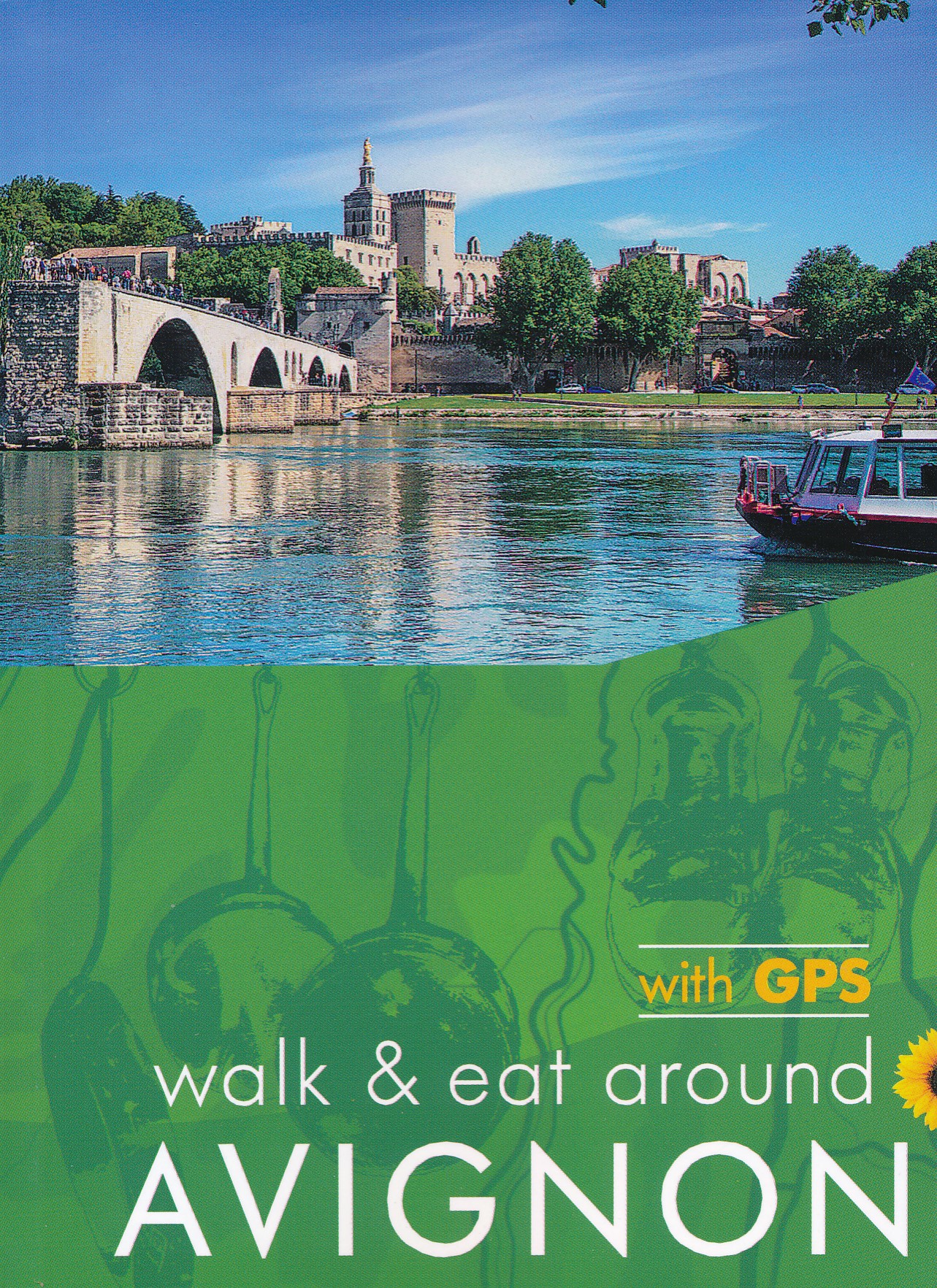
- Avignon Walk and Eat Sunflower Guide
- Walks, restaurants and recipes Read more
- Also available from:
- De Zwerver, Netherlands
- Stanfords, United Kingdom
De Zwerver
Netherlands
2020
Netherlands
2020
- Wandelgids Walk & Eat Avignon | Sunflower books
- Travel by TGV to Avignon (`city of the Popes`), then get around by local transport. This guide describes walks and restaurants in the surrounding area, from the Roman cities and sites of Nimes, Arles, Pont du Gard and St-Remy to the `must-see` villages of Gordes, Les Baux and Barbentane and the gorgeous countryside of the Alpilles mountain chain. Read more

Stanfords
United Kingdom
2020
United Kingdom
2020
- Avignon - Walk & Eat
- This pocket-sized full-colour guide is designed for short-break holidays to Provence using fast train services (or flights). It describes easy city and countryside walks, and recommends restaurants en route (with sample menus).From the Roman cities and sites of Nimes, Arles, Pont du Gard and St-Remy to the `must-see` villages of Gordes, Les... Read more


The Book Depository
United Kingdom
United Kingdom
- Moon Tokyo Walks (First Edition)
- See the City Like a Local Read more
- Also available from:
- Stanfords, United Kingdom

Stanfords
United Kingdom
United Kingdom
- Moon Tokyo Walks - First Edition: See the City Like a Local
- Experience Tokyo like a local: on foot! Stroll through the city and soak up its infectious energy, futuristic charm, and centuries of Japanese art and culture with `Moon Tokyo Walks`.- Walk through the city`s coolest neighbourhoods, including Shibuya, Harajuku, Shinjuku, Ginza, and more with colour-coded stops and turn-by-turn directions- Find... Read more

- Also available from:
- De Zwerver, Netherlands
- Stanfords, United Kingdom
De Zwerver
Netherlands
2011
Netherlands
2011
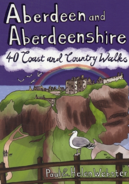
- Wandelgids Weekend Walks Aberdeen and Aberdeenshire | Pocket Mountains
- Aberdeenshire has a stunning coastline with vast, spectacular sandy beaches and picturesque fishing villages. Inland is fertile, peaceful farmland rising to the moors and finally the foothills of the Cairngorms. Its beating heart is the thriving city of Aberdeen. We help you find the best walking routes in all parts of Aberdeenshire, from the... Read more

Stanfords
United Kingdom
2011
United Kingdom
2011
- Aberdeen and Aberdeenshire
- Aberdeenshire has a stunning coastline with vast, spectacular sandy beaches and picturesque fishing villages. Inland is fertile, peaceful farmland rising to the moors and finally the foothills of the Cairngorms. Its beating heart is the thriving city of Aberdeen. We help you find the best walking routes in all parts of Aberdeenshire, from the... Read more

The Book Depository
United Kingdom
2019
United Kingdom
2019
- Walking in County Durham
- 40 walking routes exploring Pennine moors, river valleys and coastal paths Read more
- Also available from:
- Stanfords, United Kingdom

Stanfords
United Kingdom
2019
United Kingdom
2019
- Walking in County Durham: 40 walking routes exploring Pennine moors, river valleys and coastal paths
- This guidebook contains 40 routes exploring all parts of County Durham. Ranging from 5 to 24km in length, the walks encompass wild moorland, rolling pastures, riverbanks and the low cliff coast. With such a range of possibilities, there are walks here for all abilities, from easy wanders to more challenging days in the hills.Roman forts,... Read more
The Book Depository
United Kingdom
2020
United Kingdom
2020
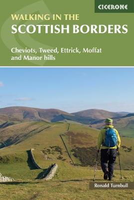
- Walking in the Scottish Borders
- Cheviots, Tweed, Ettrick, Moffat and Manor hills Read more
- Also available from:
- De Zwerver, Netherlands
- Stanfords, United Kingdom
De Zwerver
Netherlands
2020
Netherlands
2020
- Wandelgids Walking in the Scottish Borders | Cicerone
- This guidebook provides 45 day walks in the Scottish Borders. Separated into six sections, these walks are divided between the north and south Cheviots, Tweed, Ettrick, Moffat and Manor hills and feature main centres including Wooler, Kelso, Melrose, Peebles and Moffat. The guide`s seventh section outlines long distance routes, including a... Read more

Stanfords
United Kingdom
2020
United Kingdom
2020
- Walking in the Scottish Borders: Cheviots, Tweed, Ettrick, Moffat and Manor hills
- This guidebook provides 45 day walks in the Scottish Borders. Separated into six sections, these walks are divided between the north and south Cheviots, Tweed, Ettrick, Moffat and Manor hills and feature main centres including Wooler, Kelso, Melrose, Peebles and Moffat. The guide`s seventh section outlines long distance routes, including a... Read more


The Book Depository
United Kingdom
United Kingdom
- Adventurous Soul: Volume 8
- Empowering Words of Wisdom & Stories from Women Who Get Outside Read more


The Book Depository
United Kingdom
2019
United Kingdom
2019
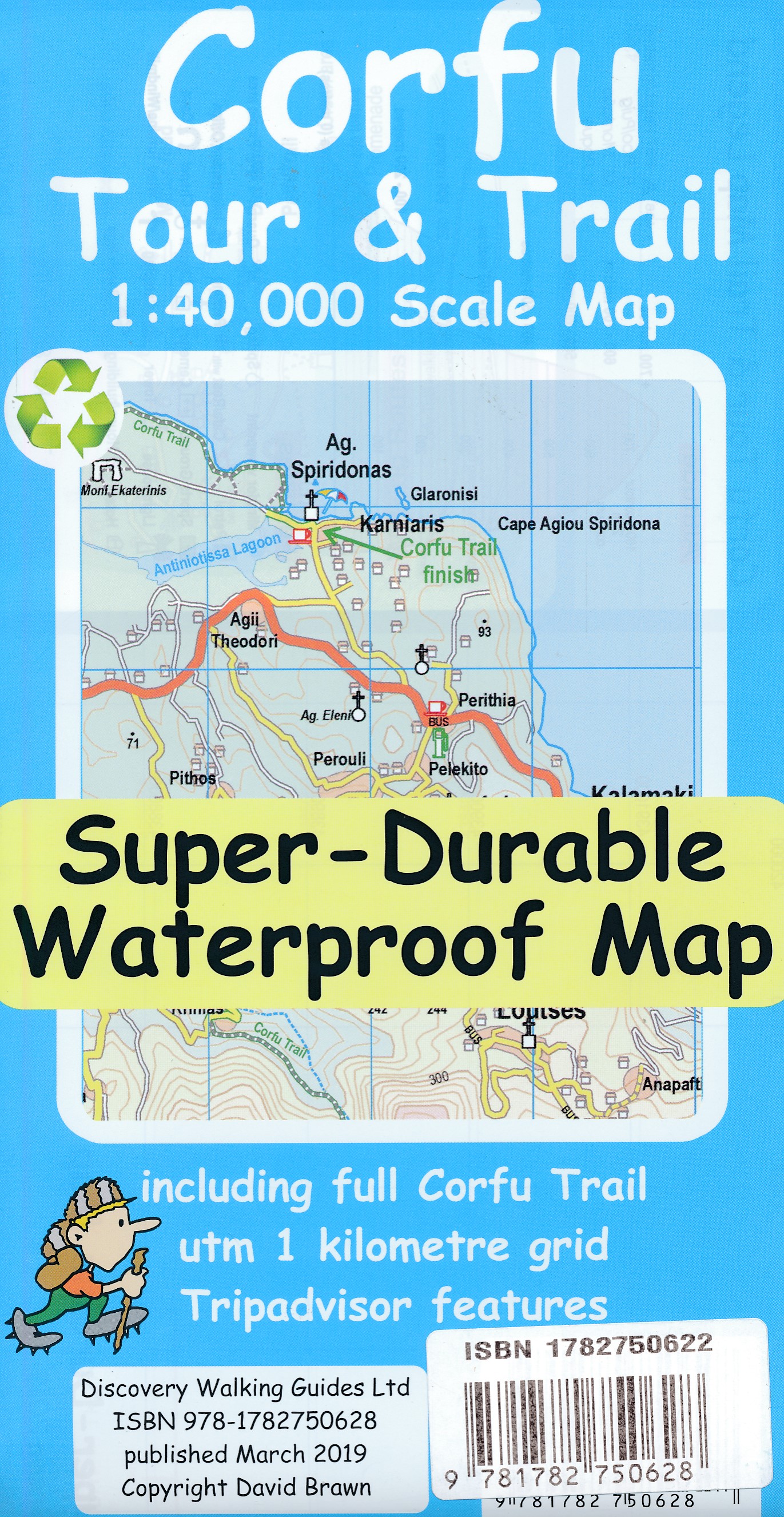
- Corfu Tour & Trail Super-Durable Map
- For better adventures, use the best map. Corfu Tour & Trail Super-Durable Map is the most detailed, accurate, toughest, large scale map of the island that you can buy. Our large 1:40,000 scale produces a double sided map sheet of 840mm by 680mm; big enough to show masses of detail but compact enough to use in the car or on the trail. Corfu... Read more
- Also available from:
- De Zwerver, Netherlands
De Zwerver
Netherlands
2019
Netherlands
2019
- Wandelkaart Tour & Trail Corfu - Korfoe | Discovery Walking Guides
- For better adventures, use the best map. Corfu Tour & Trail Super-Durable Map is the most detailed, accurate, toughest, large scale map of the island that you can buy. Our large 1:40,000 scale produces a double sided map sheet of 840mm by 680mm; big enough to show masses of detail but compact enough to use in the car or on the trail. Corfu... Read more


The Book Depository
United Kingdom
United Kingdom
- Brother Blood on the Appalachian Trail
- Thru & Through: An Appalachian Trail Journey Read more

- Also available from:
- De Zwerver, Netherlands
- Stanfords, United Kingdom
De Zwerver
Netherlands
2017
Netherlands
2017
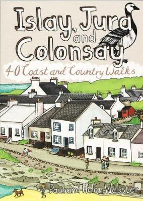
- Wandelgids Islay, Jura and Colonsay | Pocket Mountains
- 40 Coast and Country Walks Read more

Stanfords
United Kingdom
2017
United Kingdom
2017
- Islay, Jura and Colonsay: 40 Coast and Country Walks
- Islay, Jura and Colonsay make up the southerly Hebridean island group and are famed for their outstanding wildlife, glorious sandy beaches, fascinating historical treasures, rugged hills and dramatic coastlines, and on Jura, but especially on Islay - legendary distilleries which produce distinctively peaty whisky. This book aims to help you get... Read more
Karten

- Also available from:
- De Zwerver, Netherlands
- Stanfords, United Kingdom


Stanfords
United Kingdom
United Kingdom
- Glocknergruppe - Matrei - Kals - Heiligenblut Tabacco 076
- This Tabacco topographic map at 1:25,000 (1cm = 250m) covers the Alta Via routes, as well as the Via Ferrata where you get further than the ordinary walker with the help of steel ladders. Additional information includes: symbols to indicate 6 different types of accommodation from mountain hut, hotel to camping site. As well as information on... Read more

The Book Depository
United Kingdom
2018
United Kingdom
2018
- Ben Nevis and Glen Coe
- Waterproof mountain map of Ben Nevis & Glen Coe from Harvey at 1:40,000, with a geological map of the region on the reverse, an enlargement of Ben Nevis' summit, and advice on navigating the region safely.MAIN MAP: Topography is shown through clear altitude shading, spot heights, contours at 15m intervals, and index contours at 75m intervals. A... Read more
- Also available from:
- De Zwerver, Netherlands
- Stanfords, United Kingdom

De Zwerver
Netherlands
2018
Netherlands
2018
- Wandelkaart Ben Nevis & Glen Coe | Harvey Maps
- Waterproof mountain map of Ben Nevis & Glen Coe from Harvey at 1:40,000, with a geological map of the region on the reverse, an enlargement of Ben Nevis' summit, and advice on navigating the region safely.MAIN MAP: Topography is shown through clear altitude shading, spot heights, contours at 15m intervals, and index contours at 75m intervals. A... Read more

Stanfords
United Kingdom
2018
United Kingdom
2018
- Ben Nevis & Glen Coe Harvey British Mountain Map XT40
- Waterproof mountain map of Ben Nevis & Glen Coe from Harvey at 1:40,000, with a geological map of the region on the reverse, an enlargement of Ben Nevis` summit, and advice on navigating the region safely.*MAIN MAP:* Topography is shown through clear altitude shading, spot heights, contours at 15m intervals, and index contours at 75m intervals.... Read more

- Also available from:
- De Zwerver, Netherlands
- Stanfords, United Kingdom
De Zwerver
Netherlands
Netherlands

Stanfords
United Kingdom
United Kingdom
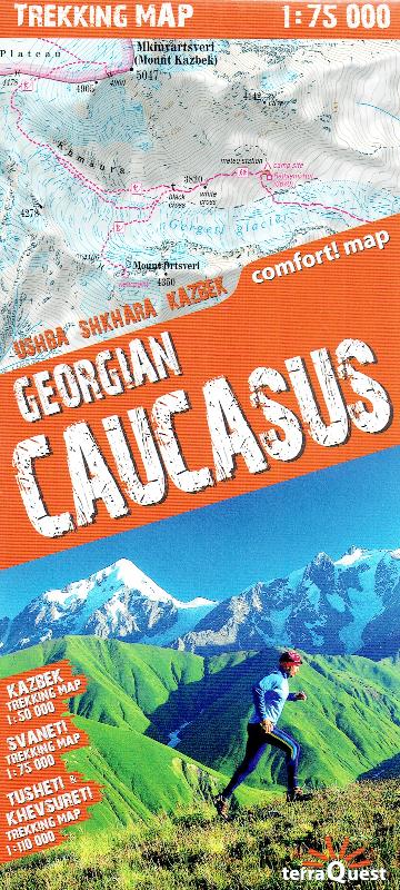
- Georgian Caucasus - Mt Ushba - Shkhara - Kazbek terraQuest Trekking Map
- The Caucasus Mountains in Georgia presented on a durable, waterproof and tear-resistant map from terraQuest, with two separate panels covering the central part including the peaks of Ushba and Shkhara with the Svaneti Range, plus the eastern region from Mount Kazbek to the Tusheti National Park.On one side a map at 1:75,000 presents the central... Read more

De Zwerver
Netherlands
2019
Netherlands
2019
- Reisgids Iceland Road Guide | Vegahandbokin
- Iceland Road Guide from Vegahandbókin, an exceptionally comprehensive, 605-page guide with region-by-region descriptions of sites accompanied by road maps and street plans, plus a separate road atlas section covering the whole country at 1:500,000 and information on a wide variety of tourism relating topics to help the user get the best of... Read more
- Also available from:
- Stanfords, United Kingdom

Stanfords
United Kingdom
2019
United Kingdom
2019
- Iceland Road Guide
- Iceland Road Guide from Vegahandbókin, an exceptionally comprehensive, 605-page guide with region-by-region descriptions of sites accompanied by road maps and street plans, plus a separate road atlas section covering the whole country at 1:500,000 and information on a wide variety of tourism relating topics to help the user get the best of... Read more
De Zwerver
Netherlands
Netherlands
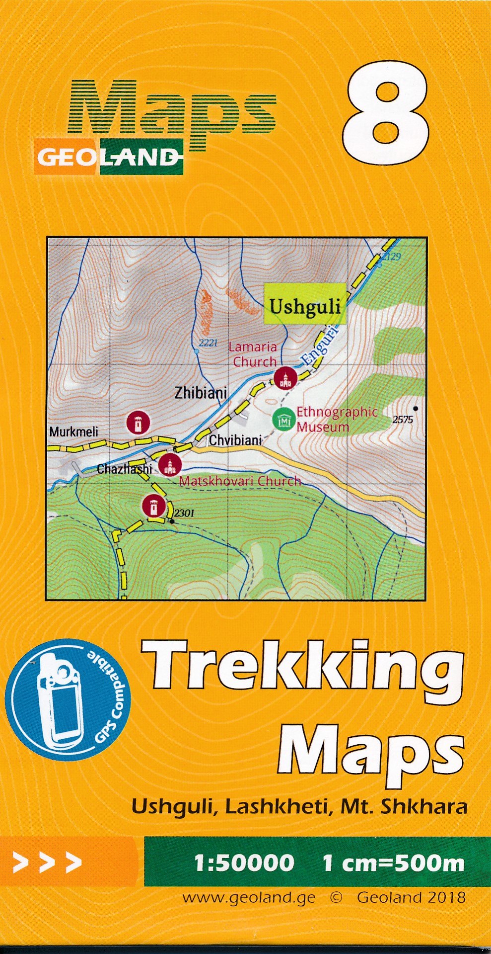
- Wandelkaart - Topografische kaart 08 Ushguli - Lashkheti - Mt. Shkhara | Geoland
- Ushguli - Lashkheti - Mt.Shkhara area of the Caucasus Mountains in Georgia at 1:50,000 on a double-sided, contoured and GPS compatible map from Geoplan, with an overprint providing tourist information including local accommodation and sights.Maps in this series have contours at 20m intervals, with additional relief shading and numerous spot... Read more
- Also available from:
- Stanfords, United Kingdom

Stanfords
United Kingdom
United Kingdom
- Ushguli - Lashkheti - Mt.Shkhara Geoland 8
- Ushguli - Lashkheti - Mt.Shkhara area of the Caucasus Mountains in Georgia at 1:50,000 on a double-sided, contoured and GPS compatible map from Geoplan, with an overprint providing tourist information including local accommodation and sights.Maps in this series have contours at 20m intervals, with additional relief shading and numerous spot... Read more

De Zwerver
Netherlands
Netherlands
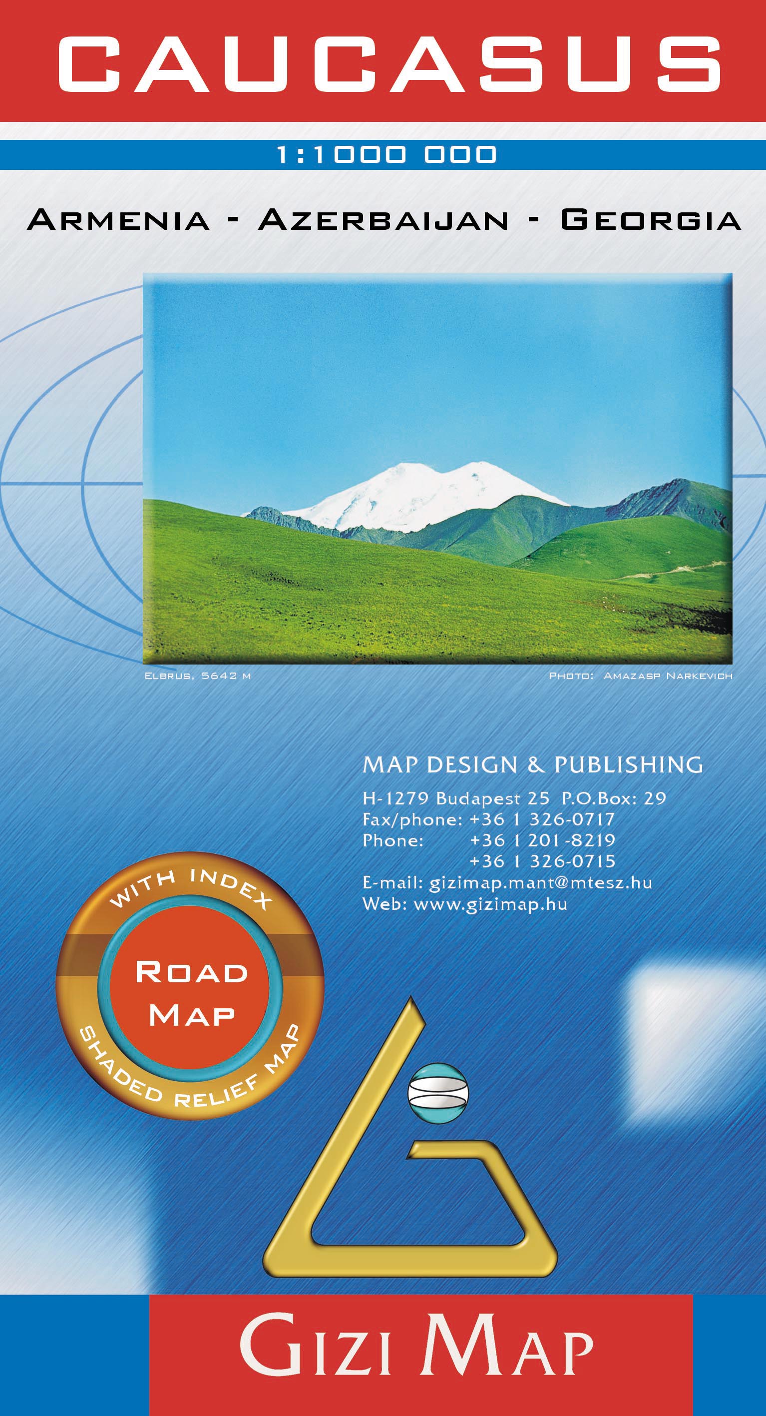
- Wegenkaart - landkaart Kaukasus - Caucasus | Gizi Map
- Caucasus Road Map 1 : 1 000 000 ab 11.95 EURO Armenia, Georgia, Azerbaijan Gizi Map. new edition Read more
De Zwerver
Netherlands
Netherlands
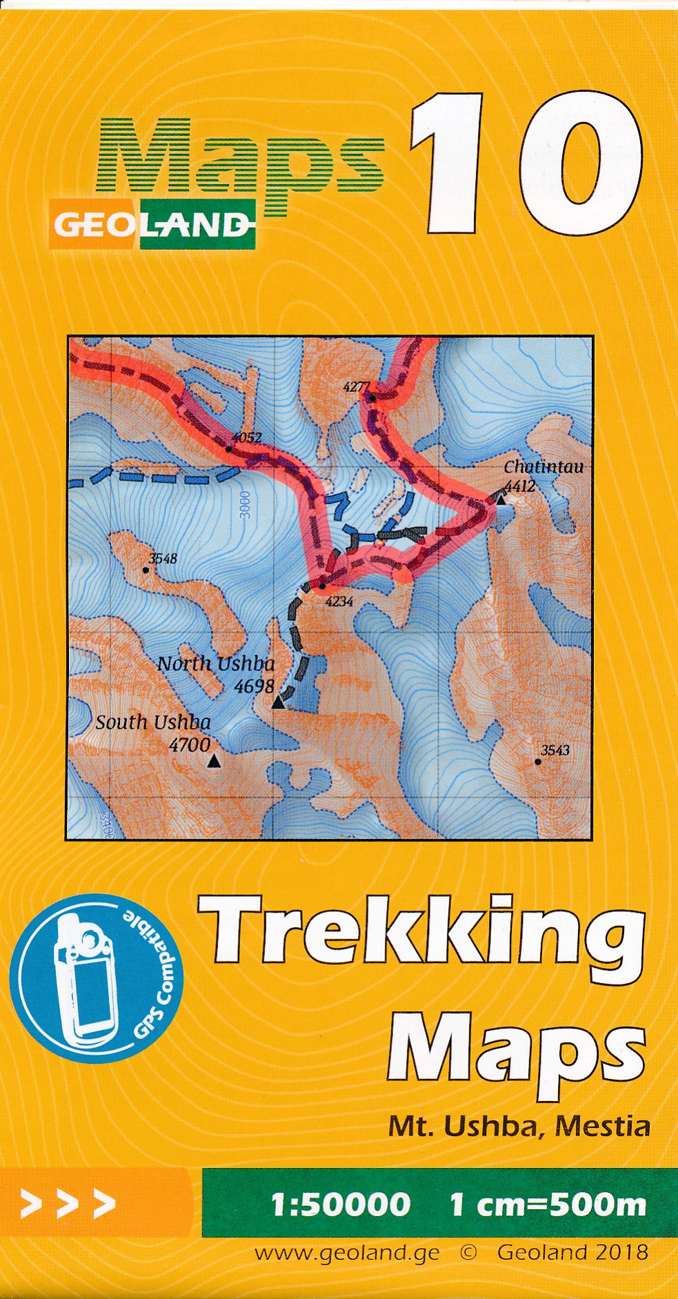
- Wandelkaart - Topografische kaart 10 Mt. Ushba - Mestia | Geoland
- Mt Ushba - Mestia area of the Caucasus Mountains in Georgia at 1:50,000 on a double-sided, contoured and GPS compatible map from Geoplan, with an overprint providing tourist information including local accommodation and sights. This is the PAPER edition of the map, which is also available in a waterproof and tear-resistant version.Maps in this... Read more
- Also available from:
- Stanfords, United Kingdom

Stanfords
United Kingdom
United Kingdom
- Mt Ushba - Mestia Geoland 10
- Mt Ushba - Mestia area of the Caucasus Mountains in Georgia at 1:50,000 on a double-sided, contoured and GPS compatible map from Geoplan, with an overprint providing tourist information including local accommodation and sights. This is the PAPER edition of the map, which is also available in a waterproof and tear-resistant version.Maps in this... Read more
De Zwerver
Netherlands
Netherlands
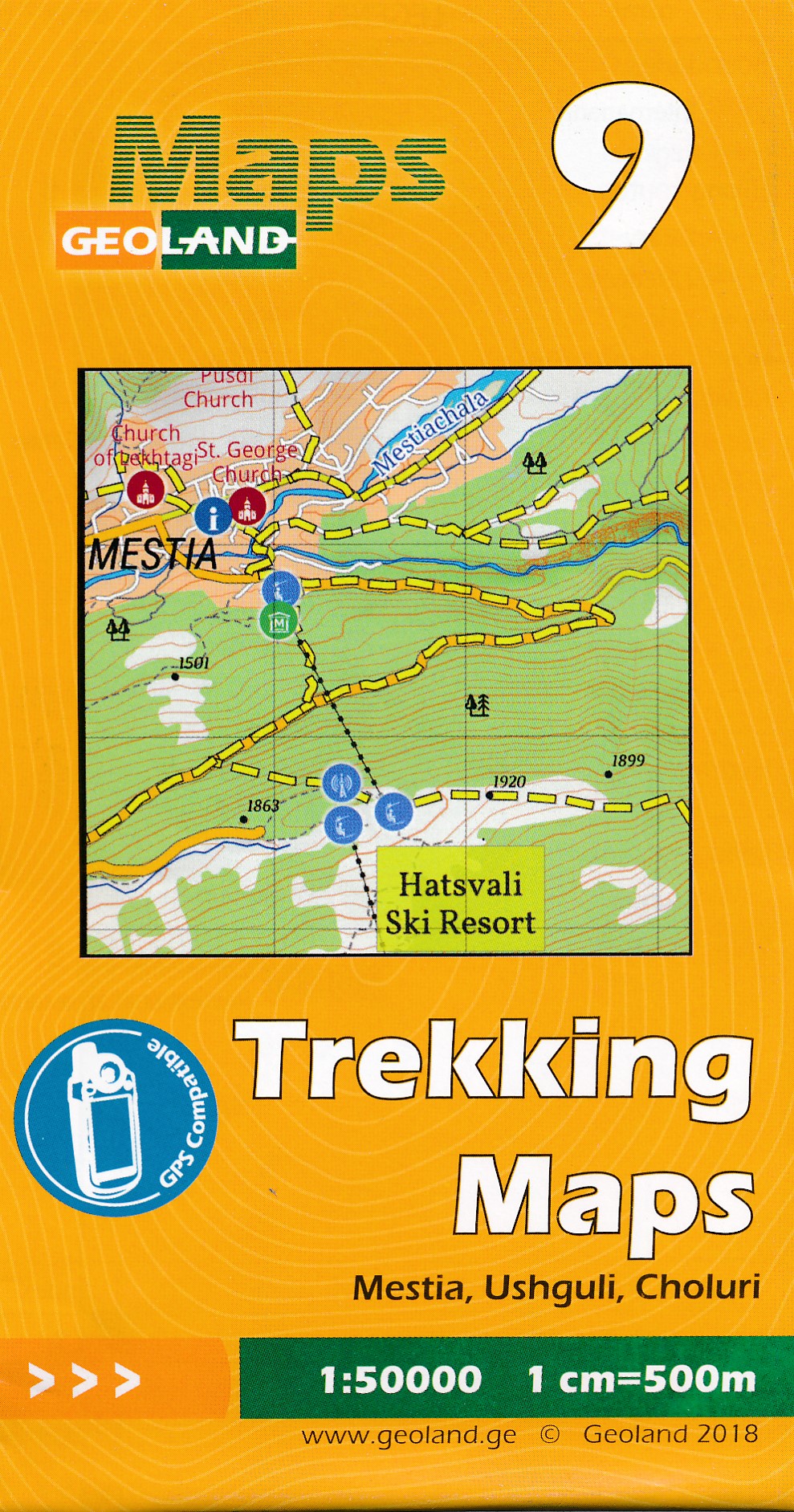
- Wandelkaart - Topografische kaart 09 Mestia - Ushguli - Choluri | Geoland
- Mestia - Ushguli - Lashkheti area of the Caucasus Mountains in Georgia at 1:50,000 on a double-sided, contoured and GPS compatible map from Geoplan, with an overprint providing tourist information including local accommodation and sights. This is the PAPER edition of the map, which is also available in a waterproof and tear-resistant... Read more
- Also available from:
- Stanfords, United Kingdom

Stanfords
United Kingdom
United Kingdom
- Mestia - Ushguli - Lashkheti Geoland 9
- Mestia - Ushguli - Lashkheti area of the Caucasus Mountains in Georgia at 1:50,000 on a double-sided, contoured and GPS compatible map from Geoplan, with an overprint providing tourist information including local accommodation and sights. This is the PAPER edition of the map, which is also available in a waterproof and tear-resistant... Read more
De Zwerver
Netherlands
Netherlands
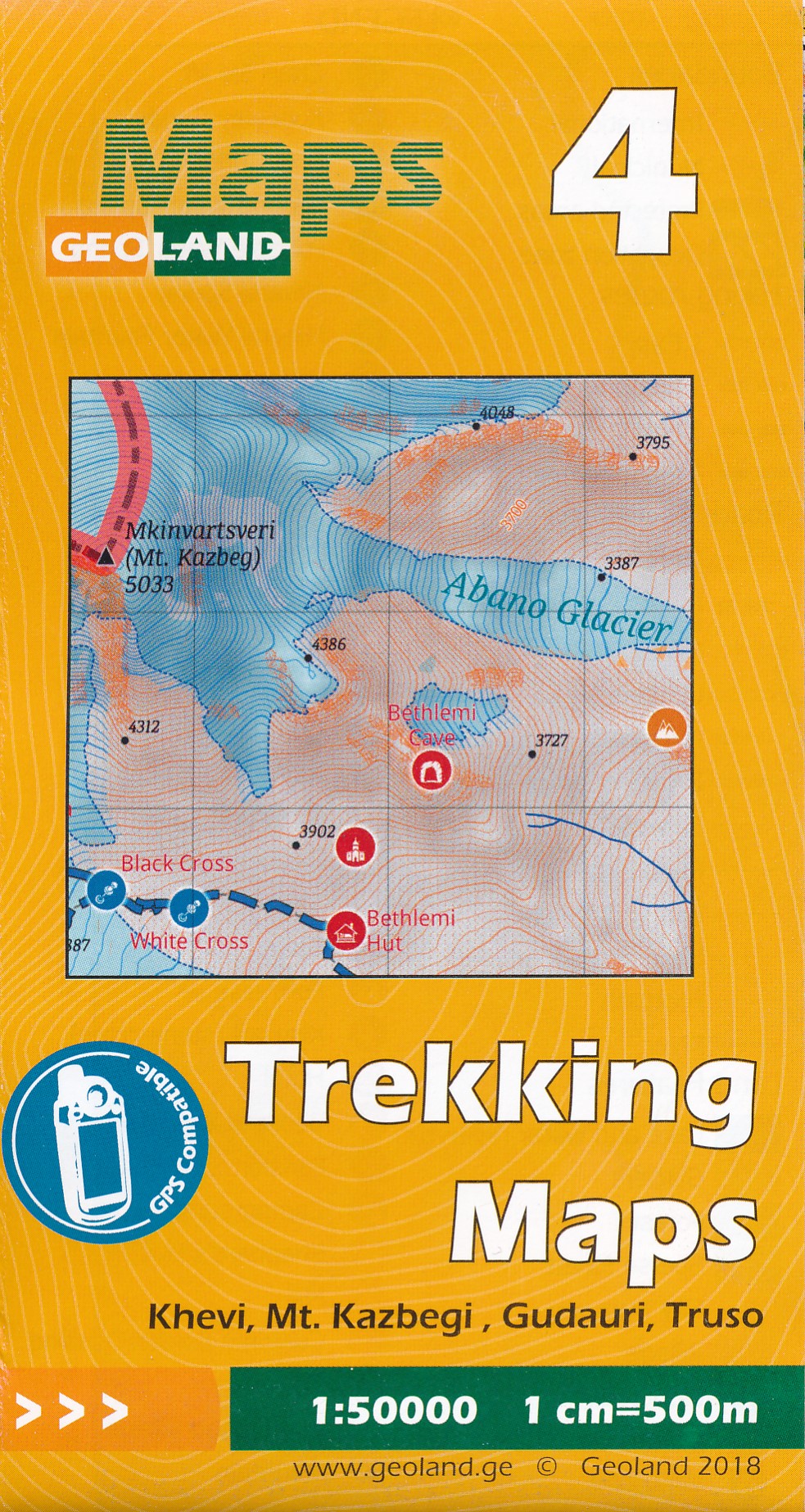
- Wandelkaart - Topografische kaart 04 Khevi - Mt. Kazbegi - Gudauri - Truso | Geoland
- Khevi - Mt. Kazbegi - Gudauri - Truso area of the Caucasus Mountains in Georgia at 1:50,000 on a double-sided, contoured and GPS compatible map from Geoplan, with an overprint providing tourist information including local accommodation and sights. This is the PAPER edition of the map, which is also available in a waterproof and tear-resistant... Read more
- Also available from:
- Stanfords, United Kingdom

Stanfords
United Kingdom
United Kingdom
- Khevi - Mt. Kazbegi - Gudauri - Truso Geoland 4
- Khevi - Mt. Kazbegi - Gudauri - Truso area of the Caucasus Mountains in Georgia at 1:50,000 on a double-sided, contoured and GPS compatible map from Geoplan, with an overprint providing tourist information including local accommodation and sights. This is the PAPER edition of the map, which is also available in a waterproof and tear-resistant... Read more
De Zwerver
Netherlands
Netherlands
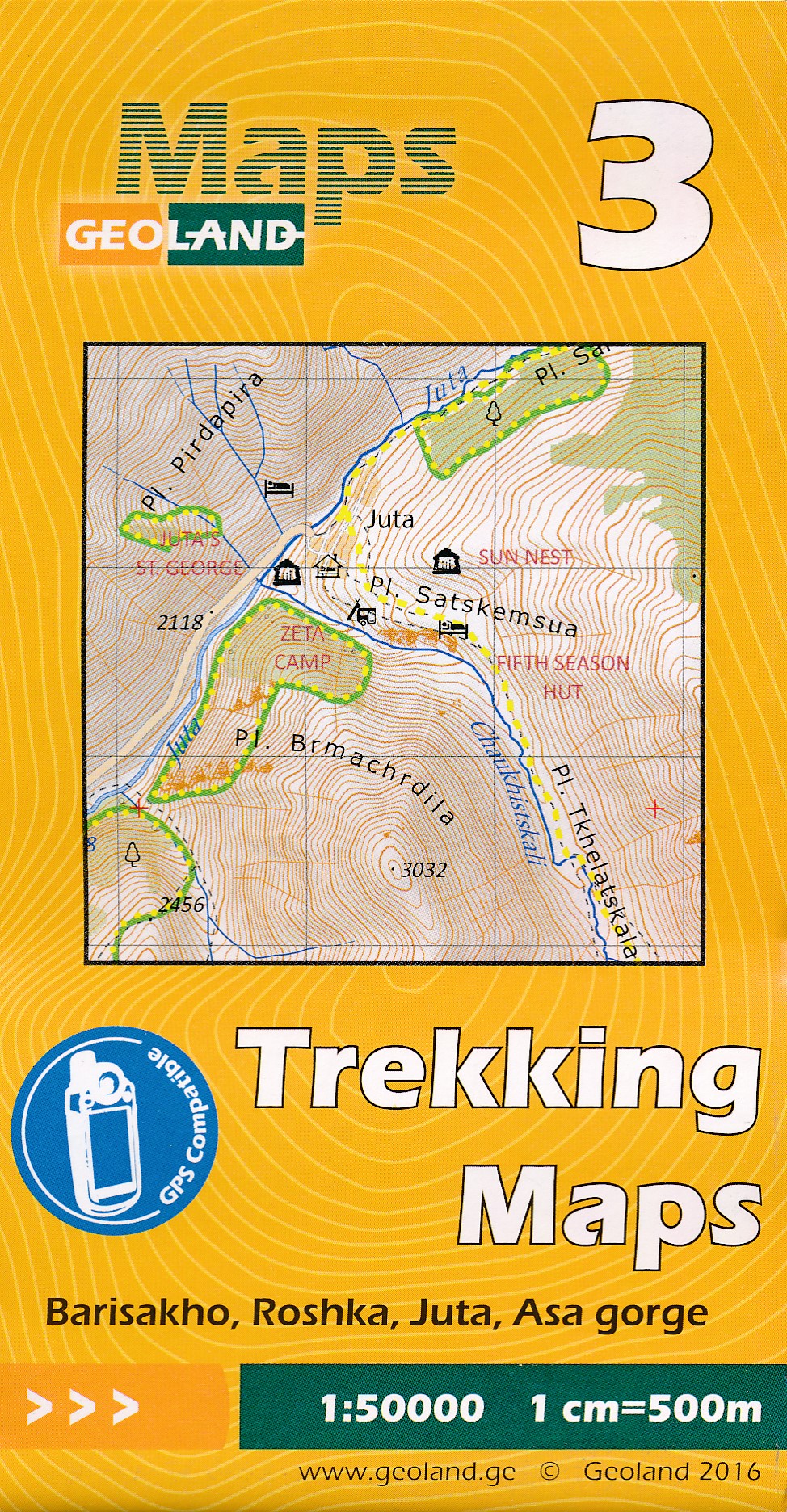
- Wandelkaart - Topografische kaart 03 Barisakho - Roshka - Juta - Asa Gorge | Geoland
- Barisakho - Roshka - Juta - Asa Gorge area of the Caucasus Mountains in Georgia at 1:50,000 on a double-sided, contoured and GPS compatible map from Geoplan, with an overprint providing tourist information including local accommodation and sights. This is the PAPER edition of the map, which is also available in a waterproof and tear-resistant... Read more
- Also available from:
- Stanfords, United Kingdom

Stanfords
United Kingdom
United Kingdom
- Barisakho - Roshka - Juta - Asa Gorge Geoland 3
- Barisakho - Roshka - Juta - Asa Gorge area of the Caucasus Mountains in Georgia at 1:50,000 on a double-sided, contoured and GPS compatible map from Geoplan, with an overprint providing tourist information including local accommodation and sights. This is the PAPER edition of the map, which is also available in a waterproof and tear-resistant... Read more

Stanfords
United Kingdom
United Kingdom
- Admiralty Chart SLB102 - Solomon Islands, Plans in the New Georgia Group
- NEW EDITION OUT ON 19/03/2020Plans included:Gizo Harbour and Approaches 1:25,000Ringgi Cove 1:15,000Port Noro 1:20,000Blackett Strait 1:50,000Lever Harbour 1:7,500Admiralty standard nautical charts comply with Safety of Life at Sea (SOLAS) regulations and are ideal for professional, commercial and recreational use. Charts within the series... Read more