
New Jersey
Beschreibung
New Jersey borders on the Atlantic. This state is very populated. Hiking is best in the mountainous northern part, with several state parks and forests. Here are 72 miles of the Appalachian Trail.
The Highlands Trail is supposed to connect New Jersey to New York, Pennsylvania and Connecticut, 150 miles.
Another important trail is the Long Path, 326 miles, also in the state of New York.
The Great Eastern Trail, East Coast Greenway and Eastern Continental Trail run through New Jersey.
Karte

Wanderwege Landesteil
Links
Fakten
Berichte
Führer und Karten
Übernachtung
Organisationen
Reisebüros
GPS
Sonstiges
Bücher

The Book Depository
United Kingdom
United Kingdom
- I Hate Running and You Can Too
- How to Get Started, Keep Going, and Make Sense of an Irrational Passion Read more

The Book Depository
United Kingdom
United Kingdom
- Cheshire Year Round Walks
- These 20 circular walks vary in length from 3 1/2 to 7 1/2 miles and are enjoyable all year the round. The author has divided the routes into seasons to show each at its very best. In spring, Macclesfield Forest is dotted with heron`s nests and the woods near Dutton are a sea of bluebells. On a summer`s day you can spot seals near Hilbre... Read more
- Also available from:
- Stanfords, United Kingdom

Stanfords
United Kingdom
United Kingdom
- Cheshire Year Round Walks
- These 20 circular walks vary in length from 3 1/2 to 7 1/2 miles and are enjoyable all year the round. The author has divided the routes into seasons to show each at its very best. In spring, Macclesfield Forest is dotted with heron`s nests and the woods near Dutton are a sea of bluebells. On a summer`s day you can spot seals near Hilbre... Read more

The Book Depository
United Kingdom
United Kingdom
- Explorer's Guide 50 Hikes in Eastern Pennsylvania
- From the Mason-Dixon Line to the Poconos and North Mountain Read more

- Also available from:
- Stanfords, United Kingdom

Stanfords
United Kingdom
United Kingdom
- The Manhattan Nobody Knows: An Urban Walking Guide
- A unique walking guide to Manhattan, from the author of `The New York Nobody Knows`Bill Helmreich walked every block of New York City--six-thousand miles in all--to write the award-winning `The New York Nobody Knows`. Now he has re-walked most of Manhattan--721 miles--to write this new, one-of-a-kind walking guide to the heart of one of the... Read more


The Book Depository
United Kingdom
2020
United Kingdom
2020
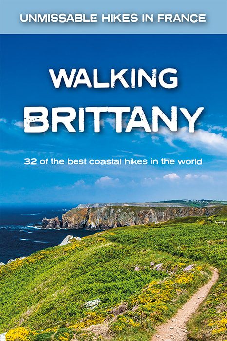
- Walking Brittany
- 32 of the best coastal hikes in the world Read more
- Also available from:
- De Zwerver, Netherlands
- Stanfords, United Kingdom
De Zwerver
Netherlands
2020
Netherlands
2020
- Wandelgids Walking Brittany - Bretagne | Knife Edge Outdoor
- Real IGN Maps included (1:25,000): no need to carry separate maps.32 epic walks along the wild and beautiful coast of Brittany in northern France.Some of the finest coastal terrain in the world: endless cliffs towering above the sea; remote rocky headlands and peninsulas; stunning beaches which would not be out of place on a Caribbean islandNo... Read more

Stanfords
United Kingdom
2020
United Kingdom
2020
- Walking Brittany: 32 of the best coastal hikes in the world
- Real IGN Maps included (1:25,000): no need to carry separate maps.32 epic walks along the wild and beautiful coast of Brittany in northern France.Some of the finest coastal terrain in the world: endless cliffs towering above the sea; remote rocky headlands and peninsulas; stunning beaches which would not be out of place on a Caribbean islandNo... Read more

The Book Depository
United Kingdom
United Kingdom

The Book Depository
United Kingdom
United Kingdom
- Happy Hiker
- The Epic Journey of an Unlikely Appalachian Trail Thru-Hiker Read more

The Book Depository
United Kingdom
United Kingdom
- London's Secret Walks
- 25 Walks Around London's Most Historic Districts Read more
- Also available from:
- Stanfords, United Kingdom

Stanfords
United Kingdom
United Kingdom
- London`s Secret Walks: 25 Walks Around London`s Most Historic Districts
- London is a great city for walking - whether for pleasure, exercise or simply to get from A to B. Despite the city`s extensive public transport system, walking is also often the quickest and most enjoyable way to get around - at least in the centre - and it`s also free and healthy!London has a somewhat haphazard street pattern (to put it... Read more

The Book Depository
United Kingdom
United Kingdom
- Minnesota State Parks
- How to Get There, What to Do, Where to Do It Read more

The Book Depository
United Kingdom
2022
United Kingdom
2022
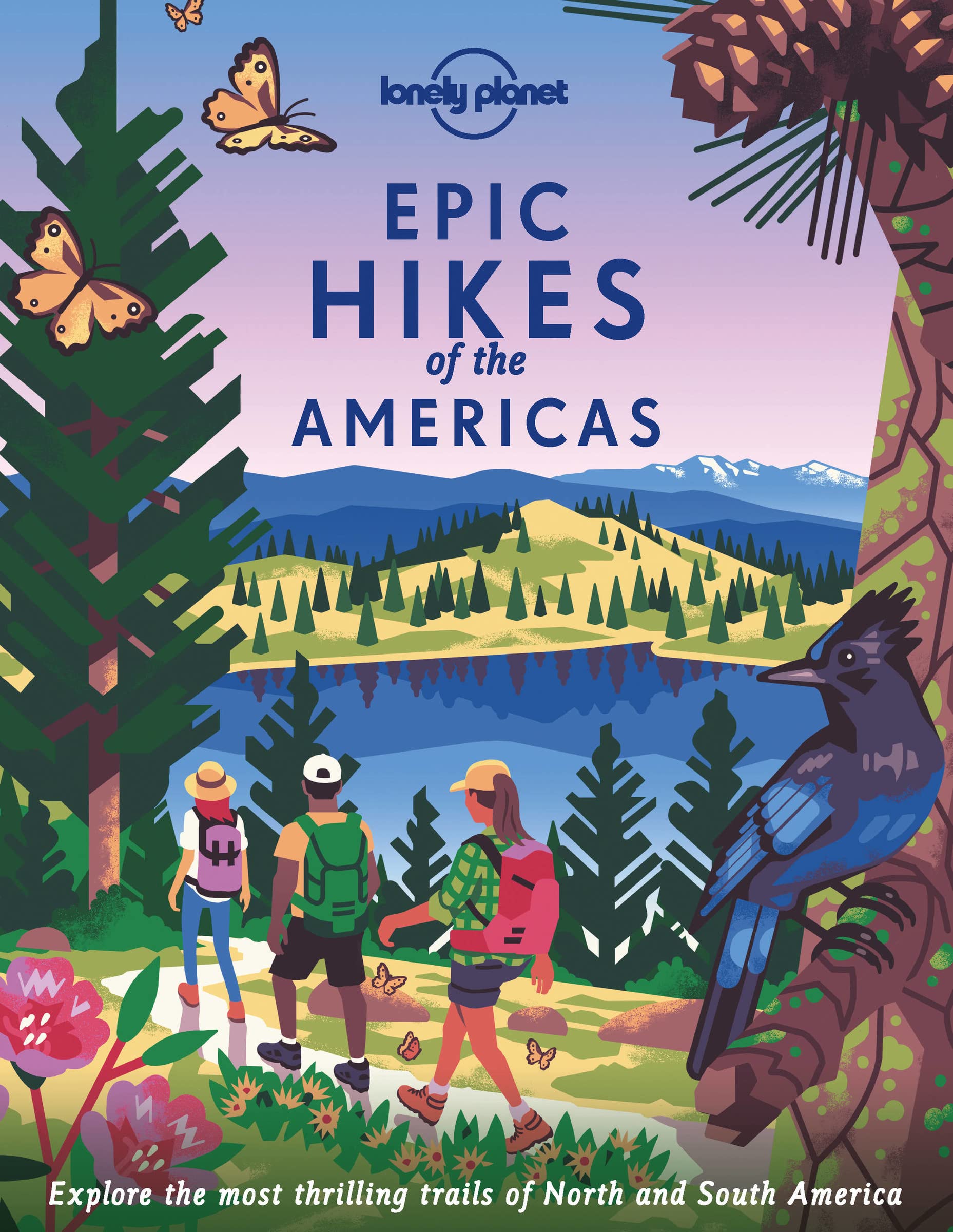
- Lonely Planet Epic Hikes of the Americas
- Lace up your hiking boots for the next in Lonely Planet`s highly successful Epic Hikes series, this time exploring 50 of the Americas` most rewarding treks and trails. From Canada`s longest hut-to-hut hike, the Sunshine Coast Trail, to a descent through Havasu Canyon in the USA, and the Santa Cruz Trail of northern Peru, we cover a huge variety... Read more
- Also available from:
- De Zwerver, Netherlands
- Stanfords, United Kingdom
De Zwerver
Netherlands
2022
Netherlands
2022
- Wandelgids Epic Hikes of the Americas | Lonely Planet
- Lace up your hiking boots for the next in Lonely Planet`s highly successful Epic Hikes series, this time exploring 50 of the Americas` most rewarding treks and trails. From Canada`s longest hut-to-hut hike, the Sunshine Coast Trail, to a descent through Havasu Canyon in the USA, and the Santa Cruz Trail of northern Peru, we cover a huge variety... Read more

Stanfords
United Kingdom
2022
United Kingdom
2022
- Epic Hikes of the Americas
- Lace up your hiking boots for the next in Lonely Planet`s highly successful Epic Hikes series, this time exploring 50 of the Americas` most rewarding treks and trails. From Canada`s longest hut-to-hut hike, the Sunshine Coast Trail, to a descent through Havasu Canyon in the USA, and the Santa Cruz Trail of northern Peru, we cover a huge variety... Read more

The Book Depository
United Kingdom
United Kingdom
- Rail-Trails New Jersey & New York
- The definitive guide to the region's top multiuse trails Read more

Weitere Bücher…

Karten

- Also available from:
- De Zwerver, Netherlands
- Stanfords, United Kingdom


Stanfords
United Kingdom
United Kingdom
- Glocknergruppe - Matrei - Kals - Heiligenblut Tabacco 076
- This Tabacco topographic map at 1:25,000 (1cm = 250m) covers the Alta Via routes, as well as the Via Ferrata where you get further than the ordinary walker with the help of steel ladders. Additional information includes: symbols to indicate 6 different types of accommodation from mountain hut, hotel to camping site. As well as information on... Read more

- Also available from:
- Stanfords, United Kingdom

Stanfords
United Kingdom
United Kingdom
- Delaware Water Gap NJ/PA
- Map No. 737, Delaware Water Gap between Pennsylvania and New Jersey at 1:40,000, in an extensive series of GPS compatible, contoured hiking maps of USA’s national and state parks or forests and other popular recreational areas. Cartography is based on the national topographic survey, with additional tourist information.The maps, with most... Read more

The Book Depository
United Kingdom
2018
United Kingdom
2018
- Ben Nevis and Glen Coe
- Waterproof mountain map of Ben Nevis & Glen Coe from Harvey at 1:40,000, with a geological map of the region on the reverse, an enlargement of Ben Nevis' summit, and advice on navigating the region safely.MAIN MAP: Topography is shown through clear altitude shading, spot heights, contours at 15m intervals, and index contours at 75m intervals. A... Read more
- Also available from:
- De Zwerver, Netherlands
- Stanfords, United Kingdom

De Zwerver
Netherlands
2018
Netherlands
2018
- Wandelkaart Ben Nevis & Glen Coe | Harvey Maps
- Waterproof mountain map of Ben Nevis & Glen Coe from Harvey at 1:40,000, with a geological map of the region on the reverse, an enlargement of Ben Nevis' summit, and advice on navigating the region safely.MAIN MAP: Topography is shown through clear altitude shading, spot heights, contours at 15m intervals, and index contours at 75m intervals. A... Read more

Stanfords
United Kingdom
2018
United Kingdom
2018
- Ben Nevis & Glen Coe Harvey British Mountain Map XT40
- Waterproof mountain map of Ben Nevis & Glen Coe from Harvey at 1:40,000, with a geological map of the region on the reverse, an enlargement of Ben Nevis` summit, and advice on navigating the region safely.*MAIN MAP:* Topography is shown through clear altitude shading, spot heights, contours at 15m intervals, and index contours at 75m intervals.... Read more

De Zwerver
Netherlands
2019
Netherlands
2019
- Reisgids Iceland Road Guide | Vegahandbokin
- Iceland Road Guide from Vegahandbókin, an exceptionally comprehensive, 605-page guide with region-by-region descriptions of sites accompanied by road maps and street plans, plus a separate road atlas section covering the whole country at 1:500,000 and information on a wide variety of tourism relating topics to help the user get the best of... Read more
- Also available from:
- Stanfords, United Kingdom

Stanfords
United Kingdom
2019
United Kingdom
2019
- Iceland Road Guide
- Iceland Road Guide from Vegahandbókin, an exceptionally comprehensive, 605-page guide with region-by-region descriptions of sites accompanied by road maps and street plans, plus a separate road atlas section covering the whole country at 1:500,000 and information on a wide variety of tourism relating topics to help the user get the best of... Read more

Stanfords
United Kingdom
United Kingdom
- Panlham
- Panlham, sheet no. 2983-12, in the topographic survey of Nepal at 1:50,000 published by the Nepali Government in the late 1990s and early 2000s and produced from remote sensing data by Finnish cartographers as part of that country’s international aid program. The maps cover 15’ x 15’ quadrangles.IMPORTANT – PLEASE NOTE BEFORE ORDERING:... Read more
Stanfords
United Kingdom
United Kingdom
- Ghunsa Khola - Olanchungola
- Ghunsa Khola - Olanchungola, sheet no. 2787-08, in the topographic survey of Nepal at 1:50,000 published by the Nepali Government in the late 1990s and early 2000s and produced from remote sensing data by Finnish cartographers as part of that country’s international aid program. The maps cover 15’ x 15’ quadrangles.IMPORTANT – PLEASE NOTE... Read more
Stanfords
United Kingdom
United Kingdom
- Mukot
- Mukot, sheet no. 2883-02, in the topographic survey of Nepal at 1:50,000 published by the Nepali Government in the late 1990s and early 2000s and produced from remote sensing data by Finnish cartographers as part of that country’s international aid program. The maps cover 15’ x 15’ quadrangles.IMPORTANT – PLEASE NOTE BEFORE ORDERING:... Read more
Stanfords
United Kingdom
United Kingdom
- Mt. Everest (Sagarmatha) - Hinku Himal
- Mount Everesr (Sagarmatha) - Hinku Himal, sheet no. 2786-04, in the topographic survey of Nepal at 1:50,000 published by the Nepali Government in the late 1990s and early 2000s and produced from remote sensing data by Finnish cartographers as part of that country’s international aid program. The maps cover 15’ x 15’ quadrangles.IMPORTANT –... Read more
Stanfords
United Kingdom
United Kingdom
- Sisne
- Sisne, sheet no. 2883-03, in the topographic survey of Nepal at 1:50,000 published by the Nepali Government in the late 1990s and early 2000s and produced from remote sensing data by Finnish cartographers as part of that country’s international aid program. The maps cover 15’ x 15’ quadrangles.IMPORTANT – PLEASE NOTE BEFORE ORDERING:... Read more
Stanfords
United Kingdom
United Kingdom
- Barhabise
- Barhabise, sheet no. 2785-04, in the topographic survey of Nepal at 1:50,000 published by the Nepali Government in the late 1990s and early 2000s and produced from remote sensing data by Finnish cartographers as part of that country’s international aid program. The maps cover 15’ x 15’ quadrangles.IMPORTANT – PLEASE NOTE BEFORE ORDERING:... Read more
Stanfords
United Kingdom
United Kingdom
- Kolti
- Kolti, sheet no. 2981-07 in the topographic survey of Nepal at 1:50,000 published by the Nepali Government in the late 1990s and early 2000s and produced from remote sensing data by Finnish cartographers as part of that country’s international aid program. The maps cover 15’ x 15’ quadrangles.IMPORTANT – PLEASE NOTE BEFORE ORDERING:... Read more
Stanfords
United Kingdom
United Kingdom
- Topkegola
- Topkegola, sheet no. 2787-07, in the topographic survey of Nepal at 1:50,000 published by the Nepali Government in the late 1990s and early 2000s and produced from remote sensing data by Finnish cartographers as part of that country’s international aid program. The maps cover 15’ x 15’ quadrangles.IMPORTANT – PLEASE NOTE BEFORE ORDERING:... Read more
Stanfords
United Kingdom
United Kingdom
- Samagau
- Samagau, sheet no. 2884-07, in the topographic survey of Nepal at 1:50,000 published by the Nepali Government in the late 1990s and early 2000s and produced from remote sensing data by Finnish cartographers as part of that country’s international aid program. The maps cover 15’ x 15’ quadrangles.IMPORTANT – PLEASE NOTE BEFORE ORDERING:... Read more
Stanfords
United Kingdom
United Kingdom
- Simi
- Simi, sheet no. 2884-11, in the topographic survey of Nepal at 1:50,000 published by the Nepali Government in the late 1990s and early 2000s and produced from remote sensing data by Finnish cartographers as part of that country’s international aid program. The maps cover 15’ x 15’ quadrangles.IMPORTANT – PLEASE NOTE BEFORE ORDERING:... Read more
Stanfords
United Kingdom
United Kingdom
- Damodar Himal
- Damodar Himal, sheet no. 2884-01, in the topographic survey of Nepal at 1:50,000 published by the Nepali Government in the late 1990s and early 2000s and produced from remote sensing data by Finnish cartographers as part of that country’s international aid program. The maps cover 15’ x 15’ quadrangles.IMPORTANT – PLEASE NOTE BEFORE ORDERING:... Read more