The Book Depository
United Kingdom
2016
» Click to open
Stanfords
United Kingdom
2016
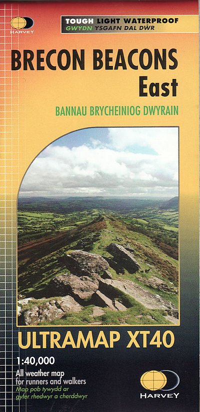
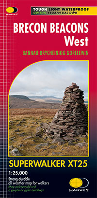
  • Brecon Beacons West Harvey Superwalker XT25
  • The western part of the Brecon Beacons at 1:25,000 on a light, waterproof and tear-resistant, contoured and GPS compatible map from Harvey Map Services in their Superwalker series.Maps in Harvey’s Superwalker series have contours at 15m intervals, with additional graphics for various types of terrain (crags, large boulders, scattered rocks) and... Read more
» Click to close
The Book Depository
United Kingdom
» Click to open
Stanfords
United Kingdom
  • Brecon Beacons Eastern OS Explorer Map OL13 (paper)
  • The eastern part of the Brecon Beacons National Park on a detailed topographic and GPS compatible map OL13, paper version, from the Ordnance Survey’s 1:25,000 Explorer series. Coverage includes Tredegar, Ebbw Vale, Abergavenny, Hay-on-Wye, the Black Mountains, Llangorse Lake, Sugar Loaf, Black Hill, Hay Bluff, sections of the Offa’s Dyke... Read more
» Click to close
The Book Depository
United Kingdom
2018
The Book Depository
United Kingdom
The Book Depository
United Kingdom
2016
» Click to open
Stanfords
United Kingdom
2016
  • Brecon Beacons East Harvey Superwalker XT25
  • The eastern part of the Brecon Beacons at 1:25,000 on a light, waterproof and tear-resistant, contoured and GPS compatible map from Harvey Map Services in their Superwalker series.Maps in Harvey’s Superwalker series have contours at 15m intervals, with additional graphics for various types of terrain (crags, large boulders, scattered rocks) and... Read more
» Click to close
The Book Depository
United Kingdom
2017
» Click to open
Stanfords
United Kingdom
2017
  • Brecon Beacons East Harvey Ultramap XT40
  • Covers a large area yet is handily compact. Pocket perfect!Detailed map for runners and walkers of the eastern part of the Brecon Beacons National Park and the Black Mountains at the magic scale of 1:40,000.Includes Pen y Fan and the Black Mountains.Welsh-English text.Has the advantages of its bigger brothers:Fully detailed genuine HARVEY... Read more
» Click to close
The Book Depository
United Kingdom
» Click to open
Stanfords
United Kingdom
  • Brecon Beacons Western & Central OS Explorer Map OL12 (paper)
  • The Western and central areas of the Brecon Beacons National Park on a detailed topographic and GPS compatible map OL12, paper version, from the Ordnance Survey’s 1:25,000 Explorer series. Coverage extends from Merthyr Tydfil in the south-east to Llandovery in the north-west and highlights include the Black Mountain, Fforest Fawr, the Beacons... Read more
» Click to close
The Book Depository
United Kingdom
2019
» Click to open
De Zwerver
Netherlands
2019
Stanfords
United Kingdom
2019
  • Nature of the Brecon Beacons: A Beginners Guide to the Upland Environment
  • For most people wandering through the beautiful landscape of the Brecon Beacons is pleasure enough, but sooner or later you may ask yourself, what is that little bird or flower that you see on most of your walks?The problem with most guides is that many of the animals, insects, rocks or plants in them are rarities, and therefore probably not... Read more
» Click to close
The Book Depository
United Kingdom
2023
» Click to open
De Zwerver
Netherlands
2023
» Click to close
The Book Depository
United Kingdom
The Book Depository
United Kingdom
» Click to open
» Click to close
The Book Depository
United Kingdom
» Click to open
Stanfords
United Kingdom
  • Brecon Beacons Eastern OS Explorer Active Map OL13 (waterproof)
  • The eastern part of the Brecon Beacons National Park on a detailed topographic and GPS compatible map OL13, waterproof version, from the Ordnance Survey’s 1:25,000 Explorer series. Coverage includes Tredegar, Ebbw Vale, Abergavenny, Hay-on-Wye, the Black Mountains, Llangorse Lake, Sugar Loaf, Black Hill, Hay Bluff, sections of the Offa’s Dyke... Read more
» Click to close
The Book Depository
United Kingdom
2019
» Click to open
De Zwerver
Netherlands
2019
  • Wandelgids Offa's Dyke Path | Trailblazer Guides
  • The Offa`s Dyke Path is a magnificent National Trail that runs from the North Wales coast to the Severn Estuary following the line of Offa`s Dyke, an impressive 8th century earthwork along the English/Welsh border. The ever-changing landscape - the Wye Valley, the Black Mountains, the Shropshire Hills and the Clwydian Hills - is steeped in... Read more
Stanfords
United Kingdom
2019
  • Offa`s Dyke Path: Prestatyn To Chepstow
  • The Offa`s Dyke Path is a magnificent National Trail that runs from the North Wales coast to the Severn Estuary following the line of Offa`s Dyke, an impressive 8th century earthwork along the English/Welsh border. The ever-changing landscape - the Wye Valley, the Black Mountains, the Shropshire Hills and the Clwydian Hills - is steeped in... Read more
» Click to close
The Book Depository
United Kingdom
The Book Depository
United Kingdom