The Book Depository
United Kingdom
2010
» Click to open
De Zwerver
Netherlands
2010
Stanfords
United Kingdom
2010
  • Suilven Harvey Superwalker
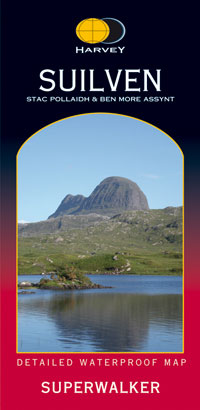
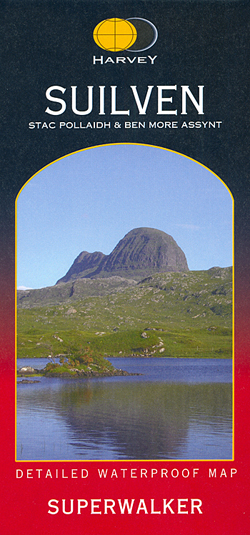
  • The Suilven area of Scottish Highlands at 1:25,000 on a waterproof and tear-resistant map from Harvey Map Services in their Superwalker series. Coverage extends from Loch Inver and Loch Assynt in the north southwards to Loch Lurgainn, Cam Loch and Ledmore Junction in the south, and includes Stac Pollaidh, Cùl Mòr and Ben More Assynt.Maps in... Read more
» Click to close
The Book Depository
United Kingdom
» Click to open
De Zwerver
Netherlands
  • Wandelkaart Rob Roy Way | Harvey Maps
  • Mooie, duidelijke kaart van de Rob Roy Way in Schotland. Geplastificeerd met veel extra informatie en uitsnedes van de route. One of Scotland's Great Trails Rob Roy Way is a walk across part of the Southern Highlands of Scotland taking in some of the most beautiful countryside in the UK. Starting from Drymen it goes north east to finish in... Read more
Stanfords
United Kingdom
  • Rob Roy Way Harvey National Trail XT40
  • Rob Roy Way, one of Scotland’s Great Trails from Drymen just north of Glasgow along Loch Tay to Pitlochry on the edge of the Cairngorms National Park presented at 1:40,000 on a light, waterproof and tear-resistant map from Harvey Map Services. The whole route, either 124km/77 miles or 151km/94 miles long depending on which variant one follows,... Read more
» Click to close
The Book Depository
United Kingdom
» Click to open
De Zwerver
Netherlands
  • Wandelkaart The West Highland Way | Footprint maps
  • The West Highland Way waterproof map from Footprint is a map-guide to the 95 mile (153km) route between Milngavie and Fort William. The mapping is based on Ordnance Survey data at a scale of 1:40,000, with compact and concise information for walkers. Read more
Stanfords
United Kingdom
» Click to close
The Book Depository
United Kingdom
2020
» Click to open
De Zwerver
Netherlands
2020
  • Wandelkaart West Highland Way | Vertebrate Publishing
  • The 153-kilometre West Highland Way encompasses the variety of Scotland`s wild places. The route, which begins in Milngavie and finishes in Fort William, passes from Glasgow, Scotland`s friendliest city, through lochs and forests, and across wild moors in the shadows of Munros. Offering panoramic views and clear waymarking, it is no wonder this... Read more
Stanfords
United Kingdom
2020
  • West Highland Way - Easy-to-use Folding Map and Essential Information
  • The 153-kilometre West Highland Way encompasses the variety of Scotland`s wild places. The route, which begins in Milngavie and finishes in Fort William, passes from Glasgow, Scotland`s friendliest city, through lochs and forests, and across wild moors in the shadows of Munros. Offering panoramic views and clear waymarking, it is no wonder this... Read more
» Click to close
The Book Depository
United Kingdom
2013
» Click to open
De Zwerver
Netherlands
2013
  • Wandelkaart South Loch Ness Trail | Harvey Maps
  • The South Loch Ness Trail, a 45km / 28 mile long hiking route from Loch Tarff near Fort Augustus on the southern tip of Loch Ness to Torbreck on the outskirts of Inverness at 1:40,000 on GPS compatible, light, waterproof and tear-resistant map from Harvey Map Services. The map also highlights the course of the Trail of the 7 Lochs, an 80km / 50... Read more
Stanfords
United Kingdom
2013
  • South Loch Ness Trail Harvey National Trail XT40
  • The South Loch Ness Trail, a 45km / 28 mile long hiking route from Loch Tarff near Fort Augustus on the southern tip of Loch Ness to Torbreck on the outskirts of Inverness at 1:40,000 on GPS compatible, light, waterproof and tear-resistant map from Harvey Map Services. The map also highlights the course of the Trail of the 7 Lochs, an 80km / 50... Read more
» Click to close
The Book Depository
United Kingdom
» Click to open
Stanfords
United Kingdom
  • Lochnagar & Glen Shee Harvey Superwalker
  • Lochnagar and Glen Shee area of the Scottish Highlands at 1:25,000 on a waterproof and tear-resistant map from Harvey Map Services in their Superwalker series. Coverage includes the Glenshee Ski Centre and Loch Muick.Maps in Harvey’s Superwalker series have contours at 15m intervals, with additional graphics for various types of terrain (crags,... Read more
» Click to close
The Book Depository
United Kingdom
2018
» Click to open
De Zwerver
Netherlands
2018
  • Wandelkaart East Highland Way | Harvey Maps
  • East Highland Way, a 132km / 82 miles trail on a light, waterproof and tear-resistant map at 1:40,000 from Harvey Map Services presenting the route accompanied by extensive additional tourist information. The route links Fort Williams, the northern point of the West Highland Way and the southern point of the Great Glen Way, with Aviemore, the... Read more
Stanfords
United Kingdom
2018
  • East Highland Way Harvey National Trail XT40
  • East Highland Way, a 132km / 82 miles trail on a light, waterproof and tear-resistant map at 1:40,000 from Harvey Map Services presenting the route accompanied by extensive additional tourist information. The route links Fort Williams, the northern point of the West Highland Way and the southern point of the Great Glen Way, with Aviemore, the... Read more
» Click to close
The Book Depository
United Kingdom
» Click to open
Stanfords
United Kingdom
  • An Teallach & Fisherfield Harvey Superwalker
  • An Teallach and Fisherfield area of Scottish Highlands at 1:25,000 on a waterproof and tear-resistant, GPS compatible map from Harvey Map Services in their Superwalker series covering popular hiking areas of Great Britain and Ireland, annotated with additional information for walkers.Maps in Harvey’s Superwalker series have contours at 15m... Read more
» Click to close
The Book Depository
United Kingdom
» Click to open
De Zwerver
Netherlands
  • Wandelkaart The Great Trossachs Path | Harvey Maps
  • The Great Trossachs Path, a 48km / 30 mile long spur off the West Highlight Way linking Inversnaid on Lomond with Callander presented at 1:40,000 on a GPS compatible, light, waterproof and tear-resistant map from Harvey Map Services. The route which runs along the shores of Loch Arklet, Loch Katrine, Loch Achray and Loch Venachar and links in... Read more
Stanfords
United Kingdom
  • The Great Trossachs Path Harvey National Trail XT40
  • The Great Trossachs Path, a 48km / 30 mile long spur off the West Highlight Way linking Inversnaid on Lomond with Callander presented at 1:40,000 on a GPS compatible, light, waterproof and tear-resistant map from Harvey Map Services. The route which runs along the shores of Loch Arklet, Loch Katrine, Loch Achray and Loch Venachar and links in... Read more
» Click to close
The Book Depository
United Kingdom
» Click to open
De Zwerver
Netherlands
  • Wandelkaart Great Glen Way | Harvey Maps
  • Great Glen Way, a 126km/79 miles trail from Fort William along Loch Ness to Inverness, presented at 1:40,000 on a light, waterproof and tear-resistant map from Harvey Map Services. The whole route is covered on four overlapping panels, and includes street plans of Fort William (showing the start/end of the West Highland Way) and Inverness. Map... Read more
Stanfords
United Kingdom
  • Great Glen Way Harvey National Trail XT40
  • Great Glen Way, a 126km/79 miles trail from Fort William along Loch Ness to Inverness, presented at 1:40,000 on a light, waterproof and tear-resistant map from Harvey Map Services. The whole route is covered on four overlapping panels, and includes street plans of Fort William (showing the start/end of the West Highland Way) and Inverness. Map... Read more
» Click to close
The Book Depository
United Kingdom
» Click to open
De Zwerver
Netherlands
  • Wandelkaart Arran including Arran Coastal Way | Harvey Maps
  • The Scottish island of Arran at 1:25,000 on a double-sided, a waterproof and tear-resistant, GPS compatible map from Harvey Map Services in their Superwalker series, with highlighting for the Arran Coastal Way and a list of archaeological and historical sites. The map divides the island east/west, with a good overlap between the sides. The... Read more
Stanfords
United Kingdom
  • Arran - incl. Arran Coastal Way Harvey Superwalker XT25 Map
  • The Scottish island of Arran at 1:25,000 on a double-sided, a waterproof and tear-resistant, GPS compatible map from Harvey Map Services in their Superwalker series, with highlighting for the Arran Coastal Way and with a list of archaeological and historical sites. The map divides the island east/west, with a good overlap between the sides. The... Read more
» Click to close
De Zwerver
Netherlands
2022
» Click to open
Stanfords
United Kingdom
2022
  • Cairn Gorm & Ben Avon Harvey Superwalker XT25
  • Cairn Gorm and Ben Avon area in the heart of the Scottish Highlands at 1:25,000 on a waterproof and tear-resistant map from Harvey Map Services in their Superwalker series. The peak of Cairn Gorm is on the eastern side of the map, with coverage extending north to Glanmore and the outskirts of Aviemore, west to Achlean and River Feshie and south... Read more
» Click to close
Stanfords
United Kingdom
Stanfords
United Kingdom
Stanfords
United Kingdom