Wandelkaart van een deelgebied van de Eifel. Deze kaarten worden uitgegeven door de zeer actieve Eifelverein. Deze vereniging houdt zich onder andere bezig met de wandelroutes in het gebied: op bijna elke boom in de Eifel vind je wel een teken! De kaarten zijn nauwkeurig en gedetaileerd, met ingetekende wandelroutes maar ook symbolen voor...Read more
Deze gedetailleerde wandelkaart beschrijft de wandelroute van 313 km lengte van Aachen naar Trier, maar ook enkele mogelijke alternatieve routes. Beschreven met veel praktische informatie en bezienswaardigheden onderweg. Erg handig uitgevoerd in water- en scheurvast plastic en in praktisch uitklapformaat! Die Wanderkarte Eifelsteig widmet sich...Read more
The central part of Alsace around Strasbourg and Saverne on a GPS compatible, double-sided map at 1:50,000 from Kümmerly+Frey printed on sturdy, waterproof and tear-resistant synthetic paper; contoured, with hiking and cycling routes, sites for other recreational activities, various accommodation options, restaurants and ferme-auberge...Read more
Pirin Mountains at 1:50,000 on a large, double-sided, contoured map with GPS waypoints for shelters and chalets, peaks, etc. and highlighting hiking routes. Topography is shown by contours at 40m intervals with additional relief shading and graphics and colouring for sandstone stacks, single rocks over 5m high, marshlands and different types of...Read more
Pirin Mountains at 1:50,000 on a large, double-sided, contoured map with GPS waypoints for shelters and chalets, peaks, etc. and highlighting hiking routes. Topography is shown by contours at 40m intervals with additional relief shading and graphics and colouring for sandstone stacks, single rocks over 5m high, marshlands and different types of...Read more
Strandzha Mountains in the south-eastern corner of Bulgaria between Burgas to the Turkish border on a contoured and GPS compatible map from Domino showing local hiking trails and highlighting various interesting sites, with three more detailed enlargements at 1:25,000. Most place names are in both Latin and Cyrillic alphabet; map legend...Read more
Strandzha Mountains in the south-eastern corner of Bulgaria between Burgas to the Turkish border on a contoured and GPS compatible map from Domino showing local hiking trails and highlighting various interesting sites, with three more detailed enlargements at 1:25,000. Most place names are in both Latin and Cyrillic alphabet; map legend...Read more
Western Rhodope Mountains at 1:100,000 on a contoured GPS compatible map from Domino extending from just west of the Pirin National Park to Asenovgrad in the north-east. The map is double-sided with a good overlap between the sides. Topography is shown by contours at 50m intervals with relief shading and spot heights, plus colouring for...Read more
Western Rhodope Mountains at 1:100,000 on a contoured GPS compatible map from Domino extending from just west of the Pirin National Park to Asenovgrad in the north-east. The map is double-sided with a good overlap between the sides. Topography is shown by contours at 50m intervals with relief shading and spot heights, plus colouring for...Read more
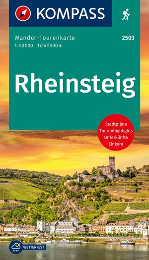
Die Wanderkarte stellt den ersten Teil des 320 km langen Rheinsteigs im praktischen Leporello-Format vor. Dieser Abschnitt führt von Bonn bis Lahnstein über 145 km am rechtsrheinischen Ufer entlang und in die angrenzenden Wälder und Weinberge. Auf schmalen Pfaden gelangt der Wanderer so zu tollen Aussichtspunkten über das Mittelrheintal. Welche...Read more
Rheinland-Pfalz. Straßen- und Freizeitkarte 1 : 20 000 ab 10 EURO Straßen- und Freizeitkarte mit Touristischen Straßen, Highlights der Region und Reisemobilstellplätzen. 1:200000 PUBLICPRESS Straßen- und Freizeitkarte. 1. AuflageRead more