De Zwerver
Netherlands
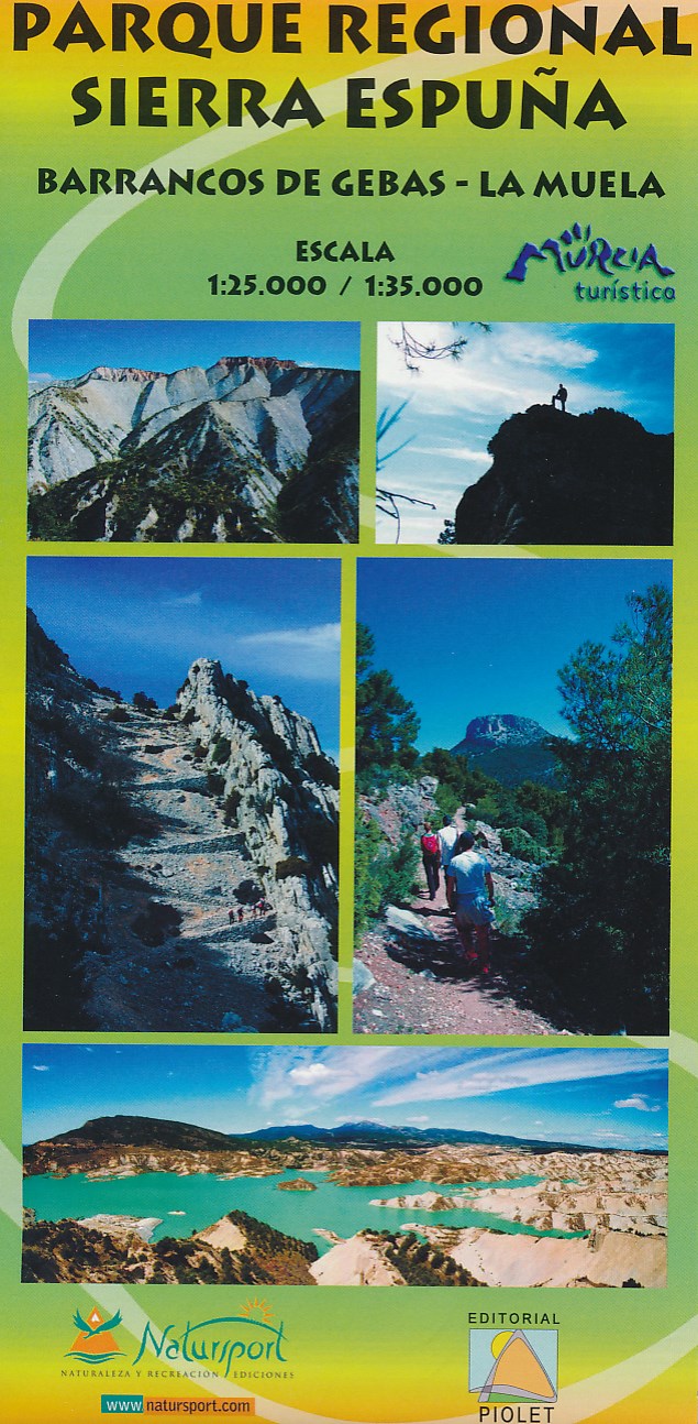
- Wandelkaart Parque Regional Sierra Espuna | Editorial Piolet
- Barrancos de Gebas - La Muela Uitstekende wandelkaart van een klein gebied. Met ingetekende wandelroutes en hoogtelijnen. Excellent 1:25.000 scale map of the area of Regional Park Sierra Espuna in Murcia. Includes local signaling pathways, GR, PR, Nordik Walking tour and most characteristic areas of diving. Equidistance between contours 10 m. Read more
De Zwerver
Netherlands
De Zwerver
Netherlands
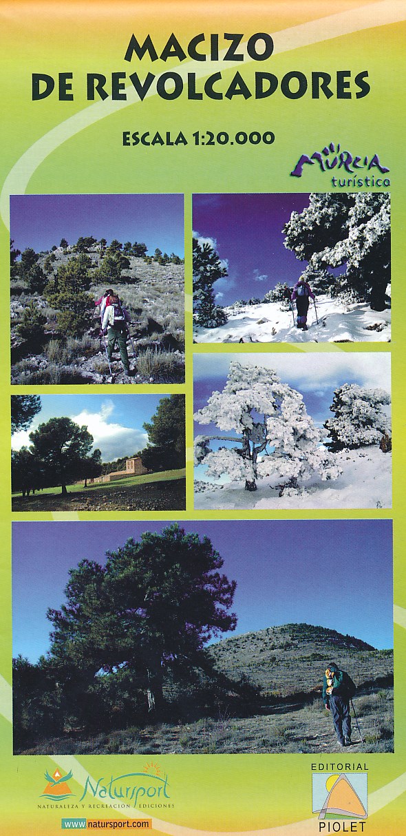
- Wandelkaart Macizo de Revolcadores | Editorial Piolet
- Uitstekende wandelkaart van een klein gebied. Met ingetekende wandelroutes en hoogtelijnen. Excellent 1:20.000 scale map of the area of Macizo de Revolcadores in Murcia. Includes local signaling pathways, GR, PR, Nordik Walking tour and most characteristic areas of diving. Equidistance between contours 10 m. Read more

Stanfords
United Kingdom
- Macizo de Revolcadores
- Macizo de Revolcadores in the western part of Murcia provice, just east of the borders with the Granada and Albacete provinces, on a contoured and GPS compatible map at 1:20,000 from Editorial Piolet. Coverage includes Sierra de Taibilla and Sierra de Villafuerte.Topography is presented by contours at 10m intervals with plenty of additional... Read more
De Zwerver
Netherlands

Stanfords
United Kingdom
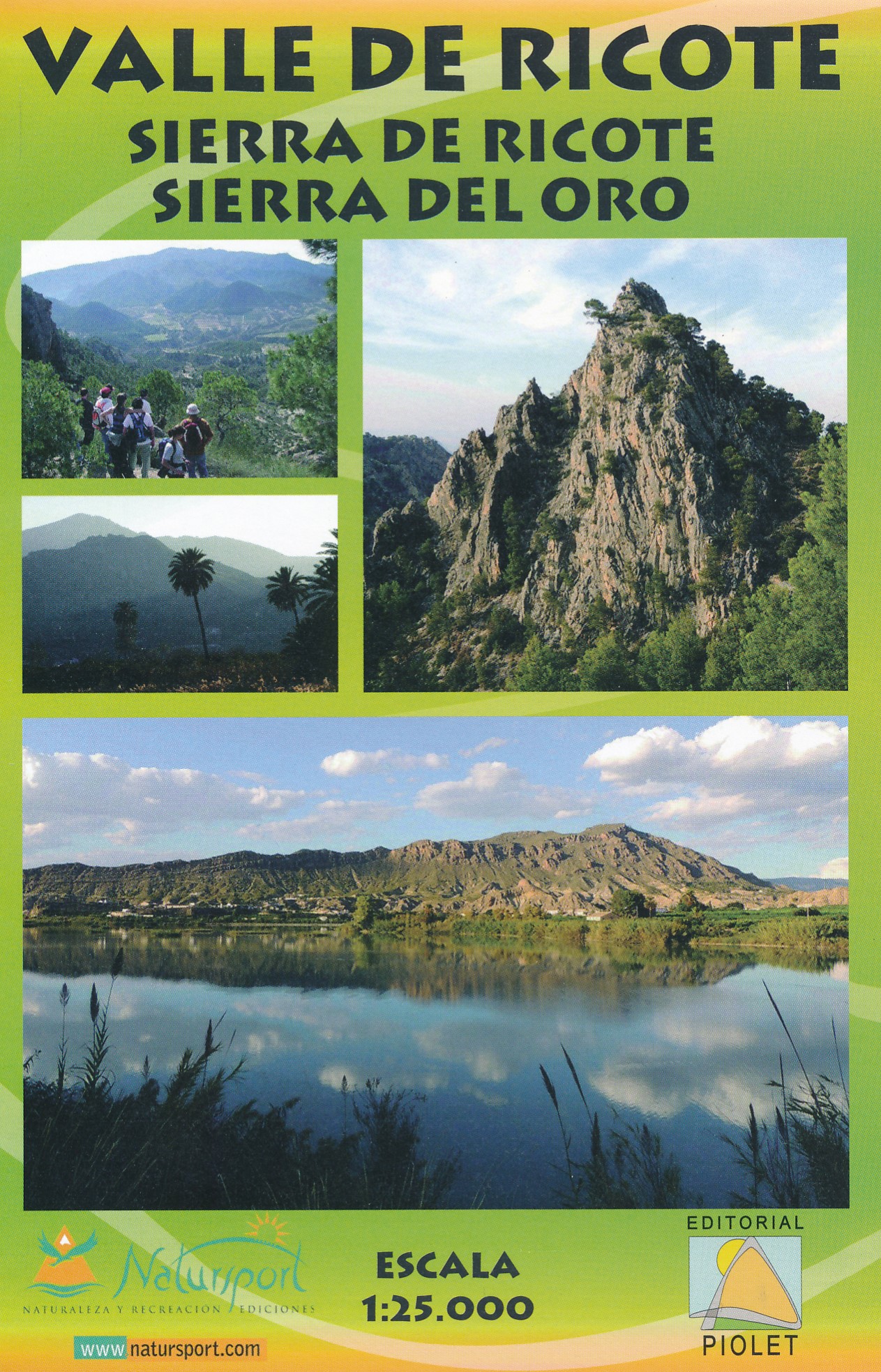
- Valle de Ricote - Sierra de Ricote - Sierra del Oro
- Valle de Ricote, Sierra de Ricote and Sierra del Oro north-west of Murcia on a contoured and GPS compatible map at 1:25,000 from Editorial Piolet. Coverage extends westwards from Archena, north to Abarán, and south to the RM-530 road.Topography is presented by contours at 10m intervals with plenty of additional spot heights. An overprint shows... Read more
De Zwerver
Netherlands
De Zwerver
Netherlands

Stanfords
United Kingdom
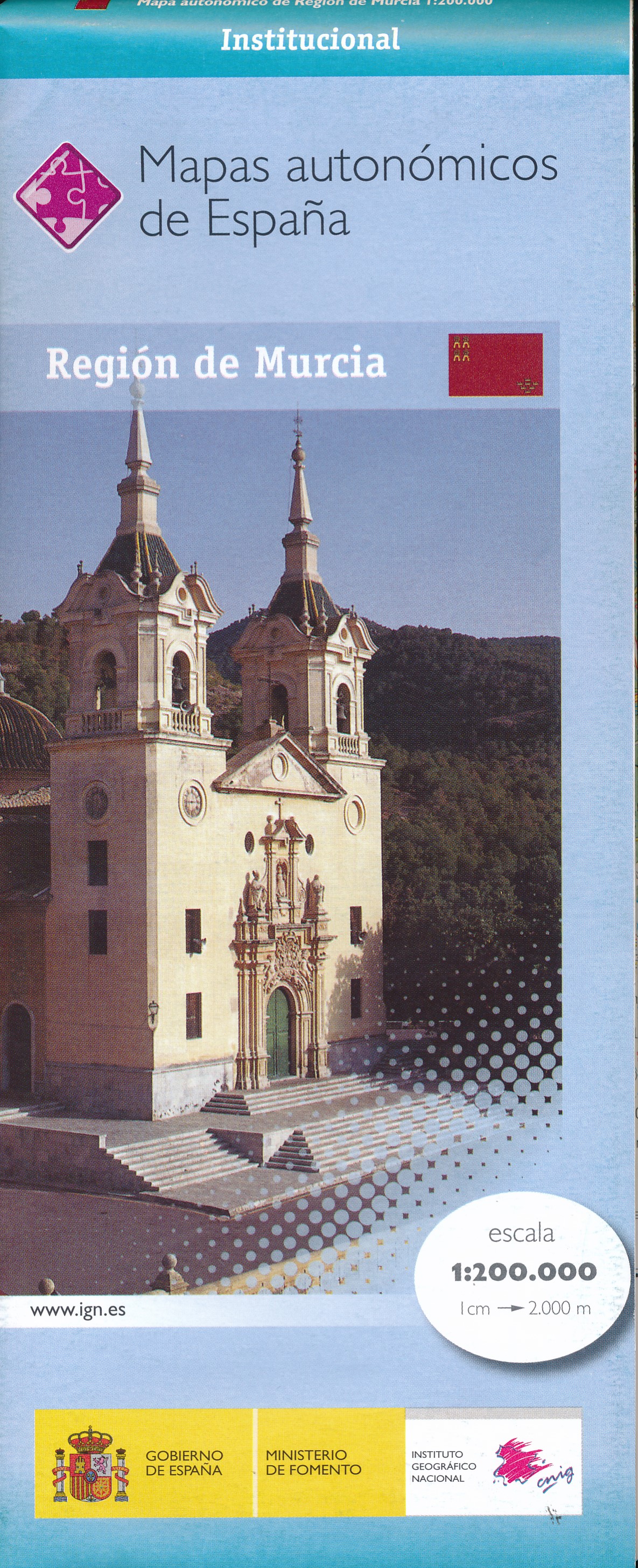
- Murcia Autonomous Region 200K CNIG Physical Road Map
- Murcia Autonomous Region of Spain at 1:200,000 in a series of physical road maps from IGN/CNIG - the country’s civilian survey organization, with an excellent presentation of the topography through relief shading and altitude colouring, plenty of names of mountain ranges, peaks, etcRelief shading is enhanced by bright altitude colouring, with... Read more

Stanfords
United Kingdom
- Alhama de Murcia CNIG Topo 933-3
- Topographic coverage of mainland Spain at 1:25,000 published by the Centro Nacional de Información Geograficá, the country’s civilian survey organization. The maps have contours at 10m intervals and colouring and/or graphics to show different types of vegetation or land use. Boundaries of national parks and other protected areas are marked. In... Read more

Stanfords
United Kingdom
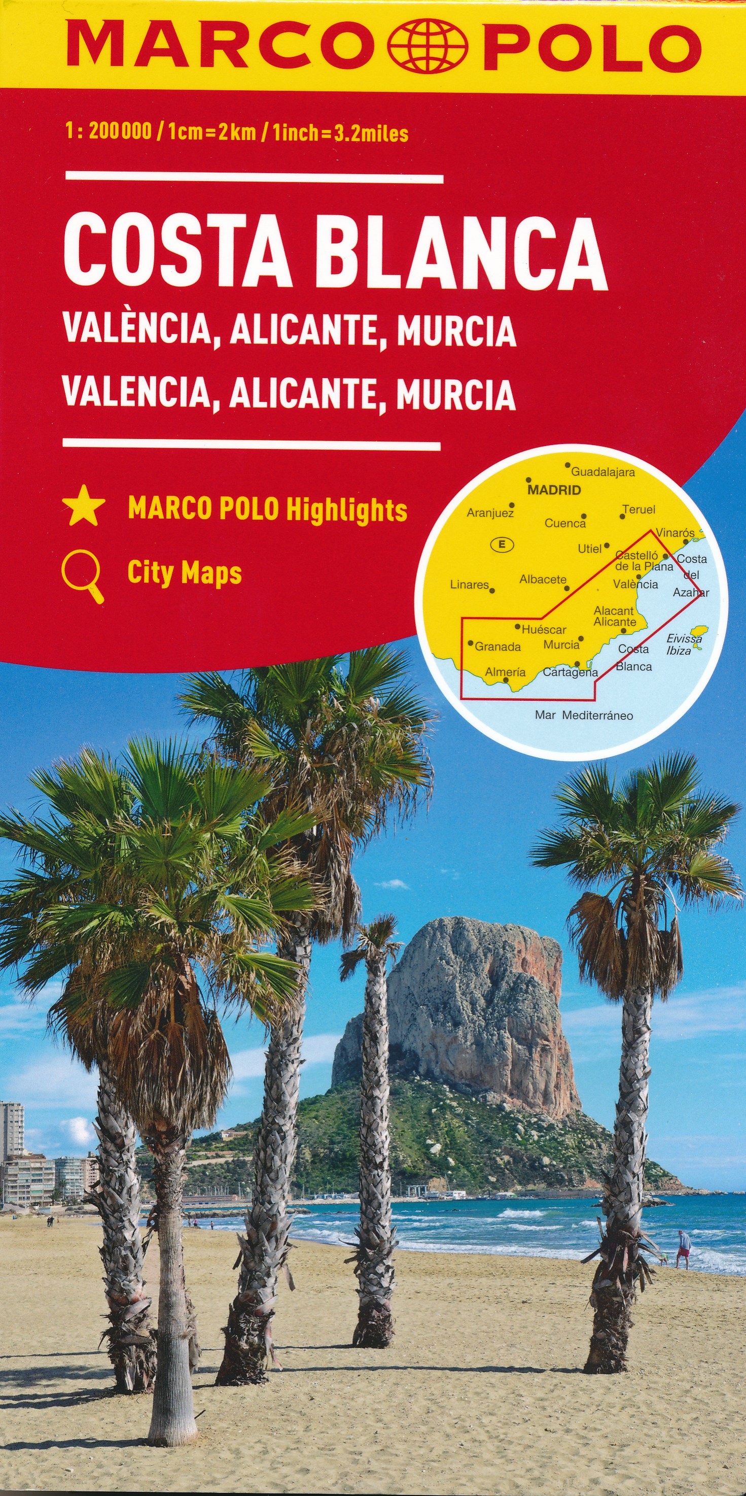
- Valencia - Alicante - Murcia 500K CNIG Regional Map No. 9
- The Mediterranean coast of Spain from north of Valencia to Costa Blanca and inland to include Sierras de Cazorla and Segura in north-eastern Andalucía, at 1:500,000 in a series of regional road maps from the country’s civilian survey organization IGN-CNIG (Instituto Geográfico Nacional - Centro Nacional de Información Geográfica), vividly... Read more

Stanfords
United Kingdom
- Murcia Province 200K CNIG Map No. 32
- Contoured, GPS-compatible, indexed road map at 1:200,000 from CNIG - Spain’s civilian survey organization, with exceptionally informative presentation of the landscape and highlighting for facilities and places of interest including campsites and paradors.Maps in CNIG’s 200K Provincial Series provide an excellent picture the topography through... Read more

Stanfords
United Kingdom
- Andalucía East: Granada - Almería - Murcia 500K CNIG Regional Map No. 12
- The eastern part of Andalucía with Granada and Sierra Nevada, extending along the Mediterranean coast from Velez-Malága to Cartagena and Mar Menor, at 1:500,000 in a series of regional road maps from the country’s civilian survey organization IGN-CNIG (Instituto Geográfico Nacional - Centro Nacional de Información Geográfica), vividly... Read more
Stanfords
United Kingdom
- Murcia CNIG Topographic Map 934-1
- Topographic coverage of mainland Spain at 1:25,000 published by the Centro Nacional de Información Geograficá, the country’s civilian survey organization. The maps have contours at 10m intervals and colouring and/or graphics to show different types of vegetation or land use. Boundaries of national parks and other protected areas are marked. In... Read more

Stanfords
United Kingdom
- Murcia CNIG Topo 934
- Topographic coverage of mainland Spain at 1:50,000 in the MTN50 (Mapa Topográfico Nacional) series from the Centro Nacional de Información Geografica, the country’s civilian survey organization. The maps have contours at 20m intervals, enhanced by relief shading, plus colouring and/or graphics to show different types of terrain, vegetation or... Read more

Stanfords
United Kingdom
- Sierra de Espuña Natural Park CNIG Map
- Sierra de Espuña Natural Park, a popular hiking area south-west of Murcia, on a contoured and GPS compatible map at 1:25,000 from IGN/CNIG using cartography of their civilian topographic survey of Spain. Contours are 10m intervals, enhanced by relief shading and graphics to show different types of vegetation. An overprint highlights local... Read more

Stanfords
United Kingdom
- Murcia CNIG Topo 934
- Topographic coverage of mainland Spain at 1:50,000 in the MTN50 (Mapa Topográfico Nacional) series from the Centro Nacional de Información Geografica, the country’s civilian survey organization. The maps have contours at 20m intervals, enhanced by relief shading, plus colouring and/or graphics to show different types of terrain, vegetation or... Read more
