De Zwerver
Netherlands
2013
Netherlands
2013
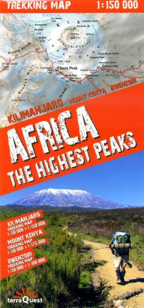
- Wandelkaart Trekking map Africa - the highest peaks | TerraQuest
- Carte de trekking des sommets de l'Afrique, les préférés des passionnés de grandes randonnées : Kilimandjaro (5 895 m), mont Kenya (5 199 m), Margherita (5 109 m) et Meru (4 565 ù). La carte présente des sites au Kenya, en Tanzanie et en Ouganda.Les sites suivants sont inclus dans la carte :les environs de Kibo, l'un des sommets du Kilimandjaro... Read more
- Also available from:
- Stanfords, United Kingdom

Stanfords
United Kingdom
2013
United Kingdom
2013
- Africa`s Highest Peaks - Kilimanjaro - Mount Kenya - Rwenzori terraQuest Trekking Map
- Three of Africa’s most popular trekking regions: Kilimanjaro, Mount Kenya and the peaks of the Ruwenzori National Park on a durable, waterproof and tear-resistant map from terraQuest. Each destination is presented on two panels: a general map of the area plus an enlargement of the highest part at 1:50,000.On one side is coverage of Kilimanjaro.... Read more