The Book Depository
United Kingdom
United Kingdom
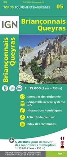
- Brianconnais Queyras
- Une carte générale de très grande lisibilité au 1/75 000 + 5 extraits de TOP25 au 1/25 000 en une seule carte ! Read more
- Also available from:
- De Zwerver, Netherlands
- Stanfords, United Kingdom
De Zwerver
Netherlands
Netherlands
- Fietskaart - Wandelkaart 05 Briançonnais - Queyras | IGN - Institut Géographique National
- Une carte générale de très grande lisibilité au 1/75 000 + 5 extraits de TOP25 au 1/25 000 en une seule carte ! Read more

Stanfords
United Kingdom
United Kingdom
- Briançonnais – Queyras IGN 75005
- Briançonnais - Queyras PNR region in a series of GPS compatible, contoured TOP 75 maps at 1:75,000 from the IGN, highlighting local and long-distance hiking paths, cycling routes and sites for other recreational activities. The map includes five large panels showing the areas around Col des Ayes, Lac de l’Ascension, Riche Gauthier, Pointe de la... Read more