
Pembrokeshire
Beschreibung
Region and county in the South West of Wales. The coastline is of special interest. Here runs the Pembrokeshire Coast National Trail, a lovely - and long - walk with great vistas.
Wanderwege Region
Links
Fakten
Berichte
Führer und Karten
Übernachtung
Organisationen
Reisebüros
GPS
Sonstiges
Bücher

The Book Depository
United Kingdom
2019
United Kingdom
2019
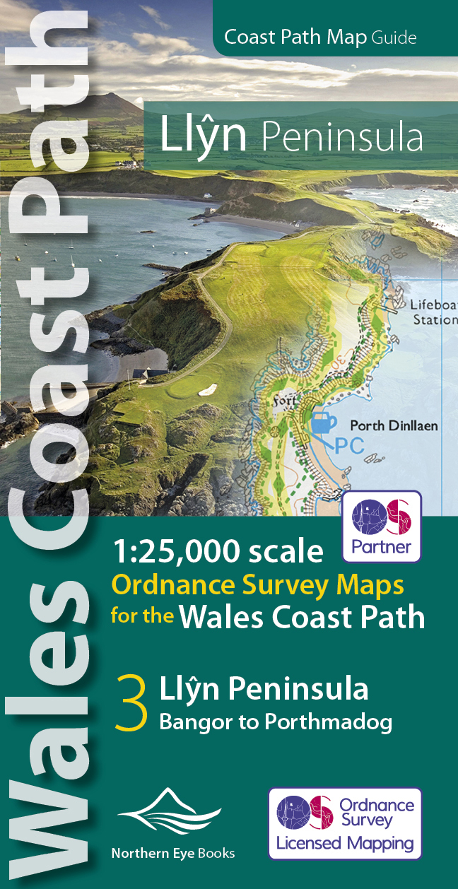
- Llyn Peninsula Coast Path Map
- 1:25,000 scale Ordnance Survey mapping for the Llyn Peninsula section of the Wales Coast Path Read more
- Also available from:
- De Zwerver, Netherlands
De Zwerver
Netherlands
2019
Netherlands
2019
- Wandelkaart Wales Coast Path Llyn Peninsula Map | Northern Eye Books
- 1:25,000 scale Ordnance Survey mapping for the Llyn Peninsula section of the Wales Coast Path Read more

- Also available from:
- De Zwerver, Netherlands
- Stanfords, United Kingdom

Stanfords
United Kingdom
2021
United Kingdom
2021
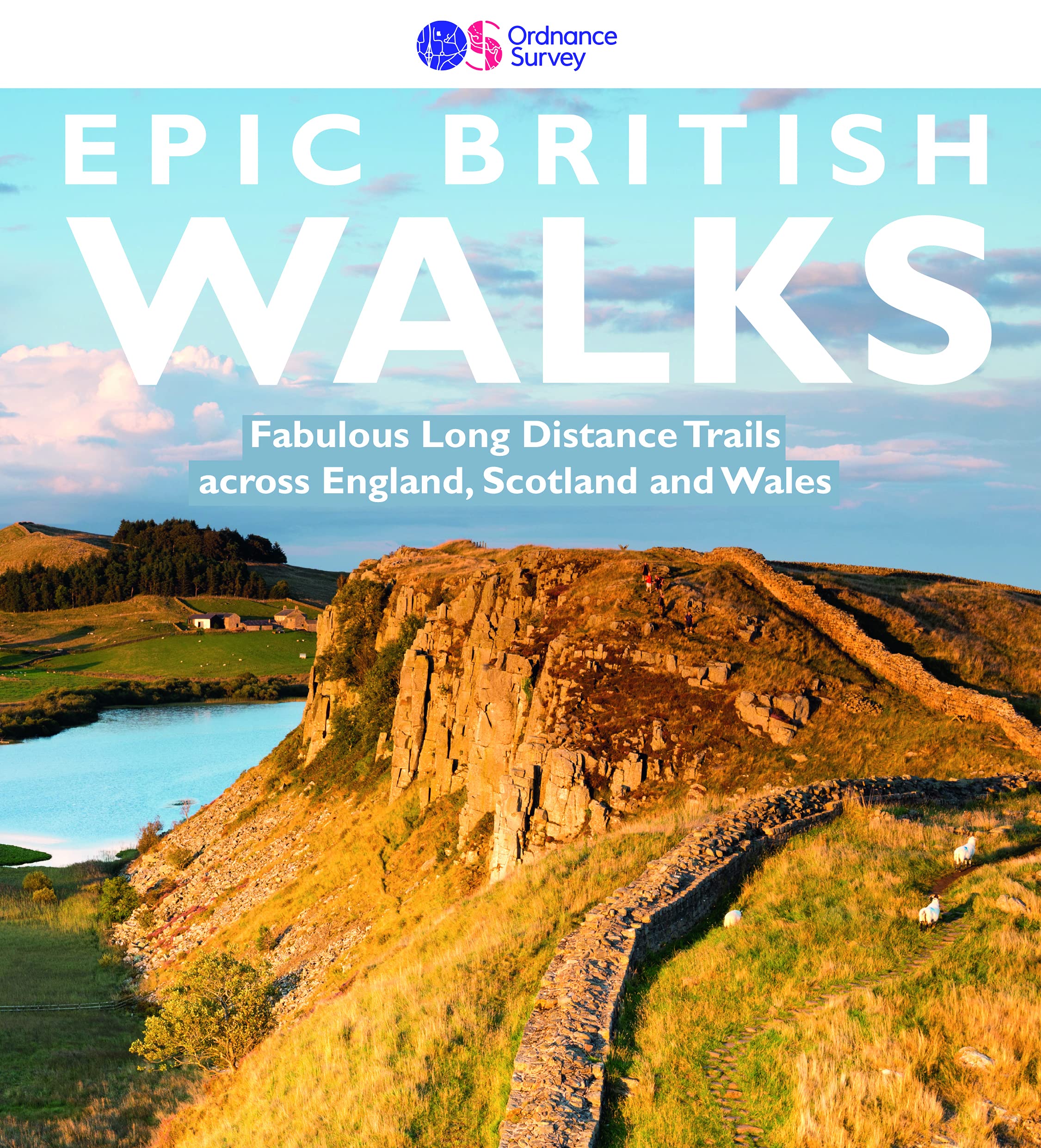
- Epic British Walks
- OS Epic British Walks allows the reader to take their walking dreams one step further with this inspiring introduction to distance walking and with thirty-eight amazing trails of immense diversity, each graded by difficulty, there are routes for first-time hikers as well as for the super-fit, seasoned multi-day rambler.This is the perfect book... Read more

The Book Depository
United Kingdom
2021
United Kingdom
2021
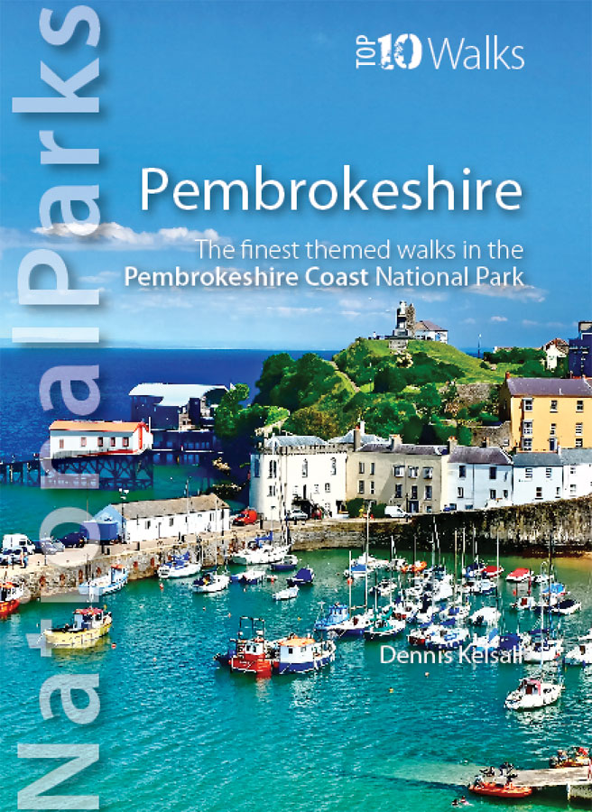
- National Parks: Pembrokeshire
- The finest themed walks in the Pembrokeshire Coast National Park Read more
- Also available from:
- De Zwerver, Netherlands
- Stanfords, United Kingdom
De Zwerver
Netherlands
2021
Netherlands
2021
- Wandelgids National Parks: Pembrokeshire | Northern Eye Books
- One of the hugely popular Top 10 Walks series, each book showcasing the very best themed walks in one of the UK`s 14 National Parks.This attractive guide gives walkers ten of the finest circular, themed walks in the Pembrokeshire Coast National Park in a popular pocketable format.With clear information, an overview and introduction for each... Read more

Stanfords
United Kingdom
2021
United Kingdom
2021
- National Parks: Pembrokeshire: The finest themed walks in the Pembrokeshire Coast National Park
- One of the hugely popular Top 10 Walks series, each book showcasing the very best themed walks in one of the UK`s 14 National Parks.This attractive guide gives walkers ten of the finest circular, themed walks in the Pembrokeshire Coast National Park in a popular pocketable format.With clear information, an overview and introduction for each... Read more


- Also available from:
- De Zwerver, Netherlands
- Stanfords, United Kingdom
De Zwerver
Netherlands
Netherlands

Stanfords
United Kingdom
United Kingdom
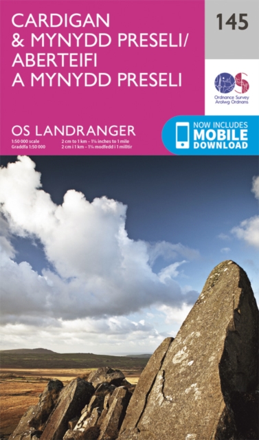
- Cardigan & Mynydd Preseli OS Landranger Map 145 (paper)
- The coast of Wales between Dinas Head and New Quay, including Cardigan and the northern part of the Pembrokeshire Coast National Park, on a paper version of map No. 145 from the Ordnance Survey’s Landranger series at 1:50,000, with contoured and GPS compatible topographic mapping plus tourist information.MOBILE DOWNLOADS: As well as the... Read more


- Also available from:
- De Zwerver, Netherlands
De Zwerver
Netherlands
2021
Netherlands
2021
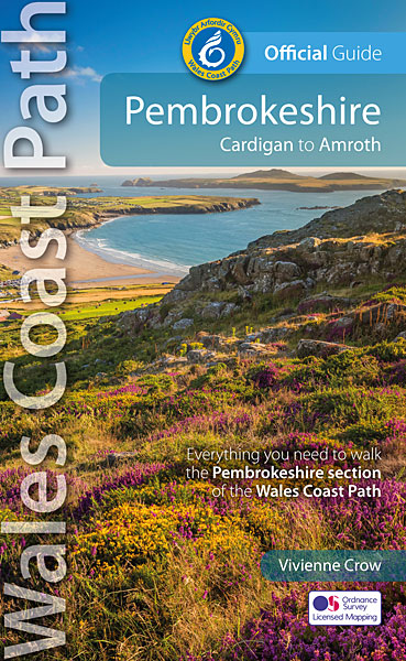
- Wandelgids Wales Coast Path: Pembrokeshire | Northern Eye Books
- Cardigan to Amroth Read more

The Book Depository
United Kingdom
United Kingdom
- Wales Coast Path 3
- Cardigan to Llanelli including Pembrokeshire Coast Path Read more

- Also available from:
- De Zwerver, Netherlands
- Stanfords, United Kingdom

De Zwerver
Netherlands
Netherlands

Stanfords
United Kingdom
United Kingdom
- South Pembrokeshire OS Explorer Map OL36 (paper)
- The southern coast of Pembrokeshire on a detailed topographic and GPS compatible map OL36, paper version, from the Ordnance Survey’s 1:25,000 Explorer series. Coverage includes Pembrokeshire Coast National Park, Haverforwest, Milford haven, Arberth, Tenby, Pembroke, Skomer Island, Caldey Island, the Pembrokeshire Coast Path National Trail which... Read more

- Also available from:
- De Zwerver, Netherlands


- Also available from:
- De Zwerver, Netherlands
- Stanfords, United Kingdom
De Zwerver
Netherlands
Netherlands

Stanfords
United Kingdom
United Kingdom
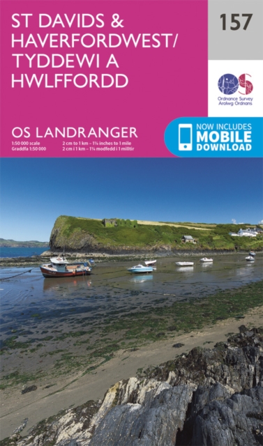
- St David`s & Haverfordwest OS Landranger Map 157 (paper)
- Pembrokeshire Coast National Park between Pembroke in the south and Fishguard in the north including St Davids, and with coverage extending inland beyond Haverfordwest, on a paper version of map No. 157 from the Ordnance Survey’s Landranger series at 1:50,000, with contoured and GPS compatible topographic mapping plus tourist information.MOBILE... Read more

- Also available from:
- De Zwerver, Netherlands
- Stanfords, United Kingdom
De Zwerver
Netherlands
2022
Netherlands
2022
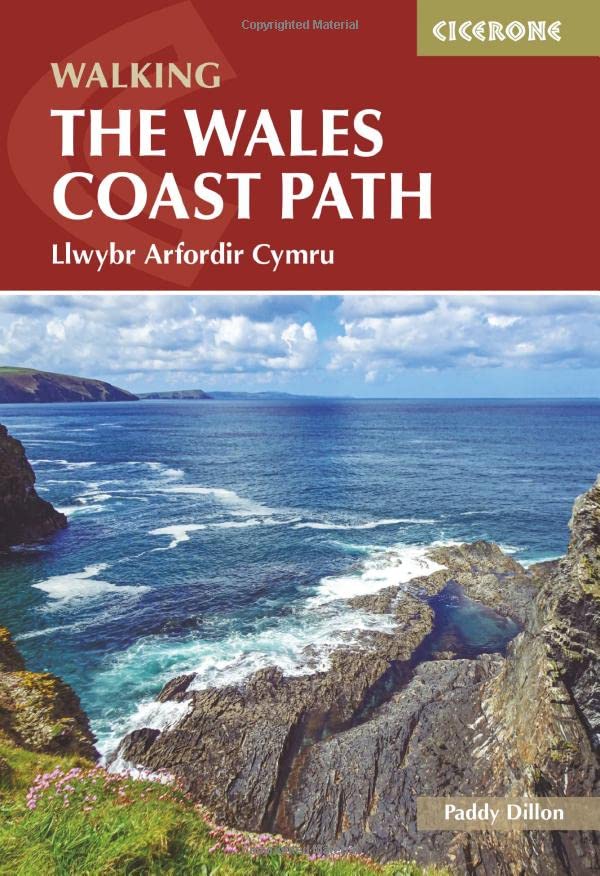
- Wandelgids Walking the Wales Coast Path | Cicerone
- Llwybr Arfordir Cymru Read more

Stanfords
United Kingdom
2022
United Kingdom
2022
- Walking the Wales Coast Path: Llwybr Arfordir Cymru
- The Wales Coast Path offers an unparalleled opportunity to walk a nation`s coastline in its entirety. Stretching 1400km (870 miles) from Chester to Chepstow, including Anglesey, the waymarked trail takes 2-3 months to complete but can easily be broken into shorter sections. The walking is generally not difficult, although there are occasional... Read more

- Also available from:
- De Zwerver, Netherlands
- Stanfords, United Kingdom
De Zwerver
Netherlands
2017
Netherlands
2017
- Wandelgids Pembrokeshire : 40 Coast and Country Walks | Pocket Mountains
- As the home of Britain`s one and only national coastal park, Pembrokeshire is rightly famed for its marine wildlife, unspoilt beaches, towering cliffs and charming harbours. Inland, however, you will also find ancient woodlands and rolling hills, as well as archaeological mysteries and crumbling castles which suggest that this peaceful part of... Read more

Stanfords
United Kingdom
2017
United Kingdom
2017
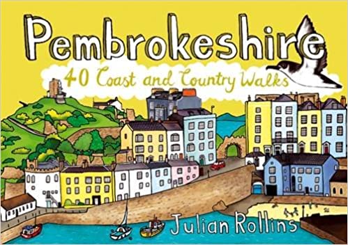
- Pembrokeshire: 40 Coast and Country Walks
- As the home of Britain`s one and only national coastal park, Pembrokeshire is rightly famed for its marine wildlife, unspoilt beaches, towering cliffs and charming harbours. Inland, however, you will also find ancient woodlands and rolling hills, as well as archaeological mysteries and crumbling castles which suggest that this peaceful part of... Read more

The Book Depository
United Kingdom
United Kingdom
- Wales Coast Path 2
- Caernarfon to Cardigan Including Llyn Peninsula Read more
Karten

The Book Depository
United Kingdom
2022
United Kingdom
2022
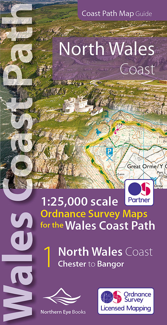
- North Wales Coast Path Map
- 1:25,000 scale Ordnance Survey mapping for the Wales Coast Path Read more
- Also available from:
- De Zwerver, Netherlands
- Stanfords, United Kingdom
De Zwerver
Netherlands
2022
Netherlands
2022
- Wandelkaart North Wales Coast Path Map | Northern Eye Books
- One of seven handy, lightweight, pocket sized map bookscovering the whole of the 870 mile/1400 kilometre Wales Coast Path. This volume covers North Wales from Chester to Bangor and includes enhanced large scale (1:25,000) Ordnance Survey mapping in a handy atlas format, with extracts from large scale Explorer maps 266, 265, 264 and OL17.The... Read more

Stanfords
United Kingdom
2022
United Kingdom
2022
- North Wales Coast - Chester to Bangor - Wales Coast Path Map-Booklet
- One of seven handy, lightweight, pocket sized map bookscovering the whole of the 870 mile/1400 kilometre Wales Coast Path. This volume covers North Wales from Chester to Bangor and includes enhanced large scale (1:25,000) Ordnance Survey mapping in a handy atlas format, with extracts from large scale Explorer maps 266, 265, 264 and OL17.The... Read more

Stanfords
United Kingdom
United Kingdom
- St David`s and Haverfordwest / Tyddewi a Hwlffordd 1922-1923
- Map No. 157, St David`s and Haverfordwest / Tyddewi a Hwlffordd 1922-1923, in the Cassini Historical Series of old Ordnance Survey mapping of England and Wales at 1:50,000 in a format designed to offer a convenient comparison with the present day coverage from the OS, and most locations in three different editions. Old historical maps have been... Read more
Stanfords
United Kingdom
United Kingdom
- St David`s and Haverfordwest / Tyddewi a Hwlffordd 1901-1912
- Map No. 157, St David`s and Haverfordwest / Tyddewi a Hwlffordd 1901-1912, in the Cassini Historical Series of old Ordnance Survey mapping of England and Wales at 1:50,000 in a format designed to offer a convenient comparison with the present day coverage from the OS, and most locations in three different editions. Old historical maps have been... Read more
Stanfords
United Kingdom
United Kingdom
- Tenby and Pembroke / Dinbych-y-pysgod & Penfro 1818-1831
- Map No. 158, Tenby and Pembroke / Dinbych-y-pysgod & Penfro 1818-1831, in the Cassini Historical Series of old Ordnance Survey mapping of England and Wales at 1:50,000 in a format designed to offer a convenient comparison with the present day coverage from the OS, and most locations in three different editions. Old historical maps have been... Read more
Stanfords
United Kingdom
United Kingdom
- St David`s and Haverfordwest / Tyddewi a Hwlffordd 1818-1923 (3-map set)
- Map No. 157, St David`s and Haverfordwest / Tyddewi a Hwlffordd 1818-1923 (3-map set), in the Cassini Historical Series of old Ordnance Survey mapping of England and Wales at 1:50,000 in a format designed to offer a convenient comparison with the present day coverage from the OS, and most locations in three different editions. Old historical... Read more
Stanfords
United Kingdom
United Kingdom
- Tenby and Pembroke / Dinbych-y-pysgod & Penfro 1818-1913 (3-map set)
- Map No. 158, Tenby and Pembroke / Dinbych-y-pysgod & Penfro 1818-1913 (3-map set), in the Cassini Historical Series of old Ordnance Survey mapping of England and Wales at 1:50,000 in a format designed to offer a convenient comparison with the present day coverage from the OS, and most locations in three different editions. Old historical maps... Read more
Stanfords
United Kingdom
United Kingdom
- Tenby and Pembroke / Dinbych-y-pysgod & Penfro 1922-1923
- Map No. 158, Tenby and Pembroke / Dinbych-y-pysgod & Penfro 1922-1923, in the Cassini Historical Series of old Ordnance Survey mapping of England and Wales at 1:50,000 in a format designed to offer a convenient comparison with the present day coverage from the OS, and most locations in three different editions. Old historical maps have been... Read more

Stanfords
United Kingdom
United Kingdom
- England Coast Path Adventure Map - Minehead to Brean Down
- The A-Z Adventure Series of maps combines the best of OS and A-Z, creating the perfect companion for walkers, off-road cyclists, horse riders and anyone wishing to explore the great outdoors.This official Minehead to Brean Down Adventure Map covers a 58 mile (93km) section of the England Coast Path, a new National Trail around England`s coast.... Read more
Stanfords
United Kingdom
United Kingdom
- Tenby and Pembroke / Dinbych-y-pysgod & Penfro 1901-1902
- Map No. 158, Tenby and Pembroke / Dinbych-y-pysgod & Penfro 1901-1902, in the Cassini Historical Series of old Ordnance Survey mapping of England and Wales at 1:50,000 in a format designed to offer a convenient comparison with the present day coverage from the OS, and most locations in three different editions. Old historical maps have been... Read more

Stanfords
United Kingdom
United Kingdom
- Pembrokeshire Coast A-Z Adventure Atlas
- Pembrokeshire Coast Adventure Atlas at 1:25,000 in a series of handy A5 size Adventure Atlases from Geographers` A-Z Map Company with cartography from the Ordnance Survey’s Explorer series. Coverage extends along the coast from Cardigan to Tenby and Amroth and includes the Pembrokeshire Coast Paths - now a section of the Wales Coast Path.To see... Read more

Stanfords
United Kingdom
United Kingdom
- North Pembrokeshire OS Explorer Map OL35 (paper)
- The northern coast of Pembrokeshire between Cardigan and St Davids on a detailed topographic and GPS compatible map OL35, paper version, from the Ordnance Survey’s 1:25,000 Explorer series. Coverage includes Pembrokeshire Coast National Park, Goodwick, Fishguard, Llys-y-fran Reservoir, Ramsey Island, the Pembrokeshire Coast Path National Trail... Read more
Stanfords
United Kingdom
United Kingdom
- St David`s and Haverfordwest / Tyddewi a Hwlffordd 1818-1820
- Map No. 157, St David`s and Haverfordwest / Tyddewi a Hwlffordd 1818-1820, in the Cassini Historical Series of old Ordnance Survey mapping of England and Wales at 1:50,000 in a format designed to offer a convenient comparison with the present day coverage from the OS, and most locations in three different editions. Old historical maps have been... Read more

Stanfords
United Kingdom
United Kingdom
- Wales Mountain Biking
- Vertebrate’s guide to mountain biking in Wales covers 20 recommended mountain bike trails, routes and rides ranging from 12km to 50km. The routes themselves have been devised and tested by local riders to help you get the very best out of the Welsh trails.Each route is described with easy-to-follow instructions, information on difficulty,... Read more
- Also available from:
- Bol.com, Netherlands
- Bol.com, Belgium

Bol.com
Netherlands
Netherlands
- Wales Mountain Biking
- Wales Mountain Biking is the 12th title in Vertebrate Publishing's bestselling series of UK mountain biking guidebooks. This book showcases 20 routes in Wales, between 12km and 50km in length, suitable for all levels of mountain bikers. Split into three sections, South Wales, Mid Wales and North Wales, this book includes classic loops in the... Read more
Bol.com
Belgium
Belgium
- Wales Mountain Biking
- Wales Mountain Biking is the 12th title in Vertebrate Publishing's bestselling series of UK mountain biking guidebooks. This book showcases 20 routes in Wales, between 12km and 50km in length, suitable for all levels of mountain bikers. Split into three sections, South Wales, Mid Wales and North Wales, this book includes classic loops in the... Read more
De Zwerver
Netherlands
2013
Netherlands
2013
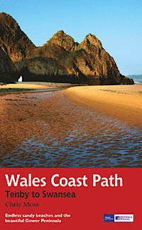
- Wandelgids Wales Coast Path: Tenby-Swansea | Aurum Press
- 2012 saw the opening of the entire Welsh coastline as an official long-distance footpath. Now, to complement its existing National Trail Guide to the Pembrokeshire Coast Path, which makes up the section of the Path from Fishguard to just beyond Tenby, Aurum publishes a completely new guide to the other most scenic and popular stretch of the... Read more
- Also available from:
- Bol.com, Netherlands
- Bol.com, Belgium
Bol.com
Netherlands
2013
Netherlands
2013
- Wales Coast Path
- 2012 saw the opening of the entire Welsh coastline as an official long-distance footpath. Now, to complement its existing National Trail Guide to the Pembrokeshire Coast Path, which makes up the section of the Path from Fishguard to just beyond Tenby, Aurum publishes a completely new guide to the other most scenic and popular stretch of the... Read more
Bol.com
Belgium
2013
Belgium
2013
- Wales Coast Path
- 2012 saw the opening of the entire Welsh coastline as an official long-distance footpath. Now, to complement its existing National Trail Guide to the Pembrokeshire Coast Path, which makes up the section of the Path from Fishguard to just beyond Tenby, Aurum publishes a completely new guide to the other most scenic and popular stretch of the... Read more

Stanfords
United Kingdom
United Kingdom
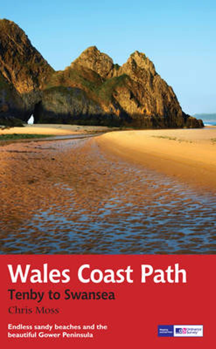
- Pembrokeshire Coast Path Harvey National Trail XT40
- Pembrokeshire Coast Path, a 265km / 165 mile section of the Wales Coast Path, presented at 1:40,000 on a light, waterproof and tear-resistant map from Harvey Map Services. The route is shown on nine panels.Maps in the Harvey’s series covering Great Britain’s national trails and other long-distance footpaths are printed on light, waterproof and... Read more
- Also available from:
- Bol.com, Netherlands
- Bol.com, Belgium
Bol.com
Netherlands
Netherlands
- Pembroke Coast Path XT40
- Pembrokeshire Coast Path, a 265km / 165 mile section of the Wales Coast Path, presented at 1:40,000 on a light, waterproof and tear-resistant map from Harvey Map Services. The route is shown on nine panels.Maps in the Harvey Read more
Bol.com
Belgium
Belgium
- Pembroke Coast Path XT40
- Pembrokeshire Coast Path, a 265km / 165 mile section of the Wales Coast Path, presented at 1:40,000 on a light, waterproof and tear-resistant map from Harvey Map Services. The route is shown on nine panels.Maps in the Harvey Read more