
Scotland
Beschreibung
Karte


Wanderwege Landesteil
- Annandale WayGPX
- Arran Coastal WayGPX
- Borders Abbeys WayGPX
- Cape Wrath TrailGPX
- Cateran TrailGPX
- Cowal WayGPX
- Dava WayGPX
- E2GPX
- Fife Coastal PathGPX
- Great Glen WayGPX
- Highland High Way
- John Muir WayGPX
- Kintyre WayGPX
- Lairig Ghru
- Lands End to John o'GroatsGPX
- Mary Queen of Scots WayGPX
- Moray Coast TrailGPX
- Moray Way
- North Sea TrailGPX
- River Ayr WayGPX
- Rob Roy WayGPX
- Saint Cuthbert's WayGPX
- Scottish Coast to Coast
- Sir Walter Scott Way
- Southern Upland WayGPX
- Speyside WayGPX
- West Highland WayGPX
- West Island WayGPX
Links
Fakten
Berichte
Führer und Karten
Übernachtung
Organisationen
Reisebüros
GPS
Sonstiges
Bücher

- Also available from:
- De Zwerver, Netherlands
- Stanfords, United Kingdom
De Zwerver
Netherlands
2010
Netherlands
2010
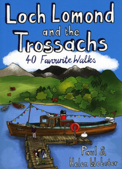
- Wandelgids Loch Lomond and the Trossachs | Pocket Mountains
- The new Loch Lomond National Park has ensured protection for what is not only Britain's largest freshwater lake, but one of its most beautiful, celebrated in ballad and song. West of Loch Lomond are the steep Arrochar Alps towering above Loch Long together with scores of much less visited lower hills stretching down to the seaboard. To the east... Read more

Stanfords
United Kingdom
2010
United Kingdom
2010
- Loch Lomond and the Trossachs
- The new Loch Lomond National Park has ensured protection for what is not only Britain`s largest freshwater lake, but one of its most beautiful, celebrated in ballad and song. West of Loch Lomond are the steep Arrochar Alps towering above Loch Long together with scores of much less visited lower hills stretching down to the seaboard. To the east... Read more

- Also available from:
- Stanfords, United Kingdom

Stanfords
United Kingdom
United Kingdom
- Derby - Uttoxeter, Ashbourne & Cheadle OS Explorer Active Map 259 (waterproof)
- Derby, Uttoxeter, Ashbourne and Cheadle area on a detailed topographic and GPS compatible map No. 259, waterproof version, from the Ordnance Survey’s 1:25,000 Explorer series.MOBILE DOWNLOADS: this title and all the other OS Explorer maps include a code for downloading after purchase the digital version onto your smartphone or tablet for... Read more

- Also available from:
- Stanfords, United Kingdom

Stanfords
United Kingdom
United Kingdom
- Torquay & Dawlish - Newton Abbot OS Explorer Active Map OL44 (waterproof)
- Torquay and Dawlish area of south Devon on a detailed topographic and GPS compatible map OL44, waterproof version, from the Ordnance Survey’s 1:25,000 Explorer series. Coverage extends from the Exe Estuary in the north-east to Totnes in the south-west and includes Paignton, Newton Abbot, Teignmouth, Exminster, Bovey Tracy, Trenchford Reservoir,... Read more

- Also available from:
- De Zwerver, Netherlands
- Stanfords, United Kingdom
De Zwerver
Netherlands
2015
Netherlands
2015

Stanfords
United Kingdom
2015
United Kingdom
2015
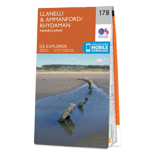
- Llanelli & Ammanford - Kidwelly OS Explorer Map 178 (paper)
- Llanelli, Ammanford and Kidwelly area on a detailed topographic and GPS compatible map No. 178, paper version, from the Ordnance Survey’s 1:25,000 Explorer series.MOBILE DOWNLOADS: this title and all the other OS Explorer maps include a code for downloading after purchase the digital version onto your smartphone or tablet for viewing on the OS... Read more

- Also available from:
- De Zwerver, Netherlands
- Stanfords, United Kingdom
De Zwerver
Netherlands
2015
Netherlands
2015

Stanfords
United Kingdom
2015
United Kingdom
2015
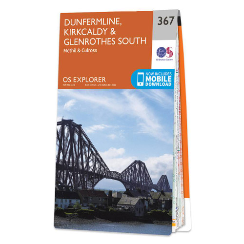
- Dunfermline, Kirkcaldy & Glenrothes South - Methil & Culross OS Explorer Map 367 (paper)
- Dunfermline, Kirkcaldy, Glenrothes South, Methil and Culross area on a detailed topographic and GPS compatible map No. 367, paper version, from the Ordnance Survey’s 1:25,000 Explorer series. MOBILE DOWNLOADS: this title and all the other OS Explorer maps include a code for downloading after purchase the digital version onto your smartphone or... Read more

- Also available from:
- De Zwerver, Netherlands
- Stanfords, United Kingdom
De Zwerver
Netherlands
Netherlands

Stanfords
United Kingdom
United Kingdom
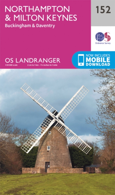
- Northampton, Milton Keynes, Buckingham & Daventry OS Landranger Map 152 (paper)
- The area around Northampton, Milton Keynes, Buckingham and Daventry, on a paper version of map No. 152 from the Ordnance Survey’s Landranger series at 1:50,000, with contoured and GPS compatible topographic mapping plus tourist information.MOBILE DOWNLOADS: As well as the physical edition of the map, each Landranger title now includes a code... Read more

The Book Depository
United Kingdom
2019
United Kingdom
2019
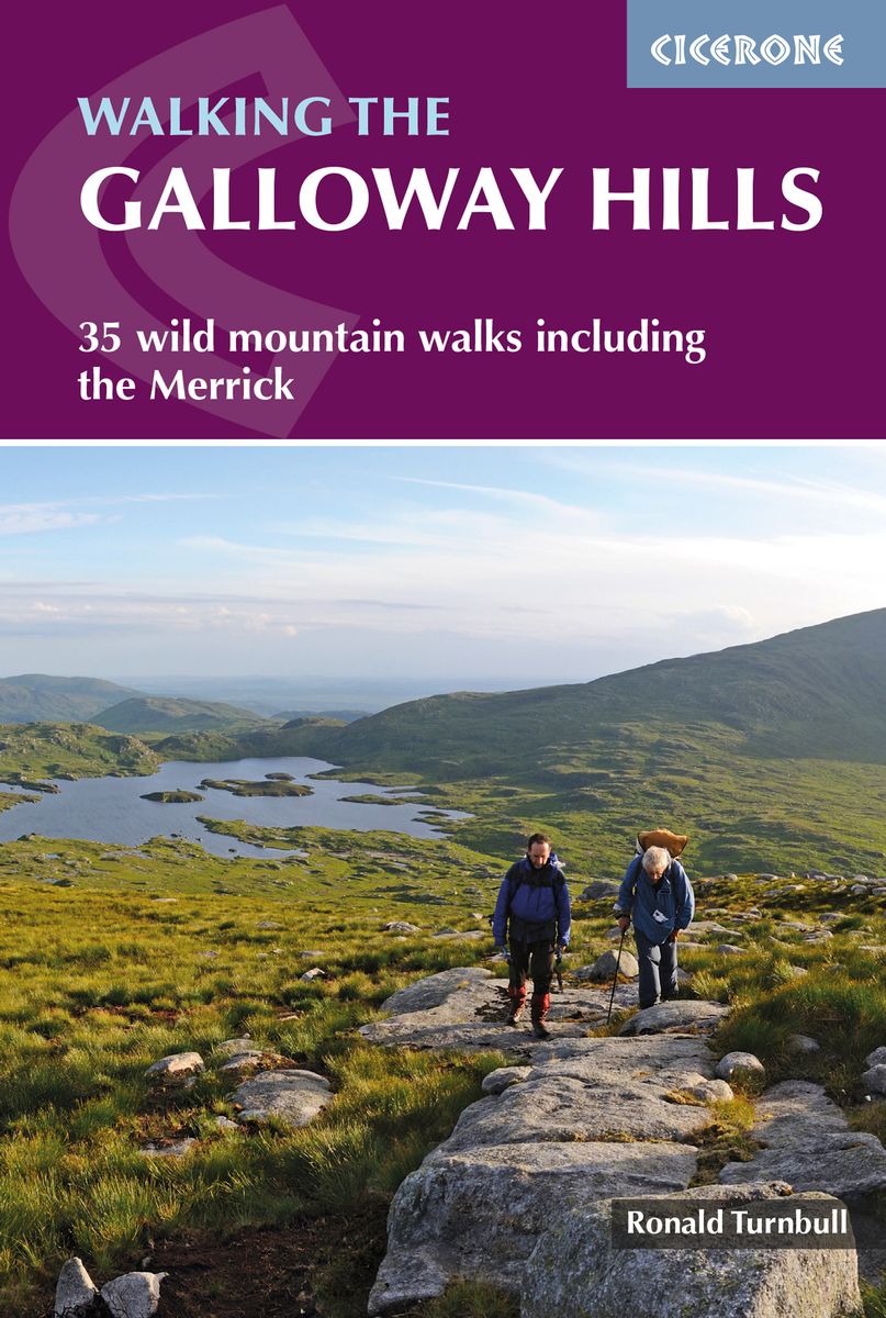
- Walking the Galloway Hills
- 35 wild mountain walks including the Merrick Read more
- Also available from:
- De Zwerver, Netherlands
- Stanfords, United Kingdom
De Zwerver
Netherlands
2019
Netherlands
2019
- Wandelgids Walking the Galloway Hills | Cicerone
- Guidebook describing mountain walks in the Galloway Hills of southern Scotland, covering Trool, Minnoch, Doon and Talnotry. Offering solitude and rugged natural beauty, this rocky, heathery wilderness presents some great hiking opportunities suitable for experienced hillwalkers. Includes summaries of longer backpack/bothy trips. Read more

Stanfords
United Kingdom
2019
United Kingdom
2019
- Walking the Galloway Hills: 35 wild mountain walks including the Merrick
- This guide covers 34 day walks and one long-distance route in the wild and remote hills of Galloway. Although there are some shorter and easier routes, many of these hill walks are long and on rugged terrain, so are more suitable for experienced walkers. The walks cover the evocative areas of The Merrick, The Awful Hand, The Rhinns of Kells,... Read more

- Also available from:
- Stanfords, United Kingdom

Stanfords
United Kingdom
United Kingdom
- Consett & Derwent Reservoir - Stanhope OS Explorer Active Map 307 (waterproof)
- Consett, Derwent Reservoir and Stanhope area on a detailed topographic and GPS compatible map No. 307, waterproof version, from the Ordnance Survey’s 1:25,000 Explorer series. MOBILE DOWNLOADS: this title and all the other OS Explorer maps include a code for downloading after purchase the digital version onto your smartphone or tablet for... Read more

- Also available from:
- Stanfords, United Kingdom

Stanfords
United Kingdom
United Kingdom
- Quantock Hills & Bridgwater OS Explorer Active Map 140 (waterproof)
- Quantock Hills & Bridgwater area on a detailed topographic and GPS compatible map No. 140, waterproof version, from the Ordnance Survey’s 1:25,000 Explorer series.MOBILE DOWNLOADS: this title and all the other OS Explorer maps include a code for downloading after purchase the digital version onto your smartphone or tablet for viewing on the OS... Read more

The Book Depository
United Kingdom
United Kingdom
- Also available from:
- Stanfords, United Kingdom

Stanfords
United Kingdom
United Kingdom
- North Harris & Loch Seaforth OS Explorer Active Map 456 (waterproof)
- North Harris with Loch Seaforth and the surrounding smaller islands on a detailed topographic and GPS compatible map No. 456, waterproof version, from the Ordnance Survey’s 1:25,000 Explorer series. MOBILE DOWNLOADS: this title and all the other OS Explorer maps include a code for downloading after purchase the digital version onto your... Read more

- Also available from:
- De Zwerver, Netherlands
- Stanfords, United Kingdom

De Zwerver
Netherlands
2015
Netherlands
2015

Stanfords
United Kingdom
2015
United Kingdom
2015
- Peterborough - March, Whittlesey, Chatteris & Oundle OS Explorer Map 227 (paper)
- Peterborough, March, Whittlesey, Chatteris and Oundle area on a detailed topographic and GPS compatible map No. 227, paper version, from the Ordnance Survey’s 1:25,000 Explorer series.MOBILE DOWNLOADS: this title and all the other OS Explorer maps include a code for downloading after purchase the digital version onto your smartphone or tablet... Read more

- Also available from:
- Stanfords, United Kingdom

Stanfords
United Kingdom
United Kingdom
- Northwich & Delamere - Winsford & Middlewich Forest OS Explorer Active Map 267 (waterproof)
- Northwich, Delamere Forest, Winsford and Middlewich area on a detailed topographic and GPS compatible map No. 267, waterproof version, from the Ordnance Survey’s 1:25,000 Explorer series.MOBILE DOWNLOADS: this title and all the other OS Explorer maps include a code for downloading after purchase the digital version onto your smartphone or... Read more

- Also available from:
- De Zwerver, Netherlands
- Stanfords, United Kingdom
De Zwerver
Netherlands
2015
Netherlands
2015

Stanfords
United Kingdom
2015
United Kingdom
2015
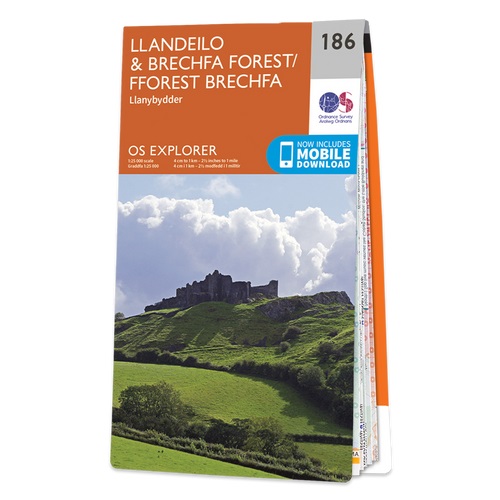
- Llandeilo & Brechfa Forest - Llanybydder OS Explorer Map 186 (paper)
- Llandeilo, Brechfa Forest and Llanybydder area on a detailed topographic and GPS compatible map No. 186, paper version, from the Ordnance Survey’s 1:25,000 Explorer series.MOBILE DOWNLOADS: this title and all the other OS Explorer maps include a code for downloading after purchase the digital version onto your smartphone or tablet for viewing... Read more

- Also available from:
- De Zwerver, Netherlands
- Stanfords, United Kingdom
De Zwerver
Netherlands
2021
Netherlands
2021

Stanfords
United Kingdom
2021
United Kingdom
2021
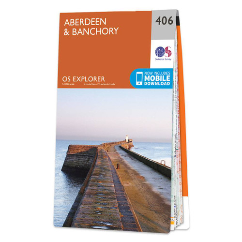
- Aberdeen & Banchory OS Explorer Map 406 (paper)
- Aberdeen and Banchory area on a detailed topographic and GPS compatible map No. 406, paper version, from the Ordnance Survey’s 1:25,000 Explorer series.MOBILE DOWNLOADS: this title and all the other OS Explorer maps include a code for downloading after purchase the digital version onto your smartphone or tablet for viewing on the OS smartphone... Read more

The Book Depository
United Kingdom
United Kingdom
- The Living Mountain
- A Celebration of the Cairngorm Mountains of Scotland Read more
Karten

The Book Depository
United Kingdom
United Kingdom
- West and Central Brecon Beacons
- West and Central Brecon Beacons at 1:25,000 in a series of Walker Read more
- Also available from:
- Stanfords, United Kingdom

Stanfords
United Kingdom
United Kingdom
- West & Central Brecon Beacons AA Walker`s Map 18
- West and Central Brecon Beacons at 1:25,000 in a series of Walker’s Maps published by the AA with the cartography from the Ordnance Survey’s Explorer series. The map is double-sided and coverage includes Brecon beacons National Park, Merthyr Tydfil, Brecon, Trecastle, Llandovery, Llanwrda, Llandeilo, etc.Maps in the AA Walker’s series are... Read more

The Book Depository
United Kingdom
United Kingdom
- Snowdon and The Conwy Valley
- Snowdon and the Conwy Valley at 1:25,000 in a series of Walker Read more
- Also available from:
- Stanfords, United Kingdom

Stanfords
United Kingdom
United Kingdom
- Snowdon & The Conway Valley AA Walker`s Map 4
- Snowdon and the Conwy Valley at 1:25,000 in a series of Walker’s Maps published by the AA with the cartography from the Ordnance Survey’s Explorer series. The map is double-sided and coverage includes parts of the New Forest National Park, Bangor, Caernarfon, Llanberis, Llanwnda, Rhyd-Ddu, Batws-y-Coed, Capel Curig, Tal-y-Bont, Llanfairfechan,... Read more
The Book Depository
United Kingdom
United Kingdom
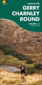
- Gerry Charnley Round
- Bob Graham Round, a 63km / 38 mile approx. circuit in the fells of the Lake District presented at 1:40,000 on a light, waterproof and tear-resistant map from Harvey Map Services. The circuit, first devised in 1984, includes Scafell and Scafell Pike but provides a shorter alternative to the better known and more challenging Bob Graham Round. The... Read more
- Also available from:
- Stanfords, United Kingdom

Stanfords
United Kingdom
United Kingdom
- Gerry Charnley Round in the Lakeland Fells
- Bob Graham Round, a 63km / 38 mile approx. circuit in the fells of the Lake District presented at 1:40,000 on a light, waterproof and tear-resistant map from Harvey Map Services. The circuit, first devised in 1984, includes Scafell and Scafell Pike but provides a shorter alternative to the better known and more challenging Bob Graham Round. The... Read more

The Book Depository
United Kingdom
United Kingdom
- Great Glen Way
- Great Glen Way, a 126km/79 miles trail from Fort William along Loch Ness to Inverness, presented at 1:40,000 on a light, waterproof and tear-resistant map from Harvey Map Services. The whole route is covered on four overlapping panels, and includes street plans of Fort William (showing the start/end of the West Highland Way) and Inverness. Map... Read more
- Also available from:
- De Zwerver, Netherlands
- Stanfords, United Kingdom

De Zwerver
Netherlands
Netherlands
- Wandelkaart Great Glen Way | Harvey Maps
- Great Glen Way, a 126km/79 miles trail from Fort William along Loch Ness to Inverness, presented at 1:40,000 on a light, waterproof and tear-resistant map from Harvey Map Services. The whole route is covered on four overlapping panels, and includes street plans of Fort William (showing the start/end of the West Highland Way) and Inverness. Map... Read more

Stanfords
United Kingdom
United Kingdom
- Great Glen Way Harvey National Trail XT40
- Great Glen Way, a 126km/79 miles trail from Fort William along Loch Ness to Inverness, presented at 1:40,000 on a light, waterproof and tear-resistant map from Harvey Map Services. The whole route is covered on four overlapping panels, and includes street plans of Fort William (showing the start/end of the West Highland Way) and Inverness. Map... Read more

The Book Depository
United Kingdom
United Kingdom
- Eastbourne and Beachy Head
- Eastbourne and Beachy Head at 1:25,000 in a series of Walker Read more
- Also available from:
- Stanfords, United Kingdom

Stanfords
United Kingdom
United Kingdom
- Eastbourne & Beachy Head AA Walker`s Map 30
- Eastbourne and Beachy Head at 1:25,000 in a series of Walker’s Maps published by the AA with the cartography from the Ordnance Survey’s Explorer series. Coverage includes Seven Sisters and the Cuckmere Haven, the start of the South Downs Way, Seaford, Newhaven, Alfriston, Firle, Glynde, Ringmer, Uckfield, Buxted, Heathfield, Herstmonceux,... Read more

- Also available from:
- De Zwerver, Netherlands
- Stanfords, United Kingdom

De Zwerver
Netherlands
Netherlands
- Wandelkaart The Great Trossachs Path | Harvey Maps
- The Great Trossachs Path, a 48km / 30 mile long spur off the West Highlight Way linking Inversnaid on Lomond with Callander presented at 1:40,000 on a GPS compatible, light, waterproof and tear-resistant map from Harvey Map Services. The route which runs along the shores of Loch Arklet, Loch Katrine, Loch Achray and Loch Venachar and links in... Read more

Stanfords
United Kingdom
United Kingdom
- The Great Trossachs Path Harvey National Trail XT40
- The Great Trossachs Path, a 48km / 30 mile long spur off the West Highlight Way linking Inversnaid on Lomond with Callander presented at 1:40,000 on a GPS compatible, light, waterproof and tear-resistant map from Harvey Map Services. The route which runs along the shores of Loch Arklet, Loch Katrine, Loch Achray and Loch Venachar and links in... Read more

The Book Depository
United Kingdom
United Kingdom
- Rob Roy Way
- Mooie, duidelijke kaart van de Rob Roy Way in Schotland. Geplastificeerd met veel extra informatie en uitsnedes van de route. One of Scotland's Great Trails Rob Roy Way is a walk across part of the Southern Highlands of Scotland taking in some of the most beautiful countryside in the UK. Starting from Drymen it goes north east to finish in... Read more
- Also available from:
- De Zwerver, Netherlands
- Stanfords, United Kingdom

De Zwerver
Netherlands
Netherlands
- Wandelkaart Rob Roy Way | Harvey Maps
- Mooie, duidelijke kaart van de Rob Roy Way in Schotland. Geplastificeerd met veel extra informatie en uitsnedes van de route. One of Scotland's Great Trails Rob Roy Way is a walk across part of the Southern Highlands of Scotland taking in some of the most beautiful countryside in the UK. Starting from Drymen it goes north east to finish in... Read more

Stanfords
United Kingdom
United Kingdom
- Rob Roy Way Harvey National Trail XT40
- Rob Roy Way, one of Scotland’s Great Trails from Drymen just north of Glasgow along Loch Tay to Pitlochry on the edge of the Cairngorms National Park presented at 1:40,000 on a light, waterproof and tear-resistant map from Harvey Map Services. The whole route, either 124km/77 miles or 151km/94 miles long depending on which variant one follows,... Read more

The Book Depository
United Kingdom
2016
United Kingdom
2016
- Yorkshire Dales South & Western
- Southern and western area of the Yorkshire Dales on a detailed topographic and GPS compatible map OL2, paper version, from the Ordnance Survey`s 1:25,000 Explorer series. Coverage includes Wharfedale with Grassington and Hebden, the upper part of the Ribblesdale with Settle and Horton, Yorkshire’s Three Peaks area of Whernside, Ingleborough and... Read more
- Also available from:
- De Zwerver, Netherlands
- Stanfords, United Kingdom

De Zwerver
Netherlands
2016
Netherlands
2016
- Wandelkaart - Topografische kaart OL02 OS Explorer Map Yorkshire Dales - Southern & Western Area | Ordnance Survey
- Southern and western area of the Yorkshire Dales on a detailed topographic and GPS compatible map OL2, paper version, from the Ordnance Survey`s 1:25,000 Explorer series. Coverage includes Wharfedale with Grassington and Hebden, the upper part of the Ribblesdale with Settle and Horton, Yorkshire’s Three Peaks area of Whernside, Ingleborough and... Read more

Stanfords
United Kingdom
2016
United Kingdom
2016
- Yorkshire Dales Southern & Western - Whernside, Ingleborough & Pen-y-ghent OS Explorer OL2
- Southern and western area of the Yorkshire Dales on a detailed topographic and GPS compatible map OL2, paper version, from the Ordnance Survey`s 1:25,000 Explorer series. Coverage includes Wharfedale with Grassington and Hebden, the upper part of the Ribblesdale with Settle and Horton, Yorkshire’s Three Peaks area of Whernside, Ingleborough and... Read more

- Also available from:
- Stanfords, United Kingdom

Stanfords
United Kingdom
United Kingdom
- Exmoor AA Walker`s Map 13
- Exmoor at 1:25,000 in a series of Walker’s Maps published by the AA with the cartography from the Ordnance Survey’s Explorer series. The map is double-sided and coverage includes the Exmoor National Park, Ilfracombe, Combe Martin, Lynton, Porlock, Minehead, Williton, Exford, Dulverton, Brayford, Barnstaple, etc.Maps in the AA Walker’s series... Read more

The Book Depository
United Kingdom
United Kingdom
- Also available from:
- De Zwerver, Netherlands
- Stanfords, United Kingdom

De Zwerver
Netherlands
Netherlands
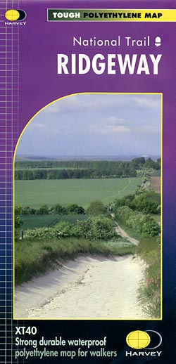
- Wandelkaart - Fietskaart Ridgeway | Harvey Maps
- The Ridgway, a 139km / 87 mile national trail from Overton Hill in Wiltshire to Ivinghoe Beacon in Buckinghamshire, presented at 1:40,000 on a light, waterproof and tear-resistant map from Harvey Map Services. The route is shown on six overlapping panels.Maps in the Harvey Read more
Stanfords
United Kingdom
United Kingdom
- Ridgeway Harvey National Trail XT40
- The Ridgway, a 139km / 87 mile national trail from Overton Hill in Wiltshire to Ivinghoe Beacon in Buckinghamshire, presented at 1:40,000 on a light, waterproof and tear-resistant map from Harvey Map Services. The route is shown on six overlapping panels.Maps in the Harvey’s series covering Great Britain’s national trails and other... Read more

The Book Depository
United Kingdom
United Kingdom
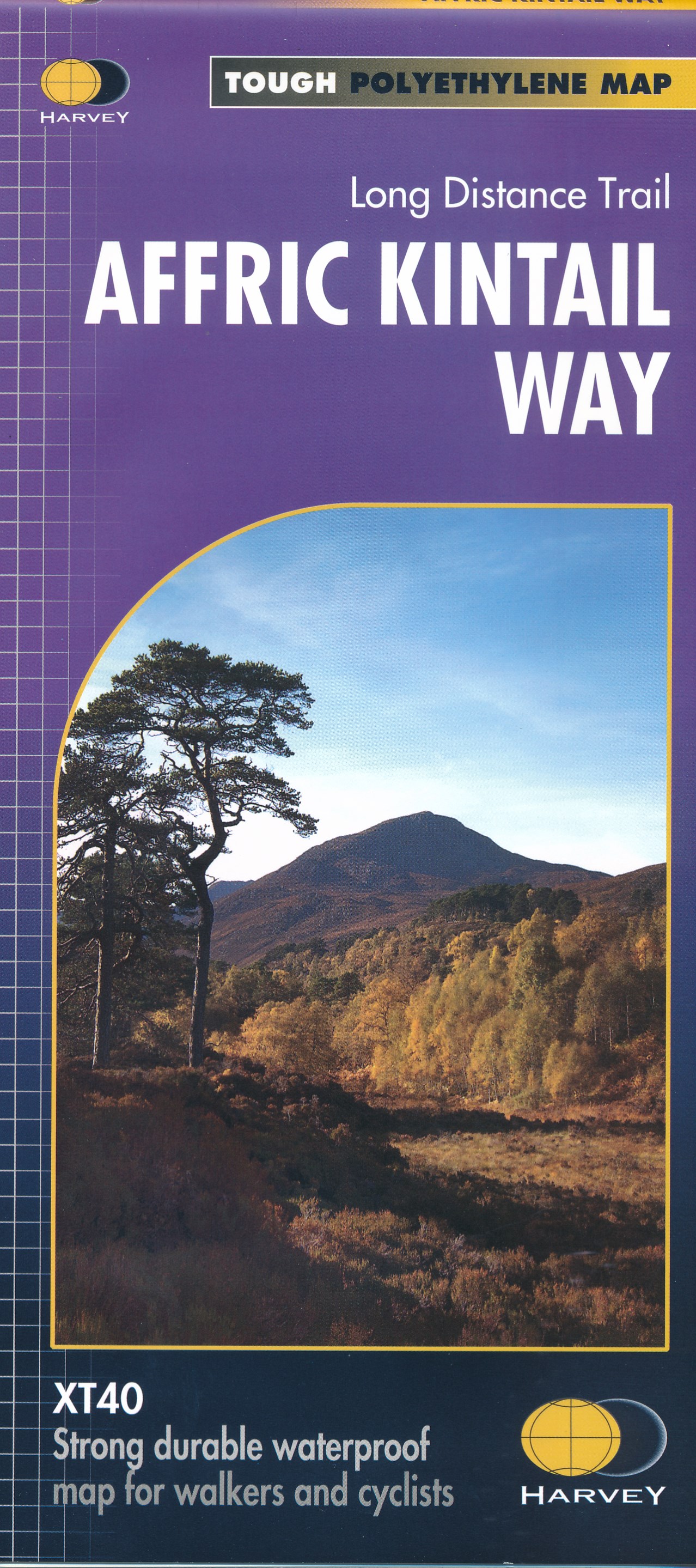
- Affric Kintail Way
- The Affric Kintail Way in Scotland, a 71km / 44 mile long-distance trail leading westwards from Drumnadrochit by Loch Ness to Morvich in Kintail by Loch Duich, presented at 1:40,000 on a light, waterproof and tear-resistant map from Harvey Map Services. The route is shown on four panels.Maps in the Harvey Read more
- Also available from:
- De Zwerver, Netherlands
- Stanfords, United Kingdom
De Zwerver
Netherlands
Netherlands
- Wandelkaart Affric Kintail Way | Harvey Maps
- The Affric Kintail Way in Scotland, a 71km / 44 mile long-distance trail leading westwards from Drumnadrochit by Loch Ness to Morvich in Kintail by Loch Duich, presented at 1:40,000 on a light, waterproof and tear-resistant map from Harvey Map Services. The route is shown on four panels.Maps in the Harvey Read more

Stanfords
United Kingdom
United Kingdom
- Affric Kintail Way Harvey National Trail XT40
- The Affric Kintail Way in Scotland, a 71km / 44 mile long-distance trail leading westwards from Drumnadrochit by Loch Ness to Morvich in Kintail by Loch Duich, presented at 1:40,000 on a light, waterproof and tear-resistant map from Harvey Map Services. The route is shown on four panels.Maps in the Harvey’s series covering Great Britain’s... Read more

The Book Depository
United Kingdom
2013
United Kingdom
2013
- South Loch Ness Trail
- The South Loch Ness Trail, a 45km / 28 mile long hiking route from Loch Tarff near Fort Augustus on the southern tip of Loch Ness to Torbreck on the outskirts of Inverness at 1:40,000 on GPS compatible, light, waterproof and tear-resistant map from Harvey Map Services. The map also highlights the course of the Trail of the 7 Lochs, an 80km / 50... Read more
- Also available from:
- De Zwerver, Netherlands
- Stanfords, United Kingdom

De Zwerver
Netherlands
2013
Netherlands
2013
- Wandelkaart South Loch Ness Trail | Harvey Maps
- The South Loch Ness Trail, a 45km / 28 mile long hiking route from Loch Tarff near Fort Augustus on the southern tip of Loch Ness to Torbreck on the outskirts of Inverness at 1:40,000 on GPS compatible, light, waterproof and tear-resistant map from Harvey Map Services. The map also highlights the course of the Trail of the 7 Lochs, an 80km / 50... Read more

Stanfords
United Kingdom
2013
United Kingdom
2013
- South Loch Ness Trail Harvey National Trail XT40
- The South Loch Ness Trail, a 45km / 28 mile long hiking route from Loch Tarff near Fort Augustus on the southern tip of Loch Ness to Torbreck on the outskirts of Inverness at 1:40,000 on GPS compatible, light, waterproof and tear-resistant map from Harvey Map Services. The map also highlights the course of the Trail of the 7 Lochs, an 80km / 50... Read more

The Book Depository
United Kingdom
United Kingdom
- Yorkshire Dales South & Western
- Southern and western area of the Yorkshire Dales on a detailed topographic and GPS compatible map OL2, waterproof version, from the Ordnance Survey`s 1:25,000 Explorer series. Coverage includes Wharfedale with Grassington and Hebden, the upper part of the Ribblesdale with Settle and Horton, Yorkshire’s Three Peaks area of Whernside,... Read more
- Also available from:
- Stanfords, United Kingdom

Stanfords
United Kingdom
United Kingdom
- Yorkshire Dales Southern & Western - Whernside, Ingleborough & Pen-y-ghent OS Explorer OL2 ACTIVE
- Southern and western area of the Yorkshire Dales on a detailed topographic and GPS compatible map OL2, waterproof version, from the Ordnance Survey`s 1:25,000 Explorer series. Coverage includes Wharfedale with Grassington and Hebden, the upper part of the Ribblesdale with Settle and Horton, Yorkshire’s Three Peaks area of Whernside,... Read more

The Book Depository
United Kingdom
United Kingdom
- Gloucester and Cheltenham
- Gloucester and Cheltenham area at 1:25,000 in a series of Walker Read more

The Book Depository
United Kingdom
United Kingdom
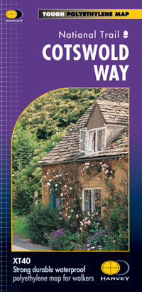
- Cotswold Way
- The Cotswold Way, a 164km / 102 mile National Trail from Chipping Campden in the north to Bath in the south, presented at 1:40,000 on a light, waterproof and tear-resistant map from Harvey Map Services. The route is shown on nine panels, with additional small street plans of Chipping Campden and Bath.Maps in the Harvey Read more
- Also available from:
- De Zwerver, Netherlands
- Stanfords, United Kingdom

De Zwerver
Netherlands
Netherlands
- Wandelkaart Cotswold Way | Harvey Maps
- The Cotswold Way, a 164km / 102 mile National Trail from Chipping Campden in the north to Bath in the south, presented at 1:40,000 on a light, waterproof and tear-resistant map from Harvey Map Services. The route is shown on nine panels, with additional small street plans of Chipping Campden and Bath.Maps in the Harvey Read more
Stanfords
United Kingdom
United Kingdom
- Cotswold Way Harvey National Trail XT40
- The Cotswold Way, a 164km / 102 mile National Trail from Chipping Campden in the north to Bath in the south, presented at 1:40,000 on a light, waterproof and tear-resistant map from Harvey Map Services. The route is shown on nine panels, with additional small street plans of Chipping Campden and Bath.Maps in the Harvey’s series covering Great... Read more