
Monte Rosa
Beschreibung
Karte

Wanderwege Region
Links
Fakten
Berichte
Führer und Karten
Übernachtung
Organisationen
Reisebüros
GPS
Sonstiges
Bücher

The Book Depository
United Kingdom
2021
United Kingdom
2021
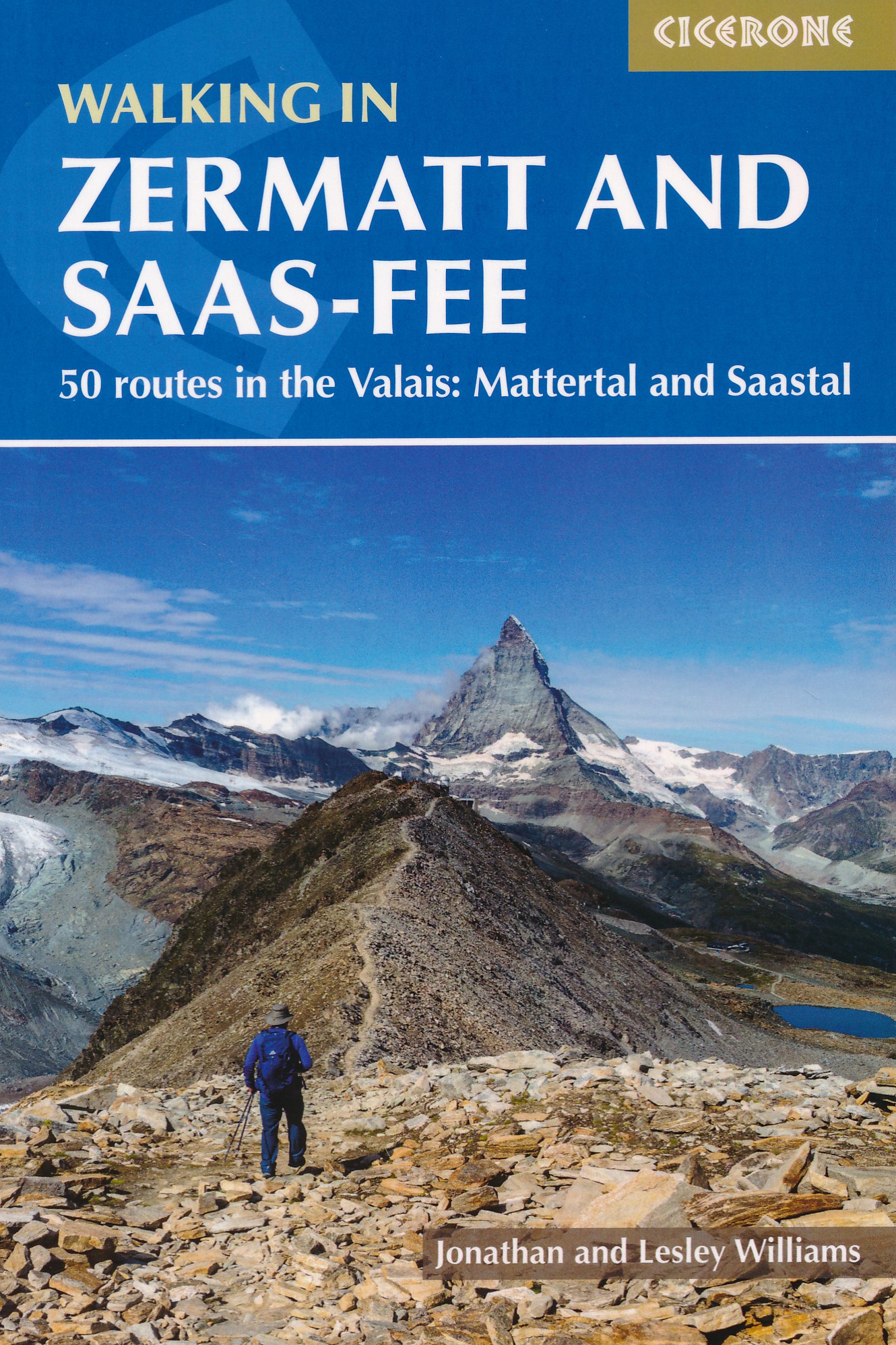
- Walking in Zermatt and Saas-Fee
- 50 routes in the Valais: Mattertal and Saastal Read more
- Also available from:
- De Zwerver, Netherlands
- Stanfords, United Kingdom
De Zwerver
Netherlands
2021
Netherlands
2021
- Wandelgids Walking in Zermatt and Saas-Fee | Cicerone
- Guidebook describing 50 varied walks in the Valais region in the heart of the Swiss Alps. The graded day walks based around the popular resort towns of Zermatt and Saas-Fee explore the Mattertal and Saastal valleys and the surrounding mountains. Ranging from 4 to 18km, the easily accessible routes make use of the area`s extensive network of... Read more

Stanfords
United Kingdom
2021
United Kingdom
2021
- Walking in Zermatt and Saas-Fee
- Guidebook describing 50 varied walks in the Valais region in the heart of the Swiss Alps. The graded day walks based around the popular resort towns of Zermatt and Saas-Fee explore the Mattertal and Saastal valleys and the surrounding mountains. Ranging from 4 to 18km, the easily accessible routes make use of the area`s extensive network of... Read more

The Book Depository
United Kingdom
2020
United Kingdom
2020
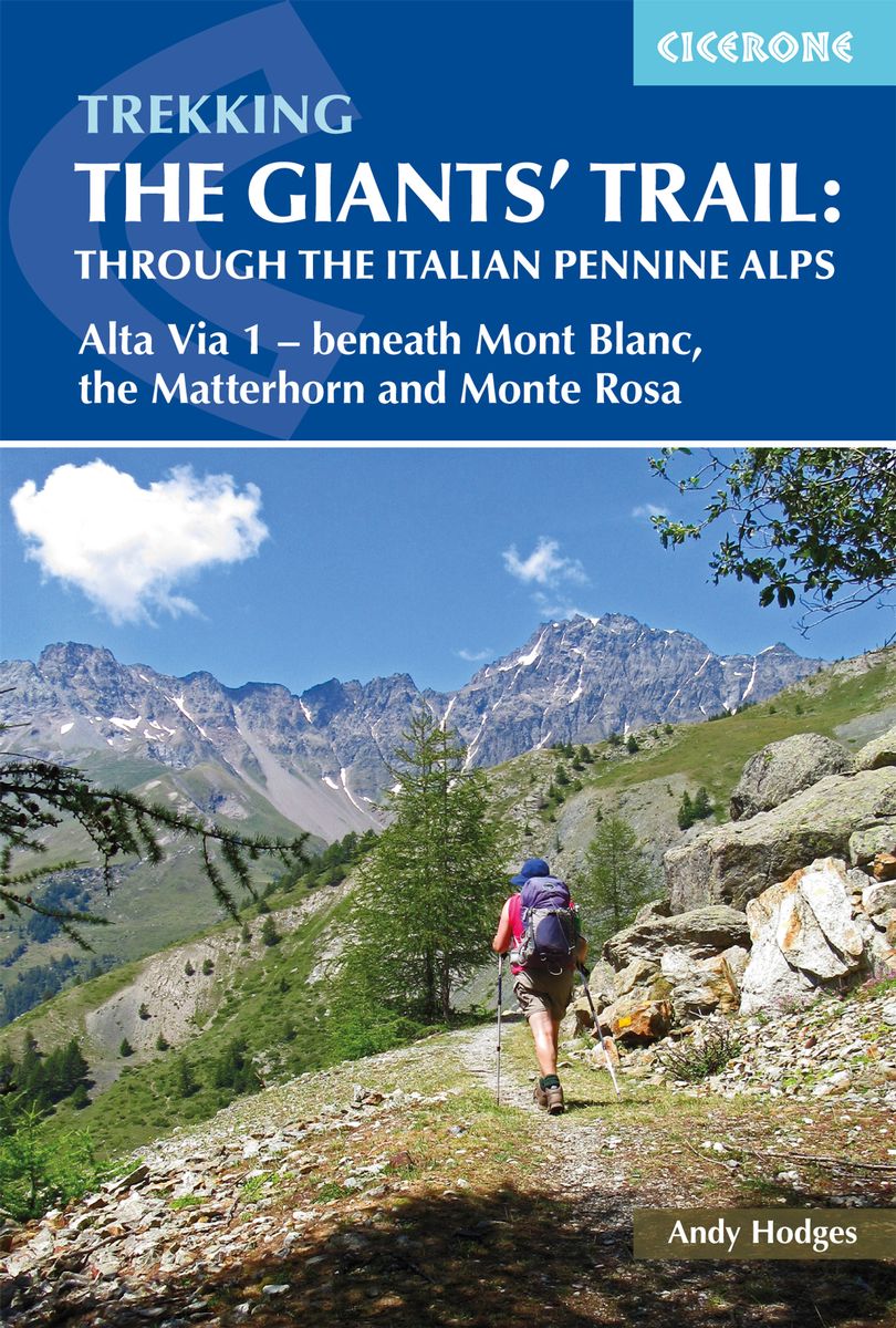
- Trekking the Giants' Trail: Alta Via 1 through the Italian Pennine Alps
- Beneath Mont Blanc, the Matterhorn and Monte Rosa Read more
- Also available from:
- De Zwerver, Netherlands
De Zwerver
Netherlands
2020
Netherlands
2020
- Wandelgids The Giants' Trail: Alta Via 1 Through the Italian Pennine Alps | Cicerone
- Beneath Mont Blanc, the Matterhorn and Monte Rosa Read more

The Book Depository
United Kingdom
2022
United Kingdom
2022
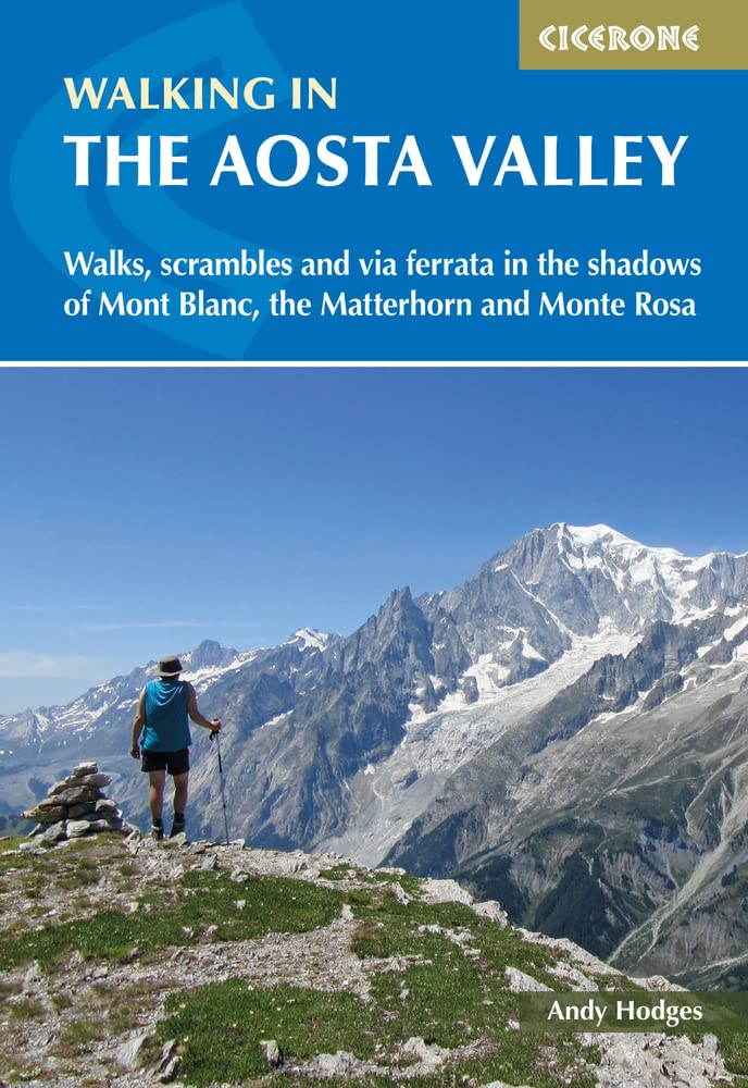
- Walking in the Aosta Valley
- Walks and scrambles in the shadows of Mont Blanc, the Matterhorn and Monte Rosa Read more
- Also available from:
- De Zwerver, Netherlands
- Stanfords, United Kingdom
De Zwerver
Netherlands
2022
Netherlands
2022
- Wandelgids Walking in the Aosta Valley | Cicerone
- A stunning, autonomous region in the Italian Alps, the Aosta valley is a walker`s paradise. This guidebook describes 32 varied and scenic routes both within the main valley and those to the north (including the Lys valley, Valpelline, Valtournenche and Grand St Bernard). The routes vary in difficulty and distance, offering something for walkers... Read more

Stanfords
United Kingdom
2022
United Kingdom
2022
- Walking in the Aosta Valley: Walks and scrambles in the shadows of Mont Blanc, the Matterhorn and Monte Rosa
- A stunning, autonomous region in the Italian Alps, the Aosta valley is a walker`s paradise. This guidebook describes 32 varied and scenic routes both within the main valley and those to the north (including the Lys valley, Valpelline, Valtournenche and Grand St Bernard). The routes vary in difficulty and distance, offering something for walkers... Read more
De Zwerver
Netherlands
2021
Netherlands
2021
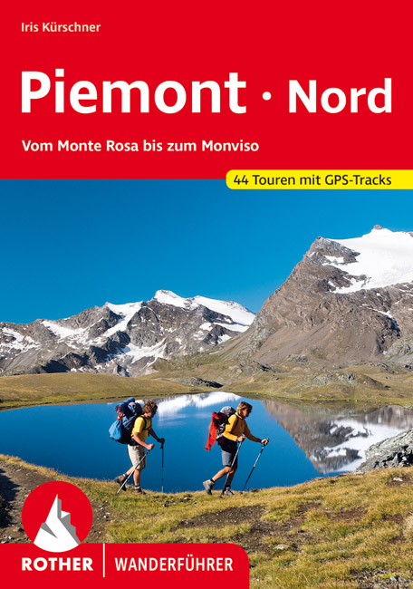
- Wandelgids 77 Piemonte Piemont - Nord | Rother Bergverlag
- Uitstekende wandelgids met een groot aantal dagtochten in dal en hooggebergte. Met praktische informatie en beperkt kaartmateriaal! Wandelingen in verschillende zwaarte weergegeven in rood/blauw/zwart 192 Seiten mit 93 Farbabbildungen 44 Höhenprofile, 44 Wanderkärtchen im Maßstab 1:25.000/1:50.000/1:75.000, eine Übersichtskarte Eine Reise ins... Read more
De Zwerver
Netherlands
2022
Netherlands
2022
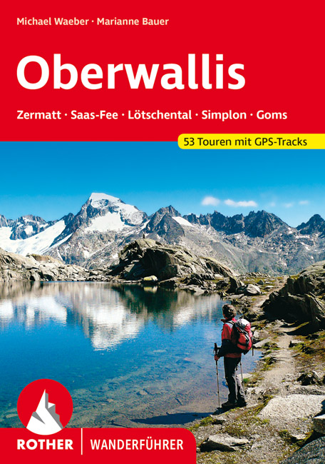
- Wandelgids Oberwallis | Rother Bergverlag
- Goede duitstalige wandelgids. Veel dagtochten, met gradaties en kleuren in zwaarte gerangschikt. Veel praktische informatie. Handzaam formaat. Das Wallis mit seinen mehr als viertausend Meter hohen Bergriesen wie Matterhorn und Monte Rosa, mit Gletscherbrüchen, Eisflanken und Felswänden ist nicht nur ein Paradies für Alpinisten, sondern... Read more
De Zwerver
Netherlands
2021
Netherlands
2021
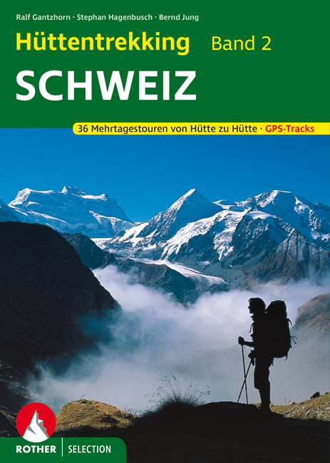
- Wandelgids Hüttentrekking Schweiz - Zwitserland Band 2 | Rother Bergverlag
- Absolute aanrader als het gaat om meerdaagse tochten van hut naar hut in Zwitserland. Gedegen Duitstalig boek! Die Schweiz gilt als Inbegriff einer schönen Landschaft. Nicht zufällig werden weltweit die unterschiedlichsten Regionen mit dem Beinamen der kleinen Alpenrepublik versehen und stets ist ein besonders reizvolles Fleckchen unserer Erde... Read more
De Zwerver
Netherlands
2012
Netherlands
2012
- Wandelgids Walliser Alpen Gebietsführer | Rother Bergverlag
- Wallis: »Land der weißen Riesen«, »Mekka des Bergsteigens«, der markigen Worthülsen und klingenden Attribute gibt es viele, namentlich im Sprachschatz einheimischer Tourismusmanager und alpenferner Werbeleute. Doch in der Tat, es steckt viel Wahres in den verbalen Superlativen für Landschaft und Natur des Viertausender-Kantons: Nirgendwo sonst... Read more

The Book Depository
United Kingdom
2018
United Kingdom
2018
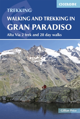
- Walking and Trekking in the Gran Paradiso
- Alta Via 2 trek and 28 day walks Read more
- Also available from:
- Stanfords, United Kingdom
- Bol.com, Netherlands
- Bol.com, Belgium

Stanfords
United Kingdom
2018
United Kingdom
2018
- Walking and Trekking in the Gran Paradiso: Alta Via 2 Trek and 28 Day Walks
- A guidebook to walking in the Gran Paradiso National Park in the Italian Alps, describing the 12-stage Alta Via 2 trek between Courmayeur and Chardonnay, and 28 walks ranging from 2 to 33km, as well as suggestions for combining routes into long-distance hikes. The Gran Paradiso sits in the Valle d`Aosta, in northwestern Italy, a region verging... Read more
Bol.com
Netherlands
2018
Netherlands
2018
- Walking and Trekking in the Gran Paradiso
- A guidebook to walking in the Gran Paradiso National Park in the Italian Alps, describing the 12-stage Alta Via 2 trek between Courmayeur and Chardonnay, and 28 walks ranging from 2 to 33km, as well as suggestions for combining routes into long-distance hikes. The Gran Paradiso sits in the Valle d'Aosta, in northwestern Italy, a region verging... Read more
Bol.com
Belgium
2018
Belgium
2018
- Walking and Trekking in the Gran Paradiso
- A guidebook to walking in the Gran Paradiso National Park in the Italian Alps, describing the 12-stage Alta Via 2 trek between Courmayeur and Chardonnay, and 28 walks ranging from 2 to 33km, as well as suggestions for combining routes into long-distance hikes. The Gran Paradiso sits in the Valle d'Aosta, in northwestern Italy, a region verging... Read more

The Book Depository
United Kingdom
2011
United Kingdom
2011
- Trekking in the Alps
- An inspirational guidebook to 20 classic treks in the Alps. As well as introducing new hiking areas in the Alps, classics such as the Tour of Mont Blanc, and Chamonix to Zermatt are included. Trekking in the Alps is immensely satisfying, and this book celebrates the rich and scenic diversity for which this great mountain range is renowned. Read more
- Also available from:
- De Zwerver, Netherlands
- Stanfords, United Kingdom
- Bol.com, Netherlands
- Bol.com, Belgium

De Zwerver
Netherlands
2019
Netherlands
2019
- Wandelgids Trekking in the Alps | Cicerone
- An inspirational guidebook to 20 classic treks in the Alps. As well as introducing new hiking areas in the Alps, classics such as the Tour of Mont Blanc, and Chamonix to Zermatt are included. Trekking in the Alps is immensely satisfying, and this book celebrates the rich and scenic diversity for which this great mountain range is renowned. Read more

Stanfords
United Kingdom
2011
United Kingdom
2011
- Alps Trekking
- An inspirational walking guide to 20 summer treks in the European Alps in Italy, Austria, Switzerland, France and Slovenia, by 8 Alpine trekking experts, including the classics such as the Tour of Mont Blanc and lesser-known routes like the Traverse of the Slovenian Alps. All the rich scenic diversity for which the Alps are renowned is... Read more

Bol.com
Netherlands
2011
Netherlands
2011
- Trekking in the Alps
- An inspirational guide to the delights of Alpine multi-day hikes. With 20 hikes described, including classics such as the Tour of Mont Blanc and the Tour of the Vanoise as well as new multi-day routes like the Traverse of the Slovenian Alps, this guide celebrates the rich scenic diversity for which the Alps are renowned.The eight talented... Read more
Bol.com
Belgium
2011
Belgium
2011
- Trekking in the Alps
- An inspirational guide to the delights of Alpine multi-day hikes. With 20 hikes described, including classics such as the Tour of Mont Blanc and the Tour of the Vanoise as well as new multi-day routes like the Traverse of the Slovenian Alps, this guide celebrates the rich scenic diversity for which the Alps are renowned.The eight talented... Read more

- Also available from:
- De Zwerver, Netherlands
- Stanfords, United Kingdom
- Bol.com, Netherlands
- Bol.com, Belgium
De Zwerver
Netherlands
2014
Netherlands
2014
- Wandelgids Walks In The Valais | Cicerone
- Comprehensive guidebook to the Valais, Switzerland, describing 111 day walks and 10 multi-day tours. Some of Europe's most dramatic mountains are found here, including the Matterhorn, Monte Rosa, Dent Blanche and Grand Combin. From easy valley walks to harder treks across rugged passes - routes for all abilities. Read more

Stanfords
United Kingdom
2014
United Kingdom
2014
- Valais Walking Guide- 120 Walks and Treks
- The Pennine Alps in the Valais region of Switzerland contain more 4000m peaks than anywhere else in Western Europe and some of the greats: the Matterhorn, Monte Rosa, Dent Blanche and Grand Combin, all surrounded by idyllic valleys and hillsides dotted with chalets, hay barns and hardy little alpine flowers as well as pristine snowfields and... Read more
Bol.com
Netherlands
2014
Netherlands
2014
- Walking in the Valais
- The Pennine Alps in the Valais region of Switzerland contain more 4000m peaks than anywhere else in Western Europe and some of the greats: the Matterhorn, Monte Rosa, Dent Blanche and Grand Combin, all surrounded by idyllic valleys and hillsides dotted with chalets, hay barns and hardy little alpine flowers as well as pristine snowfields and... Read more
Bol.com
Belgium
2014
Belgium
2014
- Walking in the Valais
- The Pennine Alps in the Valais region of Switzerland contain more 4000m peaks than anywhere else in Western Europe and some of the greats: the Matterhorn, Monte Rosa, Dent Blanche and Grand Combin, all surrounded by idyllic valleys and hillsides dotted with chalets, hay barns and hardy little alpine flowers as well as pristine snowfields and... Read more

Bol.com
Netherlands
Netherlands
- Five Weeks One Summer
- Mountain walking in the Swiss Alps - breathtaking, dramatic scenery in a magical region, a network of mountain huts, rustic inns, spectacular lakes, glaciers, flower-filled meadows... super fun! Interested? Martin Block's enthusiasm for alpine walking spills over into this fascinating and sometimes moving 'diary' of his solo alpine venture,... Read more
- Also available from:
- Bol.com, Belgium
Bol.com
Belgium
Belgium
- Five Weeks One Summer
- Mountain walking in the Swiss Alps - breathtaking, dramatic scenery in a magical region, a network of mountain huts, rustic inns, spectacular lakes, glaciers, flower-filled meadows... super fun! Interested? Martin Block's enthusiasm for alpine walking spills over into this fascinating and sometimes moving 'diary' of his solo alpine venture,... Read more
De Zwerver
Netherlands
2013
Netherlands
2013
- Wandelgids Walliser Alpen | Rother Bergverlag
- Uitstekende wandelgids met een groot aantal dagtochten in dal en hooggebergte. Met praktische informatie en beperkt kaartmateriaal! Wandelingen in verschillende zwaarte weergegeven in rood/blauw/zwart. Nirgends ballen sich solch großartige hochalpine Impressionen, so viele Viertausender auf engem Raum wie in den Walliser Alpen. Drei große... Read more
- Also available from:
- Bol.com, Netherlands
- Bol.com, Belgium
Bol.com
Netherlands
2013
Netherlands
2013
- Walliser Alpen. Die gro en Trekking-Runden
- Uitstekende wandelgids met een groot aantal dagtochten in dal en hooggebergte. Met praktische informatie en beperkt kaartmateriaal! Wandelingen in verschillende zwaarte weergegeven in rood/blauw/zwart. Nirgends ballen sich solch großartige hochalpine Impressionen, so viele Viertausender auf engem Raum wie in den Walliser Alpen. Drei große... Read more
Bol.com
Belgium
2013
Belgium
2013
- Walliser Alpen. Die gro en Trekking-Runden
- Uitstekende wandelgids met een groot aantal dagtochten in dal en hooggebergte. Met praktische informatie en beperkt kaartmateriaal! Wandelingen in verschillende zwaarte weergegeven in rood/blauw/zwart. Nirgends ballen sich solch großartige hochalpine Impressionen, so viele Viertausender auf engem Raum wie in den Walliser Alpen. Drei große... Read more
Bol.com
Netherlands
Netherlands
- Marco Polo Reisgids Noord-Italie
- Ontdek Noord-ItaliëOlijven- en citrusbomen aan de voet van de besneeuwde Alpentoppen, een modern leven in 2000 jaar oude stadjes. Als het echt helder is, wat in de vochtige nevels van de Povlakte niet vaak gebeurt, kan men vanaf het dak van de Dom van Milaan de machtige bergketens van de Centrale Alpen in het noorden en de eerste hoge heuvels... Read more
- Also available from:
- Bol.com, Belgium
Bol.com
Belgium
Belgium
- Marco Polo Reisgids Noord-Italie
- Ontdek Noord-ItaliëOlijven- en citrusbomen aan de voet van de besneeuwde Alpentoppen, een modern leven in 2000 jaar oude stadjes. Als het echt helder is, wat in de vochtige nevels van de Povlakte niet vaak gebeurt, kan men vanaf het dak van de Dom van Milaan de machtige bergketens van de Centrale Alpen in het noorden en de eerste hoge heuvels... Read more
Bol.com
Netherlands
Netherlands
- Walking In The Valais
- The Pennine Alps in the Valais region of Switzerland contain more 4000m peaks than anywhere else in Western Europe and some of the greats: the Matterhorn, Monte Rosa, Dent Blanche and Grand Combin, all surrounded by idyllic valleys and hillsides dotted with chalets, hay barns and hardy little alpine flowers as well as pristine snowfields and... Read more
- Also available from:
- Bol.com, Belgium
Bol.com
Belgium
Belgium
- Walking In The Valais
- The Pennine Alps in the Valais region of Switzerland contain more 4000m peaks than anywhere else in Western Europe and some of the greats: the Matterhorn, Monte Rosa, Dent Blanche and Grand Combin, all surrounded by idyllic valleys and hillsides dotted with chalets, hay barns and hardy little alpine flowers as well as pristine snowfields and... Read more
Bol.com
Netherlands
Netherlands
- Bergauf - Abenteuer Ausdauersport
- "BERGAUF" gibt einen faszinierenden und einmaligen Einblick in das Leben eines Menschen, der Spa am (Extrem-) Sport und Liebe zur Natur in gro artiger Weise zu verbinden versteht. Der Autor bringt einen spannenden Mix seiner Erlebnisse und Erfahrungen beim hochalpinen Skibergsteigen, Rad-Bergrennen, Berg- und Treppenlaufen und erg nzt seine... Read more
- Also available from:
- Bol.com, Belgium
Bol.com
Belgium
Belgium
- Bergauf - Abenteuer Ausdauersport
- "BERGAUF" gibt einen faszinierenden und einmaligen Einblick in das Leben eines Menschen, der Spa am (Extrem-) Sport und Liebe zur Natur in gro artiger Weise zu verbinden versteht. Der Autor bringt einen spannenden Mix seiner Erlebnisse und Erfahrungen beim hochalpinen Skibergsteigen, Rad-Bergrennen, Berg- und Treppenlaufen und erg nzt seine... Read more
Karten
De Zwerver
Netherlands
Netherlands
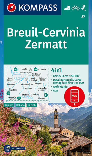
- Wandelkaart 87 Breuil-Cervinia - Zermatt | Kompass
- Breuil-Cervinia - Matterhorn - Zermatt area straddling the border of Italy and Switzerland on a GPS compatible hiking and recreational map at 1:50,000 from Kompass, printed on durable, waterproof and tear-resistant synthetic paper. Coverage extends north to Arolla and east to Monte Rosa, with Aosta in the south-western corner of the map, and... Read more
- Also available from:
- Stanfords, United Kingdom

Stanfords
United Kingdom
United Kingdom
- Breuil-Cervinia - Zermatt Kompass 87
- Breuil-Cervinia - Matterhorn - Zermatt area straddling the border of Italy and Switzerland on a GPS compatible hiking and recreational map at 1:50,000 from Kompass, printed on durable, waterproof and tear-resistant synthetic paper. Coverage extends north to Arolla and east to Monte Rosa, with Aosta in the south-western corner of the map, and... Read more

De Zwerver
Netherlands
Netherlands
- Wandelkaart 16 Genova, Genua, Varazze, Ovada | IGC - Istituto Geografico Centrale
- Genoa - Varazze - Ovada, map no. 16, in a series contoured hiking maps at 1:50,000 with local trails, long-distance footpaths, mountain accommodation, etc. from the Turin based Istituto Geografico Centrale covering the Italian Alps and Piedmont, the lakes and northern Lombardy, and the Italian Riviera.The maps have contours at 50m intervals,... Read more
- Also available from:
- Stanfords, United Kingdom

Stanfords
United Kingdom
United Kingdom
- Genoa - Varazze - Ovada 50K IGC Map No. 16
- The coast of the Italian Riviera and its hinterland around Genoa in a series contoured hiking maps at 1:50,000 with local trails, long-distance footpaths, mountain accommodation, etc. from the Turin based Istituto Geografico Centrale.Maps in this series have contours at 50m intervals, enhanced by shading and graphic relief. An overprint... Read more
De Zwerver
Netherlands
Netherlands
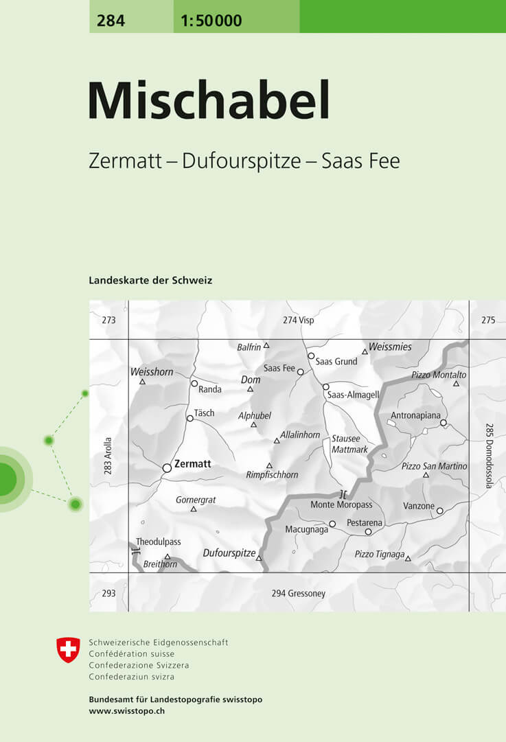
- Wandelkaart - Topografische kaart 284 Mischabel | Swisstopo
- Mischabel, map No. 284, in the standard topographic survey of Switzerland at 1:50,000 from Swisstopo, i.e. without the special overprint highlighting walking trails, local bus stops, etc, presented in Swisstopo Read more
- Also available from:
- Stanfords, United Kingdom

Stanfords
United Kingdom
United Kingdom
- Mischabel Swisstopo 284
- Mischabel, map No. 284, in the standard topographic survey of Switzerland at 1:50,000 from Swisstopo, i.e. without the special overprint highlighting walking trails, local bus stops, etc, presented in Swisstopo’s hiking editions of the 50K survey. The map covers the southern part of the Mattertal with Zermatt and Randa, the Saastal with Saas... Read more
De Zwerver
Netherlands
Netherlands
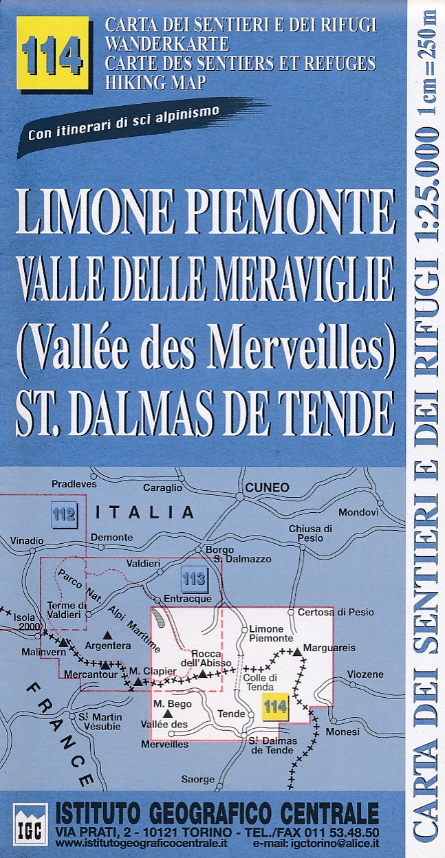
- Wandelkaart 114 Limone Piemonte, Valle Delle Meraviglie, St. Dalmas De Tende | IGC - Istituto Geografico Centrale
- IGC Italien Wanderkarten 1 : 25 000. Neuauflage. Read more
- Also available from:
- Stanfords, United Kingdom

Stanfords
United Kingdom
United Kingdom
- Limone Piemonte - Vallée des Merveilles 25K IGC Map No. 114
- Limone Piemonte - Vallée des Merveilles area at 1:25,000 in a series of contoured, GPS compatible walking maps from the Turin based Istituto Geografico Centrale, highlighting hiking trails including long-distance routes, ski routes and alpine accommodation. Maps in this series have contours at 25m intervals, enhanced by shading and graphic... Read more

De Zwerver
Netherlands
Netherlands
- Wandelkaart 14 San Remo, imperia Monte Carlo | IGC - Istituto Geografico Centrale
- The westernmost part of the Italian Riviera with coverage extending from Monte Carlo to Imperia and northwards to Tende, in a series contoured hiking maps at 1:50,000 with local trails, long-distance footpaths, mountain accommodation, etc. from the Turin based Istituto Geografico Centrale.Maps in this series have contours at 50m intervals,... Read more
- Also available from:
- Stanfords, United Kingdom

Stanfords
United Kingdom
United Kingdom
- San Remo - Imperia - Monte Carlo IGC 14
- The westernmost part of the Italian Riviera with coverage extending from Monte Carlo to Imperia and northwards to Tende, in a series contoured hiking maps at 1:50,000 with local trails, long-distance footpaths, mountain accommodation, etc. from the Turin based Istituto Geografico Centrale.Maps in this series have contours at 50m intervals,... Read more
De Zwerver
Netherlands
Netherlands
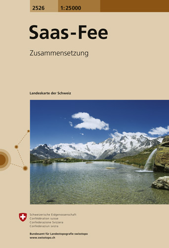
- Wandelkaart - Topografische kaart 2526 Saas - Fee | Swisstopo
- Map No. 2526, Saas-Fee, in the topographic survey of Switzerland at 1:25,000 from Swisstopo, covering the central part of the Mischabel range and both sides of the two adjoining valleys: the Mattertal between Zermatt and St Niklaus and the Saastal from north of Saas-Balen to the Mattmark Reservoir. Please note: Zermatt is at the southern edge... Read more
- Also available from:
- Stanfords, United Kingdom

Stanfords
United Kingdom
United Kingdom
- Saas-Fee Swisstopo 2526
- Map No. 2526, Saas-Fee, in the topographic survey of Switzerland at 1:25,000 from Swisstopo, covering the central part of the Mischabel range and both sides of the two adjoining valleys: the Mattertal between Zermatt and St Niklaus and the Saastal from north of Saas-Balen to the Mattmark Reservoir. Please note: Zermatt is at the southern edge... Read more

De Zwerver
Netherlands
Netherlands
- Wandelkaart 02 Valli di lanzo e Moncenisio | IGC - Istituto Geografico Centrale
- Lanzo and Moncenisio Valleys, map no. 2, in a series contoured hiking maps at 1:50,000 with local trails, long-distance footpaths, mountain accommodation, etc. from the Turin based Istituto Geografico Centrale covering the Italian Alps and Piedmont, the lakes and northern Lombardy, and the Italian Riviera.The maps have contours at 50m... Read more
- Also available from:
- Stanfords, United Kingdom

Stanfords
United Kingdom
United Kingdom
- Lanzo and Moncenisio Valleys IGC 2
- Lanzo and Moncenisio Valleys in a series contoured hiking maps at 1:50,000 with local trails, long-distance footpaths, mountain accommodation, etc. from the Turin based Istituto Geografico Centrale. This title also includes an overprint showing cycle routes.Maps in this series have contours at 50m intervals, enhanced by shading and graphic... Read more
De Zwerver
Netherlands
Netherlands
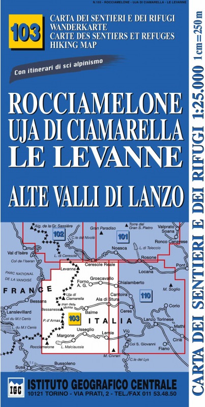
- Wandelkaart 103 Rocciamelone, Uja di Ciamarella, Le Levanne | IGC - Istituto Geografico Centrale
- IGC Italien Wanderkarten 1 : 25 000. Karte ohne Jahresangabe. Read more
- Also available from:
- Stanfords, United Kingdom

Stanfords
United Kingdom
United Kingdom
- High valleys of Lanzo - Rocciamelone - Uja di Ciamarella - Le Levanne IGC 103
- Rocciamelone - Uja di Ciamarella - Le Levanne area at 1:25,000 in a series of contoured, GPS compatible walking maps from the Turin based Istituto Geografico Centrale, highlighting hiking trails including long-distance routes, ski routes and alpine accommodation. Maps in this series have contours at 25m intervals, enhanced by shading and... Read more

De Zwerver
Netherlands
Netherlands
- Wandelkaart 17 Torino, Pinerolo e Bassa val di Susa | IGC - Istituto Geografico Centrale
- Turin - Pinerolo - Lower Susa Valley, map no. 17, in a series contoured hiking maps at 1:50,000 with local trails, long-distance footpaths, mountain accommodation, etc. from the Turin based Istituto Geografico Centrale covering the Italian Alps and Piedmont, the lakes and northern Lombardy, and the Italian Riviera.The maps have contours at 50m... Read more
- Also available from:
- Stanfords, United Kingdom

Stanfords
United Kingdom
United Kingdom
- Turin - Pinerolo - Lower Susa Valley 50K IGC Map No. 17
- Turin - Pinerolo - Lower Susa Valley area of Piedmont in a series contoured hiking maps at 1:50,000 with local trails, long-distance footpaths, mountain accommodation, etc. from the Turin based Istituto Geografico Centrale.Maps in this series have contours at 50m intervals, enhanced by shading and graphic relief. An overprint highlights local... Read more
De Zwerver
Netherlands
Netherlands
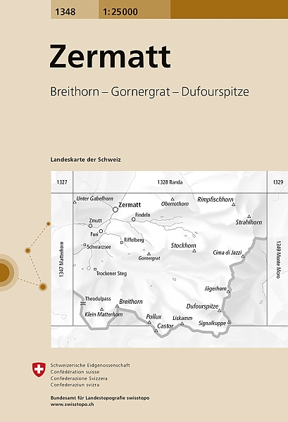
- Wandelkaart - Topografische kaart 1348 Zermatt | Swisstopo
- Map No. 1348, Zermatt, in the topographic survey of Switzerland at 1:25,000 from Bundesamt f Read more
- Also available from:
- Stanfords, United Kingdom

Stanfords
United Kingdom
United Kingdom
- Zermatt Swisstopo 1348
- Map No. 1348, Zermatt, in the topographic survey of Switzerland at 1:25,000 from Bundesamt für Landestopographie (swisstopo), covering the whole country on 247 small format sheets, with special larger maps published for popular regions including some titles now available in hiking versions.Highly regarded for their superb use of graphic relief... Read more

De Zwerver
Netherlands
Netherlands
- Wandelkaart 01 Valli di Susa, chisone e germanasca | IGC - Istituto Geografico Centrale
- IGC heeft een serie gedetailleerde wandelkaarten voor het Italiaanse gedeelte van de Alpen (Piemonte). Voldoende gedetailleerd voor het volgen van het lokale wandelnetwerk. Voorzien van schaduwreliëf; hoogtelijnen en referentiehoogtes. Onderscheid in soort wandelpad ( bergpad, bergpad met hindernissen,gletsjerovergang). Ook zijn de... Read more
- Also available from:
- Stanfords, United Kingdom

Stanfords
United Kingdom
United Kingdom
- Susa, Chisone & Germanasca Valleys: Sestiere - Sauze d`Oulx - Bardonecia 50K IGC Map No. 1
- Susa, Chisone and Germanasca Valleys, with coverage including Sestiere, Sauze d`Oulx and Bardonecia, in a series of contoured hiking maps at 1:50,000 with local trails, long-distance footpaths, mountain accommodation, etc. from the Turin based Istituto Geografico Centrale.Maps in this series have contours at 50m intervals, enhanced by shading... Read more

De Zwerver
Netherlands
Netherlands
- Wandelkaart 19 Asti, Alba, Acqui terme | IGC - Istituto Geografico Centrale
- Asti - Alba - Acqui Terme area in a series contoured hiking maps at 1:50,000 with local trails, long-distance footpaths, mountain accommodation, etc. from the Turin based Istituto Geografico Centrale.Maps in this series have contours at 50m intervals, enhanced by shading and graphic relief. An overprint highlights local footpaths and... Read more
- Also available from:
- Stanfords, United Kingdom

Stanfords
United Kingdom
United Kingdom
- Asti - Alba - Acqui Terme IGC 19
- Asti - Alba - Acqui Terme area in a series contoured hiking maps at 1:50,000 with local trails, long-distance footpaths, mountain accommodation, etc. from the Turin based Istituto Geografico Centrale.Maps in this series have contours at 50m intervals, enhanced by shading and graphic relief. An overprint highlights local footpaths and... Read more
De Zwerver
Netherlands
Netherlands
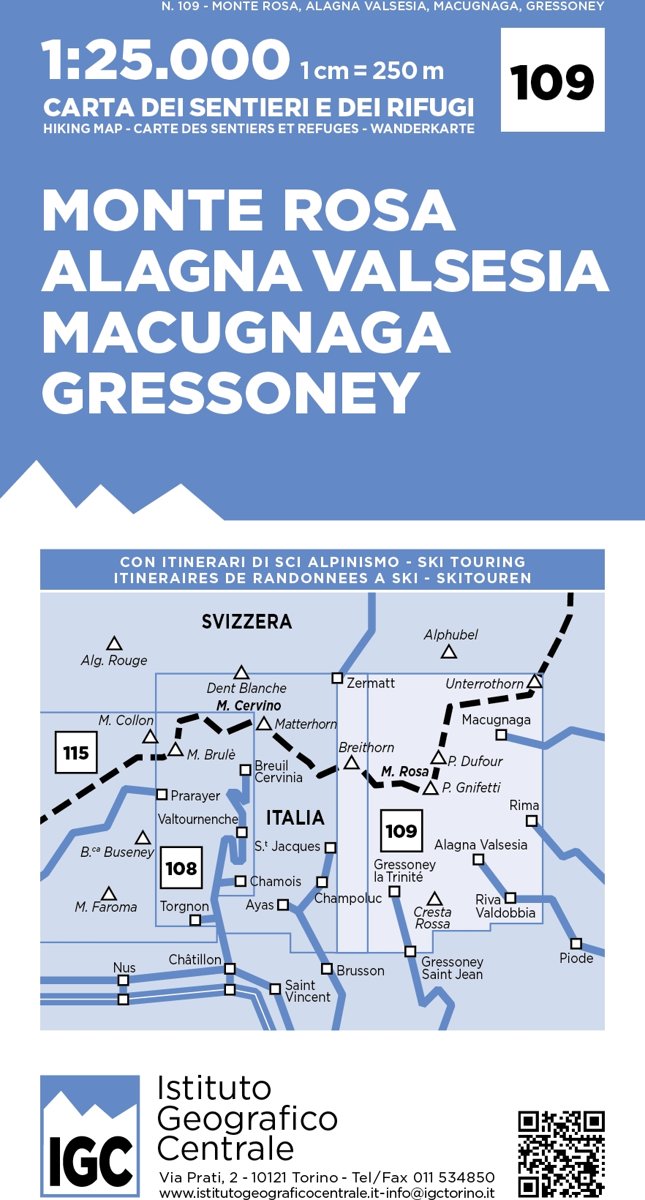
- Wandelkaart 109 Monte Rosa - Alagna Valsesia - Macugnaga - Gressoney | IGC - Istituto Geografico Centrale
- Monte Rosa - Alagna - Macugnaga - Gressoney area at 1:25,000 in a series of contoured, GPS compatible walking maps from the Turin based Istituto Geografico Centrale, highlighting hiking trails including long-distance routes, ski routes and alpine accommodation. Maps in this series have contours at 25m intervals, enhanced by shading and graphic... Read more
- Also available from:
- Stanfords, United Kingdom
Stanfords
United Kingdom
United Kingdom
- Monte Rosa - Alagna - Valsesia - Macugnaga - Gressoney IGC 109
- Monte Rosa - Alagna - Macugnaga - Gressoney area at 1:25,000 in a series of contoured, GPS compatible walking maps from the Turin based Istituto Geografico Centrale, highlighting hiking trails including long-distance routes, ski routes and alpine accommodation. Maps in this series have contours at 25m intervals, enhanced by shading and graphic... Read more

De Zwerver
Netherlands
Netherlands
- Wandelkaart 03 Il parco nazionale del Gran Paradiso | IGC - Istituto Geografico Centrale
- Gran Paradiso National Park in a series contoured hiking maps at 1:50,000 with local trails, long-distance footpaths, mountain accommodation, etc, from the Turin based Istituto Geografico Centrale. This new edition published in late 2013 highlights, among other routes, the GTA (Grande Traversata delle Alpi), Via Alpina and Alta Via 2. Coverage... Read more
- Also available from:
- Stanfords, United Kingdom

Stanfords
United Kingdom
United Kingdom
- Gran Paradiso National Park IGC 3
- Gran Paradiso National Park in a series contoured hiking maps at 1:50,000 with local trails, long-distance footpaths, mountain accommodation, etc, from the Turin based Istituto Geografico Centrale. The map highlights, among other routes, the GTA (Grande Traversata delle Alpi), Via Alpina and Alta Via 2. Coverage extends from Aosta at the top of... Read more
De Zwerver
Netherlands
2022
Netherlands
2022