
Wallis
Beschreibung
Karte

Wanderwege Region
Links
Fakten
Berichte
Führer und Karten
Übernachtung
Organisationen
Reisebüros
GPS
Sonstiges
Bücher

The Book Depository
United Kingdom
2020
United Kingdom
2020
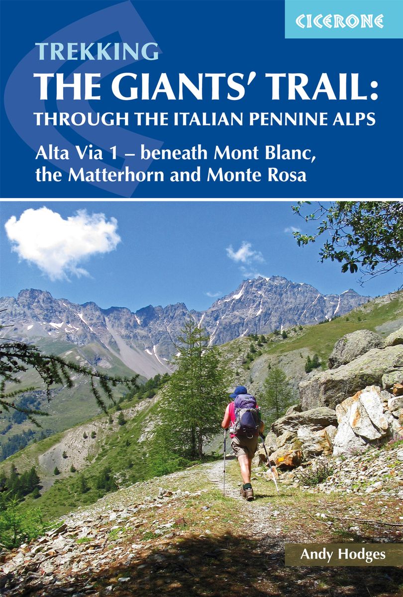
- Trekking the Giants' Trail: Alta Via 1 through the Italian Pennine Alps
- Beneath Mont Blanc, the Matterhorn and Monte Rosa Read more
- Also available from:
- De Zwerver, Netherlands
De Zwerver
Netherlands
2020
Netherlands
2020
- Wandelgids The Giants' Trail: Alta Via 1 Through the Italian Pennine Alps | Cicerone
- Beneath Mont Blanc, the Matterhorn and Monte Rosa Read more

The Book Depository
United Kingdom
2020
United Kingdom
2020
- Tour du Mont Blanc
- The most iconic long-distance, circular trail in the Alps with customised itinerary planning for walkers, trekkers, fastpackers and trail runners Read more
- Also available from:
- De Zwerver, Netherlands
- Stanfords, United Kingdom
De Zwerver
Netherlands
2020
Netherlands
2020
- Wandelgids Tour du Mont Blanc | Vertebrate Publishing
- The most iconic long-distance, circular trail in the Alps with customised itinerary planning for walkers, trekkers, fastpackers and trail runners Read more

Stanfords
United Kingdom
2020
United Kingdom
2020
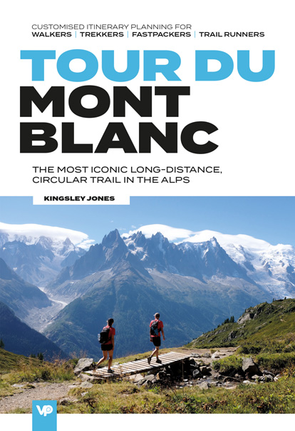
- Tour du Mont Blanc: The most iconic long-distance, circular trail in the Alps with customised itinerary planning for walkers, trekkers, fastpackers and trail runners
- Tour du Mont Blanc is the definitive guidebook for one of the most famous long-distance treks in the world. This trek circles the entire Mont Blanc massif, passing through spectacular scenery in France, Italy and Switzerland. You`ll traverse high mountain passes, see stunning glaciers, pass azure lakes, wander through tranquil green valleys and... Read more

The Book Depository
United Kingdom
2021
United Kingdom
2021
- Also available from:
- De Zwerver, Netherlands
De Zwerver
Netherlands
2021
Netherlands
2021


The Book Depository
United Kingdom
United Kingdom
- Best Hiking in Switzerland in the Valais, Bernese Alps, the Engadine and Davos
- Over 100 Hikes in the Spectacular Swiss Alps Read more

The Book Depository
United Kingdom
2023
United Kingdom
2023
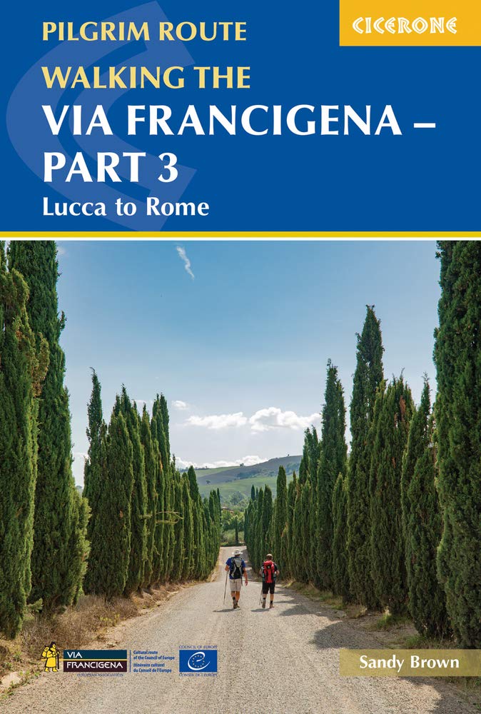
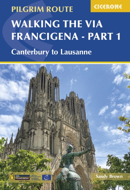
- Walking the Via Francigena Pilgrim Route - Part 1
- Canterbury to Lausanne Read more
- Also available from:
- De Zwerver, Netherlands
De Zwerver
Netherlands
2023
Netherlands
2023
- Wandelgids Via Francigena Pilgrim Route Part 1 | Cicerone
- Canterbury to Lausanne Read more
- Also available from:
- De Zwerver, Netherlands


The Book Depository
United Kingdom
2020
United Kingdom
2020
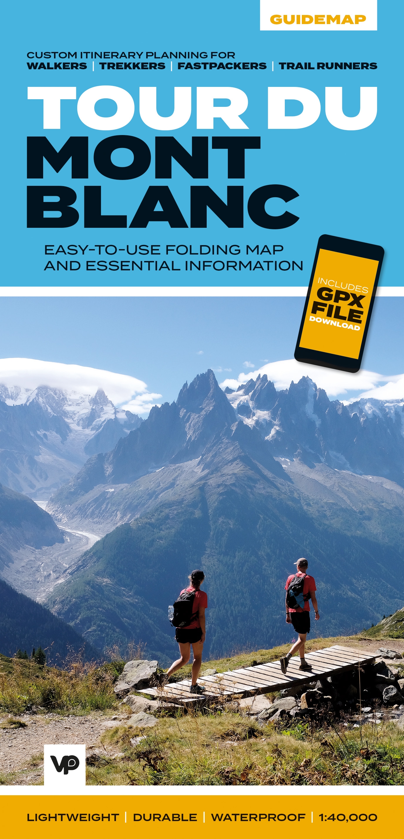
- Tour du Mont Blanc
- Easy-to-use folding map and essential information, with custom itinerary planning for walkers, trekkers, fastpackers and trail runners Read more
- Also available from:
- De Zwerver, Netherlands
- Stanfords, United Kingdom
De Zwerver
Netherlands
2020
Netherlands
2020
- Wandelkaart Tour du Mont Blanc Guidemap | Vertebrate Publishing
- Easy-to-use folding map and essential information, with custom itinerary planning for walkers, trekkers, fast packers and trail runners Read more

Stanfords
United Kingdom
2020
United Kingdom
2020
- Tour du Mont Blanc - Easy-to-use Folding Map and Essential Information
- The white dome of Mont Blanc looms over France, Italy and Switzerland, and it is no wonder that the 169-kilometre Tour du Mont Blanc (TMB) has captured the public imagination to become one of Europe`s most popular long-distance trails. The TMB appeals to people who have different levels of experience and travel at all speeds, and this... Read more

The Book Depository
United Kingdom
2021
United Kingdom
2021
- Walking the Via Francigena Pilgrim Route - Part 2
- Lausanne and the Great St Bernard Pass to Lucca Read more
- Also available from:
- De Zwerver, Netherlands
De Zwerver
Netherlands
2021
Netherlands
2021
- Wandelgids - Pelgrimsroute Via Francigena part 2 | Cicerone
- Lausanne and the Great St Bernard Pass to Lucca Read more

- Also available from:
- De Zwerver, Netherlands

The Book Depository
United Kingdom
2015
United Kingdom
2015
- The Way of St Francis
- Via di Francesco: From Florence to Assisi and Rome Read more
- Also available from:
- De Zwerver, Netherlands

De Zwerver
Netherlands
2019
Netherlands
2019
- Wandelgids - Pelgrimsroute The Way of St Francis - Via Francigena | Cicerone
- Guidebook to walking the Way of St Francis, Via di Francesco. 550km pilgrimage from Florence, through Assisi to Rome through Central Italy visiting key sites from the saint's life. Described in 28 stages, the guide to the month-long route includes detailed maps, profiles and information about all the shrines, churches and towns along the way. Read more

- Also available from:
- De Zwerver, Netherlands

The Book Depository
United Kingdom
2019
United Kingdom
2019
- Tour du Mont Blanc
- The World's most famous trek - everything you need to know to plan and walk it Read more
- Also available from:
- De Zwerver, Netherlands
- Stanfords, United Kingdom
De Zwerver
Netherlands
2019
Netherlands
2019
- Wandelgids Tour Du Mont Blanc | Knife Edge Outdoor
- The World's most famous trek - everything you need to know to plan and walk it Read more

Stanfords
United Kingdom
2019
United Kingdom
2019
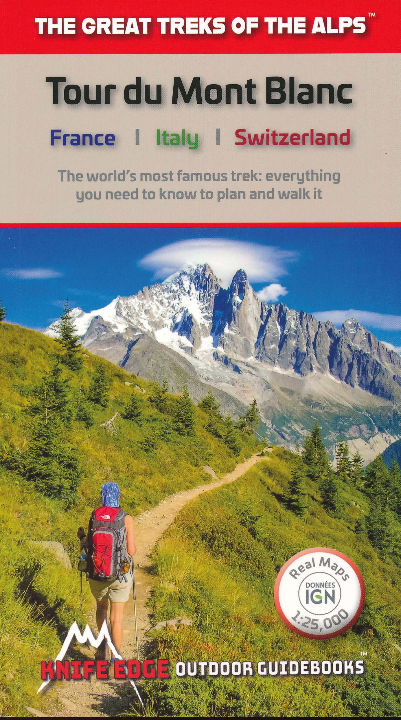
- Tour du Mont Blanc: The World`s most famous trek - everything you need to know to plan and walk it
- The world`s most famous trek: everything you need to know to plan and walk the Tour du Mont Blanc which starts near Chamonix. An epic journey around the mighty Mont Blanc, the highest peak in the Alps. 174km; 7-12 days; 9700m of altitude gain; 14 mountain passes; 3 countries, France, Italy and Switzerland. Unspoilt and remote high mountain... Read more


The Book Depository
United Kingdom
2019
United Kingdom
2019
- Walkers's Haute Route: Chamonix to Zermatt
- The epic journey between Mont Blanc and the Matterhorn Read more
- Also available from:
- De Zwerver, Netherlands
- Stanfords, United Kingdom

De Zwerver
Netherlands
2019
Netherlands
2019
- Wandelgids Walker's Haute Route: Chamonix to Zermatt | Knife Edge Outdoor
- The epic journey between Mont Blanc and the Matterhorn Read more

Stanfords
United Kingdom
2019
United Kingdom
2019
- Walkers`s Haute Route: Chamonix to Zermatt: The epic journey between Mont Blanc and the Matterhorn
- An incredible trek between the two most famous mountain towns in the Alps. Travelling from Chamonix in France to Zermatt in Switzerland, you will start at Mont Blanc and finish at the Matterhorn. On the way, pass the largest collection of snowy 4000m summits in the Alps: Mont Blanc, Grand Combin, the Weisshorn, the Zinalrothorn, the Dom, the... Read more
Karten

The Book Depository
United Kingdom
2020
United Kingdom
2020
- Trekking the Tour of Mont Blanc
- Complete two-way hiking guidebook and map booklet Read more
- Also available from:
- De Zwerver, Netherlands
- Stanfords, United Kingdom
De Zwerver
Netherlands
2020
Netherlands
2020
- Wandelgids Tour of Mont Blanc | Cicerone
- The Tour of Mont Blanc is one of the world`s classic treks. This guidebook to hiking the 170km TMB contains in-depth route description and mapping for both the classic 11 day anti-clockwise circuit and an alternative 10 day clockwise circuit. This well-signed but demanding route, starting from Les Houches or Champex, is suitable for fit... Read more

Stanfords
United Kingdom
2020
United Kingdom
2020
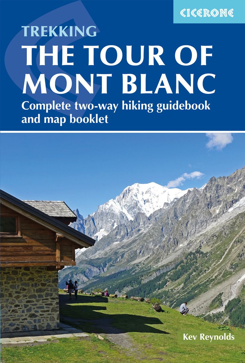
- Trekking the Tour of Mont Blanc: Complete two-way hiking guidebook and map booklet
- The Tour of Mont Blanc is one of the world`s classic treks. This guidebook to hiking the 170km TMB contains in-depth route description and mapping for both the classic 11 day anti-clockwise circuit and an alternative 10 day clockwise circuit. This well-signed but demanding route, starting from Les Houches or Champex, is suitable for fit... Read more

The Book Depository
United Kingdom
United Kingdom
- Craens - Montana
- Een nieuwe serie van de Zwitserse topografische dienst: eindelijk goede wandelkaarten met ingetekende wandelroutes op scheur- en watervast papier. Vooralsnog zijn ze uitgebracht van de populaire wandelgebieden en niet landelijk dekkend (zie overzicht) Op een gedetailleerde schaal van 1:33.333 met als ondergrond de onovertroffen topografische... Read more
- Also available from:
- De Zwerver, Netherlands
- Stanfords, United Kingdom
De Zwerver
Netherlands
Netherlands
- Wandelkaart - Topografische kaart 3305T Crans-Montana | Swisstopo
- Een nieuwe serie van de Zwitserse topografische dienst: eindelijk goede wandelkaarten met ingetekende wandelroutes op scheur- en watervast papier. Vooralsnog zijn ze uitgebracht van de populaire wandelgebieden en niet landelijk dekkend (zie overzicht) Op een gedetailleerde schaal van 1:33.333 met als ondergrond de onovertroffen topografische... Read more

Stanfords
United Kingdom
United Kingdom
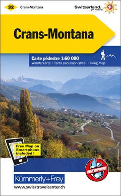
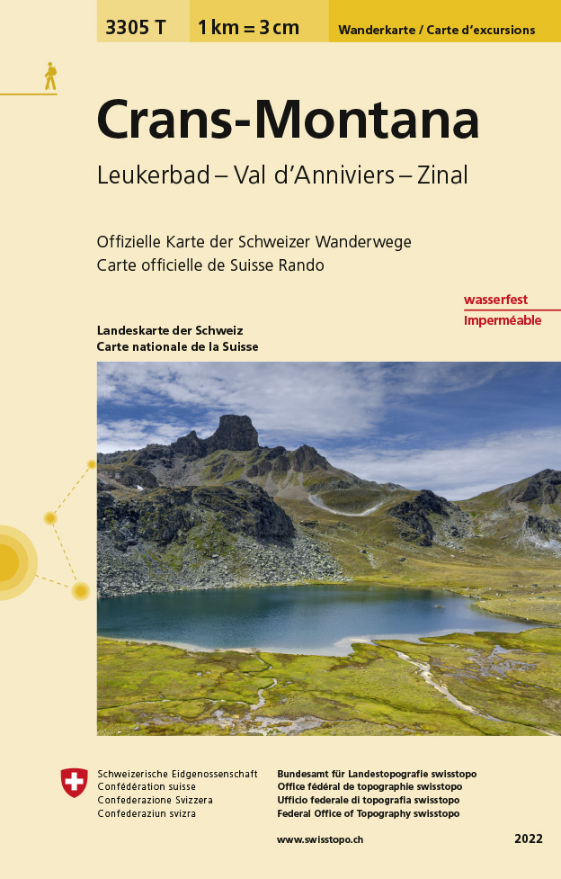
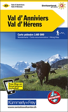
- Crans-Montana - Leukerbad - Val d`Anniviers - Zinal Swisstopo Hiking 3305T
- Crans-Montana - Leukerbad - Val d’Anniviers - Zinal area at 1:33,333 on light, waterproof and tear-resistant map No. 3305T published by Swisstopo in cooperation with the Swiss Hiking Federation. Cartography is the same as in Swisstopo’s 50K hiking maps, simply enlarged to 1:33,333 for extra clarity but without additional information. With... Read more

- Also available from:
- De Zwerver, Netherlands

De Zwerver
Netherlands
Netherlands
- Wandelkaart 21 Il Canavese da Ivrea a Chivasso | IGC - Istituto Geografico Centrale
- Il Canavese: Ivrea to Chiavasso, map no. 21, in a series contoured hiking maps at 1:50,000 with local trails, long-distance footpaths, mountain accommodation, etc. from the Turin based Istituto Geografico Centrale covering the Italian Alps and Piedmont, the lakes and northern Lombardy, and the Italian Riviera.The maps have contours at 50m... Read more
- Also available from:
- Stanfords, United Kingdom

Stanfords
United Kingdom
United Kingdom
- Il Canavese: Ivrea to Chiavasso 50K IGC Map No. 21
- Il Canavesea area including Ivrea and Chiavasso in a series contoured hiking maps at 1:50,000 with local trails, long-distance footpaths, mountain accommodation, etc. from the Turin based Istituto Geografico Centrale. This title also shows cycle routes.Maps in this series have contours at 50m intervals, enhanced by shading and graphic relief.... Read more
De Zwerver
Netherlands
Netherlands
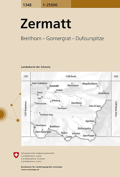
- Wandelkaart - Topografische kaart 1348 Zermatt | Swisstopo
- Map No. 1348, Zermatt, in the topographic survey of Switzerland at 1:25,000 from Bundesamt f Read more
- Also available from:
- Stanfords, United Kingdom

Stanfords
United Kingdom
United Kingdom
- Zermatt Swisstopo 1348
- Map No. 1348, Zermatt, in the topographic survey of Switzerland at 1:25,000 from Bundesamt für Landestopographie (swisstopo), covering the whole country on 247 small format sheets, with special larger maps published for popular regions including some titles now available in hiking versions.Highly regarded for their superb use of graphic relief... Read more
De Zwerver
Netherlands
Netherlands
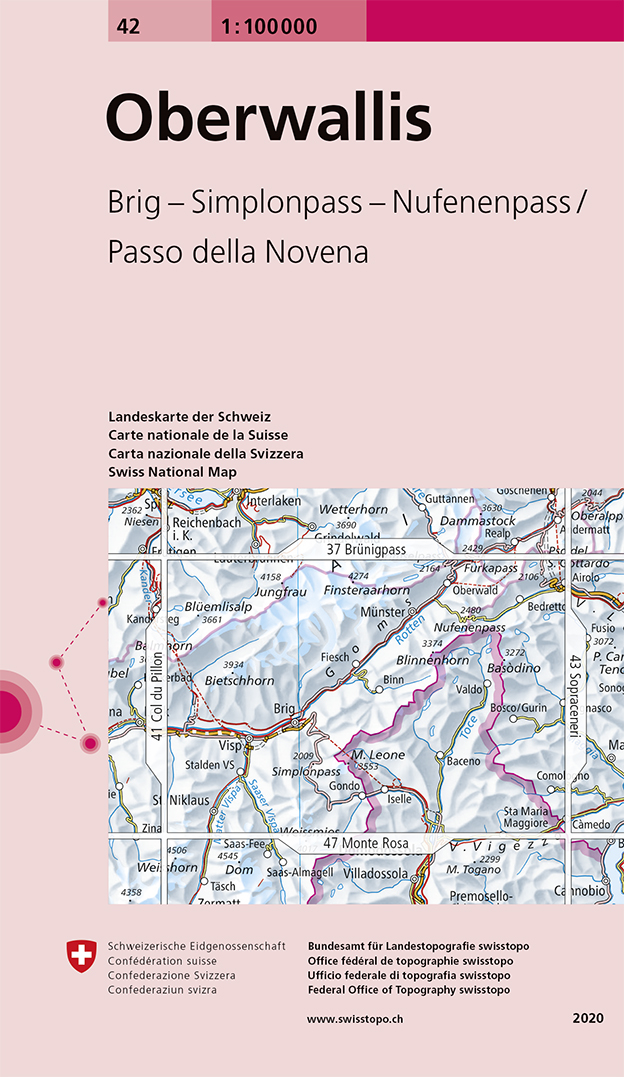
- Fietskaart - Topografische kaart - Wegenkaart - landkaart 42 Oberwallis | Swisstopo
- Map No. 42, Oberwallis, in the Swiss topographic survey at 1:100,000 published in 23 standard sheets (Nos. 26 - 48), with special larger maps centred on popular tourist destinations (Nos. 101 - 111). Swiss survey maps are highly regarded for their superb use of graphic relief and hill shading, presenting an almost 3-D picture of the country's... Read more
- Also available from:
- Stanfords, United Kingdom

Stanfords
United Kingdom
United Kingdom
- Oberwallis Swisstopo 42
- Swiss topographic survey at 1:100,000 from Swisstopo, highly regarded for it superb use of graphic relief and hill shading, presenting an almost 3-D picture of the country`s mountainous terrain. Coverage is available either as small size standard sheets – Nos 26 to 48, each covering 70 x 48 km / 43 x 30 miles approx, or as larger size maps -... Read more
De Zwerver
Netherlands
Netherlands
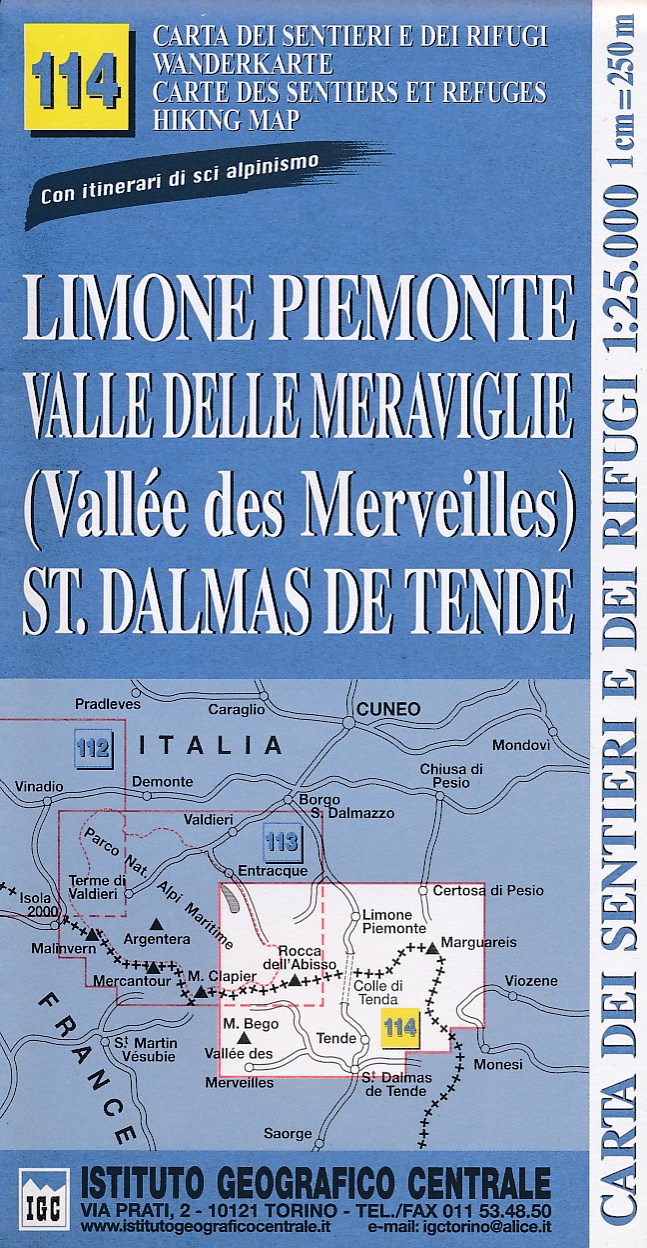
- Wandelkaart 114 Limone Piemonte, Valle Delle Meraviglie, St. Dalmas De Tende | IGC - Istituto Geografico Centrale
- IGC Italien Wanderkarten 1 : 25 000. Neuauflage. Read more
- Also available from:
- Stanfords, United Kingdom

Stanfords
United Kingdom
United Kingdom
- Limone Piemonte - Vallée des Merveilles 25K IGC Map No. 114
- Limone Piemonte - Vallée des Merveilles area at 1:25,000 in a series of contoured, GPS compatible walking maps from the Turin based Istituto Geografico Centrale, highlighting hiking trails including long-distance routes, ski routes and alpine accommodation. Maps in this series have contours at 25m intervals, enhanced by shading and graphic... Read more
De Zwerver
Netherlands
Netherlands
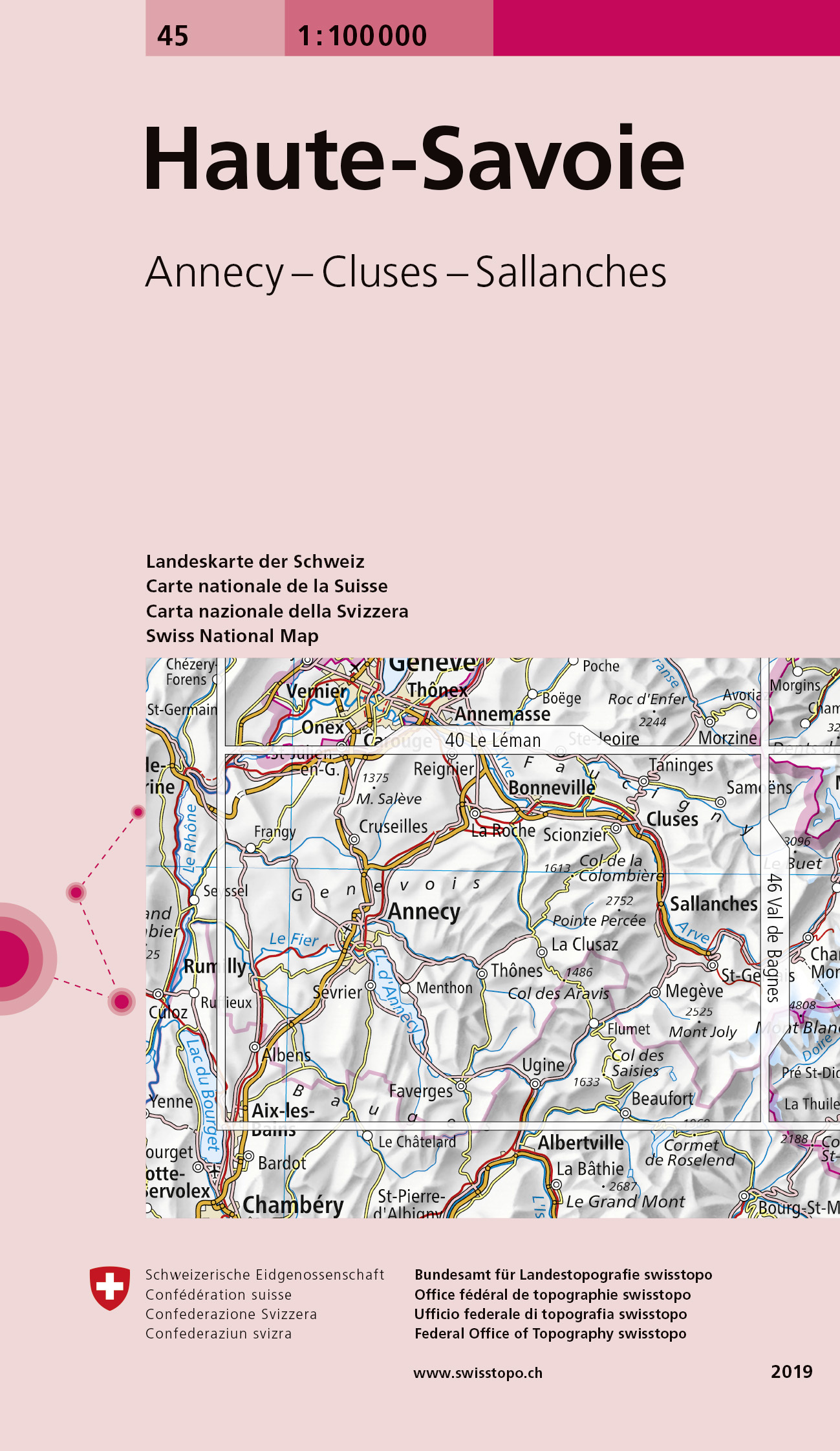
- Fietskaart - Topografische kaart - Wegenkaart - landkaart 45 Haute-Savoie | Swisstopo
- Map No. 45, Haute-Savoie, in the Swiss topographic survey at 1:100,000 published in 23 standard sheets (Nos. 26 - 48), with special larger maps centred on popular tourist destinations (Nos. 101 - 111). Swiss survey maps are highly regarded for their superb use of graphic relief and hill shading, presenting an almost 3-D picture of the country's... Read more
- Also available from:
- Stanfords, United Kingdom

Stanfords
United Kingdom
United Kingdom
- Haute-Savoie Swisstopo 45
- Swiss topographic survey at 1:100,000 from Swisstopo, highly regarded for it superb use of graphic relief and hill shading, presenting an almost 3-D picture of the country`s mountainous terrain. Coverage is available either as small size standard sheets – Nos 26 to 48, each covering 70 x 48 km / 43 x 30 miles approx, or as larger size maps -... Read more
De Zwerver
Netherlands
Netherlands
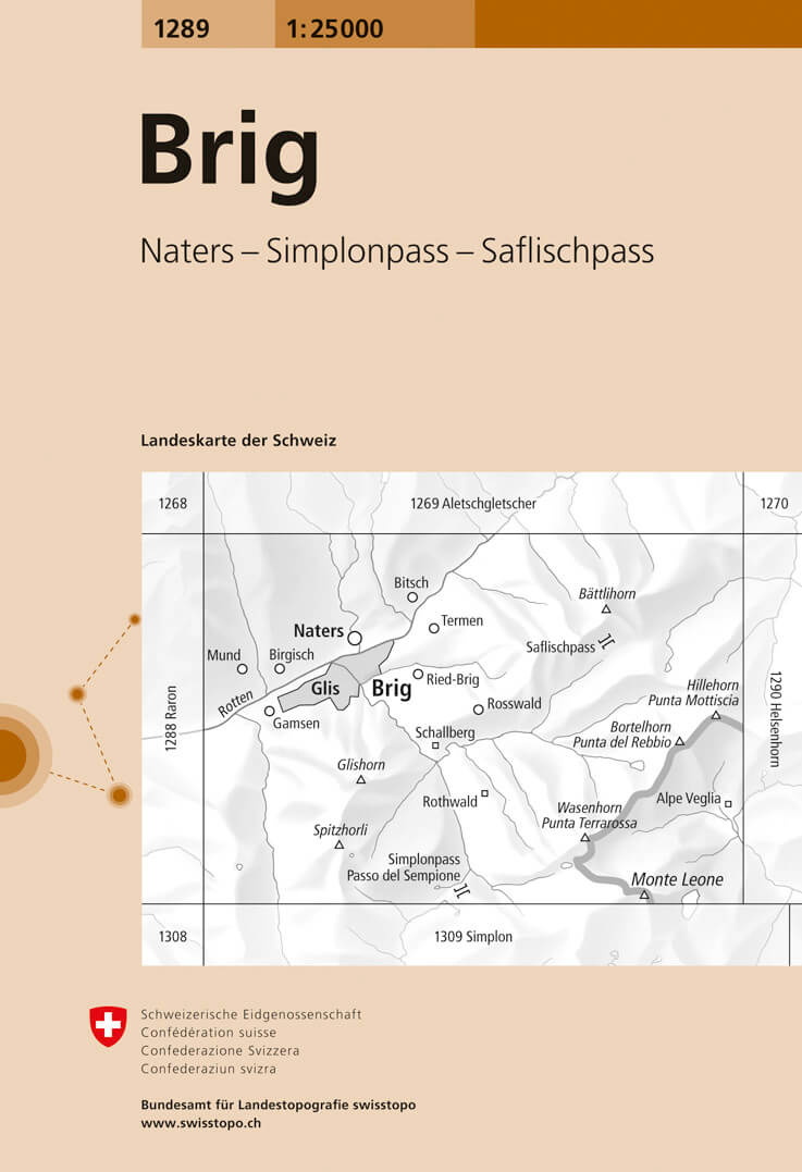
- Wandelkaart - Topografische kaart 1289 Brig | Swisstopo
- Map No. 1289, Brig, in the topographic survey of Switzerland at 1:25,000 from Bundesamt f Read more
- Also available from:
- Stanfords, United Kingdom

Stanfords
United Kingdom
United Kingdom
- Brig Swisstopo 1289
- Map No. 1289, Brig, in the topographic survey of Switzerland at 1:25,000 from Bundesamt für Landestopographie (swisstopo), covering the whole country on 247 small format sheets, with special larger maps published for popular regions including some titles now available in hiking versions.Highly regarded for their superb use of graphic relief and... Read more
De Zwerver
Netherlands
Netherlands
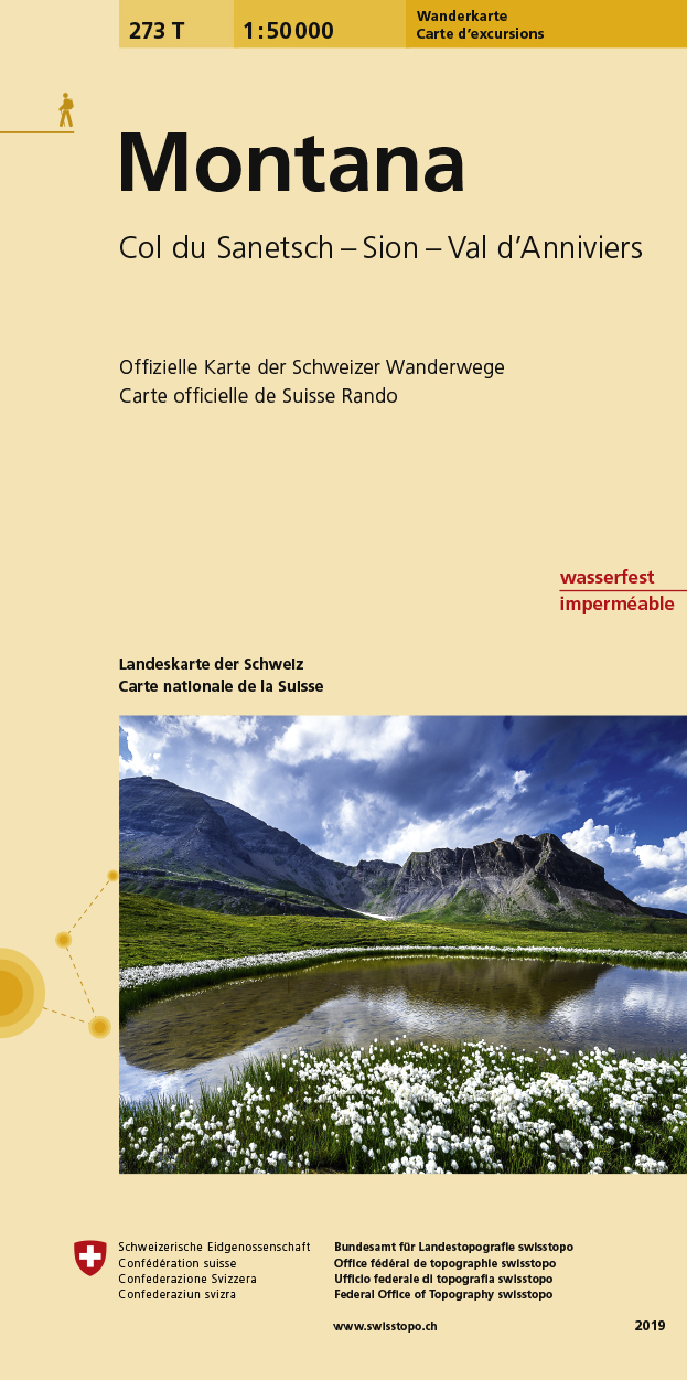
- Wandelkaart 273T Montana | Swisstopo
- Montana area, map No. 273T, at 1:50,000 in a special hiking edition of the country Read more
- Also available from:
- Stanfords, United Kingdom

Stanfords
United Kingdom
United Kingdom
- Montana Swisstopo Hiking 273T
- Montana area, map No. 273T, at 1:50,000 in a special hiking edition of the country’s topographic survey, published by Swisstopo in cooperation with the Swiss Hiking Federation. The map is divided by the Rhone Valley with Sierre and Sion and covers north of it the resorts of Crans-Montana and Lens and the peak of Wildhorn, and to the south most... Read more
De Zwerver
Netherlands
2015
Netherlands
2015
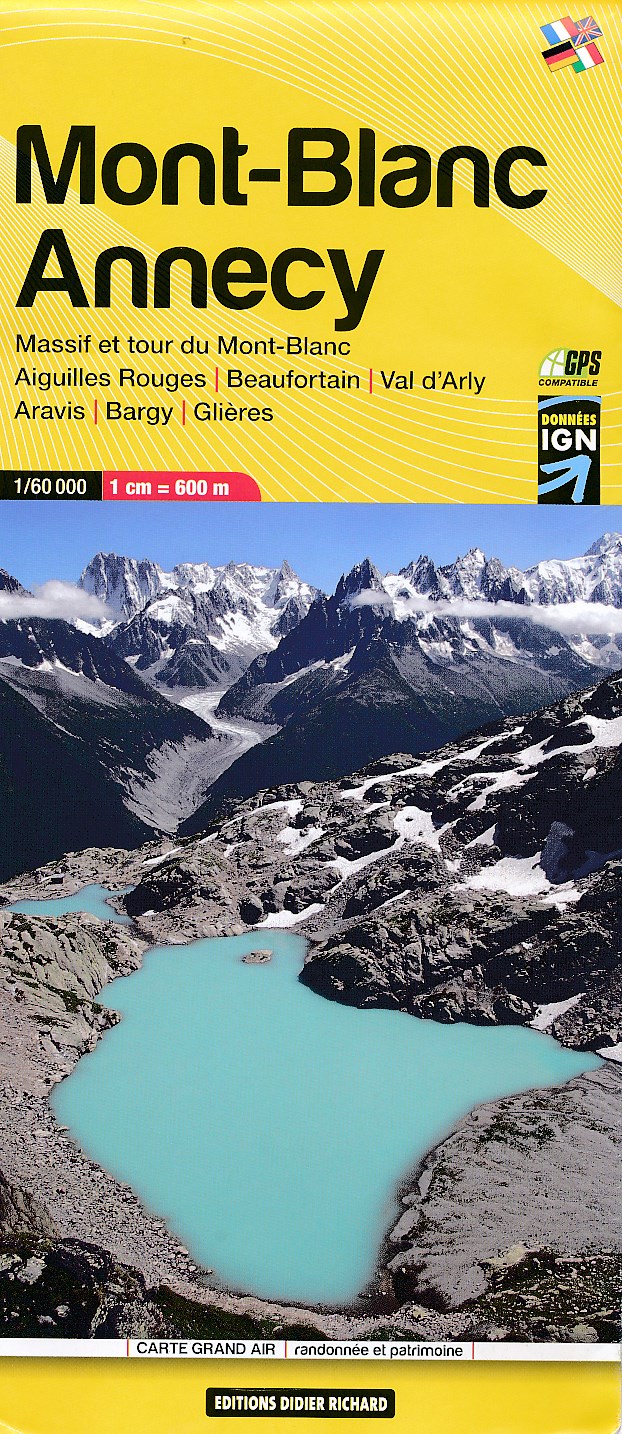
- Wandelkaart 02 Mont Blanc - Aiguilles Rouges - Aravis - Val d'Arly | Didier Richard
- Mont Blanc Massif and the adjoining region of the French Alps at 1:60,000 on a contoured and GPS compatible map from Didier Richard with a base derived from IGN Read more
- Also available from:
- Stanfords, United Kingdom

Stanfords
United Kingdom
2015
United Kingdom
2015
- Mont-Blanc - Annecy Didier Richard 02
- Mont Blanc Massif and the adjoining region of the French Alps at 1:60,000 on a contoured and GPS compatible map from Didier Richard with a base derived from IGN’s topographic survey, highlighting both local hiking routes and the GR network of long-distance paths, gîtes and mountain refuges, interesting natural and cultural sites, etc. The map... Read more

De Zwerver
Netherlands
Netherlands
- Wandelkaart 14 San Remo, imperia Monte Carlo | IGC - Istituto Geografico Centrale
- The westernmost part of the Italian Riviera with coverage extending from Monte Carlo to Imperia and northwards to Tende, in a series contoured hiking maps at 1:50,000 with local trails, long-distance footpaths, mountain accommodation, etc. from the Turin based Istituto Geografico Centrale.Maps in this series have contours at 50m intervals,... Read more
- Also available from:
- Stanfords, United Kingdom

Stanfords
United Kingdom
United Kingdom
- San Remo - Imperia - Monte Carlo IGC 14
- The westernmost part of the Italian Riviera with coverage extending from Monte Carlo to Imperia and northwards to Tende, in a series contoured hiking maps at 1:50,000 with local trails, long-distance footpaths, mountain accommodation, etc. from the Turin based Istituto Geografico Centrale.Maps in this series have contours at 50m intervals,... Read more
De Zwerver
Netherlands
Netherlands
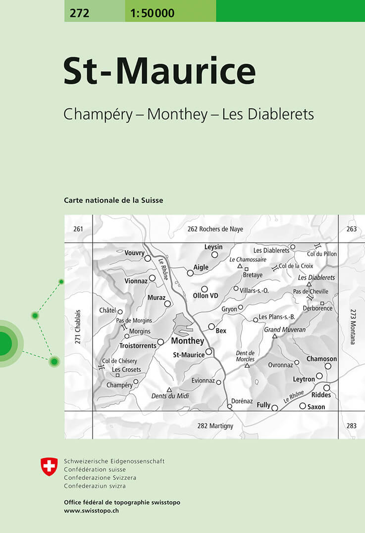
- Wandelkaart - Topografische kaart 272 St-Maurice | Swisstopo
- St-Maurice, map No. 272, in the standard topographic survey of Switzerland at 1:50,000 from Swisstopo, i.e. without the special overprint highlighting walking trails, local bus stops, etc, presented in Swisstopo Read more
- Also available from:
- Stanfords, United Kingdom

Stanfords
United Kingdom
United Kingdom
- St-Maurice Swisstopo 272
- St-Maurice, map No. 272, in the standard topographic survey of Switzerland at 1:50,000 from Swisstopo, i.e. without the special overprint highlighting walking trails, local bus stops, etc, presented in Swisstopo’s hiking editions of the 50K survey. Coverage extends from the resort of Les Diablerets and Col du Pillon in the north-east to Dents... Read more
De Zwerver
Netherlands
Netherlands
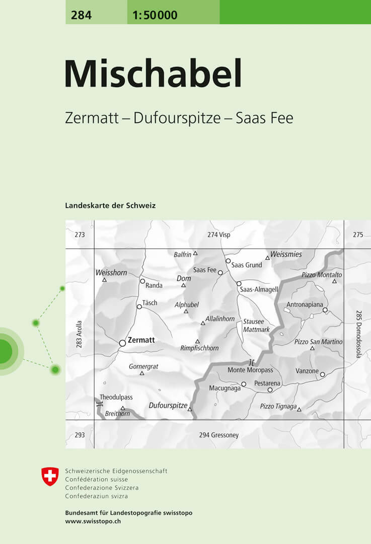
- Wandelkaart - Topografische kaart 284 Mischabel | Swisstopo
- Mischabel, map No. 284, in the standard topographic survey of Switzerland at 1:50,000 from Swisstopo, i.e. without the special overprint highlighting walking trails, local bus stops, etc, presented in Swisstopo Read more
- Also available from:
- Stanfords, United Kingdom

Stanfords
United Kingdom
United Kingdom
- Mischabel Swisstopo 284
- Mischabel, map No. 284, in the standard topographic survey of Switzerland at 1:50,000 from Swisstopo, i.e. without the special overprint highlighting walking trails, local bus stops, etc, presented in Swisstopo’s hiking editions of the 50K survey. The map covers the southern part of the Mattertal with Zermatt and Randa, the Saastal with Saas... Read more

De Zwerver
Netherlands
Netherlands
- Wandelkaart 2458 Firenze - Siena - Chianti | Kompass
- Florence - Siena - Chianti area on a double-sided map at 1:50,000 from Kompass, printed on durable, waterproof and tear-resistant synthetic paper. Coverage includes Val di Pesa, Val d’Elsa, Monteriggioni, etc. Contours are at 40m intervals, with a 2-km UTM grid. Extensive overprint includes GEA - Grande Escursione Appenninica, Sentiero Italia,... Read more
- Also available from:
- Stanfords, United Kingdom

Stanfords
United Kingdom
United Kingdom
- Florence - Siena - Chianti Kompass 2458
- Florence - Siena - Chianti area on a double-sided map at 1:50,000 from Kompass, printed on durable, waterproof and tear-resistant synthetic paper. Coverage includes Val di Pesa, Val d’Elsa, Monteriggioni, etc. Contours are at 40m intervals, with a 2-km UTM grid. Extensive overprint includes GEA - Grande Escursione Appenninica, Sentiero Italia,... Read more