
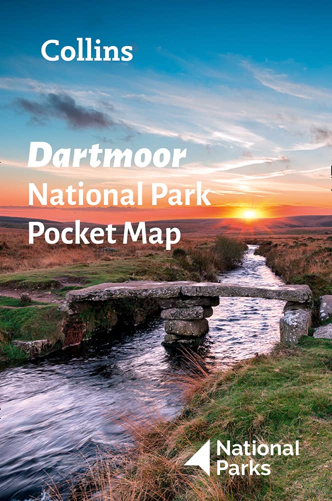
Dartmoor
Beschreibung
Dartmoor National Park, extended area of bogs, moorland and high grounds. Perfect for those who long for loneliness, getting swept away by winds, getting stuck in the permanent wet grounds.
Wanderwege Region
Links
Fakten
Berichte
Führer und Karten
Übernachtung
Organisationen
Reisebüros
GPS
Sonstiges
Bücher

The Book Depository
United Kingdom
2008
United Kingdom
2008
- The Mountains of England and Wales: Vol 2 England
- A walking guide to climbing the 253 'Nuttall' mountain summits in England, in a series of 58 walks. These form part of the total of 443 mountain summits in England and Wales which reach the height of 2000ft or more. Routes and summits in the Lake District, Cheviots, North Pennines, Yorkshire Dales, Peak District and Dartmoor. Read more
- Also available from:
- Stanfords, United Kingdom

Stanfords
United Kingdom
2008
United Kingdom
2008
- The Mountains of England and Wales: Vol. 2 - England
- John and Anne Nuttall’s Mountains of England and Wales - Volume 2: England is a comprehensive guide to the highest summits in England. Featuring the 253 mountains in England which reach the height of 2000ft, it is a companion to their similar work on Wales. Illustrated by the authors’ sketches and maps, the walker is taken to the largest... Read more

- Also available from:
- De Zwerver, Netherlands
- Stanfords, United Kingdom
De Zwerver
Netherlands
Netherlands

Stanfords
United Kingdom
United Kingdom
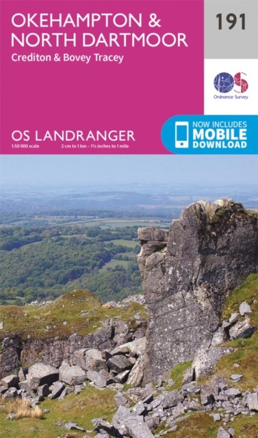
- Okehampton, North Dartmoor, Crediton & Bovey Tracey OS Landranger Map 191 (paper)
- Okehampton and the northern part of the Dartmoor National Park on a paper version of map No. 191 from the Ordnance Survey’s Landranger series at 1:50,000, with contoured and GPS compatible topographic mapping plus tourist information.MOBILE DOWNLOADS: As well as the physical edition of the map, each Landranger title now includes a code for... Read more

- Also available from:
- De Zwerver, Netherlands

The Book Depository
United Kingdom
2023
United Kingdom
2023
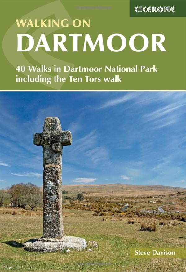
- Walking on Dartmoor
- 40 Walks in Dartmoor National Park including a Ten Tors walk Read more
- Also available from:
- De Zwerver, Netherlands
De Zwerver
Netherlands
2023
Netherlands
2023
- Wandelgids Walking on Dartmoor | Cicerone
- 40 Walks in Dartmoor National Park including a Ten Tors walk Read more

- Also available from:
- Stanfords, United Kingdom

Stanfords
United Kingdom
United Kingdom
- Okehampton, North Dartmoor, Crediton & Bovey Tracey OS Landranger Active Map 191 (waterproof)
- Okehampton and the northern part of the Dartmoor National Park on a waterproof and tear-resistant OS Active version of map No. 191 from the Ordnance Survey’s Landranger series at 1:50,000, with contoured and GPS compatible topographic mapping plus tourist information.MOBILE DOWNLOADS: As well as the physical edition of the map, each Landranger... Read more

- Also available from:
- Stanfords, United Kingdom

Stanfords
United Kingdom
United Kingdom
- Short Walks Exmoor: Leisure Walks for All Ages
- Exmoor consists of wide expanses of heather and rich woodland all of which are greatly enhanced by its varied wildlife. It has the West Country`s largest population of red deer, which frequent its woodland and moors and yet it remains less visited and less popular than the two other great uplands of south-west England - Dartmoor and Bodmin... Read more

The Book Depository
United Kingdom
United Kingdom
- Walk! Devon
- Buying Walk Devon qualifies you for a free Tour & Trail Super-Durable Map in Discovery Walking Guides Great Map Giveaway - see Discovery Walking Guides website for details. Adventurous walking tastes are as varied as Devon's many landscapes. There's always something special to explore from spectacular coastlines and wild moors to pretty... Read more
- Also available from:
- Stanfords, United Kingdom

Stanfords
United Kingdom
United Kingdom
- Walk! Devon
- Buying Walk Devon qualifies you for a free Tour & Trail Super-Durable Map in Discovery Walking Guides Great Map Giveaway - see Discovery Walking Guides website for details. Adventurous walking tastes are as varied as Devon`s many landscapes. There`s always something special to explore from spectacular coastlines and wild moors to pretty... Read more

- Also available from:
- De Zwerver, Netherlands
- Stanfords, United Kingdom
De Zwerver
Netherlands
Netherlands

Stanfords
United Kingdom
United Kingdom
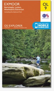
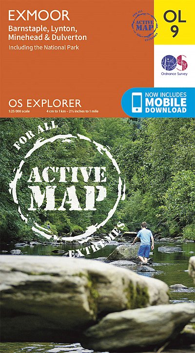
- Exmoor - Barnstaple, Lynton, Minehead & Dulverton OS Explorer Map OL9 (paper)
- The Exmoor National Park on a detailed topographic and GPS compatible map OL9, paper version, from the Ordnance Survey’s 1:25,000 Explorer series. Coverage extends westwards to Ilfracombe and Barnstaple and includes Minehead – the start of the South West Coast Path National Rrail, Lynton, Dulverton, sections of the Two Moors Way, Tarka Way,... Read more

- Also available from:
- De Zwerver, Netherlands
- Stanfords, United Kingdom
De Zwerver
Netherlands
2015
Netherlands
2015

Stanfords
United Kingdom
2015
United Kingdom
2015
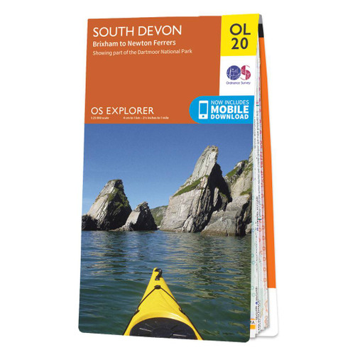
- South Devon - Brixham to Newton Ferrers OS Explorer Map OL20 (paper)
- The coast of South Devon on a detailed topographic and GPS compatible map OL20, paper version, from the Ordnance Survey’s 1:25,000 Explorer series. The map extends westwards beyond Newton Ferrers to Plymouth, eastwards beyond Brixham to Torquay, and inland to include part of the Dartmoor National Park. Coverage includes Paignton, Totness,... Read more

The Book Depository
United Kingdom
United Kingdom
- A Trail Guide to Walking The Two Moors Way
- from Lynmouth to Ivybridge Read more


- Also available from:
- De Zwerver, Netherlands
- Stanfords, United Kingdom
De Zwerver
Netherlands
Netherlands

Stanfords
United Kingdom
United Kingdom
- Exmoor - Barnstaple, Lynton, Minehead & Dulverton OS Explorer Active Map OL9 (waterproof)
- The Exmoor National Park on a detailed topographic and GPS compatible map OL9, waterproof version, from the Ordnance Survey’s 1:25,000 Explorer series. Coverage extends westwards to Ilfracombe and Barnstaple and includes Minehead – the start of the South West Coast Path National Rrail, Lynton, Dulverton, sections of the Two Moors Way, Tarka... Read more

The Book Depository
United Kingdom
2018
United Kingdom
2018
- Fastpacking
- Multi-day running adventures: tips, stories and route ideas Read more

- Also available from:
- De Zwerver, Netherlands
Karten

The Book Depository
United Kingdom
2010
United Kingdom
2010
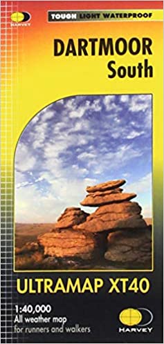
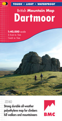
- Dartmoor
- Double-sided waterproof mountain map of Dartmoor from Harvey at 1:40,000, with a geological map of the region on the reverse, and advice on navigating the region safely.MAIN MAP: Topography is shown through clear altitude shading, spot heights, contours at 15m intervals, and index contours at 75m intervals. A variety of symbols are used to show... Read more
- Also available from:
- De Zwerver, Netherlands
- Stanfords, United Kingdom
De Zwerver
Netherlands
2010
Netherlands
2010
- Wandelkaart Dartmoor | Harvey Maps
- Double-sided waterproof mountain map of Dartmoor from Harvey at 1:40,000, with a geological map of the region on the reverse, and advice on navigating the region safely.MAIN MAP: Topography is shown through clear altitude shading, spot heights, contours at 15m intervals, and index contours at 75m intervals. A variety of symbols are used to show... Read more

Stanfords
United Kingdom
2010
United Kingdom
2010
- Dartmoor Harvey British Mountain Map XT40
- Double-sided waterproof mountain map of Dartmoor from Harvey at 1:40,000, with a geological map of the region on the reverse, and advice on navigating the region safely.*MAIN MAP:* Topography is shown through clear altitude shading, spot heights, contours at 15m intervals, and index contours at 75m intervals. A variety of symbols are used to... Read more

De Zwerver
Netherlands
2012
Netherlands
2012
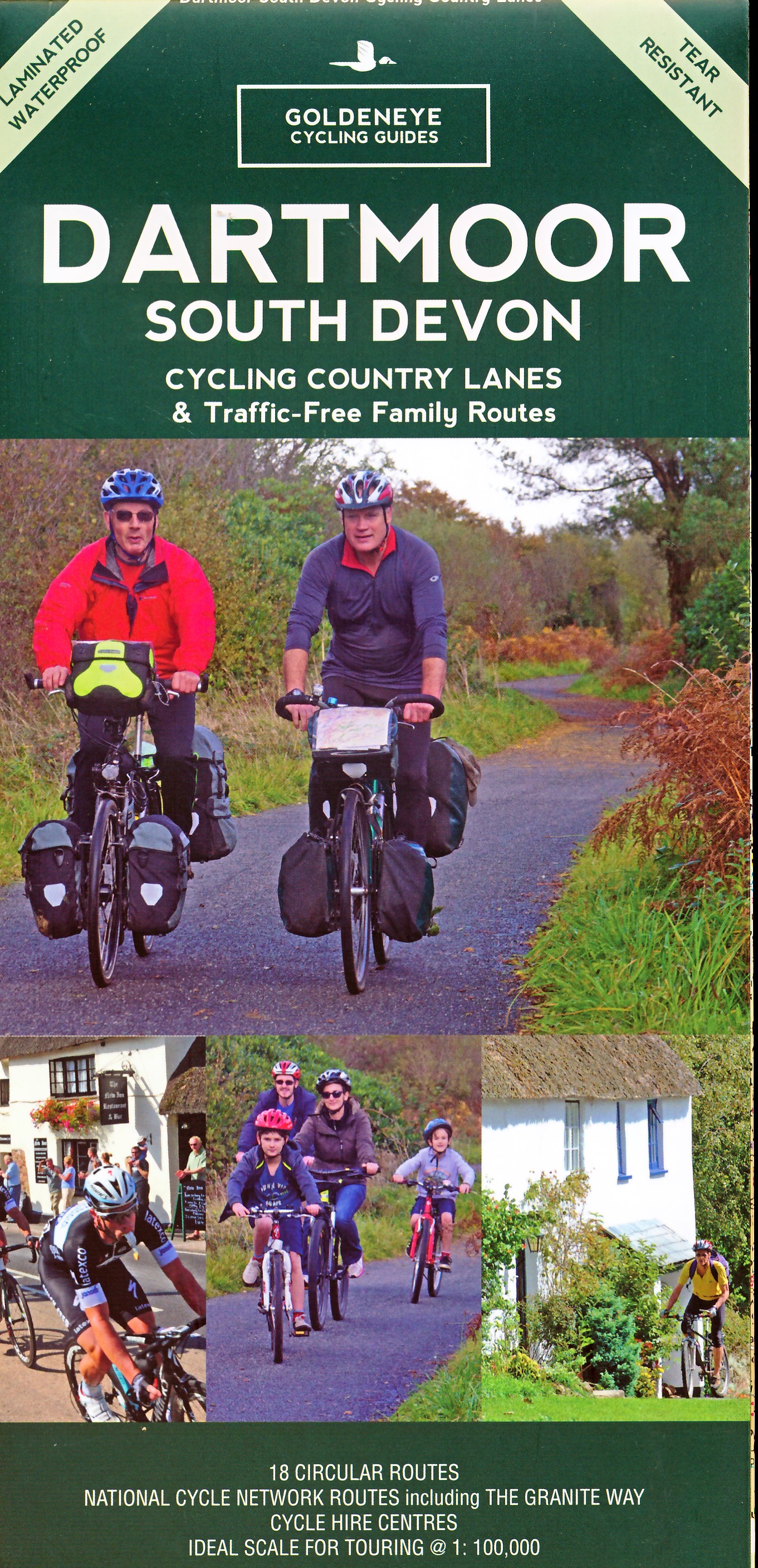
- Fietskaart Dartmoor | Harvey Maps
- Dartmoor on a double-sided, light, waterproof and tear-resistant map providing on one side a map at 1:60,000 covering a wider area between Exeter and Plymouth, with on the reverse the Dartmoor National Park at 1:40,000 with highlighting for off-road cycle trails.On one side a map at 1:60,000 covers the area between Exeter and Plymouth. The map... Read more
- Also available from:
- Stanfords, United Kingdom

Stanfords
United Kingdom
2012
United Kingdom
2012
- Dartmoor for Cyclists
- Dartmoor on a double-sided, light, waterproof and tear-resistant map providing on one side a map at 1:60,000 covering a wider area between Exeter and Plymouth, with on the reverse the Dartmoor National Park at 1:40,000 with highlighting for off-road cycle trails.On one side a map at 1:60,000 covers the area between Exeter and Plymouth. The map... Read more
De Zwerver
Netherlands
2022
Netherlands
2022

Stanfords
United Kingdom
United Kingdom
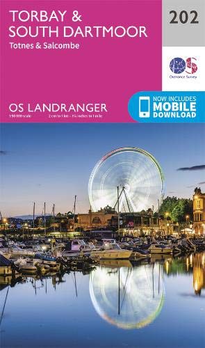
- Torbay & South Dartmoor 1899-1900 - 202
- Map No. 202, Torbay and South Dartmoor 1899-1900, in the Cassini Historical Series of old Ordnance Survey mapping of England and Wales at 1:50,000 in a format designed to offer a convenient comparison with the present day coverage from the OS, and most locations in three different editions. Old historical maps have been combined so that the... Read more

Stanfords
United Kingdom
United Kingdom
- 2000 Plus England: 254 Summits over 2000ft.
- The 2000 Plus map of England showing summits over 2000ft (609.6m), together with markings for subsidiary tops and minor summits, combining them into 16 groups listed with full details and presented with mountain profiles.The main map at 1:250,000 shows the Pennines, with three insets at 1:350,000 covering the Peak District, Dartmoor and the... Read more
Stanfords
United Kingdom
United Kingdom
- Plymouth and Launceston 1809-1813
- Map No. 201, Plymouth and Launceston 1809-1813, in the Cassini Historical Series of old Ordnance Survey mapping of England and Wales at 1:50,000 in a format designed to offer a convenient comparison with the present day coverage from the OS, and most locations in three different editions. Old historical maps have been combined so that the sheet... Read more
Stanfords
United Kingdom
United Kingdom
- Okehampton & North Dartmoor 1899-1900 - 191
- Map No. 191, Okehampton and North Dartmoor 1899-1900, in the Cassini Historical Series of old Ordnance Survey mapping of England and Wales at 1:50,000 in a format designed to offer a convenient comparison with the present day coverage from the OS, and most locations in three different editions. Old historical maps have been combined so that the... Read more

Stanfords
United Kingdom
United Kingdom
- Exmoor A-Z Adventure Atlas
- Exmoor at 1:25,000 in a series of handy A5 size Adventure Atlases from Geographers` A-Z Map Company with cartography from the Ordnance Survey’s Explorer series. Coverage includes the South West Coast path between Minehead and Combe Martin Bay, Two Moors Way, Tarka Train, Dulverton, Brendon Hills, etc.To see other titles in this series please... Read more
Stanfords
United Kingdom
United Kingdom
- Torbay and South Dartmoor 1809
- Map No. 202, Torbay and South Dartmoor 1809, in the Cassini Historical Series of old Ordnance Survey mapping of England and Wales at 1:50,000 in a format designed to offer a convenient comparison with the present day coverage from the OS, and most locations in three different editions. Old historical maps have been combined so that the sheet... Read more
Stanfords
United Kingdom
United Kingdom
- Okehampton and North Dartmoor 1809-1919 (3-map set)
- Map No. 191, Okehampton and North Dartmoor 1809-1919 (3-map set), in the Cassini Historical Series of old Ordnance Survey mapping of England and Wales at 1:50,000 in a format designed to offer a convenient comparison with the present day coverage from the OS, and most locations in three different editions. Old historical maps have been combined... Read more
Stanfords
United Kingdom
United Kingdom
- Okehampton and North Dartmoor 1809
- Map No. 191, Okehampton and North Dartmoor 1809, in the Cassini Historical Series of old Ordnance Survey mapping of England and Wales at 1:50,000 in a format designed to offer a convenient comparison with the present day coverage from the OS, and most locations in three different editions. Old historical maps have been combined so that the... Read more
Stanfords
United Kingdom
United Kingdom
- Plymouth and Launceston 1809-1919 (3-map set)
- Map No. 201, Plymouth and Launceston 1809-1919 (3-map set), in the Cassini Historical Series of old Ordnance Survey mapping of England and Wales at 1:50,000 in a format designed to offer a convenient comparison with the present day coverage from the OS, and most locations in three different editions. Old historical maps have been combined so... Read more

Stanfords
United Kingdom
United Kingdom
- Tour de Manche Vol. 2: Northern Brittany - Devon/Dorset - Channel Is. Cycle Route (580km)
- Tour de Manche Vol.2: de St-Malo à St-Malo cycling guide covering a 580km long-distance cross-Channel route from St-Malo along the northern coast of Brittany to Roscoff, across the Channel to Plymouth, inland around Dartmoor National Park to Exeter and westwards to Weymouth, and from there back to St-Malo via Guernsey and Jersey.Within France... Read more