
Dolomiti
Beschreibung
Karte

Wanderwege Region
- Alta Via Dolomiti 1GPX
- Alta Via Dolomiti 10
- Alta Via Dolomiti 2GPX
- Alta Via Dolomiti 3GPX
- Alta Via Dolomiti 4GPX
- Alta Via Dolomiti 5
- Alta Via Dolomiti 6GPX
- Alta Via Dolomiti 7
- Alta Via Dolomiti 8
- Alta Via Dolomiti 9
- Südalpenweg - 3GPX
- Sentiero della PaceGPX
- Tiroler Höhenweg
- Traumpfad München-VenedigGPX
- Via AlpinaGPX
Links
Fakten
Berichte
Führer und Karten
Übernachtung
Organisationen
Reisebüros
GPS
Sonstiges
Bücher

- Also available from:
- De Zwerver, Netherlands
- Stanfords, United Kingdom


Stanfords
United Kingdom
2021
United Kingdom
2021
- Lonely Planet Best Day Walks Italy
- Lonely Planet`s Best Day Walks Italy is your passport to 60 easy escapes into nature. Stretch your legs outside the city by picking a hike that works for you, from just a couple of hours to a full day, from easy to hard. Hike the Dolomites, explore the Italian Lakes, and stroll Sardinia`s coast. Get to the heart of Italy and begin your journey... Read more


The Book Depository
United Kingdom
2023
United Kingdom
2023
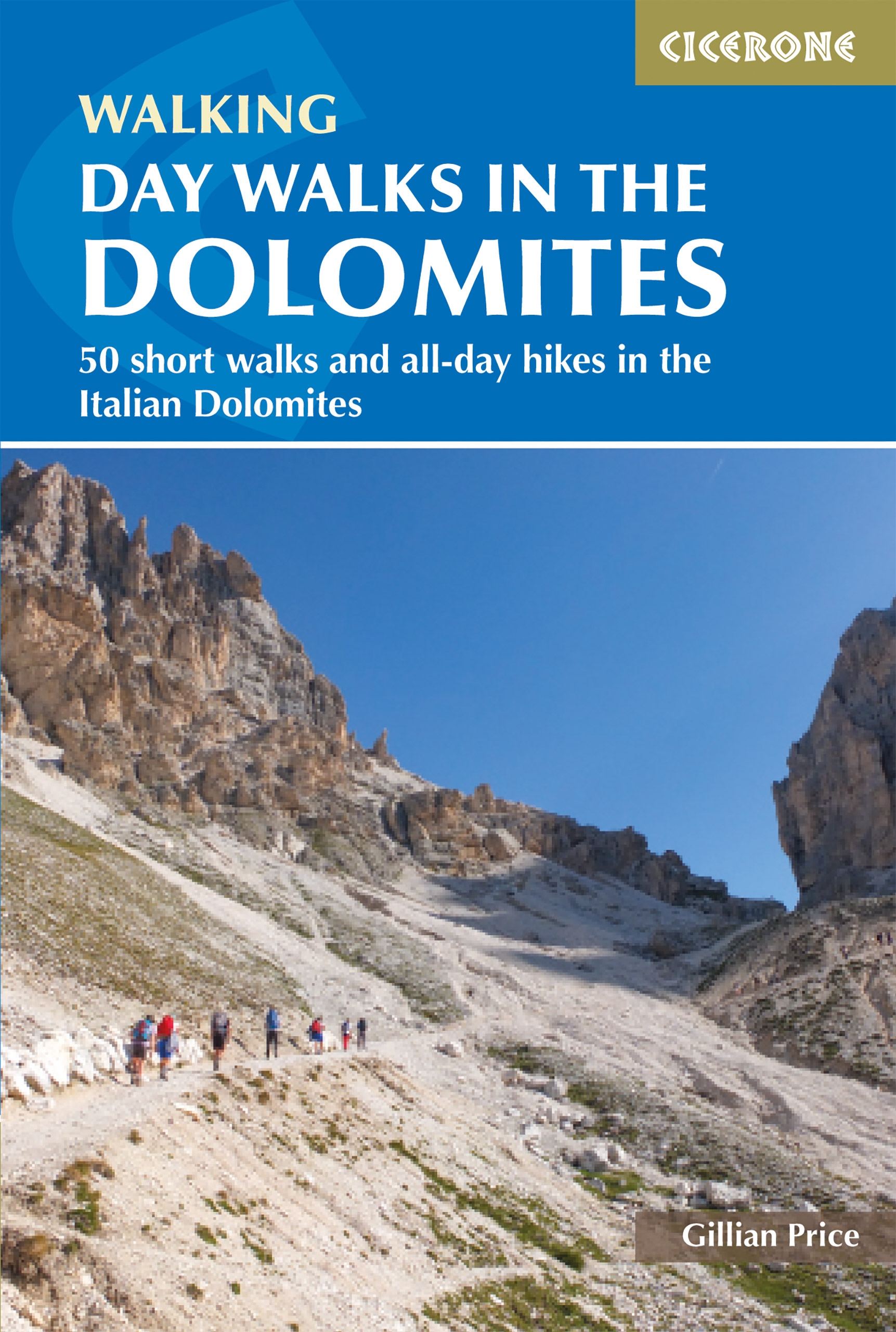
- Day Walks in the Dolomites
- 50 short walks and all-day hikes in the Italian Dolomites Read more
- Also available from:
- De Zwerver, Netherlands
De Zwerver
Netherlands
2023
Netherlands
2023
- Wandelgids Day Walks in the Dolomites - Dolomieten | Cicerone
- 50 short walks and all-day hikes in the Italian Dolomites Read more

The Book Depository
United Kingdom
2018
United Kingdom
2018
- Fastpacking
- Multi-day running adventures: tips, stories and route ideas Read more

The Book Depository
United Kingdom
2014
United Kingdom
2014
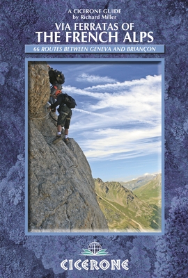
- Via Ferratas of the French Alps
- 66 routes between Geneva and Briancon Read more
- Also available from:
- De Zwerver, Netherlands
- Stanfords, United Kingdom
De Zwerver
Netherlands
2014
Netherlands
2014
- Wandelgids - Klimgids - Klettersteiggids Via Ferratas of the French Alps | Cicerone
- This guidebook covers 66 varied via ferratas in the French Alps. The routes are spread over six areas: Geneva and the Northern Alps, Chambéry, Tarentaise and Maurienne valleys, Grenoble and Briançon, amid the Mont Blanc, Vanoise and Queyras ranges. Difficulty ranges from easy, protected routes through to exposed, technical challenges. Read more

Stanfords
United Kingdom
2014
United Kingdom
2014
- French Alps - Via Ferratas - 66 Routes Between Geneva and Briançon
- Via Ferratas of the French Alps by Cicerone covers 66 varied routes across six areas: Geneva and the Northern Alps, Chambéry, Tarentaise and Maurienne valleys, Grenoble and Briançon, amid the Mont Blanc, Vanoise and Queyras ranges. Difficulty ranges from easy, protected routes through to exposed, technical challenges. The routes in this... Read more

The Book Depository
United Kingdom
2018
United Kingdom
2018
- The Karnischer Hohenweg
- A 1-2 week trek on the Carnic Peace Trail: Austria and Italy Read more
- Also available from:
- De Zwerver, Netherlands

De Zwerver
Netherlands
2018
Netherlands
2018
- Wandelgids Trekking the Karnischer Höhenweg | Cicerone
- English-language guidebook to the Karnischer Höhenweg, a 206km waymarked hut-to-hut trek along the border between Italy and Austria. Also known as the Carnic Peace Trail, it runs west to east along the Ridge of the Carnic Alps, the site of the WW1 front line. With information on planning your trip, accommodation and the history of the area. Read more

The Book Depository
United Kingdom
2022
United Kingdom
2022
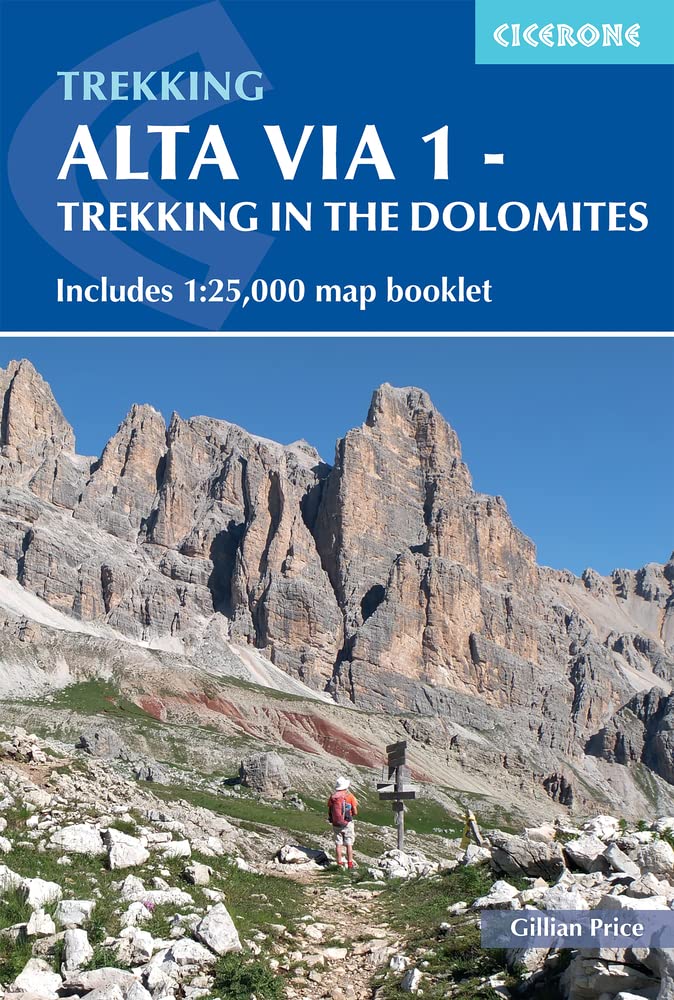
- Alta Via 1 - Trekking in the Dolomites
- Includes 1:25,000 map booklet Read more
- Also available from:
- De Zwerver, Netherlands
De Zwerver
Netherlands
2022
Netherlands
2022
- Wandelgids Alta Via 1 - Trekking in the Dolomites | Cicerone
- Includes 1:25,000 map booklet Read more
De Zwerver
Netherlands
2022
Netherlands
2022
De Zwerver
Netherlands
2018
Netherlands
2018
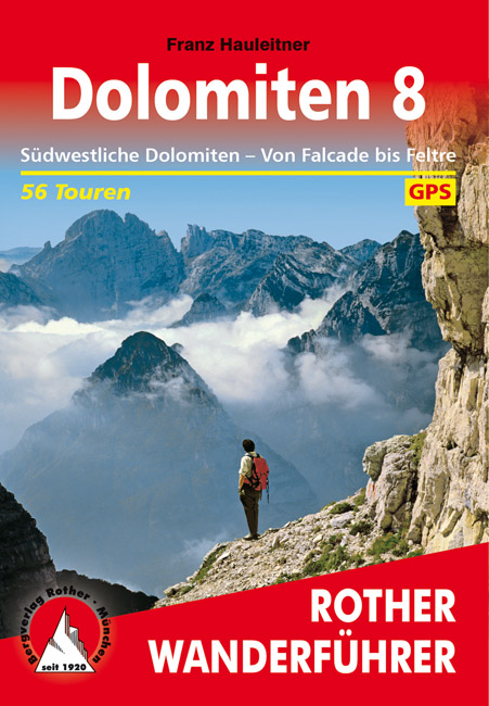
- Wandelgids Dolomiten 8 | Rother Bergverlag
- Uitstekende wandelgids met een groot aantal dagtochten in dal en hooggebergte. Met praktische informatie en beperkt kaartmateriaal! Wandelingen in verschillende zwaarte weergegeven in rood/blauw/zwart. 56 Höhenprofile; 56 Wanderkärtchen im Maßstab 1:25.000, 1:50.000 und 1:75.000, zwei Übersichtskarten im Maßstab 1:500.000 und 1:600.000,... Read more

De Zwerver
Netherlands
2015
Netherlands
2015
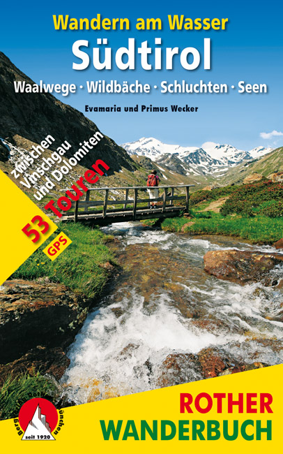
- Wandelgids Zuid Tirol -Wandern am Wasser Südtirol | Rother Bergverlag
- Waalwege · Wildbäche · Schluchten · Seen. 53 Touren zwischen Vinschgau und Dolomiten. Mit GPS-Tracks. Read more
De Zwerver
Netherlands
2012
Netherlands
2012
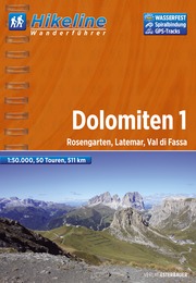
- Wandelgids Hikeline Dolomieten Dolomiten 1 | Esterbauer
- Handzame gids met een goede beschrijving van een groot aantal dagtochten in dit gebied. De gids is in spiraalbinding en elke pagina is op scheur- en watervast papier gedrukt. Daar is echt over nagedacht! Streckencharakteristik Länge, Höhenmeter Die 50 Wanderungen in diesem Buch decken eine große Bandbreite von kurzen Spaziergängen bis hin zu... Read more

De Zwerver
Netherlands
2023
Netherlands
2023
Karten

The Book Depository
United Kingdom
United Kingdom
- Dolomiti di Auronzo e del Come
- Dolomiti di Auronzo e del Comelico area in a series of Tabacco maps at 1:25,000 covering the Dolomites and the mountains of north-eastern Italy - Stanfords Read more
- Also available from:
- Stanfords, United Kingdom

Stanfords
United Kingdom
United Kingdom
- Dolomiti di Auronzo e del Comelico Tabacco 017
- Dolomiti di Auronzo e del Comelico area in a series of Tabacco maps at 1:25,000 covering the Dolomites and the mountains of north-eastern Italy - Stanfords’ most popular coverage for this region, with excellent cartography and extensive overprint for hiking routes and other recreational activities, local bus stops, etc. Additional overprint in... Read more

- Also available from:
- De Zwerver, Netherlands
De Zwerver
Netherlands
2020
Netherlands
2020

The Book Depository
United Kingdom
United Kingdom
- Alpi Carniche Orientali / Canal del Ferro
- Alpi Carniche Orientali - Canal del Ferro area in a series of Tabacco maps at 1:25,000 covering the Dolomites and the mountains of north-eastern Italy - Stanfords Read more

The Book Depository
United Kingdom
United Kingdom
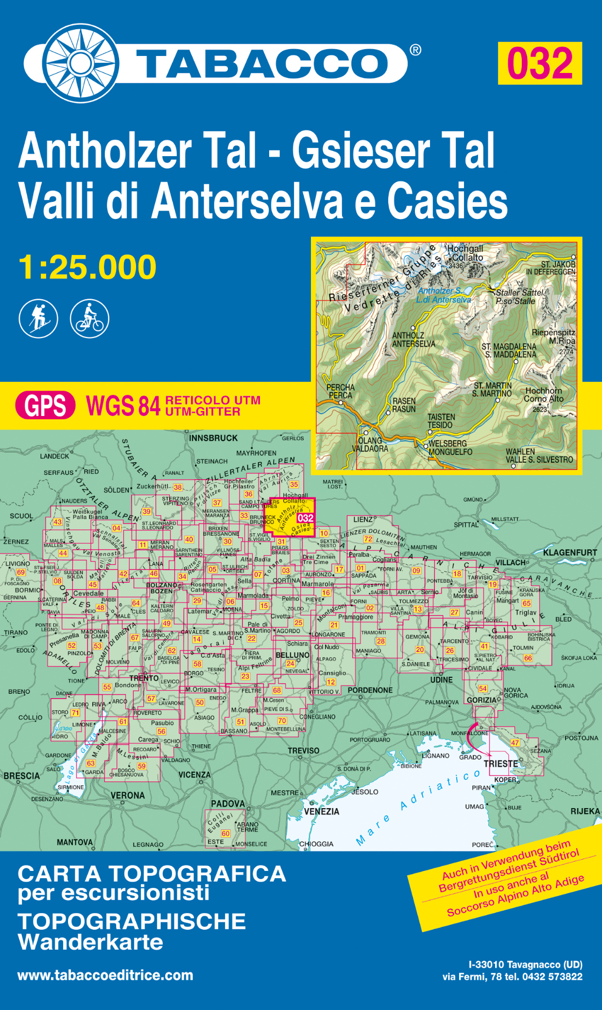
- Vallee di Anterselva / Casies
- Dolomiti di Braies/Pragser Dolomiten - Marebbe/Ennberg area in a series of Tabacco maps at 1:25,000 covering the Dolomites and the mountains of north-eastern Italy - Stanfords Read more
- Also available from:
- De Zwerver, Netherlands
- Stanfords, United Kingdom
De Zwerver
Netherlands
Netherlands
- Wandelkaart 032 Antholzer Tal - Gsieser Tal - Valli di Anterselva e Casies | Tabacco Editrice
- Dolomiti di Braies/Pragser Dolomiten - Marebbe/Ennberg area in a series of Tabacco maps at 1:25,000 covering the Dolomites and the mountains of north-eastern Italy - Stanfords Read more

Stanfords
United Kingdom
United Kingdom
- Val Anterselva / Antholz - Val Casies / Gsieser Tal Tabacco 032
- Dolomiti di Braies/Pragser Dolomiten - Marebbe/Ennberg area in a series of Tabacco maps at 1:25,000 covering the Dolomites and the mountains of north-eastern Italy - Stanfords’ most popular coverage for this region, with excellent cartography and extensive overprint for hiking routes and other recreational activities, local bus stops, etc.... Read more

The Book Depository
United Kingdom
United Kingdom
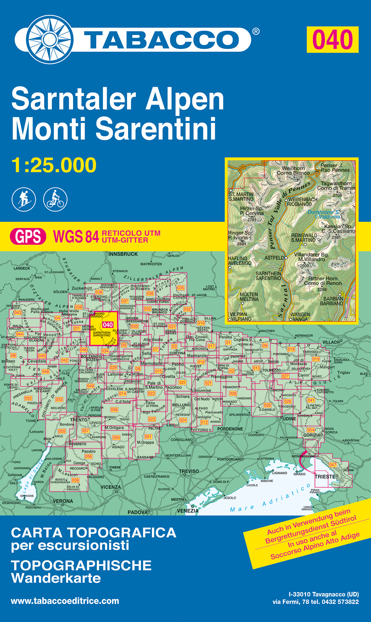
- Monti Sarentini
- Monti Sarentini/Sarntaler Alpen area in a series of Tabacco maps at 1:25,000 covering the Dolomites and the mountains of north-eastern Italy - Stanfords Read more
- Also available from:
- De Zwerver, Netherlands
- Stanfords, United Kingdom
De Zwerver
Netherlands
Netherlands
- Wandelkaart 040 Sarntaler Alpen - Monti Sarentini | Tabacco Editrice
- Monti Sarentini/Sarntaler Alpen area in a series of Tabacco maps at 1:25,000 covering the Dolomites and the mountains of north-eastern Italy - Stanfords Read more

Stanfords
United Kingdom
United Kingdom
- Monti Sarentini / Sarntaler Alpen Tabacco 040
- Monti Sarentini/Sarntaler Alpen area in a series of Tabacco maps at 1:25,000 covering the Dolomites and the mountains of north-eastern Italy - Stanfords’ most popular coverage for this region, with excellent cartography and extensive overprint for hiking routes and other recreational activities, local bus stops, etc. Additional overprint in... Read more

The Book Depository
United Kingdom
2020
United Kingdom
2020
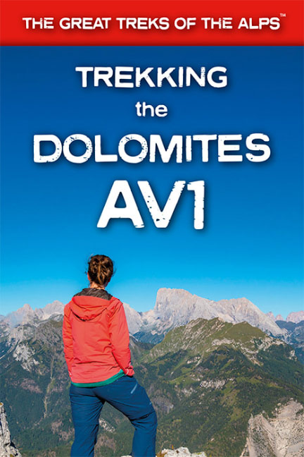
- Trekking the Dolomites AV1
- This is only guidebook exclusively for the AV1 and contains everything needed plan and walk Italy`s most popular long-distance route. The guidebook contains real maps - Tabacco 1:25,000 - the finest maps available for the Dolomites, thus making navigation easy with no need to carry additional maps.The AV1 is the premier route in the... Read more
- Also available from:
- De Zwerver, Netherlands
- Stanfords, United Kingdom
De Zwerver
Netherlands
2020
Netherlands
2020
- Wandelgids Trekking the Dolomites Av1 | Knife Edge Outdoor
- This is only guidebook exclusively for the AV1 and contains everything needed plan and walk Italy`s most popular long-distance route. The guidebook contains real maps - Tabacco 1:25,000 - the finest maps available for the Dolomites, thus making navigation easy with no need to carry additional maps.The AV1 is the premier route in the... Read more

Stanfords
United Kingdom
2020
United Kingdom
2020
- Trekking the Dolomites AV1
- This is only guidebook exclusively for the AV1 and contains everything needed plan and walk Italy`s most popular long-distance route. The guidebook contains real maps - Tabacco 1:25,000 - the finest maps available for the Dolomites, thus making navigation easy with no need to carry additional maps.The AV1 is the premier route in the... Read more

The Book Depository
United Kingdom
United Kingdom
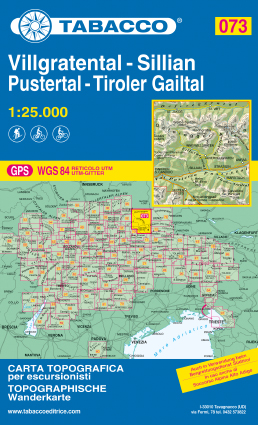
- Villgratental / Sillian / Pustertal / Tiroler Gailtal
- This Tabacco topographic map at 1:25,000 (1cm = 250m) covers Villgratental, Sillian, Pustertal, Tiroler Gailtal. It is perfect for hiking, cycling or mountain biking. The series of more than 70 maps covers the Italian Alps of the North-East including the Dolomites. Read more
- Also available from:
- De Zwerver, Netherlands
- Stanfords, United Kingdom
De Zwerver
Netherlands
Netherlands
- Wandelkaart 073 Villgratental, Sillian, Pustertal, Tiroler Gailtal | Tabacco Editrice
- This Tabacco topographic map at 1:25,000 (1cm = 250m) covers Villgratental, Sillian, Pustertal, Tiroler Gailtal. It is perfect for hiking, cycling or mountain biking. The series of more than 70 maps covers the Italian Alps of the North-East including the Dolomites. Read more

Stanfords
United Kingdom
United Kingdom
- Villgratental - Sillian - Pustertal - Tiroler Gailtal Tabacco 073
- This Tabacco topographic map at 1:25,000 (1cm = 250m) covers Villgratental, Sillian, Pustertal, Tiroler Gailtal. It is perfect for hiking, cycling or mountain biking. The series of more than 70 maps covers the Italian Alps of the North-East including the Dolomites. Read more

The Book Depository
United Kingdom
United Kingdom
- Prealpi Carniche E Giulie
- Prealpi Carniche e Giuli de Gemonese area in a series of Tabacco maps at 1:25,000 covering the Dolomites and the mountains of north-eastern Italy - Stanfords Read more
- Also available from:
- De Zwerver, Netherlands
- Stanfords, United Kingdom
De Zwerver
Netherlands
Netherlands
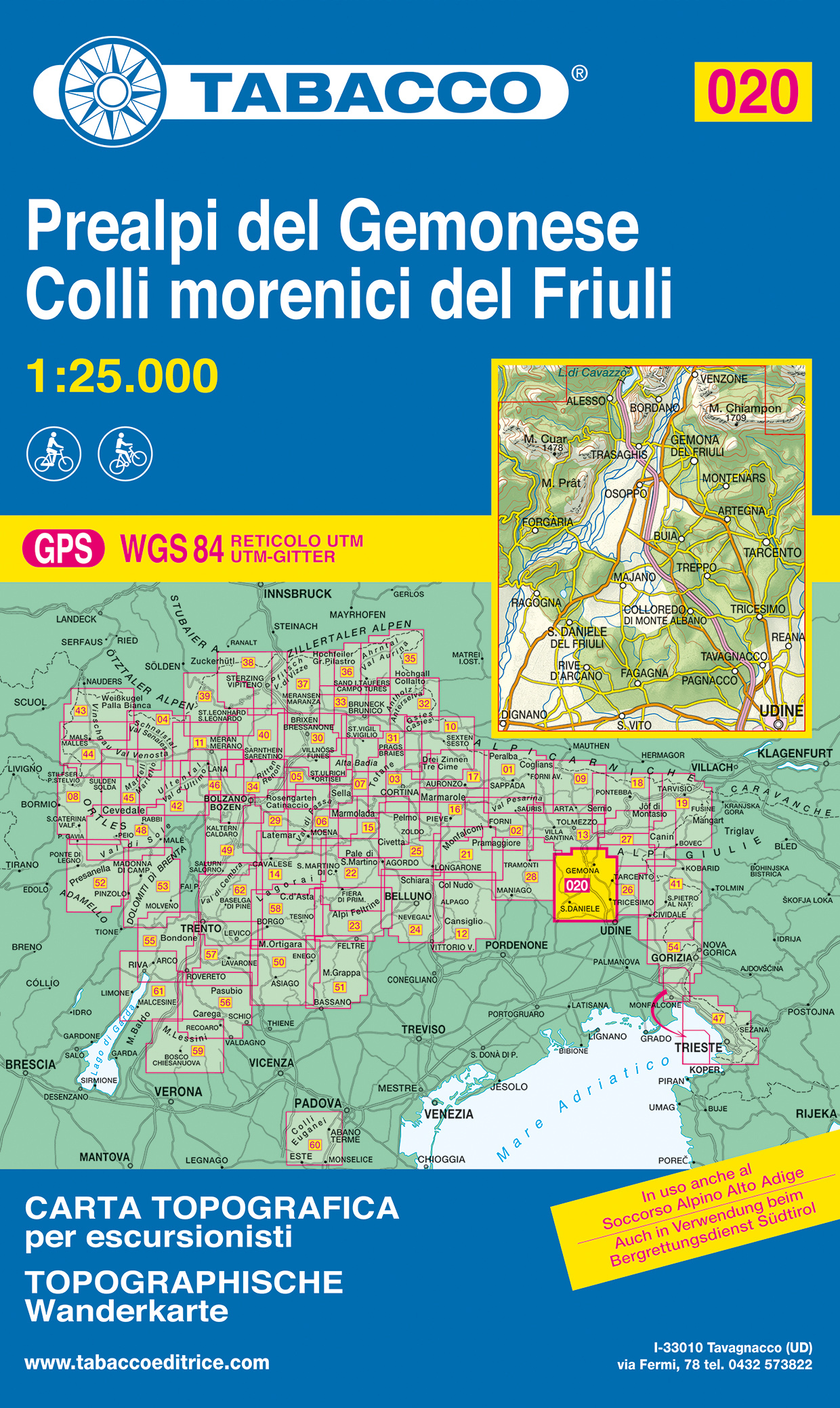
- Wandelkaart 020 Prealpi del Gemonese - Colli morecini del Friuli | Tabacco Editrice
- Prealpi Carniche e Giuli de Gemonese area in a series of Tabacco maps at 1:25,000 covering the Dolomites and the mountains of north-eastern Italy - Stanfords Read more

Stanfords
United Kingdom
United Kingdom
- Prealpi Carniche e Giuli de Gemonese Tabacco 020
- Prealpi Carniche e Giuli de Gemonese area in a series of Tabacco maps at 1:25,000 covering the Dolomites and the mountains of north-eastern Italy - Stanfords’ most popular coverage for this region, with excellent cartography and extensive overprint for hiking routes and other recreational activities, local bus stops, etc. Additional overprint... Read more

- Also available from:
- De Zwerver, Netherlands

- Also available from:
- De Zwerver, Netherlands
De Zwerver
Netherlands
2021
Netherlands
2021

The Book Depository
United Kingdom
United Kingdom
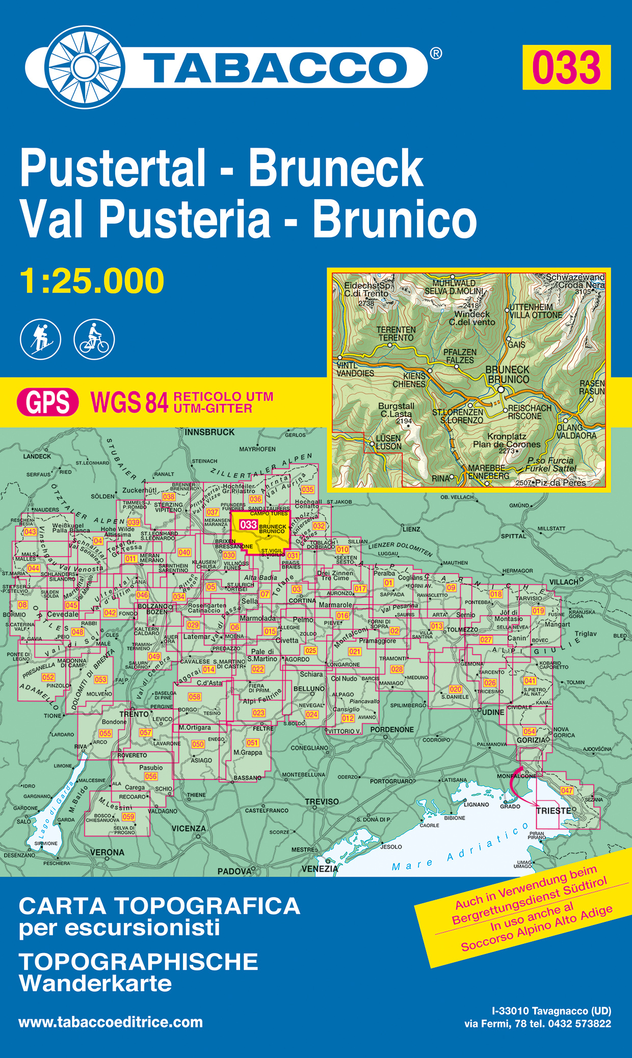
- Val Pusteria, Brunico 2017
- Val Pusteria/Pustertal - Brunico/Bruneck area in a series of Tabacco maps at 1:25,000 covering the Dolomites and the mountains of north-eastern Italy - Stanfords Read more
- Also available from:
- De Zwerver, Netherlands
- Stanfords, United Kingdom
De Zwerver
Netherlands
Netherlands
- Wandelkaart 033 Pustertal - Bruneck - Val Pusteria - Brunico | Tabacco Editrice
- Val Pusteria/Pustertal - Brunico/Bruneck area in a series of Tabacco maps at 1:25,000 covering the Dolomites and the mountains of north-eastern Italy - Stanfords Read more

Stanfords
United Kingdom
United Kingdom
- Val Pusteria / Pustertal - Brunico / Bruneck Tabacco 033
- Val Pusteria/Pustertal - Brunico/Bruneck area in a series of Tabacco maps at 1:25,000 covering the Dolomites and the mountains of north-eastern Italy - Stanfords’ most popular coverage for this region, with excellent cartography and extensive overprint for hiking routes and other recreational activities, local bus stops, etc. Additional... Read more
The Book Depository
United Kingdom
2021
United Kingdom
2021
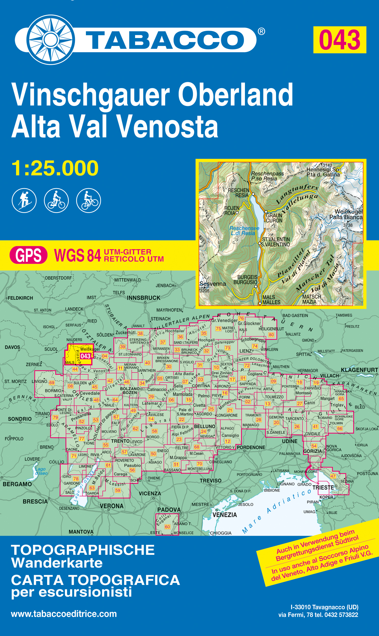
- Alta Val Venosta/Vinschgauer Oberland
- Alta Val Venosta/Vinschgauer Oberland area in a series of Tabacco maps at 1:25,000 covering the Dolomites and the mountains of north-eastern Italy - Stanfords’ most popular coverage for this region, with excellent cartography and extensive overprint for hiking routes and other recreational activities, local bus stops, etc. Additional overprint... Read more
- Also available from:
- De Zwerver, Netherlands
- Stanfords, United Kingdom
De Zwerver
Netherlands
2021
Netherlands
2021
- Wandelkaart 043 Vinschgauer Oberland - Alta Val Venosta | Tabacco Editrice
- Alta Val Venosta/Vinschgauer Oberland area in a series of Tabacco maps at 1:25,000 covering the Dolomites and the mountains of north-eastern Italy - Stanfords’ most popular coverage for this region, with excellent cartography and extensive overprint for hiking routes and other recreational activities, local bus stops, etc. Additional overprint... Read more

Stanfords
United Kingdom
2021
United Kingdom
2021
- Alta Val Venosta / Vinschgauer Oberland Tabacco 043
- Alta Val Venosta/Vinschgauer Oberland area in a series of Tabacco maps at 1:25,000 covering the Dolomites and the mountains of north-eastern Italy - Stanfords’ most popular coverage for this region, with excellent cartography and extensive overprint for hiking routes and other recreational activities, local bus stops, etc. Additional overprint... Read more

The Book Depository
United Kingdom
United Kingdom
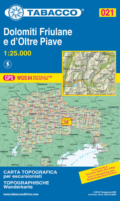
- Dolomiti di Sinistra Piave
- Dolomiti di Sinistra Piave area in a series of Tabacco maps at 1:25,000 covering the Dolomites and the mountains of north-eastern Italy - Stanfords Read more
- Also available from:
- De Zwerver, Netherlands
- Stanfords, United Kingdom
De Zwerver
Netherlands
Netherlands
- Wandelkaart 021 Dolomiti Friulane e d'Oltre Piave | Tabacco Editrice
- Dolomiti di Sinistra Piave area in a series of Tabacco maps at 1:25,000 covering the Dolomites and the mountains of north-eastern Italy - Stanfords Read more

Stanfords
United Kingdom
United Kingdom
- Dolomiti di Sinistra Piave Tabacco 021
- Dolomiti di Sinistra Piave area in a series of Tabacco maps at 1:25,000 covering the Dolomites and the mountains of north-eastern Italy - Stanfords’ most popular coverage for this region, with excellent cartography and extensive overprint for hiking routes and other recreational activities, local bus stops, etc. Additional overprint in this... Read more

The Book Depository
United Kingdom
United Kingdom
- Bolzano, Renon 2021
- Bolzano/Bozen - Renon/Ritten area in a series of Tabacco maps at 1:25,000 covering the Dolomites and the mountains of north-eastern Italy - Stanfords Read more
- Also available from:
- Stanfords, United Kingdom

Stanfords
United Kingdom
United Kingdom
- Bolzano / Bozen - Renon / Ritten Tabacco 034
- Bolzano/Bozen - Renon/Ritten area in a series of Tabacco maps at 1:25,000 covering the Dolomites and the mountains of north-eastern Italy - Stanfords’ most popular coverage for this region, with excellent cartography and extensive overprint for hiking routes and other recreational activities, local bus stops, etc. Additional overprint in this... Read more

The Book Depository
United Kingdom
United Kingdom
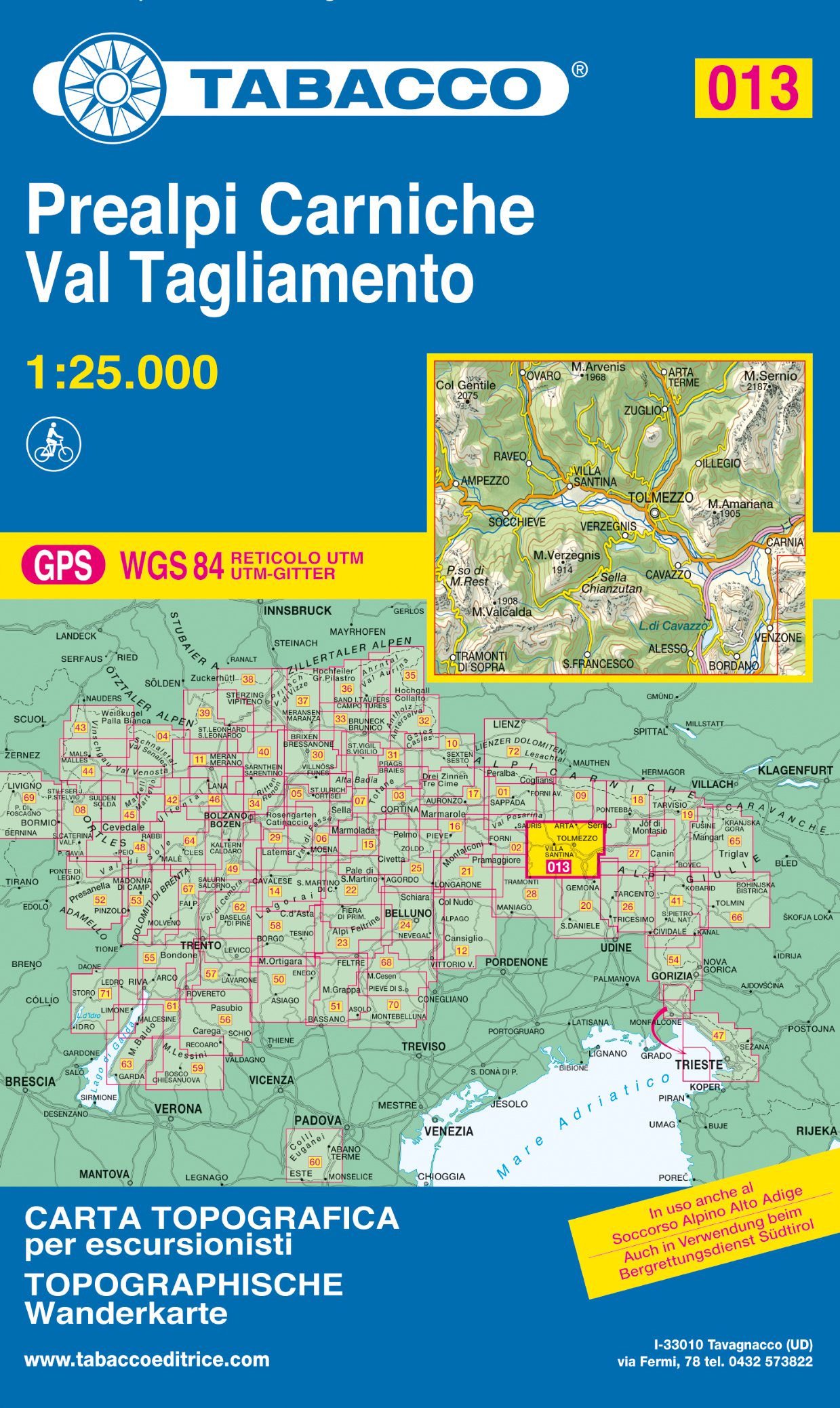
- Prealpi Carniche / Val Tagliame
- Prealpi Carniche - Val Tagliamento area in a series of Tabacco maps at 1:25,000 covering the Dolomites and the mountains of north-eastern Italy - Stanfords’ most popular coverage for this region, with excellent cartography and extensive overprint for hiking routes and other recreational activities, local bus stops, etc. Additional overprint in... Read more
- Also available from:
- De Zwerver, Netherlands
- Stanfords, United Kingdom
De Zwerver
Netherlands
Netherlands
- Wandelkaart 013 Prealpi Carniche - Val Tagliamento | Tabacco Editrice
- Prealpi Carniche - Val Tagliamento area in a series of Tabacco maps at 1:25,000 covering the Dolomites and the mountains of north-eastern Italy - Stanfords’ most popular coverage for this region, with excellent cartography and extensive overprint for hiking routes and other recreational activities, local bus stops, etc. Additional overprint in... Read more
Stanfords
United Kingdom
United Kingdom
- Prealpi Carniche - Val Tagliamento Tabacco 013
- Prealpi Carniche - Val Tagliamento area in a series of Tabacco maps at 1:25,000 covering the Dolomites and the mountains of north-eastern Italy - Stanfords’ most popular coverage for this region, with excellent cartography and extensive overprint for hiking routes and other recreational activities, local bus stops, etc. Additional overprint in... Read more