
Castilla y León
Beschreibung
Karte

Wanderwege Region
- GR1 Sendero Histórico, Senda TransversalGPX
- GR10 Senderos de la MielGPX
- GR100 Ruta de la PlataGPX
- GR14 Sendero del DueroGPX
- GR186 Caminos de MedinaGPX
- GR26 Senda de Tierra de CamposGPX
- GR260 Vuelta al Moncayo-Calcenada
- GR27 Sendero del Valle Esgueva
- GR28 Sendero de Tierra de PinaresGPX
- GR29 Sendero del río Pisuerga
- GR30 Sendero de los Montes de TorozosGPX
- GR65 Camino de SantiagoGPX
- GR69 Circular de HueteGPX
- GR82 Sierra de la DemandaGPX
- GR84 Canal del DueroGPX
- GR85 Ruta de los SentidosGPX
- GR86 Sendero Ibérico SorianoGPX
- GR89 Canales de CastillaGPX
- GR99 Sendero del EbroGPX
Links
Fakten
Berichte
Führer und Karten
Übernachtung
Organisationen
Reisebüros
GPS
Sonstiges
Bücher

- Also available from:
- De Zwerver, Netherlands
- Stanfords, United Kingdom

Stanfords
United Kingdom
2021
United Kingdom
2021
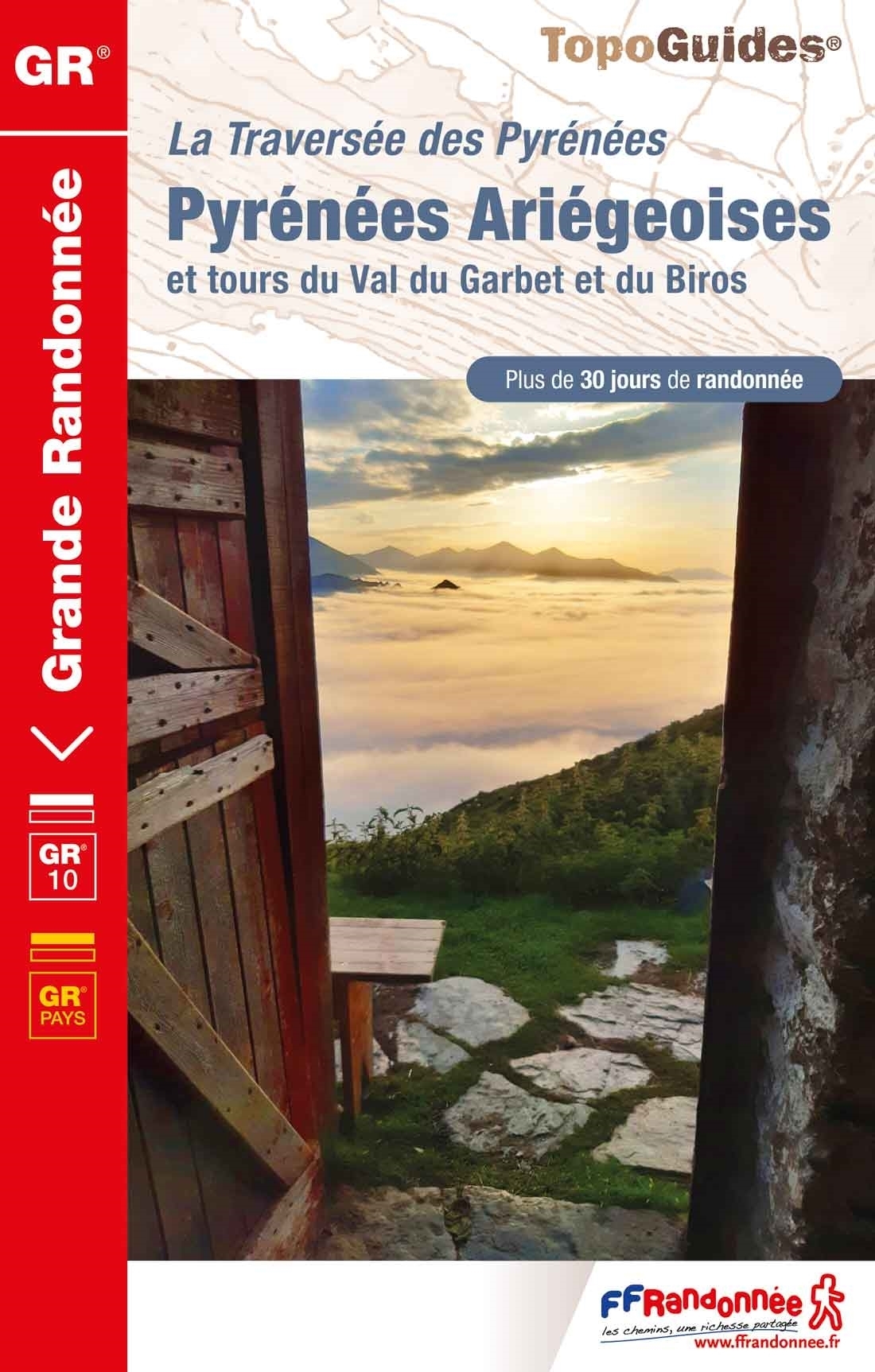
- Pyrénées Ariégeoises - La traversée des Pyrénées et tours du Val du Garbet et du Biros GR10
- Pyrénées Ariégeoises, FFRP topoguide, Ref. No. 1090, covering the third section of the GR10 along the Pyrenees from the Atlantic to the Mediterranean – a 335-km long walk from Bagnères-de-Luchon to Mérens-les-Vals. Given the mountainous terrain, the guide also provides a detailed route profile for this part of the GR10, annotated with timings... Read more

The Book Depository
United Kingdom
United Kingdom
- Vignemale - Valle de Bujaruelo
- Cross-border area of the Pyrenees at 1:25,000 on a contoured and GPS compatible map covering on the Spanish side the valleys of Bujaruelo and Ara with the western section of the Ordesa National Park and the Ordesa Valley, and within France extending from the Vignemale Massif to Gavarnie, plus a Spanish/French booklet with recommendations for... Read more
- Also available from:
- De Zwerver, Netherlands
- Stanfords, United Kingdom

De Zwerver
Netherlands
Netherlands
- Wandelkaart 06 Vignemale - Valle de Bujaruelo | Editorial Alpina
- Cross-border area of the Pyrenees at 1:25,000 on a contoured and GPS compatible map covering on the Spanish side the valleys of Bujaruelo and Ara with the western section of the Ordesa National Park and the Ordesa Valley, and within France extending from the Vignemale Massif to Gavarnie, plus a Spanish/French booklet with recommendations for... Read more

Stanfords
United Kingdom
United Kingdom
- Vignemale - Valle de Bujaruelo Editorial Alpina
- Cross-border area of the Pyrenees at 1:25,000 on a contoured and GPS compatible map covering on the Spanish side the valleys of Bujaruelo and Ara with the western section of the Ordesa National Park and the Ordesa Valley, and within France extending from the Vignemale Massif to Gavarnie, plus a Spanish/French booklet with recommendations for... Read more

The Book Depository
United Kingdom
United Kingdom


The Book Depository
United Kingdom
2015
United Kingdom
2015
- Spain's Sendero Historico: The GR1
- Northern Spain - Picos to the Mediterranean Read more
- Also available from:
- De Zwerver, Netherlands
- Stanfords, United Kingdom

De Zwerver
Netherlands
2015
Netherlands
2015
- Wandelgids Spain's Sendero Historico: the GR1 | Cicerone
- Guidebook to the 1250km of Spain's Sendero Historico (GR1), traversing northern Spain from Puerto de Tarna in the province of Leon in the west to the Mediterranean near L'Escala in Catalonia, through fascinating, varied landscapes and the foothills of the Pyrenees. Described in 53 stages, about 25km each in length, with detailed mapping. Read more

Stanfords
United Kingdom
2015
United Kingdom
2015
- Spain`s Sendero Historico: The GR1: Northern Spain - Picos to the Mediterranean
- The Sendero Historico (the GR1) is a 1,250km long-distance path that takes you from Puerto de Tarna, on the border of Asturias and Castilla y León, east along the southern flank of the Cantabrian Mountains and the foothills of the Pyrenees before finishing on the Mediterranean coast near L`Escala.This walking guide splits the route that... Read more

The Book Depository
United Kingdom
2019
United Kingdom
2019
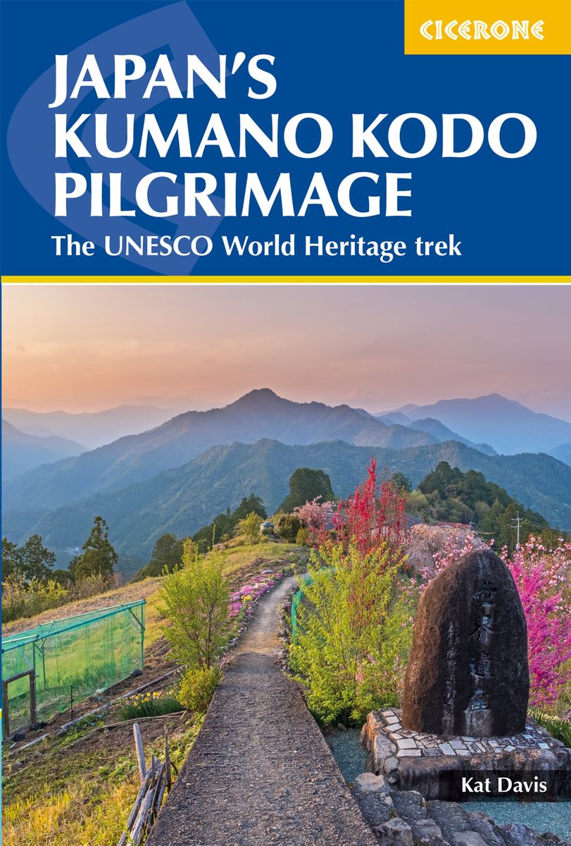
- Japan's Kumano Kodo Pilgrimage
- The UNESCO World Heritage trek Read more
- Also available from:
- De Zwerver, Netherlands
De Zwerver
Netherlands
2019
Netherlands
2019
- Wandelgids Japan's Kumano Kodo Pilgrimage | Cicerone
- Guidebook to walking Japan's Kumano Kodo, a network of ancient pilgrimage trails on the Kii Peninsula, south of Osaka. Covering the Nakahechi, Kohechi and Iseji trails, as well as Koyasan and the Choishimichi route, the guide has all the practical information needed, along with notes on the routes' rich history and culture. Read more

- Also available from:
- Stanfords, United Kingdom
Stanfords
United Kingdom
2021
United Kingdom
2021
- Volcan du Cantal et Pays de Saint-Flour - Haute-Auvergne GR400/4
- Volcan du Cantal: Pays de Saint-Flour et de Ruynes-en-Margeride, FFRP topoguide, Ref. No. 400, covering 600kms of long-distance paths in the Cantal region of the Massif Central, which can also be walked as shorter circuits. Current edition of this title was published in July 2013.To see other titles in this series please click on the series... Read more


The Book Depository
United Kingdom
2022
United Kingdom
2022
- Camino de Santiago - Via Podiensis
- Le Puy to the Pyrenees on the GR65 Read more
- Also available from:
- De Zwerver, Netherlands

De Zwerver
Netherlands
2022
Netherlands
2022
- Wandelgids Camino de Santiago - Via Podiensis GR65 | Cicerone
- Le Puy to the Pyrenees on the GR65 Read more

- Also available from:
- De Zwerver, Netherlands
- Stanfords, United Kingdom

De Zwerver
Netherlands
2022
Netherlands
2022
- Wandelgids Pyrenean Haute Route - a high level trail, Pyreneeën HRP | Cicerone
- Guidebook to trekking the Pyrenean Haute Route, which zigzags across the Franco-Spanish border, staying close to the main ridge in the highest and most spectacular central Pyrenees. It covers 750km with over 40km of ascent, so is suitable for experienced mountain walkers only. The largely unwaymarked route is presented in 45 stages. Read more

Stanfords
United Kingdom
2019
United Kingdom
2019
- The Pyrenean Haute Route
- There are three main trekking routes across the Pyrenees from coast to coast: of these, the Pyrenean Haute Route (or HRP for Haute Route Pyreneenne) is the most challenging - and arguably, the most spectacular. Unlike the GR10 and GR11, it is not waymarked and borders on mountaineering at times, sticking as closely as possible to the main... Read more

The Book Depository
United Kingdom
United Kingdom
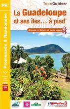
- Guadeloupe & ses iles a pied
- La Guadeloupe et ses îles à pied, FFRP topo-guide Ref. No. D971, with 49 day walks of varying length and difficulty, plus coverage of the 65km-long GR1 across the mountains of the Basse Terre. The day walks include two on Marie-Galante, one on La Désirade, and two on Les Saintes islands. Each walk is presented on a separate colour extract from... Read more
- Also available from:
- Stanfords, United Kingdom
Stanfords
United Kingdom
United Kingdom
- La Guadeloupe et ses îles à pied
- La Guadeloupe et ses îles à pied, FFRP topo-guide Ref. No. D971, with 49 day walks of varying length and difficulty, plus coverage of the 65km-long GR1 across the mountains of the Basse Terre. The day walks include two on Marie-Galante, one on La Désirade, and two on Les Saintes islands. Each walk is presented on a separate colour extract from... Read more

The Book Depository
United Kingdom
United Kingdom
- The Journey in Between
- A Thru-Hiking Adventure on El Camino de Santiago Read more

The Book Depository
United Kingdom
United Kingdom
- The Road to Find Out
- A Modern Pilgrim and the Camino de Santiago Read more

The Book Depository
United Kingdom
United Kingdom
- Turning 50 on El Camino de Santiago
- A Solo Woman's Travel Adventure Read more

The Book Depository
United Kingdom
2019
United Kingdom
2019
- Shorter Treks in the Pyrenees
- 7 great one and two week circular treks Read more
- Also available from:
- De Zwerver, Netherlands

De Zwerver
Netherlands
2019
Netherlands
2019
- Wandelgids Shorter Treks in the Pyrenees | Cicerone
- Guidebook detailing seven circular treks of 4-12 days in the beautiful Pyrenees. The varied routes cover both sides of the French-Spanish border and include both the High Pyrenees and the lower, more gentle mountains of the Basque Country and Catalonia. Variants are suggested for those wishing to shorten or extend the treks. Read more
Karten

The Book Depository
United Kingdom
2021
United Kingdom
2021
- Le long des ch�teaux de la Loire GR3/GR3B
- Le long des Châteaux de la Loire, FFRP topoguide Ref. No. 333, covering 552km route along the Loire from Bonny-sur-Loire across Orléans, Blois and Tours to Angers. Current edition of this title was published in May 2018.The Loire is world famous for its castles and gardens, now classified as World Heritage by UNESCO. The site of the Loire... Read more
- Also available from:
- Stanfords, United Kingdom
Stanfords
United Kingdom
2021
United Kingdom
2021
- Le long des Chateaux de la Loire GR3/GR3B
- Le long des Châteaux de la Loire, FFRP topoguide Ref. No. 333, covering 552km route along the Loire from Bonny-sur-Loire across Orléans, Blois and Tours to Angers. Current edition of this title was published in May 2018.The Loire is world famous for its castles and gardens, now classified as World Heritage by UNESCO. The site of the Loire... Read more

- Also available from:
- De Zwerver, Netherlands
- Stanfords, United Kingdom


Stanfords
United Kingdom
United Kingdom
- Canigou-Garrotxa Rando Editions 10
- Canigou Massif and the surrounding region of the French Pyrenees on a contoured and GPS compatible map at 1:50,000 from Rando Editions with topographic base provided by the IGN, highlighting local and long-distance hiking trails, mountain biking routes, etc. Topography is vividly presented by contours at 20m intervals enhanced by shading and... Read more

The Book Depository
United Kingdom
United Kingdom
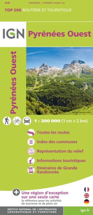
- Haut-Jura / Alpes du Nord
- Pyrénées Ouest map from the IGN at 1:200,000, with excellent presentation of the terrain through contours and vivid relief shading, plenty of names of topographic features, long-distance GR hiking routes, places of interest, etc. The map is designed to provide convenient coverage of the western and central part of the Pyrenees, extending across... Read more
- Also available from:
- Stanfords, United Kingdom

Stanfords
United Kingdom
United Kingdom
- High Jura - Northern Alps IGN Top200 202
- Pyrénées Ouest map from the IGN at 1:200,000, with excellent presentation of the terrain through contours and vivid relief shading, plenty of names of topographic features, long-distance GR hiking routes, places of interest, etc. The map is designed to provide convenient coverage of the western and central part of the Pyrenees, extending across... Read more

The Book Depository
United Kingdom
United Kingdom
- Alpes du Sud
- Pyrénées Ouest map from the IGN at 1:200,000, with excellent presentation of the terrain through contours and vivid relief shading, plenty of names of topographic features, long-distance GR hiking routes, places of interest, etc. The map is designed to provide convenient coverage of the western and central part of the Pyrenees, extending across... Read more
- Also available from:
- Stanfords, United Kingdom

Stanfords
United Kingdom
United Kingdom
- Southern Alps IGN Top200 203
- Pyrénées Ouest map from the IGN at 1:200,000, with excellent presentation of the terrain through contours and vivid relief shading, plenty of names of topographic features, long-distance GR hiking routes, places of interest, etc. The map is designed to provide convenient coverage of the western and central part of the Pyrenees, extending across... Read more

The Book Depository
United Kingdom
United Kingdom
- Bearn - Aspe - Ossau - Pyrenees NP
- Uitstekende wandelkaart met veel toeristische informatie en bijzonder gedetailleerd. Wandelroute en hutten / campings zijn ingetekend, met hoogtelijnen. Andere dorpen op deze kaart: Etsaut - Col du Somport - Fabrèges - Col du Pourtalet - la Pierre Saint Martin - Arette - Arudy - Laruns - Arrens Marsous - Argelès Gazost (Frankrijk - Pyreneeen)... Read more
- Also available from:
- De Zwerver, Netherlands
- Stanfords, United Kingdom

De Zwerver
Netherlands
Netherlands
- Wandelkaart 03 Béarn - Bearn | Rando Editions
- Uitstekende wandelkaart met veel toeristische informatie en bijzonder gedetailleerd. Wandelroute en hutten / campings zijn ingetekend, met hoogtelijnen. Andere dorpen op deze kaart: Etsaut - Col du Somport - Fabrèges - Col du Pourtalet - la Pierre Saint Martin - Arette - Arudy - Laruns - Arrens Marsous - Argelès Gazost (Frankrijk - Pyreneeen)... Read more

Stanfords
United Kingdom
United Kingdom
- Béarn - Aspe - Ossau - Pyrenees National Park Rando Editions 3
- French Pyrenees of the Béarn region, from Tardets-Sorholus to the western part of the Pyrenees National Park including the Ossau and Balaïtous massifs, on a contoured and GPS compatible map at 1:50,000 from Rando Editions with topographic base provided by the IGN, highlighting local and long-distance hiking trails, cycle and mountain bike... Read more

The Book Depository
United Kingdom
United Kingdom
- Pyrenees Western
- Pyrénées Ouest map from the IGN at 1:200,000, with excellent presentation of the terrain through contours and vivid relief shading, plenty of names of topographic features, long-distance GR hiking routes, places of interest, etc. The map is designed to provide convenient coverage of the western and central part of the Pyrenees, extending across... Read more
- Also available from:
- Stanfords, United Kingdom
Stanfords
United Kingdom
United Kingdom
- Pyrenees West IGN Top200 205
- Pyrénées Ouest map from the IGN at 1:200,000, with excellent presentation of the terrain through contours and vivid relief shading, plenty of names of topographic features, long-distance GR hiking routes, places of interest, etc. The map is designed to provide convenient coverage of the western and central part of the Pyrenees, extending across... Read more

The Book Depository
United Kingdom
United Kingdom
- Pyrenees Eastern
- Pyrénées Ouest map from the IGN at 1:200,000, with excellent presentation of the terrain through contours and vivid relief shading, plenty of names of topographic features, long-distance GR hiking routes, places of interest, etc. The map is designed to provide convenient coverage of the western and central part of the Pyrenees, extending across... Read more
- Also available from:
- Stanfords, United Kingdom

Stanfords
United Kingdom
United Kingdom
- Pyrenees East IGN Top200 206
- Pyrénées Ouest map from the IGN at 1:200,000, with excellent presentation of the terrain through contours and vivid relief shading, plenty of names of topographic features, long-distance GR hiking routes, places of interest, etc. The map is designed to provide convenient coverage of the western and central part of the Pyrenees, extending across... Read more

The Book Depository
United Kingdom
2020
United Kingdom
2020
- Tour et travers�es du Massif des Bauges GR96/GRP
- Tours et Traversées du Massif des Bauges, FFRP topoguide Ref. no. 902, covering 500kms of routes in the French Alps between Annecy, Aix-les-Bains, Chambéry and Albertville. Current edition of this title was published in May 2015.ABOUT THE FFRP (Fédération française de la randonnée pédestre) TOPOGUIDES: published in a handy A5 paperback format,... Read more
- Also available from:
- Stanfords, United Kingdom
Stanfords
United Kingdom
2020
United Kingdom
2020
- Tours et Traversées du Massif des Bauges GR96
- Tours et Traversées du Massif des Bauges, FFRP topoguide Ref. no. 902, covering 500kms of routes in the French Alps between Annecy, Aix-les-Bains, Chambéry and Albertville. Current edition of this title was published in May 2015.ABOUT THE FFRP (Fédération française de la randonnée pédestre) TOPOGUIDES: published in a handy A5 paperback format,... Read more

De Zwerver
Netherlands
2020
Netherlands
2020
- Wandelatlas - Pelgrimsroute (kaart) 160 Camino de Santiago | Michelin
- Parcourez le Chemin Français (Camino Francés) avec ce petit atlas de poche Michelin. L'outil idéal pour mieux s'y retrouver lors de la préparation du voyage de randonnée sur ce sentier historique qui part de Saint-Jean-Pied-de-Port, dans le Pays basque français, et qui traverse tout le nord de l'Espagne... Read more

De Zwerver
Netherlands
2021
Netherlands
2021
- Also available from:
- Stanfords, United Kingdom

Stanfords
United Kingdom
2021
United Kingdom
2021
- France - Ways of St James IGN Map 922
- France: Ways of St James to Compostela Map from the IGN presents an overview of all the routes across France taken by pilgrims on their way to Santiago de Compostela and the tomb of the apostle St James - the greatest of all goals for thousands of pilgrims in Europe during the Middle Ages. The map was prepared by the IGN and the Association de... Read more

De Zwerver
Netherlands
2020
Netherlands
2020
- Wandelatlas - Pelgrimsroute (kaart) 161 Chemins de Compostelle GR65 | Michelin
- Véritable petit atlas détaillant chaque étape avec indications précises concernant les villes de départ et d'arrivée ainsi que pour les localités traversées (auberges, refuges, restaurants, pharmacies, gare, épiceries, Km parcourus, Km restants....).Ce petit atlas suit le chemin du... Read more

De Zwerver
Netherlands
Netherlands
- Pelgrimsroute (kaart) - Wandelkaart Camino de Santiago in Spanje | CNIG - Instituto Geográfico Nacional
- All roads leading to Santiago de Compostela in the Iberian Peninsula are represented on this Caminos de Santiago / The Way of St. James Map. Routes highlighted on a physical map of the Iberian Peninsula at 1:1,250,000 from IGN/CNIG, Spain civilian topographic survey organization. The base map with altitude colouring and relief shading provides... Read more
- Also available from:
- Stanfords, United Kingdom

Stanfords
United Kingdom
United Kingdom
- Caminos de Santiago / Ways of St. James on the Iberian Peninsula CNIG Overview Map
- All roads leading to Santiago de Compostela in the Iberian Peninsula are represented on this Caminos de Santiago / The Way of St. James Map. Routes highlighted on a physical map of the Iberian Peninsula at 1:1,250,000 from IGN/CNIG, Spain civilian topographic survey organization. The base map with altitude colouring and relief shading provides... Read more

De Zwerver
Netherlands
Netherlands
- Wandelkaart 06 Couserans - Val D'aran | Rando Editions
- Uitstekende wandelkaart met veel toeristische informatie en bijzonder gedetailleerd. Wandelroute en hutten / campings zijn ingetekend, met hoogtelijnen. Andere dorpen op deze kaart: PN d'Aigües Tortes - St. Girons - Massat - Guzet Neige - Aulus les Bains (Frankrijk - Pyreneeen). GPS Compatible Read more
- Also available from:
- Stanfords, United Kingdom

Stanfords
United Kingdom
United Kingdom
- Couserans-Val d`Aran Rando Editions 6
- The Couserans region of the French Pyrenees, from St-Girons to Pic de Maubermé and Pica d’Estats, on a contoured and GPS compatible map at 1:50,000 from Rando Editions with topographic base provided by the IGN, highlighting local and long-distance hiking trails, etc. Topography is vividly presented by contours at 20m intervals enhanced by... Read more
De Zwerver
Netherlands
Netherlands
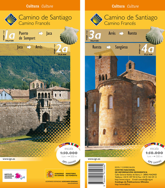
- Wandelkaart 1a-4a Camino Santiago de Compostella Puerte Somport - Sangüesa | CNIG - Instituto Geográfico Nacional
- Camino de Santiago: Stages 1a/2a/3a/4a, Col de Somport/Sangüesa, in a series of double-sided topographic maps at 1:50,000 from the Spanish civilian survey organization, overprinted with the route and sights, plus information of accommodation and other facilities, route profiles, etc.Each 1:50,000 map is double-sided and has four 57 x 35cm... Read more
- Also available from:
- Stanfords, United Kingdom

Stanfords
United Kingdom
United Kingdom
- Camino de Santiago: Stages 1a/2a/3a/4a, Col de Somport/Sangüesa 50K CNIG Map
- Camino de Santiago: Stages 1a/2a/3a/4a, Col de Somport/Sangüesa, in a series of double-sided topographic maps at 1:50,000 from the Spanish civilian survey organization, overprinted with the route and sights, plus information of accommodation and other facilities, route profiles, etc.Each 1:50,000 map is double-sided and has four 57 x 35cm... Read more
De Zwerver
Netherlands
Netherlands
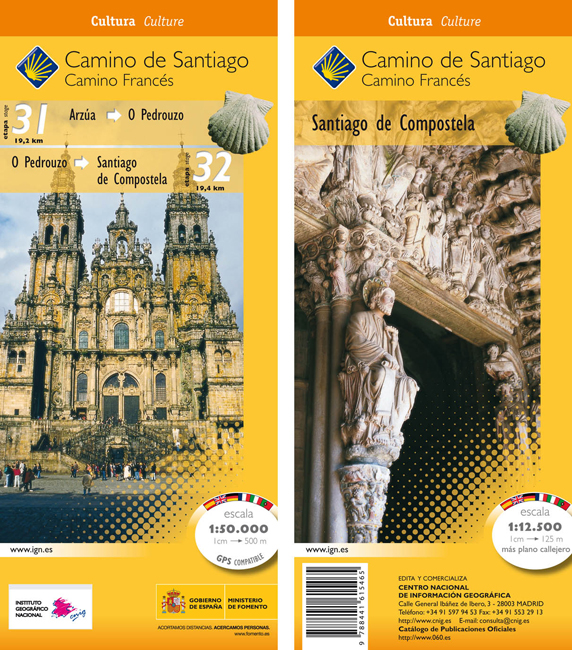
- Wandelkaart 31-32 Camino Santiago de Compostella Arzúa - Santiago | CNIG - Instituto Geográfico Nacional
- The Way of St James: the two last stages, 31 and 32, from Arzúa to Santiago de Compostela, plus a street plan of Santiago de Compostela in a series of double-sided topographic maps at 1:50,000 from the Spanish civilian survey organization, overprinted with the route and sights, plus information of accommodation and other facilities, route... Read more
- Also available from:
- Stanfords, United Kingdom
Stanfords
United Kingdom
United Kingdom
- Camino de Santiago: Stages 31/32, Arzúa/Santiago de Compostela 50K CNIG Map
- The Way of St James: the two last stages, 31 and 32, from Arzúa to Santiago de Compostela, plus a street plan of Santiago de Compostela in a series of double-sided topographic maps at 1:50,000 from the Spanish civilian survey organization, overprinted with the route and sights, plus information of accommodation and other facilities, route... Read more