
Valencia
Beschreibung
Autonomous region in the east of Spain, bordering the Mediterranean.
Wanderwege Landesteil
Links
Fakten
Berichte
Führer und Karten
Übernachtung
Organisationen
Reisebüros
GPS
Sonstiges
Bücher

The Book Depository
United Kingdom
United Kingdom


De Zwerver
Netherlands
2020
Netherlands
2020


Weitere Bücher…

Karten
De Zwerver
Netherlands
Netherlands
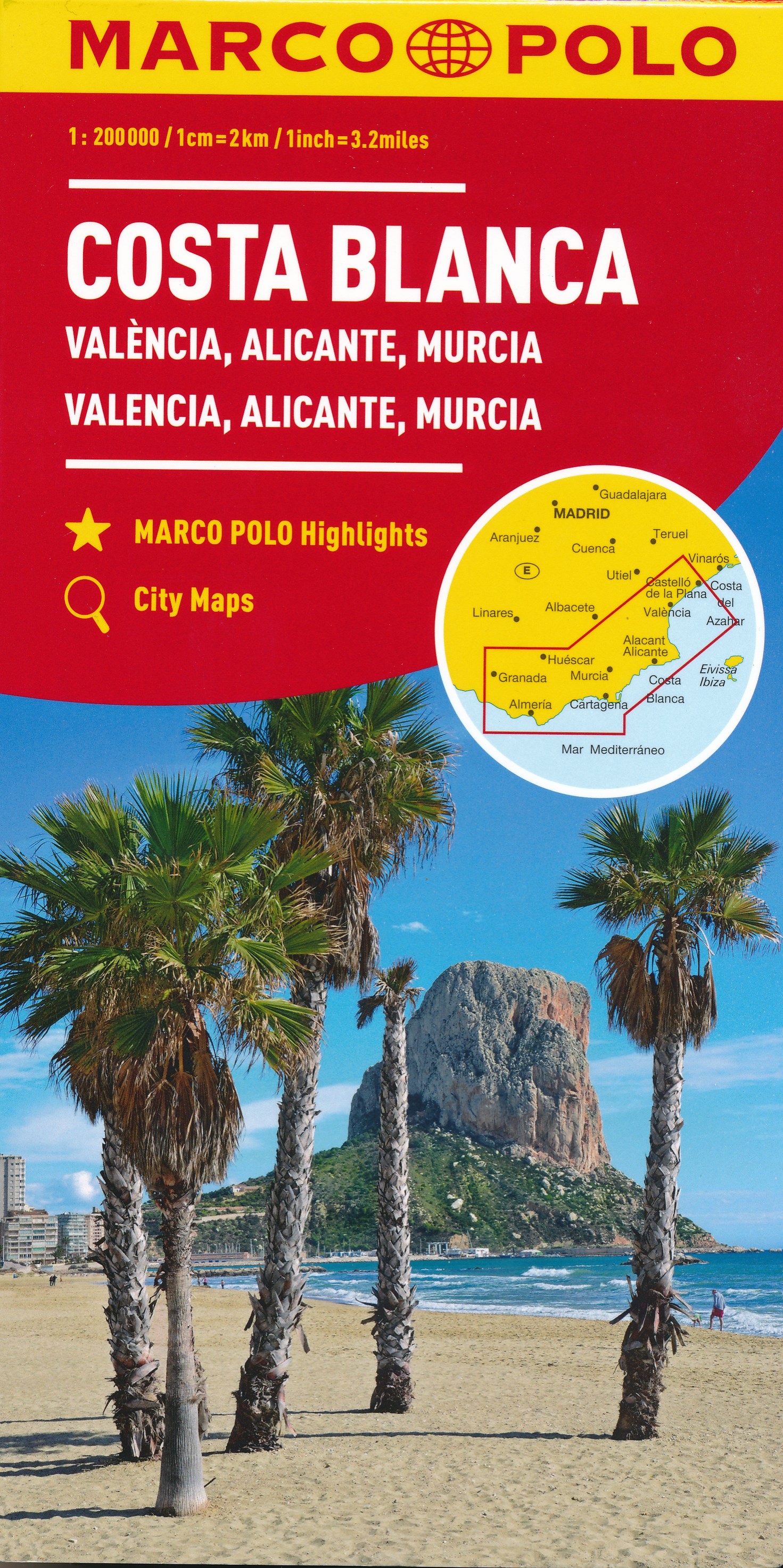
- Wegenkaart - landkaart Costa Blanca Valencia Granada | Marco Polo
- MARCO POLO Karte Costa Blanca, Valencia, Alicante, Castellón, Murcia 1:200 000 ab 9.99 EURO Marco Polo Karte. 4. Auflage Read more
De Zwerver
Netherlands
Netherlands
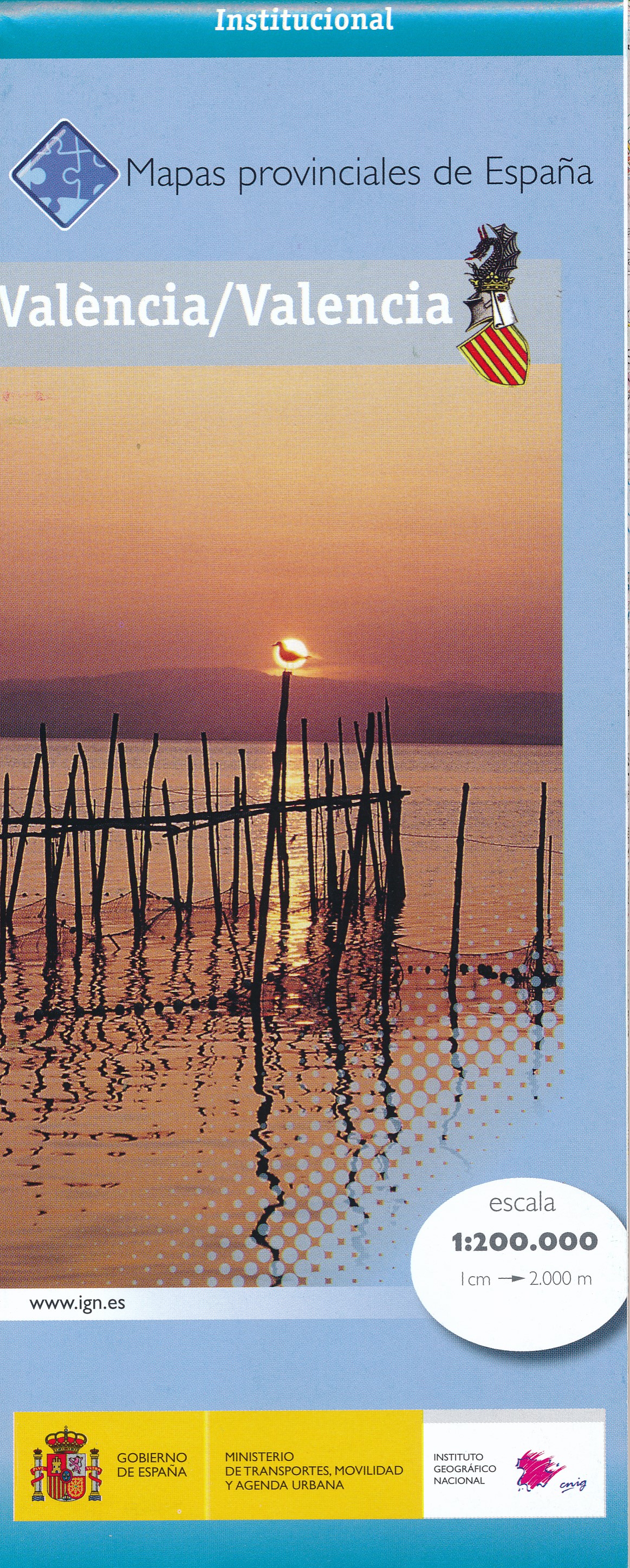
- Wegenkaart - landkaart Mapa Provincial Valencia | CNIG - Instituto Geográfico Nacional
- Contoured, GPS-compatible, indexed road map at 1:200,000 from CNIG - Spain’s civilian survey organization, with exceptionally informative presentation of the landscape and highlighting for facilities and places of interest including campsites and paradors.Maps in CNIG’s 200K Provincial Series provide an excellent picture the topography through... Read more
- Also available from:
- Stanfords, United Kingdom

Stanfords
United Kingdom
United Kingdom
- Valencia Province 200K CNIG Map No. 45
- Contoured, GPS-compatible, indexed road map at 1:200,000 from CNIG - Spain’s civilian survey organization, with exceptionally informative presentation of the landscape and highlighting for facilities and places of interest including campsites and paradors.Maps in CNIG’s 200K Provincial Series provide an excellent picture the topography through... Read more

Stanfords
United Kingdom
United Kingdom
- 3220 Cabo de la Nao to the French border Chart Atlas - 2019 Edition
- A new chart atlas covering Mediterranean Spain from Cabo de la Nao to the French border. This appealing cruising area stretches from Jávea and Dénia in the south, past the low-lying Ebro delta to the charming towns along the rugged Costa Brava in the north. It includes the cities of Valencia, Tarragona and Barcelona. The 23 sheets in the atlas... Read more
Stanfords
United Kingdom
United Kingdom
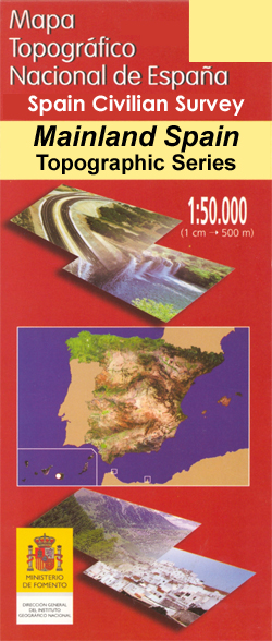
- Valencia CNIG Topo 722
- Topographic coverage of mainland Spain at 1:50,000 in the MTN50 (Mapa Topográfico Nacional) series from the Centro Nacional de Información Geografica, the country’s civilian survey organization. The maps have contours at 20m intervals, enhanced by relief shading, plus colouring and/or graphics to show different types of terrain, vegetation or... Read more

Stanfords
United Kingdom
United Kingdom
- Valencia de Alcantara CNIG Topo 701
- Topographic coverage of mainland Spain at 1:50,000 in the MTN50 (Mapa Topográfico Nacional) series from the Centro Nacional de Información Geografica, the country’s civilian survey organization. The maps have contours at 20m intervals, enhanced by relief shading, plus colouring and/or graphics to show different types of terrain, vegetation or... Read more

Stanfords
United Kingdom
United Kingdom
- Valencia - Alicante - Murcia 500K CNIG Regional Map No. 9
- The Mediterranean coast of Spain from north of Valencia to Costa Blanca and inland to include Sierras de Cazorla and Segura in north-eastern Andalucía, at 1:500,000 in a series of regional road maps from the country’s civilian survey organization IGN-CNIG (Instituto Geográfico Nacional - Centro Nacional de Información Geográfica), vividly... Read more

Stanfords
United Kingdom
United Kingdom
- M13 Denia to Barcelona and Ibiza
- Plans included: Denia (1:20,000) Valencia Harbour (1:30,000) Tarragona (1:25,000) Barcelona Harbour (1:65,000) San Antonio (Ibiza) (1:30,000) Read more