Erzgebirge
Beschreibung
")
The Ore Mountains, or Erzgebirge in German and Krušné Hory in Czech, constitute the boundary between Germany and Czech Republic. The main part is situated in the Czech Republic.
History played an important role in shaping these mountains. From mediaeval times on-wards the mountains have been exploited for silver and tin. In our times, large mining operations have removed complete mountains for lignite. More important for the walker is the attractive culture mix that resulted from the forced separation between East and West after World War II. Massive, forbidden houses of the 19th century, shoddy commu-nist building blocks, and rather vulgar modern houses fill the streets of many a village. Pompous spa towns like Karlovy Vary (Karlsbad) and Mariánské Lázně (Marienbad) show a totally different side of socialism. Historic cities like Loket show us the richness of the 18th century.
The hills and mountains are covered in large and dark forests with a variety of trees and full of game. The higher parts – Klinovec, 1.244 m, is the highest mountain – have been damaged by air pollution, but new trees are now emerging. The valleys are cultivated and offer space for small villages surrounded by gardens.
Hiking is excellent. A network of marked paths criss cross these mountains, and easy to get maps show them in their respective colours. The European Trail E3 runs from west to east, in a northern (German) and southern (Czech) variant. The larger villages have ho-tels, and on top of the highest mountains are mountain huts. Apart from summertime, you won't meet many people.
Wanderwege Region


, Czech Republic")
, Czech Republic")
, Czech Republic")


, Czech Republic")
, Czech Republic")
, Czech Republic")
, Czech Republic")
, Czech Republic")
, Czech Republic")
, Czech Republic")
, Czech Republic")
, Czech Republic")
, Czech Republic")
, Czech Republic")
, Czech Republic")
, Czech Republic")


, Czech Republic")

, Czech Republic")
, Czech Republic")
, Czech Republic")


, Czech Republic")


, Czech Republic")
, Czech Republic")
, Czech Republic")
, Czech Republic")
, Czech Republic")
, Czech Republic")
, Czech Republic")
, Hotel Orion")
, Hotel Orion")
, Czech Republic")
, Czech Republic")
, Czech Republic")
, Czech Republic")


")
")
, Sporthotel Rudolf")
, Czech Republic")
, Czech Republic")
, Czech Republic")
, Czech Republic")
, Czech Republic")
, Czech Republic")
, Czech Republic")
, Czech Republic")
, Czech Republic")
, Czech Republic")
, Czech Republic")
, Czech Republic")
, Czech Republic")

, Czech Republic")


Links
Fakten
Berichte
Führer und Karten
Übernachtung
Organisationen
Reisebüros
GPS
Sonstiges
Bücher

Netherlands
2016
- Wandelgids Kom-Emine Bulgarije E3 | Oilaripi
- Een uitstekende wandelgids van een beroemd lange-afstands-wandelpad in Bulgarije, onderdeel van de E3 route. Goede beschrijving, mooie kaarten en praktische informatie. Onverwacht hoog nivo van de gids voor een land waar tot voor kort weinig beschikbaar was. Kom-Emine is a long distance path in Bulgaria, part of the E3 European Long Distance... Read more
Netherlands
2022
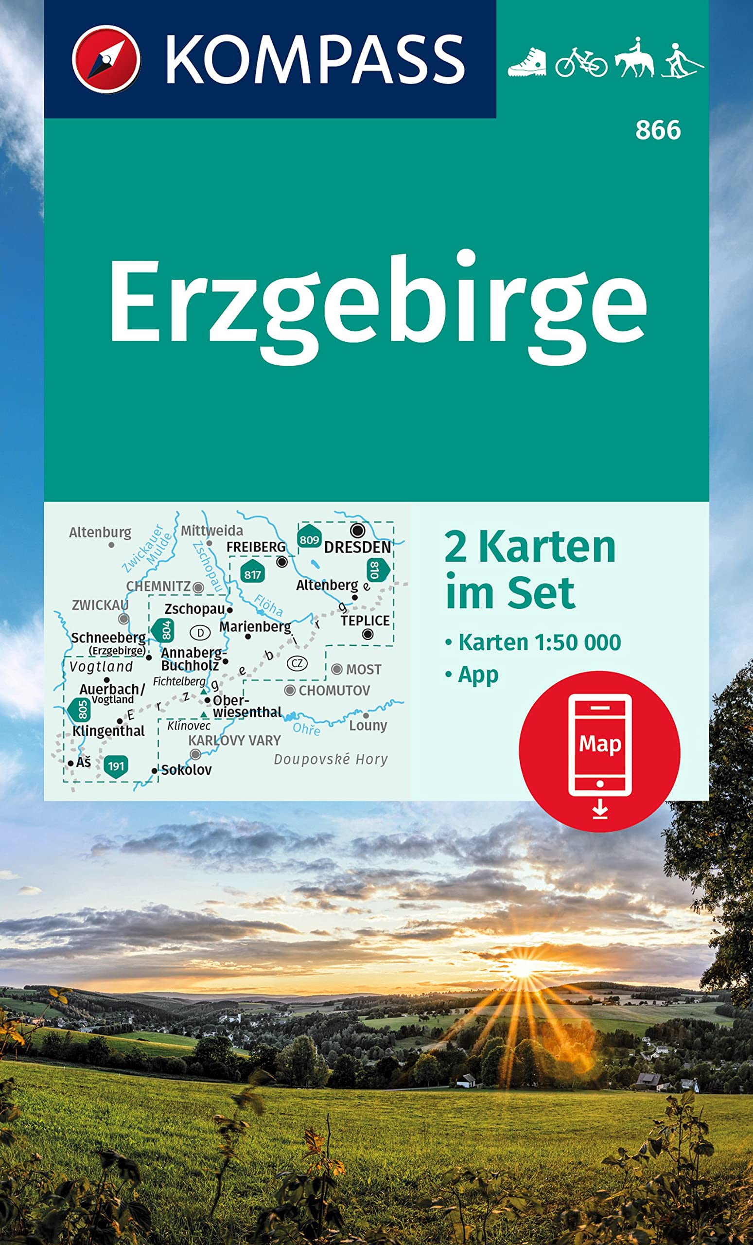
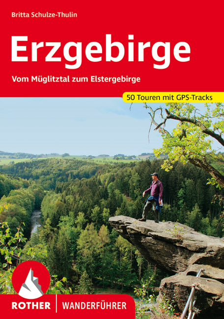
- Wandelgids Erzgebirge | Rother Bergverlag
- Uitstekende wandelgids met een groot aantal dagtochten in dal en hooggebergte. Met praktische informatie en beperkt kaartmateriaal! Wandelingen in verschillende zwaarte weergegeven in rood/blauw/zwart. 50 Höhenprofile; 50 Wanderkärtchen im Maßstab 1:50.000 und 1:75.000, zwei Übersichtskarten im Maßstab 1:500.000 und 1:850.000, GPS-Tracks zum... Read more
Netherlands
2021

United Kingdom
- Erzegebirge - Klingenthal - Altenberg - Fichtelberg - Oberwiesenthal - Seiffen 50K Kümmerly + Frey Map No. 48
- Erzegebirge - Klingenthal - Altenberg - Fichtelberg – Oberwiesenthal - Seiffen region of Germany at 1:50,000 from Kümmerly+Frey in a series GPS compatible, double-sided maps printed on durable, waterproof and tear-resistant plastic paper; contoured, with hiking and cycle routes, other recreational activities, etc.Maps in this series are at a... Read more

Netherlands
- Sachsens Museen & Schauanlagen des Berg- und H ttenwesens
- Der Bergbau in Sachsen hat eine lange Tradition. Besonders im Erzgebirge hinterlie der ber 800 Jahre lang betriebene Bergbau eine Kulturlandschaft mit einem fast un berschaubaren Bestand an technischen Denkmalen. Lebendige Volkskunst und Brauchtum zeugen noch heute von der Bl tezeit des Erzbergbaus, aber auch von den schweren Zeiten der... Read more
- Also available from:
- Bol.com, Belgium
Belgium
- Sachsens Museen & Schauanlagen des Berg- und H ttenwesens
- Der Bergbau in Sachsen hat eine lange Tradition. Besonders im Erzgebirge hinterlie der ber 800 Jahre lang betriebene Bergbau eine Kulturlandschaft mit einem fast un berschaubaren Bestand an technischen Denkmalen. Lebendige Volkskunst und Brauchtum zeugen noch heute von der Bl tezeit des Erzbergbaus, aber auch von den schweren Zeiten der... Read more
Netherlands
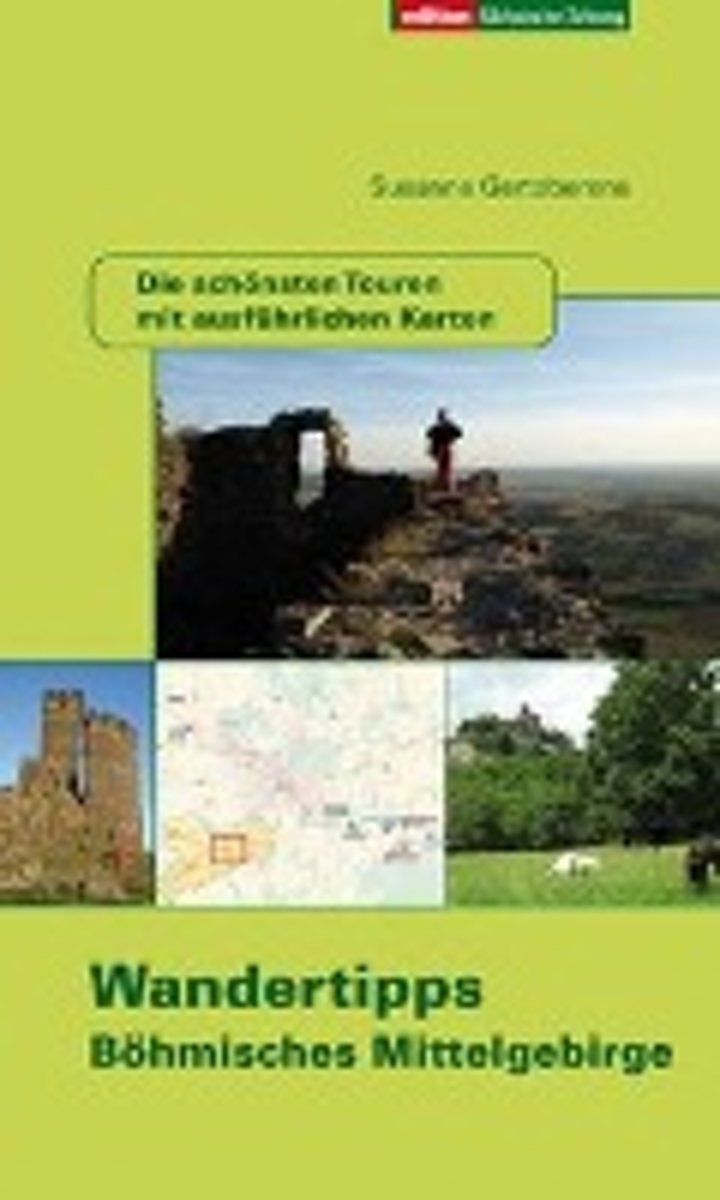
- Wandertipps Böhmisches Mittelgebirge
- Mit der Prager Autobahn und dem Wegfall der Grenzkontrollen ist das Böhmische Mittelgebirge ein gutes Stück näher an Sachsen herangerückt. Die faszinierende Vulkanlandschaft beginnt gleich hinter Ústí nad Labem (Aussig). Schon vor 200 Jahren fühlten sich romantische Maler und Dichter und auch Naturforscher magisch angezogen. Ludwig Richter... Read more
- Also available from:
- Bol.com, Belgium
Belgium
- Wandertipps Böhmisches Mittelgebirge
- Mit der Prager Autobahn und dem Wegfall der Grenzkontrollen ist das Böhmische Mittelgebirge ein gutes Stück näher an Sachsen herangerückt. Die faszinierende Vulkanlandschaft beginnt gleich hinter Ústí nad Labem (Aussig). Schon vor 200 Jahren fühlten sich romantische Maler und Dichter und auch Naturforscher magisch angezogen. Ludwig Richter... Read more
Karten


Netherlands
- Wandelkaart 2 Stara Planina gebergte | Domino
- Stara Planina Central: Uzana to Vratnik map at 1:50,000 from Bulgarian publishers Domino, contoured and GPS compatible, with hiking trails, accommodation options including a list of local mountain refuges, etc. The map is double-sided and covers the mountains from just west of the Uzana massif, the geographical centre of Bulgaria, eastwards to... Read more
- Also available from:
- Stanfords, United Kingdom

United Kingdom
- Stara Planina Central: Uzana to Vratnik Domino Map
- Stara Planina Central: Uzana to Vratnik map at 1:50,000 from Bulgarian publishers Domino, contoured and GPS compatible, with hiking trails, accommodation options including a list of local mountain refuges, etc. The map is double-sided and covers the mountains from just west of the Uzana massif, the geographical centre of Bulgaria, eastwards to... Read more
Netherlands
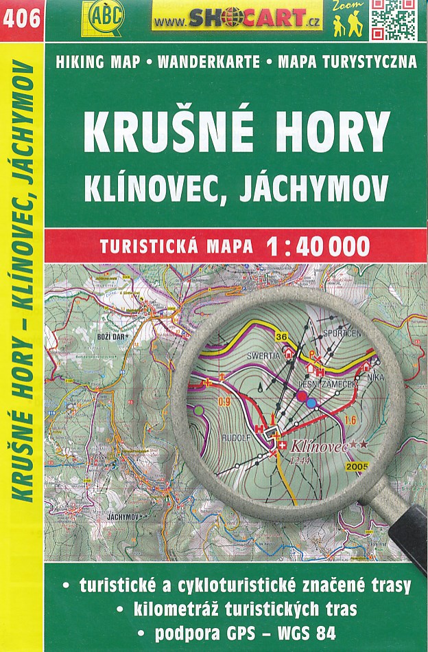
- Wandelkaart 406 Krušné hory - Klínovec, Jáchymov - Erzgebirge, Klinovec / Keilberg | Shocart
- Gedetailleerde deelkaart van Tsjechie met daarop naast vele topografische details ook ingetekende wandelroutes, hutten en andere toeristische bezienswaardigheden. Voor de wandelaar zijn de routes en bijvoorbeeld hoogtelijnen van belang. Goed kleurgebruik en legenda in meerdere talen. Als wandelkaart of fietskaart dan ook prima te gebruiken Read more

Netherlands
- Wandelkaart 3 Stara Planina gebergte | Domino
- Stara Planina Western: Belogradchik to Berkovita map at 1:50,000 from Bulgarian publishers Domino, contoured and GPS compatible, with hiking trails, accommodation options including a list of local mountain refuges, etc. The map is double-sided and covers the mountains from the peak of Byala Voda near Belogradchik eastwards to just beyond... Read more
- Also available from:
- Stanfords, United Kingdom

United Kingdom
- Stara Planina Western: Belogradchik to Berkovita Domino Map
- Stara Planina Western: Belogradchik to Berkovita map at 1:50,000 from Bulgarian publishers Domino, contoured and GPS compatible, with hiking trails, accommodation options including a list of local mountain refuges, etc. The map is double-sided and covers the mountains from the peak of Byala Voda near Belogradchik eastwards to just beyond... Read more
- Also available from:
- Stanfords, United Kingdom

United Kingdom
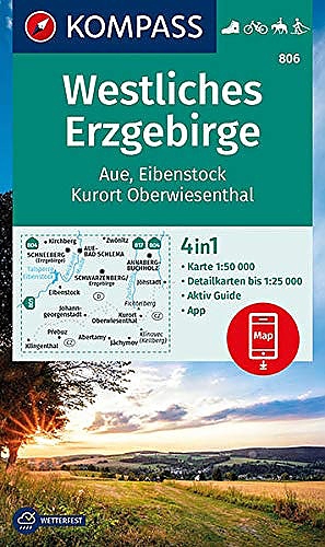
- Western Ore Mountains - Aue - Eibenstock - Kurort Oberwiesenthal Kompass 806
- Erzegebirge West: Aue - Eibenstock - Kurort Oberwiesenthal area of south-western Saxony on a detailed, GPS compatible map at 1:50,000 from Kompass with local and long-distance footpaths, cycling routes, accommodation, etc, printed on durable, waterproof and tear-resistant synthetic paper.KOMPASS HIKING & RECREATIONAL MAPS: this title is part of... Read more
Netherlands
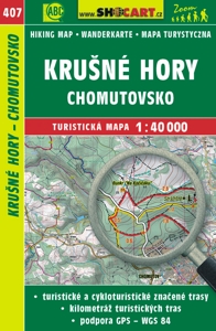
- Wandelkaart 407 Krušné hory - Chomutovsko - Erzgebirge | Shocart
- Gedetailleerde deelkaart van Tsjechie met daarop naast vele topografische details ook ingetekende wandelroutes, hutten en andere toeristische bezienswaardigheden. Voor de wandelaar zijn de routes en bijvoorbeeld hoogtelijnen van belang. Goed kleurgebruik en legenda in meerdere talen. Als wandelkaart of fietskaart dan ook prima te gebruiken Read more

Netherlands
- Wandelkaart 4 Stara Planina gebergte | Domino
- Stara Planina Western: Berkovita to Zlatitsa map at 1:50,000 from Bulgarian publishers Domino, contoured and GPS compatible, with hiking trails, accommodation options including a list of local mountain refuges, etc. The map is double-sided and covers the mountains from Varshets (directly north of Sofia) to just beyond Etrepole.Maps in the... Read more
- Also available from:
- Stanfords, United Kingdom

United Kingdom
- Stara Planina Western: Berkovita to Zlatitsa Domino Map
- Stara Planina Western: Berkovita to Zlatitsa map at 1:50,000 from Bulgarian publishers Domino, contoured and GPS compatible, with hiking trails, accommodation options including a list of local mountain refuges, etc. The map is double-sided and covers the mountains from Varshets (directly north of Sofia) to just beyond Etrepole.Maps in the... Read more
Netherlands
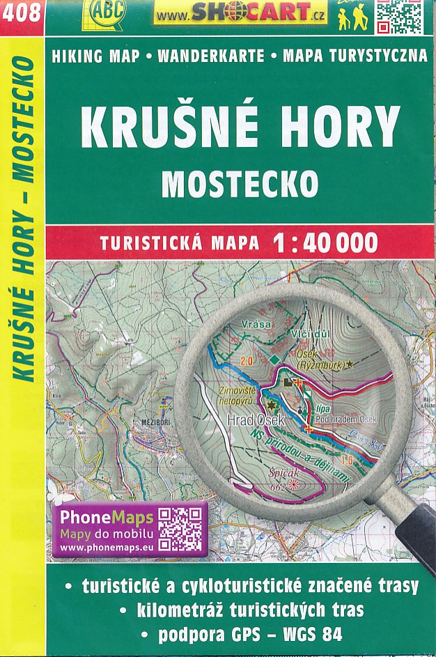
- Wandelkaart 408 Krušné hory - Mostecko - Erzgebirge, Brüx | Shocart
- Gedetailleerde deelkaart van Tsjechie met daarop naast vele topografische details ook ingetekende wandelroutes, hutten en andere toeristische bezienswaardigheden. Voor de wandelaar zijn de routes en bijvoorbeeld hoogtelijnen van belang. Goed kleurgebruik en legenda in meerdere talen. Als wandelkaart of fietskaart dan ook prima te gebruiken Read more

Netherlands
- Wandelkaart Strandzha - Bulgarije | Domino
- Strandzha Mountains in the south-eastern corner of Bulgaria between Burgas to the Turkish border on a contoured and GPS compatible map from Domino showing local hiking trails and highlighting various interesting sites, with three more detailed enlargements at 1:25,000. Most place names are in both Latin and Cyrillic alphabet; map legend... Read more
- Also available from:
- Stanfords, United Kingdom

United Kingdom
- Strandzha Mountains: Burgas to the Turkish Border Domino Map
- Strandzha Mountains in the south-eastern corner of Bulgaria between Burgas to the Turkish border on a contoured and GPS compatible map from Domino showing local hiking trails and highlighting various interesting sites, with three more detailed enlargements at 1:25,000. Most place names are in both Latin and Cyrillic alphabet; map legend... Read more

Netherlands
- Wandelkaart Sredna Gora - Bulgarije | Domino
- Pirin Mountains at 1:50,000 on a large, double-sided, contoured map with GPS waypoints for shelters and chalets, peaks, etc. and highlighting hiking routes. Topography is shown by contours at 40m intervals with additional relief shading and graphics and colouring for sandstone stacks, single rocks over 5m high, marshlands and different types of... Read more
Netherlands
2021

Netherlands
- Wandelkaart 5 Rila gebergte | Domino
- Rila Mountains at 1:50,000 on a large, double-sided, contoured map with GPS waypoints for shelters and chalets, peaks, etc. and highlighting hiking routes. Topography is shown by contours at 50m intervals with additional relief shading and graphics and colouring for scree, single rocks over 5m high, marshlands and pine scrub and forests. An... Read more
- Also available from:
- Stanfords, United Kingdom

United Kingdom
- Rila Mountains Domino
- Rila Mountains at 1:50,000 on a large, double-sided, contoured map with GPS waypoints for shelters and chalets, peaks, etc. and highlighting hiking routes. Topography is shown by contours at 50m intervals with additional relief shading and graphics and colouring for scree, single rocks over 5m high, marshlands and pine scrub and forests. An... Read more
Netherlands
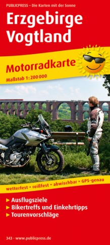
- Wegenkaart - landkaart 343 Motorkarte Erzgebirge - Vogtland | Publicpress
- Erzgebirge - Vogtland ab 10 EURO Motorradkarte mit Ausflugszielen, Einkehr- & Freizeittipps und Tourenvorschlägen, wetterfest, reissfest, abwischbar. 1:200000 PUBLICPRESS Motorradkarte. 5. Auflage Read more