Butjadingerweg
Beschreibung
- Name Butjadingerweg
- Länge von Wanderweg 58 km, 36 Meilen
- Länge in Tagen 3 Tage
- Anfang von Wanderweg Petershörn
- Ende von Wanderweg Blexen
- Traildino Schwierigkeit EW, Leichte Wanderung, Naturwanderweg
Petershörn - Blexen, 58 km, 3 days
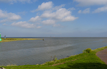
This walk takes us through the open country of German Friesland, along the North Sea. Most of time the trail runs along the vast sea inlet Jadebusen (Jade Bight). This sea inlet dates back to the Middle Ages when storms ravaged the coastal areas. Elsewhere along the North Sea, one finds similar sea inlets. In that era, lot of land was lost to the sea. In the centuries that followed, the people piecewise reclaimed bits of land, building dikes and canals. This proces has had a distinctive impact on the landscape. The shapes of the fields, dikes and canals tells us the history men trying to conquer the sea. In this open landscape, one finds few trees and no forest. Farms and small villages interrupt the spacious vistas. On the seaside of the dikes, lies a narrow strip of tidal Marshes is, only flooded at very high tides and storm flooding. They are bird-rich areas.
The Butjadinger Way is a short trail, but is part of the European Long Distance Trail E9. It connects Wilhelmshaven and Bremerhaven. The trail starts in a small hamlet, Petershörn, where another path, the Jadeweg, takes over to Wilhelmshaven. And the trail ends in Blexen, where you can take the ferry across the Weser to Bremerhaven.


