
Griechenland
Beschreibung

Greece is a famous beach destination, and many island hoppers like to go for a walk now and again. Most islands are quite suitable for hiking, and locally guides and maps are available giving good descriptions of trails. But the crowded summer season is hot and dry. April is a much better month for hiking, with all flowers in full bloom, and also May, although it will start to get busier. June is more quiet but very hot. The busy season then lasts until winter. Although common in the past, your chances of actually following in the footsteps of mules carrying their loads in the traditional manner are dim.
But there is more. If you've had enough of the island's oregano, you can head for the mainland Pindos Mountains in the province of Epirus, on the border with Albania. European long distance trail E6, running from west to east, leads right across the Pindos. In the wide expanse of forests and pastures you may cross tracks with a bear (see the picture of a bear track which caused the author to freeze with fear), or if not, then at least with one or two herdsmen smelling of the inevitable ewe's cheese. Smolikos is the highest peak, reaching up to 2637m. Walking season in the mountains is from May, when the mountain tops are still covered in snow, until mid October. Greek mountain ranges have been made increasingly accessible over the years thanks to over 100 mountain huts.
Make an effort, and find out Greece has almost twenty national trails, maintained by regional mountaineering clubs. European long distance trail E4 enters Northern Greece from Bulgaria, and runs south via Mount Olympus (2918m), highest mountain of Greece and pleasant abode of Zeus. If you plan to spend the night there yourself in July or August, make sure to reserve in advance. The trail then leads across the Peleponessos, leaving it in the south, and continues on the island of Crete. Crete of course is famous for its Samaria gorge, the longest in Europe. It is impossible to lose your way here, simply join the crowd.
The Internet is not yet a very good source of information on Greek hiking, but maps and guides are easy to find. More information can be obtained through the Hellenic Federation of Mountaineering and Climbing.
Wanderwege
Regionen
- Agatohonissi, Dodecanese
- Amorgos, Cyclades
- Anafi, Cyclades
- Andros, Cyclades
- Antiparos, Cyclades
- Arki, Dodecanese
- Astipalea, Dodecanese
- Corfu
- Crete
- Cyclades Islands
- Dodecanese Islands
- Donoussa, Cyclades
- Folegandros, Cyclades
- Fourni, Dodecanese
- Greek Islands
- Ikaria, Dodecanese
- Ionian Islands
- Ios, Cyclades
- Iraklia, Cyclades
- Kalymnos, Dodecanese
- Karpathos
- Kea, Cyclades
- Kefalonia
- Kimolos, Cyclades
- Kithnos, Cyclades
- Kos
- Koufonisi, Cyclades
- Leros, Dodecanese
- Lesbos
- Lipsi, Dodecanese
- Milos, Cyclades
- Naxos, Cyclades
- Paros, Cyclades
- Patmos, Dodecanese
- Paxos
- Peleponnese
- Peloponnesos
- Pindos Mountains
- Rhodos
- Samos, Dodecanese
- Santorini, Cyclades
- Schinoussa, Cyclades
- Serifos, Cyclades
- Sifnos, Cyclades
- Sikinos, Cyclades
- Syros, Cyclades
- Telendos, Dodecanese
- Thirassia, Cyclades
- Tinos, Cyclades
- Zakynthos


 - by K.")


Links
Fakten
Berichte
Führer und Karten
Übernachtung
Organisationen
Reisebüros
GPS
Sonstiges
Bücher

- Also available from:
- De Zwerver, Netherlands
Netherlands
2018
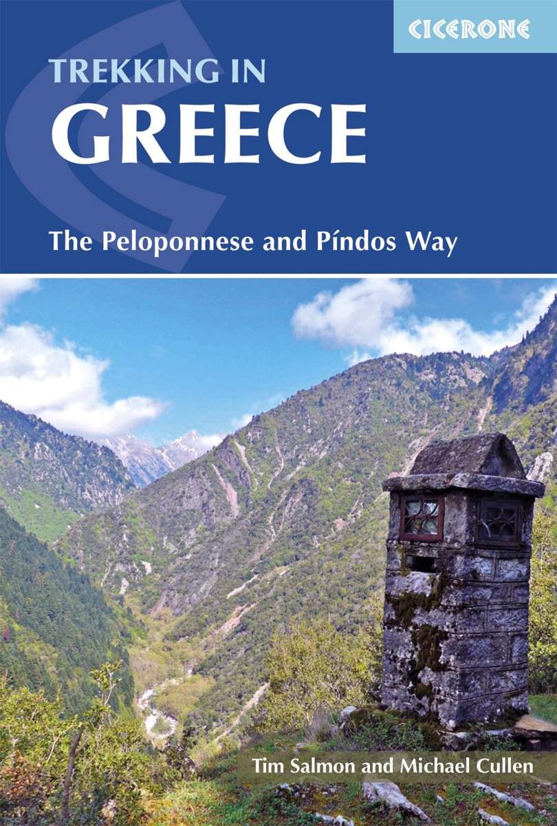
- Wandelgids Trekking in Greece - Griekenland | Cicerone
- Guidebook describing challenging treks in the mountains of Greece, traversing the Pindhos Range, near Athens, and the Peloponnese, plus a handful of shorter routes including Mount Olympus. The treks demand a high level of commitment and fitness due to their remoteness and difficult terrain, and boast stunning unspoilt scenery. Read more

United Kingdom
2019
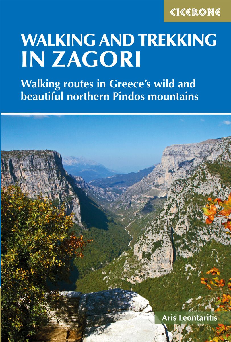
- Walking and Trekking in Zagori
- Walking routes in Greece's wild and beautiful northern Pindos mountains Read more
- Also available from:
- De Zwerver, Netherlands
Netherlands
2019
- Wandelgids Walking and Trekking in the Zagori | Cicerone
- Guidebook to 30 walks and 3 treks centred on Zagori and Konitsa in mainland Greece. From easy strolls to demanding hikes along remote mountainous traverses, including the rugged peaks of Mt Timfi and Mt Smolikas in the Pindos range, Drakolimni Lake, and the dramatic Vikos Gorge. With background information on architecture, history and wildlife. Read more

- Also available from:
- De Zwerver, Netherlands

- Also available from:
- De Zwerver, Netherlands

United Kingdom
2023
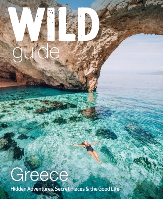
- Wild Guide Greece
- Hidden Places, Great Adventures and the Good Life (including the mainland, Crete, Corfu, Rhodes and over 20 other islands) Read more
- Also available from:
- De Zwerver, Netherlands
Netherlands
2023
- Reisgids Wild Guide Greece | Wild Things Publishing
- Hidden Places, Great Adventures and the Good Life (including the mainland, Crete, Corfu, Rhodes and over 20 other islands) Read more
Netherlands
2014
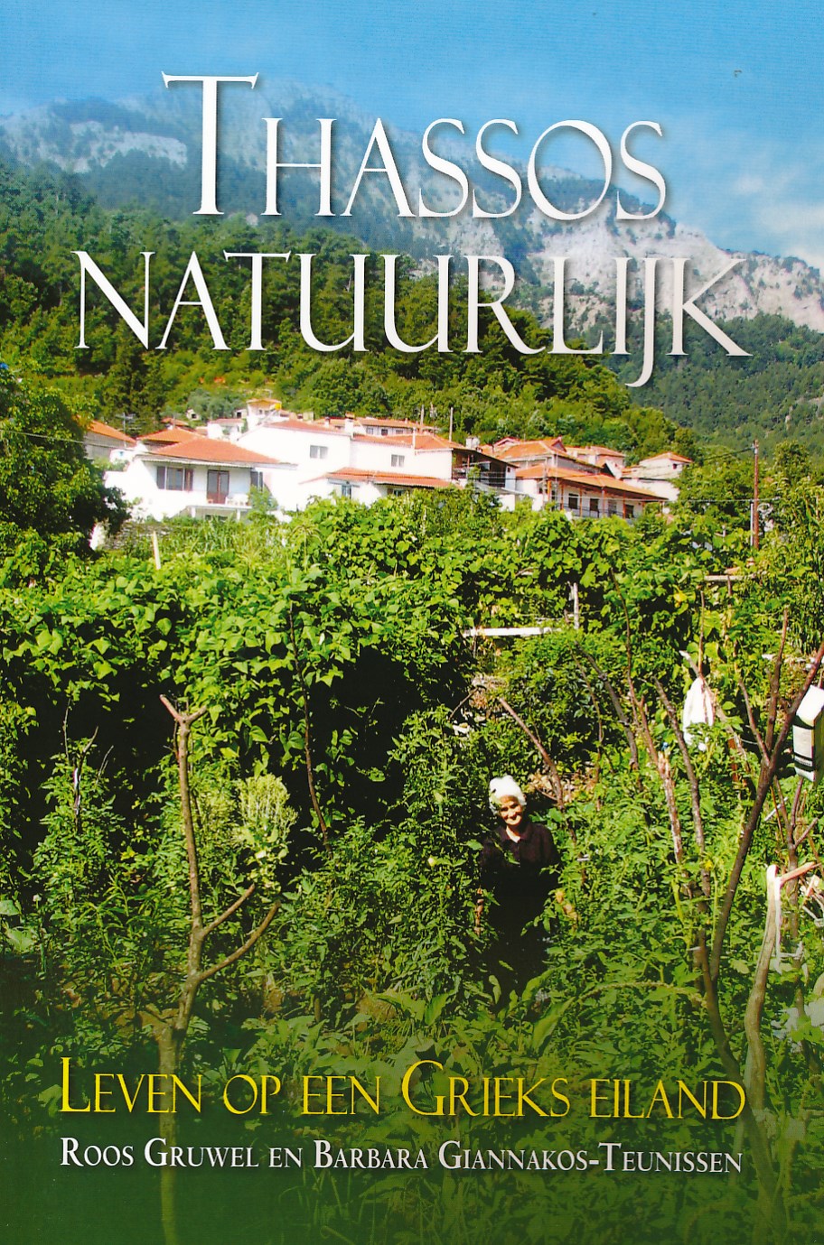
- Reisgids Thassos natuurlijk | Boekscout.nl
- Twee Nederlandse vrouwen geven een gedetailleerd beeld van het leven op Thassos, het bosrijke, bergachtige Griekse eiland. Ze geven inzicht in het leven van de Thassiten, die van hun voorouders geleerd hebben in harmonie met de natuur te leven en alles te gebruiken wat deze hen biedt. Een beschrijving van flora en fauna, van olijventeelt,... Read more
Netherlands
2018
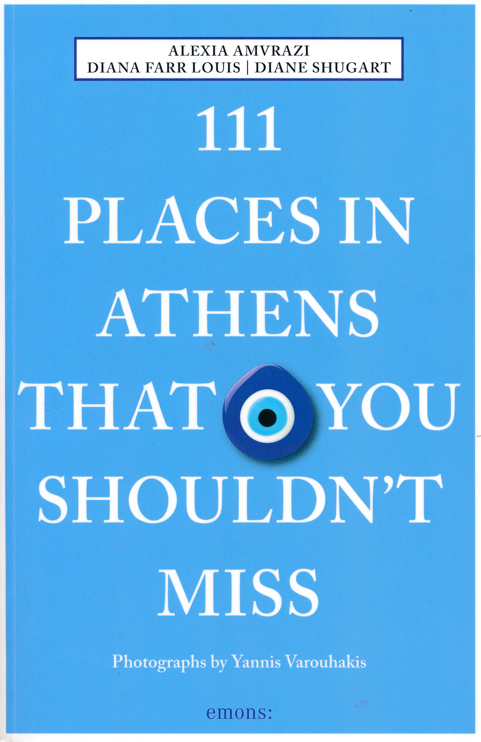
- Reisgids 111 places in Athens That You Shouldn't Miss | Emons
- The ultimate insider's guide to Athens Features interesting and unusual places not found in traditional travel guides Part of the international 111 Places/111 Shops series with over 300 titles and 1.8 million copies in print worldwide Appeals to both the local market (around 665,000 people call Athens home) and the tourist market (5 million... Read more
Netherlands
2020
Netherlands
- Natuurgids Führer zu den Vulkanen Europas - band 3: Italien & Griechenland | Enke
- Dit boekje is bedoeld voor alle geïnteresseerden in geologie - van amateurgeologen tot geschoolden, ieder vindt in deze handige gids alle informatie die nodig is ter voorbereiding op excursies naar de belangrijkste vulkaangebieden in Europa. Read more
Netherlands
2018
- Reisgids Hydra | Road Editions
- Algemene reisgids van het eiland Hydra met veel foto's. Achterin informatie voor bijvooibeeld wandelen, stranden of accommodatie. De culturele aspecten van het eiland komen uitgebreid aan bod. Read more
Netherlands
2014
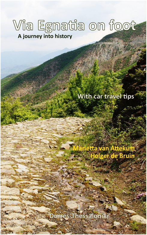
- Wandelgids Via Egnatia on foot deel 1 (Albanië - Griekenland) | Via Egnatia Foundation
- Deze Engelstalige gids is deel 1 in een serie van 3 delen. In dit boek is het stuk tussen Dürres en Thessaloniki beschreven, de complete route is van Dürres tot Istanbul. De overige 2 delen moeten nog verschijnen. De gids bevat een stap voor stap beschrijving van de route (460km) met gedetailleerde topografische kaarten, stadsplattegronden met... Read more
Karten

United Kingdom
- Prespa - Vitsi - Voras
- Uitstekende topografische kaarten van een deel van Griekenland: zonder meer hele goede kaarten voor wandeltochten in een onbekend stuk Griekenland! Ze zijn gedrukt op scheurvast en watervast papier op een schaal van 1:50.000 met een UTM grid voor GPS gebruikers. Op de meeste kaarten is geven de hoogtelijnen een interval van 20m. aan. Met... Read more
- Also available from:
- De Zwerver, Netherlands
- Stanfords, United Kingdom

Netherlands
- Wandelkaart 6.2 Prespa - Vitsi - Voras | Anavasi
- Uitstekende topografische kaarten van een deel van Griekenland: zonder meer hele goede kaarten voor wandeltochten in een onbekend stuk Griekenland! Ze zijn gedrukt op scheurvast en watervast papier op een schaal van 1:50.000 met een UTM grid voor GPS gebruikers. Op de meeste kaarten is geven de hoogtelijnen een interval van 20m. aan. Met... Read more

United Kingdom
- Prespa - Vitsi - Voras Anavasi 6.2
- Prespa - Vitsi – Voras area of northern Greece at 1:50,000 on a light, waterproof and tear-resistant, GPS compatible, contoured map from Anavasi, with recommendations for three hiking trails and notes on the E4 and E6 cross-European trails. The map is double-sided; coverage in the west starts from the Prespa Lake on the border with Albania and... Read more

United Kingdom
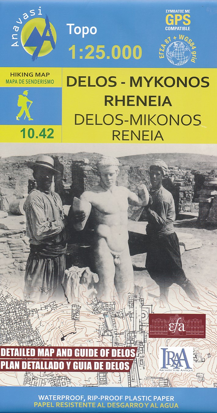
- Delos - Mykonos - Rheneia
- Mykonos with the nearby islands of Delos and Rineia / Rheneia on a light, waterproof and tear-resistant, GPS compatible map at 1:25,000 from Anavasi. The reverse side shows a large, very detailed plan of the archaeological remains on Delos of the temples of Apollo, Artemis and Leto.Topography of the islands is shown by contours with hill... Read more
- Also available from:
- De Zwerver, Netherlands
- Stanfords, United Kingdom
Netherlands
- Wandelkaart 10.42 Delos - Mykonos (Mikonos) - Rheneia (Reneia) | Anavasi
- Mykonos with the nearby islands of Delos and Rineia / Rheneia on a light, waterproof and tear-resistant, GPS compatible map at 1:25,000 from Anavasi. The reverse side shows a large, very detailed plan of the archaeological remains on Delos of the temples of Apollo, Artemis and Leto.Topography of the islands is shown by contours with hill... Read more

United Kingdom
- Mykonos - Delos - Rheneia / Rineia Anavasi 10.42
- Mykonos with the nearby islands of Delos and Rineia / Rheneia on a light, waterproof and tear-resistant, GPS compatible map at 1:25,000 from Anavasi. The reverse side shows a large, very detailed plan of the archaeological remains on Delos of the temples of Apollo, Artemis and Leto.Topography of the islands is shown by contours with hill... Read more

United Kingdom
- Spetses
- De kaarten van Anavasi zijn zeer gedetailleerd, beschikken over een helder kaartbeeld en zijn uitstekende kaarten voor diverse activiteiten. Ze beschikken over vele interessante punten voor wandelaars, fietsers of andere toeristen die het gebied bezichtigen. De wandelkaarten bevatten ook een uitzonderlijke reliefaanwijzing, verschillende vormen... Read more

United Kingdom
- Exo Mani 2018
- Uitstekende wandelkaart op scheur- en watervast papier van het wandelgebied rond Kardamyli maar ook nog met Agios Nikolaos. De wandelpaden staan er op ingetekend, zo ook alle bezienswaardigheden als klooster, kastelen en meerdere opgravingen. Mani is the middle and southernmost peninsula of the Peloponnese and is split between Laconia and... Read more
- Also available from:
- De Zwerver, Netherlands
- Stanfords, United Kingdom

Netherlands
- Wandelkaart 8.10 Exo Mani | Anavasi
- Uitstekende wandelkaart op scheur- en watervast papier van het wandelgebied rond Kardamyli maar ook nog met Agios Nikolaos. De wandelpaden staan er op ingetekend, zo ook alle bezienswaardigheden als klooster, kastelen en meerdere opgravingen. Mani is the middle and southernmost peninsula of the Peloponnese and is split between Laconia and... Read more

United Kingdom
- Exo Mani - Verga - Kardamyli - Trachila Anavasi 8.10
- The northern part of the western coast of the Mani Peninsula, the “middle finger” of the Peloponnese, on a light, waterproof and tear-resistant, double-sided, contoured and GPS-compatible map at 1:20,000 from Anavasi highlighting 24 hiking trails and various facilities and places of interest. Coverage, with a good overlap between the sides,... Read more

United Kingdom
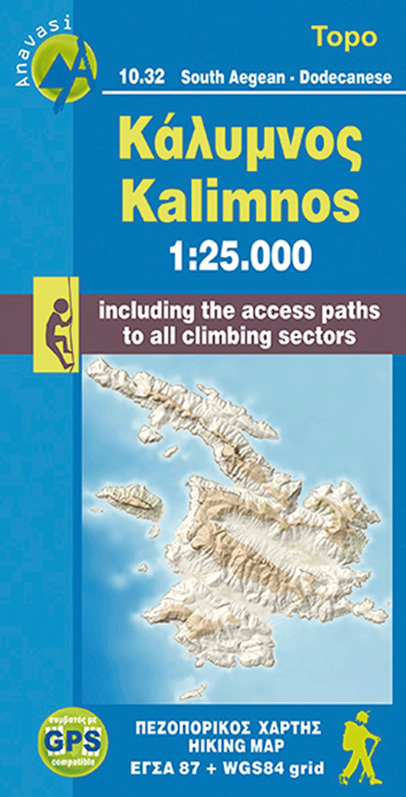
- Kalimnos
- The Dodecanese island of Kalymnos / Kalimnos on a waterproof and tear-resistant, contoured and GPS compatible map at 1:25,000 from Anavasi, highlighting hiking trails and the islands numerous rock climbing and bouldering sites.Landscape is shown by contours at 20m with altitude colouring, hill shading and spot heights. The map indicates dirt... Read more
- Also available from:
- De Zwerver, Netherlands
- Stanfords, United Kingdom
Netherlands
- Wandelkaart 10.32 Kalimnos | Anavasi
- The Dodecanese island of Kalymnos / Kalimnos on a waterproof and tear-resistant, contoured and GPS compatible map at 1:25,000 from Anavasi, highlighting hiking trails and the islands numerous rock climbing and bouldering sites.Landscape is shown by contours at 20m with altitude colouring, hill shading and spot heights. The map indicates dirt... Read more

United Kingdom
- Kalymnos - Telendos & Pserimos Anavasi 10.32
- The Dodecanese island of Kalymnos / Kalimnos on a waterproof and tear-resistant, contoured and GPS compatible map at 1:25,000 from Anavasi, highlighting hiking trails and the islands numerous rock climbing and bouldering sites.Landscape is shown by contours at 20m with altitude colouring, hill shading and spot heights. The map indicates dirt... Read more

United Kingdom
- Central Imittos (Mount Hymettos)
- Central Hymettos in a series of waterproof and tear-resistant hiking maps at scales varying from 1:50,000 to 1:10,000, with a UTM grid for GPS users. Contour interval varies depending on the scale, on most maps it is 20m. Relief shading, spot heights, springs, seasonal streams and, in most titles, landscape/land-use variations, e.g. forests,... Read more

United Kingdom
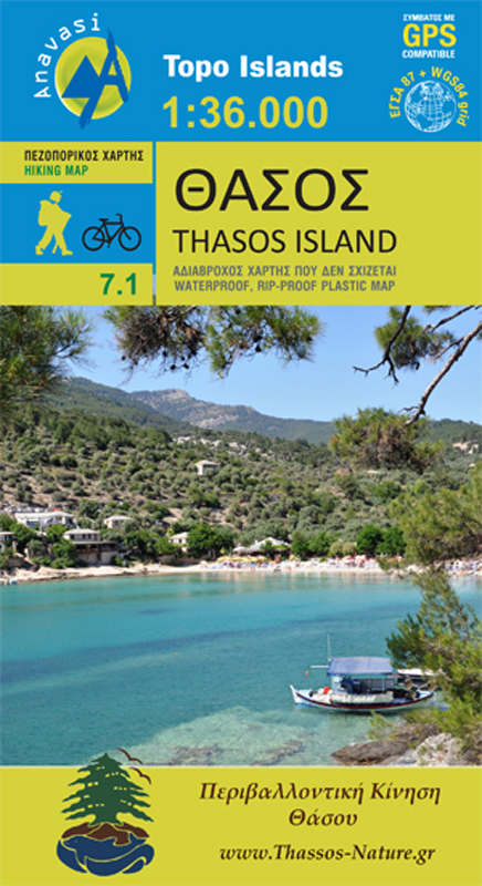
- Thasos
- Het eiland Thassos heeft een prachtige natuurlijke schoonheid. Het is rijk aan bossen en stranden, maar het eiland heeft ook oude mijntunnels en overblijfselen van de mijnen, oude torens die de kust bewaken en moderne steengroeven. Met deze kaart, die is gemaakt met de steun en samenwerking van de Environmental Association of Thasos, zijn er... Read more
- Also available from:
- De Zwerver, Netherlands
Netherlands
- Wandelkaart 7.1 Thasos | Anavasi
- Het eiland Thassos heeft een prachtige natuurlijke schoonheid. Het is rijk aan bossen en stranden, maar het eiland heeft ook oude mijntunnels en overblijfselen van de mijnen, oude torens die de kust bewaken en moderne steengroeven. Met deze kaart, die is gemaakt met de steun en samenwerking van de Environmental Association of Thasos, zijn er... Read more

United Kingdom
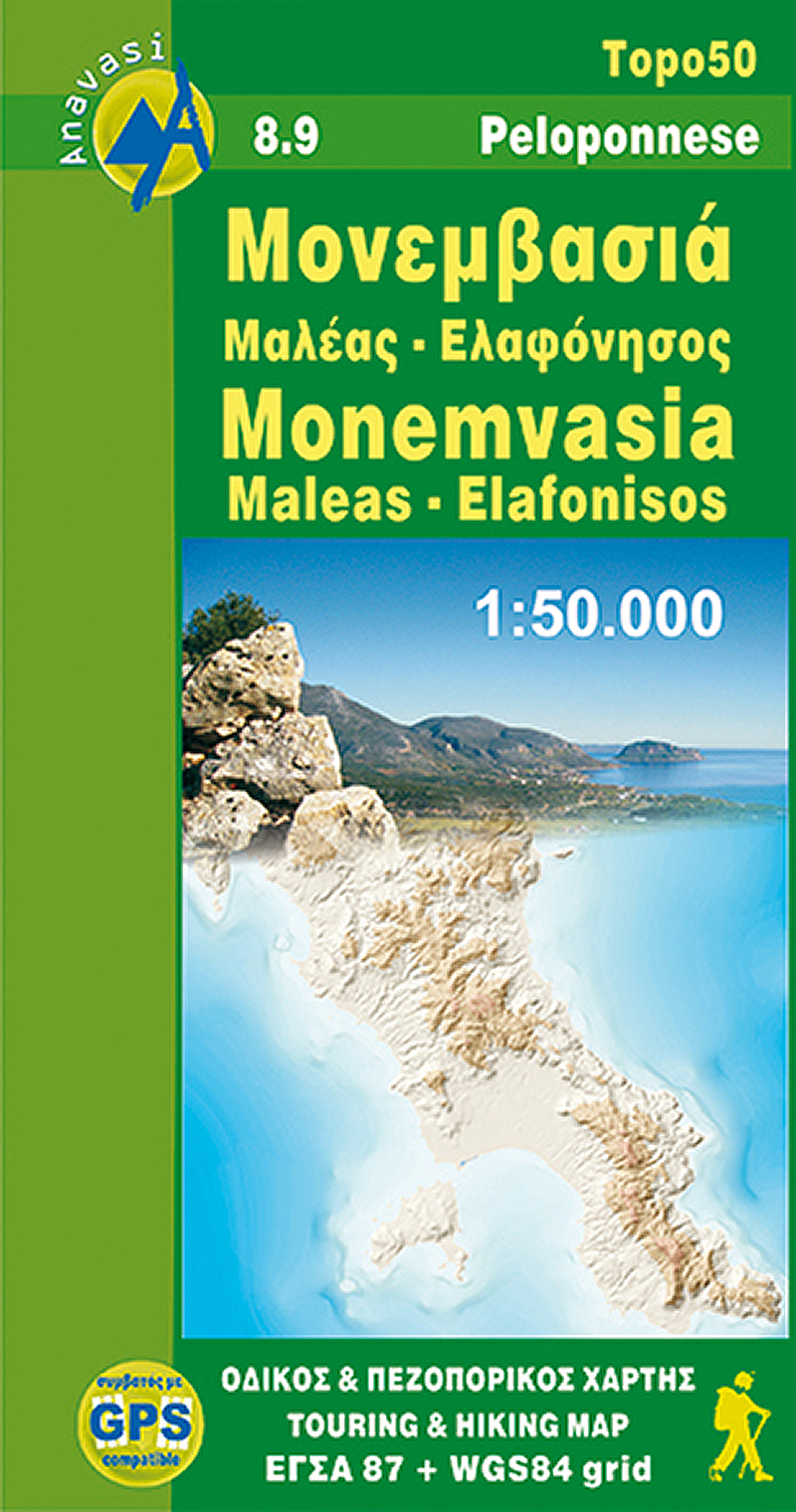
- Monemvasia - Maleas - Elafonisos
- Monemvasia - Maleas - Elafonisos area, the eastern finger of the Peloponnese and the Elsfonisos Island, at 1:50,000 in a series of waterproof and tear-resistant hiking maps from Anavasi with a UTM grid for GPS users. On one side is a topographic map of the area with contours at 20m intervals and a 1-km UTM grid. On the reverse a simplified... Read more
- Also available from:
- De Zwerver, Netherlands
- Stanfords, United Kingdom
Netherlands
- Wandelkaart 8.9 Monemvasia - Maleas - Peloponnesos | Anavasi
- Monemvasia - Maleas - Elafonisos area, the eastern finger of the Peloponnese and the Elsfonisos Island, at 1:50,000 in a series of waterproof and tear-resistant hiking maps from Anavasi with a UTM grid for GPS users. On one side is a topographic map of the area with contours at 20m intervals and a 1-km UTM grid. On the reverse a simplified... Read more

United Kingdom
- Monemvasia - Maleas - Elafonisos Anavasi 8.9
- Monemvasia - Maleas - Elafonisos area, the eastern finger of the Peloponnese and the Elsfonisos Island, at 1:50,000 in a series of waterproof and tear-resistant hiking maps from Anavasi with a UTM grid for GPS users. On one side is a topographic map of the area with contours at 20m intervals and a 1-km UTM grid. On the reverse a simplified... Read more

United Kingdom
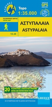
- Astypalaia
- Deze wandelkaart van Astipalaia is in samenwerking gemaakt met de gemeente Astipalaia. Het prachtige Chora met zijn grote Venetiaanse kasteel is ontzettend indrukwekkend, maar Astipalaia heeft nog veel meer te bieden. Er zijn 20 routes ontworpen en gemarkeerd. Via deze routes zijn de meeste monumenten (kastelen, basilicas, enz.) te bezoeken... Read more
- Also available from:
- De Zwerver, Netherlands
Netherlands
- Wandelkaart 10.49 Astypalaia | Anavasi
- Deze wandelkaart van Astipalaia is in samenwerking gemaakt met de gemeente Astipalaia. Het prachtige Chora met zijn grote Venetiaanse kasteel is ontzettend indrukwekkend, maar Astipalaia heeft nog veel meer te bieden. Er zijn 20 routes ontworpen en gemarkeerd. Via deze routes zijn de meeste monumenten (kastelen, basilicas, enz.) te bezoeken... Read more

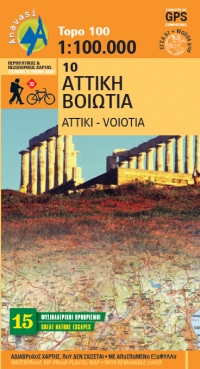
United Kingdom
- Attika Viotia
- Attica and Boeotia at 1:100,000 in a series from Anavasi covering selected popular areas of central mainland Greece and the Peloponnese on GPS compatible, detailed topographic road maps printed on light, waterproof and tear-resistant synthetic paper. Coverage extends north well beyond Thebes/Thiva and Livadia to Atlanadi and includes Salamina... Read more
- Also available from:
- De Zwerver, Netherlands
- Stanfords, United Kingdom
Netherlands
- Wegenkaart - landkaart 10 Atiki - Attika | Anavasi
- Attica and Boeotia at 1:100,000 in a series from Anavasi covering selected popular areas of central mainland Greece and the Peloponnese on GPS compatible, detailed topographic road maps printed on light, waterproof and tear-resistant synthetic paper. Coverage extends north well beyond Thebes/Thiva and Livadia to Atlanadi and includes Salamina... Read more

United Kingdom
- Attica - Boeotia Anavasi 10
- Attica and Boeotia at 1:100,000 in a series from Anavasi covering selected popular areas of central mainland Greece and the Peloponnese on GPS compatible, detailed topographic road maps printed on light, waterproof and tear-resistant synthetic paper. Coverage extends north well beyond Thebes/Thiva and Livadia to Atlanadi and includes Salamina... Read more

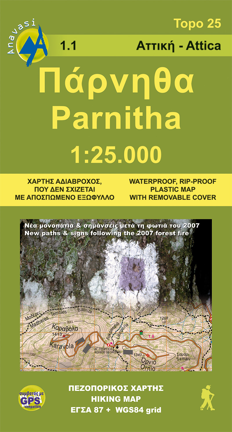
United Kingdom
- Northern Hymettus
- Mt Parnitha in a series of waterproof and tear-resistant hiking maps at scales varying from 1:50,000 to 1:10,000, with a UTM grid for GPS users. Contour interval varies depending on the scale, on most maps it is 20m. Relief shading, spot heights, springs, seasonal streams and, in most titles, landscape/land-use variations, e.g. forests,... Read more
- Also available from:
- De Zwerver, Netherlands
- Stanfords, United Kingdom
Netherlands
- Wandelkaart 1.1 Mt. Parnitha | Anavasi
- Mt Parnitha in a series of waterproof and tear-resistant hiking maps at scales varying from 1:50,000 to 1:10,000, with a UTM grid for GPS users. Contour interval varies depending on the scale, on most maps it is 20m. Relief shading, spot heights, springs, seasonal streams and, in most titles, landscape/land-use variations, e.g. forests,... Read more

United Kingdom
- Mt Parnitha Anavasi 1.1
- Mt Parnitha in a series of waterproof and tear-resistant hiking maps at scales varying from 1:50,000 to 1:10,000, with a UTM grid for GPS users. Contour interval varies depending on the scale, on most maps it is 20m. Relief shading, spot heights, springs, seasonal streams and, in most titles, landscape/land-use variations, e.g. forests,... Read more

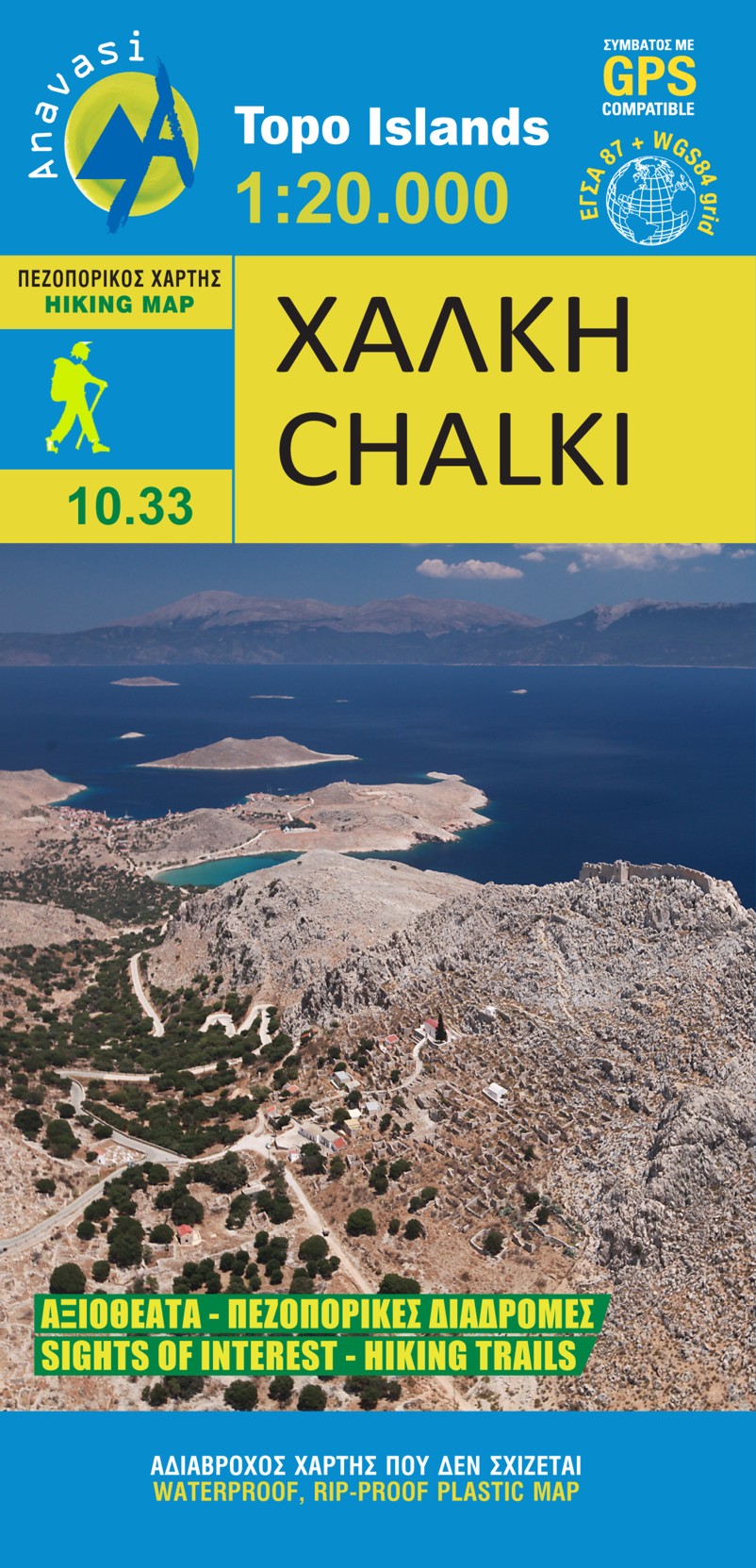
United Kingdom
- Chalki
- wandelkaart schaal 1:20.000 met hoogtelijnen, wandelpaden, toeristische informatie en UTM grid, de kaart is geschikt voor gebruik met GPS. A tiny island though very rich in monuments and ancient remains. More than 50 byzantine chappels, dozens of rock carved cisterns and old agricultural settlements and a well-preserved medieval caslte with a... Read more
- Also available from:
- De Zwerver, Netherlands
- Stanfords, United Kingdom
Netherlands
- Wandelkaart 10.33 Chalki | Anavasi
- wandelkaart schaal 1:20.000 met hoogtelijnen, wandelpaden, toeristische informatie en UTM grid, de kaart is geschikt voor gebruik met GPS. A tiny island though very rich in monuments and ancient remains. More than 50 byzantine chappels, dozens of rock carved cisterns and old agricultural settlements and a well-preserved medieval caslte with a... Read more

United Kingdom
- Chalki Anavasi 10.33
- The island of Chalki at 1:20,000 on a waterproof and tear-resistant, contoured and GPS compatible map from Anavasi, with highlighting five recommended hiking routes and other useful tips, plus an enlargement showing in greater detail the Chorio archaeological site.On one side is a map of Chalki with contours at 20m intervals and hill shading to... Read more

United Kingdom
- Smolikas Mount Trapezitsa
- Pindos: Mt Smolikas - Mt Trapezitsa area in a series of waterproof and tear-resistant hiking maps at scales varying from 1:50,000 to 1:10,000, with a UTM grid for GPS users. Contour interval varies depending on the scale, on most maps it is 20m. Relief shading, spot heights, springs, seasonal streams and, in most titles, landscape/land-use... Read more
- Also available from:
- Stanfords, United Kingdom

United Kingdom
- Mt Smolikas - Mt Trapezitsa Anavasi 3.31
- Pindos: Mt Smolikas - Mt Trapezitsa area in a series of waterproof and tear-resistant hiking maps at scales varying from 1:50,000 to 1:10,000, with a UTM grid for GPS users. Contour interval varies depending on the scale, on most maps it is 20m. Relief shading, spot heights, springs, seasonal streams and, in most titles, landscape/land-use... Read more

Netherlands
2016
- Wandelgids The Cretan Way E4 | Anavasi
- The Cretan Way is a 500km walking route which takes you from east to west across the varied and spectacular landscapes of Crete. It is the ideal way to discover the rural, mountainous and costal regions of this incredible island. This guide is based on a 28-day walk.This guide includes practical information, maps at a scale of 1:25.000 of... Read more
- Also available from:
- Stanfords, United Kingdom

United Kingdom
2016
- The Cretan Way - A 28 Day Walk
- The Cretan Way is a 500km walking route which takes you from east to west across the varied and spectacular landscapes of Crete. It is the ideal way to discover the rural, mountainous and costal regions of this incredible island. This guide is based on a 28-day walk.This guide includes practical information, maps at a scale of 1:25.000 of... Read more
Netherlands
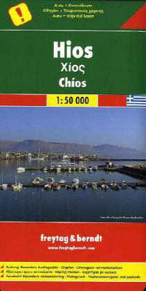
- Wandelkaart - Wegenkaart - landkaart Chios - Hios | Freytag & Berndt
- Chios at 1:50,000 on a large GPS compatible map from Freytag & Berndt with brief descriptions of places of interest highlighted on the map, plus a street plan of Chios town. Coverage includes the nearby islands of Inousses and Passas.Topography of the island is shown by bold relief shading, enhanced by contours at 40m intervals. All place names... Read more
- Also available from:
- Stanfords, United Kingdom

United Kingdom
- Chios F&B
- Chios at 1:50,000 on a large GPS compatible map from Freytag & Berndt with brief descriptions of places of interest highlighted on the map, plus a street plan of Chios town. Coverage includes the nearby islands of Inousses and Passas.Topography of the island is shown by bold relief shading, enhanced by contours at 40m intervals. All place names... Read more