Wales
Beschreibung
Karte

Wanderwege Landesteil
- All Wales Coast PathGPX
- Beacons WayGPX
- Cambrian Way
- Clwydian WayGPX
- Coed Morgannwg Way
- Dyfi Valley Way
- Glamorgan Ridgeway
- Glyndŵr's WayGPX
- Isle of Anglesey Coastal PathGPX
- Llŷn Coastal PathGPX
- North Wales PathGPX
- Offa's Dyke PathGPX
- Pembrokeshire Coast PathGPX
- Severn WayGPX
- Sirhowy Valley Walk
- Usk Valley WalkGPX
- Wye Valley WalkGPX
Links
Fakten
Berichte
Führer und Karten
Übernachtung
Organisationen
Reisebüros
GPS
Sonstiges
Bücher

- Also available from:
- De Zwerver, Netherlands

The Book Depository
United Kingdom
United Kingdom
- WALKING THE TODDS
- A Walkers Guide To 50 Of The Highest Summits In Wales With Todd The Border Terrier Leading The Way Read more

- Also available from:
- De Zwerver, Netherlands
- Stanfords, United Kingdom
De Zwerver
Netherlands
2015
Netherlands
2015

Stanfords
United Kingdom
2015
United Kingdom
2015
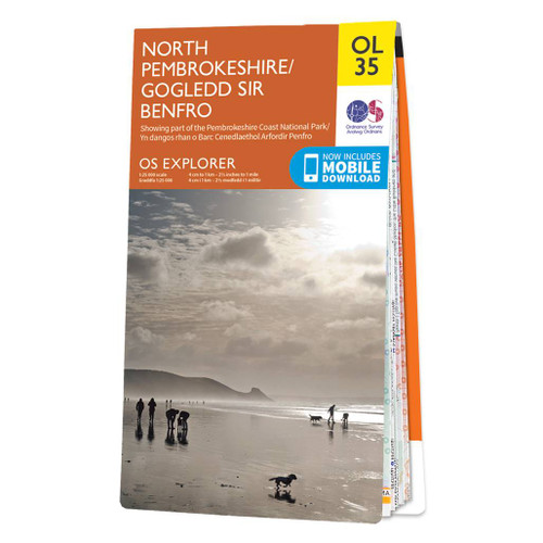
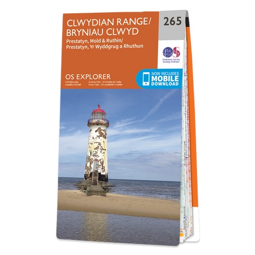
- Clwydian Range - Prestatyn, Mold & Ruthin OS Explorer Map 265 (paper)
- Clwydian Range, Prestatyn, Mold and Ruthin area on a detailed topographic and GPS compatible map No. 265, paper version, from the Ordnance Survey’s 1:25,000 Explorer series. MOBILE DOWNLOADS: this title and all the other OS Explorer maps include a code for downloading after purchase the digital version onto your smartphone or tablet for viewing... Read more

The Book Depository
United Kingdom
2022
United Kingdom
2022
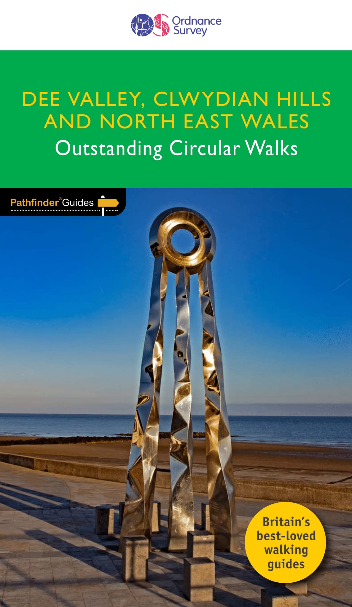
- DEE VALLEY, CLWYDIAN HILLS AND NORTH EAST WALES
- Pathfinder (R) Guide to North East Wales, featuring 28 outstanding and mostly circular rambles in the Dee Valley, over the Clwdian Hills and across Conwy east of the Vale of Conwy, Denbighshire, Flintshire and Wrexham: from the Great Orme to Chirk and from the Point of Ayr (the most northerly tip of mainland Wales) to the lofty summit of Cadair... Read more
- Also available from:
- De Zwerver, Netherlands
- Stanfords, United Kingdom
De Zwerver
Netherlands
2022
Netherlands
2022
- Wandelgids 79 Pathfinder Guides Dee Valley, Clwydian Hills and North East Wales | Ordnance Survey
- Pathfinder (R) Guide to North East Wales, featuring 28 outstanding and mostly circular rambles in the Dee Valley, over the Clwdian Hills and across Conwy east of the Vale of Conwy, Denbighshire, Flintshire and Wrexham: from the Great Orme to Chirk and from the Point of Ayr (the most northerly tip of mainland Wales) to the lofty summit of Cadair... Read more

Stanfords
United Kingdom
2022
United Kingdom
2022
- Dee Valley, Clwydian Hills and North East Wales - Outstanding Circular Walks
- Pathfinder (R) Guide to North East Wales, featuring 28 outstanding and mostly circular rambles in the Dee Valley, over the Clwdian Hills and across Conwy east of the Vale of Conwy, Denbighshire, Flintshire and Wrexham: from the Great Orme to Chirk and from the Point of Ayr (the most northerly tip of mainland Wales) to the lofty summit of Cadair... Read more

- Also available from:
- De Zwerver, Netherlands

The Book Depository
United Kingdom
2018
United Kingdom
2018
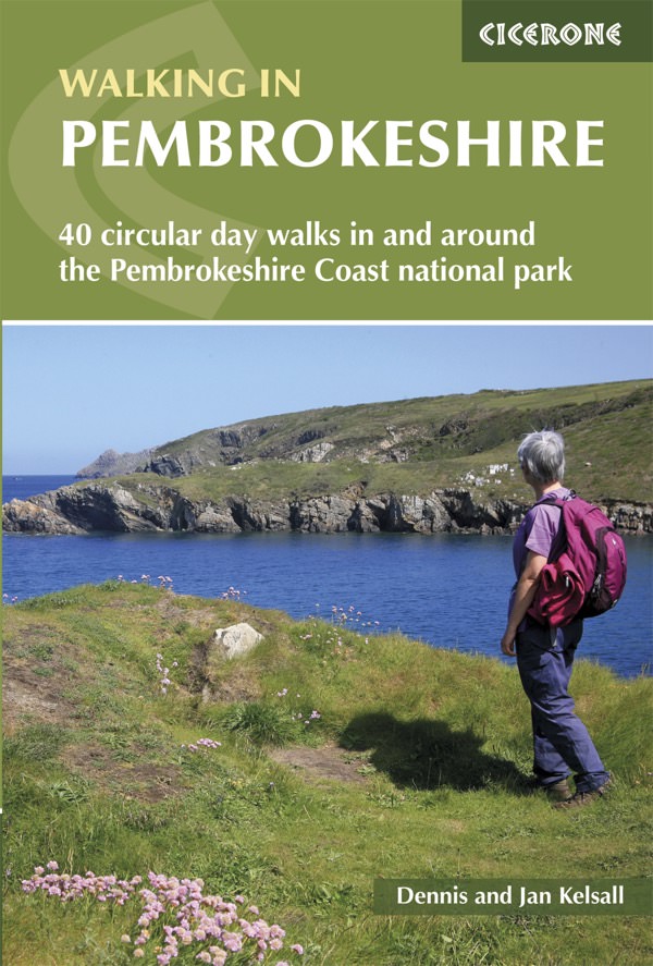
- Walking in Pembrokeshire
- 40 circular walks in and around the Pembrokeshire Coast National Park Read more
- Also available from:
- De Zwerver, Netherlands
- Stanfords, United Kingdom
De Zwerver
Netherlands
2018
Netherlands
2018
- Wandelgids Walking in Pembrokeshire | Cicerone
- Guidebook to 40 circular walks in Pembrokeshire in Wales. Routes take in the dramatic beauty of the national park and its coast, the Daugleddau and the Preseli Hills, while exploring wooded gorges, prehistoric hillforts and medieval castles. Walks range from 1 to 12 miles and route descriptions are accompanied by 1:50,000 OS map extracts. Read more

Stanfords
United Kingdom
2018
United Kingdom
2018
- Pembrokeshire Walking (40 walks)
- Guidebook to 40 circular walks in Pembrokeshire in Wales. The routes, which range from 1 to 12 miles, take in the dramatic beauty of the national park and its coast, the Daugleddau and the Preseli Hills, while exploring wooded gorges, prehistoric hillforts and medieval castles.Step-by-step route descriptions are accompanied by 1:50,000 mapping.... Read more

The Book Depository
United Kingdom
United Kingdom
- Coastal Pub Walks: North Wales
- Walks to amazing coastal pubs on the Wales Coast Path Read more
- Also available from:
- Stanfords, United Kingdom

Stanfords
United Kingdom
United Kingdom
- Coastal Pub Walks: North Wales: Walks to amazing coastal pubs on the Wales Coast Path
- These attractive and cleverly structured guides will give walkers ten of the best short circular walks along the 870-mile long Wales Coast Path.With clear information, an overview and introduction for each walk, expertly written numbered directions, large scale Ordnance Survey maps, and interpretation of points of interest along the way, these... Read more

The Book Depository
United Kingdom
United Kingdom
- Wales Coast Path 3
- Cardigan to Llanelli including Pembrokeshire Coast Path Read more

The Book Depository
United Kingdom
2019
United Kingdom
2019
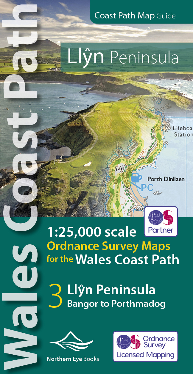
- Llyn Peninsula Coast Path Map
- 1:25,000 scale Ordnance Survey mapping for the Llyn Peninsula section of the Wales Coast Path Read more
- Also available from:
- De Zwerver, Netherlands
De Zwerver
Netherlands
2019
Netherlands
2019
- Wandelkaart Wales Coast Path Llyn Peninsula Map | Northern Eye Books
- 1:25,000 scale Ordnance Survey mapping for the Llyn Peninsula section of the Wales Coast Path Read more

The Book Depository
United Kingdom
2008
United Kingdom
2008
- The Mountains of England and Wales: Vol 2 England
- A walking guide to climbing the 253 'Nuttall' mountain summits in England, in a series of 58 walks. These form part of the total of 443 mountain summits in England and Wales which reach the height of 2000ft or more. Routes and summits in the Lake District, Cheviots, North Pennines, Yorkshire Dales, Peak District and Dartmoor. Read more
- Also available from:
- Stanfords, United Kingdom

Stanfords
United Kingdom
2008
United Kingdom
2008
- The Mountains of England and Wales: Vol. 2 - England
- John and Anne Nuttall’s Mountains of England and Wales - Volume 2: England is a comprehensive guide to the highest summits in England. Featuring the 253 mountains in England which reach the height of 2000ft, it is a companion to their similar work on Wales. Illustrated by the authors’ sketches and maps, the walker is taken to the largest... Read more

- Also available from:
- De Zwerver, Netherlands
- Stanfords, United Kingdom
De Zwerver
Netherlands
2015
Netherlands
2015

Stanfords
United Kingdom
2015
United Kingdom
2015
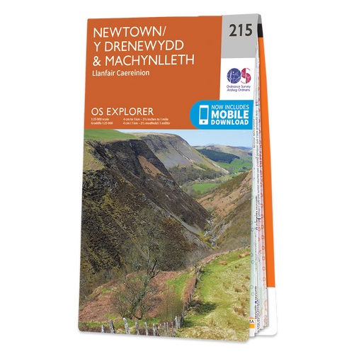
- Newtown & Machynlleth - Llanfair Caereinion OS Explorer Map 215 (paper)
- Newtown, Machynlleth and Llanfair Caereinion area on a detailed topographic and GPS compatible map No. 215, paper version, from the Ordnance Survey’s 1:25,000 Explorer series.MOBILE DOWNLOADS: this title and all the other OS Explorer maps include a code for downloading after purchase the digital version onto your smartphone or tablet for... Read more


The Book Depository
United Kingdom
United Kingdom
- Best Walks in Southern Wales
- A companion to Best Walks in North Wales, this book explores the best walking opportunities to be found in the area south of Snowdonia. It suggests 36 walks, mostly circular, each with a route description and sketch map, along with suggestions on transport and accommodation. Read more

- Also available from:
- De Zwerver, Netherlands
- Stanfords, United Kingdom

De Zwerver
Netherlands
2015
Netherlands
2015

Stanfords
United Kingdom
2015
United Kingdom
2015
- Llangollen & Berwyn - Ceiriog Valley OS Explorer Map 255 (paper)
- Llangollen, Berwyn and Ceiriog Valley area on a detailed topographic and GPS compatible map No. 255, paper version, from the Ordnance Survey’s 1:25,000 Explorer series.MOBILE DOWNLOADS: this title and all the other OS Explorer maps include a code for downloading after purchase the digital version onto your smartphone or tablet for viewing on... Read more

The Book Depository
United Kingdom
United Kingdom
Karten

The Book Depository
United Kingdom
United Kingdom
- Eastbourne and Beachy Head
- Eastbourne and Beachy Head at 1:25,000 in a series of Walker Read more
- Also available from:
- Stanfords, United Kingdom

Stanfords
United Kingdom
United Kingdom
- Eastbourne & Beachy Head AA Walker`s Map 30
- Eastbourne and Beachy Head at 1:25,000 in a series of Walker’s Maps published by the AA with the cartography from the Ordnance Survey’s Explorer series. Coverage includes Seven Sisters and the Cuckmere Haven, the start of the South Downs Way, Seaford, Newhaven, Alfriston, Firle, Glynde, Ringmer, Uckfield, Buxted, Heathfield, Herstmonceux,... Read more

The Book Depository
United Kingdom
United Kingdom
- Snowdon and The Conwy Valley
- Snowdon and the Conwy Valley at 1:25,000 in a series of Walker Read more
- Also available from:
- Stanfords, United Kingdom

Stanfords
United Kingdom
United Kingdom
- Snowdon & The Conway Valley AA Walker`s Map 4
- Snowdon and the Conwy Valley at 1:25,000 in a series of Walker’s Maps published by the AA with the cartography from the Ordnance Survey’s Explorer series. The map is double-sided and coverage includes parts of the New Forest National Park, Bangor, Caernarfon, Llanberis, Llanwnda, Rhyd-Ddu, Batws-y-Coed, Capel Curig, Tal-y-Bont, Llanfairfechan,... Read more

- Also available from:
- Stanfords, United Kingdom

Stanfords
United Kingdom
United Kingdom
- Exmoor AA Walker`s Map 13
- Exmoor at 1:25,000 in a series of Walker’s Maps published by the AA with the cartography from the Ordnance Survey’s Explorer series. The map is double-sided and coverage includes the Exmoor National Park, Ilfracombe, Combe Martin, Lynton, Porlock, Minehead, Williton, Exford, Dulverton, Brayford, Barnstaple, etc.Maps in the AA Walker’s series... Read more

The Book Depository
United Kingdom
United Kingdom
- Gloucester and Cheltenham
- Gloucester and Cheltenham area at 1:25,000 in a series of Walker Read more

The Book Depository
United Kingdom
United Kingdom
- Walkers Map Brecon and The Black Mountains
- Brecon and The Black Mountains at 1:25,000 in a series of Walker Read more

- Also available from:
- De Zwerver, Netherlands


The Book Depository
United Kingdom
United Kingdom
- North York Moors (Eastern)
- The eastern part of the North Yorkshire Moors at 1:25,000 in a series of Walker Read more
- Also available from:
- Stanfords, United Kingdom

Stanfords
United Kingdom
United Kingdom
- North York Moors East 25K AA/OS Walker`s Map No. 12
- The eastern part of the North Yorkshire Moors at 1:25,000 in a series of Walker’s Maps published by the AA with the cartography from the Ordnance Survey’s Explorer series. The map is double-sided and coverage includes the North Yorks Moors National Park, Scarborough, Robin Hood’s Bay, Whitby, Lythe, Staithes, Loftus, Goathland,... Read more

The Book Depository
United Kingdom
United Kingdom
- West and Central Brecon Beacons
- West and Central Brecon Beacons at 1:25,000 in a series of Walker Read more
- Also available from:
- Stanfords, United Kingdom

Stanfords
United Kingdom
United Kingdom
- West & Central Brecon Beacons AA Walker`s Map 18
- West and Central Brecon Beacons at 1:25,000 in a series of Walker’s Maps published by the AA with the cartography from the Ordnance Survey’s Explorer series. The map is double-sided and coverage includes Brecon beacons National Park, Merthyr Tydfil, Brecon, Trecastle, Llandovery, Llanwrda, Llandeilo, etc.Maps in the AA Walker’s series are... Read more

The Book Depository
United Kingdom
2022
United Kingdom
2022
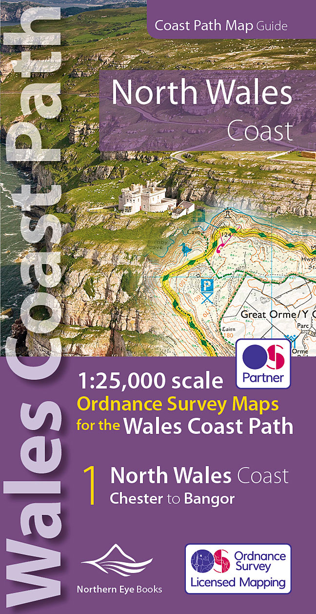
- North Wales Coast Path Map
- 1:25,000 scale Ordnance Survey mapping for the Wales Coast Path Read more
- Also available from:
- De Zwerver, Netherlands
- Stanfords, United Kingdom
De Zwerver
Netherlands
2022
Netherlands
2022
- Wandelkaart North Wales Coast Path Map | Northern Eye Books
- One of seven handy, lightweight, pocket sized map bookscovering the whole of the 870 mile/1400 kilometre Wales Coast Path. This volume covers North Wales from Chester to Bangor and includes enhanced large scale (1:25,000) Ordnance Survey mapping in a handy atlas format, with extracts from large scale Explorer maps 266, 265, 264 and OL17.The... Read more

Stanfords
United Kingdom
2022
United Kingdom
2022
- North Wales Coast - Chester to Bangor - Wales Coast Path Map-Booklet
- One of seven handy, lightweight, pocket sized map bookscovering the whole of the 870 mile/1400 kilometre Wales Coast Path. This volume covers North Wales from Chester to Bangor and includes enhanced large scale (1:25,000) Ordnance Survey mapping in a handy atlas format, with extracts from large scale Explorer maps 266, 265, 264 and OL17.The... Read more
De Zwerver
Netherlands
Netherlands
De Zwerver
Netherlands
Netherlands
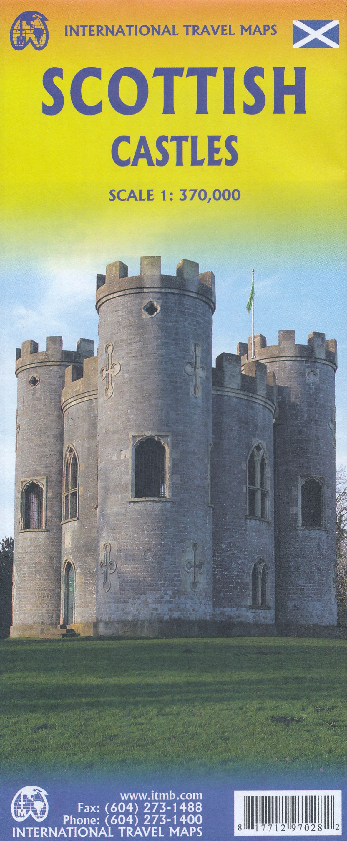
- Wegenkaart - landkaart Scottisch Castles & Whisky Distilleries | ITMB
- Wales & Southwest England Travel Reference Map 1 : 370 000 ab 10.49 EURO International Travel Map ITM. 1st Edition Read more
Weitere …