
Great Eastern Trail
Beschreibung
- Name Great Eastern Trail (GET)
- Länge von Wanderweg 2,575 km, 1,600 Meilen
- Länge in Tagen 170 Tage
- Traildino Schwierigkeit SW, Anspruchsvolle Wanderung, Bergwanderung
- Schwierigkeitsgrad Berg- und Alpinwanderung T2, Bergwandern
 GET, 1600 miles (2575 km)
Hiking trail from Alabama to New York, in the eastern States, along the Appalachian Mountains. The proposed length is 1600 miles (2575 km) or even 2000 miles. The GET should get the pressure off the AT. Currently, many local organisations are working together to get a deffinite route proposal. Under construction.
Karte


Links
Fakten
Berichte
Führer und Karten
Übernachtung
Organisationen
Reisebüros
GPS
Sonstiges
Bücher

The Book Depository
United Kingdom
2020
United Kingdom
2020
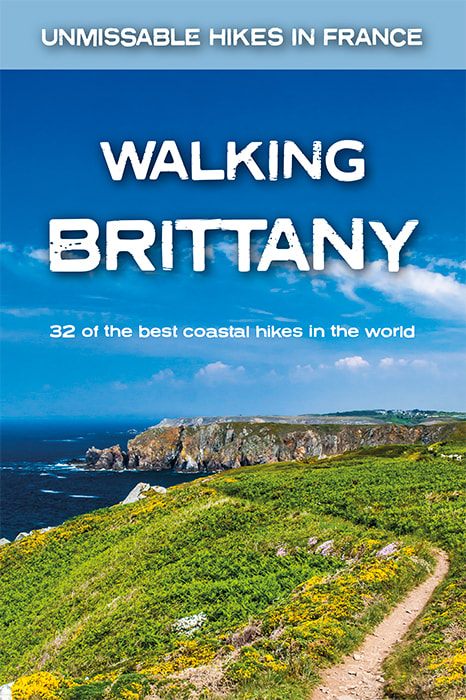
- Walking Brittany
- 32 of the best coastal hikes in the world Read more
- Also available from:
- De Zwerver, Netherlands
- Stanfords, United Kingdom
De Zwerver
Netherlands
2020
Netherlands
2020
- Wandelgids Walking Brittany - Bretagne | Knife Edge Outdoor
- Real IGN Maps included (1:25,000): no need to carry separate maps.32 epic walks along the wild and beautiful coast of Brittany in northern France.Some of the finest coastal terrain in the world: endless cliffs towering above the sea; remote rocky headlands and peninsulas; stunning beaches which would not be out of place on a Caribbean islandNo... Read more

Stanfords
United Kingdom
2020
United Kingdom
2020
- Walking Brittany: 32 of the best coastal hikes in the world
- Real IGN Maps included (1:25,000): no need to carry separate maps.32 epic walks along the wild and beautiful coast of Brittany in northern France.Some of the finest coastal terrain in the world: endless cliffs towering above the sea; remote rocky headlands and peninsulas; stunning beaches which would not be out of place on a Caribbean islandNo... Read more

The Book Depository
United Kingdom
2021
United Kingdom
2021
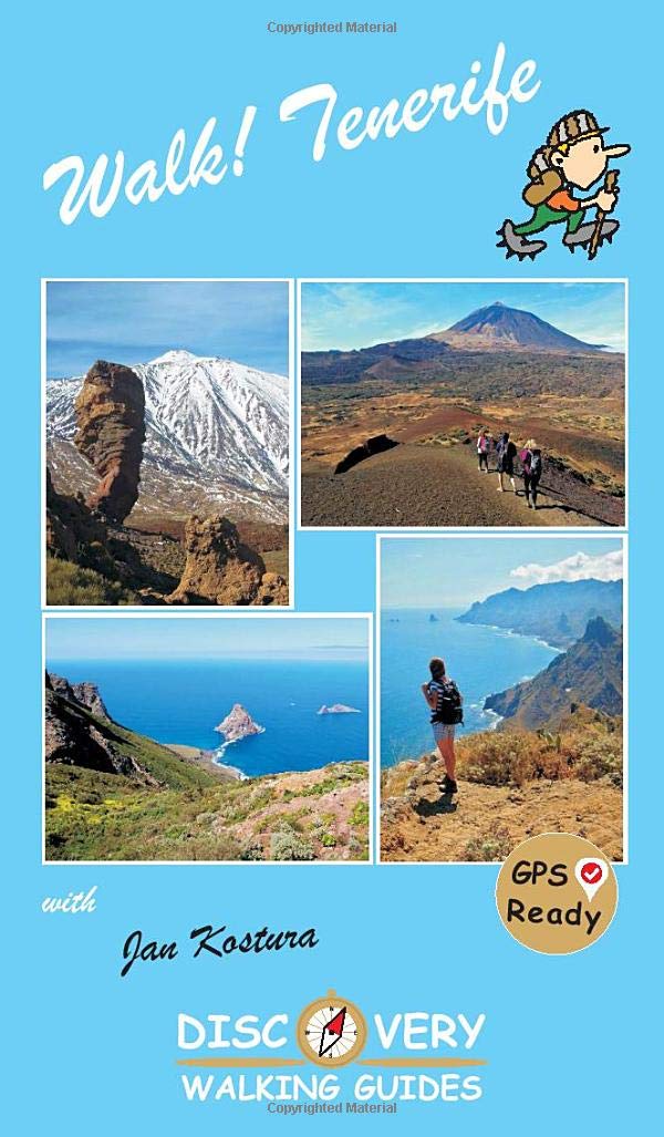
- Walk Tenerife
- TENERIFE - A WALKER`S ISLAND Tenerife is a big island - 2034 square kilometres big. It offers walkers a wide variety of exciting landscapes to choose from; everything from coastal strolls, high altitude summits, pine forests and laurel forests, challenging and strenuous routes to easy country walks. Walk! Tenerife is a comprehensive walking... Read more
- Also available from:
- De Zwerver, Netherlands
De Zwerver
Netherlands
2021
Netherlands
2021
- Wandelgids Walk! Tenerife | Discovery Walking Guides
- TENERIFE - A WALKER`S ISLAND Tenerife is a big island - 2034 square kilometres big. It offers walkers a wide variety of exciting landscapes to choose from; everything from coastal strolls, high altitude summits, pine forests and laurel forests, challenging and strenuous routes to easy country walks. Walk! Tenerife is a comprehensive walking... Read more


- Also available from:
- De Zwerver, Netherlands
- Stanfords, United Kingdom
De Zwerver
Netherlands
2017
Netherlands
2017
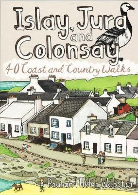
- Wandelgids Islay, Jura and Colonsay | Pocket Mountains
- 40 Coast and Country Walks Read more

Stanfords
United Kingdom
2017
United Kingdom
2017
- Islay, Jura and Colonsay: 40 Coast and Country Walks
- Islay, Jura and Colonsay make up the southerly Hebridean island group and are famed for their outstanding wildlife, glorious sandy beaches, fascinating historical treasures, rugged hills and dramatic coastlines, and on Jura, but especially on Islay - legendary distilleries which produce distinctively peaty whisky. This book aims to help you get... Read more

The Book Depository
United Kingdom
United Kingdom
- Suffolk Year Round Walks
- Suffolk, with its glorious coastline, charming villages and medieval towns, is a walker`s delight. The twenty circular walks in this book vary in length from 3 to 6 miles and are enjoyable all year round. The author has divided the routes into seasons to show each at its very best. In spring, the fen meadows and ancient woodland near Agner Fen... Read more
- Also available from:
- Stanfords, United Kingdom

Stanfords
United Kingdom
United Kingdom
- Suffolk Year Round Walks
- Suffolk, with its glorious coastline, charming villages and medieval towns, is a walker`s delight. The twenty circular walks in this book vary in length from 3 to 6 miles and are enjoyable all year round. The author has divided the routes into seasons to show each at its very best. In spring, the fen meadows and ancient woodland near Agner Fen... Read more

The Book Depository
United Kingdom
United Kingdom
- Walking The Invisible
- See through the eyes of the Brontes as you immerse yourself in their lives and landscapes, wandering the very same paths they each would have walked in search of the inspiration behind their novels and poetry. An `imaginative and elegant trek through the landscape of the Brontes` Grazia In his journey to get closer... Read more
- Also available from:
- Stanfords, United Kingdom

Stanfords
United Kingdom
United Kingdom
- Walking The Invisible
- See through the eyes of the Brontes as you immerse yourself in their lives and landscapes, wandering the very same paths they each would have walked in search of the inspiration behind their novels and poetry. An `imaginative and elegant trek through the landscape of the Brontes` Grazia In his journey to get closer... Read more

- Also available from:
- De Zwerver, Netherlands
- Stanfords, United Kingdom
De Zwerver
Netherlands
2019
Netherlands
2019
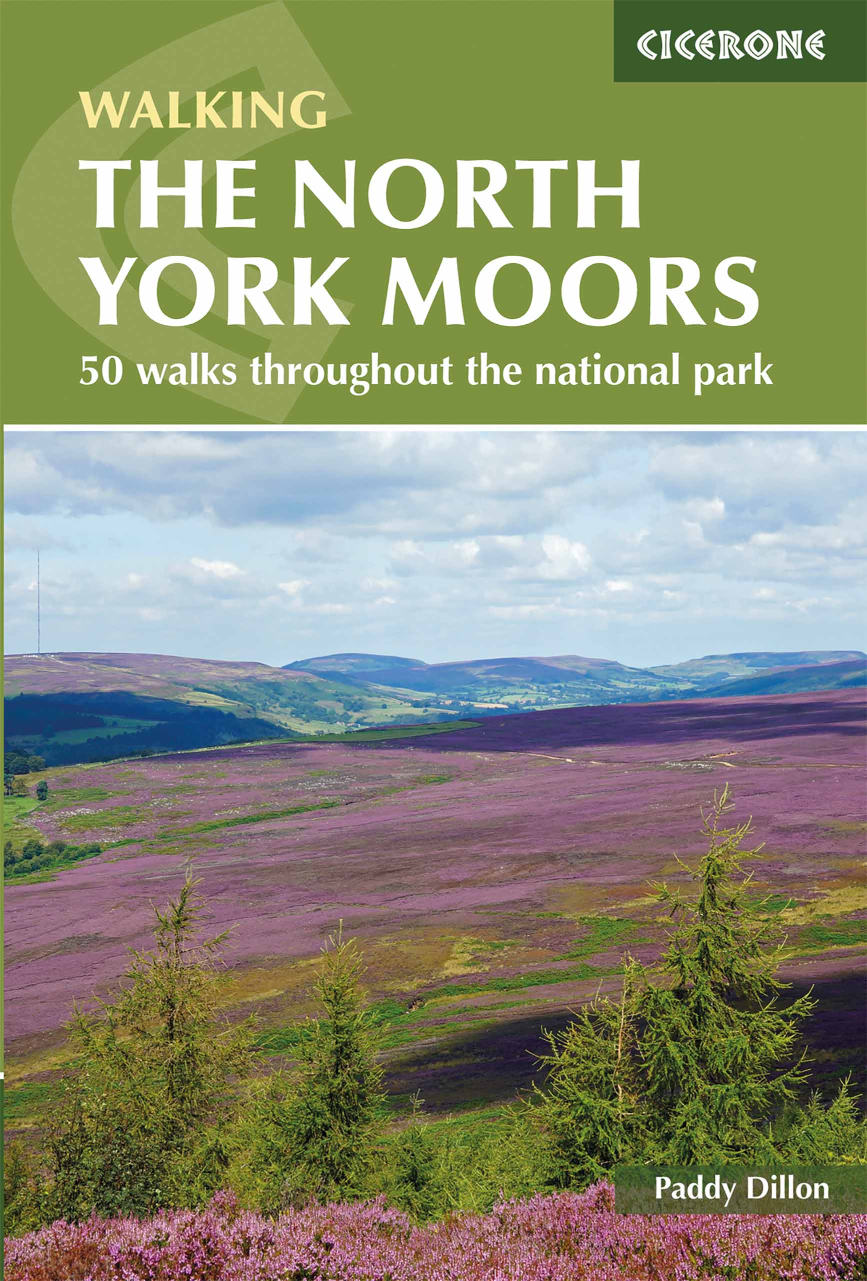
- Wandelgids The North York Moors | Cicerone
- Guidebook describing 50 varied walks in England's beautiful North York Moors National Park. Showcasing the region's sweeping moorlands, sheltered valleys, woodlands and cliff coasts, routes range from short and easy low-level walks to long and strenuous routes across the high moors, including the Lyke Wake Walk. Read more

Stanfords
United Kingdom
2019
United Kingdom
2019
- The North York Moors: 50 walks in the National Park
- Guidebook to 50 walks in the North York Moors National Park. The walks, which range from 4 to 13 miles, are distributed through seven regions within the park, enabling walkers to discover and appreciate the Tabular Hills, Hambleton Hills, Cleveland Hills, Northern Moors, High Moors, Eastern Moors and Cleveland Coast. For those who like a... Read more

- Also available from:
- De Zwerver, Netherlands
- Stanfords, United Kingdom

Stanfords
United Kingdom
2021
United Kingdom
2021
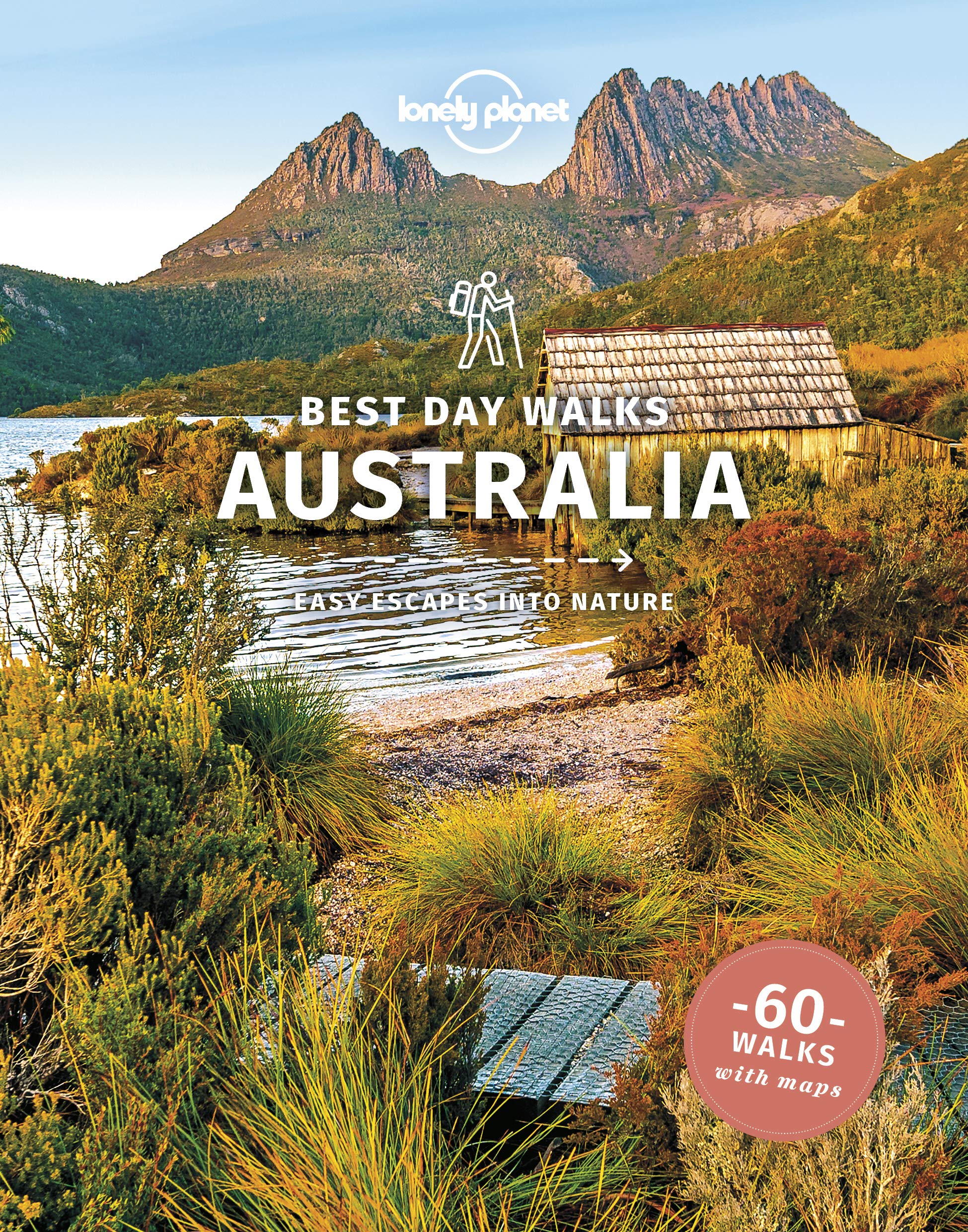
- Lonely Planet Best Day Walks Australia
- Lonely Planet`s Best Day Walks Australia is your passport to 60 escapes into nature. Stretch your legs outside the city by picking a hike that works for you, from a few hours to a full day, from easy to hard. Stroll verdant hillsides, discover hidden coastlines, or explore the Outback. Get to the heart of Australia and begin your journey... Read more

- Also available from:
- De Zwerver, Netherlands
- Stanfords, United Kingdom

Stanfords
United Kingdom
2017
United Kingdom
2017
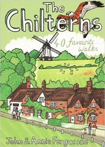
- The Chilterns: 40 Favourite Walks
- With some of the most picturesque countryside in England, yet only a short hop from London, the Chiltern Hills are just waiting to be explored. The glorious views from high ridges, ancient woodlands brimming with wildlife and downs alive with wild flowers and butterflies make the Chilterns and the communities within them English to the core.... Read more

- Also available from:
- Stanfords, United Kingdom

Stanfords
United Kingdom
United Kingdom
- Beyond Bristol: 24 Country Walks
- Bristolians are blessed with beautiful countryside on their doorstep. Deep-cut coombes, hidden valleys, woodlands, uplands and stately landscapes are within easy reach of the weary and the restless. A little further, and you`re on the ups and downs of the Mendip Hills, the deceptively tough topography of the Cotswolds and the glowering skies of... Read more

The Book Depository
United Kingdom
2020
United Kingdom
2020
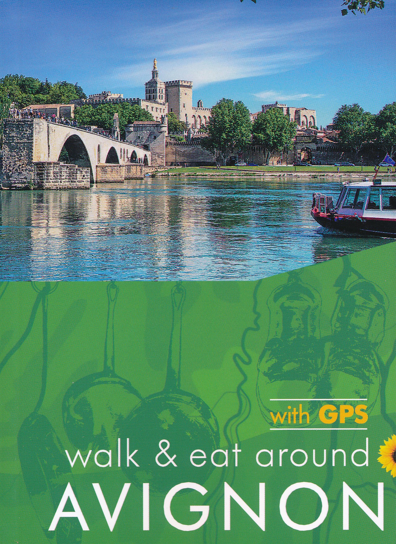
- Avignon Walk and Eat Sunflower Guide
- Walks, restaurants and recipes Read more
- Also available from:
- De Zwerver, Netherlands
- Stanfords, United Kingdom
De Zwerver
Netherlands
2020
Netherlands
2020
- Wandelgids Walk & Eat Avignon | Sunflower books
- Travel by TGV to Avignon (`city of the Popes`), then get around by local transport. This guide describes walks and restaurants in the surrounding area, from the Roman cities and sites of Nimes, Arles, Pont du Gard and St-Remy to the `must-see` villages of Gordes, Les Baux and Barbentane and the gorgeous countryside of the Alpilles mountain chain. Read more

Stanfords
United Kingdom
2020
United Kingdom
2020
- Avignon - Walk & Eat
- This pocket-sized full-colour guide is designed for short-break holidays to Provence using fast train services (or flights). It describes easy city and countryside walks, and recommends restaurants en route (with sample menus).From the Roman cities and sites of Nimes, Arles, Pont du Gard and St-Remy to the `must-see` villages of Gordes, Les... Read more

The Book Depository
United Kingdom
United Kingdom
- Adventurous Soul: Volume 8
- Empowering Words of Wisdom & Stories from Women Who Get Outside Read more

- Also available from:
- Stanfords, United Kingdom

Stanfords
United Kingdom
United Kingdom
- Guide to North Yorkshire Pub Walks
- Discover the beautiful countryside around North Yorkshire with this guide to some of the best walks in the county. The 20 circular routes vary in length from 3 to 8 miles and are each centred on a broad variety of welcoming pubs recommended for their good food. Explore the meadows and woodland around Forge Valley and Grosmont, the waterfalls at... Read more

The Book Depository
United Kingdom
2019
United Kingdom
2019
- Madeira Guide
- 100 long and short walks with detailed maps and GPS; 6 car tours with pull-out map Read more
- Also available from:
- Stanfords, United Kingdom

Stanfords
United Kingdom
2019
United Kingdom
2019
- Madeira Sunflower Landscape Guide
- Pocket-sized full-colour guides describing car tours, walks and countryside picnics - all illustrated with photographs and large-scale maps. Dubbed the ‘blue Bibles‘ by the Sunday Times, the series aims to get visitors away from the crowded tourist centres and out into the countryside, by car or on foot.• Sunflower`s best-selling guide, the... Read more

The Book Depository
United Kingdom
2017
United Kingdom
2017
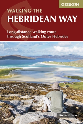
- The Hebridean Way
- Long-distance walking route through Scotland's Outer Hebrides Read more
- Also available from:
- De Zwerver, Netherlands
De Zwerver
Netherlands
2017
Netherlands
2017
- Wandelgids The Hebridean Way | Cicerone
- Guidebook to walking the Hebridean Way, a 154 mile (247km) walking route along the length of the Outer Hebrides. From the island of Vatersay to Stornoway on Lewis, the waymarked route can be walked in 8-13 days and crosses a variety of terrain including shell beaches, rugged hills and wild moor. Also includes an extension to the Butt of Lewis. Read more
Karten

The Book Depository
United Kingdom
2018
United Kingdom
2018
- Ben Nevis and Glen Coe
- Waterproof mountain map of Ben Nevis & Glen Coe from Harvey at 1:40,000, with a geological map of the region on the reverse, an enlargement of Ben Nevis' summit, and advice on navigating the region safely.MAIN MAP: Topography is shown through clear altitude shading, spot heights, contours at 15m intervals, and index contours at 75m intervals. A... Read more
- Also available from:
- De Zwerver, Netherlands
- Stanfords, United Kingdom

De Zwerver
Netherlands
2018
Netherlands
2018
- Wandelkaart Ben Nevis & Glen Coe | Harvey Maps
- Waterproof mountain map of Ben Nevis & Glen Coe from Harvey at 1:40,000, with a geological map of the region on the reverse, an enlargement of Ben Nevis' summit, and advice on navigating the region safely.MAIN MAP: Topography is shown through clear altitude shading, spot heights, contours at 15m intervals, and index contours at 75m intervals. A... Read more

Stanfords
United Kingdom
2018
United Kingdom
2018
- Ben Nevis & Glen Coe Harvey British Mountain Map XT40
- Waterproof mountain map of Ben Nevis & Glen Coe from Harvey at 1:40,000, with a geological map of the region on the reverse, an enlargement of Ben Nevis` summit, and advice on navigating the region safely.*MAIN MAP:* Topography is shown through clear altitude shading, spot heights, contours at 15m intervals, and index contours at 75m intervals.... Read more

- Also available from:
- De Zwerver, Netherlands


De Zwerver
Netherlands
2019
Netherlands
2019
- Reisgids Iceland Road Guide | Vegahandbokin
- Iceland Road Guide from Vegahandbókin, an exceptionally comprehensive, 605-page guide with region-by-region descriptions of sites accompanied by road maps and street plans, plus a separate road atlas section covering the whole country at 1:500,000 and information on a wide variety of tourism relating topics to help the user get the best of... Read more
Stanfords
United Kingdom
United Kingdom
- Nepal Survey 1:25,000 Sheet 2883 11D (Patichaur)
- Koban, sheet no. 2883-07, in the topographic survey of Nepal at 1:50,000 published by the Nepali Government in the late 1990s and early 2000s and produced from remote sensing data by Finnish cartographers as part of that country’s international aid program. The maps cover 15’ x 15’ quadrangles.IMPORTANT – PLEASE NOTE BEFORE ORDERING:... Read more

Stanfords
United Kingdom
United Kingdom
- Dhunche (2885 14)
- Upper Langtang Valley, sheet no. 2885-15, in the topographic survey of Nepal at 1:50,000 published by the Nepali Government in the late 1990s and early 2000s and produced from remote sensing data by Finnish cartographers as part of that country’s international aid program. The maps cover 15’ x 15’ quadrangles.IMPORTANT – PLEASE NOTE BEFORE... Read more

Stanfords
United Kingdom
United Kingdom
- Barcelona High 5 Edition Street Plan
- The first water-resistant “Comfort Map“ with direct access to useful additional information from the InternetBarcelona in a scale of 1:20,000 including detailed presentation of the old town in a scale of 1:11,000 presented on a practical map; inclusive of the High 5 Edition app technology for calling up additional travel information and many... Read more

Stanfords
United Kingdom
United Kingdom
- Berlin High 5 Edition Street Plan
- The first water-resistant “Comfort Map“ with direct access to useful additional information from the InternetBerlin in a scale of 1:20,000 presented on a practical map; inclusive of the High 5 Edition app technology for calling up additional travel information and many other benefits:- just the right size - 9.6 x 16.1 cm - to fit comfortably... Read more

Stanfords
United Kingdom
United Kingdom
- Cycling the Canal de la Garonne: From Bordeaux to Toulouse
- This guidebook presents a cycle ride along the Canal de la Garonne in the south of France. The 290km route is covered in 7 stages from bustling Bordeaux to the splendid rose city of Toulouse, with a 135km excursion from to Lacanau on the Atlantic coast. Optional side trips explore the countryside and historical towns and villages, including... Read more
Stanfords
United Kingdom
United Kingdom
- Damodar Himal
- Damodar Himal, sheet no. 2884-01, in the topographic survey of Nepal at 1:50,000 published by the Nepali Government in the late 1990s and early 2000s and produced from remote sensing data by Finnish cartographers as part of that country’s international aid program. The maps cover 15’ x 15’ quadrangles.IMPORTANT – PLEASE NOTE BEFORE ORDERING:... Read more

Stanfords
United Kingdom
United Kingdom
- New York City High 5 Edition Street Plan
- The first water-resistant “Comfort Map“ with direct access to useful additional information from the InternetThe world-famous Manhattan district in a scale of 1:16,000 and an overview of New York City in a scale of 1:75,000 presented on a practical map; inclusive of the High 5 Edition app technology for calling up additional travel information... Read more
Stanfords
United Kingdom
United Kingdom
- Muktinath
- Koban, sheet no. 2883-07, in the topographic survey of Nepal at 1:50,000 published by the Nepali Government in the late 1990s and early 2000s and produced from remote sensing data by Finnish cartographers as part of that country’s international aid program. The maps cover 15’ x 15’ quadrangles.IMPORTANT – PLEASE NOTE BEFORE ORDERING:... Read more
Stanfords
United Kingdom
United Kingdom
- Nepal Survey 1:25,000 Sheet 2883 11B (Tatopani)
- Koban, sheet no. 2883-07, in the topographic survey of Nepal at 1:50,000 published by the Nepali Government in the late 1990s and early 2000s and produced from remote sensing data by Finnish cartographers as part of that country’s international aid program. The maps cover 15’ x 15’ quadrangles.IMPORTANT – PLEASE NOTE BEFORE ORDERING:... Read more

The Book Depository
United Kingdom
United Kingdom
- Bryce Canyon National Park
- Trails Illustrated National Parks Read more
- Also available from:
- De Zwerver, Netherlands
- Stanfords, United Kingdom
- Bol.com, Netherlands
- Bol.com, Belgium

De Zwerver
Netherlands
Netherlands
- Wandelkaart - Topografische kaart 219 Bryce Canyon National Park | National Geographic
- Prachtige geplastificeerde kaart van het bekende nationaal park. Met alle recreatieve voorzieningen als campsites, maar ook met topografische details en wandelroutes ed. Door uitgekiend kleurgebruik zeer prettig in gebruik. Scheur en watervast! This informative Trails Illustrated map will help you plan trips and explore the area in and around... Read more

Stanfords
United Kingdom
United Kingdom
- Bryce Canyon National Park UT NGS Trails Illustrated Map 219
- Map No. 219, Bryce Canyon National Park, UT, in an extensive series of GPS compatible, contoured hiking maps of USA’s national and state parks or forests and other popular recreational areas. Cartography based on the national topographic survey, with additional tourist information.The maps, with most titles now printed on light, waterproof and... Read more

Bol.com
Netherlands
Netherlands
- Bryce Canyon National Park
- Waterproof Tear-Resistant Topographic MapNational Geographic's Trails Illustrated map of Bryce Canyon National Park is designed to meet the needs of outdoor enthusiasts by combining valuable information with unmatched detail of this unique landscape of hoodoos and forest. Created in partnership with local land management agencies, this... Read more
Bol.com
Belgium
Belgium
- Bryce Canyon National Park
- Waterproof Tear-Resistant Topographic MapNational Geographic's Trails Illustrated map of Bryce Canyon National Park is designed to meet the needs of outdoor enthusiasts by combining valuable information with unmatched detail of this unique landscape of hoodoos and forest. Created in partnership with local land management agencies, this... Read more

Ordnance Survey
United Kingdom
United Kingdom
- Ordnance Survey OS Wireless Cadence & Speed Sensor
- Get essential information on your training that can improve your fitness and refine your training goals with the OS Wireless Cadence and Speed Sensor. Whether you want to smooth your pedal stroke, develop muscular endurance or get a cardio workout, monitoring your cadence can help you focus and track your training so you can get the most out of... Read more

Stanfords
United Kingdom
United Kingdom
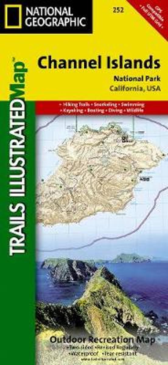
- Channel Islands National Park CA NGS Trails Illustrated Map 252
- Map No. 252, Channel Islands National Parkin California, at 1:25,000/1:50,000 in an extensive series of GPS compatible, contoured hiking maps of USA’s national and state parks or forests and other popular recreational areas. Cartography based on the national topographic survey, with additional tourist information.The maps, with most titles now... Read more
- Also available from:
- Bol.com, Netherlands
- Bol.com, Belgium
Bol.com
Netherlands
Netherlands
- Channel Islands National Park
- Waterproof Tear-Resistant Topographic MapThis two-sided map includes San Miguel Island, Santa Rosa Island, Santa Cruz Island, Santa Barbara Island, and Anacapa Island. The map combines beautiful cartography that shows the topology and natural features of each island, along with hiking trails, camping spots, rest areas, notable ship... Read more
Bol.com
Belgium
Belgium
- Channel Islands National Park
- Waterproof Tear-Resistant Topographic MapThis two-sided map includes San Miguel Island, Santa Rosa Island, Santa Cruz Island, Santa Barbara Island, and Anacapa Island. The map combines beautiful cartography that shows the topology and natural features of each island, along with hiking trails, camping spots, rest areas, notable ship... Read more