
Great Eastern Trail
Beschreibung
- Name Great Eastern Trail (GET)
- Länge von Wanderweg 2,575 km, 1,600 Meilen
- Länge in Tagen 170 Tage
- Traildino Schwierigkeit SW, Anspruchsvolle Wanderung, Bergwanderung
- Schwierigkeitsgrad Berg- und Alpinwanderung T2, Bergwandern
 GET, 1600 miles (2575 km)
Hiking trail from Alabama to New York, in the eastern States, along the Appalachian Mountains. The proposed length is 1600 miles (2575 km) or even 2000 miles. The GET should get the pressure off the AT. Currently, many local organisations are working together to get a deffinite route proposal. Under construction.
Karte


Links
Fakten
Berichte
Führer und Karten
Übernachtung
Organisationen
Reisebüros
GPS
Sonstiges
Bücher

The Book Depository
United Kingdom
United Kingdom
- How To Get Started With Potty Training
- Great Advice For Successful Potty Training: Parenting Infants Read more

- Also available from:
- Stanfords, United Kingdom

Stanfords
United Kingdom
2021
United Kingdom
2021
- North Cotswold Classic Walks
- Explore the north Cotswolds with this laminated, waterproof Cotswolds walking map. With 10 circular, clearly-marked routes this easy-to-use map will help you discover the Cotswolds via some of the finest pubs and tearooms. Step into the Cotswolds with these exceptionally beautiful walks. Discover idyllic honey-coloured stone villages,... Read more

- Also available from:
- Stanfords, United Kingdom

Stanfords
United Kingdom
United Kingdom
- The Manhattan Nobody Knows: An Urban Walking Guide
- A unique walking guide to Manhattan, from the author of `The New York Nobody Knows`Bill Helmreich walked every block of New York City--six-thousand miles in all--to write the award-winning `The New York Nobody Knows`. Now he has re-walked most of Manhattan--721 miles--to write this new, one-of-a-kind walking guide to the heart of one of the... Read more

- Also available from:
- De Zwerver, Netherlands
- Stanfords, United Kingdom


Stanfords
United Kingdom
2021
United Kingdom
2021
- Lonely Planet Best Day Walks Italy
- Lonely Planet`s Best Day Walks Italy is your passport to 60 easy escapes into nature. Stretch your legs outside the city by picking a hike that works for you, from just a couple of hours to a full day, from easy to hard. Hike the Dolomites, explore the Italian Lakes, and stroll Sardinia`s coast. Get to the heart of Italy and begin your journey... Read more

The Book Depository
United Kingdom
2017
United Kingdom
2017
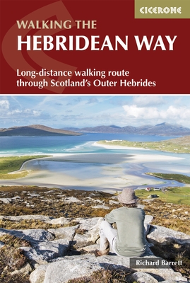
- The Hebridean Way
- Long-distance walking route through Scotland's Outer Hebrides Read more
- Also available from:
- De Zwerver, Netherlands
- Stanfords, United Kingdom
De Zwerver
Netherlands
2017
Netherlands
2017
- Wandelgids The Hebridean Way | Cicerone
- Guidebook to walking the Hebridean Way, a 154 mile (247km) walking route along the length of the Outer Hebrides. From the island of Vatersay to Stornoway on Lewis, the waymarked route can be walked in 8-13 days and crosses a variety of terrain including shell beaches, rugged hills and wild moor. Also includes an extension to the Butt of Lewis. Read more

Stanfords
United Kingdom
2017
United Kingdom
2017
- The Hebridean Way: Long-Distance Walking Route Through Scotland`s Outer Hebrides
- Officially launched in 2017, the Hebridean Way offers walkers the opportunity to experience the magic of Scotland`s Outer Hebrides in one inspirational journey. The waymarked route stretches 247km (155 miles) from Vatersay to Stornaway, linking ten major islands of the archipelago by means of causeways and two ferry crossings: Vatersay, Barra,... Read more

The Book Depository
United Kingdom
United Kingdom
- Thinking on My Feet
- The small joy of putting one foot in front of another Read more
- Also available from:
- Stanfords, United Kingdom

Stanfords
United Kingdom
United Kingdom
- Thinking on My Feet: The small joy of putting one foot in front of another
- Shortlisted for the 2019 Edward Stanford Travel Writing Award`s Travel Memoir of the Year`A beautiful and magnificent book. A paean to a simple act. I defy you to read this book and not be inspired to walk, march or hike - and as a result live a better life more connected with nature and the world around you.` - Simon Reeve`A lovely book,... Read more

The Book Depository
United Kingdom
United Kingdom
- London's Waterside Walks
- 21 Walks Along the City's Most Interesting Rivers, Canals & Docks Read more
- Also available from:
- Stanfords, United Kingdom

Stanfords
United Kingdom
United Kingdom
- London`s Waterside Walks: 21 Walks Along the City`s Most Interesting Rivers, Canals & Docks
- Many people are familiar with London`s River Thames, but the city has much more to offer when it comes to waterways, including a wealth of canals, minor rivers (most are tributaries of the Thames), lakes and reservoirs that offer tranquil and beautiful walks. Many waterways have dedicated walking and cycling paths alongside them, notably the... Read more

- Also available from:
- Stanfords, United Kingdom

Stanfords
United Kingdom
United Kingdom
- The Last Wilderness: A Journey into Silence
- Neil Ansell`s `The Last Wilderness` is a mesmerising book on nature and solitude by a writer who has spent his lifetime taking solitary ventures into the wild. For any readers of the author`s previous book, `Deep Country`, Robert Macfarlane`s `The Old Ways` or William Atkins` `The Moor`.`A gem of a book, an extraordinary tale. Ansell`s rich... Read more

- Also available from:
- De Zwerver, Netherlands
- Stanfords, United Kingdom


Stanfords
United Kingdom
2021
United Kingdom
2021
- Lonely Planet Best Day Walks Japan
- Lonely Planet`s Best Day Walks Japan is your passport to 60 easy escapes into nature. Stretch your legs away from the city by picking a walk that works for you, from just a couple of hours to a full day, from easy to hard. Climb Mt Fuji, walk the Tohoku coast, and enjoy the views in Kamikochi. Get to the heart of Japan and begin your journey... Read more

The Book Depository
United Kingdom
United Kingdom
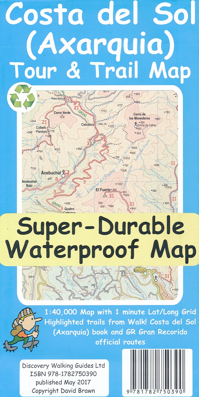
- Costa del Sol (Axarquia) Tour and Trail Map
- Costa del Sol (Axarquia) Tour & Trail Super-Durable Map comes with a 2 year adventurous use wear and tear guarantee against splitting or falling apart, see Discovery Walking Guides website for details. Our large 1:40,000 scale, combined with splitting the region into West and East sections with a generous overlap, produces double sided map... Read more
- Also available from:
- De Zwerver, Netherlands
De Zwerver
Netherlands
Netherlands
- Wandelkaart Tour & Trail Costa de Sol - Axarquia | Discovery Walking Guides
- Costa del Sol (Axarquia) Tour & Trail Super-Durable Map comes with a 2 year adventurous use wear and tear guarantee against splitting or falling apart, see Discovery Walking Guides website for details. Our large 1:40,000 scale, combined with splitting the region into West and East sections with a generous overlap, produces double sided map... Read more

The Book Depository
United Kingdom
2019
United Kingdom
2019
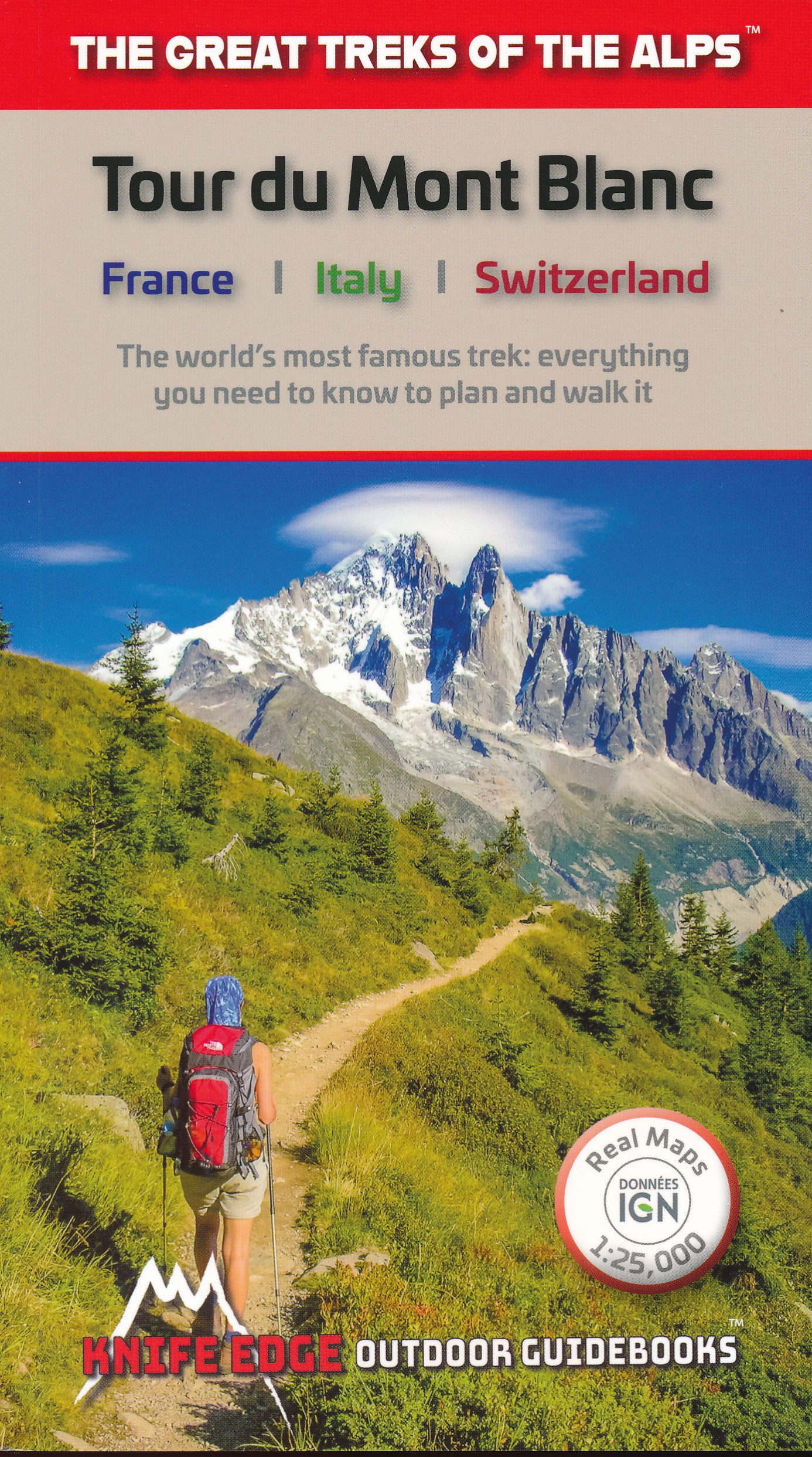
- Tour du Mont Blanc
- The World's most famous trek - everything you need to know to plan and walk it Read more
- Also available from:
- De Zwerver, Netherlands
- Stanfords, United Kingdom
De Zwerver
Netherlands
2019
Netherlands
2019
- Wandelgids Tour Du Mont Blanc | Knife Edge Outdoor
- The World's most famous trek - everything you need to know to plan and walk it Read more

Stanfords
United Kingdom
2019
United Kingdom
2019
- Tour du Mont Blanc: The World`s most famous trek - everything you need to know to plan and walk it
- The world`s most famous trek: everything you need to know to plan and walk the Tour du Mont Blanc which starts near Chamonix. An epic journey around the mighty Mont Blanc, the highest peak in the Alps. 174km; 7-12 days; 9700m of altitude gain; 14 mountain passes; 3 countries, France, Italy and Switzerland. Unspoilt and remote high mountain... Read more

The Book Depository
United Kingdom
2019
United Kingdom
2019
- Walkers's Haute Route: Chamonix to Zermatt
- The epic journey between Mont Blanc and the Matterhorn Read more
- Also available from:
- De Zwerver, Netherlands
- Stanfords, United Kingdom

De Zwerver
Netherlands
2019
Netherlands
2019
- Wandelgids Walker's Haute Route: Chamonix to Zermatt | Knife Edge Outdoor
- The epic journey between Mont Blanc and the Matterhorn Read more

Stanfords
United Kingdom
2019
United Kingdom
2019
- Walkers`s Haute Route: Chamonix to Zermatt: The epic journey between Mont Blanc and the Matterhorn
- An incredible trek between the two most famous mountain towns in the Alps. Travelling from Chamonix in France to Zermatt in Switzerland, you will start at Mont Blanc and finish at the Matterhorn. On the way, pass the largest collection of snowy 4000m summits in the Alps: Mont Blanc, Grand Combin, the Weisshorn, the Zinalrothorn, the Dom, the... Read more

The Book Depository
United Kingdom
United Kingdom
- Moon Tokyo Walks (First Edition)
- See the City Like a Local Read more
- Also available from:
- Stanfords, United Kingdom

Stanfords
United Kingdom
United Kingdom
- Moon Tokyo Walks - First Edition: See the City Like a Local
- Experience Tokyo like a local: on foot! Stroll through the city and soak up its infectious energy, futuristic charm, and centuries of Japanese art and culture with `Moon Tokyo Walks`.- Walk through the city`s coolest neighbourhoods, including Shibuya, Harajuku, Shinjuku, Ginza, and more with colour-coded stops and turn-by-turn directions- Find... Read more
The Book Depository
United Kingdom
2020
United Kingdom
2020
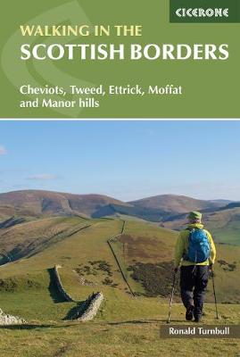
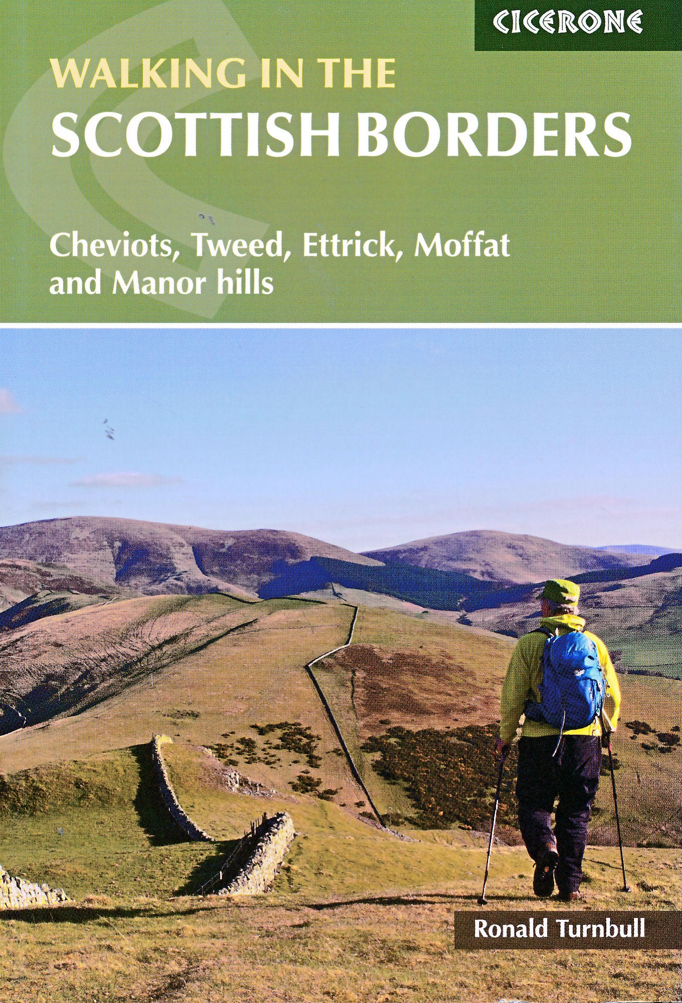
- Walking in the Scottish Borders
- Cheviots, Tweed, Ettrick, Moffat and Manor hills Read more
- Also available from:
- De Zwerver, Netherlands
- Stanfords, United Kingdom
De Zwerver
Netherlands
2020
Netherlands
2020
- Wandelgids Walking in the Scottish Borders | Cicerone
- This guidebook provides 45 day walks in the Scottish Borders. Separated into six sections, these walks are divided between the north and south Cheviots, Tweed, Ettrick, Moffat and Manor hills and feature main centres including Wooler, Kelso, Melrose, Peebles and Moffat. The guide`s seventh section outlines long distance routes, including a... Read more

Stanfords
United Kingdom
2020
United Kingdom
2020
- Walking in the Scottish Borders: Cheviots, Tweed, Ettrick, Moffat and Manor hills
- This guidebook provides 45 day walks in the Scottish Borders. Separated into six sections, these walks are divided between the north and south Cheviots, Tweed, Ettrick, Moffat and Manor hills and feature main centres including Wooler, Kelso, Melrose, Peebles and Moffat. The guide`s seventh section outlines long distance routes, including a... Read more

The Book Depository
United Kingdom
United Kingdom
- Peak District Year Round Walks
- There just isn`t a bad time to walk in the Peak District, each season offers something new. The twenty circular walks in this book vary in length from 2 to 8 miles and are enjoyable all year round. The author has divided the routes into seasons to show each at its very best. In spring, the fields around Monyash are golden with cowslips and the... Read more
- Also available from:
- Stanfords, United Kingdom

Stanfords
United Kingdom
United Kingdom
- Peak District Year Round Walks
- There just isn`t a bad time to walk in the Peak District, each season offers something new. The twenty circular walks in this book vary in length from 2 to 8 miles and are enjoyable all year round. The author has divided the routes into seasons to show each at its very best. In spring, the fields around Monyash are golden with cowslips and the... Read more
Karten

- Also available from:
- De Zwerver, Netherlands
- Stanfords, United Kingdom


Stanfords
United Kingdom
United Kingdom
- Glocknergruppe - Matrei - Kals - Heiligenblut Tabacco 076
- This Tabacco topographic map at 1:25,000 (1cm = 250m) covers the Alta Via routes, as well as the Via Ferrata where you get further than the ordinary walker with the help of steel ladders. Additional information includes: symbols to indicate 6 different types of accommodation from mountain hut, hotel to camping site. As well as information on... Read more

The Book Depository
United Kingdom
2018
United Kingdom
2018
- Ben Nevis and Glen Coe
- Waterproof mountain map of Ben Nevis & Glen Coe from Harvey at 1:40,000, with a geological map of the region on the reverse, an enlargement of Ben Nevis' summit, and advice on navigating the region safely.MAIN MAP: Topography is shown through clear altitude shading, spot heights, contours at 15m intervals, and index contours at 75m intervals. A... Read more
- Also available from:
- De Zwerver, Netherlands
- Stanfords, United Kingdom

De Zwerver
Netherlands
2018
Netherlands
2018
- Wandelkaart Ben Nevis & Glen Coe | Harvey Maps
- Waterproof mountain map of Ben Nevis & Glen Coe from Harvey at 1:40,000, with a geological map of the region on the reverse, an enlargement of Ben Nevis' summit, and advice on navigating the region safely.MAIN MAP: Topography is shown through clear altitude shading, spot heights, contours at 15m intervals, and index contours at 75m intervals. A... Read more

Stanfords
United Kingdom
2018
United Kingdom
2018
- Ben Nevis & Glen Coe Harvey British Mountain Map XT40
- Waterproof mountain map of Ben Nevis & Glen Coe from Harvey at 1:40,000, with a geological map of the region on the reverse, an enlargement of Ben Nevis` summit, and advice on navigating the region safely.*MAIN MAP:* Topography is shown through clear altitude shading, spot heights, contours at 15m intervals, and index contours at 75m intervals.... Read more

De Zwerver
Netherlands
2019
Netherlands
2019
- Reisgids Iceland Road Guide | Vegahandbokin
- Iceland Road Guide from Vegahandbókin, an exceptionally comprehensive, 605-page guide with region-by-region descriptions of sites accompanied by road maps and street plans, plus a separate road atlas section covering the whole country at 1:500,000 and information on a wide variety of tourism relating topics to help the user get the best of... Read more
- Also available from:
- Stanfords, United Kingdom

Stanfords
United Kingdom
2019
United Kingdom
2019
- Iceland Road Guide
- Iceland Road Guide from Vegahandbókin, an exceptionally comprehensive, 605-page guide with region-by-region descriptions of sites accompanied by road maps and street plans, plus a separate road atlas section covering the whole country at 1:500,000 and information on a wide variety of tourism relating topics to help the user get the best of... Read more

Stanfords
United Kingdom
United Kingdom
- Muktinath
- Koban, sheet no. 2883-07, in the topographic survey of Nepal at 1:50,000 published by the Nepali Government in the late 1990s and early 2000s and produced from remote sensing data by Finnish cartographers as part of that country’s international aid program. The maps cover 15’ x 15’ quadrangles.IMPORTANT – PLEASE NOTE BEFORE ORDERING:... Read more
Stanfords
United Kingdom
United Kingdom
- Ghandruk
- Ghandruk, sheet no. 2883-12, in the topographic survey of Nepal at 1:50,000 published by the Nepali Government in the late 1990s and early 2000s and produced from remote sensing data by Finnish cartographers as part of that country’s international aid program. The maps cover 15’ x 15’ quadrangles.IMPORTANT – PLEASE NOTE BEFORE ORDERING:... Read more
Stanfords
United Kingdom
United Kingdom
- Apsuwa Khoka - Bala
- Apsuwa Khoka – Bala, sheet no. 2787-05, in the topographic survey of Nepal at 1:50,000 published by the Nepali Government in the late 1990s and early 2000s and produced from remote sensing data by Finnish cartographers as part of that country’s international aid program. The maps cover 15’ x 15’ quadrangles.IMPORTANT – PLEASE NOTE BEFORE... Read more
Stanfords
United Kingdom
United Kingdom
- Dho
- Dho, sheet no. 2983-13, in the topographic survey of Nepal at 1:50,000 published by the Nepali Government in the late 1990s and early 2000s and produced from remote sensing data by Finnish cartographers as part of that country’s international aid program. The maps cover 15’ x 15’ quadrangles.IMPORTANT – PLEASE NOTE BEFORE ORDERING:... Read more
Stanfords
United Kingdom
United Kingdom
- Lamabagar
- Lamabagar, sheet no. 2786-01, in the topographic survey of Nepal at 1:50,000 published by the Nepali Government in the late 1990s and early 2000s and produced from remote sensing data by Finnish cartographers as part of that country’s international aid program. The maps cover 15’ x 15’ quadrangles.IMPORTANT – PLEASE NOTE BEFORE ORDERING:... Read more
Stanfords
United Kingdom
United Kingdom
- Gamgadhi
- Gamgadji, sheet no. 2982-05, in the topographic survey of Nepal at 1:50,000 published by the Nepali Government in the late 1990s and early 2000s and produced from remote sensing data by Finnish cartographers as part of that country’s international aid program. The maps cover 15’ x 15’ quadrangles.IMPORTANT – PLEASE NOTE BEFORE ORDERING:... Read more
Stanfords
United Kingdom
United Kingdom
- Langtang Lirung
- Langtang Lirung, sheet no. 2885-11, in the topographic survey of Nepal at 1:50,000 published by the Nepali Government in the late 1990s and early 2000s and produced from remote sensing data by Finnish cartographers as part of that country’s international aid program. The maps cover 15’ x 15’ quadrangles.IMPORTANT – PLEASE NOTE BEFORE ORDERING:... Read more
Stanfords
United Kingdom
United Kingdom
- Khadachakra
- Khadachakra, sheet no. 2981-15, in the topographic survey of Nepal at 1:50,000 published by the Nepali Government in the late 1990s and early 2000s and produced from remote sensing data by Finnish cartographers as part of that country’s international aid program. The maps cover 15’ x 15’ quadrangles.IMPORTANT – PLEASE NOTE BEFORE ORDERING:... Read more
Stanfords
United Kingdom
United Kingdom
- Mt. Pumori
- Mt Pumori, sheet no. 2886-16, in the topographic survey of Nepal at 1:50,000 published by the Nepali Government in the late 1990s and early 2000s and produced from remote sensing data by Finnish cartographers as part of that country’s international aid program. The maps cover 15’ x 15’ quadrangles.IMPORTANT – PLEASE NOTE BEFORE ORDERING:... Read more
Stanfords
United Kingdom
United Kingdom
- Phugau Ghomion
- Phugau Ghomion, sheet no. 2884-02, in the topographic survey of Nepal at 1:50,000 published by the Nepali Government in the late 1990s and early 2000s and produced from remote sensing data by Finnish cartographers as part of that country’s international aid program. The maps cover 15’ x 15’ quadrangles.IMPORTANT – PLEASE NOTE BEFORE ORDERING:... Read more
Stanfords
United Kingdom
United Kingdom
- Europe High 5 Edition Road Atlas
- The first physical atlas with direct access to useful additional information from the InternetThe entirety of Europe on 432 pages in a scale of 1:800,000 clearly presented, including lots more travel information:- Road Companion (roadmaps) in a scale of 1:800,000, inclusive of the High 5 - Edition app technology for calling up additional travel... Read more
Stanfords
United Kingdom
United Kingdom
- Bagarchhap
- Bagarchhap, sheet no. 2884-06, in the topographic survey of Nepal at 1:50,000 published by the Nepali Government in the late 1990s and early 2000s and produced from remote sensing data by Finnish cartographers as part of that country’s international aid program. The maps cover 15’ x 15’ quadrangles.IMPORTANT – PLEASE NOTE BEFORE ORDERING:... Read more