
Hessen
Beschreibung
Wanderwege Landesteil
- Aar HöhenwegGPX
- AlemannenwegGPX
- Badener Weg
- Barbarossaweg GPX
- BonifatiuswegGPX
- BorgmannwegGPX
- Burgenweg Bergstrasse
- Burgundenweg
- BurgwaldpfadGPX
- Diemelsteig
- E1GPX
- E6GPX
- E8GPX
- Eder HöhenwegGPX
- ElisabethpfadGPX
- EselswegGPX
- Frankenweg Odenwald
- Frankfurter GrünGürtel Rundwanderweg
- Frau HollepfadGPX
- Fränkischer Rotwein WanderwegGPX
- FuldahöhenwegGPX
- HansawegGPX
- HerkuluswegGPX
- Hessenweg 1GPX
- Hessenweg 10GPX
- Hessenweg 11GPX
- Hessenweg 2GPX
- Hessenweg 3GPX
- Hessenweg 4GPX
- Hessenweg 5GPX
- Hessenweg 6GPX
- Hessenweg 7GPX
- Hessenweg 8GPX
- Hessenweg 9GPX
- KellerwaldsteigGPX
- Lahn Dill BerglandpfadGPX
- LöwenwegGPX
- LulluspfadGPX
- MärchenlandwegGPX
- RheinburgenwegGPX
- Rheingauer Riesling Routen
- RheinhöhenwegGPX
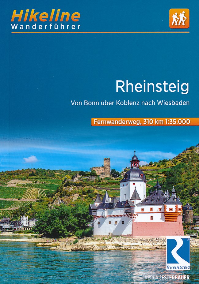
- RheinsteigGPX
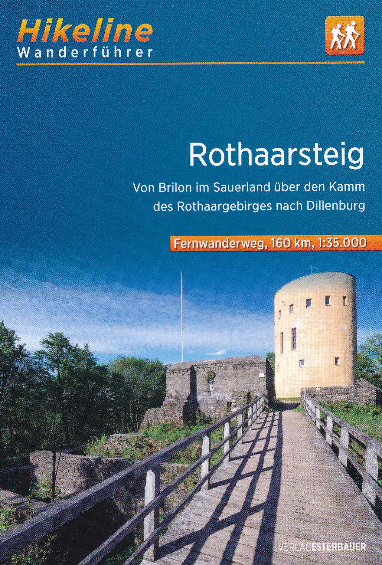
- RothaarsteigGPX
- SchinderhannespfadGPX
- StudentenpfadGPX
- Taunus HöhenwegGPX
- Taunus-Rhön-WegGPX
- UplandsteigGPX
- Urwaldsteig EderseeGPX
- Vogelsberger Vulkansteig
- Vulkanring VogelsbergGPX
- Wanderweg der Deutschen EinheitGPX
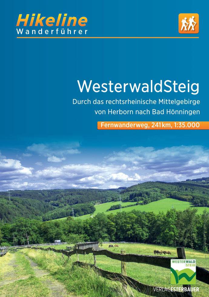
- WesterwaldsteigGPX
- WildbahnGPX
Links
Fakten
Berichte
Führer und Karten
Übernachtung
Organisationen
Reisebüros
GPS
Sonstiges
Bücher
De Zwerver
Netherlands
2021
Netherlands
2021
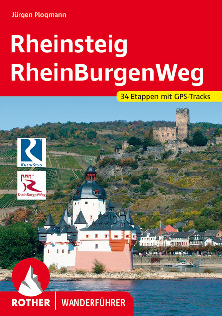
- Wandelgids Rheinsteig mit Rheinburgenweg und Rheinhöhenwegen | Rother Bergverlag
- Der romantische Mittelrhein zwischen Mainz/Wiesbaden und Bonn ist eine der spektakulärsten Landschaften Deutschlands und UNESCO-Welterbe. Neben dem Erleben der Natur trifft der Wanderer am Rhein auf viel Kultur, sehenswerte mittelalterliche Städte und die weltweit größte Burgendichte. In diesem Rother Wanderführer werden die wichtigsten... Read more
De Zwerver
Netherlands
2016
Netherlands
2016
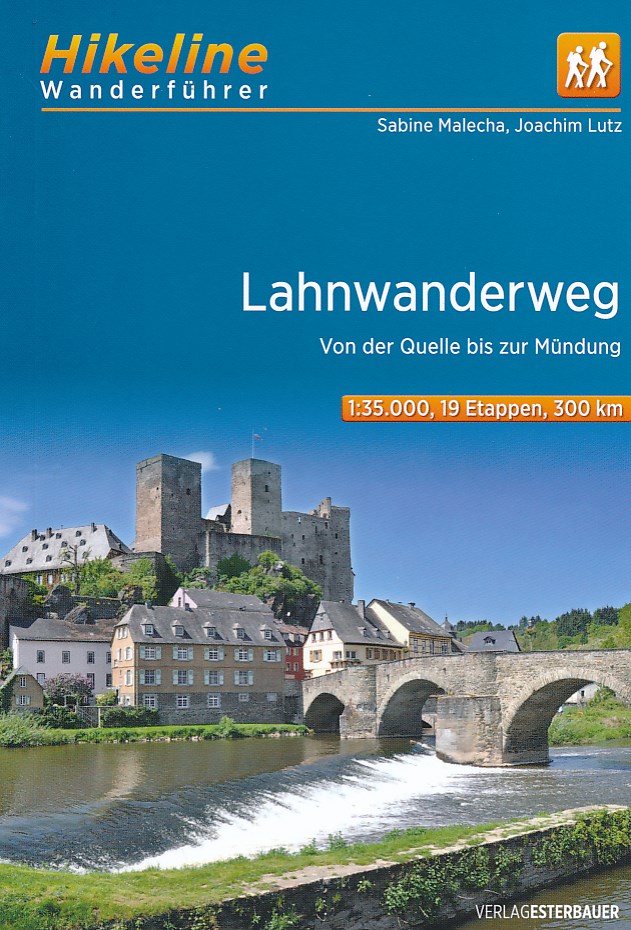
- Wandelgids Hikeline Lahnwanderweg | Esterbauer
- Handzame gids met een goede beschrijving van een groot aantal dagtochten in dit gebied. De gids is in spiraalbinding en elke pagina is op scheur- en watervast papier gedrukt. Daar is echt over nagedacht! Ein Wandertag auf dem Lahnwanderweg beginnt meist am Ufer der Lahn – oder an einem der zahlreichen Bahnhöfe entlang der Strecke. Der Wanderweg... Read more

De Zwerver
Netherlands
2021
Netherlands
2021
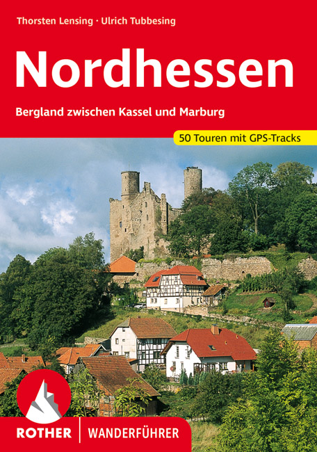
- Wandelgids Nordhessen | Rother Bergverlag
- Uitstekende wandelgids met een groot aantal dagtochten in dal en hooggebergte. Met praktische informatie en beperkt kaartmateriaal! Wandelingen in verschillende zwaarte weergegeven in rood/blauw/zwart. Im Herzen Deutschlands gelegen bildet das nordhessische Bergland zwischen Kassel und Marburg auf dem historischen Territorium des ehemaligen... Read more
De Zwerver
Netherlands
2022
Netherlands
2022
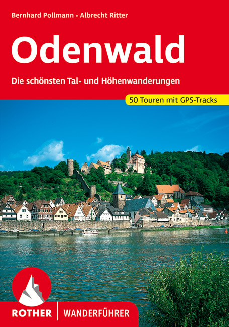
- Wandelgids Odenwald | Rother Bergverlag
- Uitstekende wandelgids met een groot aantal dagtochten in dal en hooggebergte. Met praktische informatie en beperkt kaartmateriaal! Wandelingen in verschillende zwaarte weergegeven in rood/blauw/zwart. Der Odenwald, der von der Bergstraße, dem Neckar und dem Main begrenzt wird, bietet einen reichen Schatz an Natur und Kultur. Neben den... Read more


De Zwerver
Netherlands
2022
Netherlands
2022

De Zwerver
Netherlands
2017
Netherlands
2017
- Wandelgids 411 Kautokeino - Nordkap E1 | Conrad Stein Verlag
- Handzaam boekje met de routebeschrijving inclusief een heleboel praktische informatie. De beschrijving is uitstekend, maar kaarten zijn wat beperkt. Duits. Die 330 km lange Wanderung auf dem E1 von Kautokeino zum Nordkap ist ein unvergessliches Wanderabenteuer. In 15 Etappen laufen Sie durch die Wildnis Nordnorwegens und überqueren die... Read more


De Zwerver
Netherlands
2022
Netherlands
2022
De Zwerver
Netherlands
2013
Netherlands
2013
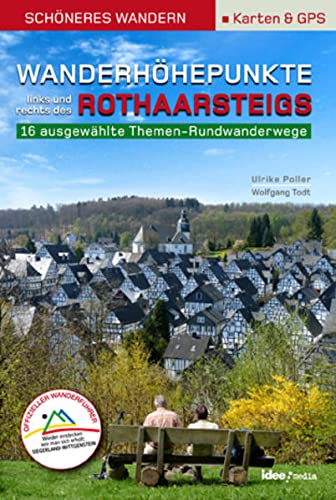
- Wandelgids Wanderhöhepunkte rechts und links des Rothaarsteigs | IdeeMedia
- 12 traumhafte neue Rundtouren im Siegerland. Neuerscheinung. Read more

De Zwerver
Netherlands
2017
Netherlands
2017
- Wandelgids Elisabethpfad von Eisenach nach Marburg | Conrad Stein Verlag
- Travel & Languages Travel (special interest) Guides (general) International Books Read more
Karten

The Book Depository
United Kingdom
United Kingdom
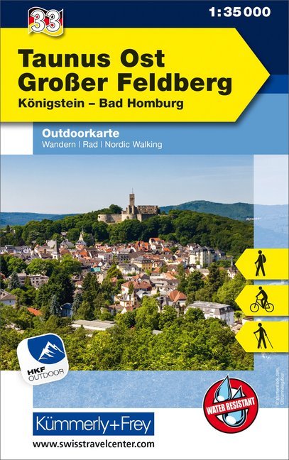
- Taunus Est - Grosser Feldberg 33
- The eastern part of the Taunus Mountains at 1:35,000 from Kümmerly+Frey in a series GPS compatible, double-sided maps printed on durable, waterproof and tear-resistant plastic paper; contoured, with hiking and cycle routes, other recreational activities, etc. Maps in this series are at a scale of either 1:50,000 or 1:35,000. Contour interval... Read more
- Also available from:
- De Zwerver, Netherlands
- Stanfords, United Kingdom
De Zwerver
Netherlands
Netherlands
- Wandelkaart 33 Outdoorkarte Taunus Ost - Großer Feldberg, | Kümmerly & Frey
- The eastern part of the Taunus Mountains at 1:35,000 from Kümmerly+Frey in a series GPS compatible, double-sided maps printed on durable, waterproof and tear-resistant plastic paper; contoured, with hiking and cycle routes, other recreational activities, etc. Maps in this series are at a scale of either 1:50,000 or 1:35,000. Contour interval... Read more

Stanfords
United Kingdom
United Kingdom
- Taunus East - Grosser Feldberg - Königstein - Bad Homberg K+F Outdoor Map 33
- The eastern part of the Taunus Mountains at 1:35,000 from Kümmerly+Frey in a series GPS compatible, double-sided maps printed on durable, waterproof and tear-resistant plastic paper; contoured, with hiking and cycle routes, other recreational activities, etc. Maps in this series are at a scale of either 1:50,000 or 1:35,000. Contour interval... Read more

The Book Depository
United Kingdom
United Kingdom
- Prespa - Vitsi - Voras
- Uitstekende topografische kaarten van een deel van Griekenland: zonder meer hele goede kaarten voor wandeltochten in een onbekend stuk Griekenland! Ze zijn gedrukt op scheurvast en watervast papier op een schaal van 1:50.000 met een UTM grid voor GPS gebruikers. Op de meeste kaarten is geven de hoogtelijnen een interval van 20m. aan. Met... Read more
- Also available from:
- De Zwerver, Netherlands
- Stanfords, United Kingdom

De Zwerver
Netherlands
Netherlands
- Wandelkaart 6.2 Prespa - Vitsi - Voras | Anavasi
- Uitstekende topografische kaarten van een deel van Griekenland: zonder meer hele goede kaarten voor wandeltochten in een onbekend stuk Griekenland! Ze zijn gedrukt op scheurvast en watervast papier op een schaal van 1:50.000 met een UTM grid voor GPS gebruikers. Op de meeste kaarten is geven de hoogtelijnen een interval van 20m. aan. Met... Read more

Stanfords
United Kingdom
United Kingdom
- Prespa - Vitsi - Voras Anavasi 6.2
- Prespa - Vitsi – Voras area of northern Greece at 1:50,000 on a light, waterproof and tear-resistant, GPS compatible, contoured map from Anavasi, with recommendations for three hiking trails and notes on the E4 and E6 cross-European trails. The map is double-sided; coverage in the west starts from the Prespa Lake on the border with Albania and... Read more

- Also available from:
- De Zwerver, Netherlands
The Book Depository
United Kingdom
United Kingdom
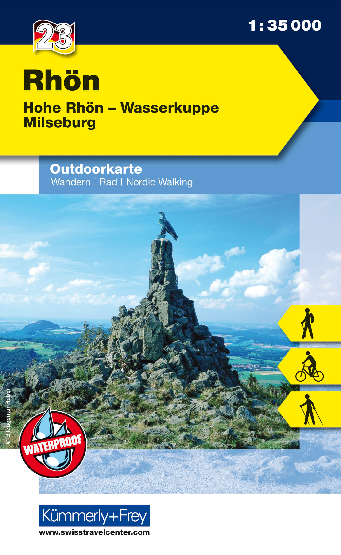
- Rhon 23
- The Rhön region between Fulda and Bad Neustadt at 1:35,000 from Kümmerly+Frey in a series GPS compatible, double-sided maps printed on durable, waterproof and tear-resistant plastic paper; contoured, with hiking and cycle routes, other recreational activities, etc. Maps in this series are at a scale of either 1:50,000 or 1:35,000. Contour... Read more
- Also available from:
- De Zwerver, Netherlands
- Stanfords, United Kingdom
De Zwerver
Netherlands
Netherlands
- Wandelkaart 23 Outdoorkarte Rhön | Kümmerly & Frey
- The Rhön region between Fulda and Bad Neustadt at 1:35,000 from Kümmerly+Frey in a series GPS compatible, double-sided maps printed on durable, waterproof and tear-resistant plastic paper; contoured, with hiking and cycle routes, other recreational activities, etc. Maps in this series are at a scale of either 1:50,000 or 1:35,000. Contour... Read more
Stanfords
United Kingdom
United Kingdom
- Rhön - Hohe Rhön - Wasserkuppe - Milseburg K+F Outdoor Map 23
- The Rhön region between Fulda and Bad Neustadt at 1:35,000 from Kümmerly+Frey in a series GPS compatible, double-sided maps printed on durable, waterproof and tear-resistant plastic paper; contoured, with hiking and cycle routes, other recreational activities, etc. Maps in this series are at a scale of either 1:50,000 or 1:35,000. Contour... Read more

- Also available from:
- De Zwerver, Netherlands
- Stanfords, United Kingdom
Stanfords
United Kingdom
United Kingdom
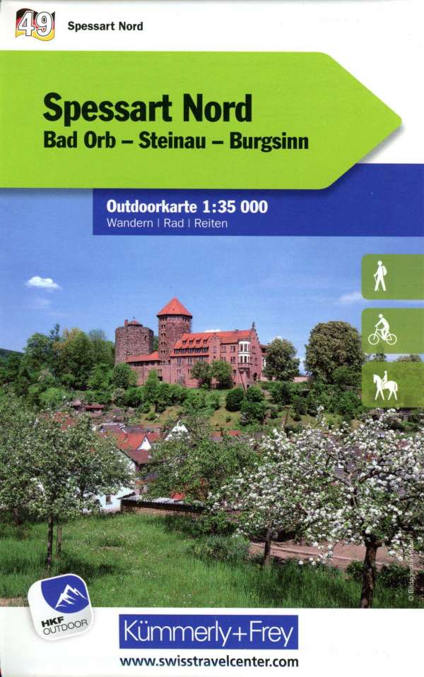
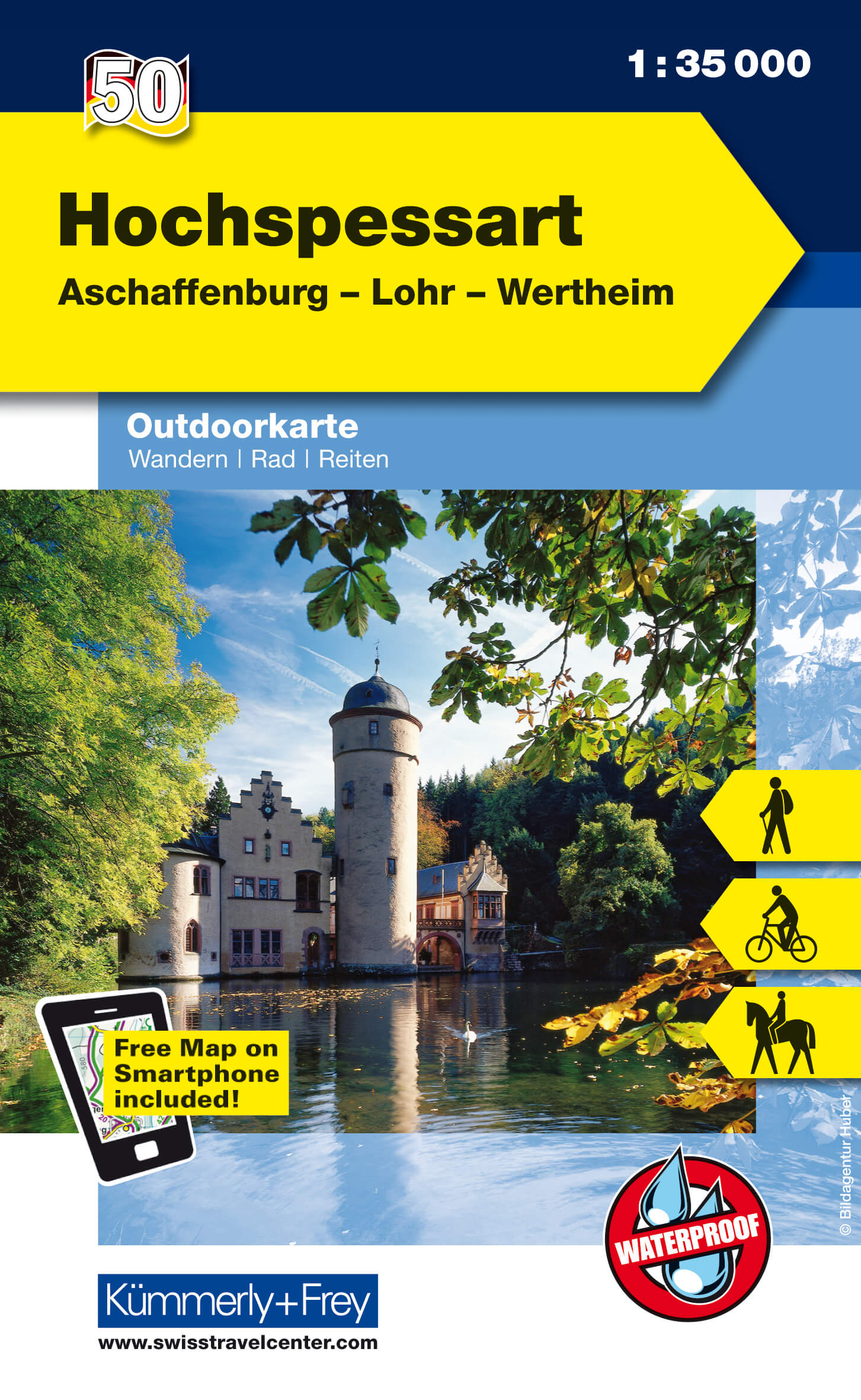
- Hochspessart - Aschaffenburg - Lohr - Wertheim K+F Outdoor Map 50
- Hochspessart - Aschaffenburg - Lohr - Wertheim area of Germany at 1:35,000 from Kümmerly+Frey in a series GPS compatible, double-sided maps printed on durable, waterproof and tear-resistant plastic paper; contoured, with hiking and cycle routes, other recreational activities, etc.Maps in this series are at a scale of either 1:50,000 or... Read more
De Zwerver
Netherlands
Netherlands
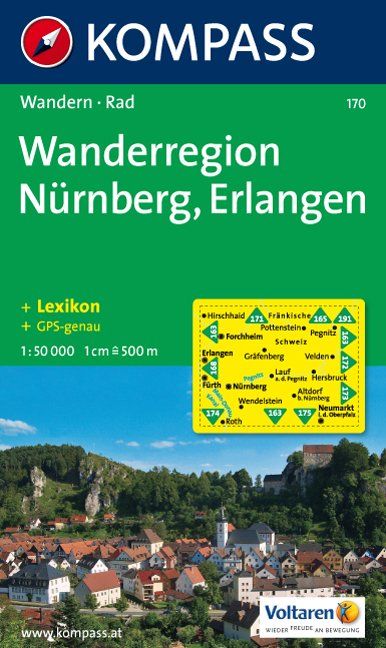
- Wandelkaart 170 Wanderregion Nürnberg - Erlangen | Kompass
- Goede wandelkaart met vrijwel alle topografische details en ingetekende routes. Ook met symbolen voor toeristische bezienswaardigheden, register. Berghutten duidelijk weergegeven. Gevaarlijke wandelroutes zijn goed herkenbaar. Inclusief een Duitstalig boekje met informatie en routesuggesties. Read more

De Zwerver
Netherlands
Netherlands
- Wandelkaart 5 Rila gebergte | Domino
- Rila Mountains at 1:50,000 on a large, double-sided, contoured map with GPS waypoints for shelters and chalets, peaks, etc. and highlighting hiking routes. Topography is shown by contours at 50m intervals with additional relief shading and graphics and colouring for scree, single rocks over 5m high, marshlands and pine scrub and forests. An... Read more
- Also available from:
- Stanfords, United Kingdom

Stanfords
United Kingdom
United Kingdom
- Rila Mountains Domino
- Rila Mountains at 1:50,000 on a large, double-sided, contoured map with GPS waypoints for shelters and chalets, peaks, etc. and highlighting hiking routes. Topography is shown by contours at 50m intervals with additional relief shading and graphics and colouring for scree, single rocks over 5m high, marshlands and pine scrub and forests. An... Read more

De Zwerver
Netherlands
Netherlands
- Wandelkaart 2.4 Nafpaktos - Panaitoliko - Karpenisi | Anavasi
- Prespa - Vitsi – Voras area of northern Greece at 1:50,000 on a light, waterproof and tear-resistant, GPS compatible, contoured map from Anavasi, with recommendations for three hiking trails and notes on the E4 and E6 cross-European trails. The map is double-sided; coverage in the west starts from the Prespa Lake on the border with Albania and... Read more

De Zwerver
Netherlands
Netherlands
- Wandelkaart 63 Eggegebirge (Nordteil) mit Eggeweg, E1, Jakobspilgerweg | GeoMap
- Topographische Wanderkarte für den nördlichen Teil des Eggegebirges mit Eggeweg, E1, Jakobspilgerweg. 4. Auflage. Read more
De Zwerver
Netherlands
2013
Netherlands
2013
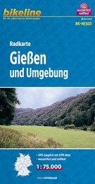
- Fietskaart HES03 Bikeline Radkarte Gießen und Umgebung | Esterbauer
- Bikeline Radkarte Deutschland Gießen und Umgebung 1 : 75 000 ab 6.9 EURO Bad Laasphe - Biedenkopf - Lich - Marburg - Schotten - Staufenberg - Treysa - Wetzlar Bikeline Radkarte Hessen. 1. Auflage Read more
De Zwerver
Netherlands
Netherlands
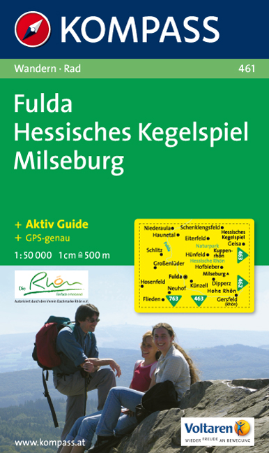
- Wandelkaart 461 Fulda - Hessisches Kegelspiel - Milseburg | Kompass
- Goede wandelkaart met vrijwel alle topografische details en ingetekende routes. Ook met symbolen voor toeristische bezienswaardigheden, register. Berghutten duidelijk weergegeven. Gevaarlijke wandelroutes zijn goed herkenbaar. GPS toepasbaar. Inclusief een Duitstalig boekje met informatie en routesuggesties. Eine heiße Sache: Eine Reihe... Read more

De Zwerver
Netherlands
2023
Netherlands
2023