
Rheinland-Pfalz
Beschreibung
Wanderwege Landesteil
- Ahr-Venn-WegGPX
- AhrtalwegGPX
- Alsenztal Wanderweg
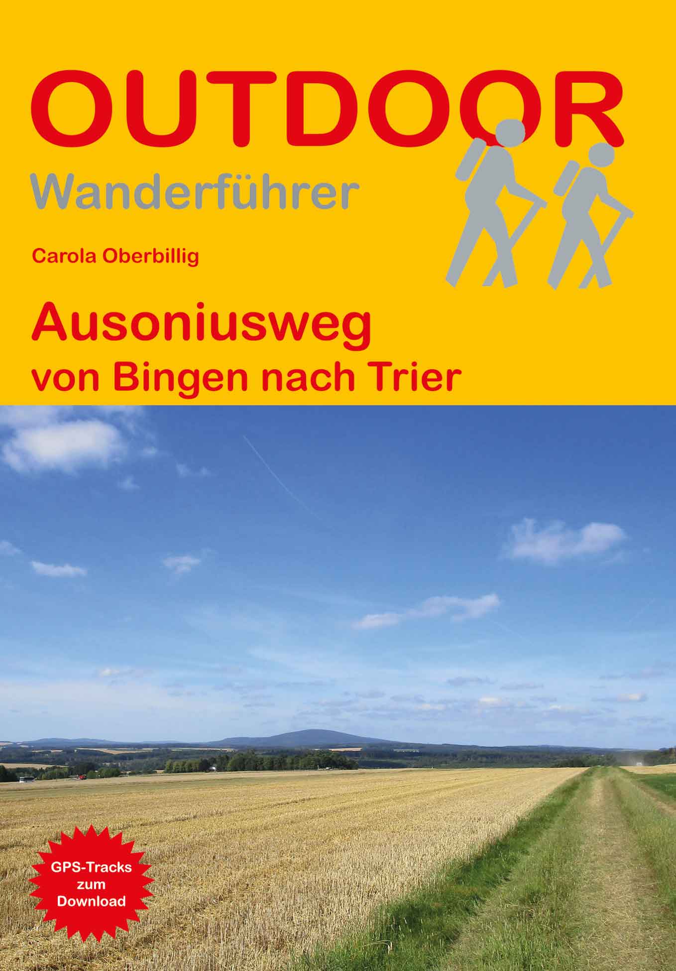
- AusoniuswegGPX
- BonifatiuswegGPX
- Deutsche WeinstrasseGPX
- E1GPX
- E8GPX
- EifelsteigGPX
- Erft-Lieser-Mosel-Weg GPX
- GR15 - AE - Ardennes-EifelGPX
- GR5GPX
- Hessenweg 7GPX
- Hunsrück Höhenweg
- Jakobsweg im Elsass
- Josef-Schramm-Weg GPX
- Karl-Kaufmann-WegGPX
- KarolingerwegGPX
- KrönungswegGPX
- Lahn WanderwegGPX
- LahnhöhenwegGPX
- LieserpfadGPX
- MatthiaswegGPX
- Mosel-OurwegGPX
- MoselhöhenwegGPX
- MoselsteigGPX
- Nahe HöhenwegGPX
- NibelungenwegGPX
- Pfälzer WeinsteigGPX
- Rhein-Kyll-WegGPX
- Rhein-Rureifel-Weg GPX
- RheinburgenwegGPX
- Rheingauer Riesling Routen
- RheinhöhenwegGPX
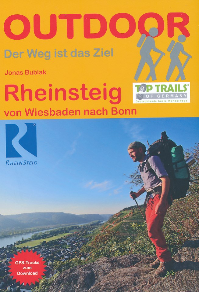
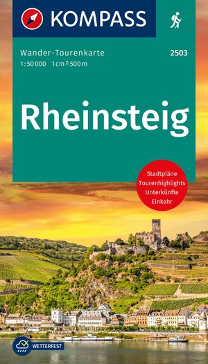
- RheinsteigGPX
- Rotwein WanderwegGPX
- Saar-HunsrücksteigGPX
- SchinderhannespfadGPX
- Siegerland HöhenringGPX
- SironawegGPX
- SoonwaldsteigGPX
- SponheimerwegGPX
- Taunus HöhenwegGPX
- VulkanwegGPX
- Weinwanderweg Rhein-NaheGPX
- WesterwaldsteigGPX
- Westpfalz WanderwegGPX
- WillibrorduswegGPX
Links
Fakten
Berichte
Führer und Karten
Übernachtung
Organisationen
Reisebüros
GPS
Sonstiges
Bücher

The Book Depository
United Kingdom
2018
United Kingdom
2018
- The GR5 Trail - Benelux and Lorraine
- The North Sea to Schirmeck in the Vosges mountains Read more
- Also available from:
- De Zwerver, Netherlands

De Zwerver
Netherlands
2018
Netherlands
2018
- Wandelgids The GR5 Trail Benelux and Lorraine | Cicerone
- Guidebook to walking the northern section of the GR5 - 1000km starting in Hoek van Holland and passing through the Netherlands, Belgium, Luxembourg and Lorraine to Schirmeck in France. A long-distance route covering a variety of cultures and landscapes. The full GR5 from the North Sea to the Mediterranean is one of the world's greatest trails. Read more


- Also available from:
- De Zwerver, Netherlands

De Zwerver
Netherlands
2021
Netherlands
2021

The Book Depository
United Kingdom
2022
United Kingdom
2022
- Also available from:
- De Zwerver, Netherlands


De Zwerver
Netherlands
2015
Netherlands
2015
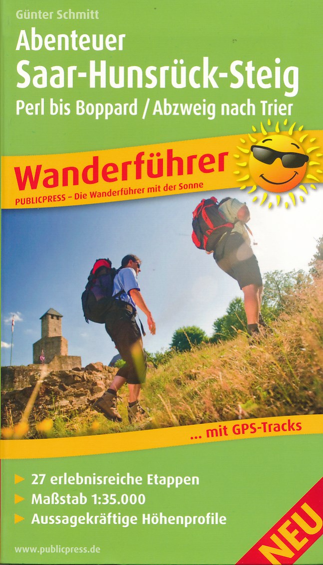
- Wandelgids Abenteuer Saar-Hunsrück-Steig | Publicpress
- Wanderführer mit 27 erlebnisreichen Etappen, Maßstab 1:35 000, aussagekräftigen Höhenprofilen und GPS-Tracks Read more
De Zwerver
Netherlands
2012
Netherlands
2012
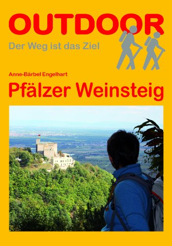
- Wandelgids Pfalz - Pfälzer Weinsteig | Conrad Stein Verlag
- Im April 2011 wurden die Pfälzer Prädikatswege eingeweiht. Einer davon ist der Weinsteig. Er zieht sich am Westrand des Pfälzerwaldes, am Haardtrand, durch die Wälder, die Weinberge und die pittoresken Ortschaften. Die Veränderung von im Norden sanft hügeligen zu im Süden steiler werdenden Taleinschnitten spürt der Wanderer unter den Sohlen und... Read more
De Zwerver
Netherlands
2019
Netherlands
2019
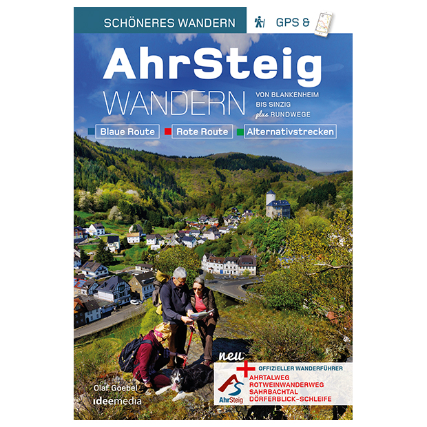
- Wandelgids Ahrsteig - von Blankenheim bis Sinzig | IdeeMedia
- Von Blankenheim bis Sinzig. Blaue Route. Verbindungswege. Rote Route. Rotweinwanderweg. Sahrbachtal. Dörflerblick-Schleife Read more
De Zwerver
Netherlands
2022
Netherlands
2022
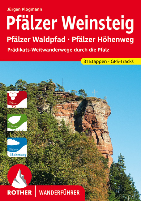
- Wandelgids Pfälzer Weinsteig | Rother Bergverlag
- Dieser Wanderführer beschreibt die drei neuen, insgesamt ca. 400 km langen Qualitätsweitwanderwege durch die Pfalz: Pfälzer Weinsteig, Pfälzer Waldpfad und Pfälzer Höhenweg. Alle drei Wege haben einen eigenen Charakter. Der Pfälzer Höhenweg führt aussichtsreich durch das Nordpfälzer Bergland. Wald, Wiesen und Felder bilden ein... Read more
De Zwerver
Netherlands
2020
Netherlands
2020
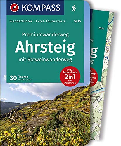
- Wandelgids 5215 Wanderführer Premiumwanderweg Ahrsteig mit Rotweinwanderweg | Kompass
- Die Vorteile des Wanderführers auf einen Blick:- Von KOMPASS-Experten erwanderte Touren- Jede Tour mit Höhenprofil und Kartenausschnitt- Ausflugs- und Übernachtungstipps- Kostenloser Download der GPX-DatenDie Vorteile der Extra-Tourenkarte auf einen Blick:- Unterstützt die Tourenauswahl- Kartografische Gesamtübersicht- Touren können einfach... Read more

De Zwerver
Netherlands
2021
Netherlands
2021
Karten

- Also available from:
- De Zwerver, Netherlands

De Zwerver
Netherlands
Netherlands
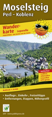
- Wandelkaart Moselsteig | Publicpress
- Beschreven met veel praktische informatie en bezienswaardigheden onderweg. Erg handig uitgevoerd in water- en scheurvast plastic en in praktisch uitklapformaat! Der Qualitätswanderweg führt auf seinen 365 km Länge von Perl nach Koblenz entlang der Mosel durch eine der schönsten Kulturlandschaften Europas. Geprägt wird sie vom Wein, einer über... Read more

De Zwerver
Netherlands
Netherlands
- Wandelkaart 05 Outdoorkarte FR Elsass - Colmar - Sélestat - Elzas | Kümmerly & Frey
- The central part of Alsace around Colmar and Sélestat on a GPS compatible, double-sided map at 1:50,000 from Kümmerly+Frey printed on sturdy, waterproof and tear-resistant synthetic paper; contoured, with hiking and cycling routes, sites for other recreational activities, various accommodation options, restaurants and ferme-auberge locations,... Read more
- Also available from:
- Stanfords, United Kingdom

Stanfords
United Kingdom
United Kingdom
- Alsace - Colmar - Sélestat - Freiburg im Breisgau - Lahr K+F Outdoor Map 5
- The central part of Alsace around Colmar and Sélestat on a GPS compatible, double-sided map at 1:50,000 from Kümmerly+Frey printed on sturdy, waterproof and tear-resistant synthetic paper; contoured, with hiking and cycling routes, sites for other recreational activities, various accommodation options, restaurants and ferme-auberge locations,... Read more


De Zwerver
Netherlands
Netherlands
- Wandelkaart 5 Rila gebergte | Domino
- Rila Mountains at 1:50,000 on a large, double-sided, contoured map with GPS waypoints for shelters and chalets, peaks, etc. and highlighting hiking routes. Topography is shown by contours at 50m intervals with additional relief shading and graphics and colouring for scree, single rocks over 5m high, marshlands and pine scrub and forests. An... Read more
- Also available from:
- Stanfords, United Kingdom

Stanfords
United Kingdom
United Kingdom
- Rila Mountains Domino
- Rila Mountains at 1:50,000 on a large, double-sided, contoured map with GPS waypoints for shelters and chalets, peaks, etc. and highlighting hiking routes. Topography is shown by contours at 50m intervals with additional relief shading and graphics and colouring for scree, single rocks over 5m high, marshlands and pine scrub and forests. An... Read more
De Zwerver
Netherlands
Netherlands
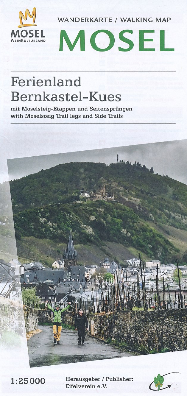
- Wandelkaart 35 Mosel - Ferienland Bernkastel-Kues - Eifel | Eifelverein
- Wandelkaart van een deelgebied van de Eifel. Deze kaarten worden uitgegeven door de zeer actieve Eifelverein. Deze vereniging houdt zich onder andere bezig met de wandelroutes in het gebied: op bijna elke boom in de Eifel vind je wel een teken! De kaarten zijn nauwkeurig en gedetaileerd, met ingetekende wandelroutes maar ook symbolen voor... Read more

De Zwerver
Netherlands
Netherlands
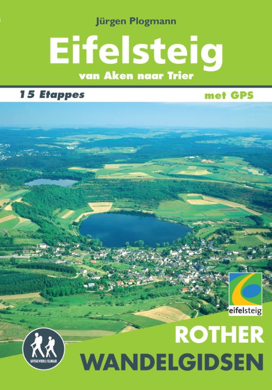
- Wandelkaart Eifelsteig | Publicpress
- Deze gedetailleerde wandelkaart beschrijft de wandelroute van 313 km lengte van Aachen naar Trier, maar ook enkele mogelijke alternatieve routes. Beschreven met veel praktische informatie en bezienswaardigheden onderweg. Erg handig uitgevoerd in water- en scheurvast plastic en in praktisch uitklapformaat! Die Wanderkarte Eifelsteig widmet sich... Read more

De Zwerver
Netherlands
Netherlands
- Wandelkaart 07 Outdoorkarte FR Elsass, Vogesen - Alsace, Strasbourg Elzas - Vogezen | Kümmerly & Frey
- The central part of Alsace around Strasbourg and Saverne on a GPS compatible, double-sided map at 1:50,000 from K Read more
- Also available from:
- Stanfords, United Kingdom

Stanfords
United Kingdom
United Kingdom
- Alsace - Strasbourg - Saverne - Barr - Offenburg K+F Outdoor Map 7
- The central part of Alsace around Strasbourg and Saverne on a GPS compatible, double-sided map at 1:50,000 from Kümmerly+Frey printed on sturdy, waterproof and tear-resistant synthetic paper; contoured, with hiking and cycling routes, sites for other recreational activities, various accommodation options, restaurants and ferme-auberge... Read more


De Zwerver
Netherlands
Netherlands
- Wandelkaart 6 Pirin gebergte | Domino
- Pirin Mountains at 1:50,000 on a large, double-sided, contoured map with GPS waypoints for shelters and chalets, peaks, etc. and highlighting hiking routes. Topography is shown by contours at 40m intervals with additional relief shading and graphics and colouring for sandstone stacks, single rocks over 5m high, marshlands and different types of... Read more
- Also available from:
- Stanfords, United Kingdom

Stanfords
United Kingdom
United Kingdom
- Pirin Mountains Domino
- Pirin Mountains at 1:50,000 on a large, double-sided, contoured map with GPS waypoints for shelters and chalets, peaks, etc. and highlighting hiking routes. Topography is shown by contours at 40m intervals with additional relief shading and graphics and colouring for sandstone stacks, single rocks over 5m high, marshlands and different types of... Read more

De Zwerver
Netherlands
Netherlands
- Wandelkaart - Wegenkaart - landkaart 7 Westelijke Rhodopen - Western Rhodopes | Domino
- Western Rhodope Mountains at 1:100,000 on a contoured GPS compatible map from Domino extending from just west of the Pirin National Park to Asenovgrad in the north-east. The map is double-sided with a good overlap between the sides. Topography is shown by contours at 50m intervals with relief shading and spot heights, plus colouring for... Read more
- Also available from:
- Stanfords, United Kingdom

Stanfords
United Kingdom
United Kingdom
- Western Rhodope Mountains Domino Map
- Western Rhodope Mountains at 1:100,000 on a contoured GPS compatible map from Domino extending from just west of the Pirin National Park to Asenovgrad in the north-east. The map is double-sided with a good overlap between the sides. Topography is shown by contours at 50m intervals with relief shading and spot heights, plus colouring for... Read more

De Zwerver
Netherlands
Netherlands
- Wandelkaart Strandzha - Bulgarije | Domino
- Strandzha Mountains in the south-eastern corner of Bulgaria between Burgas to the Turkish border on a contoured and GPS compatible map from Domino showing local hiking trails and highlighting various interesting sites, with three more detailed enlargements at 1:25,000. Most place names are in both Latin and Cyrillic alphabet; map legend... Read more
- Also available from:
- Stanfords, United Kingdom

Stanfords
United Kingdom
United Kingdom
- Strandzha Mountains: Burgas to the Turkish Border Domino Map
- Strandzha Mountains in the south-eastern corner of Bulgaria between Burgas to the Turkish border on a contoured and GPS compatible map from Domino showing local hiking trails and highlighting various interesting sites, with three more detailed enlargements at 1:25,000. Most place names are in both Latin and Cyrillic alphabet; map legend... Read more