
Bernina
Beschreibung
Karte


Links
Fakten
Berichte
Führer und Karten
Übernachtung
Organisationen
Reisebüros
GPS
Sonstiges
Bücher

The Book Depository
United Kingdom
2015
United Kingdom
2015
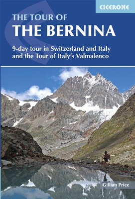
- The Tour of the Bernina
- 9 day tour in Switzerland and Italy and Tour of Italy's Valmalenco Read more
- Also available from:
- De Zwerver, Netherlands
De Zwerver
Netherlands
2015
Netherlands
2015
- Wandelgids The Tour of the Bernina | Cicerone
- Guidebook describing a 9-stage (119km) route around the Piz Bernina massif in the Alps on the Swiss-Italian border near St Moritz, and the 8-stage (94km) Alta Via Valmalenco exploring the Valmalenco valley, in the shadow of Monte Disgrazia. The Tour of the Bernina is suitable for first-time trekkers but the Alta Via needs some experience. Read more
De Zwerver
Netherlands
2019
Netherlands
2019
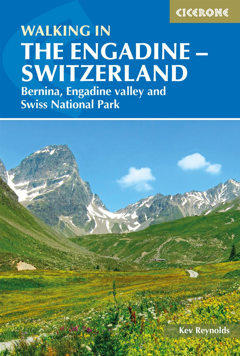
- Wandelgids Walking in the Engadine - Engadin | Cicerone
- A guidebook to 100 day walks in the Engadine, Val Bregaglia, neighbouring valleys and the Engadine National Park. Varying from gentle rambles to adventurous high-level routes for the experienced mountain walker. The routes range from 4 to 16km long, visiting forests and meadows, high mountain landscapes, lakes and passes. Read more
- Also available from:
- Stanfords, United Kingdom

Stanfords
United Kingdom
2019
United Kingdom
2019
- Walking in the Engadine - Switzerland: Bernina, Engadine valley and Swiss National Park
- Walking in the Engadine contains detailed route descriptions for 100 day walk routes that vary from 4 to 16km long in length. The routes cover a variety of terrain from luscious meadows and craggy mountains to glaciers and snowpeaks. Most of the walks described in this guidebook have been chosen with a particular viewpoint, lake, alp hamlet,... Read more
Bol.com
Netherlands
Netherlands
- Rick Steves Switzerland (Ninth Edition)
- Cross mountains on cable cars, cruise Lake Geneva, and wander bridges bedecked with flowers: with Rick Steves on your side, Switzerland can be yours!Inside Rick Steves Switzerland you'll find:Comprehensive coverage for spending a week or more exploring SwitzerlandRick's strategic advice on how to get the most out of your time and money, with... Read more
- Also available from:
- Bol.com, Belgium
Bol.com
Belgium
Belgium
- Rick Steves Switzerland (Ninth Edition)
- Cross mountains on cable cars, cruise Lake Geneva, and wander bridges bedecked with flowers: with Rick Steves on your side, Switzerland can be yours!Inside Rick Steves Switzerland you'll find:Comprehensive coverage for spending a week or more exploring SwitzerlandRick's strategic advice on how to get the most out of your time and money, with... Read more
Bol.com
Netherlands
Netherlands
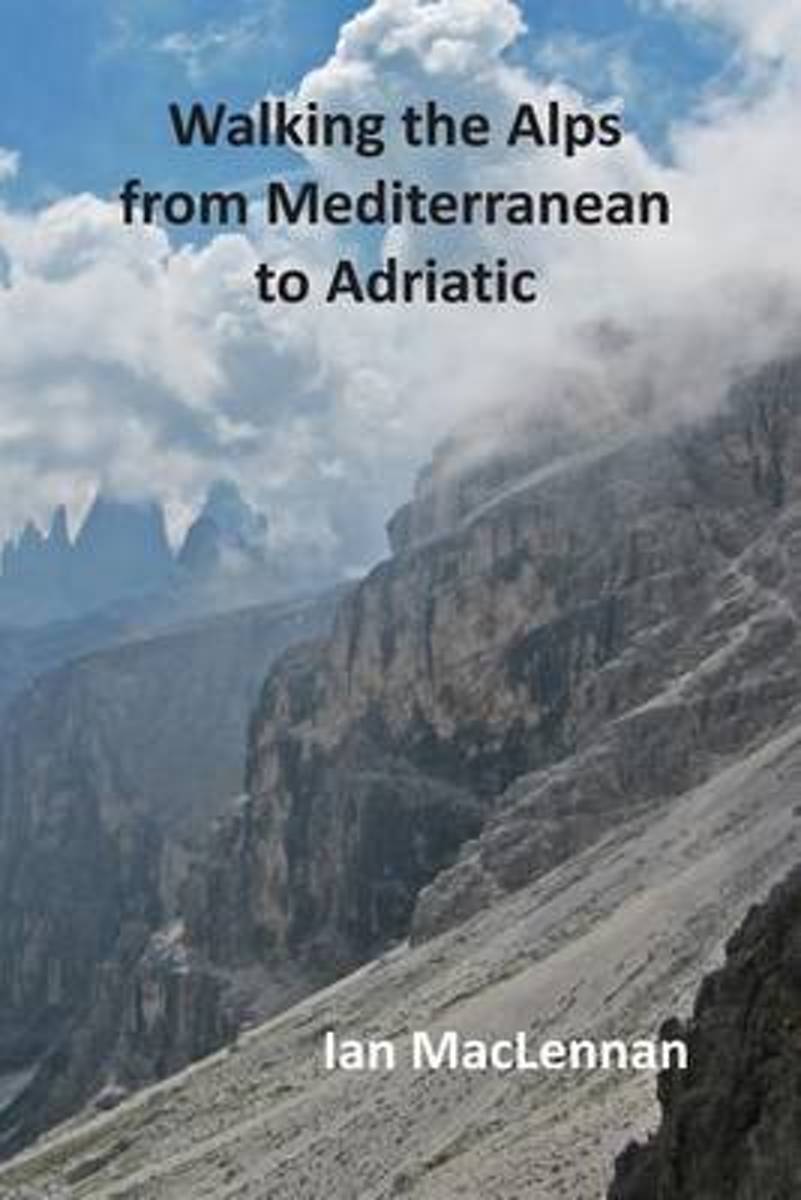
- Walking the Alps from Mediterranean to Adriatic
- This 82-day walk through the Alps starts at Menton on the Mediterranean coast and follows the French-Italian boarder hills to Lake Geneva. The route then continues through the Swiss Alps crossing the Bernese Oberland and the Bernina Alps before entering the Südtyrol. Here the journey traverses the Ortler range and the Dolomites to their... Read more
- Also available from:
- Bol.com, Belgium
Bol.com
Belgium
Belgium
- Walking the Alps from Mediterranean to Adriatic
- This 82-day walk through the Alps starts at Menton on the Mediterranean coast and follows the French-Italian boarder hills to Lake Geneva. The route then continues through the Swiss Alps crossing the Bernese Oberland and the Bernina Alps before entering the Südtyrol. Here the journey traverses the Ortler range and the Dolomites to their... Read more
Bol.com
Netherlands
2005
Netherlands
2005
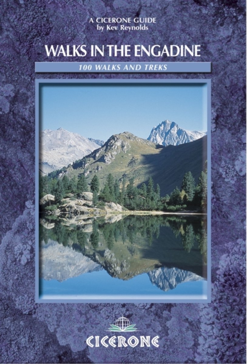
- Walks In The Engadine
- Walks in the Engadine contains detailed route descriptions for 100 day walk routes that vary from 2 to 10 miles in length. The routes cover a variety of terrain from luscious meadows and craggy mountains to glaciers and snowpeaks. Most of the walks described in this guidebook have been chosen with a particular viewpoint, lake, alp hamlet, hut... Read more
- Also available from:
- Bol.com, Belgium
Bol.com
Belgium
2005
Belgium
2005
- Walks In The Engadine
- Walks in the Engadine contains detailed route descriptions for 100 day walk routes that vary from 2 to 10 miles in length. The routes cover a variety of terrain from luscious meadows and craggy mountains to glaciers and snowpeaks. Most of the walks described in this guidebook have been chosen with a particular viewpoint, lake, alp hamlet, hut... Read more
Karten

The Book Depository
United Kingdom
2019
United Kingdom
2019
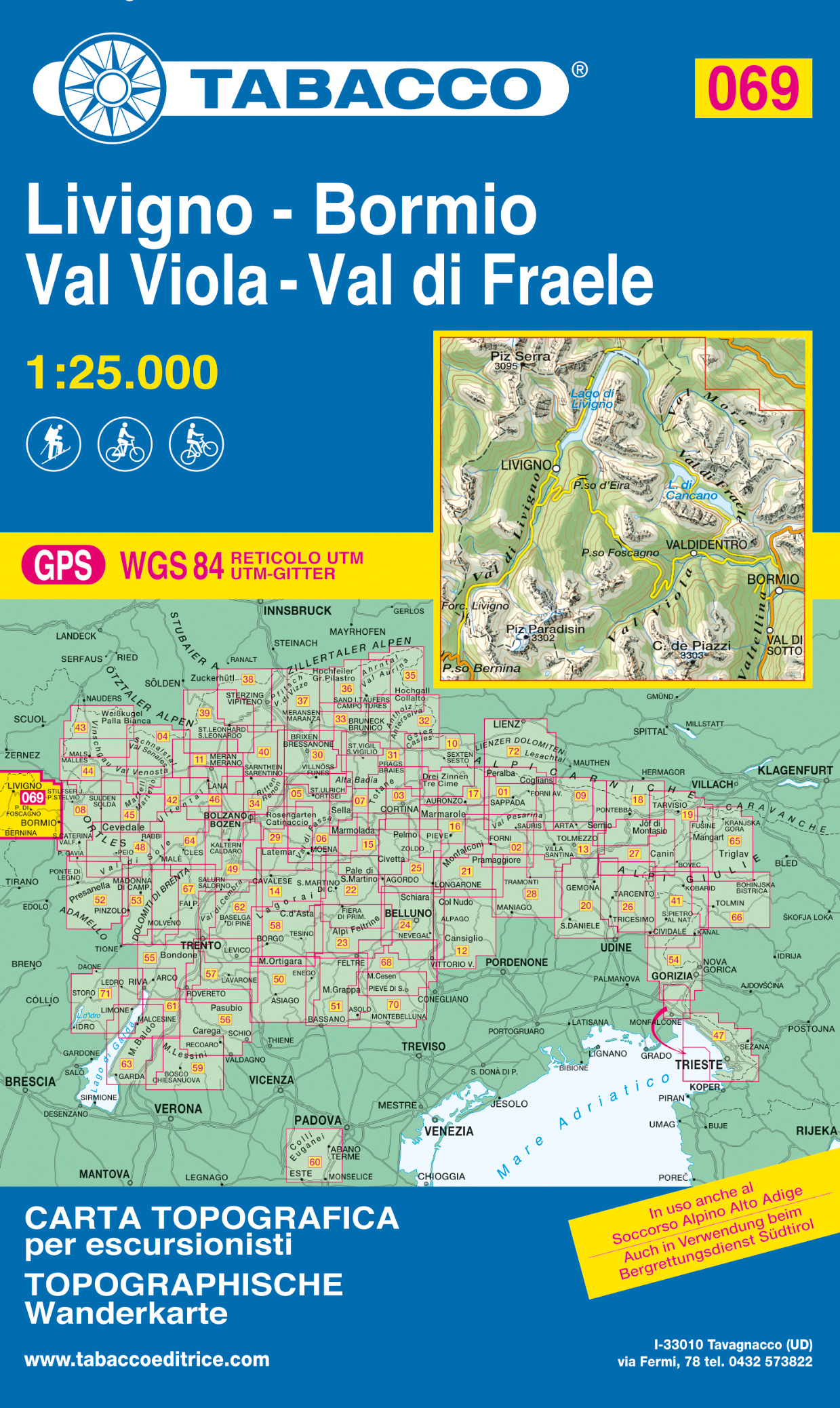
- Livigno / Bormio / Passo del Bernina
- De beste wandelkaarten voor de Dolomieten. Zeer veel topografische details met secure hoogtelijnen (25 meter interval), helder kleurgebruik en bijna alle Tabacco kaarten hebben een UTM grid (voor GPS toepasbaar). Daarnaast zijn op deze wandelkaarten wandelroutes ingetekend met nummering gelijk aan markering onderweg aangebracht door de lokale... Read more
- Also available from:
- De Zwerver, Netherlands
De Zwerver
Netherlands
2019
Netherlands
2019
- Wandelkaart 069 Livigno - Bormio - Val Viola - Val di Fraele | Tabacco Editrice
- De beste wandelkaarten voor de Dolomieten. Zeer veel topografische details met secure hoogtelijnen (25 meter interval), helder kleurgebruik en bijna alle Tabacco kaarten hebben een UTM grid (voor GPS toepasbaar). Daarnaast zijn op deze wandelkaarten wandelroutes ingetekend met nummering gelijk aan markering onderweg aangebracht door de lokale... Read more

The Book Depository
United Kingdom
United Kingdom
- Bernina / Pontresina / Val Poschiavo
- Experience the most beautiful hiking tours!Plan, discover and take the best tours. These hiking maps on a scale of 1:40 000 are ideal for planning a hiking tour. The precise cartography shows the walkways including classification. Information on accommodation and meals, bus lines with stops, mountain railways, regional parks, sights and much... Read more
- Also available from:
- Stanfords, United Kingdom

Stanfords
United Kingdom
United Kingdom
- Bernina - Pontresina - Val Poschiavo K+F Hiking Map 47
- Experience the most beautiful hiking tours!Plan, discover and take the best tours. These hiking maps on a scale of 1:40 000 are ideal for planning a hiking tour. The precise cartography shows the walkways including classification. Information on accommodation and meals, bus lines with stops, mountain railways, regional parks, sights and much... Read more
De Zwerver
Netherlands
Netherlands
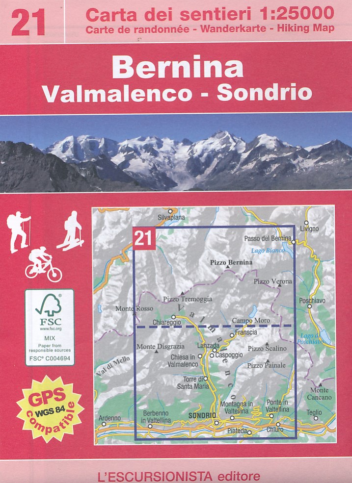
- Wandelkaart 21 Bernina: Valmalenco - Sondrio | L'Escursionista editore
- Voor weinig gebieden in Italië zijn echt goede wandelkaarten beschikbaar. Dit is gelukkig zo'n serie: voor de noordwestelijke Alpen van Italië; Gran Paradiso, Mont Blanc en Aosta en omgeving. Met GPS grid uitgeruste detailkaart, schaal 1:25.000 met alle noodzakelijke wandelinformatie als ingetekende routes, Via Ferrata routes, campings,... Read more
De Zwerver
Netherlands
Netherlands
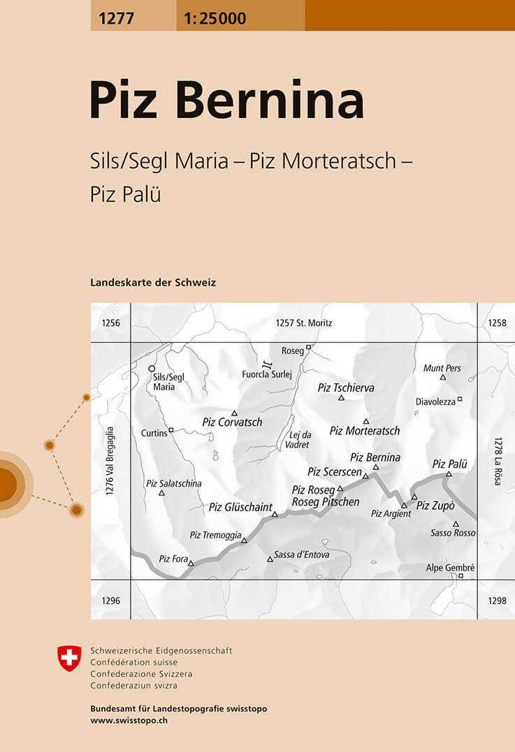
- Wandelkaart - Topografische kaart 1277 Piz Bernina | Swisstopo
- Map No. 1277, Piz Bernina, in the topographic survey of Switzerland at 1:25,000 from Bundesamt f Read more
- Also available from:
- Stanfords, United Kingdom

Stanfords
United Kingdom
United Kingdom
- Piz Bernina Swisstopo 1277
- Map No. 1277, Piz Bernina, in the topographic survey of Switzerland at 1:25,000 from Bundesamt für Landestopographie (swisstopo), covering the whole country on 247 small format sheets, with special larger maps published for popular regions including some titles now available in hiking versions.Highly regarded for their superb use of graphic... Read more
De Zwerver
Netherlands
Netherlands
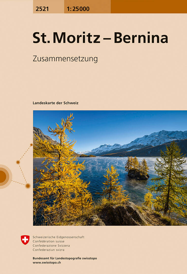
- Wandelkaart - Topografische kaart 2521 St. Moritz - Bernina | Swisstopo
- Map No. 2521, St Moritz - Bernina, in the topographic survey of Switzerland at 1:25,000 from Swisstopo, covering the Upper Engadine Valley (Oberengadin / Engadina Ota) from the Maloja Pass to Samedat, plus the Bernina Valley with Pontresina. Swiss topographic survey at 1:25,000 covers the whole country on 247 small format sheets, with special... Read more
- Also available from:
- Stanfords, United Kingdom

Stanfords
United Kingdom
United Kingdom
- St Moritz - Bernina Swisstopo 2521
- Map No. 2521, St Moritz - Bernina, in the topographic survey of Switzerland at 1:25,000 from Swisstopo, covering the Upper Engadine Valley (Oberengadin / Engadina Ota) from the Maloja Pass to Samedat, plus the Bernina Valley with Pontresina. Swiss topographic survey at 1:25,000 covers the whole country on 247 small format sheets, with special... Read more
De Zwerver
Netherlands
Netherlands
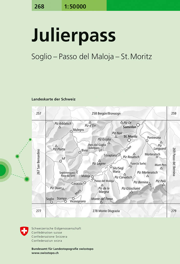
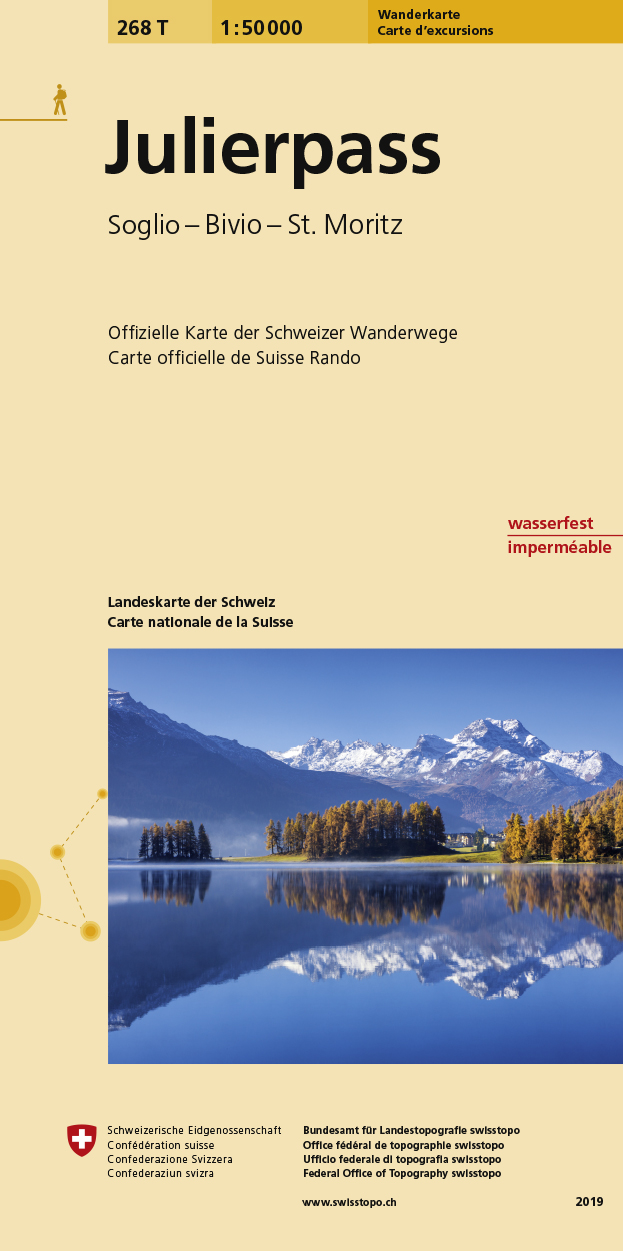
- Wandelkaart - Topografische kaart 268 Julierpass | Swisstopo
- Julierpass, map No. 268, in the standard topographic survey of Switzerland at 1:50,000 from Swisstopo, i.e. without the special overprint highlighting walking trails, local bus stops, etc, presented in Swisstopo Read more
- Also available from:
- Stanfords, United Kingdom

Stanfords
United Kingdom
United Kingdom
- Julierpass Swisstopo 268
- Julierpass, map No. 268, in the standard topographic survey of Switzerland at 1:50,000 from Swisstopo, i.e. without the special overprint highlighting walking trails, local bus stops, etc, presented in Swisstopo’s hiking editions of the 50K survey. Coverage includes the Upper Engadine Valley with St. Moritz and Pontresina, across the Maloja... Read more
De Zwerver
Netherlands
Netherlands
- Wandelkaart 268T Julierpass | Swisstopo
- Julierpass area, map No. 268T, at 1:50,000 in a special hiking edition of the country Read more
- Also available from:
- Stanfords, United Kingdom

Stanfords
United Kingdom
United Kingdom
- Julierpass Swisstopo Hiking 268T
- Julierpass area, map No. 268T, at 1:50,000 in a special hiking edition of the country’s topographic survey, published by Swisstopo in cooperation with the Swiss Hiking Federation. Coverage includes the Upper Engadine Valley with St. Moritz and Pontresina, across the Maloja Pass the top part of Val Bregaglia, the peak of Piz Bernina,... Read more
De Zwerver
Netherlands
Netherlands
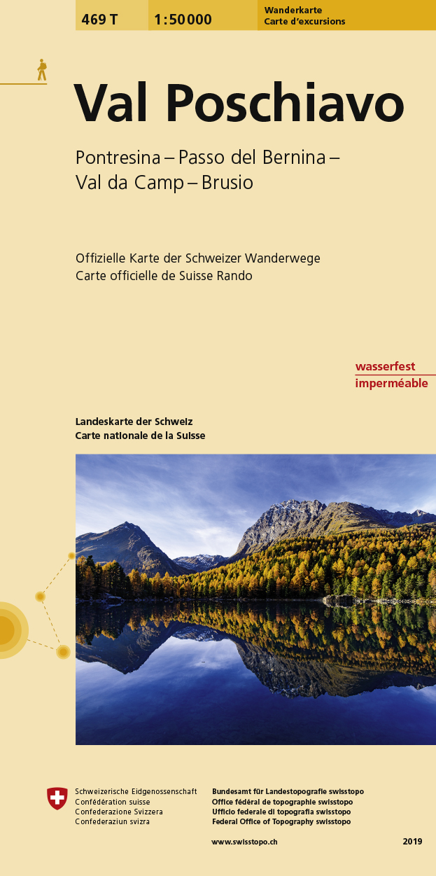
- Wandelkaart 469T Val Poschiavo | Swisstopo
- Val Poschiavo, map No. 469T, at 1:50,000 in a special hiking edition of the country Read more
- Also available from:
- Stanfords, United Kingdom

Stanfords
United Kingdom
United Kingdom
- Val Poschiavo Swisstopo Hiking 469T
- Val Poschiavo, map No. 469T, at 1:50,000 in a special hiking edition of the country’s topographic survey, published by Swisstopo in cooperation with the Swiss Hiking Federation. The map extends from Pontresina southwards along Val Bernina and Val Poschiavo to Tirano in Italy. Coverage includes the peak of Bernina and, on the north-eastern edge... Read more
De Zwerver
Netherlands
Netherlands
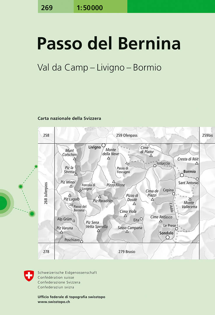
- Wandelkaart - Topografische kaart 269 Passo del Bernina | Swisstopo
- Passo del Bernina, map No. 269, in the standard topographic survey of Switzerland at 1:50,000 from Swisstopo, i.e. without the special overprint highlighting walking trails, local bus stops, etc, presented in Swisstopo Read more
- Also available from:
- Stanfords, United Kingdom
Stanfords
United Kingdom
United Kingdom
- Passo del Bernina Swisstopo 269
- Passo del Bernina, map No. 269, in the standard topographic survey of Switzerland at 1:50,000 from Swisstopo, i.e. without the special overprint highlighting walking trails, local bus stops, etc, presented in Swisstopo’s hiking editions of the 50K survey. The map covers mostly Italy, extending from the Berninia Pass to Bormio.Highly regarded... Read more

Stanfords
United Kingdom
United Kingdom
- Engadine - St Moritz Hallwag Mountain Bike Map 11
- Upper Engadine Valley: St Moritz - Bernina area at 1:50,000 in a series of waterproof and tear-resistant, contoured mountain biking maps from Hallwag, each highlighting several circuits and providing route profiles, guidance on the difficulty and overall experience, etc. Each map in this series is printed on sturdy, waterproof and... Read more
Stanfords
United Kingdom
United Kingdom
- Oberengadin - Bernina K+F Hiking 07
- 33 specially selected hiking trails in the Upper Engadin valley of Switzerland presented at 1:50,000 on a waterproof and tear-resistant, contoured and GPS compatible map from the Hallwag/Kümmerly + Frey group, with route profiles, grading for the severity of the terrain and the degree of fitness required, etc. Coverage includes St. Moritz,... Read more

Stanfords
United Kingdom
United Kingdom
- Valmalenco
- Valmalenco on a double-sided, contoured and GPS compatible map at 1:25,000 from Litografia Artistica Cartografica in their Global Map imprint. Coverage extends from Sondrio and the Adda River northwards to beyond the Swiss border and includes Monte Disgrazia, Pizzo Scalino and the peak of Bernina with the surrounding glaciers.The map has... Read more

Stanfords
United Kingdom
United Kingdom
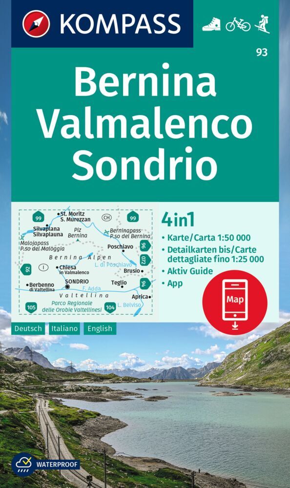
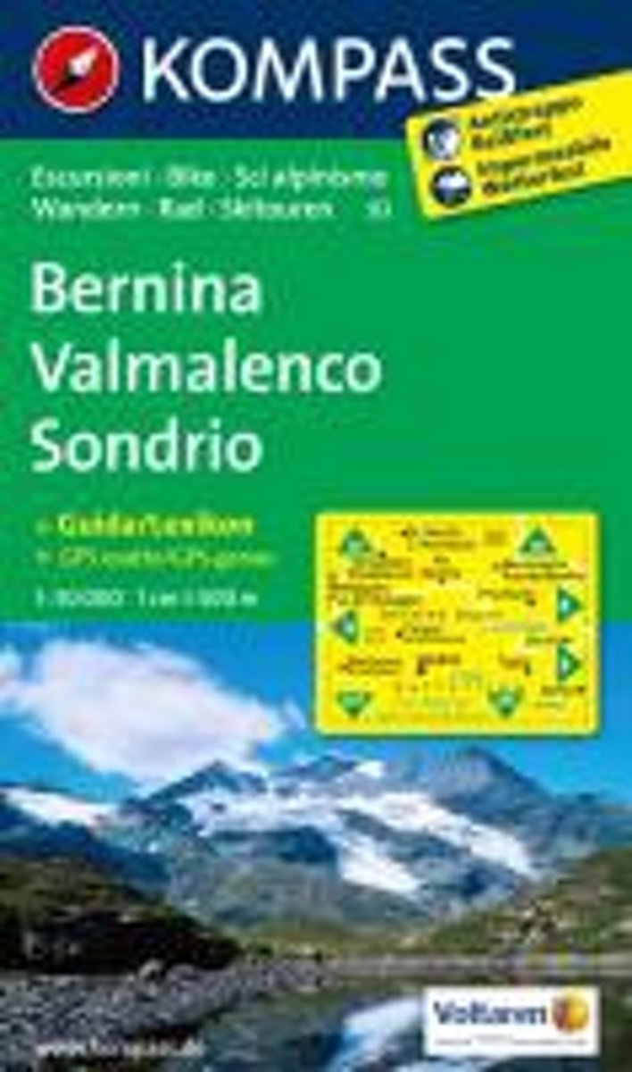
- Bernina - Valmalenco - Sondrio Kompass 93
- Bernina - Valmalenco - Sondrio area at 1:50,000 on a GPS compatible hiking and recreational map at 1:50,000 from Kompass, printed on durable, waterproof and tear-resistant synthetic paper.KOMPASS HIKING MAPS OF ITALY:This title is part of an extensive series of walking maps from Kompass covering selected areas of Italy at mainly 1:50,000, with... Read more
Bol.com
Netherlands
Netherlands
- Bernina, Sondrio WK93
- Deze Kompass wandelkaart, schaal 1:50 000, is ideaal om uw route uit te stippelen en om onderweg te gebruiken • naast de bekende bestemmingen, worden ook de minder bekende vermeld • openbaar vervoer bij begin- of eindpunt van een route aangegeven • eenvoudige wandelingen tot pittige (berg)tochten, voor getrainde en ongetrainde wandelaars • met... Read more
- Also available from:
- Bol.com, Belgium
Bol.com
Belgium
Belgium
- Bernina, Sondrio WK93
- Deze Kompass wandelkaart, schaal 1:50 000, is ideaal om uw route uit te stippelen en om onderweg te gebruiken • naast de bekende bestemmingen, worden ook de minder bekende vermeld • openbaar vervoer bij begin- of eindpunt van een route aangegeven • eenvoudige wandelingen tot pittige (berg)tochten, voor getrainde en ongetrainde wandelaars • met... Read more