
Sentiero Italia
Beschreibung
- Name Sentiero Italia (SI)
- Länge von Wanderweg 6,166 km, 3,831 Meilen
- Länge in Tagen 350 Tage
- Anfang von Wanderweg Trieste
- Ende von Wanderweg Santa Teresa Gallura
- Traildino Schwierigkeit MW, Mittelschwere Wanderung mit Rucksack
- Schwierigkeitsgrad Berg- und Alpinwanderung T1, Wandern


SI
6166 km.
Sentiero Italia. begins in Trieste and then crosses the entire Alpine Arc, the entire Apennine mountain chain, Sicily and Sardinia before ending at Santa Teresa Gallura in Sardinia.
Select some tracks
☐Sentiero Italia - Tappa C12, 14km
☐Sentiero Italia - Tappa 205, 9.5km
☐Sentiero Italia - Tappa 366, 45km
☐(SI B03 OLD) Pralongià - Forcella Travenanzes (Bivio Lagazuoi), 12km
☐Sentiero Italia - Tappa C08, 7.5km
☐(SI C05) Bagni di Bresimo - Bevia - Castello di Altaguarda - Bassetta Giovèl - Malga Stablei - Mocenigo di Rumo, 12km
☐Sentiero Italia - Tappa C15, 17km
☐Sentiero Italia - Variante del Marghine-Goceano
☐Sentiero Italia - Tappa Z06, 19km
☐Sentiero Italia - Tappa Z10, 0.3km
☐(SI-Z25 OLD) Armungia - Su Niu ‘e S’Achili, 14km
☐(SI Z24 OLD) Cuile Is Arrantas - Armungia, 22km
☐(SI Z23) Santa Barbara Perdasdefogu - Cuile Arrantas, 15km
☐(SI Z28 OLD) Caserma Noci Sette Fratelli - Castadias, 21km
☐(SI Z27 OLD) Monte Serpeddì – Caserma Noci Sette Fratelli, 19km
☐Sentiero Italia - Tappa Z27, 15km
☐(SI Z26 OLD) Su Niu ‘e S’Achili – Monte Serpeddì, 18km
☐Sentiero Italia - Tappa V01, 30km
☐Sentiero Italia - Tappa V03, 24km
☐Sentiero Italia - Tappa V02, 36km
☐Sentiero Italia - Tappa V08, 3.7km
☐Sentiero Italia - Tappa V07, 13km
☐Sentiero Italia - Tappa V06, 2.7km
☐Sentiero Italia - Tappa V05, 20km
☐Sentiero Italia - Tappa V04, 25km
☐Sentiero Italia - Tappa V11, 25km
☐Sentiero Italia - Tappa V09, 18km
☐Sentiero Italia - Tappa V16, 14km
☐Sentiero Italia - Tappa V15, 15km
☐Sentiero Italia - Tappa V14, 18km
☐Sentiero Italia - Tappa V13, 35km
☐Sentiero Italia - Tappa V12, 23km
☐Sentiero Italia - Tappa V19, 22km
☐Sentiero Italia - Tappa V18, 21km
☐Sentiero Italia - Tappa V17, 12km
☐Sentiero Italia - Tappa V20, 23km
☐Sentiero Italia - Tappa V23, 32km
☐Sentiero Italia - Tappa V22, 15km
☐Sentiero Italia - Tappa V21, 26km
☐Sentiero Italia - Tappa V10, 24km
☐Sentiero Italia - Tappa 016c, 12km
☐(SI T03) Bosco Magnano - Latronico, 22km
☐(SI T02) Madonna di Pollino - Bosco Magnano, 27km
☐(SI T01) Piano Gaudolino - Madonna del Pollino, 6.8km
☐(SI T06) Conserva - Madonna di Sirino, 6.5km
☐(SI T05) Castelsaraceno - Conserva, 28km
☐(SI T08) Lagonegro - Fortino, 8.5km
☐(SI S10) Monte Polveracchio - Acerno, 10km
☐(SI S07) Sicignano degli Alburni - Senerchia, 32km
☐Sentiero Italia - Tappa S06, 8.5km
☐Sentiero Italia - Tappa S07, 3.9km
☐Sentiero Italia - Tappa S23, 0.4km
☐Sentiero Italia - Tappa S22, 0.4km
☐Sentiero Italia - Tappa Q01, 2.9km
☐Sentiero Italia - Tappa S25, 1.8km
☐(SI Q11) Pescolanciano - Carovilli, 7.9km
☐Sentiero Italia - Tappa Q12O, 15km
☐(SI Q10O) Colli al Volturno - Castelnuovo al Volturno, 12km
☐(SI Q09O) Isernia - Colli Al Volturno, 20km
☐(SI O01) Passo dei Monaci - Picinisco, 13km
☐(SI O02) Picinisco - Forca d'Acero, 25km
☐(SI Q11O) Castelnuovo al Volturno - Passo dei Monaci, 17km
☐Sentiero Italia - Tappa P07, 4.6km
☐Sentiero Italia - Tappa P25, 14km
☐Sentiero Italia - Tappa P24, 14km
☐Sentiero Italia - Tappa P23, 13km
☐Sentiero Italia - Tappa P22, 36km
☐Sentiero Italia - Tappa P21, 8.7km
☐Sentiero Italia - Tappa P12, 2.9km
☐Sentiero Italia - Tappa P14, 8.5km
☐Sentiero Italia - Tappa N01, 6.7km
☐Sentiero Italia - Tappa M01, 2km
☐Sentiero Italia - Tappa M03, 3.8km
☐Sentiero Italia - Tappa M02, 4.7km
☐Sentiero Italia - Tappa L02, 5.1km
☐Sentiero Italia - Tappa L03c, 7.8km
☐Sentiero Italia - Tappa L13, 6.3km
☐(SI L16 OLD) Lago Santo Modenese - Passo delle Radici, 18km
☐(SI L20OLD) Passo del Cerreto - Rifugio Sarzana al Monte Acuto - Diga del Lagastrello - Pratospilla, 16km
☐Sentiero Italia - Tappa L22, 3.7km
☐Sentiero Italia - Tappa L24, 4.8km
☐Sentiero Italia - Tappa G01, 5.3km
☐Sentiero Italia - Tappa G02, 4.9km
☐Sentiero Italia - Tappa G03, 14km
☐Sentiero Italia - Tappa G04, 8.5km
☐Sentiero Italia - Tappa G05, 12km
☐Sentiero Italia - Tappa G08, 8.2km
☐Sentiero Italia - Tappa G07, 6.8km
☐Sentiero Italia - Tappa G06, 6.8km
☐Sentiero Italia - Tappa G09, 10km
☐Sentiero Italia - Tappa G12, 13km
☐Sentiero Italia - Tappa G11, 8.5km
☐Sentiero Italia - Tappa G10, 5.3km
☐Sentiero Italia - Tappa G14, 6.8km
☐Sentiero Italia - Tappa G13, 7.2km
☐Sentiero Italia - Tappa G16, 12km
☐Sentiero Italia - Tappa G15, 6.3km
☐Sentiero Italia - Tappa G19, 9km
☐Sentiero Italia - Tappa G18, 9.7km
☐Sentiero Italia - Tappa G17, 11km
☐Sentiero Italia - Tappa G20, 11km
☐Sentiero Italia - Tappa G26, 4.5km
☐Sentiero Italia - Tappa G25, 8.7km
☐Sentiero Italia - Tappa G24, 12km
☐Sentiero Italia - Tappa G23, 14km
☐Sentiero Italia - Tappa G22, 11km
☐Sentiero Italia - Tappa G21, 11km
☐Sentiero Italia - Tappa G33, 8.3km
☐Sentiero Italia - Tappa G32, 9.9km
☐Sentiero Italia - Tappa G31, 6km
☐Sentiero Italia - Tappa G30, 7.1km
☐Sentiero Italia - Tappa G29, 11km
☐Sentiero Italia - Tappa G28, 8.3km
☐Sentiero Italia - Tappa G27, 6.6km
☐Sentiero Italia - Tappa E11V, 19km
☐Sentiero Italia - Tappa E26, 1km
☐Sentiero Italia - Tappa E22, 4km
☐Sentiero Italia - Tappa E39, 9.1km
☐Sentiero Italia - Tappa E44, 6.5km
☐Sentiero Italia - Tappa E60, 2.9km
☐Sentiero Italia - Tappa E57, 0.6km
☐Sentiero Italia - Tappa E50, 4.8km
☐Sentiero Italia - Tappa E6x, 29km
☐Sentiero Italia - Tappa E65
☐Sentiero Italia - Tappa E63, 1.1km
☐Sentiero Italia - tappa E59b, 4.2km
☐(SI D21N-SR) Rifugio Bonacossa - Rifugio Allievi - Rifugio Cesare Ponti (Variante sul Sentiero Roma), 11km
☐(SI D20N-SR) Rifugio Gianetti all' Alpe Porcellizzo - Rifugio Bonacossa - Rifugio Allievi (Variante sul Sentiero Roma), 10km
☐(SI D19N-SR) Rifugio Luigi Brasca - Rifugio Gianetti all' Alpe Porcellizzo (Variante sul Sentiero Roma), 9.7km
☐(SI D18N-SR) Codera - Rifugio Luigi Brasca (Variante sul Sentiero Roma), 6.2km
☐(SI D22N-SR) Rifugio Cesare Ponti - Rifugio Bosio Galli all'Alpe Airale (Variante sul Sentiero Roma), 5.6km
☐Sentiero Italia - Tappa D36N, 23km
☐Sentiero Italia - Tappa Q09O, 4.4km
☐Sentiero Italia - Tappa M12, 3.3km
☐(no name), 7.5km
☐Sentiero Italia Tappa 06, 0.5km
☐(no name), 1.1km
☐Sentiero Italia - Dorsale Nebrodi, 40km
☐(SI-C V13-A) Ciminna - Montemaggiore Belsito, 26km
☐Sentiero Italia Tappa 19 bis, 5.4km
☐(SI V23) Floresta - Roccella Valdemone, 23km
☐(SI V24) Roccella Valdemone - Portella Mandrazzi, 24km
☐(SI V25) Portella Mandrazzi - Cantoniera di Vernà, 17km
☐Sentiero Italia - Tappa 30, 5.5km
☐Sentiero Italia - Tappa E64, 6.7km
☐Sentiero Italia - Tappa E62, 8.4km
☐Sentiero Italia - tappa E61, 13km
☐Sentiero Italia - Tappa E68, 13km
☐(SI V23V) Variante Sentiero Italia Parco dell'Etna, 107km
☐Sentiero Italia - raccordo 720 Malvagna, 4.2km
☐(SI U33) Morano Calabro - Piano Gaudolino, 12km
☐(SI S05) Passo della Sentinella - Casone Aresta, 15km
☐Gioia del Colle - Cassano delle Murge, 19km
☐Cassano delle Murge - Quasano (Toritto), 23km
☐(SI F18N) Alpe della Forca Inferiore - Rifugio Gabiet, 14km
☐(SI F19N) Rifugio Gabiet - Reale Superiore, 13km
☐(SI C08V) Sella di Favogna - Pianizzia, 10km
☐(SI C12SV) Passo Val Cion - Caoria, 22km
☐(SI C12N OLD) Malga Parco Corno - Redagno di Sopra, 14km
☐(SI C14N) Passo Lavaze - Obereggen, 6.4km
☐(SI C15N) Obereggen - Bivio Rifugio Coronelle, 19km
☐(SI C16N) Bivio Rifugio Coronelle - San Cipriano Tires, 11km
☐(SI C17N OLD) San Cipriano Tires - Rifugio Bolzano, 7.7km
☐(SI C20N) Rifugio Sasso Piatto - Selva di Val Gardena, 14km
☐(SI C21N) Selva di Val Gardena - Forcella Puez, 7.3km
☐(SI C22N) Forcella Puez - Rifugio Kostner, 11km
☐(SI C23N) Rifugio Kostner - Arabba, 4.6km
☐(SI O09 OLD) Cervara - Carsoli, 21km
☐(SI S07B) Contursi Terme - Senerchia, 17km
☐Tratta Sentiero Italia Monti della Laga, 102km
☐(no name), 24km
☐Pellegrino SI, 8.2km
☐Tarantonio Candelara Sentiero Italia, 8.2km
☐Variantedi fondo valle del Sentiero Italia, 5.2km
☐Cavaliere Sentiero Italia (Via Forte Campone Musolino), 12km
☐Variante Saponara Sentiero Italia (Via Piano Verde), 4km
☐(no name), 9.2km
☐Castroreale Sentiero Italia, 16km
☐Bafia Pizzo Daini S.I., 13km
☐S. Maria sentiero Italia, 12km
☐Santissima Sentiero Italia, 2.6km
☐Mandanici Sentiero Italia, 4.1km
☐Artale Sentiero Italia, 13km
☐Roccafiorita Sentiero Italia, 26km
☐Antillo Sentiero Italia, 4.9km
☐Antillo Vernà sentiero Italia, 8.7km
☐Motta Camastra-Portella Tre Fontane-Chiesa, 16km
☐(SI V13) Ciminna - Montemaggiore Belsito, 26km
☐Julius Kugy-Dreiländerweg E 14a, 22km
☐Julius Kugy-Dreiländerweg E 15b, 14km
☐Julius Kugy-Dreiländerweg E 15a, 23km
☐Julius Kugy-Dreiländerweg E 16a, 8.2km
☐Julius Kugy-Dreiländerweg E 17b, 14km
☐Julius Kugy-Dreiländerweg E 17a, 13km
☐path also belonging to Sentiero Italia long route, 25km
☐path also belonging to Sentiero Italia long route, 14km
☐(no name), 3km
☐path also belonging to Sentiero Italia long route, 9.3km
☐path also belonging to Sentiero Italia long route, 11km
☐path also belonging to Sentiero Italia long route, 7.8km
☐Alte Valli - Tappa 01, 11km
☐Alte Valli - Tappa 02, 8.1km
☐Alte Valli - Tappa 03, 16km
☐Alte Valli - Tappa 04, 18km
☐Alte Valli - Tappa 05, 12km
☐Alte Valli - Tappa 06, 16km
☐Alte Valli - Tappa 07, 22km
☐CUE - Tappa 01, 21km
☐CUE - Tappa 02, 17km
☐CP - Tappa 01, 13km
☐CP - Tappa 02, 11km
☐CP - Tappa 03, 6.5km
☐CP - Tappa 04, 12km
☐Alta via dei Monti Lattari - 01, 12km
☐Alta via dei Monti Lattari - 02, 2.7km
☐Alta via dei Monti Lattari - 03, 5.8km
☐Alta via dei Monti Lattari - 4, 4.7km
☐Alta via dei Monti Lattari - 5, 9km
☐Alta via dei Monti Lattari - 6, 4.4km
☐Alta via dei Monti Lattari - 7, 20km
☐Alta via dei Monti Lattari - 8, 3.8km
☐Alta via dei Monti Lattari - 9, 3.9km
☐Alta via dei Monti Lattari - 10, 2.3km
☐Alta via dei Monti Lattari - 11, 3.1km
☐Sentiero europeo E1, Italia - Umbria/Marche, 208km
Links
Fakten
Berichte
Führer und Karten
Übernachtung
Organisationen
Reisebüros
GPS
Sonstiges
Bücher
Bol.com
Netherlands
Netherlands
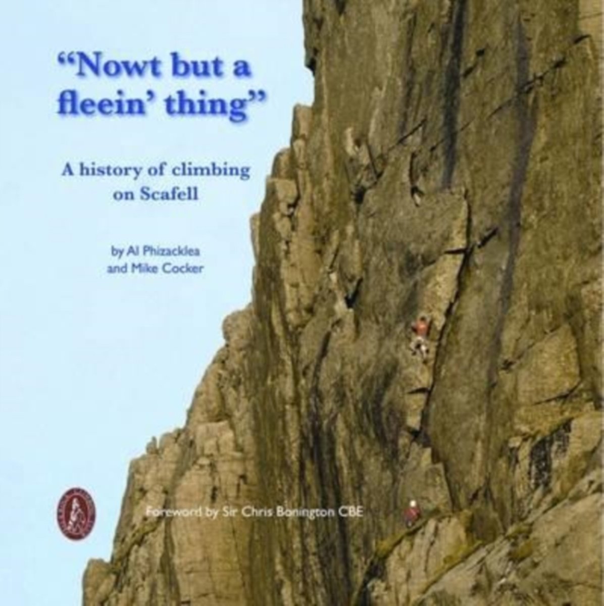
- Nowt but a Fleein' Thing
- In 1874 George Seatree and Stanley Martin made the first ascent of North Climb, which was the first time the main face of Scafell had been ascended outside of the obvious gully lines. It was the start of great things on the crags of Scafell. Upon hearing their report of this new route, Will Ritson, landlord of the Huntsman's Inn, looked at them... Read more
- Also available from:
- Bol.com, Belgium
Bol.com
Belgium
Belgium
- Nowt but a Fleein' Thing
- In 1874 George Seatree and Stanley Martin made the first ascent of North Climb, which was the first time the main face of Scafell had been ascended outside of the obvious gully lines. It was the start of great things on the crags of Scafell. Upon hearing their report of this new route, Will Ritson, landlord of the Huntsman's Inn, looked at them... Read more

The Book Depository
United Kingdom
2016
United Kingdom
2016
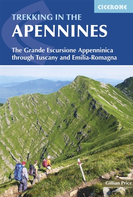
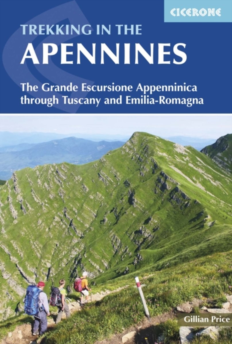
- Trekking in the Apennines
- The Grande Escursione Appenninica Read more
- Also available from:
- De Zwerver, Netherlands
- Stanfords, United Kingdom
- Bol.com, Netherlands
- Bol.com, Belgium
De Zwerver
Netherlands
2016
Netherlands
2016
- Wandelgids Trekking in the Apennines - Apennijnen | Cicerone
- Guidebook to the Grand Apennines Trek, or Grande Escursione Appenninica (GEA). Through Tuscany and Emilia-Romagna and two National Parks, this 400km, 23 day trail explores the mountains, forests and hills of central Italy. Suitable for a range of walkers, it can be split into shorter sections or day walks if needed. Read more

Stanfords
United Kingdom
2016
United Kingdom
2016
- Apennines Trekking - The Grande Escursione Appenninica
- This guidebook describes the Grande Escursione Appenninica (GEA), a nearly 400km long, three week trek crossing the Appenines in 23 stages, from Bocca Trabaria to Passo Due Santi on the edge of Liguria. The route dips in and out of Tuscany and Emilia-Romagna, never dropping below 400 metres. Best walked between spring and autumn, it is suitable... Read more
Bol.com
Netherlands
2016
Netherlands
2016
- Trekking in the Apennines
- This guidebook describes the Grande Escursione Appenninica (GEA), a nearly 400km long, three week trek crossing the Apenines in 23 stages, from Bocca Trabaria to Passo Due Santi on the edge of Liguria. The route dips in and out of Tuscany and Emilia-Romagna, never dropping below 400 metres. Best walked between spring and autumn, it is suitable... Read more
Bol.com
Belgium
2016
Belgium
2016
- Trekking in the Apennines
- This guidebook describes the Grande Escursione Appenninica (GEA), a nearly 400km long, three week trek crossing the Apenines in 23 stages, from Bocca Trabaria to Passo Due Santi on the edge of Liguria. The route dips in and out of Tuscany and Emilia-Romagna, never dropping below 400 metres. Best walked between spring and autumn, it is suitable... Read more
Karten

The Book Depository
United Kingdom
United Kingdom
- Lienz Dolomites - Lesachtal - Villgratner Mountains Hiking + Leisure Map 1:50 000
- Lienz Dolomites - Lesachtal area of Carinthia presented at 1:50,000 in a series of contoured and GPS compatible outdoor leisure map from Freytag & Berndt with hiking and cycling routes, mountain huts, campsites and youth hostels, local bus stops, plus other tourist information.To see the list of currently available titles in this series please... Read more
- Also available from:
- Stanfords, United Kingdom

Stanfords
United Kingdom
United Kingdom
- Lienz Dolomites - Lesachtal - Villgratner Berge F&B WK182
- Lienz Dolomites - Lesachtal area of Carinthia presented at 1:50,000 in a series of contoured and GPS compatible outdoor leisure map from Freytag & Berndt with hiking and cycling routes, mountain huts, campsites and youth hostels, local bus stops, plus other tourist information.To see the list of currently available titles in this series please... Read more

De Zwerver
Netherlands
Netherlands
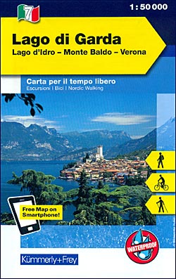
- Wandelkaart - Fietskaart 07 Outdoorkarte IT Gardasee - Gardameer | Kümmerly & Frey
- Lake Garda - Lake d'Idro - Monte Baldo - Verona area at 1:50,000 in a series of waterproof and tear-resistant, GPS compatible and contoured recreational maps from K Read more
- Also available from:
- Stanfords, United Kingdom
Stanfords
United Kingdom
United Kingdom
- Lake Garda - Lake Idro - Monte Baldo - Verona K+F Outdoor Map 7
- Lake Garda - Lake d`Idro - Monte Baldo - Verona area at 1:50,000 in a series of waterproof and tear-resistant, GPS compatible and contoured recreational maps from Kümmerly + Frey with both local and long-distance hiking and cycling trails, ski routes, sites for other outdoor pursuits, accommodation, bus stops, etc. An inset provides a small... Read more

De Zwerver
Netherlands
Netherlands
- Wandelkaart 2458 Firenze - Siena - Chianti | Kompass
- Florence - Siena - Chianti area on a double-sided map at 1:50,000 from Kompass, printed on durable, waterproof and tear-resistant synthetic paper. Coverage includes Val di Pesa, Val d’Elsa, Monteriggioni, etc. Contours are at 40m intervals, with a 2-km UTM grid. Extensive overprint includes GEA - Grande Escursione Appenninica, Sentiero Italia,... Read more
- Also available from:
- Stanfords, United Kingdom

Stanfords
United Kingdom
United Kingdom
- Florence - Siena - Chianti Kompass 2458
- Florence - Siena - Chianti area on a double-sided map at 1:50,000 from Kompass, printed on durable, waterproof and tear-resistant synthetic paper. Coverage includes Val di Pesa, Val d’Elsa, Monteriggioni, etc. Contours are at 40m intervals, with a 2-km UTM grid. Extensive overprint includes GEA - Grande Escursione Appenninica, Sentiero Italia,... Read more
- Also available from:
- Stanfords, United Kingdom

Stanfords
United Kingdom
United Kingdom
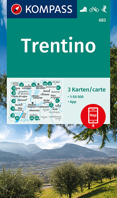
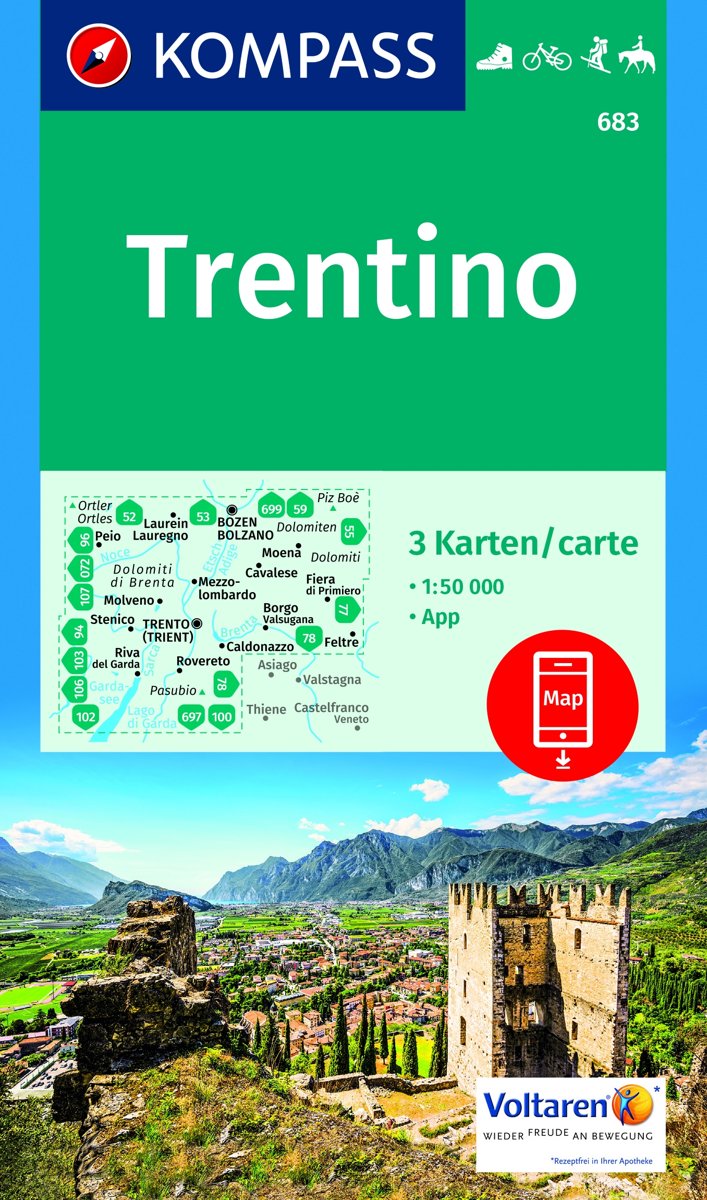
- Trentino 3-Map Set Kompass 683
- Trentino region of Italy on a set of three double-sided, GPS compatible and contoured maps at 1:50,000 from Kompass, with hiking trails, cycling, ski and horse riding routes, various recreational facilities, etc. The set provides very wide coverage of this popular part of Italy, extending from north of Bolzano southwards to include the northern... Read more

Stanfords
United Kingdom
United Kingdom
- Siena - Volterra - Massa Marittima - Roccastrada Kompass 2462
- Siena - Volterra - Massa Marittima - Rocca Strada map at 1:50,000 from Kompass, printed on durable, waterproof and tear-resistant synthetic paper. Coverage includes Colle di Va d’Elsa, Casole d’Elsa, Metallifere hills, etc. Contours are at 40m intervals, with a 2-km UTM grid. Extensive overprint includes GEA - Grande Escursione Appenninica,... Read more

Stanfords
United Kingdom
United Kingdom
- Prato Province Hiking Routes
- The province of Prato, just north-west of Florence, on a double-sided, contoured and GPS compatible map at 1:25,000 from Edizioni Multigraphic highlighting waymarked routes and other hiking paths, with access by public transports, etc.The map has contours at 20m intervals with relief shading and plenty of spot heights. Hiking paths are... Read more

Stanfords
United Kingdom
United Kingdom
- Monti Sibillini National Park Edizioni Multigraphic 60/61
- Monti Sibillini National Park at 1:25,000 on a double-sided contoured map from Edizioni Multigraphic highlighting local waymarked hiking routes including the GAS – Grand Anello dei Sibilini, the circular tour around the mountains.The map has contours at 25m intervals with colouring for woodlands. Waymarked routes are highlighted and annotated... Read more

Stanfords
United Kingdom
United Kingdom
- Monti Nebrodi
- Parco Naturale dei Monti Nebrodi on the northern coast of Sicily on a contoured and GPS compatible map at 1:50,000 from Litografia Artistica Cartografica in their Global Map imprint, highlighting hiking trails plus various facilities and/or places of interest in and around the park.Topography is shown by contours at 25m intervals with light... Read more

Stanfords
United Kingdom
United Kingdom
- Parco delle Madonie
- Parco delle Madonie on the north coast of Sicily just south of Cefalù on a detailed, GPS compatible map at 1:50,000 from LAC in their Globalmap imprint. An overprint highlights hiking trails, including the local section of Sentiero Italia, and indicates more strenuous sections.Topography of this interesting area is very well presented by... Read more

Stanfords
United Kingdom
United Kingdom
- Val Venosta / Vinschgau K+F Outdoor Map 1
- Val Venosta / Vinschgau area in the Dolomites at 1:50,000 in a series of waterproof and tear-resistant, GPS compatible and contoured recreational maps from Kümmerly + Frey with both local and long-distance hiking and cycling trails, ski routes, sites for other outdoor pursuits, accommodation, bus stops, etc. Coverage includes the Ortles/Ortler... Read more

Stanfords
United Kingdom
United Kingdom
- Monti Sibillini National Park 6-Map Set
- Monti Sibillini National Park in a 6 sheet set, contoured and GPS compatible map at 1:25,000 published by Societá Editrice Ricerche. The maps highlight hiking trails, including the Grande Anello dei Monti Sibilini long-distance circuit.Modern cartography from the Italian topographic survey has contours at 20m intervals, relief shading, and... Read more

Stanfords
United Kingdom
United Kingdom
- Arezzo - Casentino - Foreste Casentinesi NP - Monte Falterona Kompass 2459
- Arezzo - Casentino - Monte Falterona map at 1:50,000 from Kompass, printed on durable, waterproof and tear-resistant synthetic paper. Coverage includes Foreste Casentinesi National Park. Contours are at 40m intervals, with a 2-km UTM grid. Extensive overprint includes GEA - Grande Escursione Appenninica, Sentiero Italia, etc, plus cycling and... Read more

Stanfords
United Kingdom
United Kingdom
- Lake Maggiore - Lake Orta - Lake Varese K+F Outdoor Map 8
- Lake Maggiore - Lake Orta - Lake Varese area at 1:50,000 in a series of waterproof and tear-resistant, GPS compatible and contoured recreational maps from Kümmerly + Frey with both local and long-distance hiking and cycling trails, ski routes, sites for other outdoor pursuits, accommodation, bus stops, etc. An inset provides a small road map of... Read more

Stanfords
United Kingdom
United Kingdom
- Lake Como K+F Outdoor Map 9
- Lake Como area at 1:50,000 on a double-sided, waterproof and tear-resistant, GPS compatible and contoured recreational maps from Kümmerly + Frey with both local and long-distance hiking and cycling trails, ski routes, sites for other outdoor pursuits, accommodation, bus stops, etc. Coverage includes the northern part of Lake Lugano and extends... Read more
Bol.com
Netherlands
Netherlands
- Trentino 1:50 000
- -Die Provinz Trentino erstreckt sich vom Tonalepass im Westen bis zur Pala-Gruppe bei San Martino di Castrozza im Osten. In der Nord-Süd-Ausdehnung reicht sie von Canazei im Norden und im Süden bis zum Gardasee.-Geprägt wird die östliche Trentino-Region durch einzeln stehende Kalkmassive wie Pala- und Sellagruppe, Latemar-Rosengarten, Marmolata... Read more
- Also available from:
- Bol.com, Belgium
Bol.com
Belgium
Belgium
- Trentino 1:50 000
- -Die Provinz Trentino erstreckt sich vom Tonalepass im Westen bis zur Pala-Gruppe bei San Martino di Castrozza im Osten. In der Nord-Süd-Ausdehnung reicht sie von Canazei im Norden und im Süden bis zum Gardasee.-Geprägt wird die östliche Trentino-Region durch einzeln stehende Kalkmassive wie Pala- und Sellagruppe, Latemar-Rosengarten, Marmolata... Read more